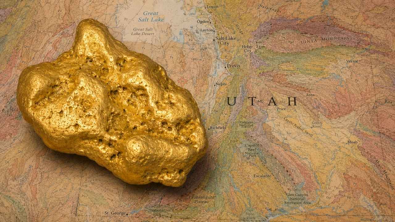
Gold in Utah has come out of a single hole in the Oquirrh Mountains in a quantity almost nobody outside the state talks about, more than 30 million ounces from Bingham Canyon alone. Utah supplied better than a third of all the gold mined in the United States in 1944.
With gold trading above $4,000 an ounce, you do not need to find much for a weekend in the desert to pay for itself.
Most people who go looking for gold in Utah pick a famous district off a map and start digging. Then they find out the ground is covered by an active mining claim, or that the canyon they drove to is a closed drinking water watershed.
Yes, you can still find gold in Utah today, especially along Pine Creek in Bullion Canyon and the Sevier River near Marysvale, where placer gold has been washing out of the Tushar Mountains since the 1860s. This guide covers ground that is genuinely open to you, from a national forest picnic area that invites panning to BLM washes in the west desert and river bars on the San Juan.
Our team of geologists and experienced rockhounds built this guide around the two very different gold stories Utah tells, the intrusive belts that built the mining camps and the plateau rivers that carry fine gold in from far upstream. Here is exactly where both of them put gold in water and gravel you can legally reach.
Table of Contents
- Biggest Discovery
- Types of Gold
- Where Gold Hides
- Best Places
- Techniques
- Real vs Fool’s Gold
- How Gold Got Here
- What To Bring
- Best Seasons
- Other Minerals
- Legal Rules
- FAQ
The Biggest Gold Discovery in Utah History
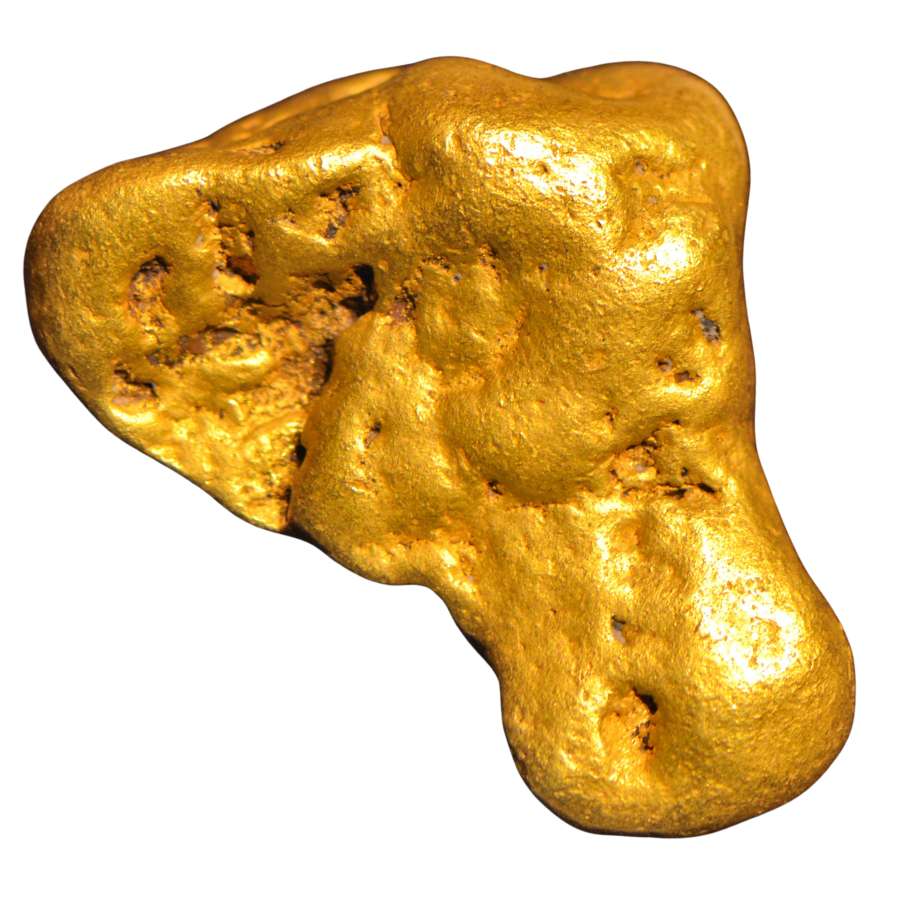
The biggest gold find in Utah history was not a nugget, it was a mountain. Bingham Canyon in the Oquirrh Mountains has yielded more than 30 million troy ounces of gold, which at today’s prices is well over one hundred billion dollars in metal.
The strange part is that nobody went there for gold at first. Thomas and Sanford Bingham grazed cattle in the canyon in the late 1840s and noticed mineral in the rock. Miners organized the West Mountain Mining District in 1863, found placer gold in the canyon gravels in 1864, and washed roughly a million dollars of it out by 1871 when a dollar bought a great deal more than it does now.
Then the real prize showed up underneath. The whole mountain sits over a porphyry, a body of molten rock that pushed up into the crust and cooked gold, copper, silver, and molybdenum into the surrounding stone in tiny scattered grains. The copper paid the bills, and the gold came out of the same ore as a byproduct, year after year, decade after decade.
That is natural gold in every sense. It grew in the rock, and the mill simply separated it out.
The lesson for you sits in the geology, not the pit. That same band of intrusive rock built the Tintic, Ophir, Mercur, and Camp Floyd camps across the Oquirrh and East Tintic ranges, and every one of those districts has been shedding gold into the washes below it ever since.
The Kinds of Gold You Can Find in Utah
Utah hands you four kinds of gold, and knowing which one your ground carries tells you exactly how to work it. The plateau rivers in the east run almost entirely on superfine gold, the mountain creeks in the Tushars and the Wasatch give up flakes and pickers, and the west desert washes hide the chunky pieces.
Flour Gold
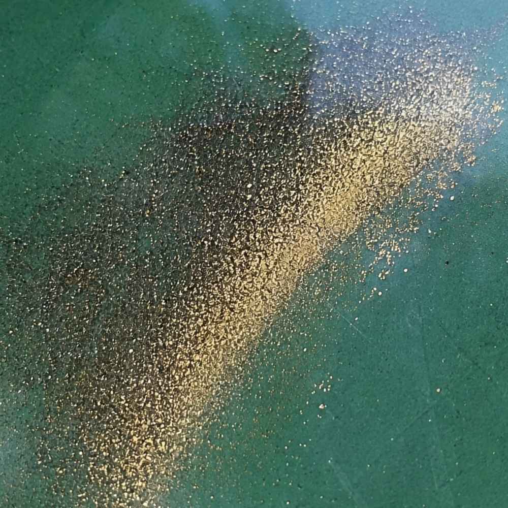
Flour gold is gold ground finer than sugar, and it is what the Colorado, Green, and San Juan rivers carry across eastern Utah. These rivers pick gold up hundreds of miles upstream and hammer it flat and tiny by the time it reaches Utah, which is why the old timers called it flood gold. In the pan it shows as a bright yellow tail in the crease after everything lighter has washed away.
Mica is the mineral that fools people here. Mica flashes gold in sunlight but weighs almost nothing and floats on the surface film. Real flour gold sinks straight to the bottom and stays warm yellow even when you shade the pan with your hand.
Because flour gold rides out of a rough pan so easily, use a smooth finish pan for your last few swirls. The Garrett Prospecting 10 Inch Backpacker Gold Pan is built for exactly that final step.
This is also the moment a good identification reference earns its keep. The Rocks and Minerals of the United States Field Guide shows real gold side by side with every mineral that imitates it, so you know what you are holding while your pan is still wet.
Gold Flakes and Pickers
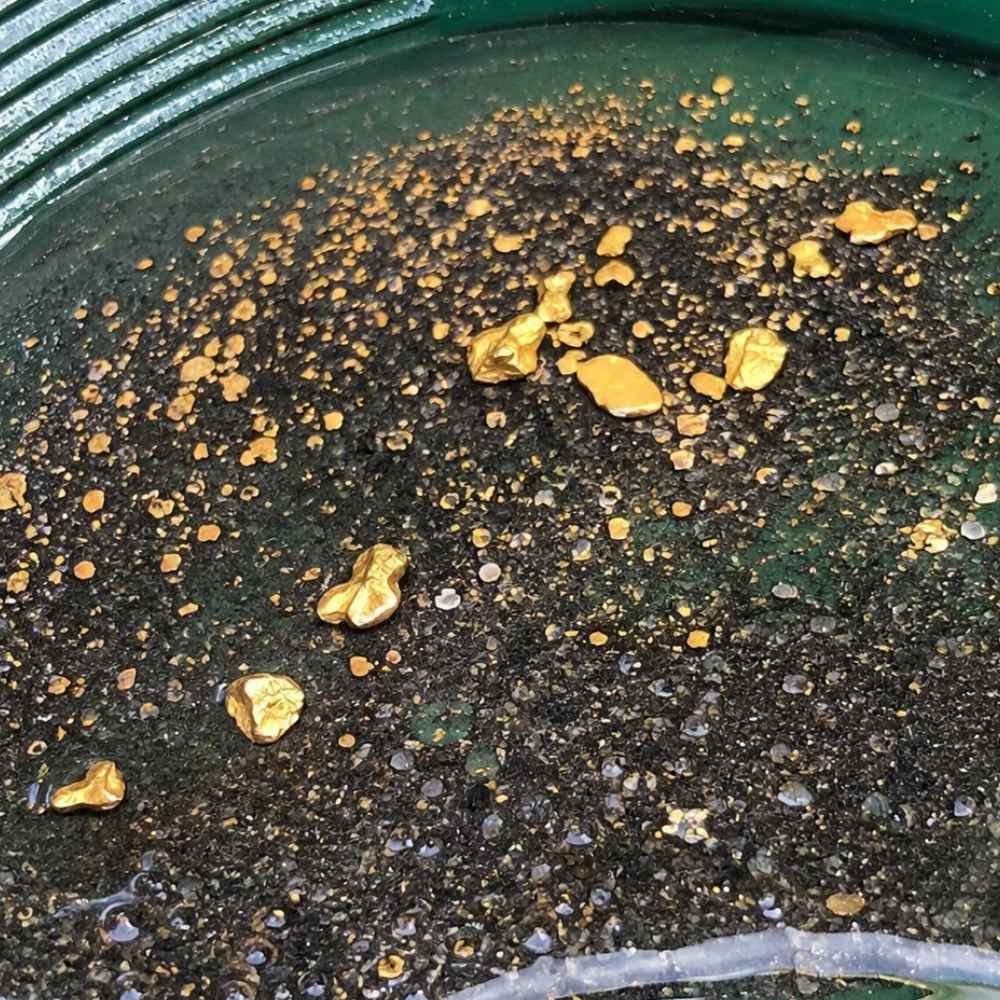
Flakes and pickers are the pieces you can grab with your fingers, and Utah’s mountain creeks produce them all season. A flake is flat and thin, a picker is thick enough to pick up without a snuffer bottle, and both mean you are standing close to the source. Pine Creek in Bullion Canyon, the Sevier River below Marysvale, and the American Fork drainage all give up pieces this size.
Pyrite is the lookalike that trips people up on flakes. Pyrite comes in hard little cubes with sharp corners and it shatters when you press it. A real gold flake bends and dents instead, and it never grows a flat crystal face.
Pull flakes and pickers out of your pan with a snuffer bottle before a wave takes them back. The Garrett Gold Guzzler Bottle sucks them straight off the water without a single lost piece.
Gold Nuggets
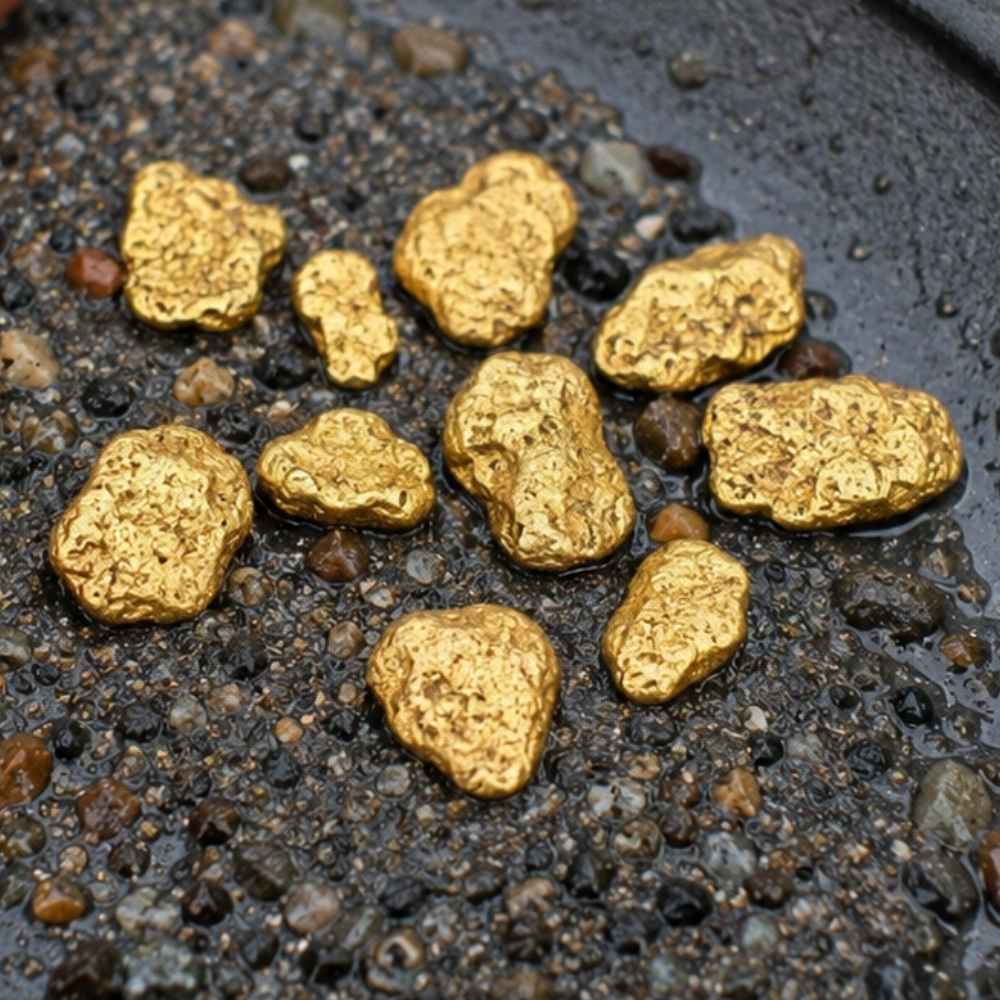
Nuggets are the trophy, and Utah keeps them in two kinds of country. Crescent Creek on the flank of Mount Ellen is known for heavy, high karat gold in grains, wires, and occasional pea sized pieces. The dry washes below Gold Hill in Tooele County hold coarse gold too, because there has never been enough water there to grind it down.
Nuggets carry a deep buttery color and a heft that surprises people the first time. Anything that looks like a nugget but feels light for its size is almost always weathered pyrite or a chunk of iron stained rock.
Nuggets big enough to matter are often buried under packed gravel and caliche, which is where a detector earns its price. The Garrett AT Gold Metal Detector is tuned for small gold and handles Utah’s mineralized desert ground well.
Gold in Quartz
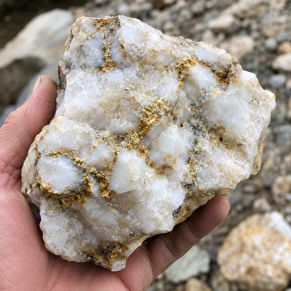
Gold in quartz is where nearly all of Utah’s mountain gold came from, and pieces of it still tumble into the creeks. Look for chunks of milky white quartz with rusty orange staining and thin yellow threads running through the fresh breaks. Tintic, Gold Mountain above Marysvale, and Bromide Basin in the Henry Mountains all sit on this kind of rock, and float boulders from those veins travel a long way downhill.
Chalcopyrite is the mineral that fakes it best inside quartz, showing a brassy yellow that looks convincing until you scratch it. Chalcopyrite streaks greenish black on a rough surface, while gold streaks yellow and stays yellow. Our guide to quartz in Utah covers the districts where the best vein material shows up.
Cracking a promising quartz cobble takes a real rock pick, not a claw hammer. The Estwing Geo Paleo Rock Pick splits quartz cleanly so you can see what is inside.
Every one of these four kinds has a technique that suits it best, and the techniques section further down breaks each one apart with the gear list to match.
Where Gold Hides in Utah Streams
Utah gold sits exactly where moving water or a flash flood gives up speed, and reading that is worth more than any map. These are the features that pay off across the state, from the Wasatch canyons to the desert washes of the west.
Inside River Bends
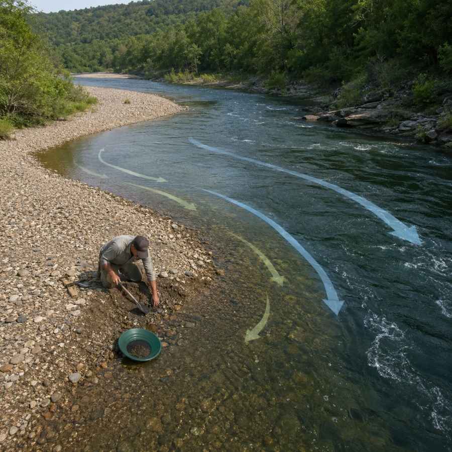
The inside of a bend is the slowest water in the whole channel, and gold drops there first. Stand at the bend and look for the point where the gravel goes from cobbles to sand, because that transition line is where the heavy material quits moving.
Digging an inside bend feels like work at first and then gets easy. The top layer is loose rounded rock, and about a foot down you hit packed gravel that holds together when you shovel it. That packed layer is the one you want in your pan.
A round point shovel moves the overburden fast so you can get to the good material. The Bully Tools 14 Gauge Round Point Shovel holds up to Utah cobble without bending.
Gravel Bars
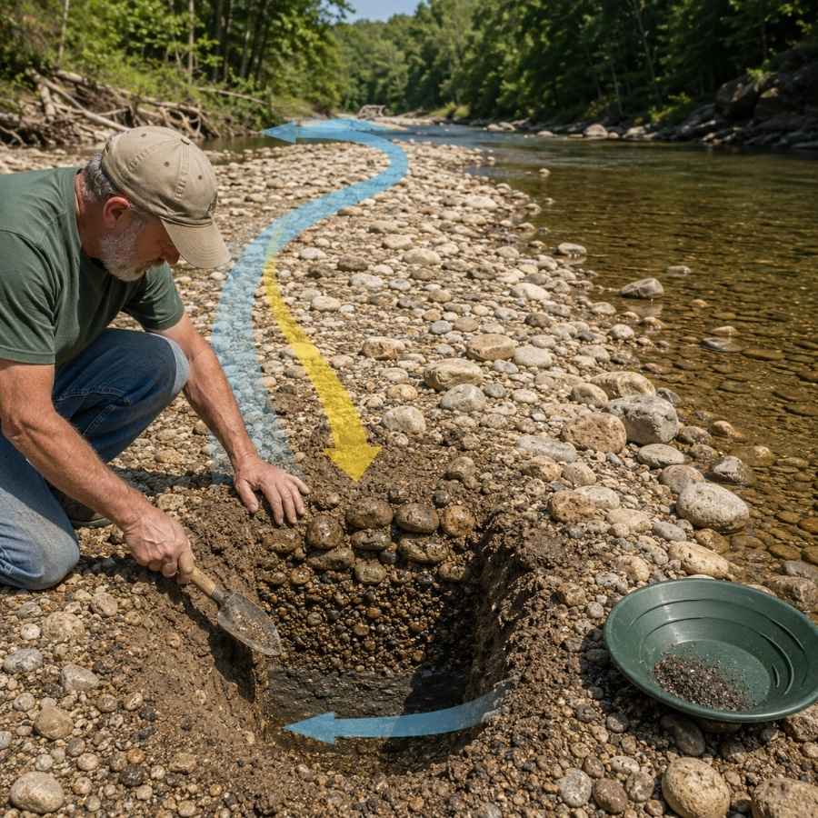
Gravel bars are the easiest gold traps in Utah to spot and the easiest to work. The upstream tip of a bar is the money spot, because that is where the current first slows and drops what it is carrying. On the Green and the San Juan, whole bars rebuild after every high water year.
Bar gravel is loose on top and tighter underneath, and the color usually improves as you go down. Dig test holes across the bar rather than one deep hole in the middle.
Screening the oversize rock out before you pan doubles how much material you can process. The SE Half Inch Sifting Screen sits right on your pan and does it in seconds.
Bedrock Cracks
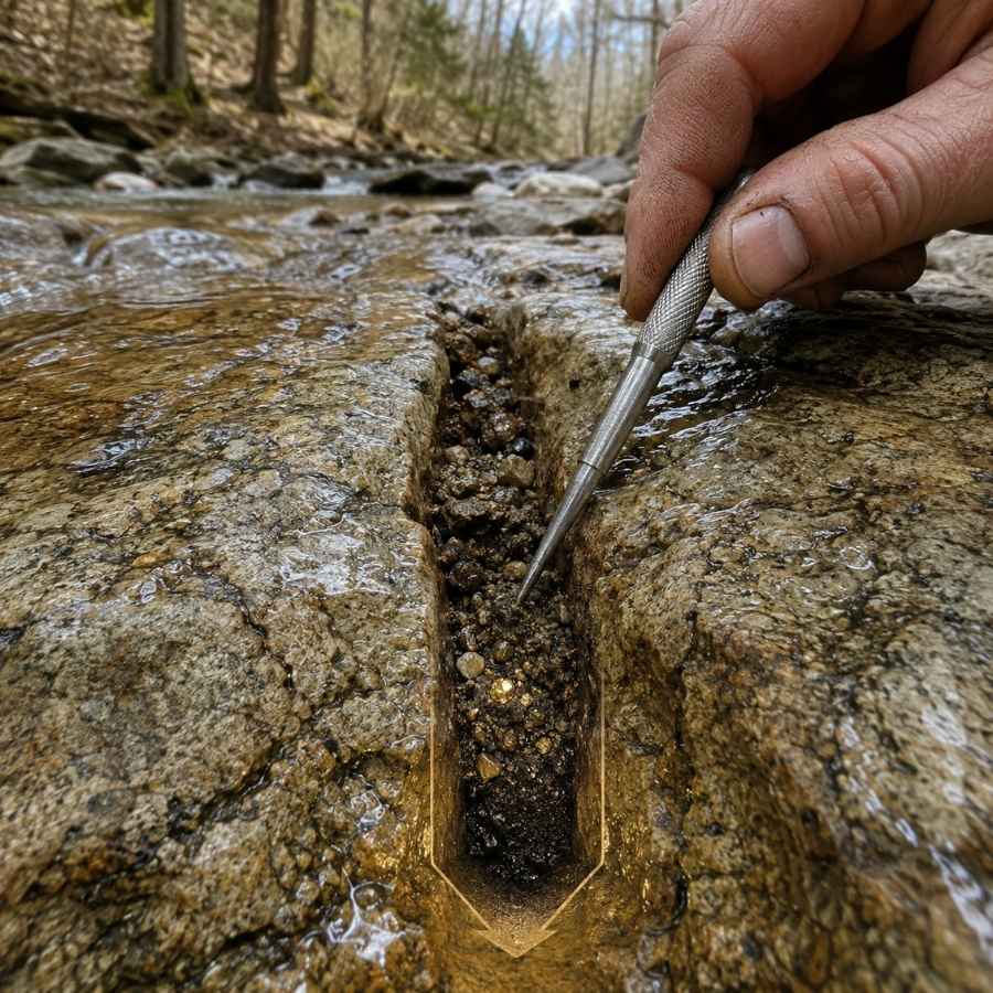
Bedrock is the floor gold cannot fall through, and in Utah’s steep canyons that floor is often exposed right in the creek. Pine Creek in Bullion Canyon and the Abajo Mountain drainages both have runs of hard rock with cracks and joints across the flow. Gold works down into those seams over decades and stays there.
Cleaning a crack feels like dentistry. You scrape, you flush, and you keep going until the crack is empty, because the last spoonful is usually the richest.
A steel crevice tool set is the only thing that gets down into a tight seam. The ASR Outdoor Steel Crevice Tool Set gives you several shapes so one of them always fits.
Desert Washes and Alluvial Fans
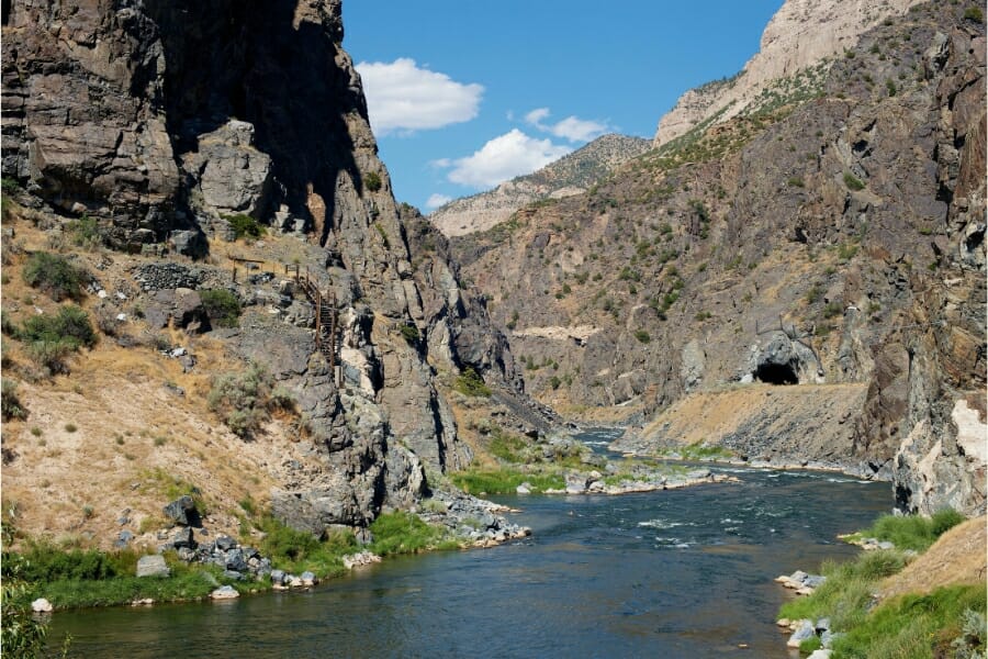
Dry washes are Utah’s signature gold trap, and they work on the same physics as a creek with the water turned off. A flash flood roars down the wash once or twice a year, drops the heavy material where the grade flattens, and leaves it there. The best ground is right where a wash spills out of a mineralized range onto the fan below.
Digging a wash feels different from digging a creek. You are cutting through loose sand until you hit a hard caliche layer or bedrock, and the gold sits on top of that hard layer in a thin, concentrated band.
Haul the good material to water in buckets and pan it there, or work it dry with a classifier first. The SE 1/8 Inch Mesh Sifting Screen cuts your bucket weight in half before the long walk back.
Black Sand Streaks
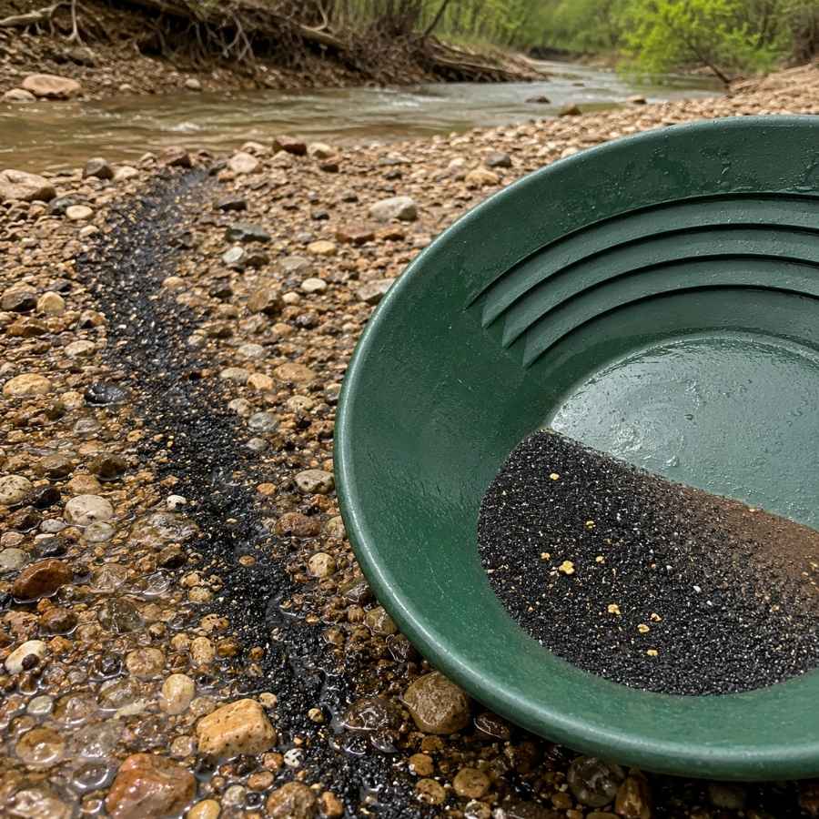
Black sand is your compass in Utah, because it is heavy iron mineral that travels and settles exactly where gold does. Look for dark ribbons on top of a bar, dark layers in a cut bank, or a black stripe at the base of desert gravel. Where the black sand concentrates, your gold is in the same handful.
Following black sand also means your pan fills with magnetite, which you need to get out before you can see anything. That is a two minute job with the right tool.
A magnetic separator pulls the iron out of your concentrate and leaves the gold behind. The SE Magnetic Separator Pick Up Tool with Quick Release drops the whole load in one click.
Always Confirm Access and Collection Rules!
Before heading out to any of the locations on our list you need to confirm access requirements and collection rules for both public and private locations directly with the location. We haven’t personally verified every location and the access requirements and collection rules often change without notice.
Many of the locations we mention will not allow collecting but are still great places for those who love to find beautiful rocks and minerals in the wild without keeping them. We also can’t guarantee you will find anything in these locations since they are constantly changing.
Always get updated information directly from the source ahead of time to ensure responsible rockhounding. If you want even more current options it’s always a good idea to contact local rock and mineral clubs and groups
The Best Places To Find Gold in Utah
Utah’s gold sits in four broad regions, and each one has ground that is open to you without a claim or a landowner conversation. Here is every spot worth your gas money, starting with the ones you can drive to and start panning the same day. Many of these overlap with the best rockhounding sites in Utah, so plan on filling more than one bag.
Northern Utah
The Wasatch Front canyons and the ranges along the Idaho line hold Utah’s most accessible mountain gold. National forest ground gives you legal room to work, and these are the shortest drives in the state for anybody living between Ogden and Provo.
American Fork Canyon, Utah County
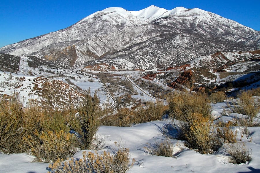
American Fork Canyon is the easiest mountain gold creek to reach from the Wasatch Front, cutting east from Highland on State Route 92 into the Uinta Wasatch Cache National Forest. The American Fork mining district above it produced roughly 45,000 ounces of gold from veins in the limestone and quartzite, and the river below has been collecting the loose material ever since. A recreation fee pass covers the canyon, and there are pullouts and picnic areas along the water the whole way up.
The gold here is fine flake with the occasional picker, and careful panning is the technique that keeps it. Work the inside bends and the bedrock cracks where the canyon narrows, because the gradient is steep and the traps are obvious.
Your pan will also turn up quartz, pyrite, galena, and heavy black sand from the old workings upstream. This is exactly the moment people throw away a good stone, because everything looks the same when it is wet. The US Rocks and Minerals Field Guide lets you check every odd piece against clear photos before it goes back in the creek.
Timpanogos Cave National Monument sits inside the canyon and is closed to prospecting, so stay well clear of the monument boundary. Claims are scattered around Dutchman Flat and the old Pacific Mine, and some of the upper side gulches carry mine waste, so check claim status and posted signs before you dig. Bring the crevice tools from the techniques section below.
Difficulty: 3 out of 5
Raft River Mountains and Clear Creek, Box Elder County
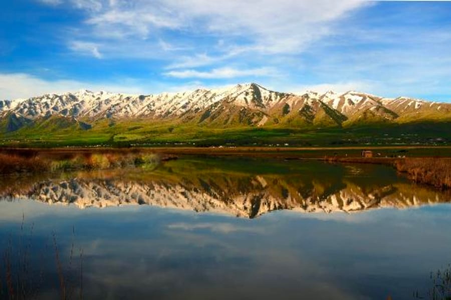
The Raft River Mountains sit in Utah’s far northwest corner and are the only range in the state that runs east to west. Sawtooth National Forest covers the high country, and the drainages coming off the north and south flanks cut through Precambrian schist and quartzite that is among the oldest rock in Utah. A mining camp called Golden operated near here around the turn of the last century, which tells you what people were finding.
Flakes and fine gold are the standard find, and panning the creek gravel and bedrock is the method. Work the small drainages where they leave the range and slow down onto the flats.
The gravel carries black sand, quartz, garnet, and mica from the metamorphic rock above. This is remote country reached from Yost or Park Valley on gravel roads, so carry a full tank, real water, and a spare tire.
Forest Service ground is open to casual hand prospecting where it is not claimed, and the surrounding valley floor is a patchwork of private ranch and BLM. Standard panning gear from the techniques section covers this ground.
Difficulty: 3 out of 5
Western Utah
The Great Basin ranges west of the Wasatch hold Utah’s classic desert gold, and this is where BLM ground opens up in a way it does not anywhere else in the state. Bring water, because most of this gold sits in washes that only run a few days a year.
Gold Hill and Clifton Wash, Tooele County
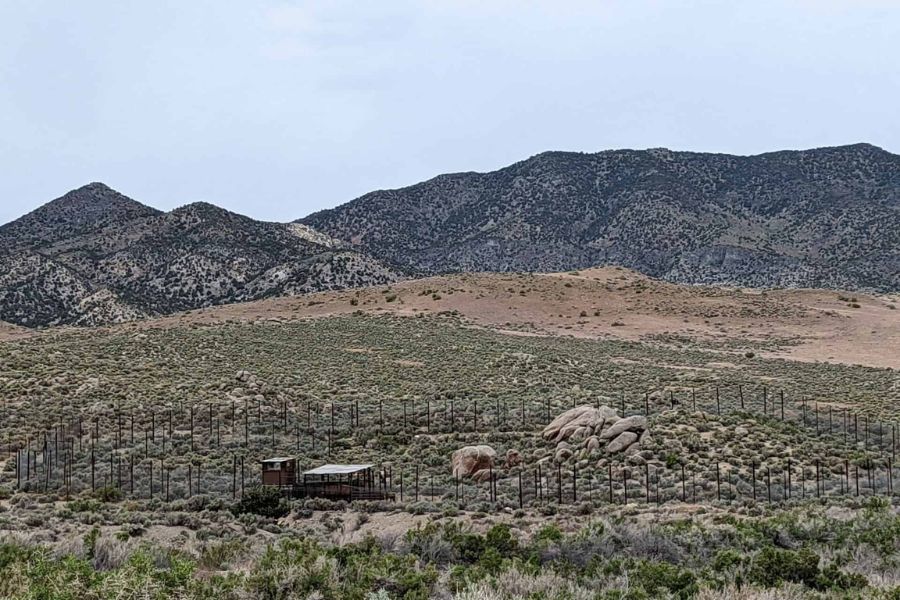
Gold Hill is a near ghost town on the east side of the Deep Creek Mountains, and the washes around it are the best known dry placer ground in Utah. The Clifton mining district was organized in 1889 and produced around 26,000 ounces of gold from the veins, and Gold Hill Wash, Clifton Wash, Rodenhouse Wash, and Miners Canyon all carry loose gold shed off those same outcrops. BLM land surrounds the townsite, reached on a long graded road from Ibapah or Wendover.
Coarse gold is the draw here, because there has never been enough water to flatten it out. Dig to the caliche hardpan in the wash bottoms, screen the material, and haul buckets to water, or swing a detector across the bench gravel.
Expect quartz, arsenopyrite, jasper, and heavy black sand in the same concentrate. Active claims cover parts of the district and the old mill and dump areas carry arsenic in the soil, so check claim status with the BLM, stay out of the workings, and wash your hands before you eat.
There is no service, no water, and no cell coverage out here, so tell someone your plan. The classifier and detector from the techniques section are the right tools for this ground.
Difficulty: 4 out of 5
Ophir Canyon, Tooele County
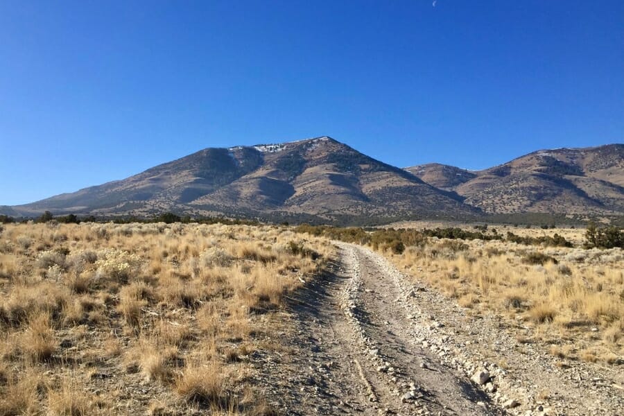
Ophir Canyon cuts into the south end of the Oquirrh Mountains and holds one of Utah’s oldest mining camps, founded after soldiers followed local reports of silver in 1870. The Ophir and Rush Valley districts produced about 104,000 ounces of gold along with a great deal of silver and lead, and the creek in the canyon drains straight through that mineralized rock. The road in from State Route 73 at Ophir is paved to the town and then climbs onto Uinta Wasatch Cache National Forest land.
Fine flakes and small pickers come out of the creek gravel, and panning the bedrock and boulder pockets is the technique. The canyon is narrow, which funnels everything into a few good traps.
Bycatch here runs to quartz, galena, pyrite, and cerussite from the old vein material, and this district is one of the best in the state for finding silver in Utah too. The town of Ophir itself is private property with residents and a small museum, so park where signs allow and start your work upstream on forest ground.
Claims are present in the canyon and on the slopes above, so read posts carefully before you dig. Standard panning gear from the techniques section is all you need here.
Difficulty: 3 out of 5
Amasa Valley and the House Range, Millard County
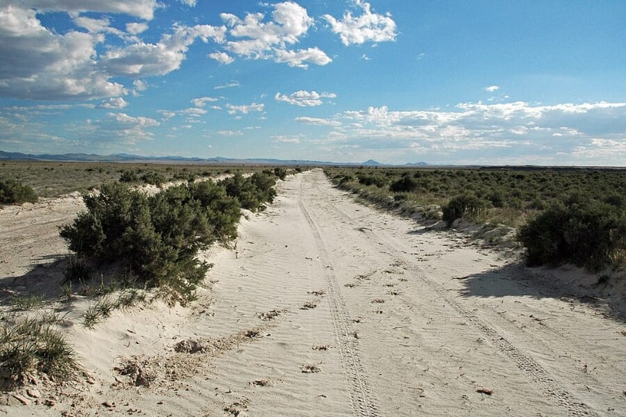
Amasa Valley sits under the west face of the House Range in Millard County, and it is one of the few named dry placer areas in Utah’s central desert. Gold has been reported from the gravels of Amasa Valley, North Canyon, and the washes below Notch Peak, where a huge granite intrusion pushed into the limestone and left mineral behind. This is wide open BLM country reached on graded roads west of Delta.
Coarse and fine gold both turn up, and the work is classic desert prospecting. Find where a wash leaves the range front, dig to the hard layer, screen everything, and either detect the bench gravel or bucket the good material to water.
The same ground gives up quartz, jasper, agate, and the trilobite bearing shale that makes this range one of the top spots for Utah fossils. There is no water anywhere out here, so bring far more than you plan to drink and go with a second vehicle if you can.
Notch Peak has a wilderness study area on part of it where motorized use and surface disturbance are limited, so check the BLM Fillmore Field Office map before you pick a spot. The screens and detector from the techniques section carry this trip.
Difficulty: 4 out of 5
Southern Utah
Southern Utah is the friendliest gold country in the state for a first trip, because the Tushar Mountains put real gold in creeks that anybody can walk to. This is also where organized prospecting clubs hold claims that members can work without any research at all.
Bullion Canyon and Pine Creek, Piute County
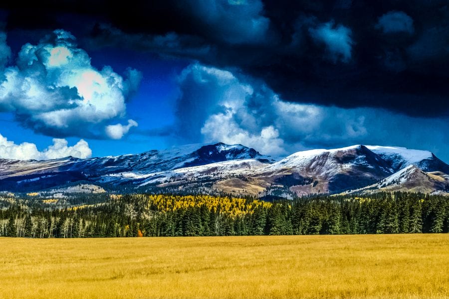
Bullion Canyon is the single best beginner gold trip in Utah, and the Forest Service practically invites you to pan there. The canyon climbs west out of Marysvale off US Highway 89 into the Fishlake National Forest, and the locals call it the Canyon of Gold for good reason, because gold discoveries in the 1880s built the Bully Boy Mine and a string of camps up the drainage. Miners Park partway up the canyon is a free open air museum with parking, picnic tables, interpretive signs, an old prospector’s cabin, and Pine Creek running right past it.
Flakes and fine gold are what Pine Creek carries, and simple panning is the technique. Work the inside bends, the bedrock seams, and the gravel behind boulders, and take your time because the creek is small and the good traps are easy to read.
The same gravel brings down quartz, pyrite, and colorful altered volcanic rock from the Tushar peaks above. The canyon road is passable for most vehicles in summer, and the Paiute ATV Trail system runs through the area, so watch for traffic on the narrow sections.
Fill your holes, keep your work in the creek gravel rather than the banks, and check current forest rules with the Fishlake National Forest Beaver Ranger District. A pan and classifier from the techniques section is the whole kit here.
Difficulty: 1 out of 5
The Sevier River near Marysvale, Piute and Sevier Counties
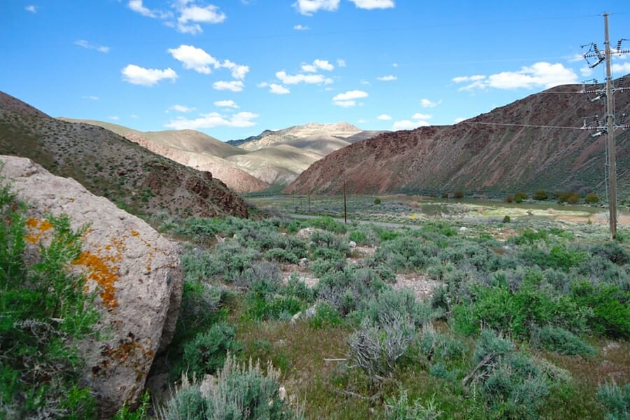
The Sevier River collects everything the Tushar Mountains shed, which makes it the most productive gold river in central Utah. It runs north through Marysvale Canyon between Marysvale and Sevier, paralleled by US Highway 89 with pullouts, campgrounds, and river access the whole way. Big Rock Candy Mountain sits right on this stretch, and the bright yellow and orange rock there is a visible sign of the hydrothermal alteration that put gold in this valley.
Fine gold and flakes come out of the bar gravel, and this river rewards a sluice more than a pan because the gold is spread thin through a lot of material. Work the upstream tips of the bars and follow the black sand.
You will also pan up black sand, quartz, alunite, and pieces of altered rhyolite. The Utah Gold Prospecting Club holds several claims on the Sevier in Sevier County that members can pan, sluice, and camp on, which is the simplest way to work this river with zero claim research.
Ground along the river is a mix of BLM, private ranch, and claims, so confirm where you are standing before you unload gear. Bring the sluice from the techniques section.
Difficulty: 2 out of 5
Gold Springs District, Iron County
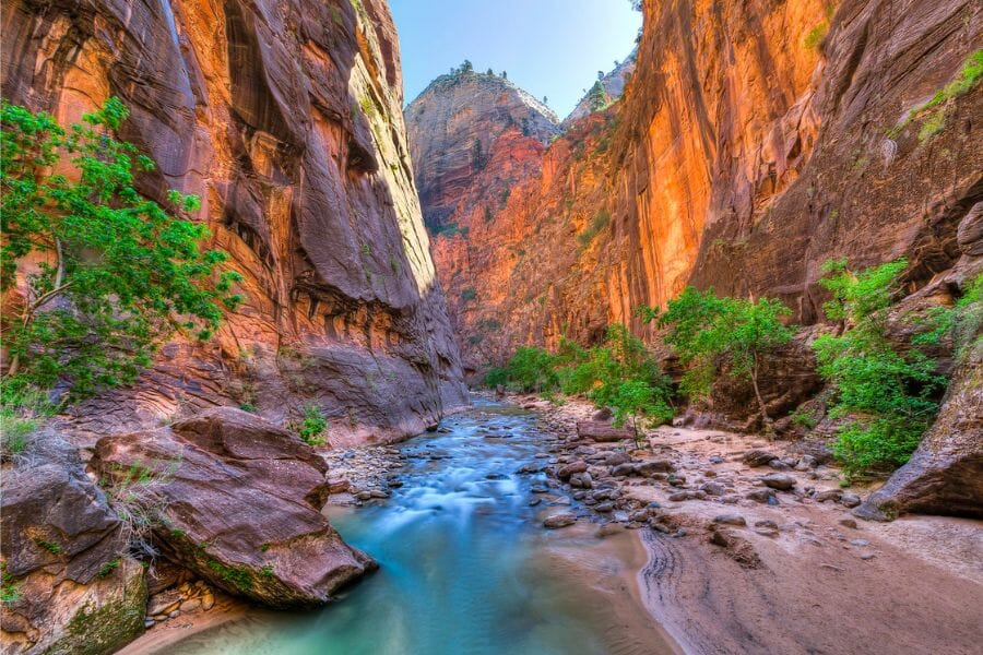
Gold Springs sits on the Utah Nevada line west of Modena, and it is the most productive gold district in southwestern Utah. Also called the Stateline district, it produced somewhere around 12,000 ounces from quartz veins cutting volcanic rock, and the washes draining those outcrops carry the loose material. BLM land covers most of the district, reached on graded roads north from State Route 56.
Fine gold and small coarse pieces both turn up, and dry wash prospecting and detecting are the methods that fit. Look for the point where a wash leaves the hills and flattens, then dig to the hard layer.
The district gives up quartz, hematite, fluorite, and manganese stained vein material along with the gold. Old shafts and adits are scattered through the hills and none of them are safe to enter, so admire them from outside.
Claims cover parts of the district on both sides of the state line, so check the BLM records before you settle in. The detector and classifier from the techniques section suit this ground best.
Difficulty: 3 out of 5
Eastern Utah
Eastern Utah splits into two kinds of gold country, the big plateau rivers carrying superfine gold in from the Rockies and the laccolithic mountain islands rising out of the canyon country. Both are quiet, and you will often have a whole river bar or creek to yourself.
Crescent Creek, Henry Mountains, Garfield County
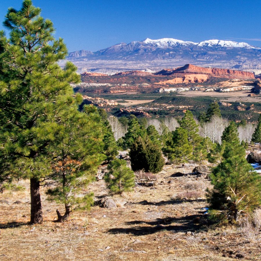
Crescent Creek drains the east flank of Mount Ellen in the Henry Mountains, and it produces the chunkiest, richest colored gold in Utah. The Henry Mountains district was organized in 1883 and the Bromide Basin strike in 1889 built the boom town of Eagle City just up the drainage. The creek is reached from State Route 95 between Hanksville and Lake Powell, up a rough road that wants high clearance and four wheel drive.
The gold here is high karat and heavy, showing up as grains, wires, thick flakes, and the occasional pea sized nugget. It concentrates in black sand streaks at the base of the gravel and on bedrock in the creek channel, so panning and crevicing both pay.
Your concentrates will carry black sand, quartz, and pieces of the diorite that makes up the mountain core. Claims cover most of the placer ground from North Wash up toward Bromide Basin, and a public panning area with shade and an old cabin has traditionally been kept open on the creek, so confirm the current arrangement with the BLM Henry Mountains Field Station in Hanksville before you go.
Hanksville is the last real supply point and it is a long way back, so fuel up and carry recovery gear. The crevice tools from the techniques section are the key to this creek.
Difficulty: 4 out of 5
San Juan River at Sand Island, San Juan County
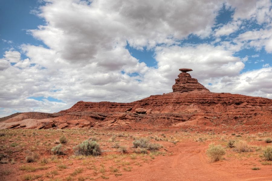
The San Juan River has been giving up fine gold since prospectors chased it here in the 1890s, and the BLM keeps public river access open at Sand Island near Bluff. There is a campground, a boat ramp, restrooms, and easy walking to the gravel bars. Mexican Hat downstream has a second public ramp with more bar access.
The gold is extremely fine flood gold carried in from the San Juan Mountains in Colorado, and it takes a patient hand and a good finish pan to keep it. Work the upstream tips of the bars and chase the black sand streaks, because the gold rides with the heavy sand rather than the cobbles.
The same gravel carries black sand, agate, jasper, and petrified wood washed out of the plateau formations. The south bank of the river below Bluff is Navajo Nation land and needs a tribal permit, so keep your work on the north side at the marked BLM sites.
Monument boundaries in this part of San Juan County have changed more than once, so check the current status with the BLM Monticello Field Office before you pick a bar. The finish pan and magnet from the techniques section make this river worthwhile.
Difficulty: 3 out of 5
The Colorado River along Highway 128, Grand County

The Colorado River corridor upstream of Moab is the most scenic gold ground in Utah and one of the easiest to reach. State Route 128 follows the river northeast from US 191 for more than thirty miles, with BLM campgrounds, day use areas, and boat ramps giving you legal footing on the bars at Big Bend, Hittle Bottom, and Dewey Bridge. Cass Hite’s 1883 discovery in Glen Canyon set off the rush that put prospectors all along this river.
The gold is superfine flood gold carried down from the Colorado Rockies, and it concentrates in the fine sand and black sand layers rather than the coarse gravel. A slow, careful pan and a finish pan are what keep it.
The bars also give up agate, jasper, petrified wood, and river polished sandstone. This river holds endangered fish, so in stream disturbance is tightly restricted and hand panning of bar material above the waterline is the safe approach.
Confirm current rules with the BLM Moab Field Office, and remember that Arches and Canyonlands National Parks are closed to prospecting entirely. The finish pan from the techniques section is the tool that makes this stretch pay.
Difficulty: 2 out of 5
Johnson Creek and Recapture Creek, San Juan County
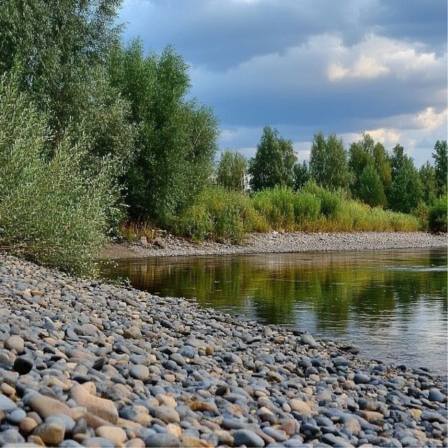
Johnson Creek and Recapture Creek drain the south and east sides of the Abajo Mountains, and both have documented placer workings from the 1892 rush. The Abajos are a laccolith, a blister of intrusive rock that pushed up under the sedimentary layers and carried gold with it, and the creeks have been cutting into that rock ever since. Manti La Sal National Forest covers the upper drainages, reached on forest roads west and north of Blanding.
Fine gold and small flakes are the find, and panning the bedrock and gravel behind boulders is the technique. The creeks are small, which makes the traps easy to read.
Bycatch runs to black sand, quartz, garnet, and pyrite from the intrusive rock. The lower reaches of both creeks cross private and tribal land, so start on national forest ground upstream and work down only where you have confirmed access.
Recapture Reservoir and its immediate surroundings have their own rules, so stay clear of the water supply infrastructure. Standard panning gear from the techniques section covers these creeks.
Difficulty: 3 out of 5
Green River below Flaming Gorge, Daggett County
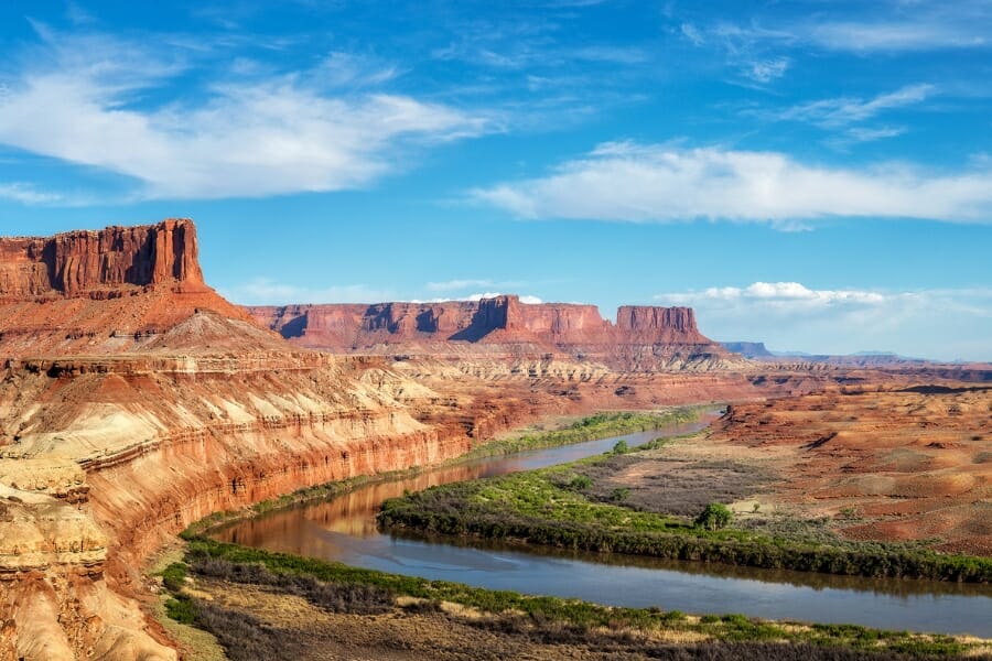
The Green River below Flaming Gorge Dam carried enough fine gold to draw serious attention in the 1800s, with the old workings concentrated around Horseshoe Bend and the bends downstream. The river cuts out of the Uinta Mountains through Red Canyon and then flattens, and every place it slows it drops what it is carrying. Ashley National Forest and BLM land give you access along much of the corridor, with the Little Hole road and the Browns Park road reaching the water.
Fine gold in the bar sand is the target, and a finish pan with careful technique is what keeps it. Focus on the black sand layers where a bar meets the bank.
The bars carry black sand, quartz, chert, and colorful Uinta Mountain quartzite cobbles. The river below the dam runs cold and the flows change without much warning when the dam releases, so watch the water and stay out of the channel when it is rising.
Dinosaur National Monument covers the river further downstream and is closed to prospecting, and recreation area rules apply near the reservoir, so confirm the boundary and the current rules with the Ashley National Forest Flaming Gorge Ranger District before you start. The finish pan and magnet from the techniques section are what this river asks for.
Difficulty: 3 out of 5
More Proven Places To Find Gold in Utah
The spots above are the easiest wins, and the list below is where the state opens up. Every one of these has documented gold or steady prospector reports behind it, and every one needs a rules and access check before you go, because Utah’s public land is threaded with active mining claims.
Northern Utah
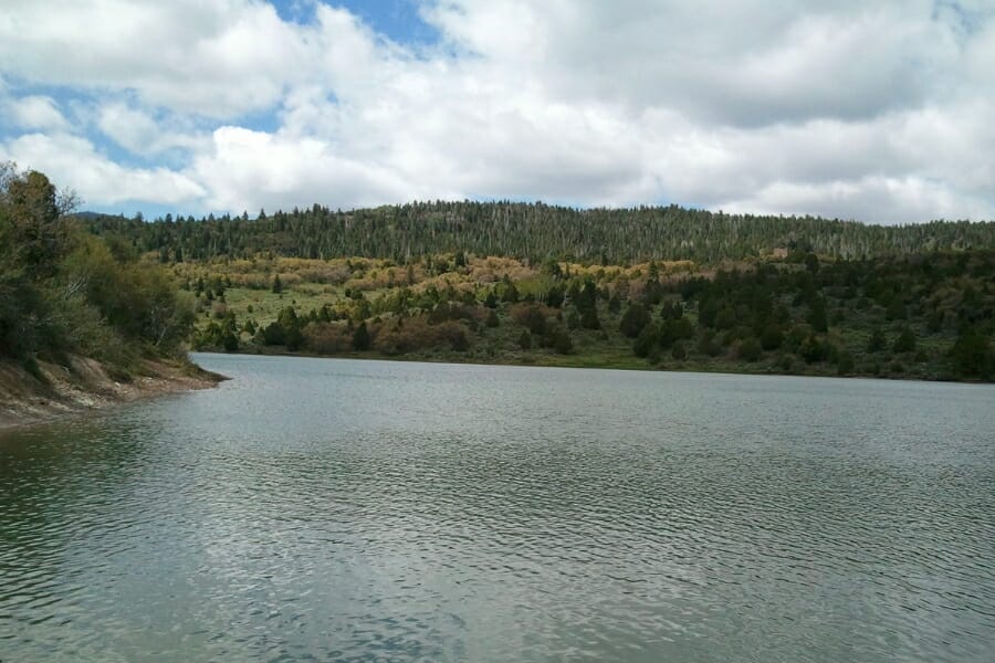
Park Valley and the Century Mine, Box Elder County. Park Valley sits on the south side of the Raft River Mountains and was a working gold camp built around the Century Mine and its neighbors. The washes and gulches coming off the range carry material shed from those veins. Much of the valley floor is private ranch with BLM sections mixed in, so map the ownership before you unload.
Willard Canyon, Box Elder County. Willard Canyon cuts into the Wasatch face above the town of Willard, and prospectors have long reported color in its gravel. The canyon is steep and short, which concentrates everything into a narrow channel. Part of the drainage is municipal watershed and part is national forest, so contact Willard City and the Ogden Ranger District before you plan a dig.
Parrish Canyon, Davis County. Parrish Canyon above Centerville drains the Wasatch front range and appears in Utah gold occurrence records. The canyon mouth has trailhead parking and the creek runs right beside the trail. Davis County canyons supply drinking water to the cities below, so confirm what is allowed with the city and the Uinta Wasatch Cache National Forest before you put a pan in.
Mary Ellen Gulch, Utah County. Mary Ellen Gulch is the high side drainage above American Fork Canyon that fed the district’s richest workings, reached from the Pacific Mine trailhead. Prospectors report gold in the gulch gravel and in the old dumps. The gulch has seen mine waste cleanup work and carries active claims, so check current access with the Uinta Wasatch Cache National Forest before you drive up.
Cold Water Canyon, Weber County. Cold Water Canyon in the mountains east of Ogden shows up in Utah gold occurrence records alongside the small Fremont Island district. The drainage is short and steep with exposed bedrock in places. Access crosses a mix of national forest, city watershed, and private ground, so confirm before you go.
Western Utah
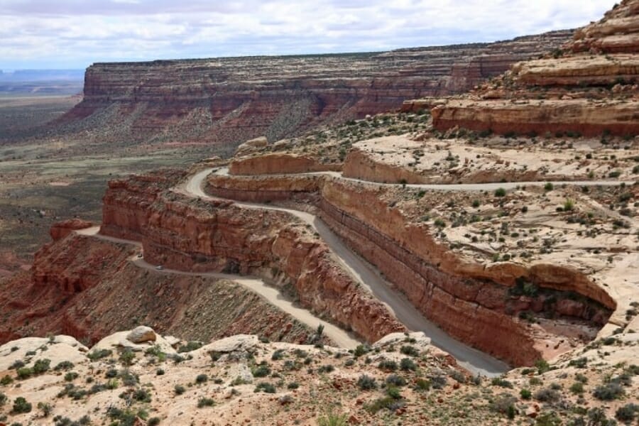
Deep Creek Mountains and Trout Creek, Juab County. The Deep Creek Mountains are Utah’s highest west desert range and hold the Trout Creek mining district on their east side. Granite and quartzite peaks feed washes that carry gold down onto the flats. Much of the high country is a wilderness study area with restrictions, and the Goshute Reservation borders the range on the west, so check boundaries with the BLM Salt Lake Field Office first.
Drum Mountains, Juab County. The Drum Mountains hold the Detroit district, a gold and manganese camp with quartz veins in the older sedimentary rock. Washes coming off the range carry loose material onto the desert floor. This is remote BLM country north of Delta with claims scattered through it, so bring a claim map and plenty of water.
Sheeprock Mountains, Juab County. The Sheeprock Mountains southwest of Vernon carry gold in granite and quartzite along with the tungsten the range is better known for. Sheeprock Canyon and the drainages around it have documented placer occurrences. The range sits on a mix of BLM and Uinta Wasatch Cache National Forest ground, so confirm which agency manages the spot you pick.
Tintic District near Eureka, Juab County. Tintic is the second biggest gold district in Utah at roughly 2.6 million ounces, and the old dumps and washes below Eureka still carry gold in the vein material. The district ran from 1869 into the 1950s and left workings all over the hills. Nearly all of it is patented private ground or active claims, so this one starts with permission and a claim check rather than a shovel.
Granite Canyon and Notch Peak, Millard County. Granite Canyon cuts into the big intrusion at the south end of the House Range, and gold has been reported from its gravels and the neighboring canyons. The granite contact with the limestone is what makes this ground interesting. Access is BLM on graded desert roads west of Delta, with wilderness study area limits nearby.
Ibex Canyon, Millard County. The Ibex area southwest of Delta appears in Utah gold occurrence records along with the small workings scattered through the Barn Hills. Washes here run out onto the old lake bed flats. This is open BLM desert with almost no shade or water, so treat it as a cool season trip.
Willow Springs District, Tooele County. The Willow Springs district near Callao produced roughly 12,000 ounces of gold from veins on the east side of the Deep Creek country. The washes below the old workings carry loose material. This is a long drive on the Pony Express route with no services, and claims are present, so plan the trip carefully.
Southern Utah
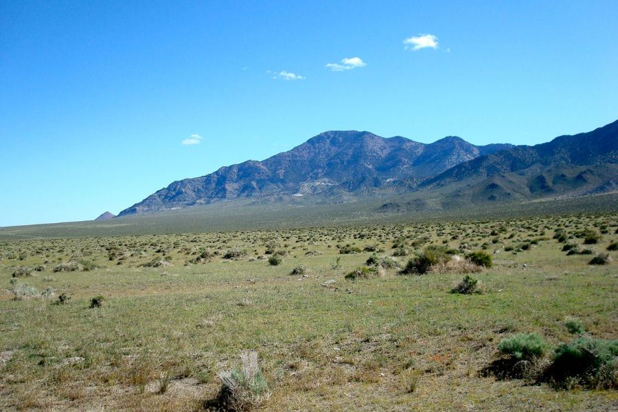
Indian Creek, Beaver County. Indian Creek drains the mineralized country of southern Beaver County and appears in Utah gold occurrence records along with several small prospects nearby. The creek runs through sagebrush and juniper country with BLM sections along it. Private ranch land is mixed in, so check the map before you step off the road.
San Francisco Mountains and the Frisco District, Beaver County. The San Francisco district west of Milford produced about 33,000 ounces of gold alongside enormous silver production from the Horn Silver Mine. The washes below the range carry material shed from those veins. The ghost town of Frisco and its charcoal kilns sit on the road in, and the ground around the old mines is claimed and unsafe, so work the open BLM washes instead.
Star District and Rocky Hollow, Beaver County. The Star or Rocky district in the Star Range southwest of Milford produced gold along with lead and silver, and Rocky Hollow shows up in Utah gold occurrence records. Washes drain the range onto the desert flats where the heavy material settles. This is BLM ground with scattered claims, so bring a claim map.
Mill Creek, Piute County. Mill Creek drains the Tushar country in Piute County and appears in state gold occurrence records. It runs through the same altered volcanic rock that makes Bullion Canyon productive. Access is a mix of Fishlake National Forest and private ground, so confirm which you are on.
Mount Baldy District near Marysvale, Piute County. The Mount Baldy district produced roughly 77,000 ounces of gold from veins in the Marysvale volcanic field. Drainages coming off the peak carry loose vein material down toward the Sevier. Fishlake National Forest covers much of it, with claims scattered through the old workings.
Clear Creek Canyon, Sevier County. Clear Creek Canyon carries Interstate 70 west from Sevier through the same volcanic country that feeds the Tushar gold, and the creek has documented gold occurrences. There are pullouts, the Fremont Indian State Park visitor center, and easy walking to the water. State park ground is closed to collecting, so work the national forest and BLM stretches outside the park boundary.
Beaver Dam Wash, Washington County. Beaver Dam Wash in Utah’s far southwest corner appears in gold occurrence records and drains the mineralized Bull Valley country. The wash runs through Mojave Desert terrain unlike anywhere else in the state. Much of the lower wash sits inside a national conservation area with its own rules, so contact the BLM St George Field Office before you plan a dig.
Goldstrike and the Bull Valley District, Washington County. The Goldstrike district in the Bull Valley Mountains northwest of St George produced gold from quartz veins and has drawn prospectors back repeatedly. The washes below the old workings carry the loose material. This is BLM ground on rough roads, with claims present around the historic mines.
Eastern Utah

Gorge Creek, Daggett County. Gorge Creek drains into the Green River corridor in Daggett County and appears in Utah gold occurrence records. The drainage cuts through the older rock on the flank of the Uinta Mountains. Ashley National Forest and BLM ground cover the area, with recreation area rules nearby, so confirm which apply.
North Wash below the Henry Mountains, Garfield County. North Wash carries everything Crescent Creek and the east side of Mount Ellen send downhill, and the placers along it were worked during the Henry Mountains rush. State Route 95 follows the wash, which makes scouting simple. The lower end runs into Glen Canyon National Recreation Area where prospecting is closed, so keep your work on the BLM stretch above that boundary.
Dolores River near Dewey Bridge, Grand County. The Dolores River meets the Colorado just above Dewey Bridge, and both rivers carry fine flood gold to the confluence. A side river dumping into a big one is a natural drop point for anything heavy. BLM ground and a campground give you access, and the same endangered fish restrictions apply as on the Colorado.
Miners Basin, Grand County. Miners Basin is a high bowl on the north side of the La Sal Mountains that boomed after the 1892 gold discoveries, and a ghost town site still sits there. The creeks draining the basin cut into the intrusive core of the range. Manti La Sal National Forest covers it, reached on a steep road from Castle Valley, and claims are present.
Westwater Creek, Grand County. Westwater Creek runs south out of the Book Cliffs toward the Colorado River and shows up in Utah gold occurrence records. The drainage crosses open BLM country north of Interstate 70. Roads in are unimproved and turn to mud fast when it rains, so pick a dry stretch of weather.
Cottonwood Wash near Blanding, San Juan County. Cottonwood Wash drains the east side of the Abajo Mountains past Blanding and carries the same intrusive derived material as Recapture Creek. The wash runs through a mix of BLM, state, and private ground. Confirm ownership at each access point, because the pattern changes every mile.
Wilson Mesa and the La Sal South Slope, San Juan County. Wilson Mesa and the drainages on the south side of the La Sal Mountains hold documented placer occurrences from the 1892 rush. The country is high, forested, and cool even in midsummer. Manti La Sal National Forest ground gives you access, with private inholdings and claims mixed in.
Dry Fork Creek near Vernal, Uintah County. Dry Fork Creek comes out of the south flank of the Uinta Mountains northwest of Vernal, and prospectors report gold flakes in its placer gravel. The canyon has road access and public land sections along it. Private ranch land lines parts of the lower canyon, so confirm before you step to the water.
Green River near Jensen, Uintah County. The stretch of the Green around Jensen was worked for fine gold in the 1800s and still carries it in the bar sand. There is BLM ground and a state park boat access in the area. Dinosaur National Monument is immediately upstream and closed to prospecting, so check the boundary carefully before you pick a bar.
The Best Gold Hunting Techniques in Utah
Four techniques cover every kind of Utah gold ground, and you can start with the first one for the price of lunch. Work through them in order and each new tool multiplies what the last one taught you.
Gold Panning (Difficulty: 1 out of 5)
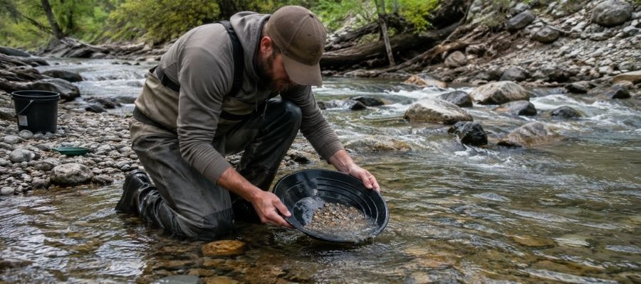
Panning is swirling gravel and water in a pan so the heavy gold sinks and everything lighter rides out over the lip. It takes about twenty minutes to learn and a season to get good at, and it is the only technique that works everywhere in Utah. Every legal spot in this guide allows it.
Much of Utah’s gold is very fine, so slow down. Tip the pan a little less than feels right and let the water do the work, because a fast pan throws flour gold straight back into the river. In the desert, carry buckets of screened material to the nearest water rather than trying to work dry ground with a pan.
Essential Tools
- Gold pan: Garrett 15 Inch Dual Riffle SUPERSLUICE Gold Pan
- Finish pan: Garrett Prospecting 10 Inch Backpacker Gold Pan
- Classifier screen: SE Half Inch Sifting Screen
- Snuffer bottle: Garrett Gold Guzzler Bottle
- Storage vials: SE Glass Vials with Caps
Sluicing (Difficulty: 2 out of 5)
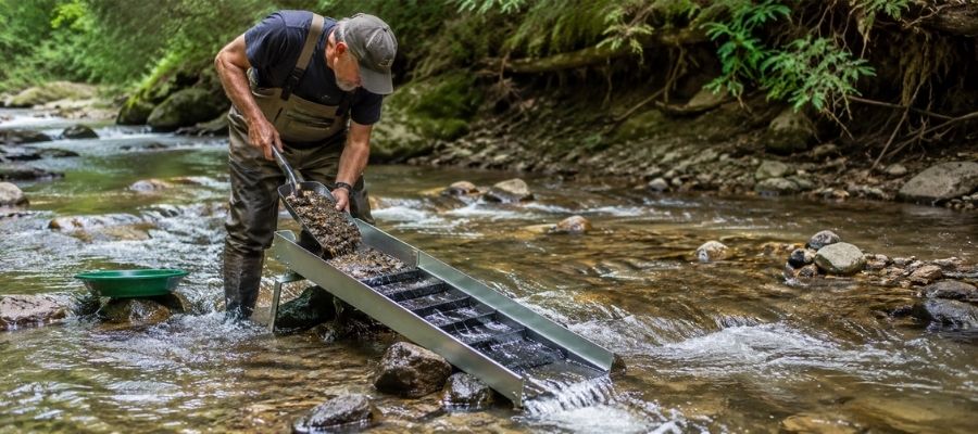
A sluice is a metal trough with riffles that you set in the current so it pans for you all day long. You shovel classified gravel in the top, the water carries the light material away, and the gold hangs up behind the riffles. It processes ten times what a pan can in the same hour.
Sluicing is where the Sevier River and the club claims along it really pay, because there is volume gravel and legal room to set up. A hand sluice that moves water can count as stream alteration in Utah, so check with the Utah Division of Water Rights and the managing agency for the specific site before you set one in.
Essential Tools
- Sluice box: Keene A52 Hand Sluice
- Digging shovel: Bully Tools 14 Gauge Round Point Shovel
- Fine classifier: SE 1/8 Inch Mesh Sifting Screen
- Black sand magnet: SE Magnetic Separator Pick Up Tool with Quick Release
Metal Detecting (Difficulty: 2 out of 5)
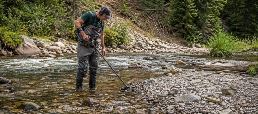
A gold detector finds pieces your pan would never reach, buried in packed gravel, caliche, and old tailings. It is the only practical way to hunt nuggets in dry country, and Utah’s west desert is exactly that. You swing slowly, listen for a clean tone, and dig every signal.
The washes and bench gravels around Gold Hill, the Gold Springs district, and the House Range are the classic Utah detecting ground. The mineralized desert soil out there is noisy, so ground balance carefully before you start swinging.
Essential Tools
- Gold detector: Garrett AT Gold Metal Detector
- Pinpointer: Garrett Pro Pointer AT
- Hand trowel: Edward Tools Bend Proof Trowel
- Magnifying loupe: JARLINK 30X 60X Illuminated Loupe
Crevicing (Difficulty: 3 out of 5)
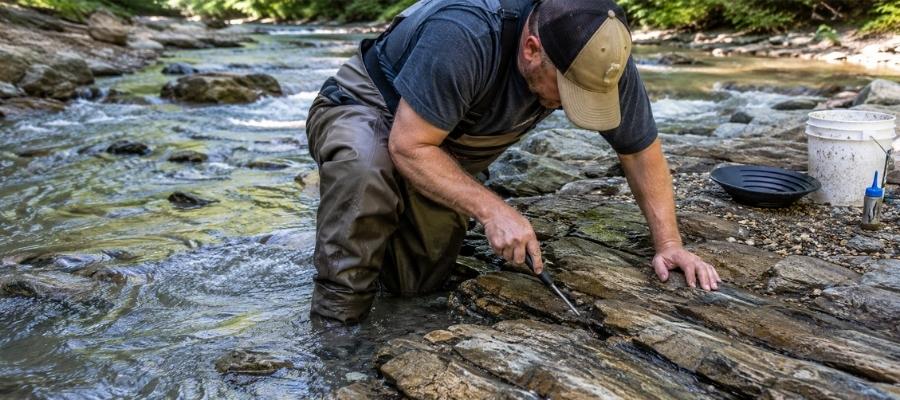
Crevicing is digging gold out of the cracks in exposed bedrock, and in Utah’s steep canyons it is the highest payoff technique there is. Gold works its way down into a seam over decades and cannot go any further, so a crack nobody has cleaned is a savings account. You scrape, flush, and repeat until the crack is empty.
Pine Creek in Bullion Canyon, Crescent Creek in the Henry Mountains, and the American Fork drainage all have exposed bedrock in the channel. Work at low water in late summer and fall when more of that bedrock is dry.
Essential Tools
- Crevice tool set: ASR Outdoor Steel Crevice Tool Set
- Rock hammer: ESTWING 22 oz Rock Pick
- Snuffer bottle: Garrett Gold Guzzler Bottle
- Storage vials: SE Glass Vials with Caps
How To Tell Real Gold From Fool’s Gold
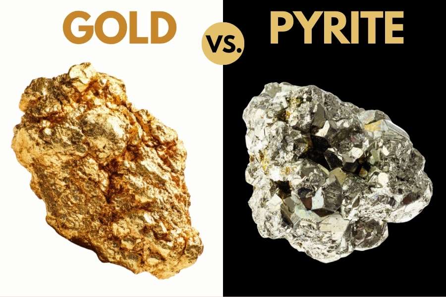
Utah gravel carries more pyrite and mica than gold, and both put on a very convincing show in a wet pan. The good news is that two simple tests separate them every single time, and neither one takes more than a few seconds.
The shadow test is the fastest. Cup your hand over the pan and watch the sparkle. Real gold keeps its warm yellow glow in shade, while pyrite and mica go gray and flat the instant the direct sunlight leaves them.
The poke test settles whatever the shadow test leaves open. Press a pin or a knife tip firmly into the piece, and gold will dent and hold the mark because it is soft metal. Pyrite is brittle and cracks apart, and mica peels into thin sheets.
Getting this right matters because the real cost of guessing is not embarrassment. It is dumping a pan that had gold in it, or leaving behind a topaz crystal or a piece of red beryl that was worth more than the gold. The US Rocks and Minerals Field Guide puts gold and all of its imitators side by side on waterproof pages you can hold right over a dripping pan.

How Gold Got Into Utah
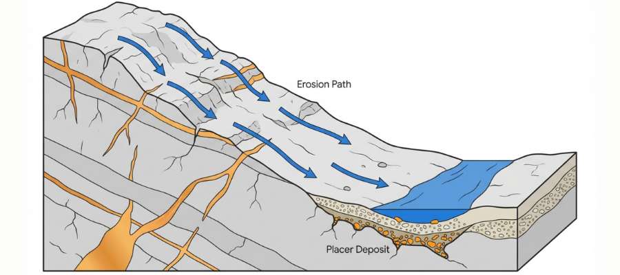
Every spot in this guide sits where it does because of two completely different processes, and knowing which one you are standing on tells you what your pan will look like. The first is Utah’s own gold, and the second is gold that was born in another state.
Utah’s own gold came from magma. Between roughly 40 and 20 million years ago, bodies of molten rock pushed up into the crust under the Oquirrh, Tintic, Deep Creek, Tushar, La Sal, Abajo, and Henry Mountains. Superheated water carrying dissolved gold moved through cracks in the surrounding limestone and quartzite, and as it cooled it dropped that metal into the cracks as quartz veins and scattered grains.
Those veins are the source of every flake in the Wasatch canyons, the west desert washes, and the mountain islands of the canyon country. That is why the mining camps sit where they sit, and why the washes below them are worth your shovel.
Then the land came apart. Basin and Range faulting dropped the valleys and lifted the ranges, and rain, frost, and flash floods began tearing the veins open. Because gold is roughly seven times heavier than the sand around it, it sank into the wash bottoms and creek gravels and stayed while everything lighter kept moving.
The second kind of gold arrives from Colorado. The Colorado, Green, San Juan, and Dolores Rivers all start in the Rocky Mountains, pick up gold hundreds of miles upstream, and hammer it into featherweight flakes on the trip down. That is why plateau river gold is so fine, and why the bars there rebuild themselves every high water year.
What To Bring for a Utah Gold Day Trip
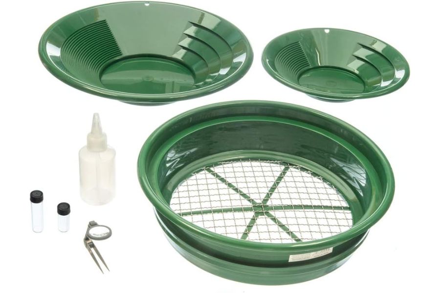
Pack for heat and distance, because most Utah gold sits an hour past the last gas station. Here is the checklist that covers a full day on any ground in this guide.
Prospecting gear
- Gold pan and finish pan, from the techniques section
- Classifier screen and a small shovel
- Buckets for hauling material to water in dry country
- Crevice tools if you are working bedrock
- Snuffer bottle and glass vials for your gold
- Magnet for pulling black sand out of concentrates
Everything else
- Far more water than you think you need, plus electrolytes
- Sunscreen and a wide brim hat, because desert sun burns fast
- A full size spare tire and a way to air up, since most access roads are gravel or worse
- Boots you can soak, and wool socks
- Printed permission, passes, or claim maps for wherever you are headed
- Snacks, a first aid kit, and a charged phone with offline maps
If you would rather buy the whole prospecting side in one box, the Garrett Deluxe Gold Pan Kit covers the pans, classifier, vials, and snuffer bottle together. Our full gold hunting and prospecting equipment guide breaks down what each piece actually does.
The Best Time of Year To Hunt for Gold in Utah
Timing matters enormously in Utah, because the mountains are buried in snow half the year and the desert is dangerous the other half. Here is the window for each region.
Northern Utah
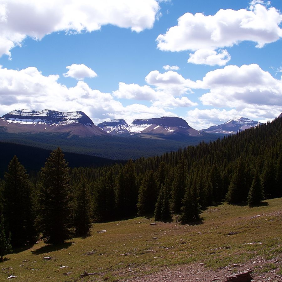
July through early October is prime time on the Wasatch and Raft River drainages. Snowmelt keeps these creeks high and pushy into June, and by late summer the water drops enough to expose bedrock and bar gravel.
Spring runoff in May and June makes the canyon creeks genuinely dangerous, and the upper roads often stay gated until the snow clears. The lower canyon mouths can work in April and again in November when the weather cooperates.
Western Utah
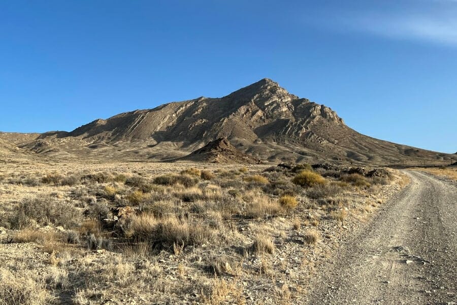
October through April is the season in the west desert, and summer is the one to avoid. Daytime temperatures out past Delta and Wendover climb past anything comfortable and there is no shade and no water for many miles.
Late fall and early spring give you cool digging, firm roads, and long enough days to get real work done. Watch for mud after winter storms, because the desert clay out here turns roads into a trap fast.
Southern Utah
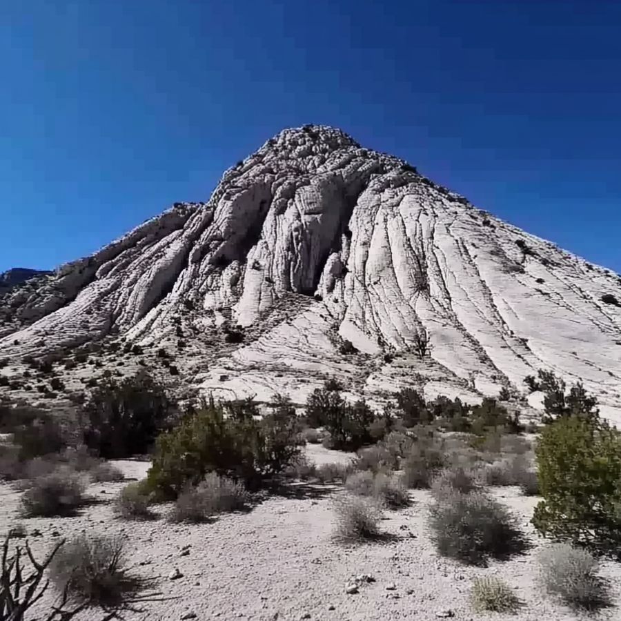
June through October is the window in the Tushar Mountains, and the lower country works nearly year round. Bullion Canyon sits high enough that snow closes the upper road well into spring, while the Sevier River stays reachable much longer.
The Dixie corner around St George is a winter destination, best from October through April. Watch the monsoon in July and August, because a thunderstorm miles away can send a wall of water down a dry wash you are standing in.
Eastern Utah
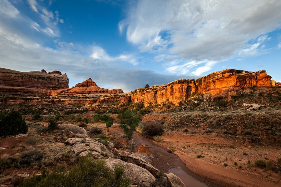
Spring and fall are the sweet spot in canyon country, roughly March through May and again from September into November. The rivers drop to workable levels after runoff, and the temperatures are ideal for long days on a gravel bar.
The Henry Mountains and the La Sals hold snow on the high roads into June and get it back in October, so plan those for midsummer. Flash flooding during the July and August monsoon is the real hazard in the washes, so check the forecast for the whole watershed and not just where you are standing.
Other Valuable Rocks and Minerals You Can Find in Utah
The same ground that holds Utah’s gold holds some of the best mineral specimens in the country. Keep your eyes open while you pan, because more than one prospector has funded a trip on something that was not gold at all.
Topaz
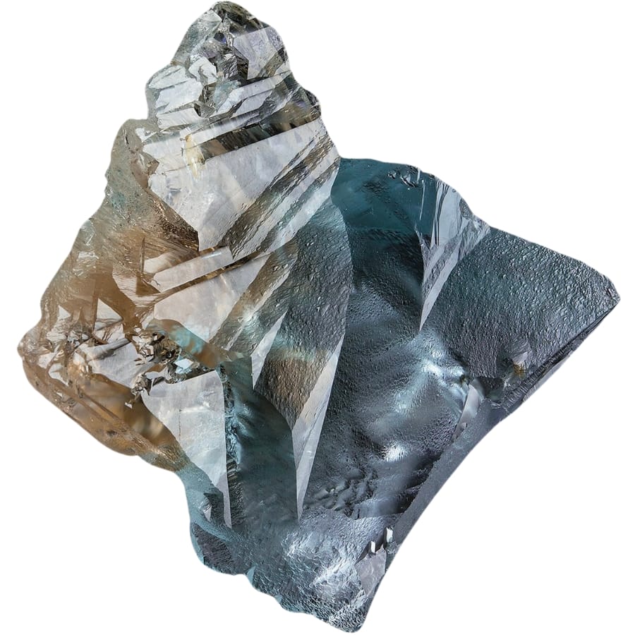
Topaz is Utah’s state gem, and the sherry colored crystals from Topaz Mountain in the Thomas Range are famous with collectors worldwide. They grow in gas cavities inside rhyolite and weather free onto the slopes below. Sunlight fades the amber color to clear over time, which is why collectors store them in the dark.
Our guide to finding crystals in Utah covers where topaz turns up and how to work the rhyolite.
Red Beryl
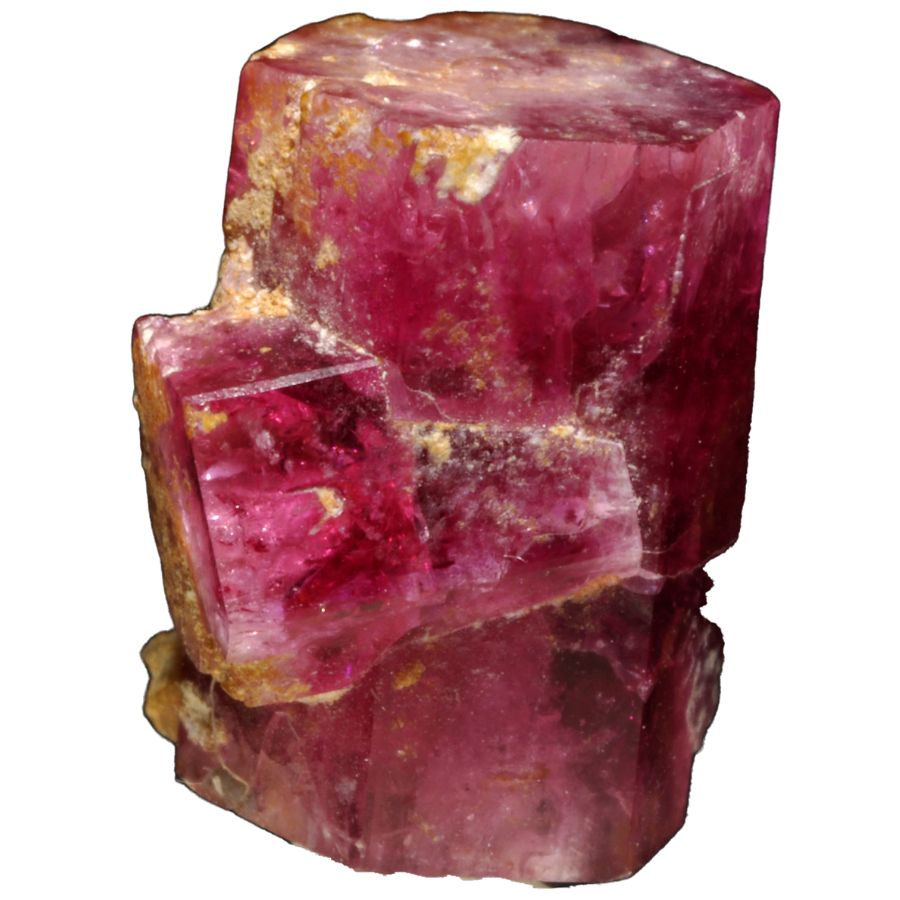
Red beryl is one of the rarest gemstones on earth and the Wah Wah Mountains in Beaver County are the only place that has produced gem quality material. The crystals are raspberry red hexagonal prisms grown in rhyolite, and fine cut stones outprice diamond by weight. The classic locality is claimed, but the mineral turns up in the surrounding volcanic country.
See our gem hunting in Utah guide for the areas where red beryl shows up.
Geodes
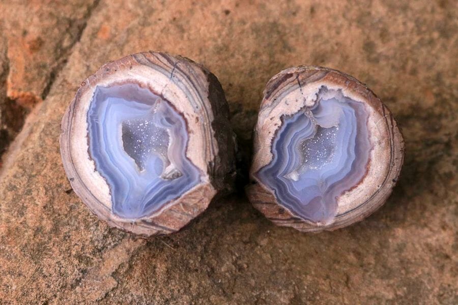
The Dugway geode beds in the west desert are among the most famous collecting sites in North America, and they sit in the same country as several gold districts. The geodes formed as gas bubbles in volcanic rock and filled with quartz, amethyst, and chalcedony. A hollow one feels surprisingly light for its size.
Our guide to geodes in Utah maps out the beds and how to dig them.
Obsidian
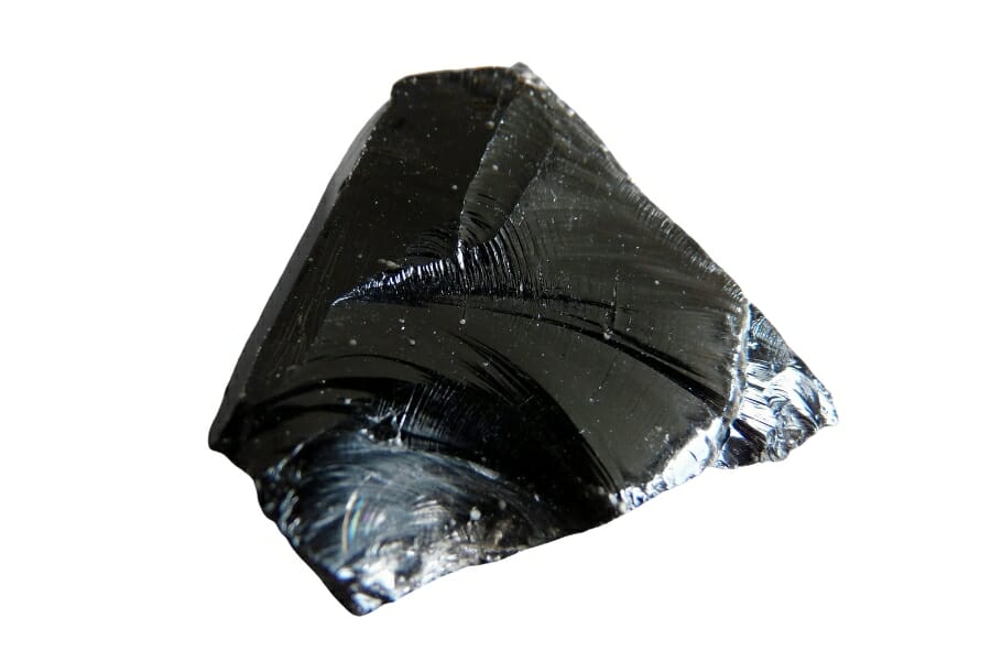
Obsidian is volcanic glass, and Utah’s Black Rock Desert and Mineral Mountains produce it in black, mahogany, and snowflake varieties. It breaks with a curved, razor sharp edge and feels lighter than rock should. Big clean pieces cut and polish beautifully.
Our guide to obsidian in Utah covers the best fields to search.
Agate

Agate turns up on gravel bars across Utah, often in the same pan as your gold. Look for waxy translucent pebbles that glow when you hold them to the sun, with banding or moss like inclusions inside. The San Rafael Swell and the desert ranges are especially good.
Our guide to agates in Utah covers the best hunting grounds by region.
Jasper

Jasper is opaque, solid colored chalcedony and Utah produces some of the most sought after varieties anywhere, including picasso jasper and wonderstone. It shows up as dense red, yellow, brown, and gray cobbles that take a mirror polish. Desert washes are the easiest place to find it.
Our guide to jasper in Utah walks through the best collecting spots.
Petrified Wood
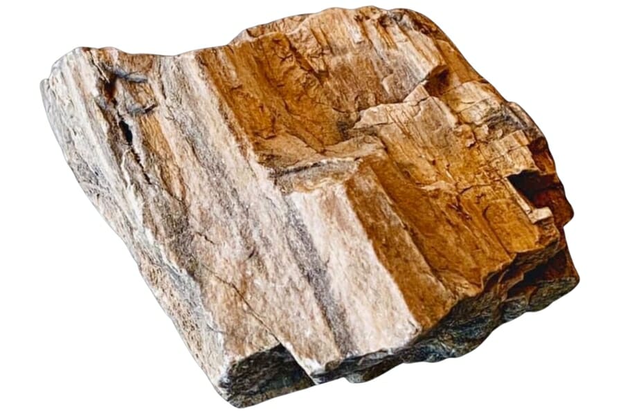
Petrified wood weathers out of the Morrison and Chinle Formations across eastern and southern Utah, and pieces travel down every wash and river. Look for stone with visible growth rings and bark texture, often in red, yellow, and black. Some pieces hold agate and even small crystal pockets inside.
Our guide to petrified wood in Utah covers where it weathers out and the collecting limits that apply.
Garnet

Garnet shows up as deep red grains in Utah creek sand and as full crystals in the metamorphic rock of the Raft River and Uinta country. In a pan it looks like tiny red glass beads sitting with the black sand. Larger clean crystals from schist outcrops can be cut into gems.
Our guide to garnets in Utah covers the best collecting areas.
Amethyst
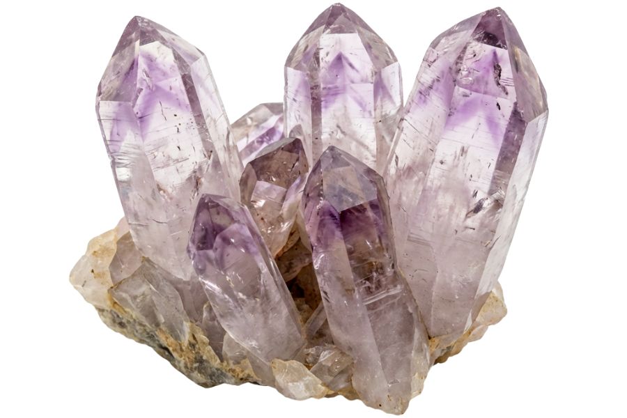
Amethyst is purple quartz, and Utah produces it inside geodes and in vein pockets through the volcanic country of the west desert and the Marysvale field. The color runs from pale lavender to deep grape, and the crystals often line a cavity like teeth. Some of the Dugway geodes hold it.
Our guide to amethyst in Utah covers the localities worth a trip.
Opal

Opal forms where silica rich water soaks into volcanic rock, and Utah’s Milford and Fish Lake areas have produced both common and precious material. Look for waxy nodules and seams with a glassy sheen, sometimes flashing color when you turn them. It is softer than quartz, so it scratches easily.
Our guide to opal in Utah covers where to search and what quality material looks like.
Every one of these can end up in your pan or your pocket on a gold trip, and every one of them is easy to walk past when it is wet and dirty. The Rocks and Minerals of the United States Field Guide gives you photos of all of them on waterproof pages, so nothing valuable goes back in the wash by mistake.

Legal Rules for Gold Prospecting in Utah

Read this before you put a pan in the water. We are rockhounds, not lawyers, and nothing here is legal advice. Rules change constantly in Utah, and staying legal is entirely your responsibility.
Private Property
Utah is a checkerboard of federal land, state trust land, tribal land, and private ground, and the boundaries are rarely marked in the backcountry. Prospecting on private land without the owner’s consent is trespassing, and that includes streambeds where the adjacent land is privately owned. A quick ask ahead of time keeps every flake you find 100% yours.
State trust land managed by the School and Institutional Trust Lands Administration is not the same as open public land and needs its own authorization. Tribal land, including the Navajo Nation, the Goshute Reservation, and the Ute reservation, requires a permit from that nation.
Active Mining Claims
This is the big one in Utah. Tens of thousands of active unpatented mining claims cover BLM and Forest Service ground across the state, and a claim gives the holder the rights to the minerals even though the surface stays public. Panning on someone’s claim is taking their property, so check the ground before you dig using the BLM’s Mineral and Land Records System, and look for claim posts and monuments in the field.
Joining a prospecting club is the fastest way around all of that research. Club claims like the Utah Gold Prospecting Club ground on the Sevier River give members legal, mapped, gold bearing dirt with no homework required.
Equipment Restrictions
A gold pan and hand tools are the safe baseline everywhere you have legal access. Casual use hand panning with no significant surface disturbance and no motorized equipment is generally allowed on open, unclaimed BLM land and on the Uinta Wasatch Cache, Manti La Sal, Ashley, Fishlake, and Dixie National Forests.
Anything beyond that escalates fast. Sluices, highbankers, and dredges can count as stream alteration or a discharge, which brings in the Utah Division of Water Rights, the Utah Division of Water Quality, the Utah Division of Oil, Gas and Mining, and sometimes an Army Corps of Engineers permit, plus written approval from the land managing agency.
Several places are closed outright. All five Utah national parks are off limits, along with Dinosaur National Monument, Timpanogos Cave National Monument, Glen Canyon National Recreation Area, national wildlife refuges, and designated wilderness areas.
National monument lands are withdrawn from mineral entry and their boundaries have shifted more than once, so verify the current line before you go. The Salt Lake City watershed canyons, including Big and Little Cottonwood, prohibit entering the streams at all, which points you toward the open ground in this guide instead.
Play it safe on every trip. Confirm access directly with the landowner or the managing agency before you dig, because boundaries and rules change without notice.
Some locations in this guide sit on or near ground where collecting is limited or where mine waste cleanup is underway. When in doubt, treat a spot as look but do not take until you have confirmation in hand.
The best shortcut is local knowledge. Utah’s rock and mineral clubs and prospecting clubs know which stretches are open, which claims are active, and which landowners welcome visitors, and a membership usually pays for itself in access alone.
Utah Gold FAQ
Can you still find gold in Utah?
Yes, you can still find gold in Utah, and people do it every weekend. Placer gold keeps washing out of the Tushar, Wasatch, Deep Creek, Henry, and Abajo Mountains into creeks and washes you can reach, and the big plateau rivers carry fine gold in from Colorado. Bullion Canyon near Marysvale and the Sevier River are the easiest places to start.
Where can I legally pan for gold in Utah?
The most reliable legal options are open, unclaimed BLM land and the national forests, where casual hand panning is generally allowed. Pine Creek in Bullion Canyon, the BLM river access sites on the San Juan and the Colorado, the washes around Gold Hill, and prospecting club claims on the Sevier River are the standouts. The best places section above lists the rules for each one.
Do you need a permit to pan for gold in Utah?
Recreational hand panning on open BLM and Forest Service land generally does not require a permit, as long as the ground is not claimed or closed. Sluices, highbankers, and dredges are a different story and can require approval from the Utah Division of Water Rights, the Division of Water Quality, and the land managing agency. State trust land and tribal land both need their own authorization before you start.
What is the biggest gold mine in Utah?
Bingham Canyon in the Oquirrh Mountains is the biggest gold producer in Utah by an enormous margin, with more than 30 million ounces recovered as a byproduct of copper mining. It is an active industrial operation with no public access for prospecting. The gold there is scattered through the ore in microscopic grains rather than sitting in a vein.
Which river in Utah has the most gold?
The Sevier River is the best gold river you can actually work, because it drains the mineralized Tushar Mountains and has public access plus club claims along it. The San Juan, Colorado, and Green Rivers all carry fine flood gold from the Rockies and have BLM access points on the bars. For coarse gold, Crescent Creek in the Henry Mountains is the standout.
Get Every Find In Your Pan Identified In Seconds

Every pan you pull out of a Utah creek or wash is a question until you can name what is in it. Gold, pyrite, garnet, topaz, and red beryl all show up in the same country, and the difference between them is thousands of dollars.
The Rocks and Minerals of the United States Field Guide identifies 140 rocks, minerals, and gemstones with clear photos, printed on waterproof pages that work right at the water’s edge.