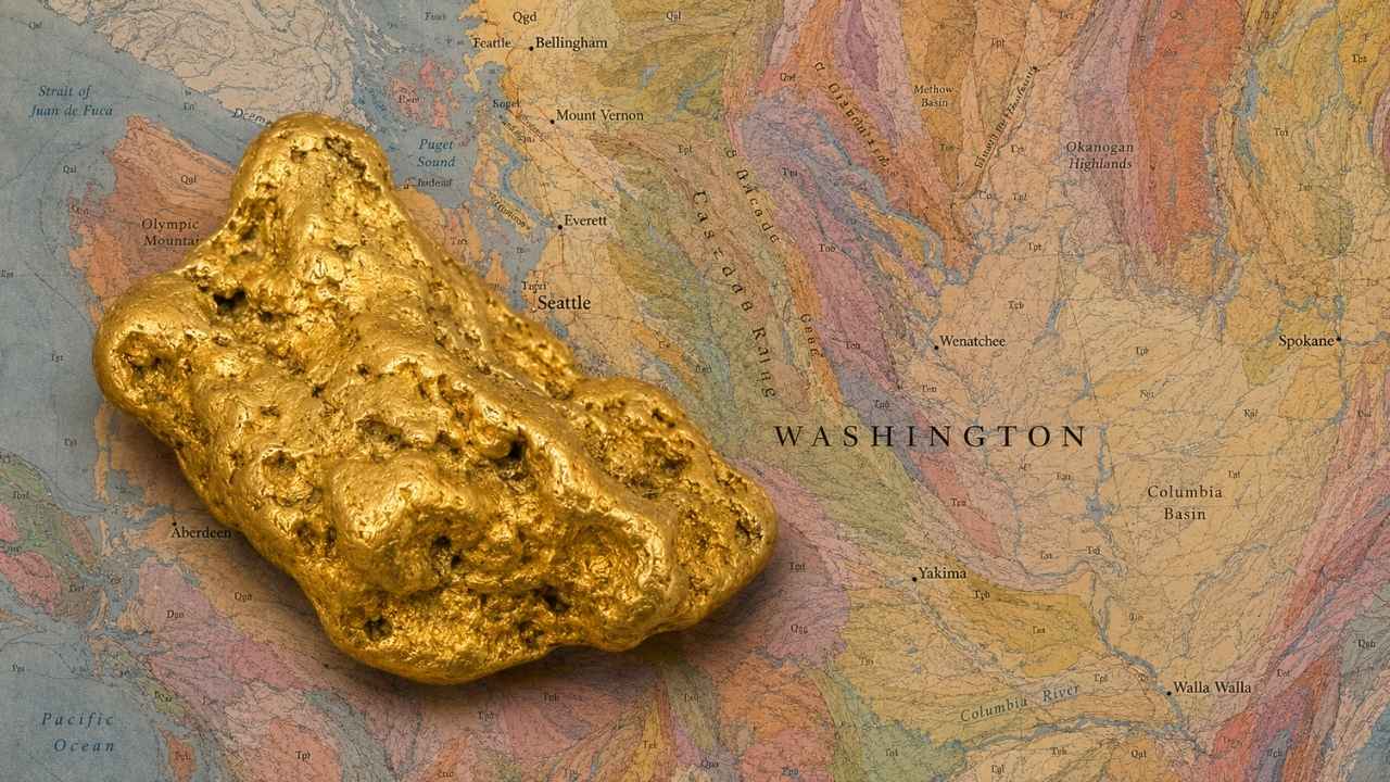
Gold in Washington built a mining town called Liberty around a single creek, and two of the nuggets that came out of that district weighed 73 and 77 troy ounces. Both of them came from Swauk Creek country in Kittitas County, and the same gravels still give up gold every summer.
With gold trading above $4,000 an ounce, you do not need to find much for a weekend on a Washington creek to pay for itself.
Most people who go looking for gold in Washington pick a famous creek off a map and drive straight to it. Then they find out that the stretch they picked is covered by an active mining claim, or that they showed up outside the work window the state sets for that water.
Yes, you can still find gold in Washington today, especially along Swauk Creek and the Similkameen River, where placer deposits have been producing since the 1860s. This guide covers the ground that is genuinely open to you, from national forest creeks you can drive to in an hour to the ocean beach black sands at Ocean Shores, plus the exact rules that keep every trip clean.
Our team of geologists and experienced rockhounds built this guide around Washington’s accreted terranes, the belts of ancient island arc rock that carried gold into the state and then shed it into the Cascade and Okanogan drainages. Here is where that gold sits today, and how to reach it legally.
Table of Contents
- Biggest Discovery
- Types of Gold
- Where Gold Hides
- Best Places
- Techniques
- Real vs Fool’s Gold
- How Gold Got Here
- What To Bring
- Best Seasons
- Other Minerals
- Legal Rules
- FAQ
The Biggest Gold Discovery in Washington History
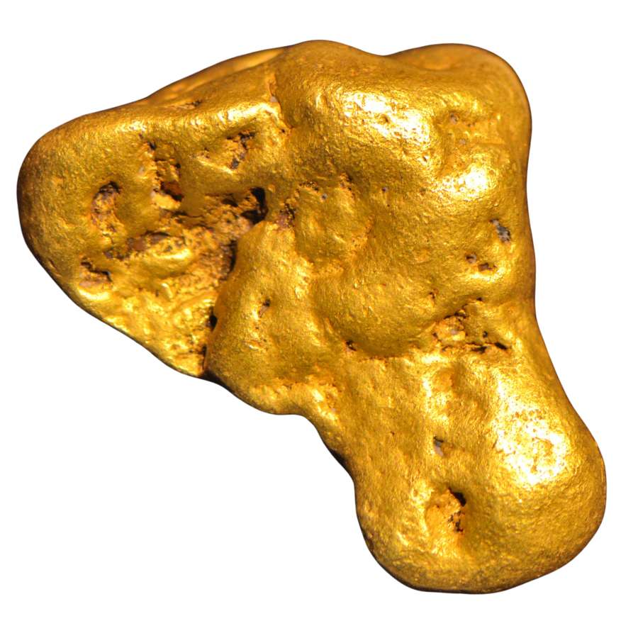
The largest documented gold nugget in Washington weighed 77 troy ounces, and it came off a bench above Swauk Creek just upstream of where Baker Creek comes in. The Washington Geological Survey put that find on the record along with a second monster, a 73 troy ounce nugget pulled from the Elliott placer on Williams Creek in 1900.
Seventy seven troy ounces is more than six pounds of gold. At today’s prices that single piece would be worth over $300,000 as raw metal, and a natural nugget that size sells to collectors for far more than melt value.
The Swauk district around the town of Liberty is strange country, and that is exactly why it produced pieces like this. The gold sits in old bench channels, which are the beds of rivers that ran there long before the current creek cut down to where it is now. Those benches sit above and away from the water, so a miner who only works the modern streambed walks right past them.
Liberty is also the one place in Washington famous for crystalline gold, where the metal grew as sharp intergrown crystals and delicate wire instead of rounded lumps. Specimens like that are worth several times their weight to collectors.
The district has never stopped giving. Reworking the gravels of one small piece of streambed recovered more than 100 pounds of gold, and in the fall of 2013 a prospector swinging a metal detector over freshly exposed bedrock in an old channel pulled out a 16.25 ounce nugget and a 13 ounce nugget on the same ground. Those two are known as the Potato Patch nuggets because they came out smooth, rounded, and iron stained.
The lesson for you is simple. Swauk Creek, Williams Creek, and Baker Creek all drain the same hills, and every high water year pushes more of that gold into water you can reach.
The Kinds of Gold You Can Find in Washington
Washington gives you four kinds of gold, and knowing which one your water carries tells you how to work it. The big rivers run heavy on flour gold, the Cascade and Okanogan creeks hold flakes and pickers, and the old lode districts still shed gold locked in white quartz.
Flour Gold
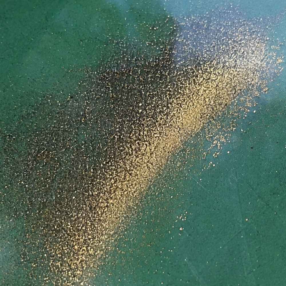
Flour gold is gold ground down to specks finer than sugar, and it is the most widespread gold in Washington. The Columbia and Snake River bars are famous for it, and the Methow and Okanogan Rivers carry the same fine material. It shows up as a bright yellow tail in the crease of your pan once everything lighter has washed out.
The mineral that fools people here is mica. Mica flashes gold when the sun hits it, but it weighs almost nothing and floats along the top of the water. Real flour gold sinks straight down and stays warm yellow even when you shade the pan with your hand.
Because flour gold rides out of a rough pan so easily, use a smooth finish pan for your final swirls. The Garrett Prospecting 10 Inch Backpacker Gold Pan is built for exactly that last step.
This is also the moment a good identification reference earns its keep. The Rocks and Minerals of the United States Field Guide shows real gold side by side with every mineral that imitates it, so you know what you are holding while your pan is still wet.
Gold Flakes and Pickers
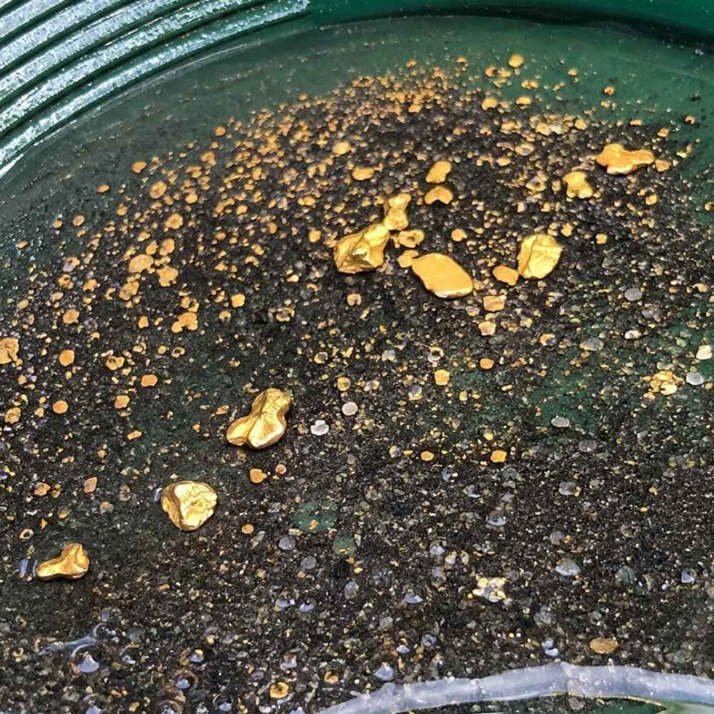
Flakes and pickers are the pieces you can grab with your fingers, and Washington’s mountain creeks produce them all season. A flake is flat and thin, a picker is thick enough to pick up without a snuffer bottle, and both mean you are standing over good ground. The Wenatchee River below Leavenworth, the Kettle River, and the Similkameen all give up pieces this size.
Pyrite is the lookalike that trips people up on flakes. Pyrite comes in hard little cubes with sharp corners, and it shatters when you press it. A real gold flake bends and dents instead, and it never grows a flat crystal face.
Pull flakes and pickers out of your pan with a snuffer bottle before a wave takes them back. The Garrett Gold Guzzler Bottle sucks them straight off the water without losing a piece.
Gold Nuggets
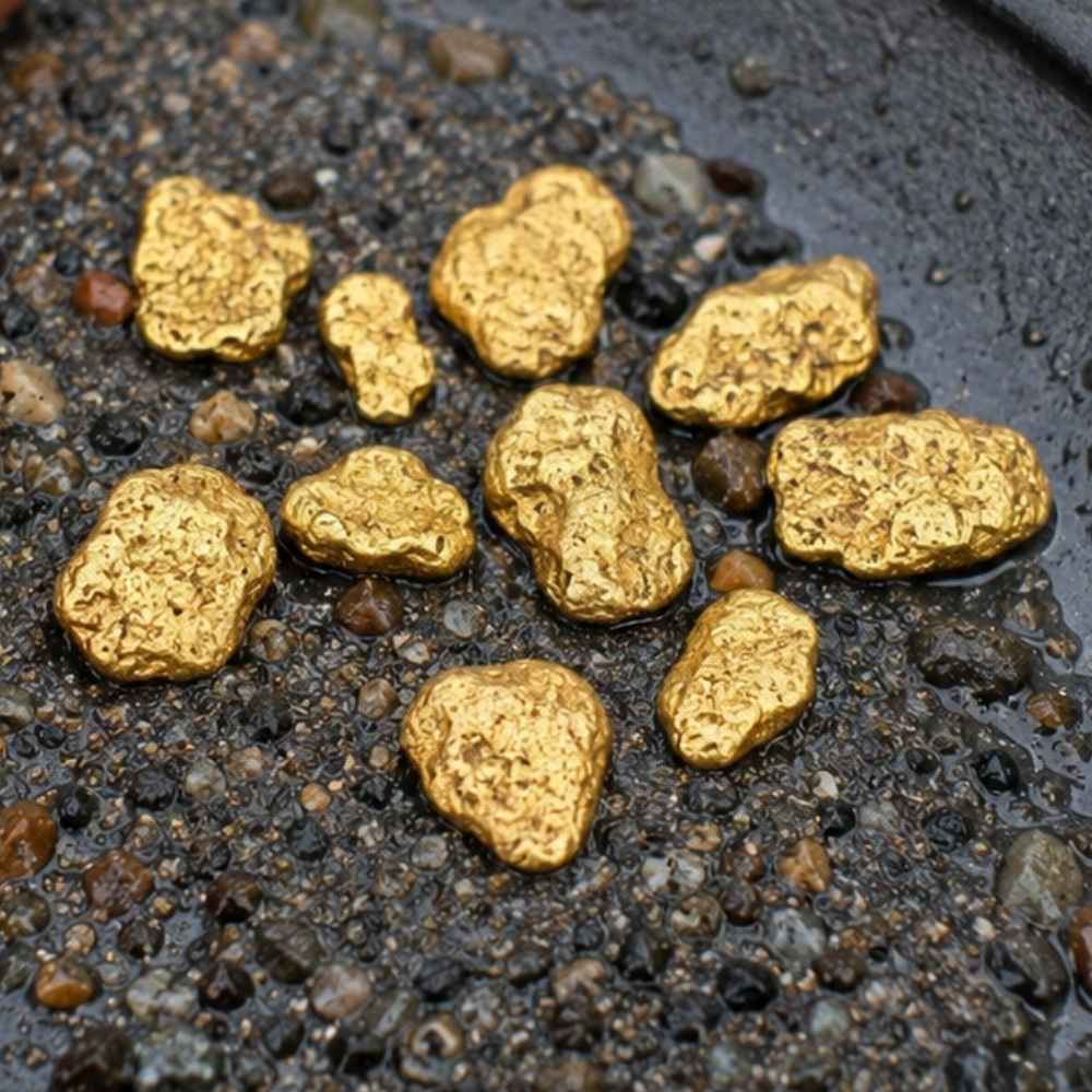
Nuggets are the trophy, and Washington has the pedigree to back them up. They come out of the drainages below the old lode districts, where a vein was rich enough that gravity delivered whole chunks into the creek instead of dust. Swauk Creek and Williams Creek near Liberty produced the state’s record pieces, and Sullivan Creek in Pend Oreille County has given up nuggets weighing tens of grams.
Nuggets carry a deep buttery color and a heft that surprises people the first time. Anything that looks like a nugget but feels light for its size is almost always weathered pyrite or a chunk of iron stained rock.
Liberty is also where Washington’s crystalline gold comes from, and those sharp bright crystals are the most valuable gold in the state by weight. Nuggets big enough to matter usually sit under packed gravel, which is where a detector earns its price. The Garrett AT Gold Metal Detector is tuned for small gold and handles mineralized Cascade ground well.
Gold in Quartz
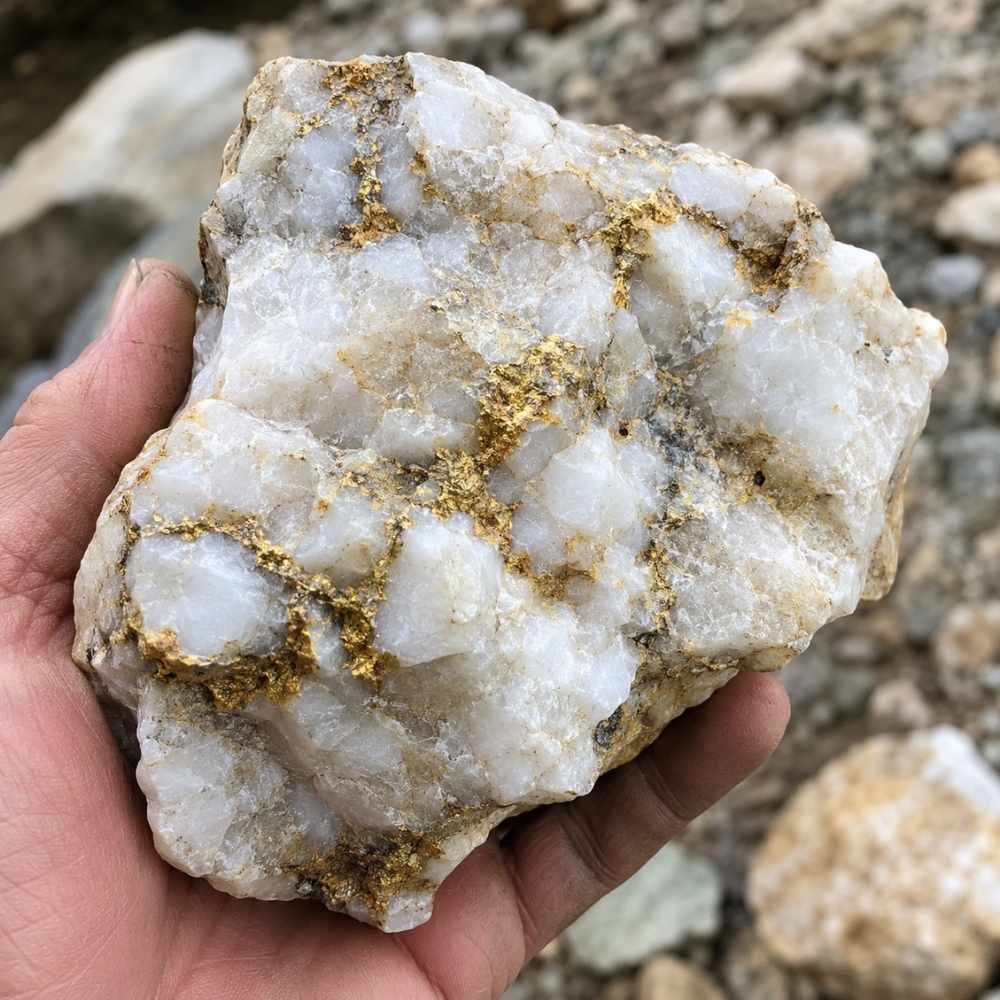
Gold in quartz is where all of Washington’s placer gold came from, and pieces of it still wash into the creeks. Look for chunks of milky white quartz with rusty orange staining and thin yellow threads running through the breaks. Culver Gulch above Blewett, the Republic district in Ferry County, and the veins above Monte Cristo all produced this kind of rock, and float boulders travel a long way downhill from a vein.
Chalcopyrite is the mineral that fakes it best inside quartz, showing a brassy yellow that looks convincing until you scratch it. Chalcopyrite streaks greenish black on a rough surface, while gold streaks yellow and stays yellow.
Cracking a promising quartz cobble takes a real rock pick, not a claw hammer. The Estwing Geo Paleo Rock Pick splits quartz cleanly so you can see what is inside.
Each of these four kinds has a technique that suits it best, and the techniques section further down breaks each one apart with the gear list to match.
Where Gold Hides in Washington Streams
Washington gold sits exactly where the water gives up speed, and reading that beats any map. These are the five features that pay off across the state, from the Cascade creeks to the big eastern rivers.
Inside River Bends
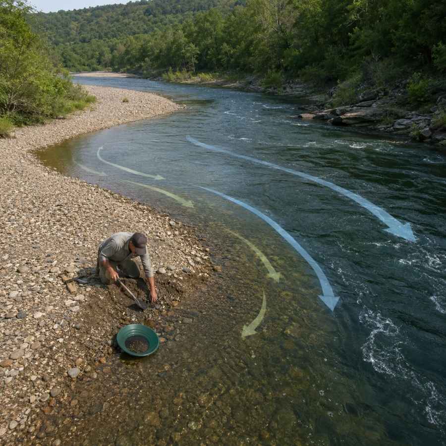
The inside of a bend is the slowest water in the whole creek, and gold drops there first. Stand at the bend and look for the point where the gravel changes from cobbles to sand, because that transition line is where the heavy material quits moving.
Digging an inside bend feels like work at first and then gets easy. The top layer is loose rounded rock, and about a foot down you hit packed gravel that holds together on the shovel. That packed layer is the one you want in your pan.
A round point shovel moves overburden fast so you can reach the good material. The Bully Tools 14 Gauge Round Point Shovel holds up to Cascade cobble without bending.
Gravel Bars
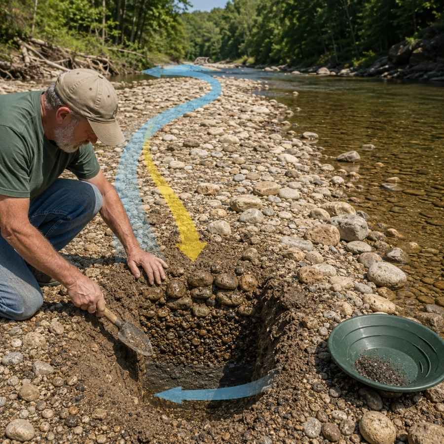
Gravel bars are the easiest gold traps in Washington to spot and the easiest to work. The upstream tip of a bar is the money spot, because that is where the current first slows and drops what it is carrying. On the Similkameen and the Skykomish, whole bars rebuild after every high water season.
Bar gravel is loose on top and tighter underneath, and the color usually improves as you go down. Dig test holes across the bar rather than one deep hole in the middle.
Screening the oversize rock out before you pan doubles how much material you can process. The SE Half Inch Sifting Screen sits right on your pan and does it in seconds.
Bedrock Cracks
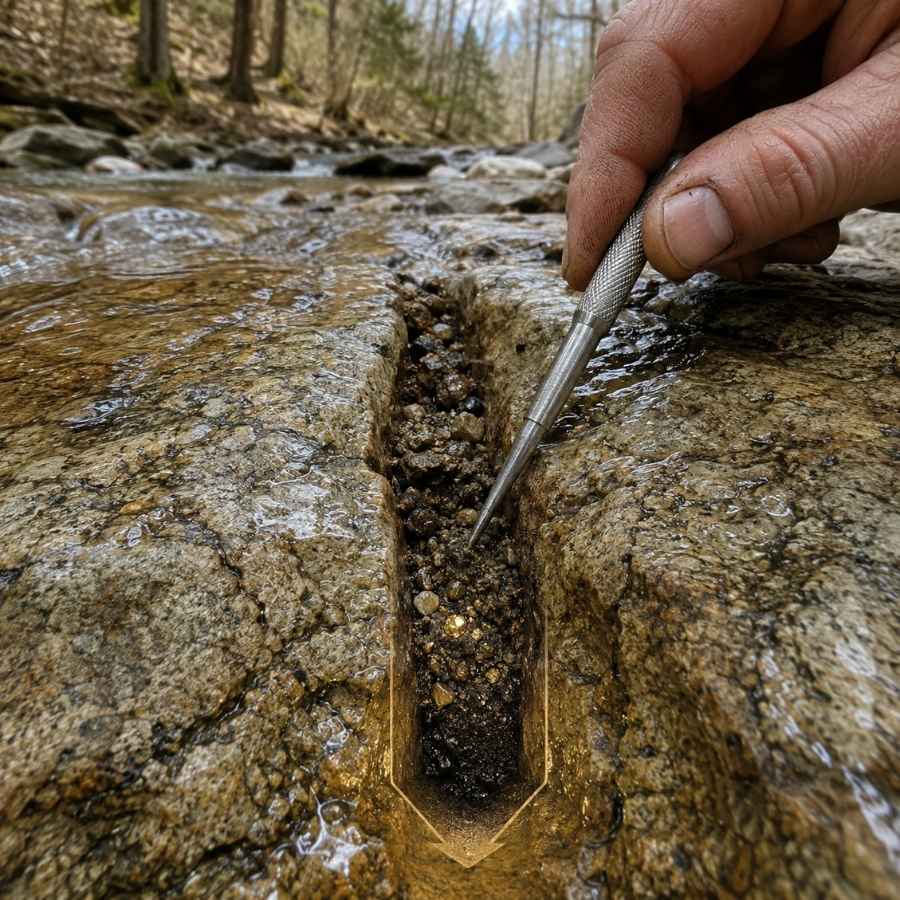
Bedrock is the floor gold cannot fall through, and Washington’s steep creeks expose plenty of it. Canyon Creek near Glacier, the upper Cle Elum, and the Methow tributaries all have long runs of hard rock with cracks and joints running across the flow. Gold works down into those seams over decades and stays there.
Cleaning a crack feels like dentistry. You scrape, you flush, and you keep going, because the last spoonful is usually the richest.
A steel crevice tool set is the only thing that reaches into a tight seam. The ASR Outdoor Steel Crevice Tool Set gives you several shapes so one of them always fits.
Behind Boulders
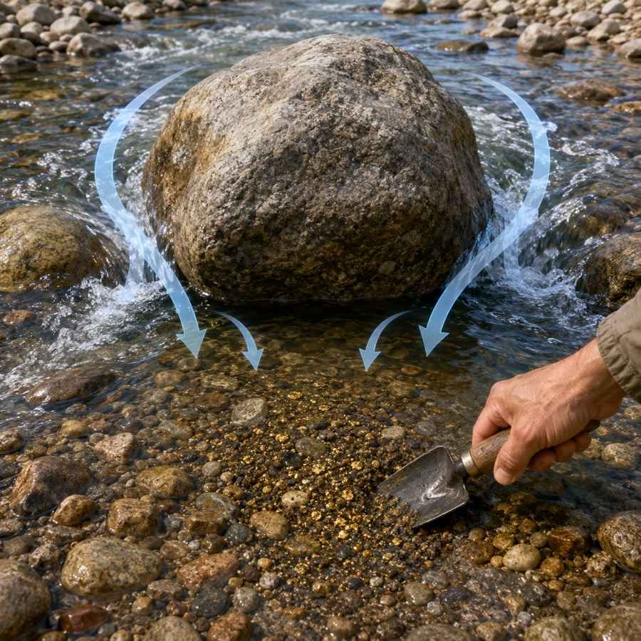
Every big boulder in a Washington creek builds a pocket of dead water behind it, and dead water drops gold. The bigger the boulder and the faster the water around it, the better the pocket. This is the single most reliable feature in steep streams like Sullivan Creek and the Cascade River.
The gravel behind a boulder is usually packed tight and loaded with black sand, which is exactly the sign you want. Dig it out down to whatever hard surface sits underneath.
A bend proof hand trowel gets into the pocket without wrecking your back. The Edward Tools Bend Proof Trowel is the one that survives a season of cobble.
Black Sand Streaks
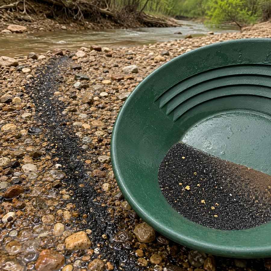
Black sand is your compass in Washington, because it is heavy iron mineral that travels and settles exactly where gold does. Look for dark ribbons on top of a bar, dark layers in a cut bank, or the wide black stripes that show up on the ocean beaches after a winter storm. Where the black sand concentrates, your gold is in the same handful.
Following black sand also means your pan fills with magnetite, which has to come out before you can see anything. That is a two minute job with the right tool.
A magnetic separator pulls the iron out of your concentrate and leaves the gold behind. The SE Magnetic Separator Pick Up Tool with Quick Release drops the whole load in one click.
Always Confirm Access and Collection Rules!
Before heading out to any of the locations on our list you need to confirm access requirements and collection rules for both public and private locations directly with the location. We haven’t personally verified every location and the access requirements and collection rules often change without notice.
Many of the locations we mention will not allow collecting but are still great places for those who love to find beautiful rocks and minerals in the wild without keeping them. We also can’t guarantee you will find anything in these locations since they are constantly changing.
Always get updated information directly from the source ahead of time to ensure responsible rockhounding. If you want even more current options it’s always a good idea to contact local rock and mineral clubs and groups
The Best Places To Find Gold in Washington
Washington’s gold sits in six broad regions, and every one of them has water you can legally work. Here is every spot worth your gas money, starting with the national forest creeks you can reach in a morning.
Central Washington
The Swauk, Blewett, and Wenatchee country is the heart of Washington gold, and most of it sits inside the Okanogan Wenatchee National Forest with roads running right along the water. This region produced the state’s record nuggets and remains the most rewarding place in Washington to spend a weekend.
Cle Elum River Above Roslyn, Kittitas County
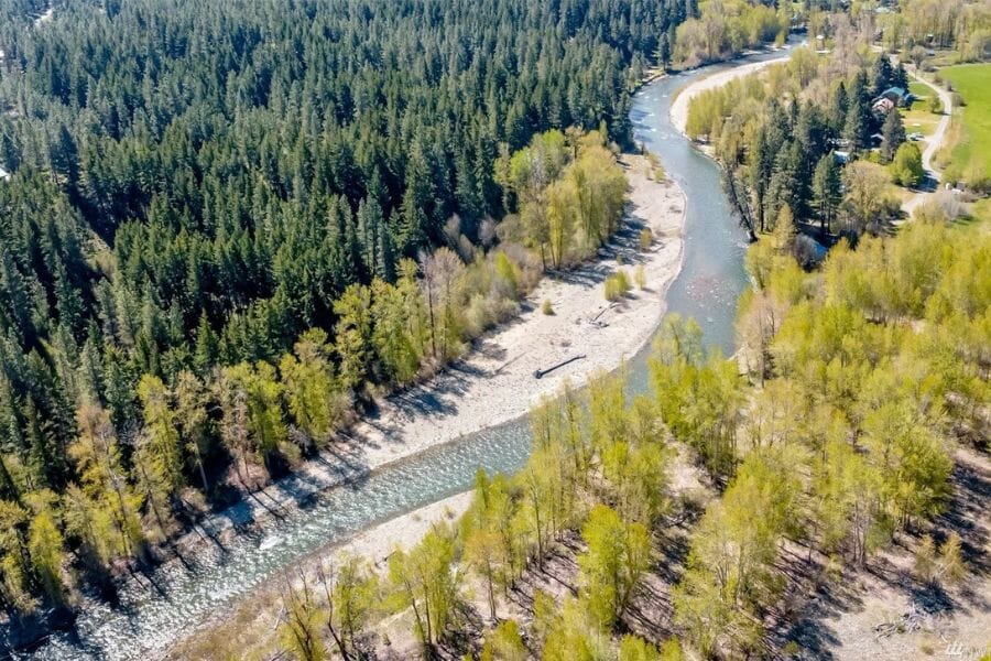
The Cle Elum River is the friendliest first trip in Washington gold country, with national forest ground, paved access, and a string of campgrounds along the water above Cle Elum Lake. The Washington Geological Survey lists this drainage among the state’s known placer areas, and the river collects gold shed from the same mineralized belt that feeds Swauk Creek. Salmon la Sac Road follows the river north from Roslyn and puts you at the water every few minutes.
Fine flakes with occasional pickers are the standard find, and careful panning is the technique that keeps them. Work the inside bends and the upstream tips of the gravel bars, because the river rebuilds both every spring.
Your pan will also turn up quartz, garnet, black sand, and pieces of the granite that makes up the Wenatchee Mountains. This is exactly the moment people throw away a good stone, because everything looks the same when it is wet. The US Rocks and Minerals Field Guide lets you check every odd piece against clear photos before it goes back in the river.
Check the work window for this water in the state Gold and Fish pamphlet before you go, and carry a copy with you. A classifier and a good pan from the techniques section are the whole kit here.
Difficulty: 2 out of 5
Swauk Creek and the Liberty District, Kittitas County
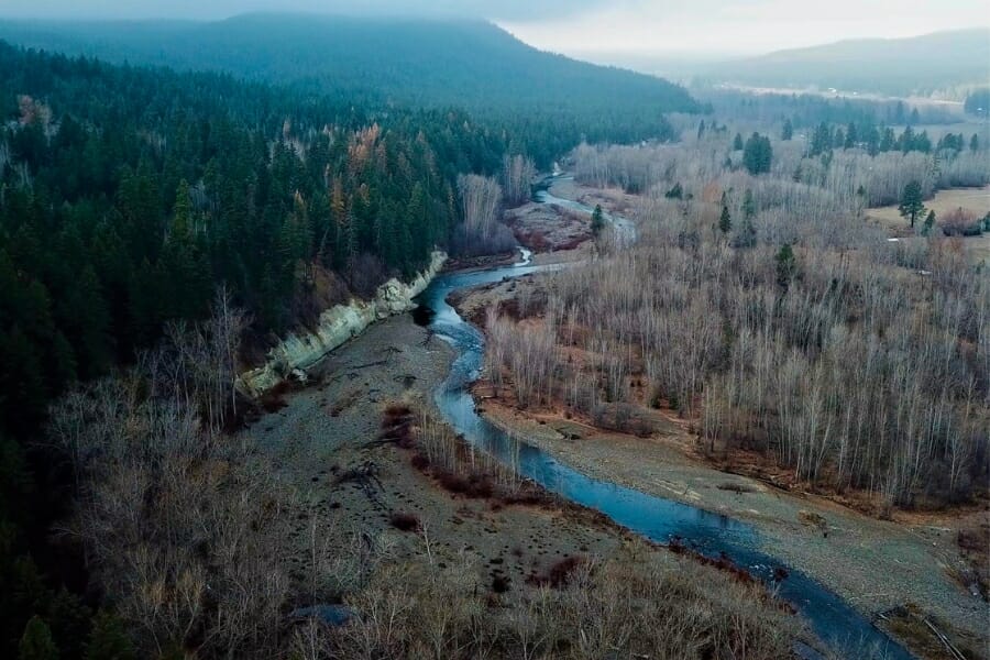
Swauk Creek is where Washington’s biggest gold came from, and Highway 97 runs right up the valley from Cle Elum toward Blewett Pass. Gold turned up here in the 1870s, and the district around the old town of Liberty went on to produce the state’s two record nuggets plus its famous crystalline gold specimens. Liberty Road leaves Highway 97 and takes you into the heart of it, with a BLM campground on Pine Gulch Road just past town.
Coarse flakes, pickers, and the occasional nugget are the reward, and the payoff comes from the old bench channels above the modern creek as much as from the streambed. Crevicing exposed bedrock and detecting reworked gravel both produce here.
Bycatch runs to quartz, pyrite, and heavy black sand. Active claims cover much of Swauk and Williams Creek, so a claim map check with the BLM Mineral and Land Records System is the first step, and prospectors report a section near the Highway 97 turnoff that has been withdrawn from mineral entry and is open to panning. The Cle Elum Ranger District can confirm what is open before you unload.
Bring the crevice tools and detector from the techniques section.
Difficulty: 3 out of 5
Peshastin Creek and the Blewett District, Chelan County
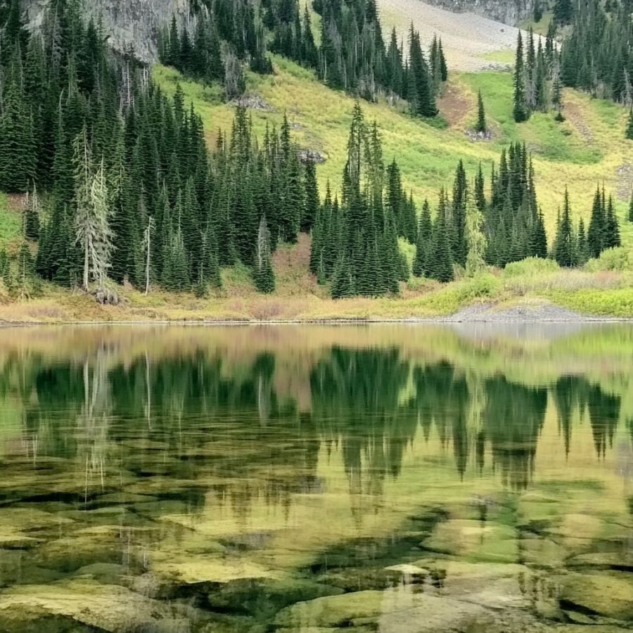
Peshastin Creek carried the first big placer discovery in Washington, back in the 1860s, and Highway 97 follows it for miles between Blewett Pass and the Wenatchee River. The old Blewett townsite once held a few hundred people, and the arrastra they used to grind ore still sits beside the highway. National forest land covers long stretches of the creek with pullouts and side roads the whole way.
The gold here runs coarser than most Washington water, and prospectors report small pickers along with flakes. Panning the bedrock cracks and the boulder pockets is what pays, since the creek runs fast through a narrow valley.
Expect quartz, pyrite, and copper stained rock from the veins in Culver Gulch above you. Claims are scattered through the drainage and some of the lower creek is private, so check boundaries at each pullout before you dig.
The ASR Outdoor Steel Crevice Tool Set is the tool that unlocks this creek.
Difficulty: 2 out of 5
Wenatchee River From Leavenworth to Monitor, Chelan County
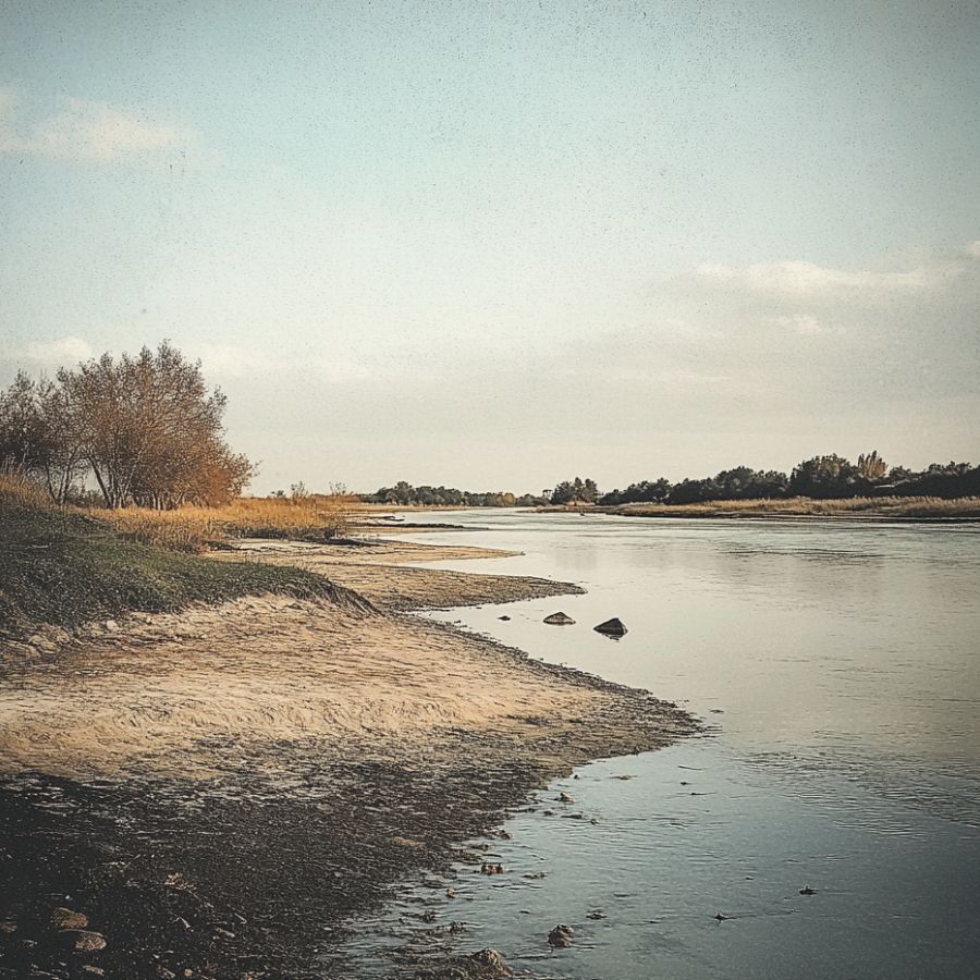
The Wenatchee River is on the state survey’s list of known placer areas, and the stretch below Leavenworth toward Peshastin and Monitor was noted for particularly rich bars. Gold was reported here as early as 1853, and the river collects everything that Peshastin Creek and Icicle Creek deliver. Highway 2 runs beside the water with plenty of public pullouts and river access points.
Fine gold with flakes mixed in is the standard find, and this is good bar gravel for a hand sluice where the rules allow one. Test the upstream ends of several bars rather than committing to one hole.
The same gravel carries quartz, jasper, agate, and thick black sand. This is a listed salmon and steelhead river, so the work window matters more here than almost anywhere, and the Gold and Fish pamphlet spells out the dates.
The sluice and classifier from the techniques section make the most of a day on these bars.
Difficulty: 2 out of 5
North Central Washington
The Okanogan highlands and the Methow Valley hold the state’s most reliable eastern placer ground, and the Similkameen brings a fresh load of gold across the border every year. Roads are good, the country is open, and you will often have a whole bar to yourself.
Similkameen River Near Oroville and Nighthawk, Okanogan County

The Similkameen is the most dependable gold river in Washington, because the state survey notes that each year a new supply of gold dust is deposited on its bars. The river drops out of British Columbia and cuts through the old Nighthawk mining camp before it joins the Okanogan at Oroville. The Loomis Oroville Road follows the water with pullouts and public access points along the way.
Fine gold is the bread and butter, and prospectors report sizable pieces on this river as well. Work the gravel bars and the inside bends, and pan slowly because a lot of this gold is very fine.
Bycatch includes garnet, black sand, quartz, and colorful jasper from the surrounding rock. Land along the river is a patchwork of public and private, and claims sit on some of the best bars, so confirm the ground you are standing on before you dig.
The Garrett 15 Inch Dual Riffle SUPERSLUICE Gold Pan handles the volume this river rewards.
Difficulty: 2 out of 5
Methow River Near Carlton and Twisp, Okanogan County
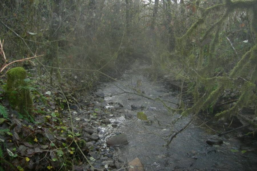
The Methow River and its side creeks are on the state’s placer list, and the valley between Carlton and Twisp gives you national forest access on both sides. Gold Creek near Carlton fed the old Alder Mine, and the Twisp River drainage above town produced fine gold dust for generations of small operators. Highway 153 and the Twisp River Road put you at the water quickly.
Very fine gold is what this valley carries, which makes a slow hand and a finish pan the winning combination. Concentrate on the tight bends and the boulder pockets where fine gold has a chance to settle.
The gravel also brings down quartz, epidote, and heavy black sand. Private ranch land lines much of the lower valley, so start on the Okanogan Wenatchee National Forest sections upstream and work down from there.
The Garrett Prospecting 10 Inch Backpacker Gold Pan is the right tool for gold this fine.
Difficulty: 3 out of 5
Northeastern Washington
The Kettle River country and the Selkirk drainages are the quietest gold ground in Washington, and the Colville National Forest covers a huge share of it. This corner of the state was worked hard in the 1890s and then largely left alone.
Kettle River Near Orient and Barstow, Ferry and Stevens Counties
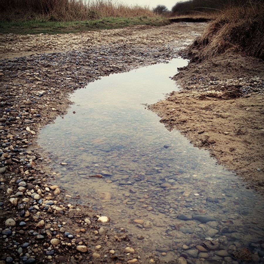
The Kettle River bars carry documented placer gold from Danville down past Orient and Barstow, and the Washington Geological Survey lists them by name. The river runs south out of British Columbia through Ferry and Stevens Counties with Highway 395 and Highway 21 tracking it most of the way. Colville National Forest and public river access points give you legal ground at several points along the run.
Flakes and fine gold in the bar gravel are the target, and this is friendly water for a pan or a hand sluice. The upstream tips of the bars produce best, especially after a high water year.
Your concentrates will carry black sand, garnet, and quartz. The First Thought Mine near Orient worked lode gold right above this river, which is a good sign for what the water below it is carrying.
Bring the sluice and shovel from the techniques section.
Difficulty: 2 out of 5
Sullivan Creek and the Pend Oreille River, Pend Oreille County
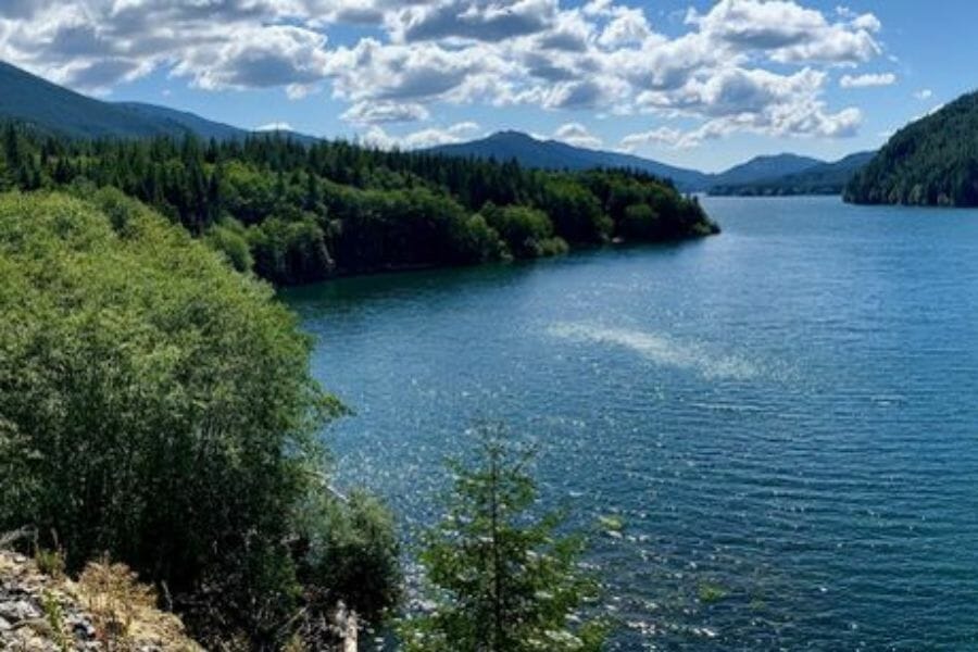
Sullivan Creek near Metaline Falls has produced some of the largest placer nuggets in eastern Washington, with pieces weighing tens of grams on the record. The creek drops out of the Selkirk Mountains into the Pend Oreille River, and the river bars themselves are on the state survey’s placer list. Sullivan Lake Road and the Colville National Forest roads above it get you into the drainage.
Coarse gold and small nuggets are the prize here, and working the boulder pockets and bedrock in the creek is how people find them. The Pend Oreille bars downstream reward a sluice on the fine material.
Bycatch includes quartz, pyrite, galena, and heavy black sand from the surrounding rock. This is steep, remote country with active claims scattered through it, so check claim status and carry a map, because cell service disappears fast.
The rock hammer and crevice tools from the techniques section suit this ground.
Difficulty: 4 out of 5
Northwestern Washington
The western Cascade rivers drop out of high snowfields into forest, and they have been carrying gold to the Puget lowlands since the 1860s. Access here is the best in the state, with towns, campgrounds, and paved roads right beside the water.
Skykomish River at Gold Bar and Sultan, Snohomish County
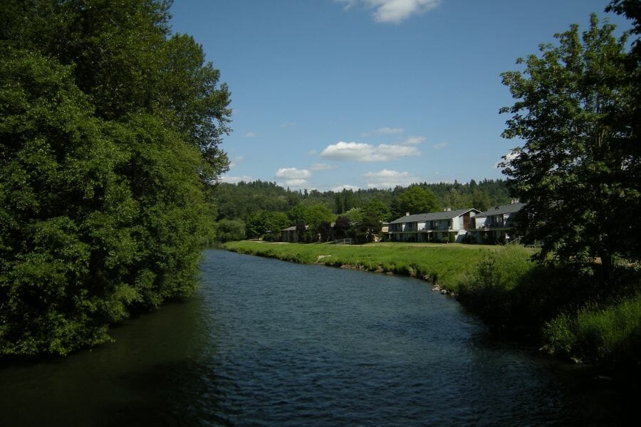
The town of Gold Bar was named in 1869 when prospectors camped at the meeting of the Skykomish and Wallace Rivers found gold on a gravel bar there. The Skykomish is on the state survey’s placer list, and the stretch through Sultan, Startup, and Gold Bar is the most productive part of it. Highway 2 runs beside the river with public access points, and you can be standing on gold gravel an hour from Everett.
Fine gold and flakes are the find, and the bars here restock after every winter flood. Pan the upstream tips of the bars and follow the black sand streaks across the cobbles.
The gravel also gives up quartz, jasper, agate, and serpentine from the high country. This is a listed salmon river, so check the work window in the Gold and Fish pamphlet, keep off the vegetated banks, and move if you find spawning gravel.
A pan, classifier, and snuffer bottle from the techniques section cover this trip.
Difficulty: 1 out of 5
Money Creek and the Miller River, King County
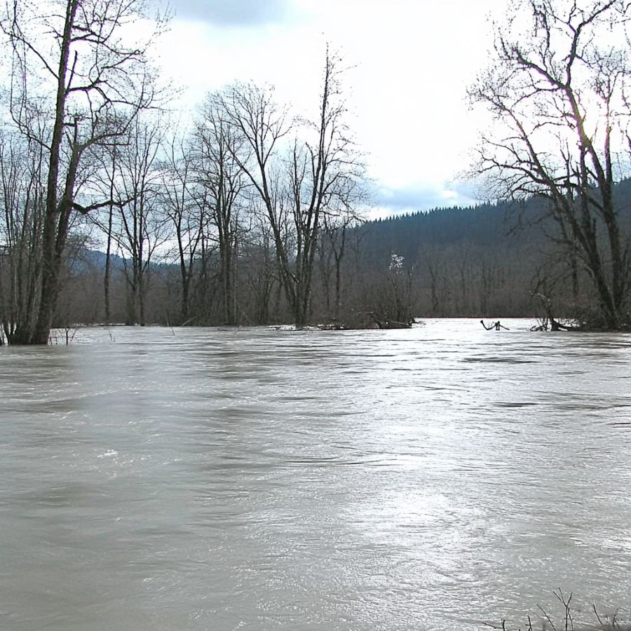
Money Creek is named on the state survey’s list of Washington placer areas, and it sits inside the Mount Baker Snoqualmie National Forest with a campground right on the water. The creek and the nearby Miller River both drain the mineralized rock along the old Great Northern route, and Old Cascade Highway gets you there from Skykomish in minutes. The name alone tells you what people were doing here.
Fine gold and flakes are the standard find, and the creek has good bedrock and boulder pockets to work. Panning and crevicing both pay off on this water.
Expect quartz, black sand, and pieces of the granodiorite that makes up the surrounding ridges. National forest ground gives you legal access under casual use rules, and claims turn up in spots, so read any posted markers.
The ASR Outdoor Steel Crevice Tool Set is the tool that makes the difference in this bedrock.
Difficulty: 2 out of 5
Cascade River and the Skagit at Marblemount, Skagit County
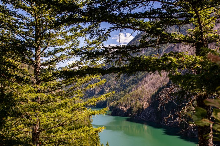
The Skagit River is on the state’s placer list, and Marblemount sits at the mouth of the Cascade River where prospectors have panned since the 1880s. The Cascade River Road runs southeast from town into the Mount Baker Snoqualmie National Forest with river access most of the way. This is the last easy road access before the country turns into national park land.
Fine gold with occasional flakes is the find, and working the inside bends and the boulder pockets is the play. The Cascade River drops fast, which builds excellent traps behind every large rock.
The gravel carries quartz, serpentine, and the nephrite jade this county is known for. North Cascades National Park and the Ross Lake and Lake Chelan National Recreation Areas are closed to prospecting, so stay downstream of the park boundary above Newhalem and keep to national forest ground.
Bring the trowel and pan from the techniques section.
Difficulty: 3 out of 5
Canyon Creek Near Glacier, Whatcom County
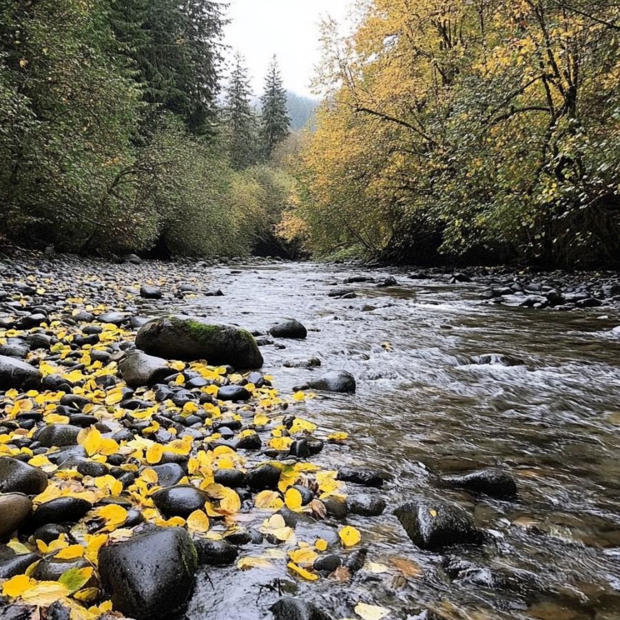
Canyon Creek near Glacier holds documented placer workings on the state survey’s Whatcom County list, in the same neighborhood as the Mount Baker and Silesia Creek prospects. Forest Road 31 climbs the creek from the Mount Baker Highway just past the town of Glacier, and the Mount Baker Snoqualmie National Forest covers the drainage. The road gets rough as it climbs, so high clearance helps.
Flakes and fine gold sit in the bedrock cracks and behind the boulders, and this is classic crevicing water. The creek is steep and cold, which means the traps are sharp and well defined.
Bycatch includes quartz, pyrite, and serpentine from the surrounding belt rock. The upper drainage runs into steep, unstable ground and the road washes out in places, so check conditions with the Glacier Public Service Center before you drive up.
The ESTWING 22 oz Rock Pick and a crevice set are what this creek asks for.
Difficulty: 4 out of 5
Southwestern Washington
Southwest Washington runs from the Gifford Pinchot National Forest creeks down to the open ocean beaches, and the coast holds a kind of gold that is unique to this corner of the state. Black sand placers stripe the beaches after every winter storm.
Damon Point and Point Brown at Ocean Shores, Grays Harbor County
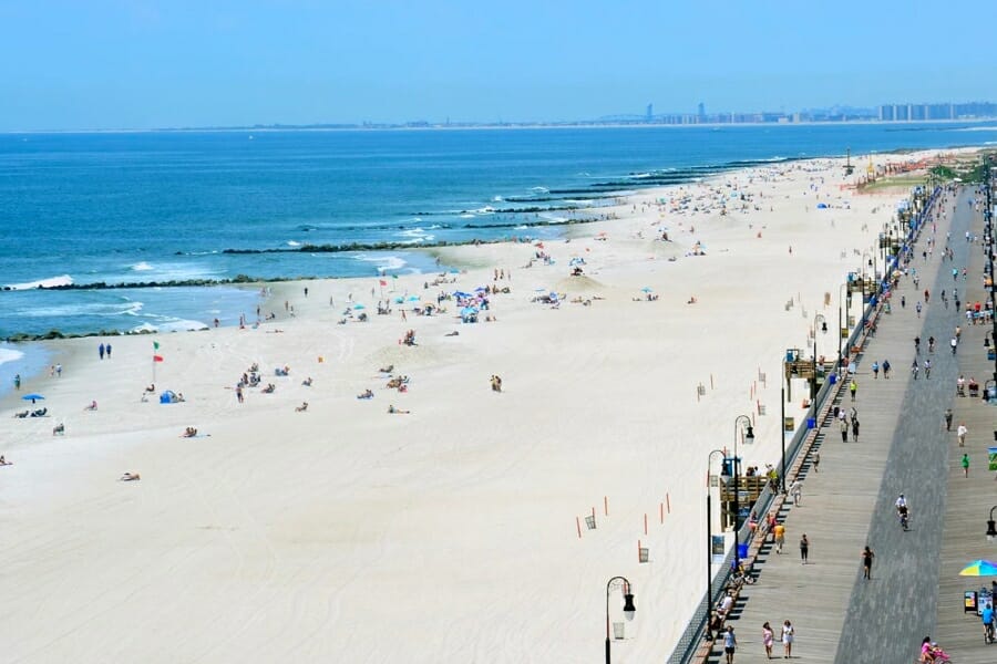
Damon Point and Point Brown at Ocean Shores are named on the Washington Geological Survey’s list of the state’s placer gold areas, and the gold there rides in the black sand that collects along the beach. Ocean beach prospecting has its own section in the state Gold and Fish rules, which makes this one of the clearest legal paths to a pan of Washington gold. Parking, restrooms, and miles of open sand make it the easiest trip in this guide.
The gold is flour fine and it travels with garnet and magnetite, so you are really hunting the dark stripes rather than the gold itself. Scoop the black layers after a storm has scoured the beach, then pan them down slowly.
Your concentrate will be loaded with magnetite, garnet, and ilmenite, and a magnet is the fastest way to get through it. The beaches here fall inside the Seashore Conservation Area, so confirm current rules with Washington State Parks, and respect the seasonal wildlife closures posted at Damon Point.
The SE Magnetic Separator Pick Up Tool with Quick Release turns an hour of picking into a minute of work.
Difficulty: 1 out of 5
Southeastern Washington
The Snake and Columbia bars in the southeast corner carry the finest gold in Washington, delivered from Idaho and eastern Oregon and dropped where the big rivers slow. This is dry, open country with long seasons and easy driving.
Snake River Bars Near Asotin and Clarkston, Asotin County
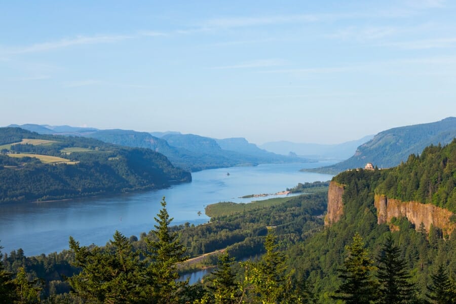
The Snake River bars in Asotin County are on the state survey’s placer list, and the survey notes that this river, like the Similkameen, gets a fresh supply of gold dust every year. Chinese miners worked these bars through the 1870s and 1880s, and the gravel they left behind is still there. Highway 129 runs south from Clarkston along the river with public access points and boat ramps.
The gold is extremely fine flour gold, which means slow panning and a smooth finish pan. Work the sand and fine gravel behind the cobble berms rather than the coarse rock itself.
Bycatch runs to garnet, black sand, and agate from the basalt country. Much of the shoreline is federal land managed with the river, so confirm which access points allow prospecting and stay off the private ranch ground above the high water line.
The SE 1/8 Inch Mesh Sifting Screen and a finish pan are the difference between finding this gold and losing it.
Difficulty: 3 out of 5
More Proven Places To Find Gold in Washington
The spots above are the easiest wins, and the list below is where the state opens up. Every one of these has documented placer gold or steady prospector reports behind it, and every one needs a claim, access, and work window check first, because Washington’s national forests are threaded with active claims.
Central Washington
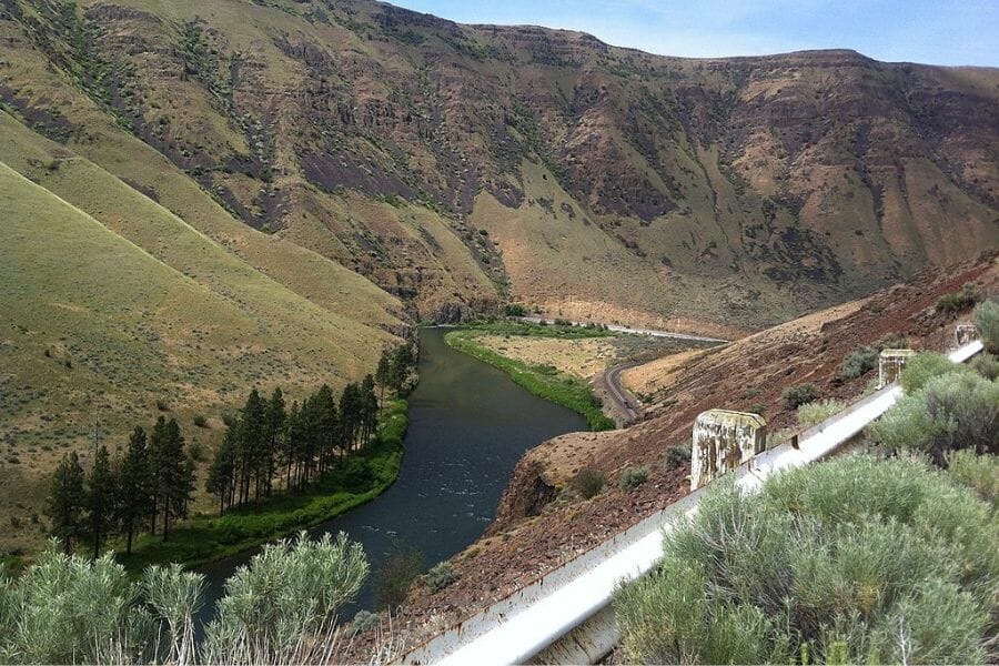
Chiwawa River near Deep Creek, Chelan County. The Chiwawa carries placer gold down from the Glacier Peak country, and the state survey lists it among Chelan County’s placer areas. Prospectors report the best color near the mouth of Deep Creek. Okanogan Wenatchee National Forest roads follow the river with several campgrounds along the way.
Entiat River above Ardenvoir, Chelan County. The Entiat and its side creeks are on the state’s placer list, and the valley road runs deep into the national forest. The gold is fine and spread through the bar gravel. The upper drainage runs into the Glacier Peak Wilderness, which is closed to mineral entry, so keep your work downstream of the boundary.
Icicle Creek near Leavenworth, Chelan County. Icicle Creek feeds the Wenatchee River right where the richest bars were worked, and it carries the same gold. Icicle Road gives you national forest access and a string of campgrounds. The Alpine Lakes Wilderness covers the headwaters and is closed, so work the lower creek.
Ingalls Creek below the wilderness line, Chelan County. Ingalls Creek drains the Stuart Range straight into Peshastin Creek, and old placer workings are recorded along it. The lower creek sits on national forest ground with a trailhead off Highway 97. Everything above the wilderness boundary is closed to prospecting, so stay low.
Mad River near Pine Flats, Chelan County. The Mad River carries fine gold and sees very little traffic compared to the bigger valleys. Pine Flats Campground puts you right on the water in the national forest. Forest roads in are rough, which is part of why this drainage stays quiet.
Railroad Creek at Lucerne, Chelan County. Railroad Creek is on the state survey’s Chelan County placer list, draining the mineralized ground above Holden. Access is by boat up Lake Chelan, which makes this a genuine expedition. The old mine site upstream has been through a major cleanup, so keep your work well downstream and check current access first.
Baker Creek and Boulder Creek near Liberty, Kittitas County. These two creeks feed Swauk Creek right where the state’s 77 ounce nugget was found on the bench above their confluence. Both drain the same gold bearing Swauk Formation gravels. Claims cover much of this ground, so run a claim map check before you pick a spot.
Manastash Creek west of Ellensburg, Kittitas County. Manastash Creek appears on the state survey’s Kittitas County placer list and drains the south side of the same uplift that feeds Swauk Creek. Manastash Road climbs west from Ellensburg into national forest ground. Private ranch land lines the lower creek, so start upstream.
Naneum Creek northeast of Ellensburg, Kittitas County. Naneum Creek is another listed Kittitas placer stream, running off the Wenatchee Mountains toward the Kittitas Valley. Forest roads reach the upper drainage. Expect fine gold and a quiet day with nobody else on the creek.
Teanaway River north of Cle Elum, Kittitas County. The Teanaway is on the state’s placer list and drains the same country as Swauk Creek from the west side. The Teanaway Community Forest and national forest land give you access along the North Fork. Rules differ between the community forest and the national forest, so check which one you are standing on.
Yakima River near Thorp, Kittitas County. The Yakima carries gold shed from the Cle Elum and Swauk drainages and is listed by the state survey as a placer area. Public river access points near Thorp and Ellensburg get you to the bars. The gold is fine, so pan slowly and follow the black sand.
American River near Chinook Pass, Yakima County. The American River is on the state’s Yakima County placer list, draining the mineralized Summit district. Highway 410 follows the river with campgrounds and pullouts inside the national forest. Snow closes the pass in winter, so plan for summer and fall.
Morse Creek in the Summit district, Yakima County. Morse Creek is a listed Yakima County placer stream in the same mineral belt as the American River. Forest roads off Highway 410 reach it. This is lightly worked ground with good boulder pockets.
Surveyors Creek near Nile, Yakima County. Surveyors Creek shows up on the state survey’s Yakima County placer list and drains toward the Naches River. National forest ground covers much of the drainage. Bring a map, because the forest road network here is a maze.
North Central Washington
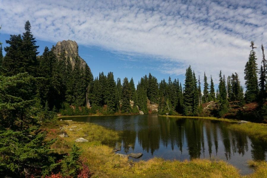
Chewuch River above Winthrop, Okanogan County. The Chewuch drains the Pasayten country north of Winthrop and carries fine gold in its bar gravel. The Chewuch River Road runs up the valley through national forest with campgrounds along it. The Pasayten Wilderness at the head of the valley is closed to prospecting, so work the lower and middle river.
Gold Creek near Carlton, Okanogan County. Gold Creek fed the old Alder Mine and drains straight into the Methow near Carlton. The name is not an accident, and placer gold has been reported along it for well over a century. Private land sits at the mouth, so use the national forest sections upstream.
Mary Ann Creek near Chesaw, Okanogan County. Mary Ann Creek is named on the state survey’s Okanogan County placer list, in the old Chesaw mining country near the Canadian line. This was one of the earliest placer camps in the state. Much of the ground is private ranch land now, so a friendly ask comes first.
Myers Creek near Chesaw, Okanogan County. Myers Creek sits beside Mary Ann Creek in the same historic district and appears on the state’s placer list. Chinese and American miners both worked these gravels in the 1890s. Check land status carefully, because the pattern of private and public ground here is complicated.
Okanogan River near Malott, Okanogan County. The Okanogan carries very fine gold along its whole length, and the state survey lists the Oroville area specifically. Public access points near Malott and Riverside get you to the bars. Pan slowly, because this gold is about as fine as it gets.
Salmon Creek near Conconully, Okanogan County. Salmon Creek drains the mineralized country around Conconully, where silver and gold mines operated from the 1880s. The creek runs down to the Okanogan River through a mix of national forest and private land. Work the forest sections above the reservoir.
Slate Creek and the Barron district near Harts Pass, Okanogan County. Slate Creek is on the state survey’s list, and the old Barron camp above it was one of the highest mining towns in Washington. Harts Pass Road is a spectacular and narrow drive with no trailers allowed. The season here is short, roughly July through September.
Toroda Creek near Wauconda, Okanogan County. Toroda Creek drains the Wauconda gold country toward the Kettle River and appears on the state’s placer list. Highway 20 and county roads follow much of it. Claims and private land are both present, so check before you dig.
Twisp River above Twisp, Okanogan County. The Twisp River carries fine gold dust and drains past the old Alder Mine ground. Twisp River Road runs up the valley through national forest with several campgrounds. The Lake Chelan Sawtooth Wilderness caps the headwaters and is closed.
Northeastern Washington
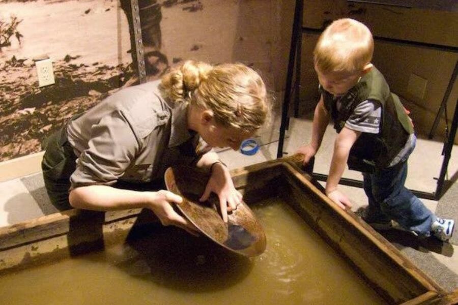
Curlew Creek near Curlew, Ferry County. Curlew Creek runs down to the Kettle River through country worked hard in the 1890s. Prospectors report fine gold and flakes in the creek gravel. Much of the valley is private, so start with the Colville National Forest sections and ask before you cross a fence.
Eureka Gulch at Republic, Ferry County. Eureka Gulch is the drainage below Republic’s lode mines, which produced enormous quantities of gold from quartz veins. The state survey lists Republic among Ferry County’s placer areas. Active claims and mine property cover most of the gulch, so this one starts with a claim map and a conversation.
Sanpoil River above Republic, Ferry County. The Sanpoil is on the state survey’s placer list and carries gold shed from the Republic district. The upper river above Republic runs through Colville National Forest with road access along Highway 21. The river below Ten Mile crosses the Colville Reservation, where you need tribal permission, so keep your work upstream.
Pend Oreille River bars near Ione, Pend Oreille County. The Pend Oreille River bars are named on the state survey’s placer list and hold fine gold delivered from the Selkirk drainages. Public access points near Ione and Metaline get you to the water. This is quiet country with long summer days.
Russian Creek near Metaline, Pend Oreille County. Russian Creek is a listed Pend Oreille placer stream in the same mineral belt as Sullivan Creek. Colville National Forest roads reach the drainage. Expect coarse material in the boulder pockets and very little company.
Sheep Creek near Northport, Stevens County. Sheep Creek drains the Northport district, which the state survey lists among Stevens County’s placer areas. The creek runs down to the Columbia through a mix of national forest and private ground. The old mining ground above has been reworked more than once, which is usually a good sign.
Northwestern Washington
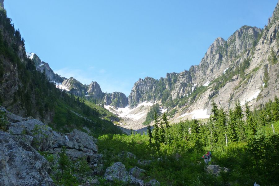
Denny Creek near Snoqualmie Pass, King County. Denny Creek is on the state survey’s King County placer list and sits inside the Mount Baker Snoqualmie National Forest with a campground and paved access off Interstate 90. The creek drains mineralized rock right below the pass. It is one of the easiest gold creeks in the state to reach from Seattle.
Tolt River near Carnation, King County. The Tolt is named on the state’s placer list and carries fine gold down from the Cascade front. County parks and public access points along the lower river get you to the gravel. The upper watershed is a closed municipal supply, so keep to the public access below it.
Skagit River bars near Rockport, Skagit County. The Skagit bars below the national park boundary carry fine gold delivered from the whole upper basin. Public river access points and boat launches near Rockport and Concrete make scouting easy. This is prime salmon water, so the work window and the redd rules matter here.
Sauk River near Darrington, Snohomish County. The Sauk drains the Darrington area, which the state survey lists among Snohomish County’s placer localities. Mountain Loop Highway follows the river with national forest access along it. Fine gold and flakes turn up in the bar gravel after high water.
Silver Creek near Index, Snohomish County. Silver Creek drains the mineralized ground above Index and has a long history of small scale placer work. Forest roads climb the creek from the Skykomish valley. Claims are present in the drainage, so check before you set up.
South Fork Stillaguamish at Granite Falls, Snohomish County. The state survey lists Granite Falls among Snohomish County’s placer areas, and the South Fork carries gold down from the Monte Cristo country. Public access points along the Mountain Loop Highway get you to the river. The old Monte Cristo townsite itself is a cleanup site, so work well downstream.
Sultan River below Culmback Dam, Snohomish County. The Sultan River is on the state’s placer list and carried enough gold to keep small operators busy for decades. The basin above Culmback Dam is Everett’s municipal water supply and is closed to the public, so the legal ground is the river below it. Public access near the town of Sultan is the practical starting point.
Silesia Creek near Mount Baker, Whatcom County. Silesia Creek appears on the state survey’s Whatcom County placer list, draining the north side of the Mount Baker country toward the border. Access is by forest road and a walk, which keeps traffic low. Bring a map and check road conditions before you commit.
South Fork Nooksack near Acme, Whatcom County. The state survey lists the Acme vicinity among Whatcom County’s placer localities, and the South Fork carries the gold. Public access points along the valley road get you to the gravel bars. Private farmland lines much of the river, so confirm access at each spot.
Southwestern Washington
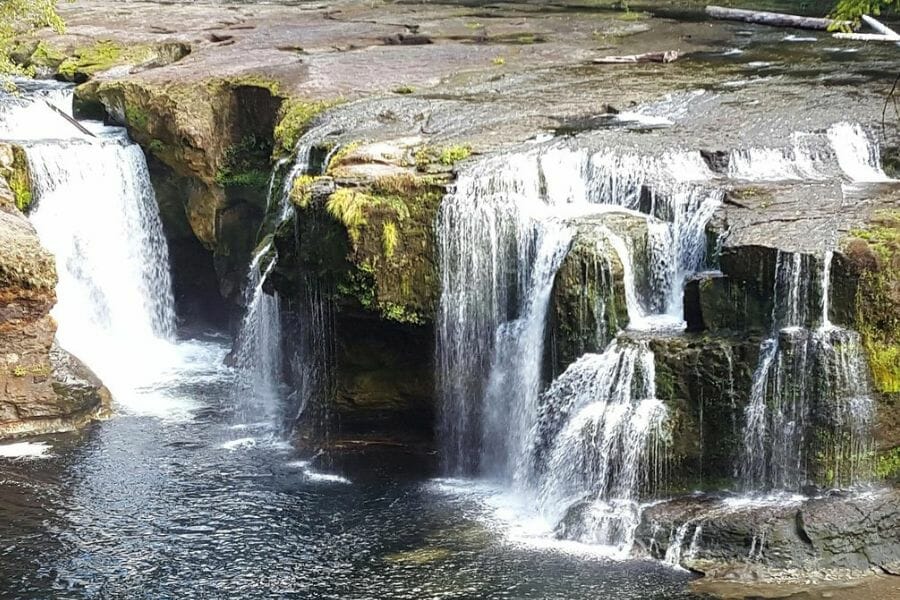
East Fork Lewis River near Yacolt, Clark County. The East Fork Lewis carries fine gold with occasional small pickers, and prospectors have recovered platinum group material here as well. County parks and public access points along the river make scouting easy. Private land is common along the lower river, so use the marked public access.
South Fork Lewis River, Clark County. The state survey lists the South Fork Lewis among Clark County’s placer areas. The drainage runs into the Gifford Pinchot National Forest, which gives you legal ground upstream. Fine gold in the bar gravel is what to expect.
Moclips River, Grays Harbor County. The Moclips River is on the state survey’s Grays Harbor placer list, carrying beach type gold near the coast. The Quinault Indian Reservation lies immediately north, and tribal land is closed to prospecting, so confirm exactly where you are before you start. The public beach access south of town is the safer approach.
Cowlitz River near Randle, Lewis County. Prospectors report fine gold in the Cowlitz gravels below the Cascade crest, fed by mineralized rock in the Gifford Pinchot National Forest. Public access points near Randle and Packwood get you to the river. Work the bars and follow the black sand.
Silver Creek near Mineral, Pierce County. Silver Creek is the state survey’s listed placer locality for Pierce County, draining the mineralized ground south of Mount Rainier. National forest land covers part of the drainage. Mount Rainier National Park is closed to prospecting, so stay well outside the park boundary.
Camp Creek in the Wind River country, Skamania County. Camp Creek is named on the state survey’s Skamania County placer list, in the Gifford Pinchot National Forest north of Carson. Forest roads follow much of the drainage. This is quiet, heavily timbered country with good boulder pockets.
McCoy Creek near Northwoods, Skamania County. McCoy Creek is another listed Skamania placer stream, draining toward the Wind River. National forest ground covers the area with road access. Expect fine gold and a long walk to the good water.
Southeastern Washington
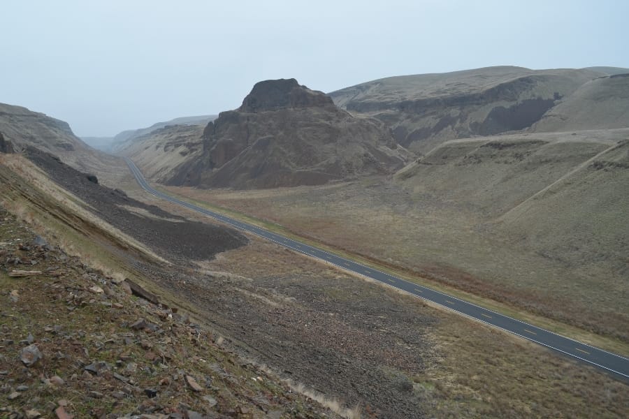
Columbia River bars near Paterson, Benton County. The state survey lists Columbia River bars among Benton County’s placer areas, carrying flour gold delivered from far upstream. Public access points and boat ramps along the river give you legal footing. The Hanford Reach National Monument upstream is closed to prospecting, so keep well below it.
Snake River bars near Little Goose, Garfield County. The Snake River bars in Garfield County are on the state’s placer list and carry the same extremely fine gold as the Asotin County stretch. Public access sites near the dams and boat ramps get you to the gravel. Slow panning and a fine classifier are what this material demands.
Snake River bars near Central Ferry, Whitman County. The state survey lists Snake River bars among Whitman County’s placer areas. Central Ferry and the nearby state park access points put you on the river. Fine gold sits in the sand behind the cobble berms, so screen down and pan carefully.
The Best Gold Hunting Techniques in Washington
Four techniques cover every kind of Washington gold ground, and you can start with the first one for the price of lunch. Work through them in order and each new tool multiplies what the last one taught you.
Gold Panning (Difficulty: 1 out of 5)
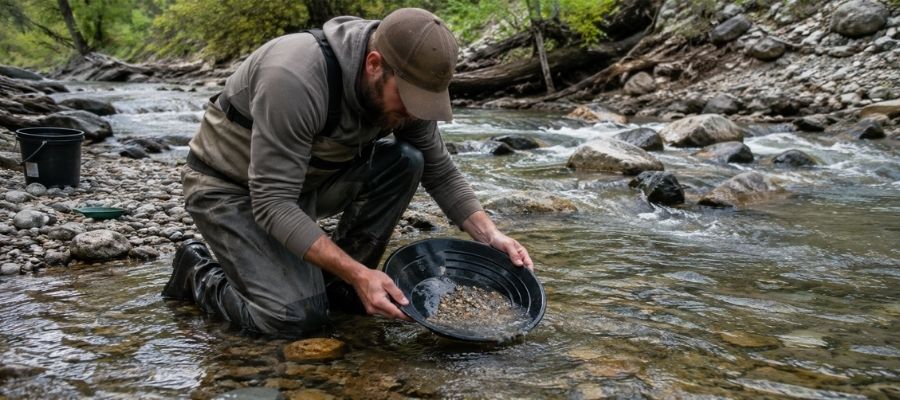
Panning is swirling gravel and water in a pan so the heavy gold sinks and everything lighter rides out over the lip. It takes about twenty minutes to learn and a season to get good at, and the state’s Gold and Fish rules cover it everywhere they apply. Every legal spot in this guide allows it.
A lot of Washington gold is very fine, so slow down. Tip the pan a little less than feels right and let the water do the work, because a fast pan throws flour gold straight back into the river.
Essential Tools
- Gold pan: Garrett 15 Inch Dual Riffle SUPERSLUICE Gold Pan
- Finish pan: Garrett Prospecting 10 Inch Backpacker Gold Pan
- Classifier screen: SE Half Inch Sifting Screen
- Snuffer bottle: Garrett Gold Guzzler Bottle
- Storage vials: SE Glass Vials with Caps
Sluicing (Difficulty: 2 out of 5)
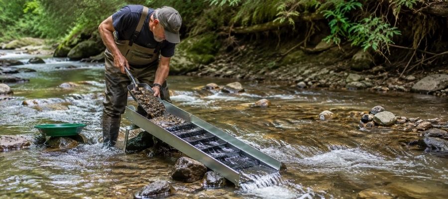
A sluice is a metal trough with riffles that you set in the current so it pans for you all day long. You shovel classified gravel in the top, the water carries the light material away, and the gold hangs up behind the riffles. It processes ten times what a pan can in the same hour.
Washington allows hand powered sluices under the Gold and Fish rules, with limits on riffle area and on how much of the stream width your sluice can cover. The Kettle River, the Similkameen, and the Wenatchee bars all have the volume gravel that makes a sluice worth carrying.
Essential Tools
- Sluice box: Keene A52 Hand Sluice
- Digging shovel: Bully Tools 14 Gauge Round Point Shovel
- Fine classifier: SE 1/8 Inch Mesh Sifting Screen
- Black sand magnet: SE Magnetic Separator Pick Up Tool with Quick Release
Metal Detecting (Difficulty: 2 out of 5)
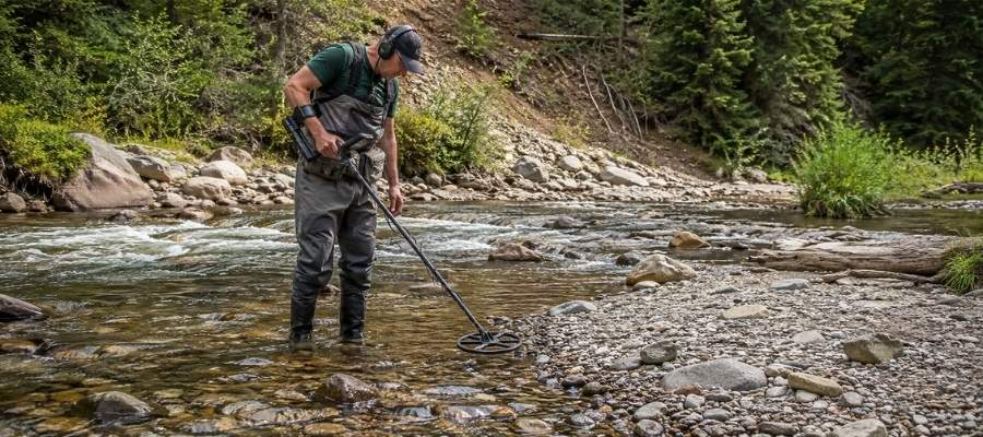
A gold detector finds pieces your pan would never reach, buried in packed gravel and old workings. It is the only efficient way to hunt nuggets, and the Potato Patch nuggets at Liberty were found exactly this way. You swing slowly, listen for a clean tone, and dig every signal.
The old bench gravels and reworked tailings around Liberty and Blewett are the classic Washington detecting ground, and detecting above the water line keeps you out of the in stream rules entirely. Cascade soil is mineralized and noisy, so ground balance carefully before you start.
Essential Tools
- Gold detector: Garrett AT Gold Metal Detector
- Pinpointer: Garrett Pro Pointer AT
- Hand trowel: Edward Tools Bend Proof Trowel
- Magnifying loupe: JARLINK 30X 60X Illuminated Loupe
Crevicing (Difficulty: 3 out of 5)
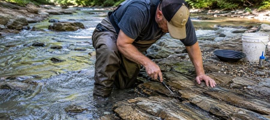
Crevicing is digging gold out of the cracks in exposed bedrock, and in Washington’s steep creeks it is the highest payoff technique there is. Gold works its way down into a seam over decades and cannot go any further, so a crack nobody has cleaned is a savings account. You scrape, flush, and repeat until the crack is empty.
Peshastin Creek, Money Creek, Canyon Creek, and the upper Methow tributaries all have long runs of exposed bedrock. Work at low water in late summer and early fall when more of that bedrock is dry and reachable.
Essential Tools
- Crevice tool set: ASR Outdoor Steel Crevice Tool Set
- Rock hammer: ESTWING 22 oz Rock Pick
- Snuffer bottle: Garrett Gold Guzzler Bottle
- Storage vials: SE Glass Vials with Caps
How To Tell Real Gold From Fool’s Gold
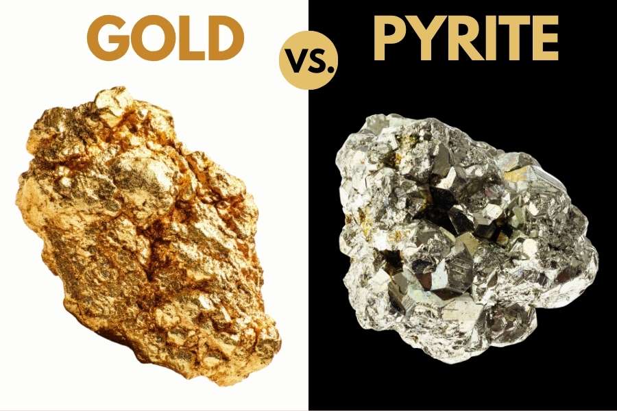
Washington creeks carry more pyrite and mica than gold, and both put on a convincing show in a wet pan. The good news is that two simple tests separate them every single time, and neither one takes more than a few seconds.
The shadow test is the fastest. Cup your hand over the pan and watch the sparkle. Real gold keeps its warm yellow glow in shade, while pyrite and mica go gray and flat the instant direct sunlight leaves them.
The poke test settles whatever the shadow test leaves open. Press a pin or a knife tip firmly into the piece, and gold will dent and hold the mark because it is soft metal. Pyrite is brittle and cracks apart, and mica peels into thin sheets.
Getting this right matters because the real cost of guessing is not embarrassment. It is dumping a pan that had gold in it, or leaving behind a piece of Ellensburg blue agate or nephrite jade that was worth more than the gold. The US Rocks and Minerals Field Guide puts gold and all of its imitators side by side on waterproof pages you can hold right over a dripping pan.

How Gold Got Into Washington
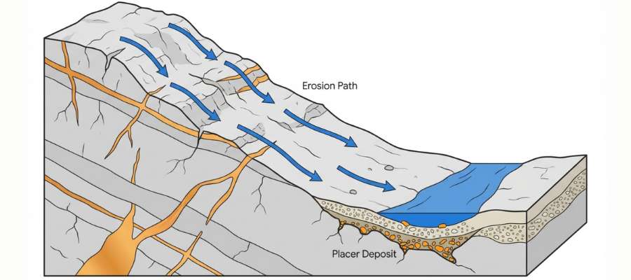
Every spot in this guide sits where it does because Washington was built out of pieces that arrived from somewhere else. The state is a stack of accreted terranes, which are chunks of old ocean floor and volcanic island chains that rode the moving seafloor east and welded themselves onto the edge of North America.
Those collisions did two things at once. They jammed metal rich ocean rock deep into the crust, and they melted the base of that pile into bodies of molten granite. Superheated water carrying dissolved gold moved up through the cracks around those intrusions, cooled, and dropped its metal as quartz veins.
That is why Washington’s gold clusters where it does. The Swauk and Blewett veins, the Republic district, the Monte Cristo and Index veins, and the Northport and Metaline ground all sit along the seams where one terrane met another.
Then the mountains started coming apart. Ice ages, rain, and freeze and thaw broke the veins open, glaciers scoured whole valleys, and meltwater carried the gold downhill. Because gold is roughly seven times heavier than the sand around it, it sank into the gravel and stayed while everything lighter kept moving.
The Swauk Formation tells that story best. Its old sandstone and conglomerate benches are the beds of rivers that ran long before the current creeks existed, and they are exactly where Washington’s record nuggets came from. Rivers like the Similkameen and the Snake keep the cycle going by delivering a fresh load of gold onto their bars every high water season.
What To Bring for a Washington Gold Day Trip
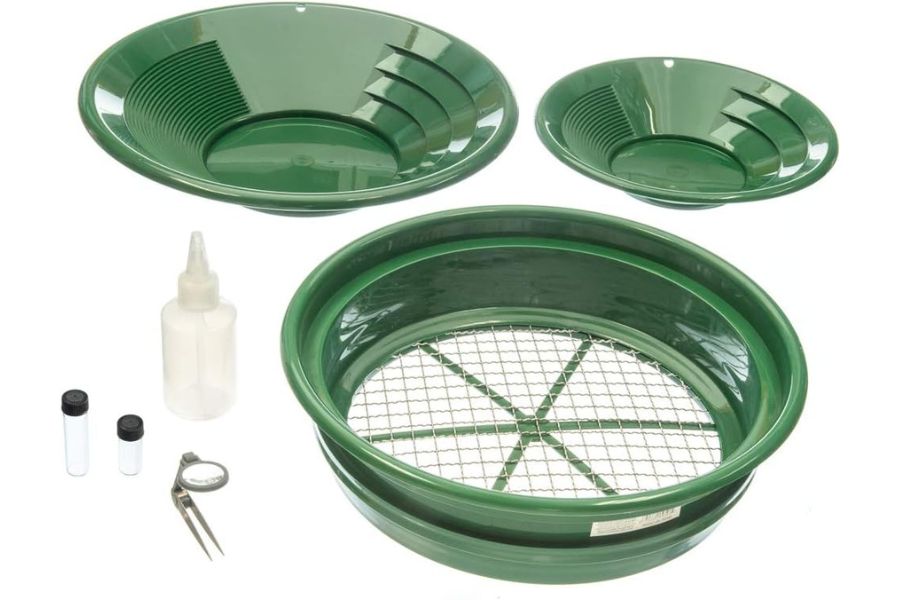
Pack for cold water and changing weather, because most Washington gold sits in snowmelt fed creeks. Here is the checklist that covers a full day on any water in this guide.
Prospecting gear
- Gold pan and finish pan, from the techniques section
- Classifier screen and a small shovel
- Crevice tools if you are working bedrock
- Snuffer bottle and glass vials for your gold
- Magnet for pulling black sand out of concentrates
Everything else
- The current Gold and Fish pamphlet, on your phone or printed
- Printed permission, passes, or claim maps for wherever you are headed
- Rain shell and a warm layer, because Cascade weather turns fast
- Boots you can soak, wool socks, and a dry change in the truck
- Plenty of water, sunscreen, and bug spray for the east side
- Snacks, a first aid kit, and a charged phone with offline maps
If you would rather buy the whole prospecting side in one box, the Garrett Deluxe Gold Pan Kit covers the pans, classifier, vials, and snuffer bottle together. Our full gold hunting and prospecting equipment guide breaks down what each piece actually does.
The Best Time of Year To Hunt for Gold in Washington
Timing matters more in Washington than in most gold states, because snowmelt controls the water and the state sets a work window for every river. Here is the window for each region.
Central Washington
Late July through October is prime time in the Swauk, Blewett, and Wenatchee country. Runoff keeps the creeks high and cold into early summer, and the bars and bedrock come out of the water as flows drop.
Highway 97 over Blewett Pass stays open year round, which makes the Liberty area a good early season scouting trip even when the creeks are still up. Check the Gold and Fish work window for each specific stream, because they differ across the region.
North Central Washington
August through October is the sweet spot on the Similkameen, the Okanogan, and the Methow. The rivers drop to workable levels by late summer and the weather stays dry and warm well into fall.
High country access like Harts Pass runs roughly July through September before snow closes the road. The east side gets hot in July and August, so start early and carry more water than you think you need.
Northeastern Washington
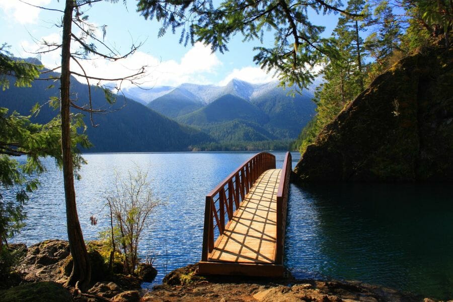
July through October works across the Kettle River and Selkirk country. The Kettle drops to easy wading by midsummer, and the Pend Oreille bars stay accessible into fall.
Sullivan Creek and the steeper Selkirk drainages hold snow later, so give them until July. Winter comes early up here, and forest roads can drift shut by November.
Northwestern Washington
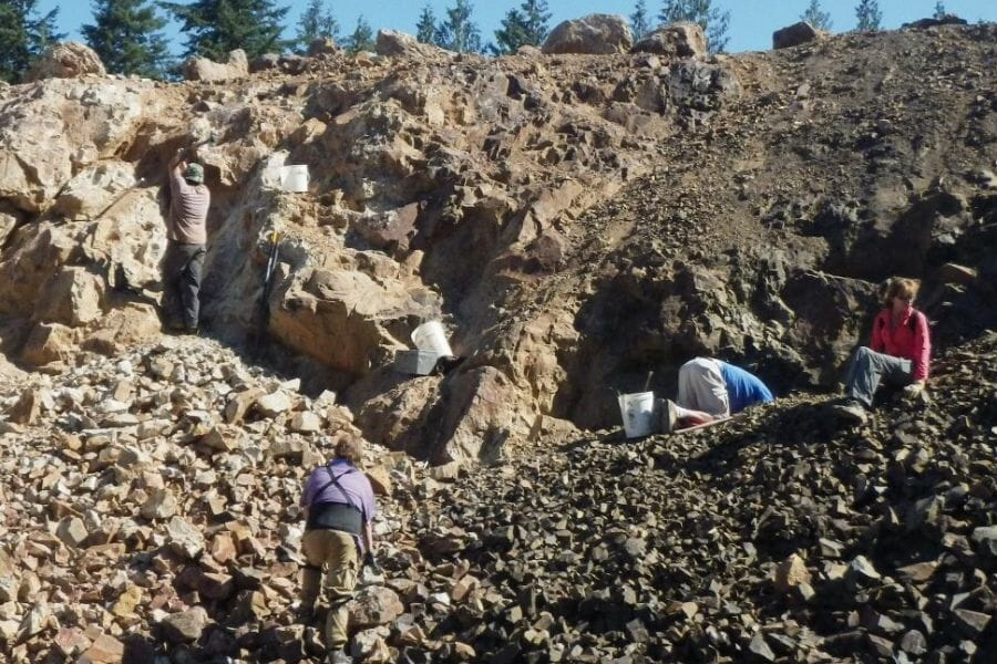
August through October is the window on the west side Cascade rivers, when flows finally drop and the bars come out. The Skykomish, Skagit, and Snoqualmie all run high and fast through spring and early summer.
Fall rains can bring the rivers up quickly, so watch the forecast and the gauges. The upside is that every flood reshuffles the bars and restocks the gravel you panned last season.
Southwestern Washington
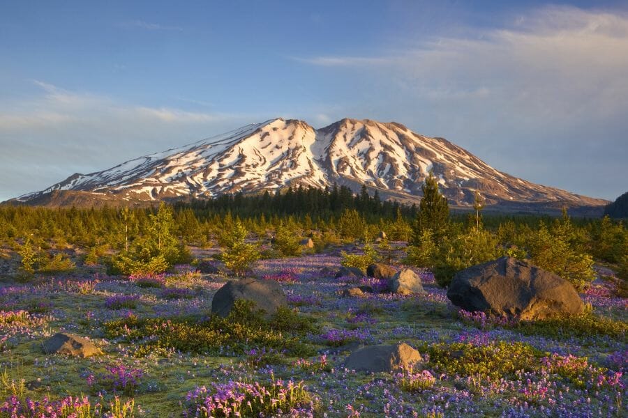
Late summer through October is best on the Gifford Pinchot creeks, once runoff has passed and the forest roads dry out. The Lewis River drainages hold good flows all season.
The ocean beaches at Ocean Shores work in the opposite direction. Winter storms are what strip the sand and expose the black layers, so the best beach prospecting comes right after a big blow from November through March.
Southeastern Washington

Spring and fall are the comfortable seasons on the Snake and Columbia bars. April through June and September through November give you mild temperatures and low water on the gravel.
Midsummer here runs very hot and shade is scarce, so an early morning start is the play if you go in July or August. Winter is workable on the lower bars whenever the roads are clear.
Other Valuable Rocks and Minerals You Can Find in Washington
The same gravel that holds Washington’s gold holds some of the best rockhounding material on the West Coast. Keep your eyes open while you pan, because more than one prospector has funded a trip on something that was not gold at all.
Ellensburg Blue Agate
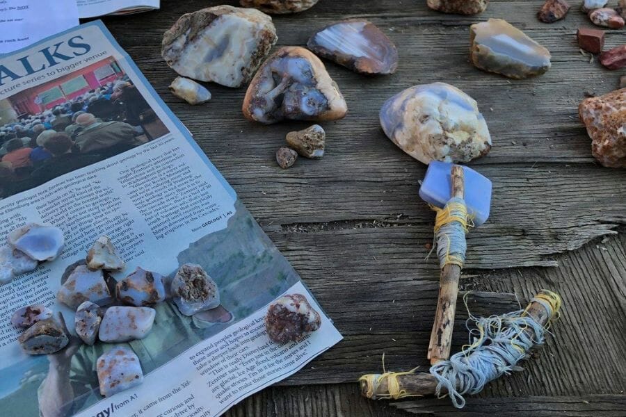
Ellensburg blue agate is one of the rarest agates on earth and it comes from exactly the country you will be panning in Kittitas County. The color runs from pale sky blue to a deep cornflower, and top material sells for serious money per carat. It turns up as waxy translucent pebbles in gravel and plowed ground.
Our guide to agates in Washington covers where the blue agate country sits and what a real piece looks like.
Nephrite Jade
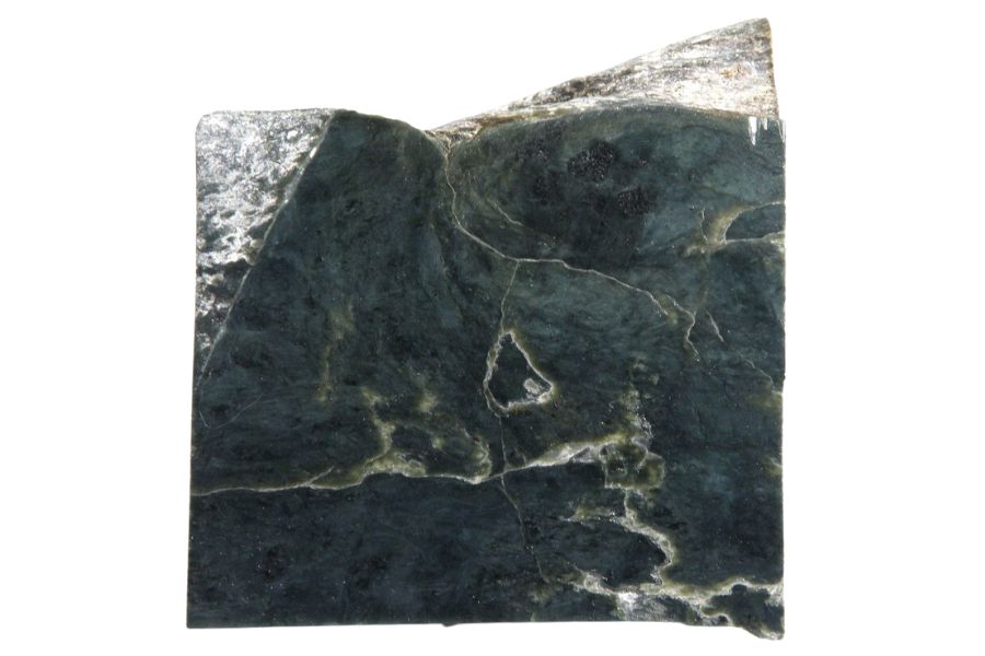
Nephrite jade shows up in the same North Cascades drainages that carry gold, especially around Darrington and the Skagit country. Look for heavy, dense green stones with a greasy shine and no visible crystals. It is tough enough to ring when you tap two pieces together.
Our guide to jade in Washington maps out the creeks and river bars where it comes from.
Carnelian
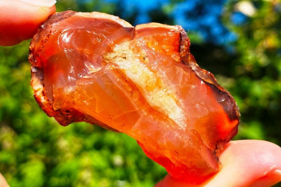
Carnelian is the orange to deep red form of chalcedony, and it shows up on Washington gravel bars in the same handful as your black sand. Hold a pebble up to the sun and it glows like a coal. The best pieces come out of the basalt country and the rivers draining it.
Our full guide on how to find agates explains what separates a good piece from a common one.
Geodes
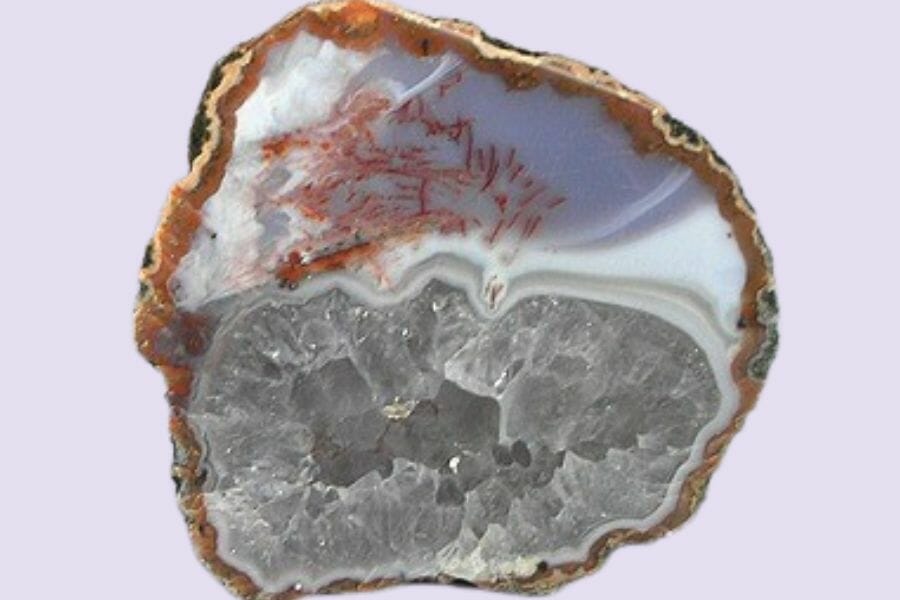
Washington geodes come out of the volcanic rock across the state, and cracking one open is one of the great rockhounding moments. They look like plain lumpy stones on the outside and hold quartz or chalcedony crystals inside. Weight is the giveaway, since a hollow geode feels light for its size.
Our guide to geodes in Washington shows the digging areas that produce the best ones.
Quartz Crystals
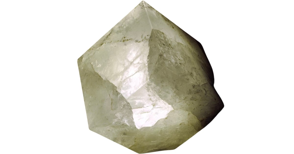
Quartz crystals grow in pockets in the same veins that carry Washington’s gold, which means the two often turn up together. Look for clear to milky points with six sides and a sharp termination. Clean, undamaged crystals are worth real money to collectors.
Our guide to quartz in Washington covers the districts where the best pockets open up.
Amethyst
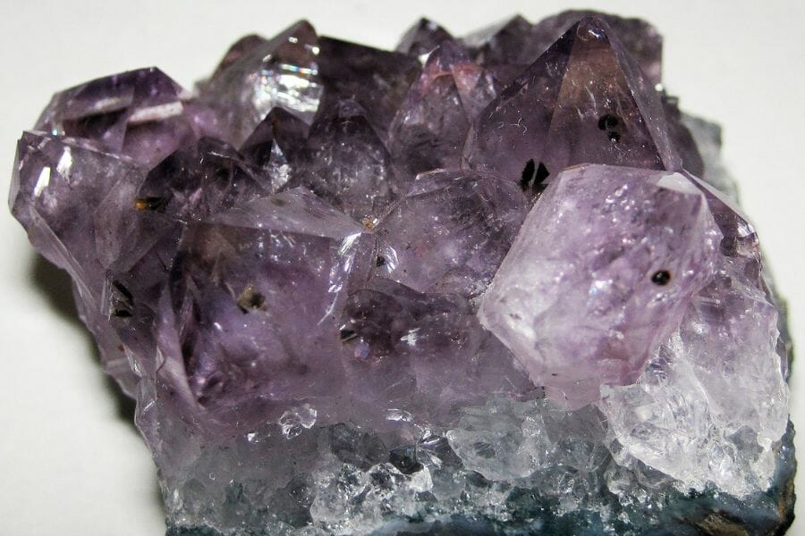
Amethyst is purple quartz, and Washington’s volcanic rock produces it in cavities and seams. The color runs from a faint lavender to a rich grape, and even pale material makes a nice specimen. It often sits alongside chalcedony in the same pocket.
Our guide to crystals in Washington covers the areas where amethyst shows up.
Garnet
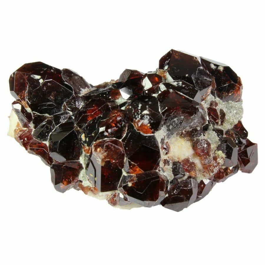
Garnet is everywhere in Washington gold country, showing up as deep red grains in your pan and as full crystals in the metamorphic rock of the Cascades. On the ocean beaches it stains whole stretches of sand pink. Larger clean crystals can be cut into gems.
Our guide to garnets in Washington covers the best collecting areas in the state.
Jasper
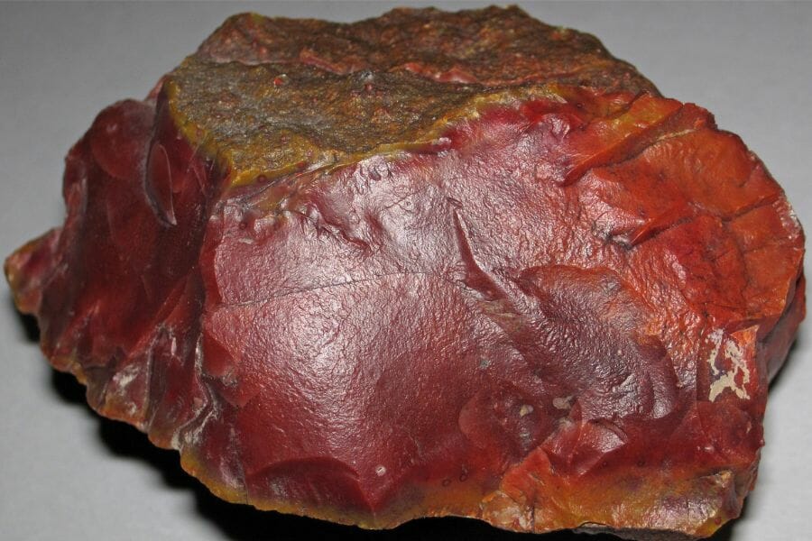
Jasper is opaque, richly colored chalcedony, and Washington produces it in red, yellow, green, and mixed picture patterns. It rounds into smooth pebbles on gravel bars, which is exactly where your gold pan is already working. Cut and polished, the picture jaspers from this state are collector favorites.
Our gem hunting in Washington guide covers the rivers and beaches that produce the best jasper.
Petrified Wood
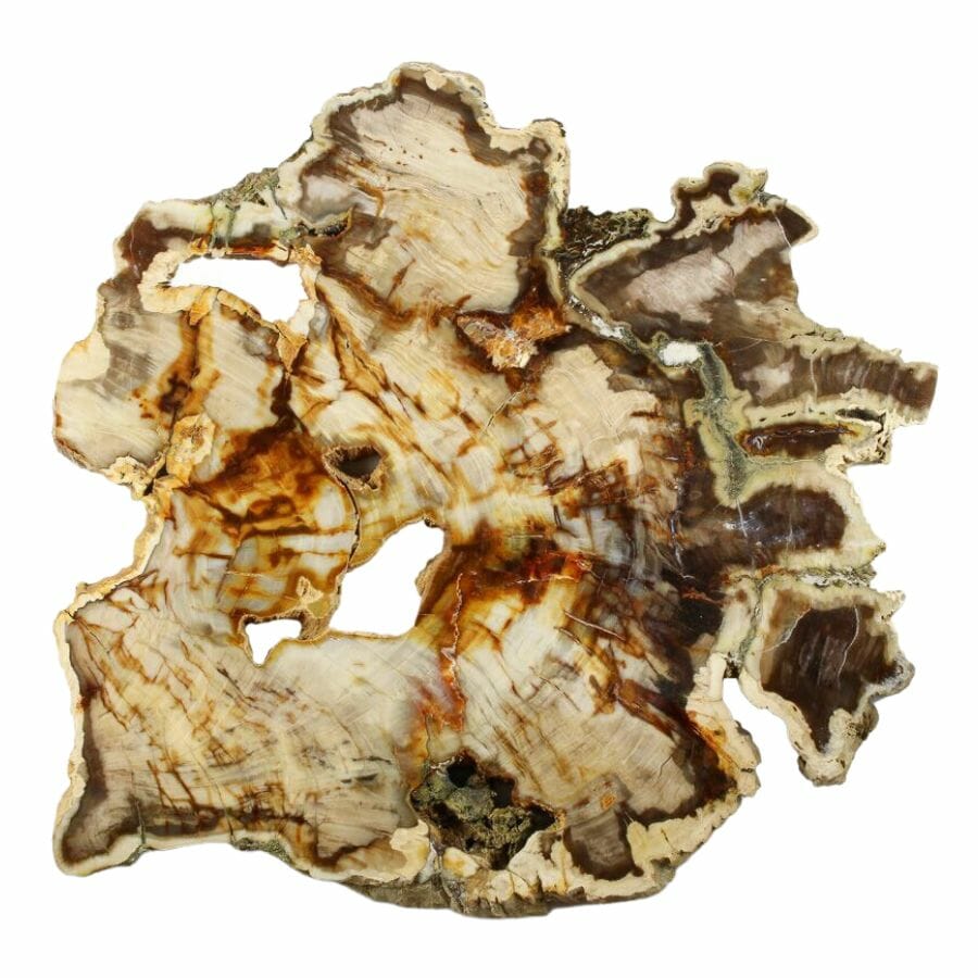
Petrified wood is Washington’s state gem, and lava flows buried whole forests here in the Columbia Basin. Look for stones that keep the grain and bark texture of wood but weigh like rock. Some pieces are agatized and take a mirror polish.
Our guide to petrified wood explains how it forms and how to spot a good piece.
Rhodonite
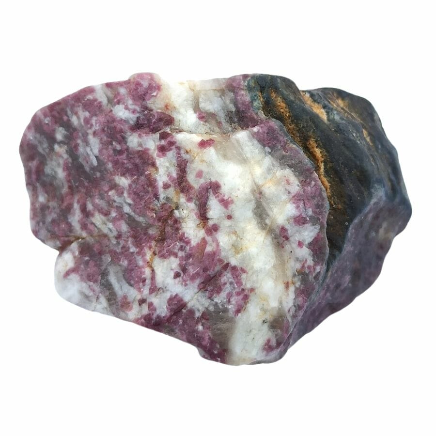
Rhodonite is a pink to rose red manganese mineral with black veining running through it, and Washington produces good cutting material. It turns up in the metamorphic belts of the Cascades and the northeast corner. The color is unmistakable once you have seen a piece.
Our rockhounding in Washington guide covers the areas where rhodonite and other cutting material show up.
Every one of these can end up in your pan or your pocket on a gold trip, and every one is easy to walk past when it is wet and dirty. The Rocks and Minerals of the United States Field Guide gives you photos of all of them on waterproof pages, so nothing valuable goes back in the river by mistake.

Legal Rules for Gold Prospecting in Washington

Read this before you put a pan in the water. We are rockhounds, not lawyers, and nothing here is legal advice. Washington has some of the most specific in stream rules in the country, and staying legal is entirely your responsibility.
Start with the state’s Gold and Fish pamphlet from the Department of Fish and Wildlife. That pamphlet is both the rulebook and the permit for hand powered mineral prospecting, it sets a work window for every listed water in the state, and you are expected to carry a copy with you on the job site. Read the entry for your specific river before you drive.
Private Property
Washington is a checkerboard of federal, state, tribal, and private ground, and boundaries are rarely marked in the backcountry. Prospecting on private land without the owner’s consent is trespassing, and that includes streambeds where the adjacent land is privately owned. A quick ask ahead of time keeps every flake you find 100% yours.
State land has its own layer. The Department of Natural Resources does not allow gold panning on state trust lands, and panning on state owned aquatic lands takes a use authorization from the DNR Aquatic Resources Division along with the Gold and Fish pamphlet. Tribal land is closed unless the tribe grants permission.
Active Mining Claims
This is the big one in Washington. Large stretches of the Okanogan Wenatchee, Mount Baker Snoqualmie, Colville, and Gifford Pinchot National Forests are covered by active unpatented mining claims, and a claim gives the holder rights to the minerals even though the surface stays public. Panning on someone’s claim is taking their property, so check the ground with the BLM Mineral and Land Records System and look for claim posts and monuments in the field.
Joining a club is the shortcut here. Washington’s prospecting associations hold well over a thousand acres of claims across the state and let members work them and keep what they find, which turns claim research into a membership card.
Equipment Restrictions
The Gold and Fish pamphlet authorizes pans, hand tools, mini rocker boxes, and hand powered sluices and high bankers, with limits on riffle area and on how much of the stream width your sluice may cover. Anything motorized, and any gravity siphon equipment, falls outside the pamphlet and needs an individual Hydraulic Project Approval, and many Washington waters have been closed to motorized and gravity siphon mining since 2020.
The pamphlet also protects the habitat you are standing in. You may not disturb spawning fish or redds, you may not cut or undermine live rooted vegetation, and you have to move your operation if fish start spawning where you are working.
National parks are closed to prospecting everywhere in the country, so Olympic, Mount Rainier, and North Cascades are all off limits, along with the Ross Lake and Lake Chelan National Recreation Areas that the North Cascades complex manages. National monuments, national wildlife refuges, national scenic areas, and designated wilderness are closed as well, which covers Hanford Reach, Mount St. Helens, the Columbia River Gorge, and wilderness areas like Alpine Lakes, Glacier Peak, and Pasayten. Municipal watersheds for Seattle and Everett are closed to the public.
Play it safe on every trip. Confirm access directly with the landowner or the managing agency before you dig, because boundaries and rules change without notice.
Some locations in this guide sit on or near ground where collecting is limited or where cleanup work is underway. When in doubt, treat a spot as look but do not take until you have confirmation in hand.
The best shortcut is local knowledge. Washington’s rock and mineral clubs and prospecting associations know which stretches are open, which claims are active, and which landowners welcome visitors, and a membership usually pays for itself in access alone.
Washington Gold FAQ
Can you still find gold in Washington state?
Yes, you can still find gold in Washington, and people do it every weekend. Placer gold keeps washing out of the Cascades and the Okanogan highlands into creeks across the state, and rivers like the Similkameen and the Snake get a fresh supply of gold dust on their bars every year. Fine gold and flakes are the everyday find, with pickers and nuggets in the Swauk and Selkirk drainages.
Where can I legally pan for gold in Washington?
National forest ground that is not claimed or closed is the main option, which covers big stretches of the Cle Elum River, Peshastin Creek, the Kettle River, Money Creek, and the Methow tributaries. Ocean beach prospecting at Ocean Shores has its own section in the state rules. The best places section above lists the access and rules notes for each spot.
Do you need a permit to pan for gold in Washington?
The state’s Gold and Fish pamphlet acts as your permit for hand powered mineral prospecting, and you are expected to carry a copy while you work. It sets the work window and the equipment limits for every listed water. Motorized and gravity siphon equipment falls outside the pamphlet and needs an individual Hydraulic Project Approval from the Department of Fish and Wildlife.
What river in Washington has the most gold?
The Similkameen River in Okanogan County is the most dependable, because the state survey notes that new gold dust is deposited on its bars every year. Swauk Creek in Kittitas County produced Washington’s record nuggets and the state’s famous crystalline gold. The Kettle River and the Wenatchee are the next best bets for steady flakes.
What is the largest gold nugget found in Washington?
The largest documented nugget in Washington weighed 77 troy ounces and came from a bench of Swauk Creek above the mouth of Baker Creek in Kittitas County. A 73 troy ounce nugget came out of the Elliott placer on Williams Creek in 1900. In the fall of 2013 a prospector detecting an old channel near Liberty recovered nuggets of 16.25 ounces and 13 ounces on the same ground.
Get Every Find In Your Pan Identified In Seconds

Every pan you pull out of a Washington creek is a question until you can name what is in it. Gold, pyrite, garnet, jade, and Ellensburg blue agate all show up in the same gravel, and the difference between them is thousands of dollars.
The Rocks and Minerals of the United States Field Guide identifies 140 rocks, minerals, and gemstones with clear photos, printed on waterproof pages that work right at the water’s edge.