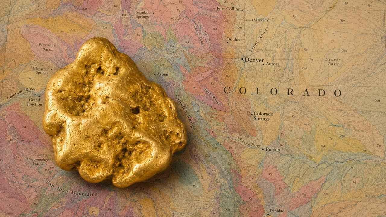
Gold in Colorado was first panned out of Ralston Creek in 1850, eight years before the Pikes Peak rush pulled a hundred thousand people across the plains. That creek still runs through a city park in Arvada, and people still pull color out of it.
With gold trading above $4,000 an ounce, you do not need to find much for a weekend in the mountains to pay for itself.
Most people who go looking for gold in Colorado pick a famous creek off a map and start digging. Then they learn the hard way that the stretch they picked is covered by an active mining claim, which makes the gold in it someone else’s property.
Yes, you can still find gold in Colorado today, especially along Clear Creek and the Arkansas River, where placer gold has been filling pans since 1859. This guide covers the spots that are genuinely open to you, from free prospecting parks in the Denver suburbs to BLM placer ground above Salida, plus the technique that works at each one.
Our team of geologists and experienced rockhounds built this guide around the Colorado Mineral Belt, the band of gold bearing rock that runs diagonally from Boulder County down to the San Juans. Here is exactly where that belt drops gold into water you can legally reach.
Table of Contents
- Biggest Discovery
- Types of Gold
- Where Gold Hides
- Best Places
- Techniques
- Real vs Fool’s Gold
- How Gold Got Here
- What To Bring
- Best Seasons
- Other Minerals
- Legal Rules
- FAQ
The Biggest Gold Discovery in Colorado History
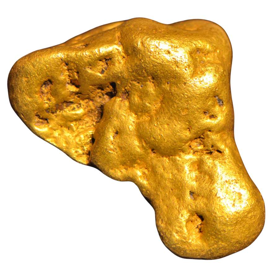
The largest piece of gold ever pulled out of Colorado weighed about thirteen and a half pounds, and two miners carried it out of the hill wrapped in a blanket. Tom Groves and Harry Lytton hit it on July 23, 1887, inside Farncomb Hill above Breckenridge, and the way Groves cradled the thing on the walk to town earned it the nickname Tom’s Baby.
Thirteen and a half pounds is close to 197 troy ounces. At today’s prices that is more than three quarters of a million dollars in raw metal, and a specimen like that would sell for far more than melt value to a collector.
Farncomb Hill is strange country geologically. The gold there grew inside vugs, which are gas bubbles frozen into the rock, and superheated fluids later forced their way into those pockets and left gold behind. That is why the hill is famous for delicate wire gold and leaf gold instead of the rounded nuggets you get out of a river.
Tom’s Baby vanished for most of a century before it turned up in a Denver bank vault in 1972. About ten and a half pounds of it survived, and you can go look at it today at the Denver Museum of Nature and Science.
The lesson for you is simple. Farncomb Hill sits above French Gulch and the Blue River, and every one of those drainages has been feeding gold downstream ever since.
The Kinds of Gold You Can Find in Colorado
Colorado gives you four kinds of gold, and knowing which one your creek carries tells you exactly how to work it. The Front Range creeks run heavy on fine gold, the mountain gulches hold chunkier pieces, and the old lode districts still shed gold locked in white quartz.
Flour Gold
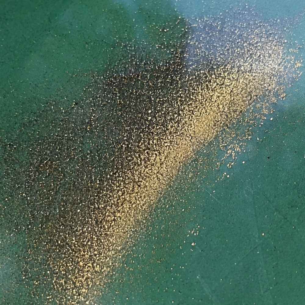
Flour gold is gold ground down to specks finer than sugar, and it is the most common gold in Colorado water. The Arkansas River is famous for it, and so is Clear Creek Canyon, where prospectors report material so fine it takes a slow hand to keep it in the pan. It shows up as a bright yellow tail in the crease of your pan after everything lighter has washed away.
The mineral that fools people here is mica. Mica flashes gold when the sun hits it, but it weighs almost nothing and rides on top of the water. Real flour gold sinks straight down and stays warm yellow even when you shade the pan with your hand.
Because flour gold rides out of a rough pan so easily, use a smooth finish pan for your last few swirls. The Garrett Prospecting 10 Inch Backpacker Gold Pan is built for exactly that final step.
This is also the moment a good identification reference earns its keep. The Rocks and Minerals of the United States Field Guide shows real gold side by side with every mineral that imitates it, so you know what you are holding while your pan is still wet.
Gold Flakes and Pickers
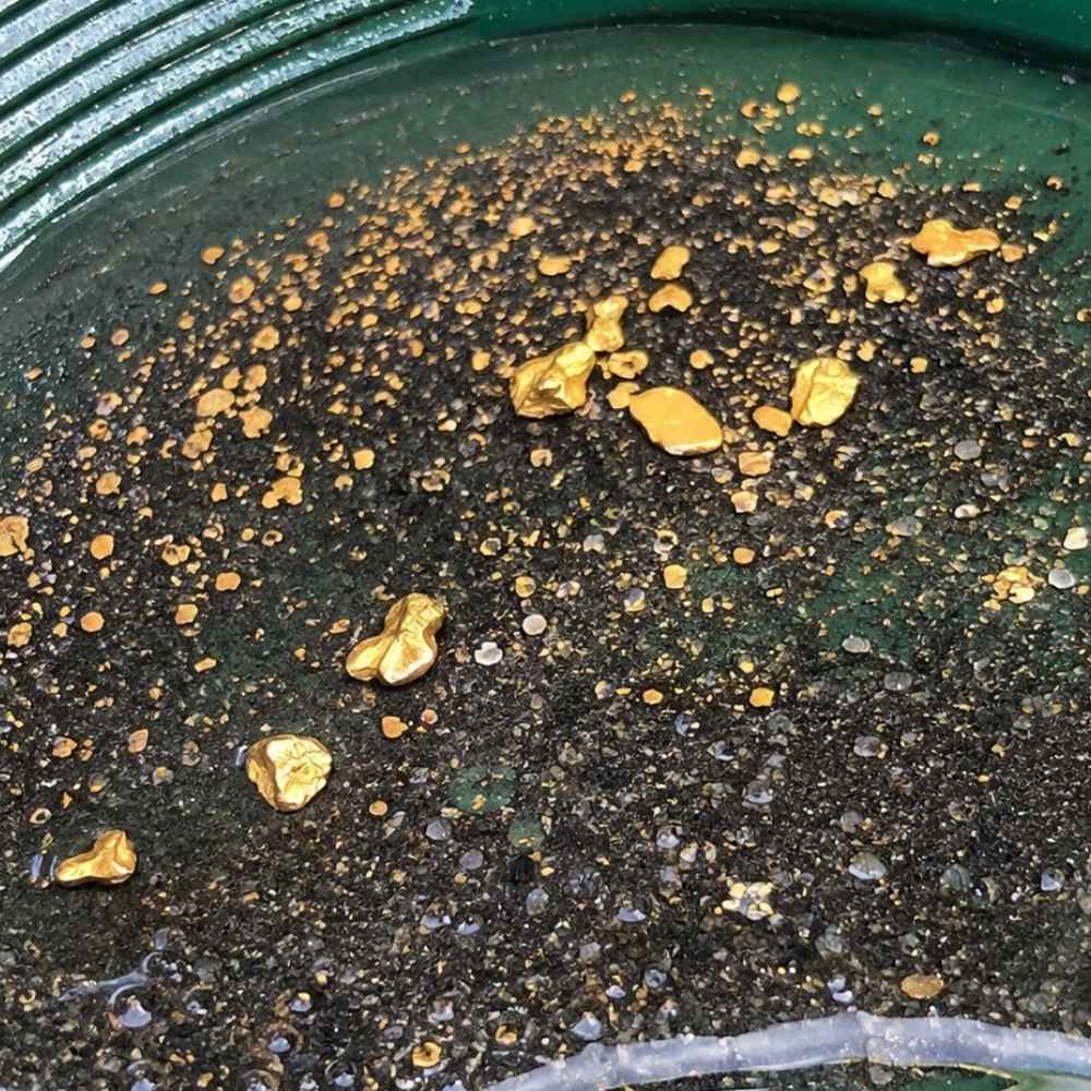
Flakes and pickers are the pieces you can grab with your fingers, and Colorado’s mountain creeks produce them all season. A flake is flat and thin, a picker is thick enough to pick up without a snuffer bottle, and both mean you are standing over good ground. Cache Creek near Granite and the gravels around Fairplay both give up pieces this size.
Pyrite is the lookalike that trips people up on flakes. Pyrite comes in hard little cubes with sharp corners and it shatters when you press it. A real gold flake bends and dents instead, and it never grows a flat crystal face.
Pull flakes and pickers out of your pan with a snuffer bottle before a wave takes them back. The Garrett Gold Guzzler Bottle sucks them straight off the water without a single lost piece.
Gold Nuggets
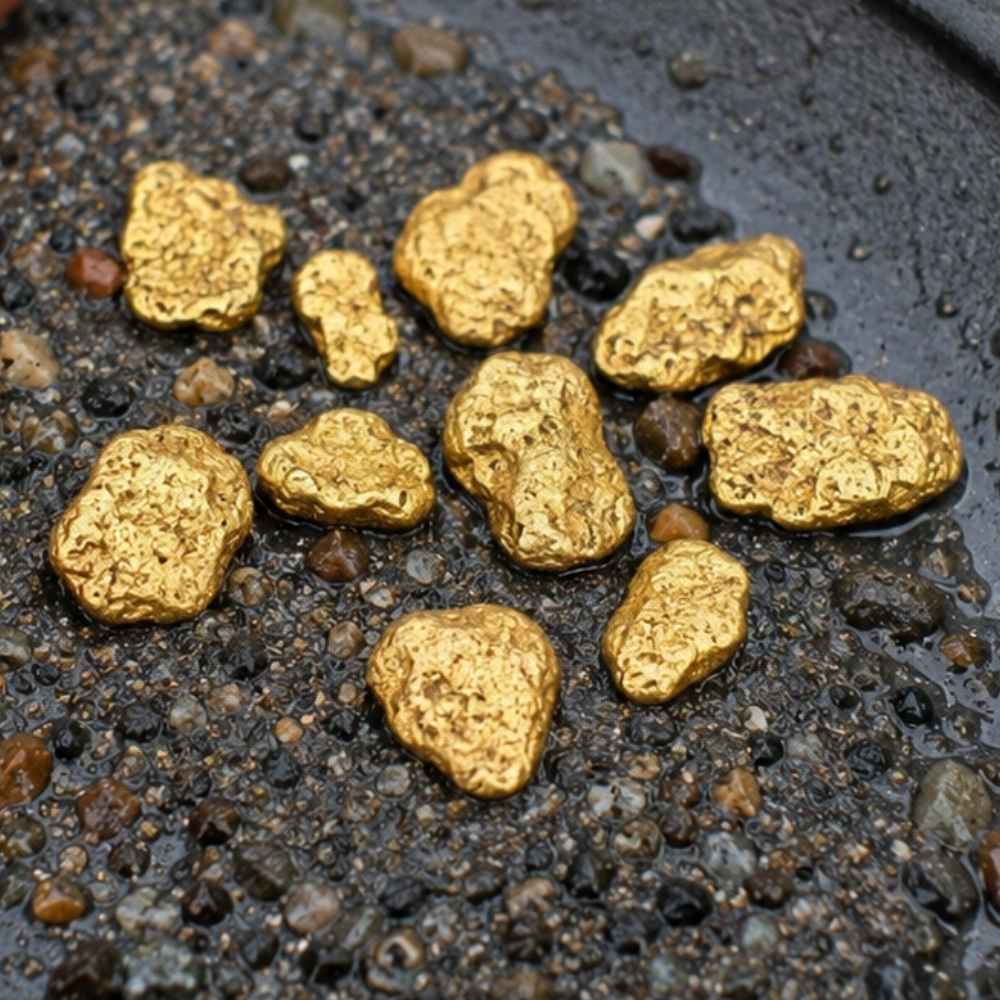
Nuggets are the trophy, and Colorado has produced more of them than almost any state in the country. They come out of the gulches below the old lode districts, where a vein was rich enough that gravity delivered whole chunks into the creek instead of dust. Breckenridge, Fairplay, and the upper Arkansas drainage all have documented nugget ground.
Nuggets carry a deep buttery color and a heft that surprises people the first time. Anything that looks like a nugget but feels light for its size is almost always weathered pyrite or a chunk of iron stained rock.
Nuggets big enough to matter are often buried under a foot of packed gravel, which is where a detector earns its price. The Garrett AT Gold Metal Detector is tuned for small gold and handles Colorado’s mineralized ground well.
Gold in Quartz
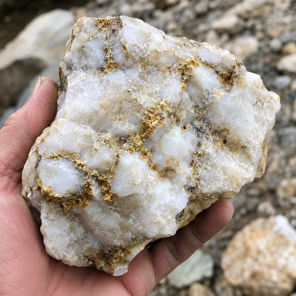
Gold in quartz is where all of Colorado’s placer gold came from, and pieces of it still wash into the creeks. Look for chunks of milky white quartz with rusty orange staining and thin yellow threads running through the breaks. Central City, Idaho Springs, and Cripple Creek all sit on this kind of rock, and float boulders from those veins travel a long way downhill.
Chalcopyrite is the mineral that fakes it best inside quartz, showing a brassy yellow that looks convincing until you scratch it. Chalcopyrite streaks greenish black on a rough surface, while gold streaks yellow and stays yellow.
Cracking a promising quartz cobble takes a real rock pick, not a claw hammer. The Estwing Geo Paleo Rock Pick splits quartz cleanly so you can see what is inside.
Every one of these four kinds has a technique that suits it best, and the techniques section further down breaks each one apart with the gear list to match.
Where Gold Hides in Colorado Streams
Colorado gold sits exactly where the water gives up speed, and reading that is more valuable than any map. These are the five features that pay off across the state, from the Front Range canyons to the San Juan drainages.
Inside River Bends
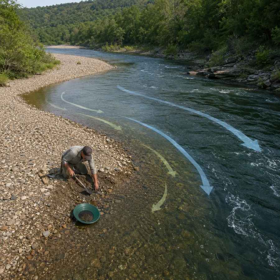
The inside of a bend is the slowest water in the whole creek, and gold drops there first. Stand at the bend and look for the point where the gravel goes from cobbles to sand, because that transition line is where the heavy stuff quits moving.
Digging an inside bend feels like work at first and then gets easy. The top layer is loose rounded rock, and about a foot down you hit packed gravel that holds together when you shovel it. That packed layer is the one you want in your pan.
A round point shovel moves the overburden fast so you can get to the good material. The Bully Tools 14 Gauge Round Point Shovel holds up to Colorado cobble without bending.
Gravel Bars
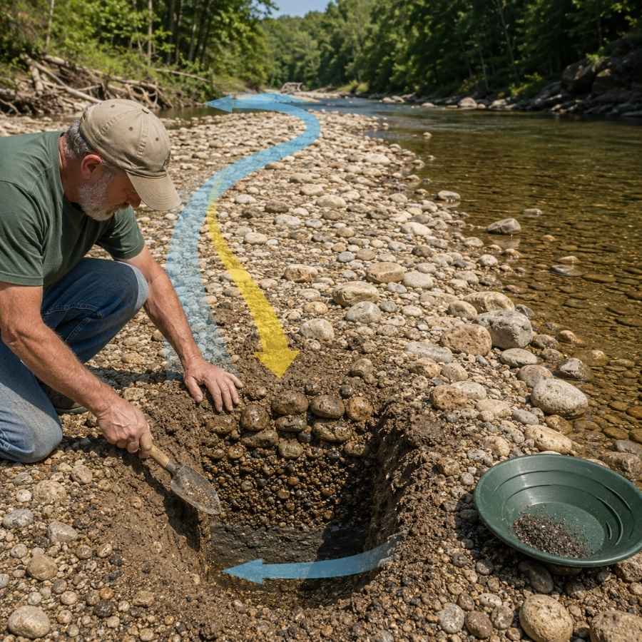
Gravel bars are the easiest gold traps in Colorado to spot and the easiest to work. The upstream tip of a bar is the money spot, because that is where the current first slows and drops what it is carrying. On the Arkansas, whole bars rebuild after every spring runoff.
Bar gravel is loose on top and tighter underneath, and the color usually improves as you go down. Dig test holes across the bar rather than one deep hole in the middle.
Screening the oversize rock out before you pan doubles how much material you can process. The SE Half Inch Sifting Screen sits right on your pan and does it in seconds.
Bedrock Cracks
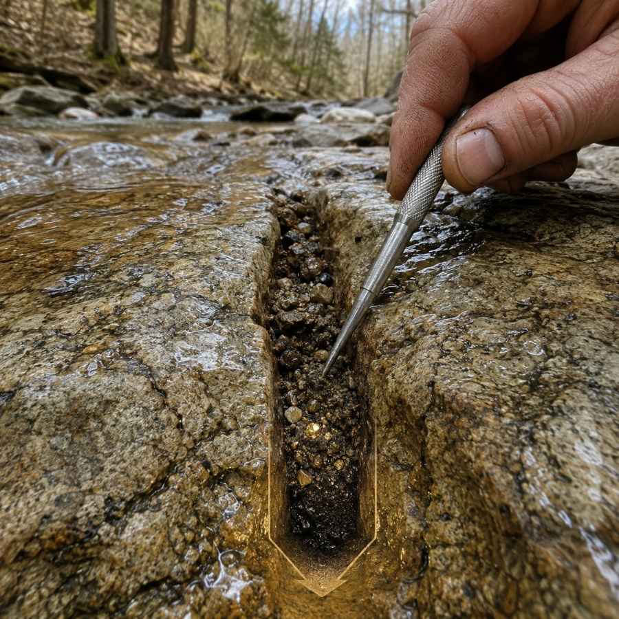
Bedrock is the floor gold cannot fall through, and in Colorado’s canyons that floor is often exposed right in the creek. Clear Creek Canyon and the upper Arkansas both have long runs of hard rock with cracks and joints running across the flow. Gold works down into those cracks over decades and stays there.
Cleaning a crack feels like dentistry. You scrape, you flush, and you keep going until the crack is empty, because the last spoonful is usually the richest.
A steel crevice tool set is the only thing that gets down into a tight seam. The ASR Outdoor Steel Crevice Tool Set gives you several shapes so one of them always fits.
Behind Boulders
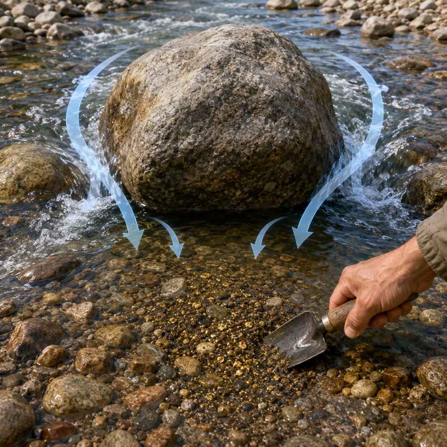
Every big boulder in a Colorado creek builds a pocket of dead water behind it, and dead water drops gold. The bigger the boulder and the faster the water around it, the better the pocket. This is the single most reliable feature in steep mountain streams like French Gulch or Chalk Creek.
The gravel behind a boulder is usually packed tight and full of black sand, which is a good sign. Dig it out down to whatever hard surface sits underneath.
A bend proof hand trowel gets into the pocket without wrecking your back. The Edward Tools Bend Proof Trowel is the one that survives a season of cobble.
Black Sand Streaks
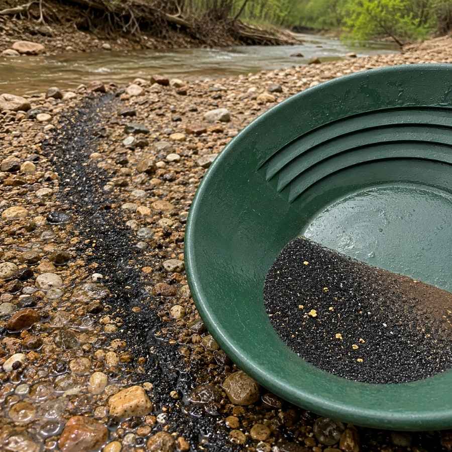
Black sand is your compass in Colorado, because it is heavy iron mineral that travels and settles exactly where gold does. Look for dark ribbons on top of a bar or dark layers in a cut bank. Where the black sand concentrates, your gold is in the same handful.
Following black sand also means your pan fills with magnetite, which you need to get out before you can see anything. That is a two minute job with the right tool.
A magnetic separator pulls the iron out of your concentrate and leaves the gold behind. The SE Magnetic Separator Pick Up Tool with Quick Release drops the whole load in one click.
Always Confirm Access and Collection Rules!
Before heading out to any of the locations on our list you need to confirm access requirements and collection rules for both public and private locations directly with the location. We haven’t personally verified every location and the access requirements and collection rules often change without notice.
Many of the locations we mention will not allow collecting but are still great places for those who love to find beautiful rocks and minerals in the wild without keeping them. We also can’t guarantee you will find anything in these locations since they are constantly changing.
Always get updated information directly from the source ahead of time to ensure responsible rockhounding. If you want even more current options it’s always a good idea to contact local rock and mineral clubs and groups
The Best Places To Find Gold in Colorado
Colorado’s gold sits in three broad regions, and each one has ground that is open to you without a claim or a landowner conversation. Here is every spot worth your gas money, starting with the ones you can drive to and start panning the same day.
Northern Colorado
The Front Range foothills and the Denver metro creeks are where Colorado’s gold rush started, and they are still the easiest gold in the state to reach. Several cities and counties run free prospecting areas on Clear Creek and the South Platte, which makes this region the best place in Colorado to learn.
Clear Creek Canyon Park, Jefferson County

Clear Creek Canyon Park gives you close to ten miles of legal gold creek along US Highway 6 west of Golden, and Jefferson County Open Space allows prospecting through nearly all of it. This is the same water that touched off Colorado’s 1859 rush, cutting through hard Precambrian schist and gneiss that has been shedding gold for a very long time. Six trailheads, including Gateway, Tunnel 1, Mayhem Gulch, and Cannonball Flats, put you at the water within a few minutes of parking.
The gold here is fine flake and flour gold, and careful panning with a slow hand is the technique. Work the bedrock cracks and the gravel behind boulders, because the canyon has plenty of both.
Your pan will also turn up quartz, feldspar, garnet, and heavy black sand from the surrounding gneiss. This is exactly the moment people throw away a good stone, because everything looks the same when it is wet. The US Rocks and Minerals Field Guide lets you check every odd piece against clear photos before it goes back in the creek.
County rules ask you to fill your holes, leave the banks and vegetation alone, and stay a hundred feet back from bridges and steps. Prospecting is closed at the Big Easy Trailhead, so read the signs at whichever lot you use. Bring the crevice tools from the techniques section below.
Difficulty: 2 out of 5
Arapahoe Bar, Wheat Ridge, Jefferson County
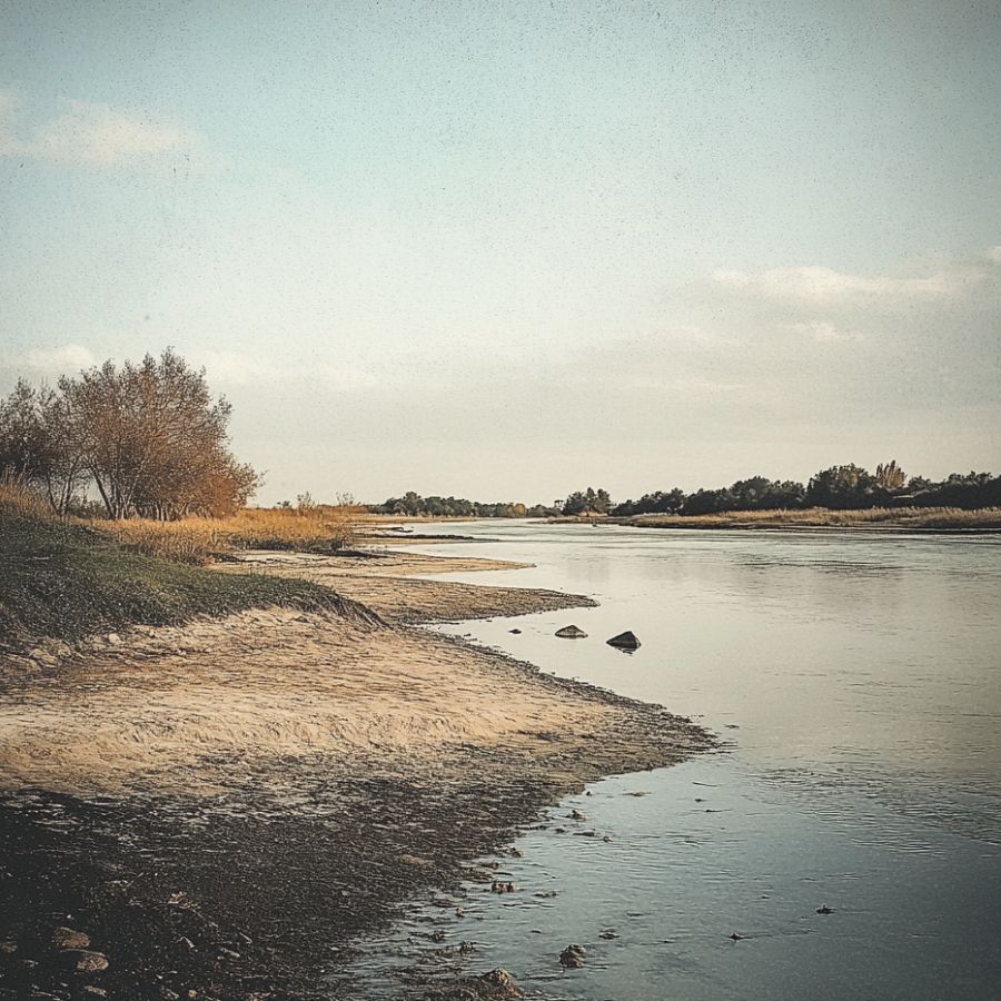
Arapahoe Bar is a free public prospecting park on Clear Creek in Wheat Ridge, and it is the friendliest first trip in Colorado. Park at the Wheat Ridge Greenbelt trailhead off Youngfield Street, walk a paved path to the water, and you are standing on gold ground about ten minutes from the interstate. The productive stretch runs roughly a quarter mile upstream from the parking area.
Fine flakes and flour gold are the standard find, and panning or running a hand sluice both work. There is a gray black layer under the surface gravel that carries noticeably bigger pieces, so dig past the loose top material.
The same gravel gives up quartz pebbles, jasper, and thick black sand. Digging is allowed in the creek bed and on the north bank, but leave the sloped south bank below the rec path alone. Gas engines are not allowed, and battery powered gear is fine, which makes this an easy spot to bring kids.
Difficulty: 1 out of 5
Clear Creek at Idaho Springs, Clear Creek County
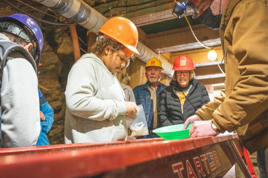
Idaho Springs sits on the exact spot where George Jackson found the gold that started Colorado’s rush, at the mouth of Chicago Creek. Clear Creek County allows simple panning on county open space and on Arapaho National Forest ground, defined as one person with a pan and no sluice box or dredge. The catch is that a lot of this valley is covered by unpatented mining claims, so checking claim status before you dig is part of the plan here.
Coarse flakes and the occasional picker are the reward, and panning bedrock cracks along the creek is the technique. The canyon walls funnel everything into a narrow channel, which concentrates the gold nicely.
Expect quartz, pyrite, galena, and mica in the same pan. If you want a guaranteed legal dig with no claim research, the Phoenix Gold Mine and the Argo Mill in town both run pay to pan operations with an underground tour attached. Standard panning gear from the techniques section covers this creek.
Difficulty: 3 out of 5
South Platte River in Denver, Denver County

The South Platte carries gold straight through downtown Denver, and several city and county parks put you legally on the bar gravel. Grant Frontier Park south of Evans Avenue sits on the ground where the 1858 discovery camp stood, and Adams County Open Space runs more river access north of the city at Big Bend and Twin Lakes. Parking is easy and the walk to the water is short at every one of them.
Fine flour gold is what the river carries, and a slow careful pan is the only way to keep it. Work the upstream tips of the sandbars and follow the black sand streaks.
The gravel also brings down agate, jasper, petrified wood, and granite pebbles from the mountains. Keep your work in the open space greenway sections rather than manicured lawn, fill any hole you dig, and skip gas powered equipment entirely. The finish pan from the techniques section is the tool that makes this river worthwhile.
Difficulty: 2 out of 5
Central Colorado
Central Colorado is the heart of the gold country, running from South Park through Breckenridge and down the Arkansas River. This region holds the best public placer ground in the state, including two BLM areas where nobody can stake a claim over you.
Cache Creek Placer Area, Granite, Chaffee County
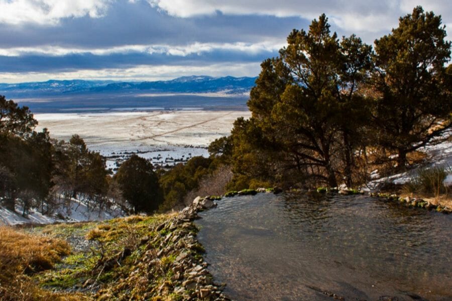
Cache Creek is the best free placer ground in Colorado, a BLM tract near Granite that is open to recreational panning and sluicing and cannot be claimed. It was one of Colorado’s first big placer camps in the 1860s, and the old workings left behind acres of reworked gravel that keeps producing. Turn west off US 24 onto Lost Canyon Road and follow it to the marked dirt lot.
Flakes and small pickers are the draw, and this is one of the few public spots in the state where people genuinely find nugget sized pieces. Panning and hand sluicing both work well on the creek gravel and the old tailings.
Your concentrates will carry black sand, quartz, and pieces of the granite and gneiss that make up the Sawatch Range. Diverting the water is not allowed and neither is digging under or near the trees.
Motorized vehicle access runs from Memorial Day weekend through November 30 because the ground is winter elk range, and dispersed camping is allowed at marked spots. The hand sluice in the techniques section is the right call here.
Difficulty: 2 out of 5
Arkansas Headwaters Recreation Area, Chaffee County
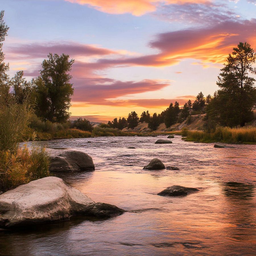
The Arkansas Headwaters Recreation Area is a hundred and fifty miles of managed river access from Leadville to Cañon City, and Colorado Parks and Wildlife lists gold panning as a permitted activity along its shores. Colorado Parks and Wildlife and the BLM run it jointly, which means marked parking, restrooms, and clear boundaries at dozens of access points between Buena Vista and Salida. A Colorado parks pass gets you in.
Fine flour gold with occasional flakes is what this river carries, and it responds best to a sluice or a careful finish pan. The bars rebuild every year after runoff, so the same spot fishes fresh season after season.
You will also pan up black sand, quartz, and the pink Pikes Peak granite that gives the valley its color. Confirm the current panning rules for the specific access site with the park office before you set up, since river management here changes with the season. Bring the sluice from the techniques section.
Difficulty: 2 out of 5
Point Barr on the Arkansas River, Fremont County
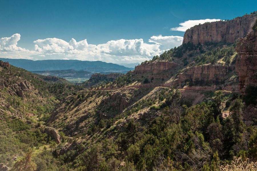
Point Barr is a thirty seven acre BLM tract on the Arkansas that cannot be claimed, and you can drive right down to the riverside. It sits between Wellsville and Howard, and the approach from the west off US 50 near Wellsville is the dependable one. Claims sit immediately upstream and downstream, so stay inside the posted public boundary.
The gold is classic Arkansas River material, fine and remarkably consistent in size, which makes it perfect sluice ground. Set up on a gravel bar and run volume rather than chasing single flakes in a pan.
Black sand is thick here, along with quartz and river polished granite. High clearance is essential year round and 4WD is smart, because the access road gets rough when the river is up in June and July.
BLM camping is available on site for a fee. Use the sluice and magnet from the techniques section.
Difficulty: 3 out of 5
Texas Creek at the Arkansas, Fremont County
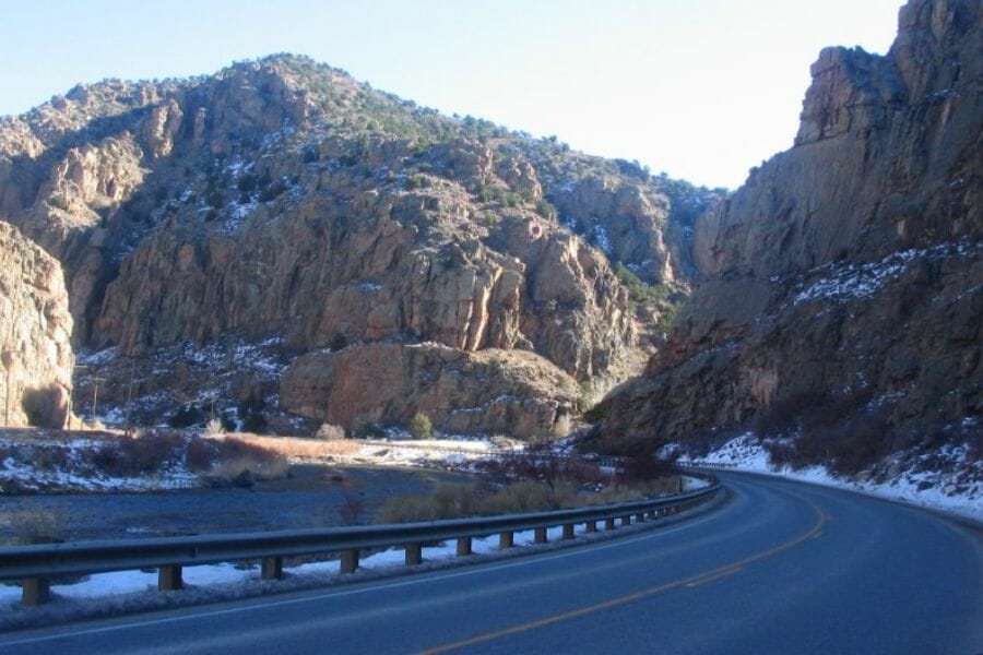
Texas Creek is a free BLM prospecting site where Texas Creek meets the Arkansas River on US 50, roughly halfway between Salida and Cañon City. The BLM allows pans and sluices here and the ground is open public land, which makes it a good stop on the same trip as Point Barr. Parking sits close to the highway, so you are on the water quickly.
Fine gold and small flakes come out of both the creek mouth and the river bars. Work the confluence itself, because a side creek dumping into a big river is a natural drop point for anything heavy.
The gravel carries black sand, quartz, and pieces of the Precambrian rock that makes up the canyon walls. ATV routes run through the area, so watch for traffic and stay off any posted claim. Standard panning and sluicing gear from the techniques section is all you need.
Difficulty: 3 out of 5
Fairplay Prospecting Park, Park County
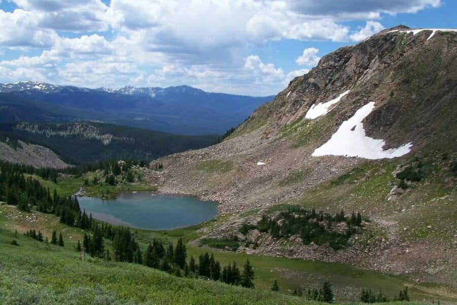
Fairplay runs a town prospecting park on the Middle Fork of the South Platte, and it is the most beginner friendly dig in the Colorado high country. You buy a pass at the Town Hall or online, then drive southwest over the river to Platte Drive, where about half a mile of waterway is open to you. There is parking on the flats above the river and a restroom nearby.
The gold is fine and rosy colored with some surprisingly chunky flakes mixed in, and prospectors report the top eight inches being the richest layer where the material turns sticky and clay like. Panning and hand sluicing are both allowed.
Old dredge tailings line this whole valley, so expect quartz, granite cobbles, and heavy black sand. Powered equipment is not allowed and digging is kept out of the live channel, which keeps the park in good shape year after year. A classifier and pan from the techniques section is the whole kit.
Difficulty: 1 out of 5
Blue River and French Gulch, Breckenridge, Summit County
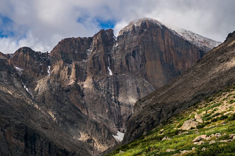
Breckenridge is where Colorado’s biggest gold came from, and the Blue River, French Gulch, and the Swan River all drain the same rich hills. Prospectors found gold in the Blue in 1859, and Farncomb Hill above French Gulch produced Tom’s Baby along with the wire gold specimens that made the district famous. The trade off is that most of the old dredge tailings and the patented mines east of town are private ground.
Coarse gold and pickers are the prize here, and crevicing bedrock in the small gulches is the technique that pays. The creeks that drain east into the rivers hold gold on White River National Forest land, and finding the stretches that are not actively claimed is the homework that unlocks this district.
Bycatch runs to quartz, pyrite, galena, and sphalerite from the old lode veins. If you want gold in your vial without the claim research, Lomax Gulch in town runs a guided panning experience through the Breckenridge Heritage Alliance and the Country Boy Mine offers panning with its tour. The rock pick and crevice tools from the techniques section suit this ground.
Difficulty: 3 out of 5
Southwestern Colorado
The San Juan Mountains and the red rock canyons below them hold Colorado’s other great gold belt, and the BLM keeps two stretches of the San Miguel River permanently open. This is the quietest gold country in the state, and you will often have a whole river bar to yourself.
Piñon Bridge Recreational Placer Mining Area, Montrose County

Piñon Bridge is a BLM recreational placer mining area on the San Miguel River near Naturita, and it cannot be claimed because the land was once railroad property. That single fact makes it one of the most secure places to prospect in Colorado, since nobody can post a claim over you while you work. The BLM manages it specifically for casual prospecting, and a notification form is available from the Uncompahgre Field Office.
Fine placer gold washed down from the Telluride mining district is the find, and panning or sluicing the bar gravel is the method. The San Miguel has been carrying gold out of the San Juans for a very long time, and the lower river collects it.
Expect black sand, quartz, and colorful sandstone cobbles from the canyon walls. This is desert canyon country, so bring far more water than you think you need and watch the weather upstream. Sluice gear from the techniques section makes the most of a day here.
Difficulty: 2 out of 5
Norwood Bridge Recreational Placer Mining Area, San Miguel County
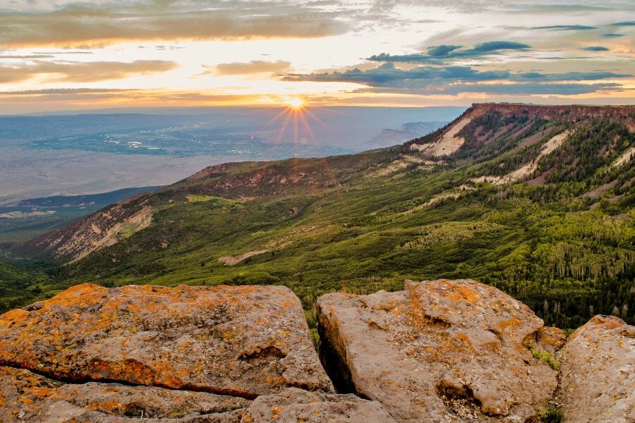
Norwood Bridge is the second BLM placer area on the San Miguel, sitting south of Norwood where Highway 145 crosses the river. Like Piñon Bridge it is unclaimable public ground, and prospectors report the gold here being noticeably good for a free site. The bridge itself makes it simple to find.
Fine gold in the bar gravel is the target, and running material through a sluice beats chasing individual flakes. Test several bars before you commit, since the river reshuffles them every spring.
The same gravel carries black sand, agate, and jasper from the surrounding formations. The river runs fast and cold through June, so plan a late summer or fall trip for the best access. Bring the classifier and sluice from the techniques section.
Difficulty: 3 out of 5
La Plata River, La Plata Canyon, La Plata County
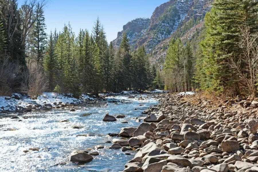
La Plata Canyon north of Hesperus is a classic San Juan gold canyon with a road running right up the middle of it. The La Plata River drains a mineralized cluster of peaks that produced both gold and silver, and placer gold has been reported along the river for well over a century. San Juan National Forest land covers much of the upper canyon, which gives you legal ground to work under casual use rules.
Flakes and fine gold are the standard find, and panning the bedrock cracks and boulder pockets is the play. The canyon is steep and the water moves fast, which builds excellent traps behind every large rock.
Bycatch here includes quartz, pyrite, and copper stained rock from the old workings. Claims are scattered through the canyon and some of the lower ground is private, so check boundaries carefully and stay out of any posted area or old mine opening. The crevice tools from the techniques section are the key gear.
Difficulty: 4 out of 5
More Proven Places To Find Gold in Colorado
The spots above are the easiest wins, and the list below is where the state opens up. Every one of these has documented gold or steady prospector reports behind it, and every one needs a rules and access check before you go, because Colorado’s public land is threaded with active mining claims.
Northern Colorado
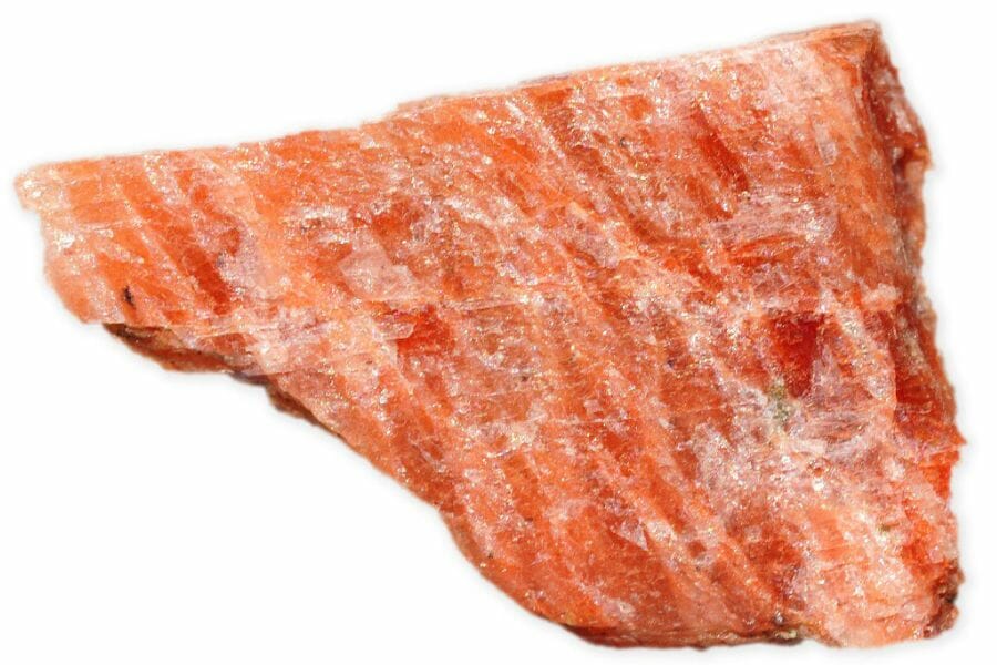
Big Bend Open Space, Adams County. Adams County Open Space keeps this stretch of the South Platte north of 78th Avenue open for prospecting with hand powered gear. The river carries fine flour gold down from the mountains and drops it on the inside bends. Park at the marked lot, stay off the vegetated banks, and fill every hole you dig.
Fourmile Creek near Salina, Boulder County. Fourmile Creek drains the Gold Hill district, one of the earliest and richest lode camps on the Front Range, and prospectors still report color in its gravel. The creek runs beside Fourmile Canyon Drive, which makes scouting simple. Much of the canyon is private property with claims mixed in, so confirm access at each spot before you unload a pan.
Left Hand Creek below Jamestown, Boulder County. Left Hand Creek drains the Jamestown mining district and carries gold shed from the same mineralized zone that fed Gold Hill. Prospectors report fine flakes in the bend gravels along the lower canyon. Roosevelt National Forest holds part of the drainage, and the rest runs through private land and claims.
Clear Creek at Georgetown and Empire, Clear Creek County. The upper Clear Creek valley above Idaho Springs holds two more historic districts, and the county allows simple panning on its open space and on national forest ground. The gold is coarser here than downstream because you are closer to the source veins. Claims are dense through this stretch, so a claim map check is the first step.
Cherry Creek at Confluence Park, Denver County. Cherry Creek gave the 1858 diggings their name, and its gravel still shows fine gold today. The creek is walkable through downtown Denver with parking and trails the whole way. City park rules govern what you can do here, so contact Denver Parks and Recreation before you bring a shovel.
Russellville Gulch near Franktown, Douglas County. Russellville Gulch is a documented placer where an 1858 party worked the gravels before the rush moved to the mountains. The gulch drains Black Forest country into Cherry Creek and its old workings are still visible. Nearly all of it sits on private ranch land, so this one starts with a phone call and a handshake.
North Clear Creek at Black Hawk, Gilpin County. North Clear Creek drains Gregory Gulch, where the 1859 strike built the district people called the richest square mile on earth. Prospectors report gold in the creek gravel below the old mill sites. Much of the corridor is private, claimed, or inside the casino district, so pick your spot carefully and confirm it first.
Gold Strike Park on Ralston Creek, Jefferson County. This Arvada park sits at the spot where Lewis Ralston panned Colorado’s first documented gold in 1850, and both Ralston Creek and nearby Clear Creek carry fine gold through the property. There is parking and a restroom right there. City park code governs prospecting in Arvada, so check the current rules with Arvada Parks and Recreation before you dig.
Cache la Poudre River at Lions Open Space, Larimer County. The Poudre carries very fine gold out of the Front Range and Lions Open Space near Laporte gives you free public river access. Larimer County commissioners voted down a proposed prospecting ban, so panning remains part of what people do here. Fine gold rewards patience and a good finish pan.
Elkhorn Creek and the Manhattan district, Larimer County. Manhattan was a gold camp northwest of Fort Collins, and Elkhorn Creek drains the same mineralized ground. Prospectors report fine gold in the creek gravels along the Roosevelt National Forest sections. The old townsite area is a mix of forest and private land, so read boundaries before you dig.
Willow Creek at Hahns Peak, Routt County. Hahns Peak was northwest Colorado’s gold camp after placer gold turned up there in the 1860s, and Willow Creek below the peak was the productive water. Routt National Forest covers much of the drainage under casual use rules. Expect fine gold and a beautiful drive, and check for active claims around the old workings.
Central Colorado

Chalk Creek near St. Elmo, Chaffee County. Chalk Creek drains the St. Elmo mining district under the flank of Mount Princeton, and its gravels carry gold from the veins above. The creek runs along County Road 162 with San Isabel National Forest on both sides. Work the boulder pockets and check claim status, because the district is still actively held in places.
Clear Creek above Granite, Chaffee County. This Clear Creek is the Chaffee County one, running west from Granite past the Vicksburg and Winfield ghost towns. Placer gold has been reported along it since the 1860s and the road follows the water most of the way. National forest ground gives you access, and posted claims tell you where to stop.
Homestake Creek at Gold Park, Eagle County. Gold Park was a mining camp on Homestake Creek in the Holy Cross district, and the creek below it drains that mineralized ground. White River National Forest covers the area with a campground and good road access. Fine gold and small flakes are what prospectors report there, and claims are present in spots.
Currant Creek, Fremont County. Currant Creek drains the country between Cañon City and the South Park highlands, and it appears in Colorado gold occurrence records. The creek crosses public land in stretches along US 9. Access is a patchwork of BLM, forest, and private ranch, so map it before the drive.
Willow Creek at Tin Cup, Gunnison County. Tin Cup began as a placer camp in 1860 when prospectors found gold in Willow Creek, and the gulch still draws panners. Gunnison National Forest surrounds the old townsite, and the road in from Taylor Park is scenic and easy in summer. Watch for claims and stay clear of old shafts.
Arkansas River between Leadville and Granite, Lake County. The upper Arkansas below Leadville carries gold shed from the Leadville district and the surrounding gulches, and the Arkansas Headwaters Recreation Area manages public access along it. Fine gold in the bar gravel is the target. California Gulch itself is a federal cleanup site, so keep your work on the managed river access points instead.
Tarryall Creek below Tarryall Reservoir, Park County. Tarryall Creek produced some of Colorado’s earliest and coarsest placer gold in 1859, and the stretch below the reservoir still holds it. The creek runs from Mount Silverheels down to the South Platte through open meadow and canyon. Most of the valley is private ranch land with public sections mixed in, so confirm before you step off the road.
Lincoln Gulch near Independence Pass, Pitkin County. Lincoln Gulch drains into the Roaring Fork below Independence Pass, and placer gold has been reported along it since the silver days. White River National Forest covers the gulch and there is a campground on the road in. The season is short at this elevation, so plan for July through September.
Lomax Gulch in Breckenridge, Summit County. The Breckenridge Heritage Alliance runs guided gold panning at the historic Lomax Placer site on Gold Run Road, complete with the old hydraulic workings and an assay office. This is a fee experience rather than open ground, which makes it a guaranteed legal dig. It is the easiest way to put Breckenridge gold in a vial the same afternoon.
Swan River near Tiger, Summit County. The Swan River drains Farncomb Hill and the same rich ground that produced Tom’s Baby, and dredge tailings line its valley. Summit County has restored long sections of the river, and open space and county rules govern what you can do there. Confirm current access with Summit County Open Space before you plan a dig.
Southwestern Colorado
Dolores River near Rico, Dolores County. Rico was a rich mining town on the upper Dolores, and the river below it carries gold shed from the district. San Juan National Forest sections along Highway 145 give you legal access. The water is cold and fast into July, so late summer is the window.
West Mancos River, Montezuma County. The West Mancos drains the La Plata Mountains, the same range that feeds the La Plata River placers, and placer gold has long been reported from it. Forest roads north of Mancos follow the drainage. Private land sits along the lower river, so start with the national forest sections upstream.
Bachelor Syracuse Mine near Ouray, Ouray County. The Bachelor Syracuse offers an underground tour and outdoor gold panning just north of Ouray, in the middle of one of the richest districts in the San Juans. It is a fee operation, which means no claim research and no access questions. The Uncompahgre valley around it is heavily claimed, so this is the practical way to prospect there.
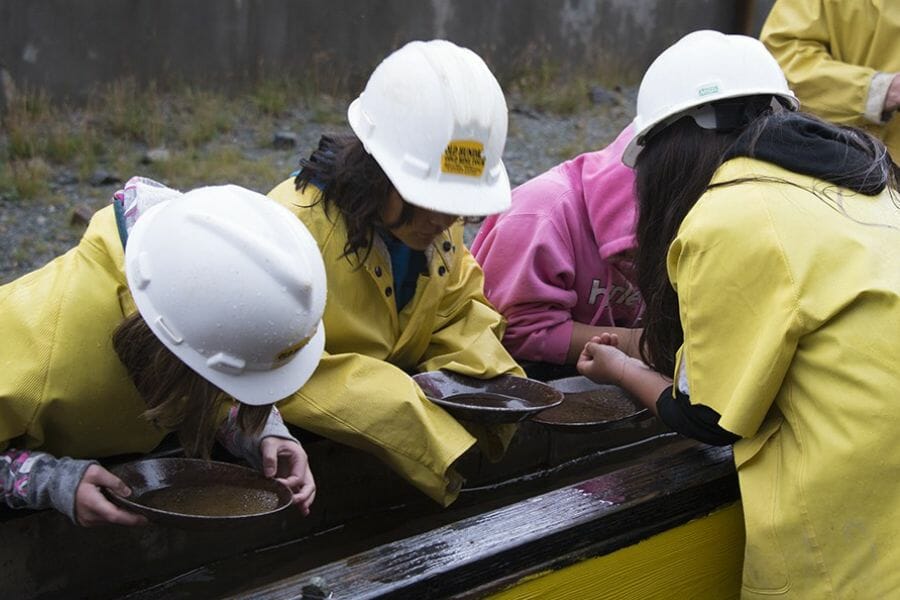
Old Hundred Gold Mine, San Juan County. The Old Hundred runs mine tours and gold panning on Cunningham Gulch outside Silverton, deep in the Animas district. A fee gets you inside a real hard rock mine and then out to the panning troughs. The surrounding drainages are claimed and much of the area is under federal cleanup, so the tour is the smart way to see this country.
San Miguel River between Telluride and Placerville, San Miguel County. This stretch drains the Telluride district, which produced millions of ounces, and the river’s bends and gravel bars have been trapping gold ever since. Highway 145 follows the water with pullouts the whole way. Claims and private land are common along it, so verify each spot, or drop downstream to the BLM areas at Norwood and Piñon Bridge.
The Best Gold Hunting Techniques in Colorado
Four techniques cover every kind of Colorado gold ground, and you can start with the first one for the price of lunch. Work through them in order and each new tool multiplies what the last one taught you.
Gold Panning (Difficulty: 1 out of 5)
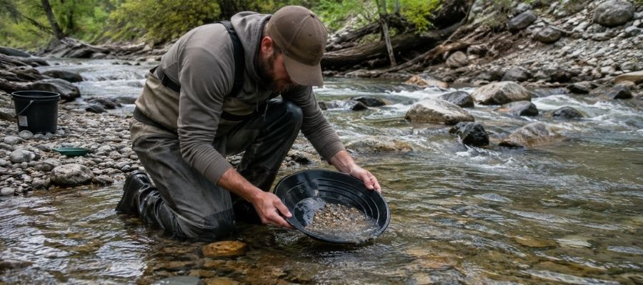
Panning is swirling gravel and water in a pan so the heavy gold sinks and everything lighter rides out over the lip. It takes about twenty minutes to learn and a season to get good at, and it is the only technique that works everywhere in Colorado. Every legal spot in this guide allows it.
Colorado gold is fine, so slow down. Tip the pan a little less than feels right and let the water do the work, because a fast pan throws flour gold straight into the creek.
Essential Tools
- Gold pan: Garrett 15 Inch Dual Riffle SUPERSLUICE Gold Pan
- Finish pan: Garrett Prospecting 10 Inch Backpacker Gold Pan
- Classifier screen: SE Half Inch Sifting Screen
- Snuffer bottle: Garrett Gold Guzzler Bottle
- Storage vials: SE Glass Vials with Caps
Sluicing (Difficulty: 2 out of 5)
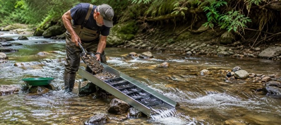
A sluice is a metal trough with riffles that you set in the current so it pans for you all day long. You shovel classified gravel in the top, the water carries the light material away, and the gold hangs up behind the riffles. It processes ten times what a pan can in the same hour.
Sluicing is where Cache Creek, the Arkansas River access points, and the two San Miguel BLM areas really pay, because all four have volume gravel and legal room to set up. Check the rules for each spot, since some parks allow pans only.
Essential Tools
- Sluice box: Keene A52 Hand Sluice
- Digging shovel: Bully Tools 14 Gauge Round Point Shovel
- Fine classifier: SE 1/8 Inch Mesh Sifting Screen
- Black sand magnet: SE Magnetic Separator Pick Up Tool with Quick Release
Metal Detecting (Difficulty: 2 out of 5)
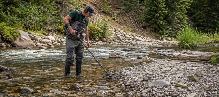
A gold detector finds pieces your pan would never reach, buried in packed gravel and old tailings. It is the only way to hunt nuggets efficiently, and Colorado has the nugget history to justify it. You swing slowly, listen for a clean tone, and dig every signal.
Old dredge tailings around Breckenridge and Fairplay and the reworked gravel at Cache Creek are the classic detecting ground. Colorado’s mineralized soil is noisy, so ground balance carefully before you start.
Essential Tools
- Gold detector: Garrett AT Gold Metal Detector
- Pinpointer: Garrett Pro Pointer AT
- Hand trowel: Edward Tools Bend Proof Trowel
- Magnifying loupe: JARLINK 30X 60X Illuminated Loupe
Crevicing (Difficulty: 3 out of 5)
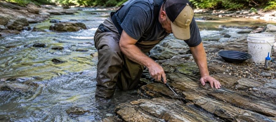
Crevicing is digging gold out of the cracks in exposed bedrock, and in Colorado’s canyons it is the highest payoff technique there is. Gold works its way down into a seam over decades and cannot go any further, so a crack that nobody has cleaned is a savings account. You scrape, flush, and repeat until the crack is empty.
Clear Creek Canyon, the upper Arkansas, and the steep San Juan drainages all have long runs of exposed bedrock in the creek. Work at low water in late summer and fall when more of that bedrock is dry.
Essential Tools
- Crevice tool set: ASR Outdoor Steel Crevice Tool Set
- Rock hammer: ESTWING 22 oz Rock Pick
- Snuffer bottle: Garrett Gold Guzzler Bottle
- Storage vials: SE Glass Vials with Caps
How To Tell Real Gold From Fool’s Gold
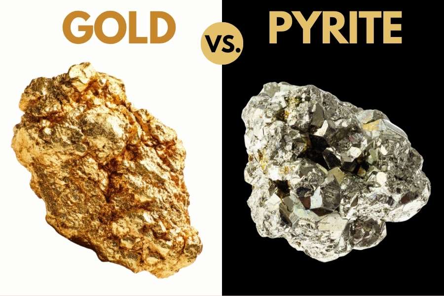
Colorado creeks carry more pyrite and mica than gold, and both put on a very convincing show in a wet pan. The good news is that two simple tests separate them every single time, and neither one takes more than a few seconds.
The shadow test is the fastest. Cup your hand over the pan and watch the sparkle. Real gold keeps its warm yellow glow in shade, while pyrite and mica go gray and flat the instant the direct sunlight leaves them.
The poke test settles whatever the shadow test leaves open. Press a pin or a knife tip firmly into the piece, and gold will dent and hold the mark because it is soft metal. Pyrite is brittle and cracks apart, and mica peels into thin sheets.
Getting this right matters because the real cost of guessing is not embarrassment. It is dumping a pan that had gold in it, or leaving behind an amazonite crystal or a piece of rhodochrosite that was worth more than the gold. The US Rocks and Minerals Field Guide puts gold and all of its imitators side by side on waterproof pages you can hold right over a dripping pan.

How Gold Got Into Colorado
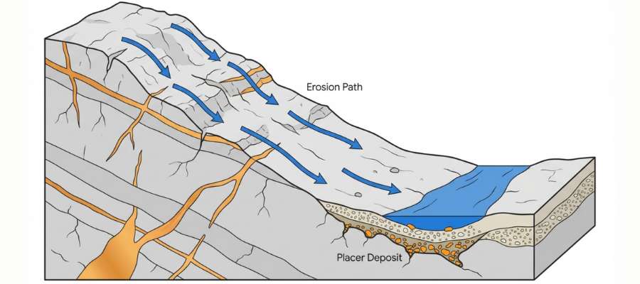
Every spot in this guide sits where it does because of one band of rock called the Colorado Mineral Belt. It runs diagonally across the state from Boulder County southwest to the San Juan Mountains, and almost all of Colorado’s gold comes from inside that band.
The belt formed when molten rock pushed up into the crust as the Rocky Mountains rose. Superheated water carrying dissolved gold and silver moved through cracks in the surrounding granite and gneiss, and as that water cooled it dropped its metal into the cracks as quartz veins. Those veins are the original source of every flake you will ever pan in Colorado.
Then the mountains started coming apart. Ice, rain, and freezing and thawing broke the veins open, and gravity plus snowmelt carried the gold downhill into the creeks. Because gold is roughly seven times heavier than the sand around it, it sank and stayed while everything lighter kept moving.
The numbers are staggering. The Cripple Creek district alone produced more than 21 million troy ounces, the Telluride area added close to 7 million, and Central City contributed over 6 million more. All of that gold had to travel through creeks to get where it was found, and the creeks are still moving what is left.
What To Bring for a Colorado Gold Day Trip
Pack light and pack for altitude, because most Colorado gold sits above 7,000 feet. Here is the checklist that covers a full day on any creek in this guide.
Prospecting gear
- Gold pan and finish pan, from the techniques section
- Classifier screen and a small shovel
- Crevice tools if you are working bedrock
- Snuffer bottle and glass vials for your gold
- Magnet for pulling black sand out of concentrates
Everything else
- More water than you think you need, plus electrolytes for the altitude
- Sunscreen and a wide brim hat, since thin air burns fast
- A rain shell, because afternoon thunderstorms are a daily event in summer
- Boots you can soak, and wool socks
- Printed permission, passes, or claim maps for wherever you are headed
- Snacks, a first aid kit, and a charged phone with offline maps
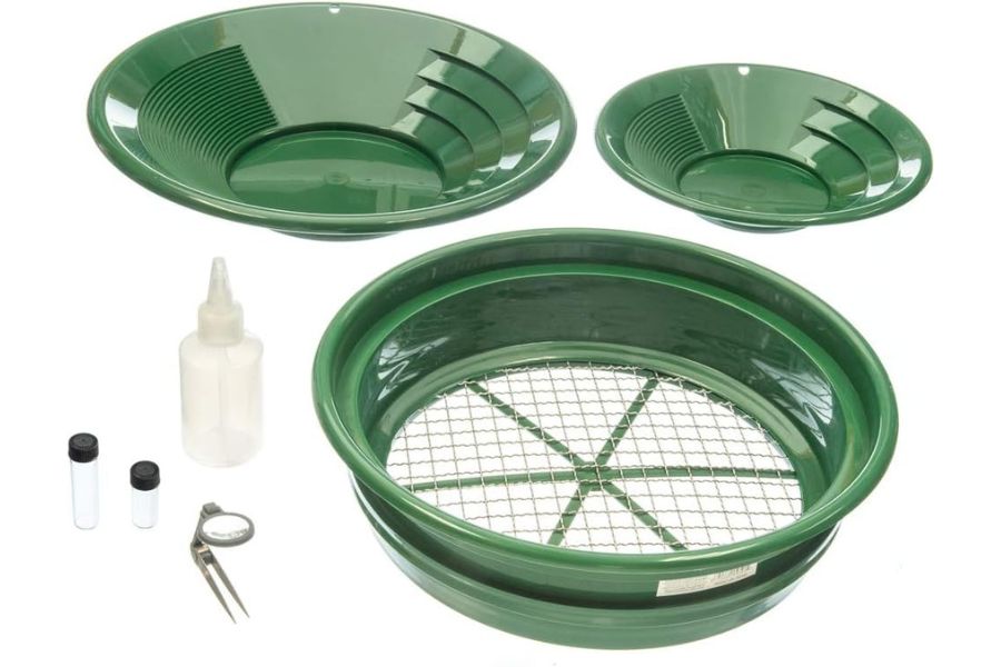
If you would rather buy the whole prospecting side in one box, the Garrett Deluxe Gold Pan Kit covers the pans, classifier, vials, and snuffer bottle together. Our full gold hunting and prospecting equipment guide breaks down what each piece actually does.
The Best Time of Year To Hunt for Gold in Colorado
Timing matters more in Colorado than in almost any other gold state, because snowmelt controls the water and the roads. Here is the window for each region.
Northern Colorado
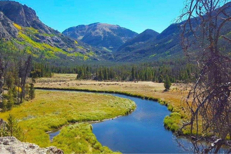
August through October is prime time on the Front Range creeks. Clear Creek and the South Platte drop to safe wading levels by late summer, and the exposed bedrock and bars that appear in September are the best of the year.
Spring runoff in May and June makes these creeks genuinely dangerous, and the water is too high to reach anything good. Winter works surprisingly well on the metro spots, since low water opens up the center of the channel and the parks stay accessible.
Central Colorado
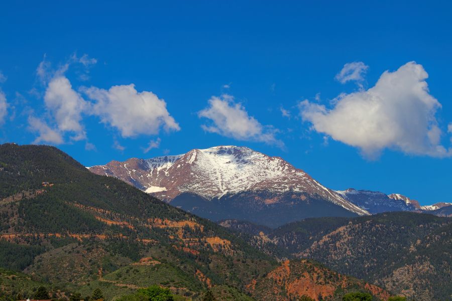
July through early October is your window in the central mountains, and it is shorter the higher you go. Cache Creek opens to motorized access Memorial Day weekend and closes November 30, while the Arkansas River access points stay usable longer at lower elevation.
Runoff peaks in June and keeps the Arkansas high into July, so aim for August and September when the bars come out of the water. Fairplay and the high gulches around Breckenridge can hold snow into June and get it back in October.
Southwestern Colorado
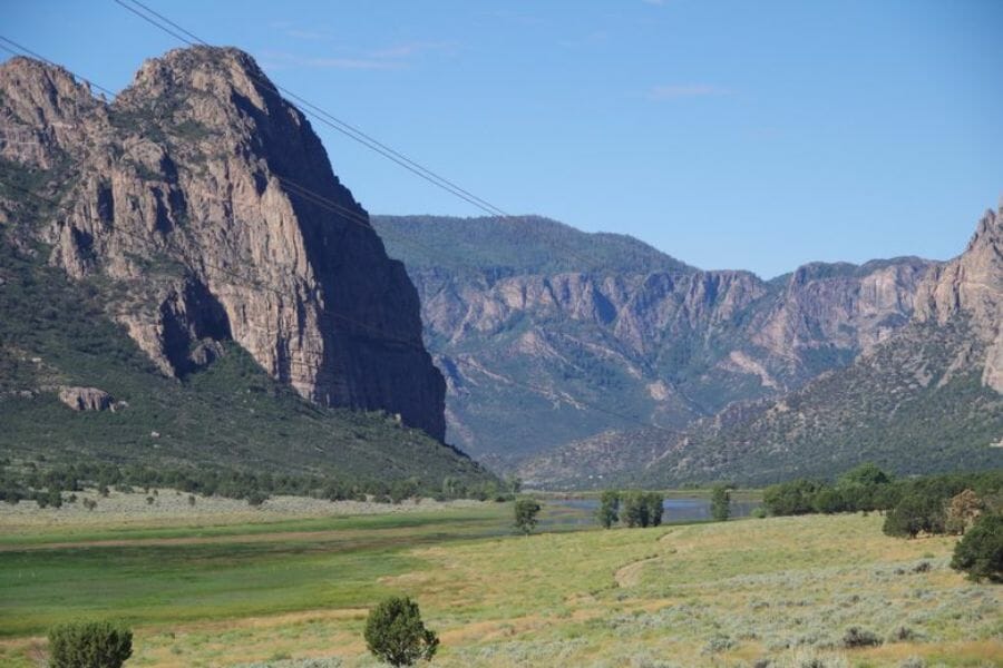
Late summer through October is the sweet spot in the San Juans and the canyon country below them. The San Miguel drops to workable levels by August, and the BLM areas near Norwood and Naturita stay accessible well into fall.
Watch the monsoon in July and August, because flash flooding in the lower canyons comes fast and the desert washes fill in minutes. High country drainages like La Plata Canyon are best from July through September before the first real snow closes the roads.
Other Valuable Rocks and Minerals You Can Find in Colorado
The same dirt that holds Colorado’s gold holds some of the best mineral specimens in North America. Keep your eyes open while you pan, because more than one prospector has funded a trip on something that was not gold at all.
Rhodochrosite
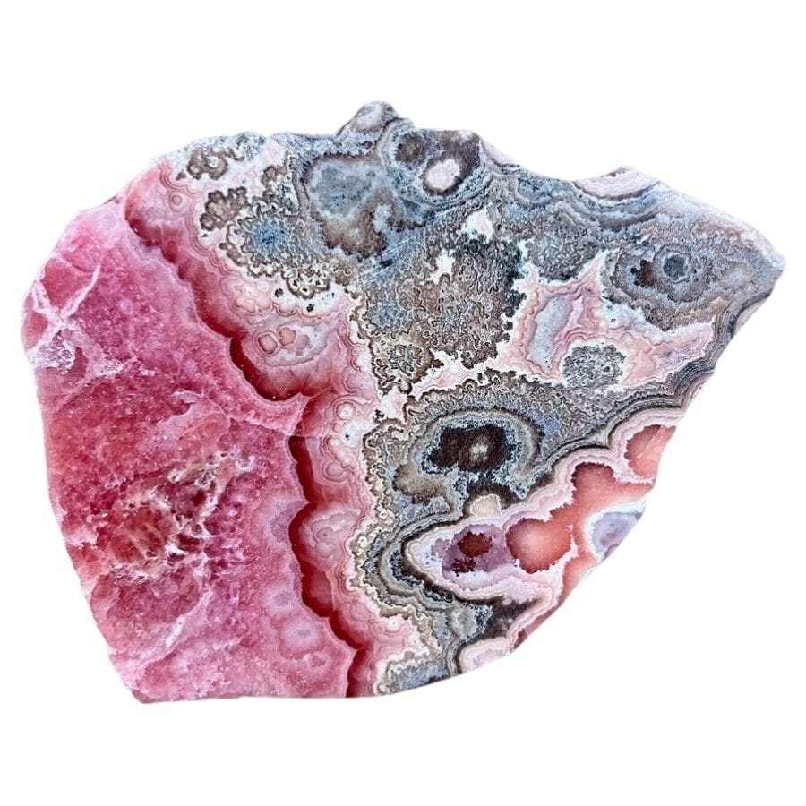
Rhodochrosite is Colorado’s state mineral, and the crystals from the Sweet Home Mine near Alma are considered the finest in the world. It shows up as deep rose red to pink, sometimes in sharp rhombs and sometimes in banded masses. Fine specimens sell for serious money.
Our guide to finding crystals in Colorado covers where rhodochrosite turns up and what makes a specimen valuable.
Amazonite
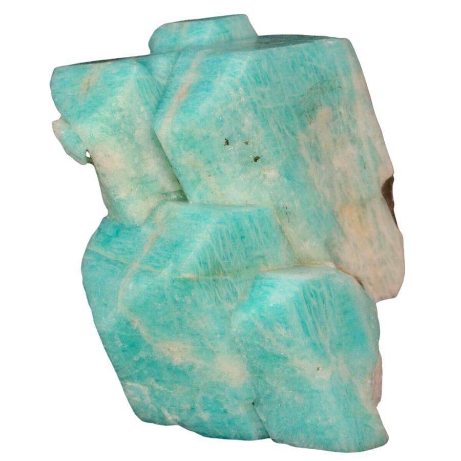
Amazonite is the blue green feldspar that made the Pikes Peak region famous among collectors. It grows in pockets inside the granite alongside smoky quartz, and the two together make some of the most sought after specimens in the country. Crystal Peak in Teller County is the classic ground.
See our gem hunting in Colorado guide for the areas where amazonite pockets show up.
Aquamarine
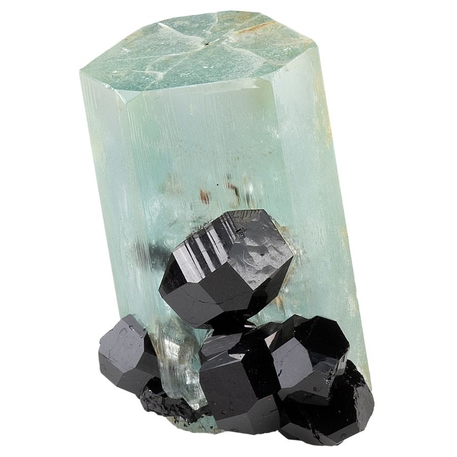
Aquamarine is Colorado’s state gemstone, and the best crystals come off Mount Antero and White Mountain in Chaffee County above 13,000 feet. The color runs from pale sky blue to a deep sea green in the best pieces. Getting to the pockets is a serious alpine hike.
Our gem hunting in Colorado guide covers the Mount Antero area and what the climb involves.
Smoky Quartz
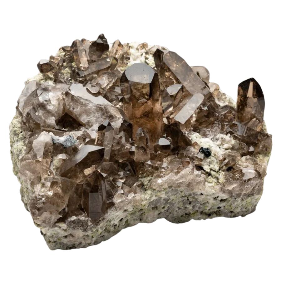
Smoky quartz is everywhere in the Pikes Peak granite and it turns up in creek gravel across the Front Range. The crystals run from light tea brown to nearly black, with sharp points and glassy faces. Big clean crystals are worth real money to collectors.
Our guide to quartz in Colorado shows the districts where the best crystals come out.
Topaz
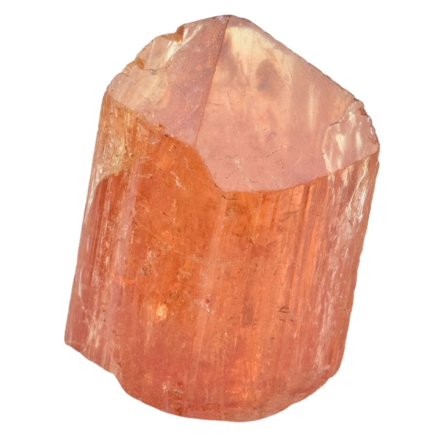
Topaz forms in the same granite pockets as amazonite and smoky quartz, and Colorado’s sherry colored crystals are collector favorites. Look for stubby crystals with a diamond shaped cross section and a slick, almost soapy feel. Devils Head and the Crystal Peak area are the classic spots.
Our crystals in Colorado guide walks through the pocket hunting areas.
Agate
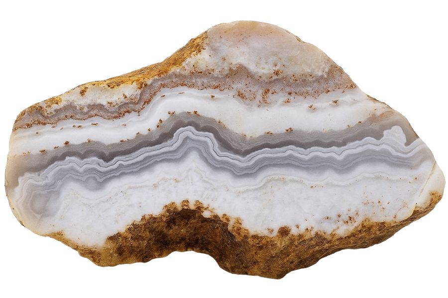
Agate turns up on gravel bars across Colorado, often in the same pan as your gold. Look for waxy translucent pebbles that glow when you hold them up to the sun, with banding or moss like inclusions inside. The San Luis Valley and the western rivers are especially good.
Our guide to agates in Colorado covers the best hunting grounds by region.
Geodes
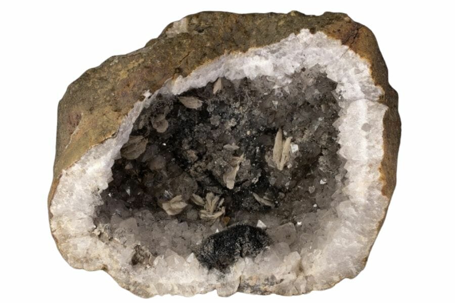
Colorado geodes come out of volcanic rock in the southern part of the state, and cracking one open is one of the great rockhounding moments. They look like plain lumpy stones on the outside and hold quartz or amethyst crystals inside. Weight is the giveaway, since a hollow geode feels light for its size.
Our guide to geodes in Colorado maps out where to look.
Fluorite
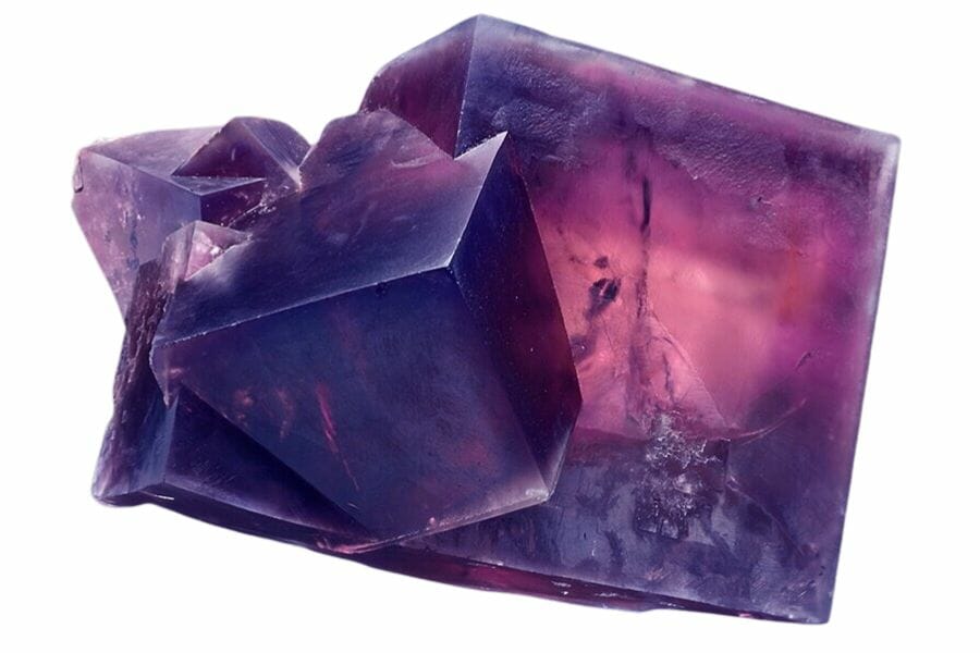
Fluorite grows in cubes in purple, green, and blue, and it shows up in the mine dumps and vein material of Colorado’s old districts. It is soft enough to scratch with a knife, which separates it from quartz immediately. Many pieces glow under ultraviolet light.
Our rockhounding in Colorado guide covers the districts where fluorite is common.
Garnet
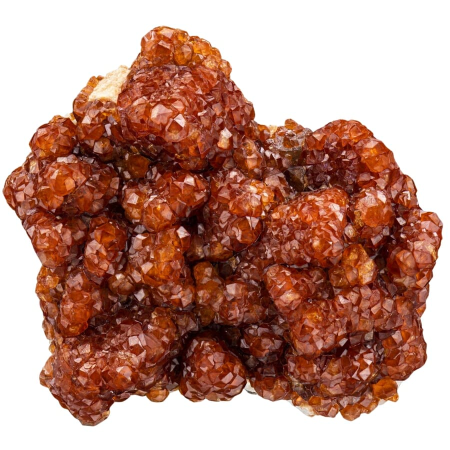
Garnet shows up as deep red grains in Colorado creek sand and as full crystals in the metamorphic rock of the Front Range. In a pan it looks like tiny red glass beads sitting with the black sand. Larger crystals from schist outcrops can be cut into gems.
Our guide to garnets in Colorado covers the best collecting areas.
Turquoise
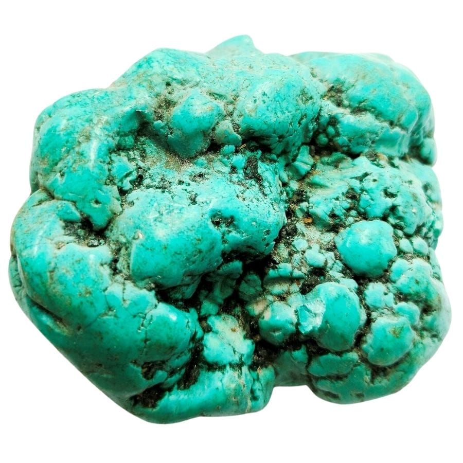
Turquoise forms in the weathered zones above copper deposits, and Colorado has produced some genuinely fine material. Look for sky blue to green crusts and nodules in altered volcanic rock, usually with brown or black matrix running through it. Villa Grove and the Cripple Creek area are known sources.
Our guide to turquoise in Colorado covers the districts and what quality material looks like.
Every one of these can end up in your pan or your pocket on a gold trip, and every one of them is easy to walk past when it is wet and dirty. The Rocks and Minerals of the United States Field Guide gives you photos of all of them on waterproof pages, so nothing valuable goes back in the creek by mistake.

Legal Rules for Gold Prospecting in Colorado

Read this before you put a pan in the water. We are rockhounds, not lawyers, and nothing here is legal advice. Rules change constantly in Colorado, and staying legal is entirely your responsibility.
Private Property
Colorado is a mix of federal land, state land, and private ground, and the boundaries are rarely marked in the backcountry. Prospecting on private land without the owner’s consent is trespassing, and that includes streambeds where the adjacent land is privately owned. A quick ask ahead of time keeps every flake you find 100% yours.
Active Mining Claims
This is the big one in Colorado. Huge stretches of BLM and Forest Service land are covered by active unpatented mining claims, and a claim gives the holder the rights to the minerals even though the surface stays public. Panning on someone’s claim is taking their property, so check the ground before you dig using the BLM’s Mineral and Land Records System, and look for claim posts and monuments in the field.
The BLM areas at Cache Creek, Point Barr, Texas Creek, Piñon Bridge, and Norwood Bridge are set aside so they cannot be claimed, which is exactly why they are worth the drive.
Equipment Restrictions
A gold pan and hand tools are the safe baseline everywhere you have legal access, and recreational hand panning is generally allowed on BLM and Forest Service land where it is not otherwise closed. Sluices are allowed at many sites but not all, so check each one.
Anything motorized, including highbankers and dredges, triggers a Notice of Intent to Prospect with the Colorado Division of Reclamation, Mining and Safety plus possible permits from the Forest Service, the state health department, and the Army Corps of Engineers. Clear Creek Canyon Park allows dredges with a nozzle of four inches or less, which is unusually generous, while Clear Creek County defines simple panning as one person with a pan and nothing else.
National parks are closed to prospecting everywhere in the country, so Rocky Mountain, Mesa Verde, Great Sand Dunes, and Black Canyon of the Gunnison are all off limits. Designated wilderness areas are closed to mineral entry as well.
Play it safe on every trip. Confirm access directly with the landowner or the managing agency before you dig, because boundaries and rules change without notice.
Some locations in this guide sit on or near ground where collecting is limited or where cleanup work is underway. When in doubt, treat a spot as look but do not take until you have confirmation in hand.
The best shortcut is local knowledge. Colorado’s rock and mineral clubs and prospecting clubs know which stretches are open, which claims are active, and which landowners welcome visitors, and a membership usually pays for itself in access alone.
Colorado Gold FAQ
Can you still find gold in Colorado?
Yes, you can still find gold in Colorado, and people do it every weekend. Placer gold keeps washing down from the Colorado Mineral Belt into creeks across the state, and free public sites like Clear Creek Canyon Park and Cache Creek are open specifically for it. The gold is mostly fine flakes and flour gold, with pickers and nuggets in the mountain gulches.
Where can I legally pan for gold in Colorado?
The easiest legal options are Clear Creek Canyon Park in Jefferson County, Arapahoe Bar in Wheat Ridge, the Cache Creek Placer Area near Granite, and the BLM areas at Point Barr, Texas Creek, Piñon Bridge, and Norwood Bridge. Fairplay runs a town prospecting park that requires a small pass. The best places section above lists the rules for each one.
Do you need a permit to pan for gold in Colorado?
Recreational hand panning on BLM and Forest Service land generally does not require a permit, as long as the ground is not claimed or closed. Some sites do have their own requirements, such as the pass Fairplay sells for its prospecting park and the parks pass for the Arkansas Headwaters Recreation Area. Motorized equipment requires a Notice of Intent to Prospect with the state.
What river in Colorado has the most gold?
Clear Creek and the Arkansas River are the two most productive gold rivers you can actually access. Clear Creek started Colorado’s rush in 1859 and still carries fine gold through its canyon west of Golden, and the Arkansas runs gold from Leadville down past Salida with public access the whole way. The Blue River at Breckenridge produced the coarsest gold in the state.
What is the largest gold nugget found in Colorado?
The largest piece of gold ever found in Colorado is Tom’s Baby, a specimen of about thirteen and a half pounds pulled from Farncomb Hill above Breckenridge on July 23, 1887. Roughly ten and a half pounds of it survives today and is displayed at the Denver Museum of Nature and Science. The gold formed as wire and leaf gold inside cavities in the rock.
Get Every Find In Your Pan Identified In Seconds

Every pan you pull out of a Colorado creek is a question until you can name what is in it. Gold, pyrite, garnet, amazonite, and rhodochrosite all show up in the same gravel, and the difference between them is thousands of dollars.
The Rocks and Minerals of the United States Field Guide identifies 140 rocks, minerals, and gemstones with clear photos, printed on waterproof pages that work right at the water’s edge.