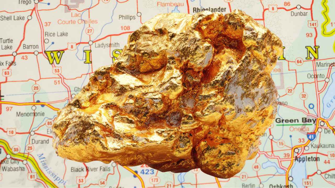
Gold in Wisconsin is real, and the state geological survey says you can pan a trace of it in almost any county. Back in the 1880s, sluicers in Pierce County were pulling gold out of Plum Creek, and they kept finding tiny diamonds in the very same gravel.
With gold trading above $4,000 an ounce, you do not need to find much for a weekend of panning to pay for itself.
Most people who try gold prospecting in Wisconsin make the same mistake. They assume the glaciers spread the gold evenly, so they pan whatever pretty creek is closest and miss the color by a few hundred yards.
The gold concentrates in two kinds of places, the old outwash creeks along the edge of the Driftless Area and the streams draining the ancient greenstone country up north. Yes, you can still find gold in Wisconsin today, especially along Plum Creek in Pierce County and the Plover River near Stevens Point, where glacial placer gold has been showing up in pans since the 1800s. This guide covers every proven spot, the technique that works at each one, and the rules that keep your trip legal.
Our team of geologists and experienced rockhounds put this guide together the same way we approach every gold state. We mapped where the ice sheets dropped their load, matched it against the state’s documented gold occurrences, and sorted out what a panner can actually reach. Here is everything you need to plan your first Wisconsin gold trip.
Table of Contents
- Biggest Discovery
- Types of Gold
- Where Gold Hides
- Best Places
- Techniques
- Real vs Fool’s Gold
- How Gold Got Here
- What To Bring
- Best Seasons
- Other Minerals
- Legal Rules
- FAQ
The Biggest Gold Discovery in Wisconsin History
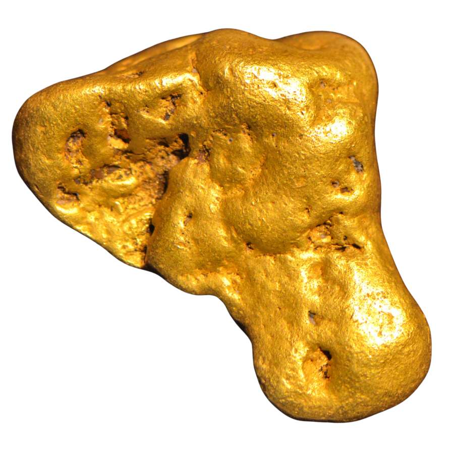
Wisconsin’s biggest gold strike was hiding under a farm field, and nobody panned a single flake of it. In 1968, geologists drilling south of Ladysmith in Rusk County hit one of the richest copper and gold deposits ever found in North America. The Flambeau deposit sat just a few dozen feet below the plow line, and it had been sitting there for almost two billion years.
It took decades of permits and public fights before the mine finally opened. Between 1993 and 1997, the Flambeau Mine dug a pit 220 feet deep and pulled out 1.9 million tons of ore so rich that miners called it a freak of nature.
The haul included about 178,000 tons of copper and roughly 328,000 ounces of gold. At today’s prices, the gold alone would be worth well over a billion dollars.
The pit was backfilled and the land reclaimed, so you cannot prospect the mine site today. But the same ancient rocks that made Flambeau run under much of northern Wisconsin, and the glaciers spent two million years smearing their gold into the creeks in this guide.
The Kinds of Gold You Can Find in Wisconsin
Wisconsin gold is glacial placer gold, ground fine by ice and water, and knowing what it actually looks like is the difference between a great day and an empty vial. The Wisconsin Geological and Natural History Survey confirms flour gold across most of the state, with flakes and small nuggets waiting for panners who put in the hours. The glaciers hauled that gold here and spread it through every drainage they touched, and it adds up pan after pan.
Flour Gold
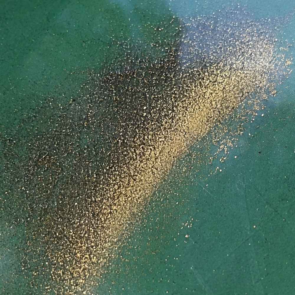
Flour gold is gold ground down to particles smaller than grains of sugar, and it is the most common form of gold in Wisconsin by far. Glaciers are the best rock crushers nature ever built, so most Wisconsin gold arrived already pulverized. It shows up as bright golden dust in the crease of your pan after everything lighter washes away.
The mineral that fools people here is mica, which glitters all through Wisconsin’s glacial till. Mica flashes gold in sunlight but it is nearly weightless. Real flour gold sinks straight to the bottom of your pan and stays golden in the shade, while mica floats, flutters, and goes dull the moment the light changes.
Because flour gold washes out of a normal pan so easily, you want a dedicated finish pan for your final concentrates. The Garrett Prospecting 10 Inch Backpacker Gold Pan is the one our team uses for exactly this job.
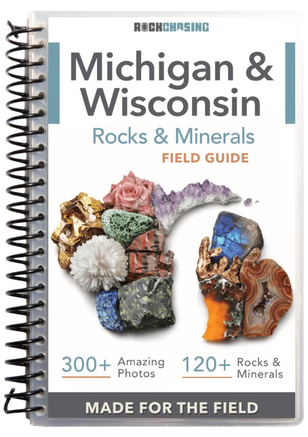
This is also the stage where a good identification reference saves your whole trip. The Michigan and Wisconsin Rocks and Minerals Field Guide shows you exactly what real gold looks like next to every mineral that imitates it in these two states, so you know what you are looking at while your pan is still wet.
Gold Flakes
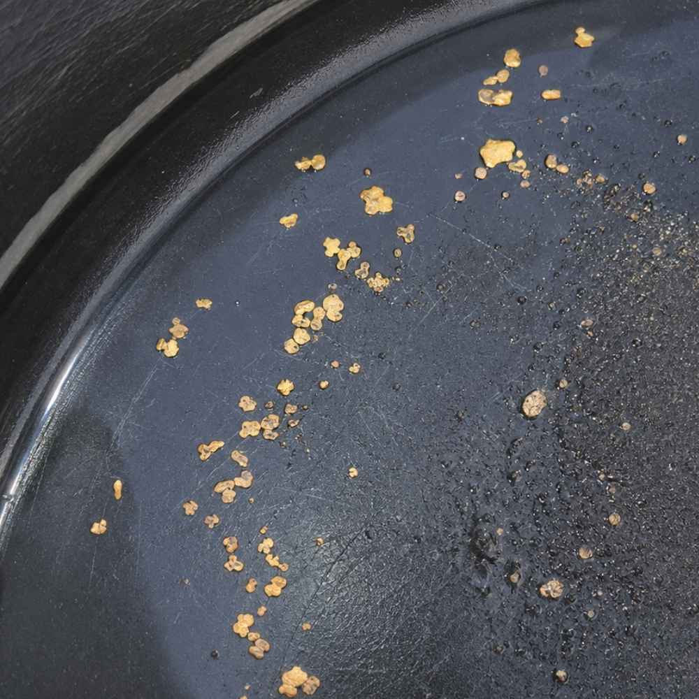
Flakes are the next size up, flat pieces about the size of a grass seed that you can actually pick out and admire. In Wisconsin these turn up where creeks have had thousands of years to concentrate the glacial gold, especially in black sand layers on bedrock and clay hardpan. A pan with two or three solid flakes is a genuinely good Wisconsin day.
The lookalike here is chalcopyrite, a brassy copper mineral that breaks into small glittery pieces and is common in the state’s northern rocks. The test takes one second. Poke it with a pin, because gold dents like soft metal while chalcopyrite shatters or flakes apart.
Flakes are nearly impossible to pick up with wet fingers. A snuffer bottle like the Garrett Gold Guzzler Bottle sucks them straight out of your pan without losing a single one.
Small Glacial Nuggets
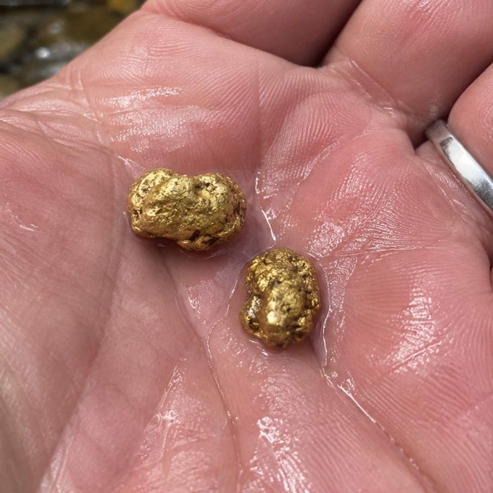
Real nuggets do exist in Wisconsin, and they are the state’s most exciting prize. Pieces up to pea size have been reported to the state survey, and old reports describe nuggets and coarse flakes in the bedrock potholes of the St. Croix Dalles. Every one of them traveled hundreds of miles inside a glacier, which rounds and hammers the gold into smooth, worn shapes.
Pyrite is the classic false alarm, and Wisconsin gravel carries plenty of it. Pyrite forms sharp little cubes with flat faces that glitter, while a true glacial nugget is rounded, dented, and butter colored with no crystal faces at all.
Serious nugget hunters multiply their odds by going electronic. The Garrett AT Gold Metal Detector is tuned for exactly this kind of small gold, and Wisconsin’s rules allow detectors for recreational prospecting.
Knowing what the gold looks like is half the game. The other half is knowing where the creek hides it and how to get it out, and that is exactly where this guide goes next.
Where Gold Hides in Wisconsin Streams
Gold is about 19 times heavier than water, so it always sinks to the lowest, slowest spot the current allows. Learn to read these five features and you can walk up to any creek in this guide and know where to dig first.
Inside Bends
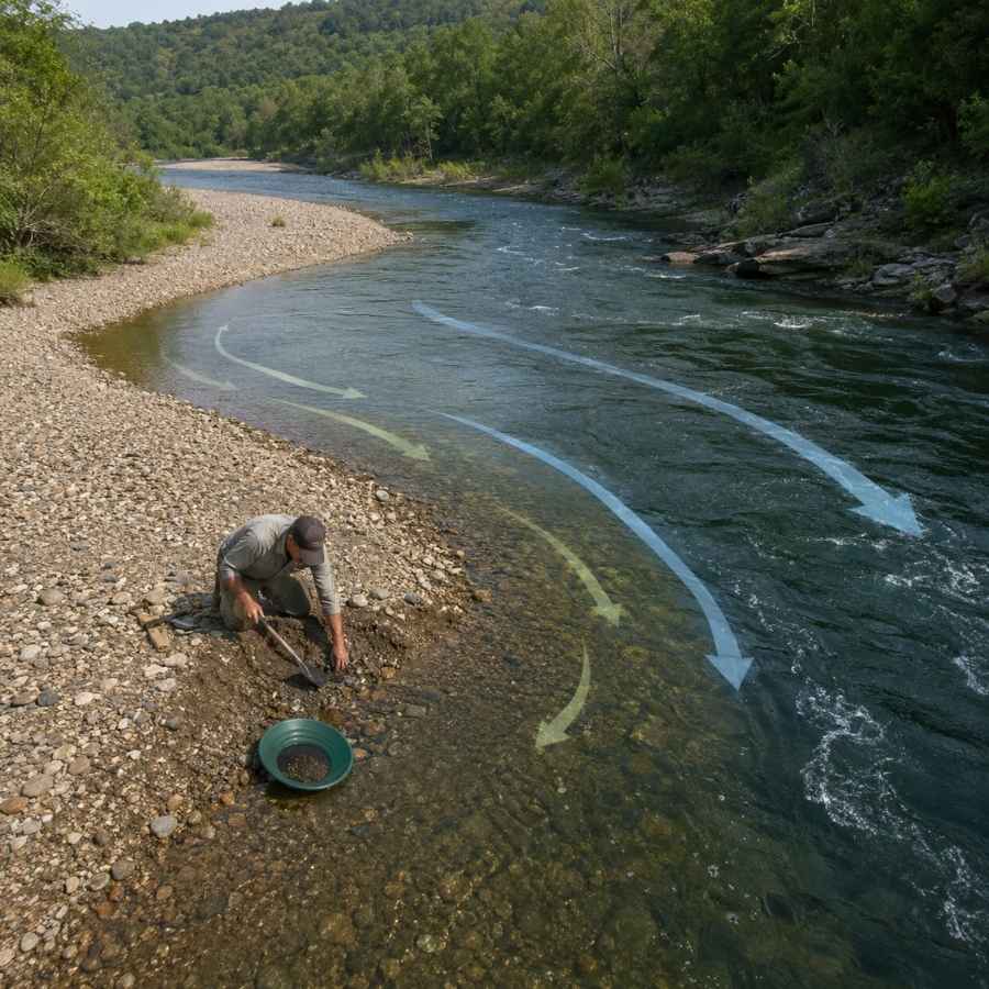
Water slows down on the inside of every curve, and slow water drops its gold. Look for the gravel bar that builds up on the inside of a bend and dig where the coarse gravel starts. In Wisconsin’s winding glacial till creeks, inside bends are the most reliable producers.
Digging here means moving packed gravel, and a wide pan with deep riffles catches the fine gold as you work. The Garrett 15 Inch Dual Riffle SUPERSLUICE Gold Pan is built for exactly this kind of high volume panning.
Gravel Bars
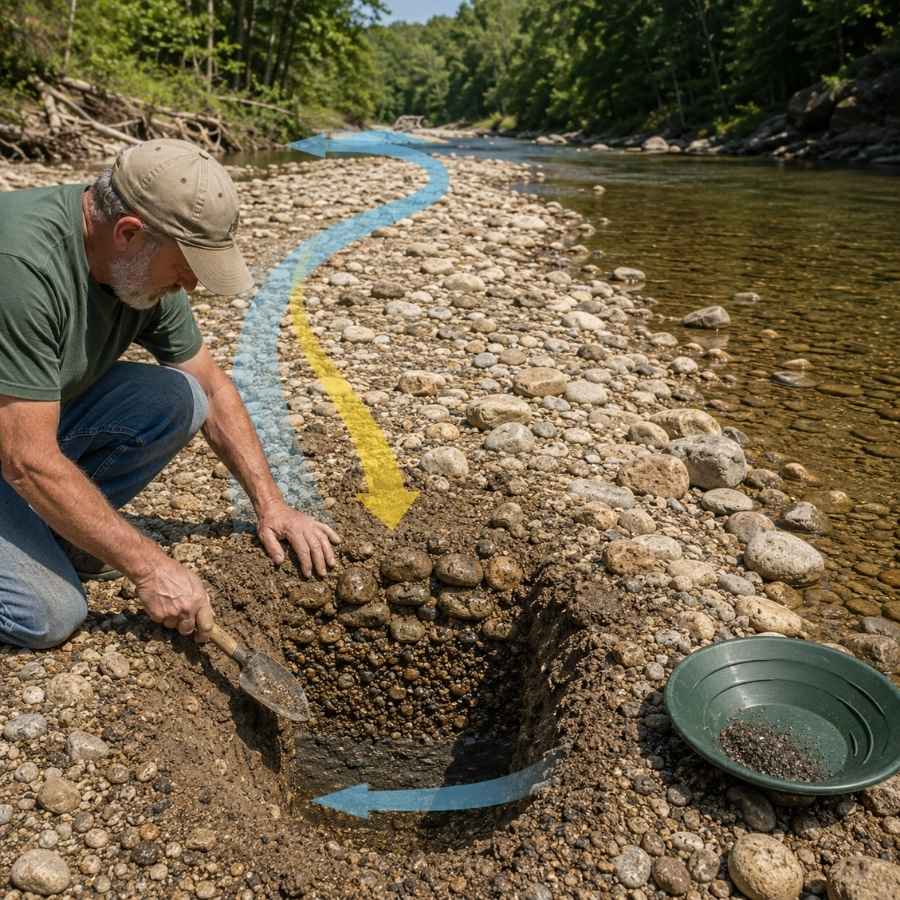
Summer low water exposes gravel bars that were underwater all spring. The gold in a bar concentrates at its upstream end and down at the base, not on the surface. Dig test holes and pan the bottom material.
Bars are full of oversized glacial cobbles that waste pan space. Screening them out first with the SE Half Inch Sifting Screen doubles the gravel you can actually process in a day.
Bedrock Cracks
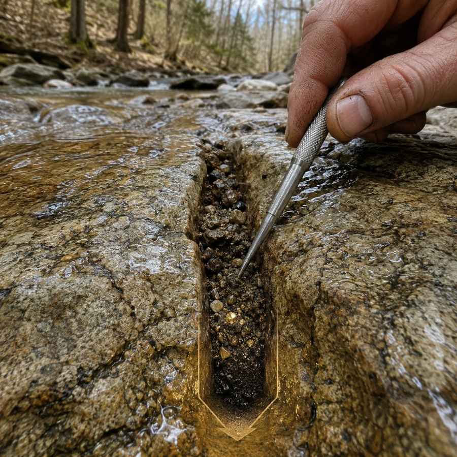
Bedrock is the floor gold cannot sink through, so its cracks fill up like nature’s own sluice box. Where a Wisconsin river cuts through its glacial blanket down to solid rock, every crack and pothole is a gold trap that has been collecting since the ice melted. The rumored Depression era recoveries at Big Falls on the Eau Claire River came out of exactly these crevices.
The dirt in the bottom inch of a crack is the richest material in the creek. A steel crevice tool set like the ASR Outdoor Steel Crevice Tool Set scrapes out material your fingers cannot reach.
Behind Boulders
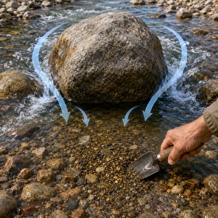
Wisconsin’s rivers are dotted with glacial boulders the ice left behind, and every one splits the current to create a calm pocket directly downstream. Gold traveling in a flood drops right into that pocket. Feel around the downstream base of big rocks and dig the packed gravel your fingers find there.
That gravel is usually cemented tight. A strong shovel like the Bully Tools 14 Gauge Round Point Shovel breaks it loose without snapping a handle mid trip.
Black Sand Streaks
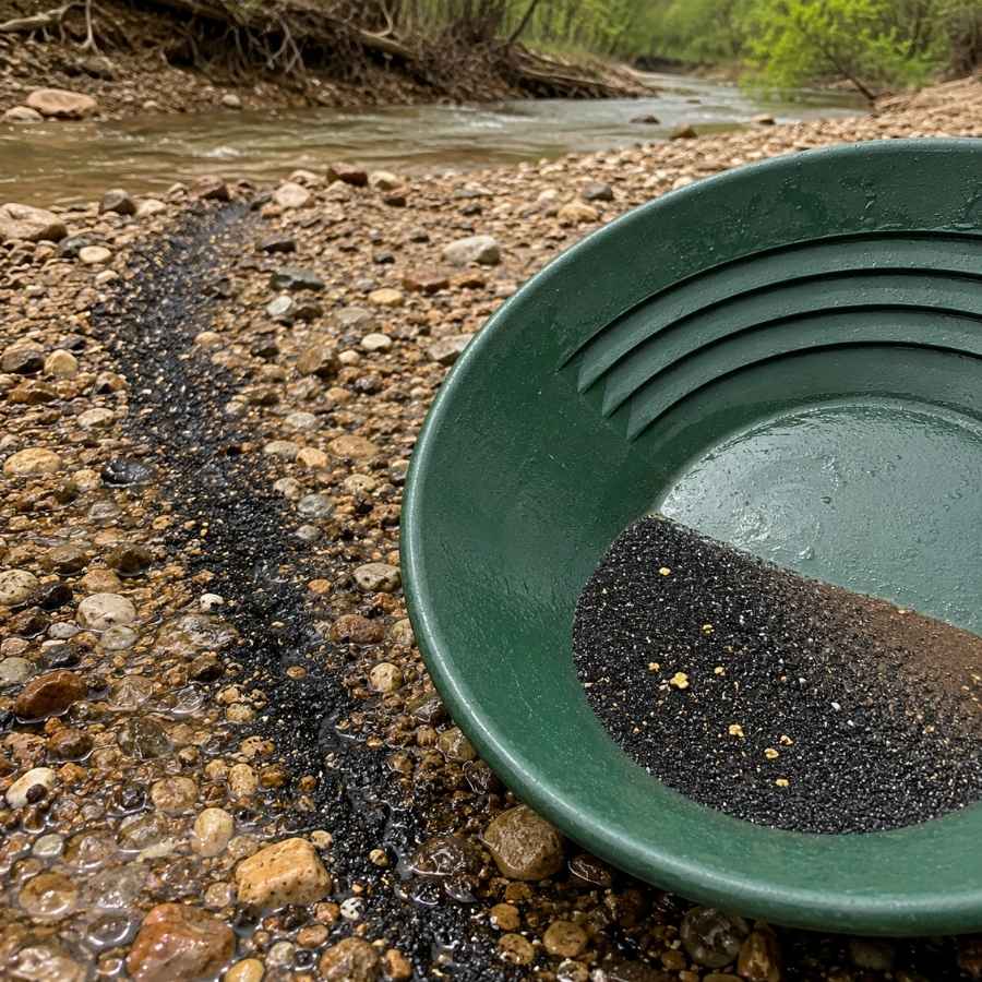
Black sand is crushed magnetite and hematite, and it is the number one gold indicator in Wisconsin. The glaciers ground it out of the iron country up north and dropped it in the same load as the gold, so the two settle in the same spots. When you see a dark streak in the gravel or a black layer in your pan, you are digging in the right place.
Separating fine gold from black sand at the end of the day is tedious by hand. A magnetic separator like the SE Magnetic Separator Pick Up Tool with Quick Release pulls the black sand out and leaves your gold behind in seconds.
Always Confirm Access and Collection Rules!
Before heading out to any of the locations on our list you need to confirm access requirements and collection rules for both public and private locations directly with the location. We haven’t personally verified every location and the access requirements and collection rules often change without notice.
Many of the locations we mention will not allow collecting but are still great places for those who love to find beautiful rocks and minerals in the wild without keeping them. We also can’t guarantee you will find anything in these locations since they are constantly changing.
Always get updated information directly from the source ahead of time to ensure responsible rockhounding. If you want even more current options it’s always a good idea to contact local rock and mineral clubs and groups
The Best Places To Find Gold in Wisconsin
Wisconsin’s gold clusters in four zones, the driftless edge creeks of the northwest, the greenstone streams of the north central counties, the border rivers of the northeast, and the outwash valleys of the south. Here is every spot worth your gas money, grouped by region.
Northwestern Wisconsin
Pierce County’s creeks along the Driftless Area’s edge are the most storied placer ground in the state, and the big rivers to the north drain glacial outwash by the mile. This corner is where Wisconsin panning history actually happened.
Plum Creek at Nugget Lake County Park
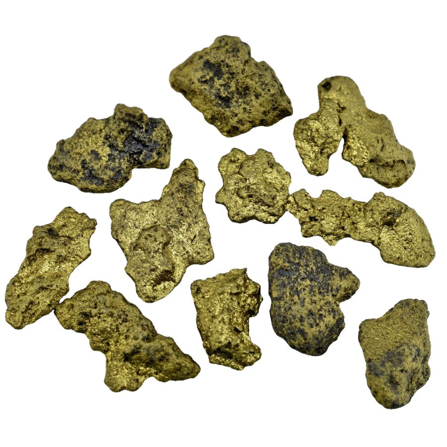
Plum Creek is Wisconsin’s most famous gold water, the site of real placer workings that sluiced flour gold from 1887 to 1890. The state survey documents the diggings, and the county park that now surrounds the creek is literally named Nugget Lake. Along with the gold, those old sluicers recovered more than a dozen tiny diamonds from the same gravel.
Flour gold with occasional slightly larger grains is the find, and careful panning is the technique that works. Work the inside bends and pan the gravel down to the clay hardpan.
Your pan will also turn up garnet sand, magnetite, quartz pebbles, and possibly one of those famous little diamonds, which look like greasy glass and get flicked away by people who cannot name them. This is exactly the moment people throw away good finds, because a wet unidentified stone looks like nothing. The Michigan and Wisconsin Rocks and Minerals Field Guide lets you check every odd stone against clear photos before it goes back in the creek.
Bring the finish pan and snuffer bottle from the techniques section below.
Difficulty: 1 out of 5
Rock Elm Creek
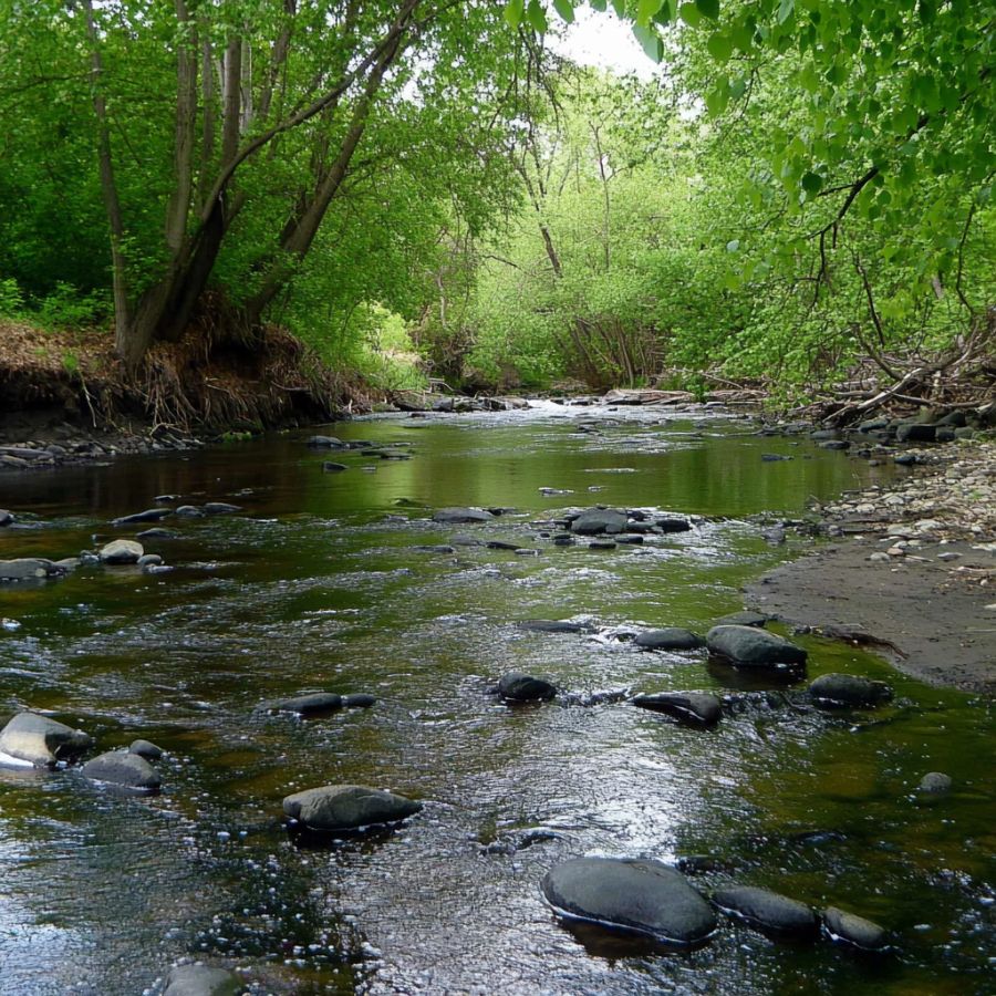
Rock Elm Creek carries the same documented placer gold as its neighbor Plum Creek, worked by the same 1880s sluicing crews. The creek drains rolling Pierce County farm country, and it holds one more surprise. It flows across the Rock Elm Disturbance, a buried meteorite impact structure about four miles wide.
Fine flour gold in gravel bars and clay pockets is the find, and panning is the technique. Test the upstream ends of bars and any gravel resting on bedrock or hardpan.
The gravel also carries garnets, magnetite, and heavy black sand, the classic Pierce County mix. Most of the creek runs through private farmland, so a polite knock and a friendly ask are your ticket in. Standard panning gear from the techniques section covers it.
Difficulty: 2 out of 5
Eau Claire River at Big Falls
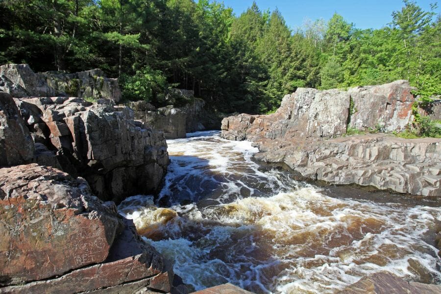
Big Falls is where the Eau Claire River spills across a wide apron of exposed bedrock, and old accounts say Depression era panners pulled gold out of these crevices in the 1930s. The state survey records the story for Eau Claire County, and the setting explains it. Every crack in that bedrock has been trapping fine glacial gold since the ice melted.
Fine gold in bedrock crevices is the target, and crevicing is the standout technique. Scrape the cracks and potholes at low water and pan what you recover.
Expect black sand, garnets, and quartz in every pan. Big Falls sits in a county park, so keep it to hand tools and confirm current county rules before you dig. A crevice tool set is the key gear, linked in the techniques section.
Difficulty: 3 out of 5
Chippewa River
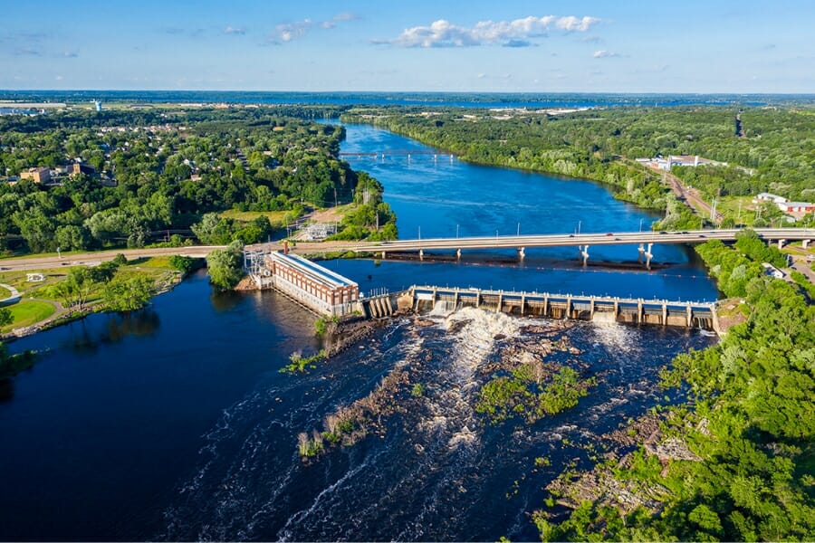
The Chippewa is one of Wisconsin’s great glacial drains, a big river that has been reworking outwash from the gold bearing north for ten thousand years. Prospectors report fine color from its gravel bars and the mouths of its feeder creeks, especially downstream of Chippewa Falls. It is easy water to reach, with public landings and bridge crossings up and down the valley.
Flour gold in bar gravel and behind boulders is the pattern, and this is good water for a hand sluice where rules and permission allow. Check the legal section before running one.
The pan turns up agate chips, garnets, and plenty of black sand. Respect posted land and get permission away from public access points. The sluicing setup is covered in the techniques section.
Difficulty: 2 out of 5
North Central Wisconsin
This is greenstone country, where Wisconsin’s ancient volcanic belts hold real lode gold deposits like Reef and Bend. The glaciers chewed across those belts and salted every stream below them with fine gold.
Plover River
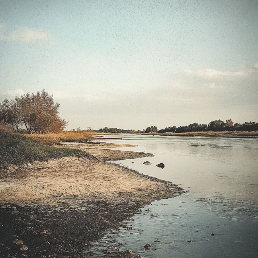
The Plover River is where Wisconsin’s gold story began, because old accounts place the state’s first documented gold find here in 1871. The river runs south through Marathon and Portage counties to meet the Wisconsin River at Stevens Point, gathering fine glacial gold the whole way. Long stretches are shallow, clear, and easy to read.
Bright flour gold is the find, and panning the inside bends and gravel bars is the technique. The Plover is a classified trout stream along much of its length, so mind the seasonal rules in the legal section and leave spawning gravel alone.
The gravel carries garnets, magnetite, and the occasional agate. Much of the corridor is private, though public fishing easements dot the valley. Standard panning gear from the techniques section is all you need.
Difficulty: 3 out of 5
Big Rib River
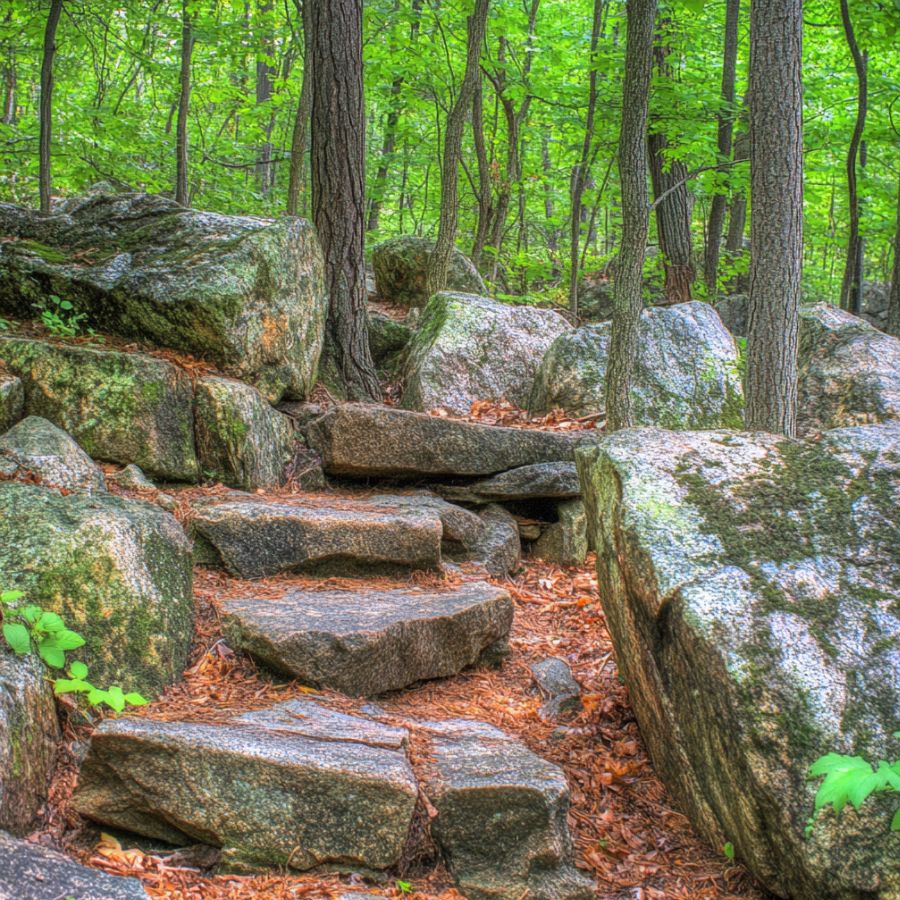
The Big Rib drains the hills west of Wausau, right through the heart of Marathon County’s documented gold country. The state survey records gold at several localities around Wausau and Mosinee, including tiny gold grains in the area’s ancient rocks, and prospectors report steady fine color from the river’s gravel bars. Rib Mountain towers over the lower valley, one of the oldest landforms on Earth.
Flour gold in black sand streaks is the find, and panning is the technique. Work the bends and bar bases downstream of the highway crossings at low water.
Expect heavy black sand, garnets, and quartz in the pan. The valley is mostly private farm and forest land, so ask before you wade in. Bring the black sand magnet from the techniques section because concentrates here run dark.
Difficulty: 3 out of 5
Bend Deposit Country, Chequamegon-Nicolet National Forest
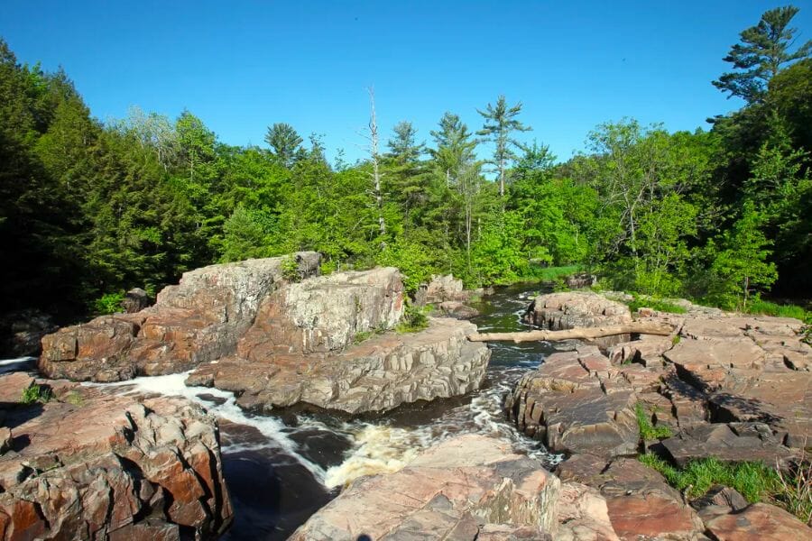
Deep in the national forest north of Medford, the Bend deposit proves Wisconsin grows its own gold. The state survey documents tiny visible gold crystals in the deposit’s weathered cap, locked in 1.8 billion year old volcanic rocks. You cannot dig the deposit itself, but the forest streams draining this country have been receiving its eroded gold for ages.
Fine gold in small stream gravels is the find, and panning is the technique. The national forest allows hand panning with a pan, small shovel, and hand pick, limited to small areas for a few days a year, and asks you to contact the forest minerals program manager before you go.
The gravel carries pyrite, chalcopyrite, and black sand, the signature of sulfide country. This is remote, buggy, unmarked ground, so bring a map, a full tank, and patience. A finish pan matters for gold this fine, linked in the techniques section.
Difficulty: 4 out of 5
Northeastern Wisconsin
The northeast corner shares its rivers with Michigan’s Upper Peninsula, and its bedrock belongs to the same ancient volcanic belts that host gold on both sides of the border. The border rivers here are big, wild, and full of reworked glacial gravel.
Menominee River
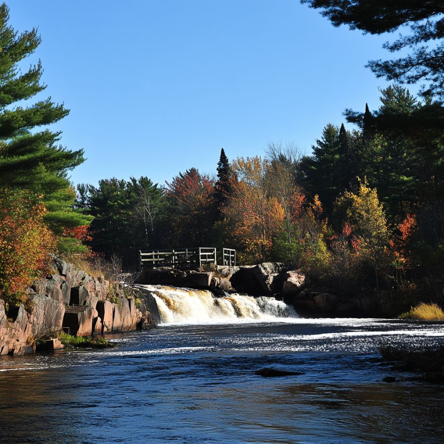
The Menominee forms the boundary between Marinette County and Michigan’s Upper Peninsula, draining greenstone country on both banks. Prospectors report fine glacial gold in its gravel bars and slack water pockets, and the state survey records old gold prospects in Marinette County’s quartz veins. This is big, powerful water with rapids, so treat it with respect.
Flour gold and small flakes below rapids and behind boulders are the find, and panning the bars at summer low water is the technique. The Michigan side has its own gold story, which we cover in our guide to gold in Michigan.
The pan also shows garnets, magnetite, and agate chips carried down from Lake Superior country. Power companies and private owners control much of the shoreline, so use public landings and ask before crossing land. Standard panning gear from the techniques section covers it.
Difficulty: 3 out of 5
Southern Wisconsin
The south holds the state’s most surprising gold water, tucked against the edge of the Driftless Area west of Madison. Glacial meltwater poured off the ice sheet’s margin here and left its heavy load in the valleys.
Black Earth Creek
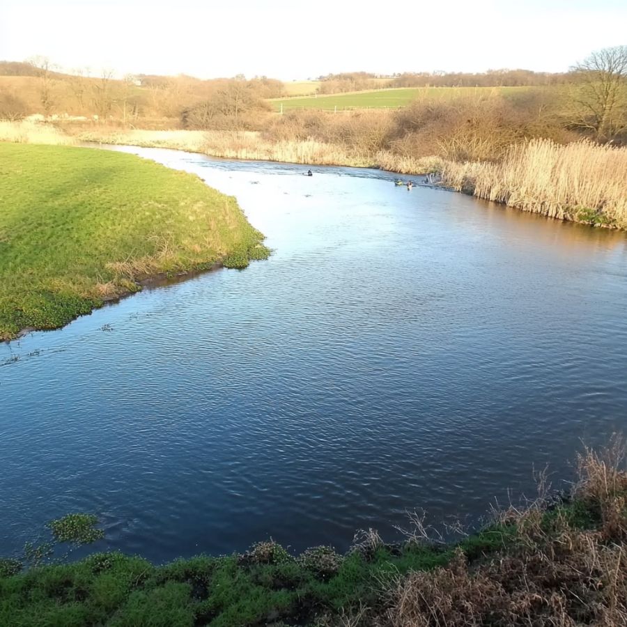
Black Earth Creek is the documented gold water closest to Madison, and the state survey itself notes that placer gold can reportedly be panned along it near Cross Plains. The creek runs west through Dane County at the very edge of the Driftless Area, where glacial meltwater dumped its outwash. It is also one of the most famous trout streams in the Midwest.
Flour gold is the find, and gentle panning of gravel bars is the technique. This is a Class I trout stream, so stay off the spawning gravel, keep your digging minimal, and mind the seasonal cautions in the legal section.
The gravel carries quartz, black sand, and the occasional garnet. Nearly the whole valley is private land laced with public fishing easements, and those easements are for fishing, so get true landowner permission before you pan. A hand trowel and finish pan do the light work here, linked in the techniques section.
Difficulty: 2 out of 5
More Proven Places To Find Gold in Wisconsin
The nine spots above are where we would send a friend first, but the glaciers spread Wisconsin’s gold far wider than one shortlist. These next spots come from state survey notes, historical reports, and prospecting club experience, and every one of them earns a trip too. Rules and access change, so check current regulations and get permission before visiting any of them.
Northwestern Wisconsin
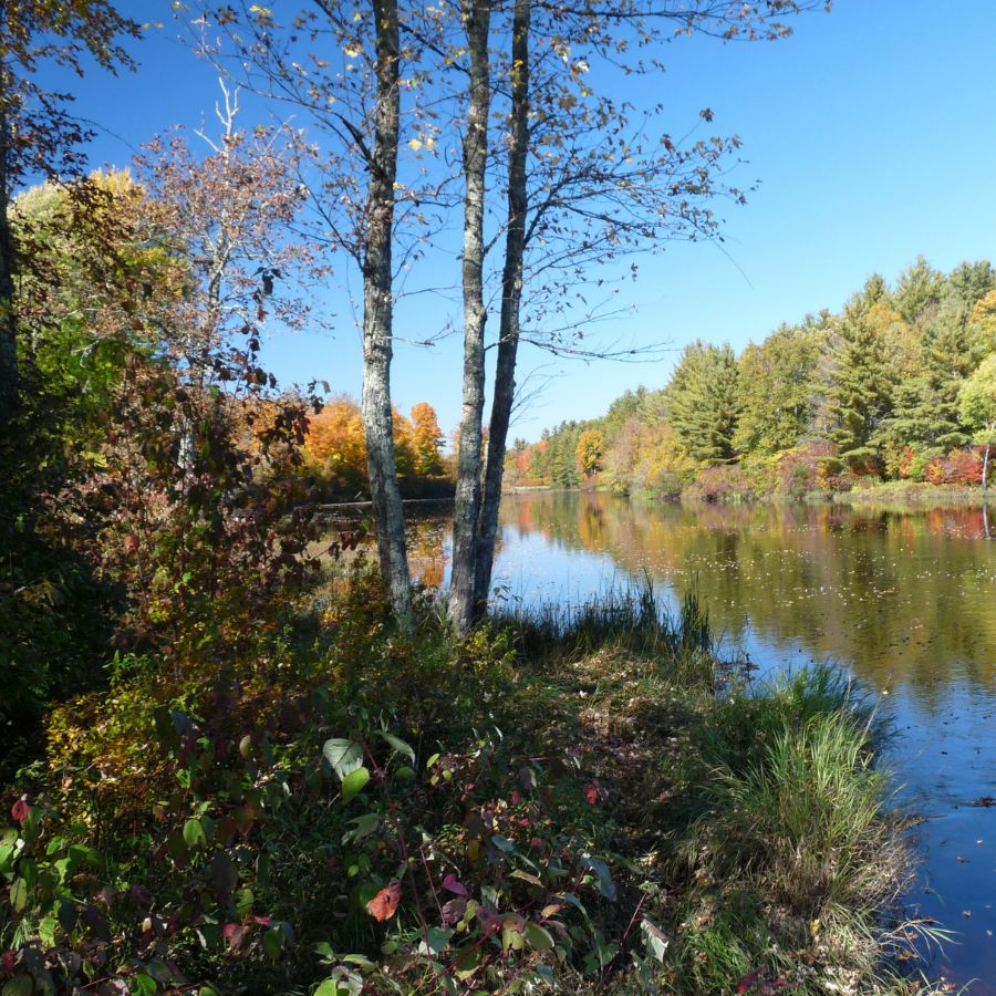
Brunschweiler Creek (Ashland County). The state survey records placer mining attempts on this creek back in the 1880s, when gold fever briefly gripped the Penokee Range country. The gold is fine, shed from the ancient rocks upstream. The creek crosses a mix of private and public forest land, so check ownership and ask before you dig.
Poplar and Middle Rivers (Douglas County). The state survey reports placer gold along both of these south shore rivers, which drain old copper and gold bearing rocks toward Lake Superior. Pan the upstream gravel bars and bedrock stretches, not the lakeshore. Stay above the lake itself, because removing material from Great Lakes bottomlands is off limits.
Rush River (Pierce County). Prospectors report fine flour gold in the Rush, which drains the same driftless edge country as Plum Creek. It is also a celebrated trout stream, so tread lightly and keep digging out of the spawning gravel. The banks are private farm country, and permission opens more water than any tool in your kit.
St. Croix Falls Area (Polk County). The state survey documents placer flakes in the glacial drift near St. Croix Falls, and old reports describe nuggets and coarse flakes in the bedrock potholes of the Dalles. The catch is that the Dalles sits inside Interstate State Park and the federally protected riverway, where collecting is banned. Work the drift on private land outside the protected corridor with the landowner’s permission instead.
Flambeau River near Ladysmith (Rusk County). The reclaimed Flambeau Mine site itself is closed to prospecting, but the river that named it flows right past, reworking gravel from the same mineralized belt. Prospectors report fine color from bars downstream of Ladysmith. Ask before crossing private land, and leave the old mine property alone.
North Central Wisconsin
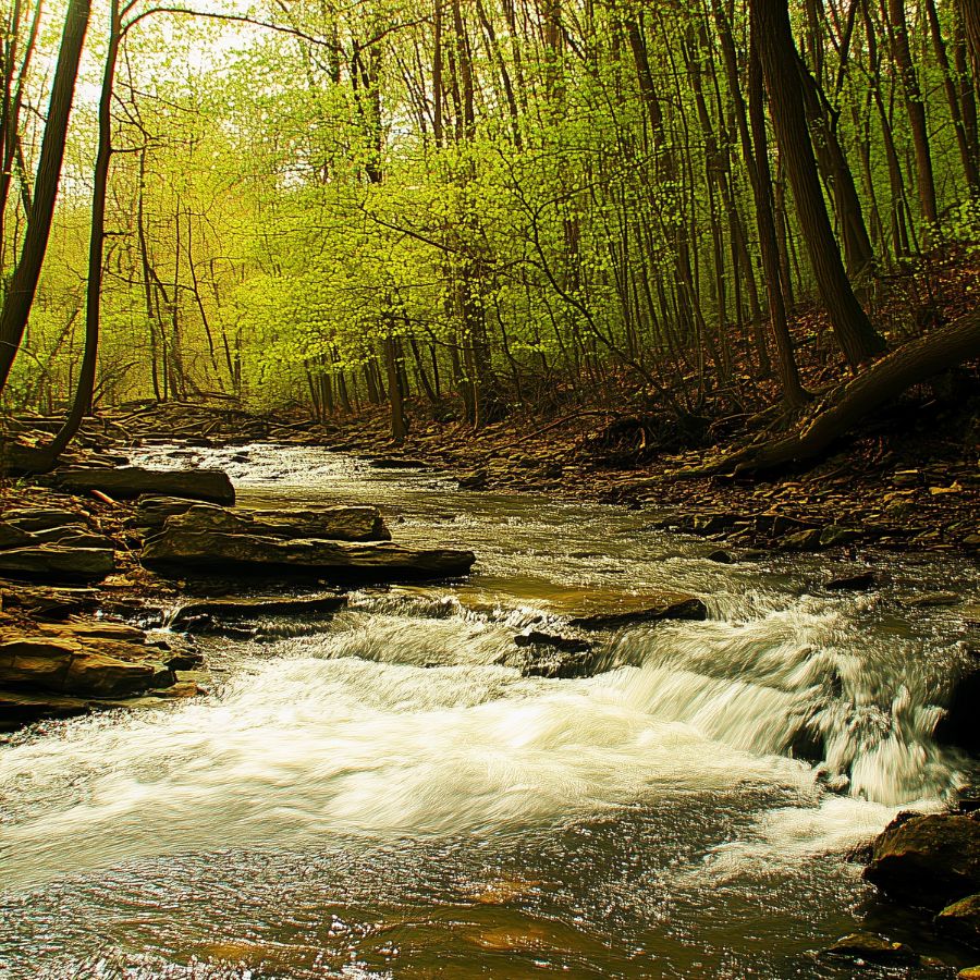
Hawk and Horseshoe Prospects (Lincoln County). Federal records list these two old gold prospects in Lincoln County’s slice of the greenstone belt. The prospects sit on land you will need permission to reach, and the smart play is panning the small streams that drain them, since those gravels have been collecting the prospects’ shed gold for ages. Fine gold is the target, and treat any old workings as look but do not enter.
Reef Gold Deposit Area (Marathon County). The Reef property east of Wausau is Wisconsin’s best defined lode gold deposit, with the state survey citing estimated reserves of well over one hundred thousand ounces. The deposit is private and undeveloped, so nobody is handing out tours. The glaciers smeared its top across the countryside, which is one more reason Marathon County creeks keep showing color.
Pelican River (Oneida County). The state survey records gold in the Pelican River area near Rhinelander, part of the same buried sulfide belt that produced the region’s zinc and copper finds. Pan the gravel bars and bridge crossings at low water. Much of the frontage is private, so ask first.
Ritchie Creek (Price County). A copper and gold deposit was drilled along this little creek, and its name now belongs to one of the state’s documented mineral discoveries. The deposit is deep and private, but the creek gravels drain the mineralized ground and reward a patient pan with fine color. Get landowner permission and give it a go.
Northeastern Wisconsin
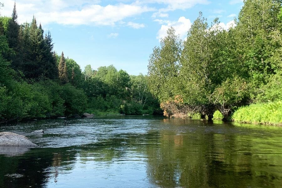
Pine and Popple Rivers (Florence County). Prospectors report fine glacial gold in these two wild northwoods rivers, which drain the same ancient volcanic country as the Menominee. Both carry state Wild River protections, so keep any panning to hand tools and minimal disturbance, and confirm current rules with the DNR first. The reward is some of the prettiest prospecting water in Wisconsin.
Peshtigo River (Marinette County). Prospectors report fine color from the Peshtigo’s gravel bars, downstream of some of the wildest whitewater in the Midwest. The river reworks glacial outwash for miles through forest and farm country. Use public landings, watch the current, and ask permission away from access points.
The Best Gold Hunting Techniques in Wisconsin
Wisconsin’s fine glacial gold rewards patient technique over expensive machinery, and the state’s rules point the same direction. These are the four methods that actually put Wisconsin gold in a vial, ordered from easiest to hardest.
Gold Panning (Difficulty: 1 out of 5)
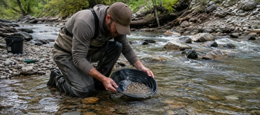
Panning is the whole game in Wisconsin, and the DNR requires no permit for it. Fill your pan with gravel, submerge it, shake hard so the heavy gold sinks, then tilt and swirl the light material off the top until only the heavy concentrate line remains. With flour gold this fine, finish each pan slowly, because one careless swirl sends a day of gold back into the creek.
It works everywhere in this guide, and it is the only method you need at Plum Creek, Rock Elm Creek, and Black Earth Creek.
Essential Tools:
- Deep riffle gold pan: Garrett 15 Inch Dual Riffle SUPERSLUICE Gold Pan
- Finish pan: Garrett Prospecting 10 Inch Backpacker Gold Pan
- Snuffer bottle: Garrett Gold Guzzler Bottle
- Storage vials: SE Glass Vials with Caps
Crevicing (Difficulty: 2 out of 5)
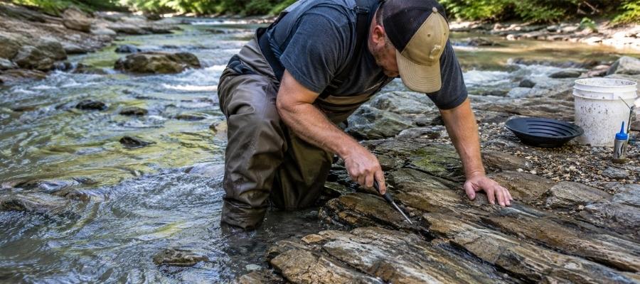
Crevicing means cleaning out the cracks in exposed bedrock and panning what you scrape loose. It is slow, surgical, and it produces some of the best gold in Wisconsin because those cracks have been trapping flakes since the glaciers melted. Big Falls on the Eau Claire River is the state’s crevicing headquarters, and the bedrock stretches of the northern rivers run a close second.
Work every crack down to its very bottom, because the last spoonful of packed dirt holds most of the gold.
Essential Tools:
- Crevice tool set: ASR Outdoor Steel Crevice Tool Set
- Hand trowel: Edward Tools Bend Proof Trowel
- Finish pan: linked in the panning list above
- Magnifying loupe: JARLINK 30X 60X Illuminated Loupe
Metal Detecting (Difficulty: 2 out of 5)
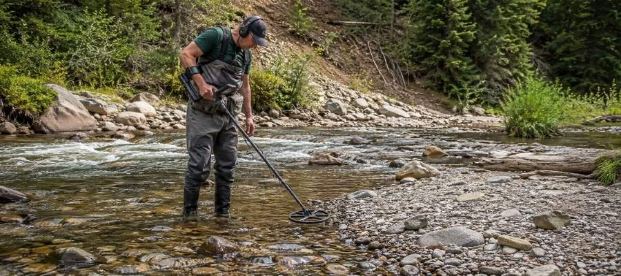
The DNR specifically allows metal detectors for recreational gold hunting, and a detector covers ground no pan can. Wisconsin’s glacial nuggets go to the hunters who sweep the most gravel, and the same drift also hides native float copper, so every pass has two ways to pay off. Work exposed gravel bars, old crossings, and the drift country around the northern prospects.
Get permission on private land, and remember that state parks and nature preserves are off limits for removing finds.
Essential Tools:
- Gold metal detector: Garrett AT Gold Metal Detector
- Pinpointer: Garrett Pro-Pointer AT
- Hand trowel: linked in the crevicing list above
Sluicing (Difficulty: 3 out of 5)
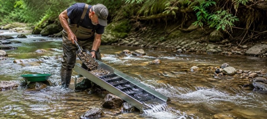
A hand sluice is a small channel with riffles that you set in the current, then feed with gravel while the creek does the panning for you. Wisconsin’s rules allow small manual sluice boxes for recreational prospecting, with a limit of two cubic yards of streambed material per waterway per year. Anything motorized crosses into permit territory, so keep it human powered.
In Wisconsin a sluice earns its keep on the bigger waters, the Chippewa, the Menominee, and the Peshtigo, where gravel is deep and flow is steady. Remember that sluices are not allowed when panning in the national forest.
Essential Tools:
- Hand sluice: Keene A52 Hand Sluice
- Digging shovel: Bully Tools 14 Gauge Round Point Shovel
- Classifier screen: SE Half Inch Sifting Screen
- Black sand magnet: SE Magnetic Separator Pick Up Tool with Quick Release
How To Tell Real Gold From Fool’s Gold
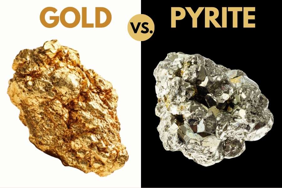
Wisconsin’s glacial gravel sparkles with pyrite, mica, and chalcopyrite, three minerals that love to imitate gold. Telling them apart is a skill you can master in one afternoon. Two quick tests sort them out every time.
The shadow test takes one second. Shade your pan with your hand and watch the sparkle. Real gold stays rich and golden in shadow, while pyrite and mica go gray and lifeless the instant the direct light leaves them.
The poke test settles anything the shadow test misses. Press a pin firmly into the particle. Gold is soft metal, so it dents and holds the mark. Pyrite is brittle and shatters, and mica just slides apart in sheets.
The reason to get this right is not avoiding embarrassment. It is that people who cannot tell the difference eventually toss a pan that had real gold in it. The Michigan and Wisconsin Rocks and Minerals Field Guide is the insurance policy, with side by side photos of gold and every one of its imitators, printed on waterproof pages you can hold right over your wet pan.

How Gold Got Into Wisconsin
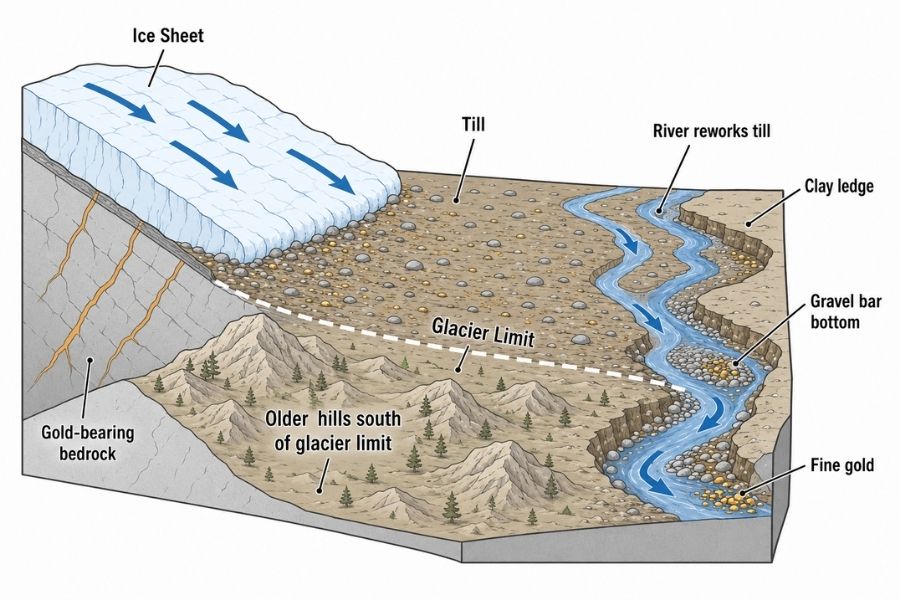
Every spot in this guide sits where it sits because of ice, but Wisconsin’s gold story starts long before the glaciers. Almost two billion years ago, volcanic island chains slammed into the edge of the ancient continent and welded on the greenstone belts that now run under northern Wisconsin. Hot fluids moving through those rocks left behind real gold, the same kind of geology that built the Flambeau, Bend, and Reef deposits.
Then came the ice. Starting about two million years ago, glaciers up to a mile thick ground across Canada and northern Wisconsin again and again, plucking up gold from the bedrock, crushing it fine, and dragging it south. When the last ice melted around 10,000 years ago, it dropped that load across most of the state as glacial till and outwash, with the gold scattered through it like pepper through a stew.
One corner escaped. The Driftless Area of southwestern Wisconsin was never buried by the last glaciers, but meltwater rivers poured along its edge and dumped their heavy cargo there. That is why Pierce County’s creeks and Black Earth Creek, sitting right on that edge, are some of the best panning waters in the state.
Ever since, Wisconsin’s rivers have been doing the slow work of washing the till and concentrating the heavy gold into the bends, bars, and bedrock cracks in this guide. The gold is everywhere the ice went, every flood restocks the gravels with a fresh dose, and the survey says a patient panner can raise color in almost any county.
What To Bring for a Wisconsin Gold Day Trip
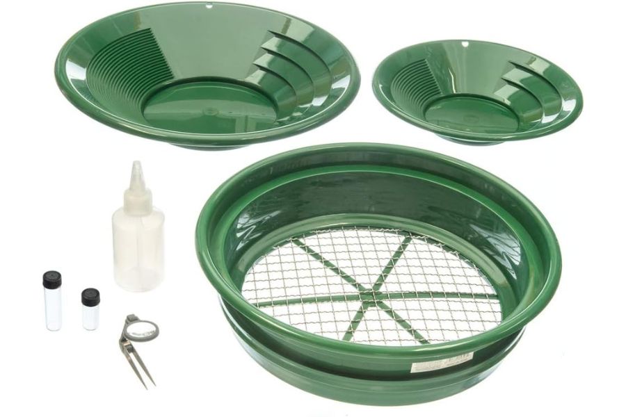
Here is the full checklist. Screenshot this section before you head for the creek.
- Gold pans and snuffer bottle, covered in the techniques section
- Crevice tools and trowel, same place
- Classifier screen and vials
- Rubber boots or waders with real tread, northern rivers run cold all year
- Drinking water and bug spray, Wisconsin creek bottoms are mosquito country in summer
- Sunscreen and a brimmed hat
- Printed landowner permission and a paper map of property lines
- Snacks and a dry change of clothes
If you are starting from zero, one box solves it. The Garrett Deluxe Gold Pan Kit has the pans, classifier, snuffer, and vials in one purchase, and it is the kit we hand to every beginner who joins us.
The Best Time of Year To Hunt for Gold in Wisconsin
Timing a Wisconsin gold trip is about water levels and trout seasons, because the gold does not move but the creeks and the rules sure do. Here is the calendar, region by region.
Northwestern Wisconsin
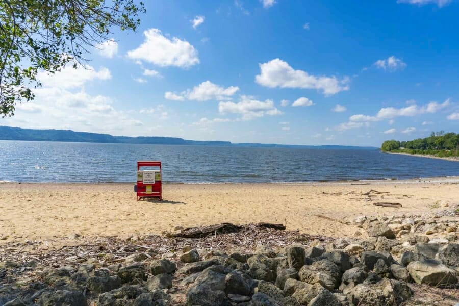
Late summer through early fall is prime time on the Pierce County creeks and the Chippewa. Water drops to its lowest levels, exposing gravel bars and the bedrock apron at Big Falls. The bonus window is right after spring high water recedes, when fresh gold has just been redeposited.
Skip the weeks after heavy rain. These creeks rise fast, run muddy, and hide everything you came to read.
North Central Wisconsin
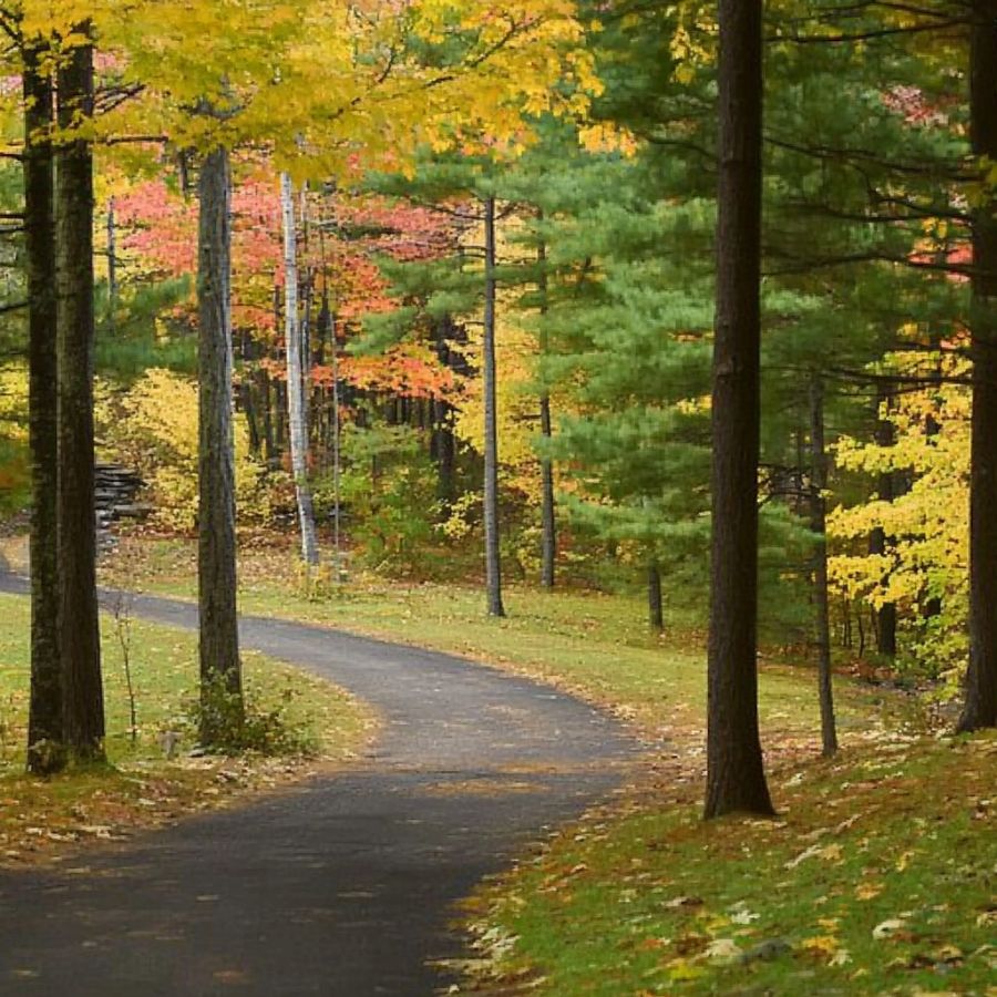
Mid June through mid September is the window for the Plover, the Big Rib, and the forest streams. It matches the national forest’s allowed season on trout waters, and the northwoods bugs finally ease off by late August. Low, clear water makes the black sand streaks easy to spot.
March through May is snowmelt season up here. Let the rivers drop before you wade, because northern water is pushy and cold.
Northeastern Wisconsin
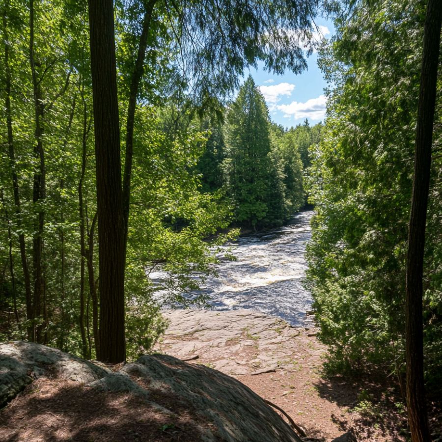
August and September are best on the Menominee, Peshtigo, and Pine. These are powerful rivers, and late summer is when their bars finally surface and their rapids calm enough to work safely. Fall color season doubles as the prettiest panning of the year.
Respect dam releases on the border rivers. Water can rise on a schedule, so check the flow before you commit to a bar.
Southern Wisconsin
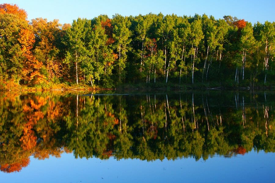
Late summer and early fall are best on Black Earth Creek, after the spring trout crowds thin and the water drops clear. September and October give you low flows, dry banks, and easier landowner conversations after the crops are in. Winter panning is possible in mild spells, but frozen banks hide the gravel.
Give the creek a wide berth during fall spawning. The trout made this valley famous, and keeping them happy keeps panners welcome.
Other Valuable Rocks and Minerals You Can Find in Wisconsin
The same glacial gravel that hides Wisconsin’s gold is loaded with other treasure, and some of it is worth more than the gold. The glaciers were not picky about what they carried south, so keep an eye out for all of these while your pan is working. Our Wisconsin rockhounding guide covers even more places these turn up.
Lake Superior Agates

The glaciers carried banded agates from the Lake Superior shores into gravel across Wisconsin, so agate hunting and gold panning happen in the same creeks. Wet agates glow with red and orange bands that dry rock hides. Here is our full guide to finding agates in Wisconsin.
Native Copper
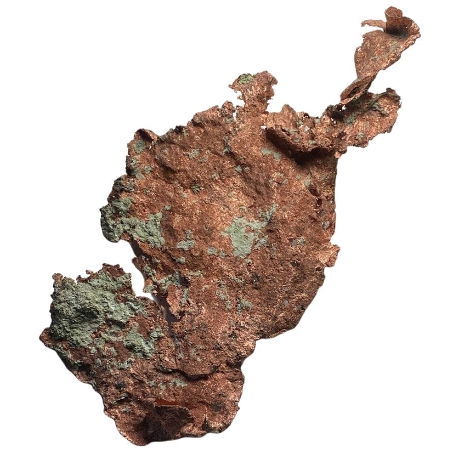
Wisconsin’s glaciers dragged native copper down from the Lake Superior copper country, and green stained float copper still turns up in northern gravel and fields. A detector finds it faster than a pan. Our overview of Wisconsin rocks, minerals, and gems shows what good pieces look like.
Diamonds
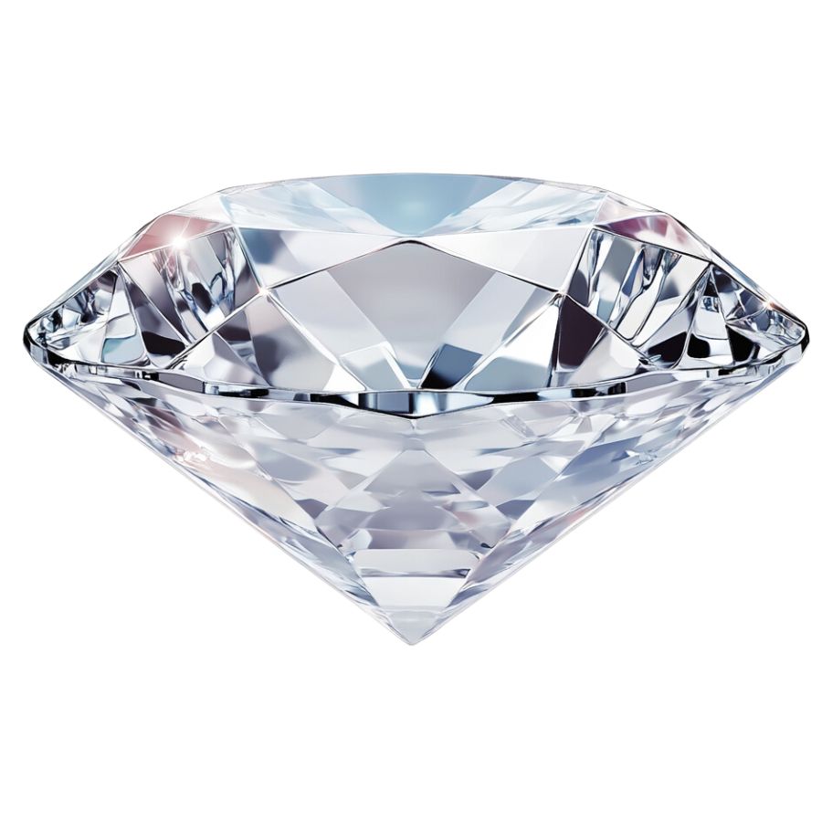
Wisconsin is one of the few states with genuinely documented glacial diamonds, including the stones recovered right alongside the gold at Plum Creek. They look like greasy glass pebbles, not sparkling gems, which is exactly why people throw them away. The full story is in our guide to diamonds in Wisconsin.
Galena
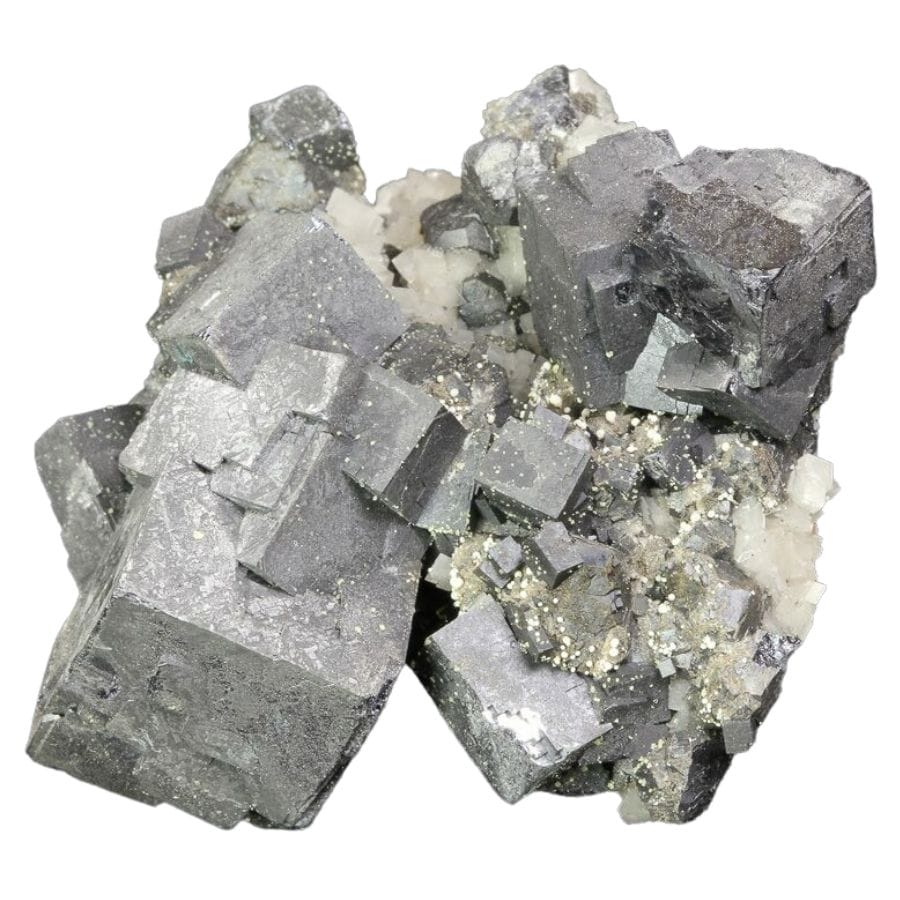
Southwestern Wisconsin was once one of the world’s great lead districts, and heavy silver gray galena cubes still surface in the old mining country. If a shiny gray pebble feels absurdly heavy, you may have found some. Our guide to Wisconsin crystals covers where the best specimens come from.
Geodes
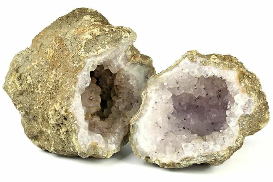
Wisconsin geodes look like plain round rocks until you crack them open on a crystal lined hollow. Creek gravel in the southern counties is a reliable place to spot them. Our guide to Wisconsin geodes lists the best hunting grounds.
Quartz Crystals
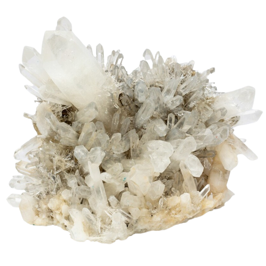
Clear and milky quartz is everywhere in Wisconsin gravel, and clean crystal points survive the glacial ride more often than you would expect. Wet quartz flashes like glass in a working pan. Our guide to gem hunting in Wisconsin shows what other gems hide in the same gravel.
Garnet
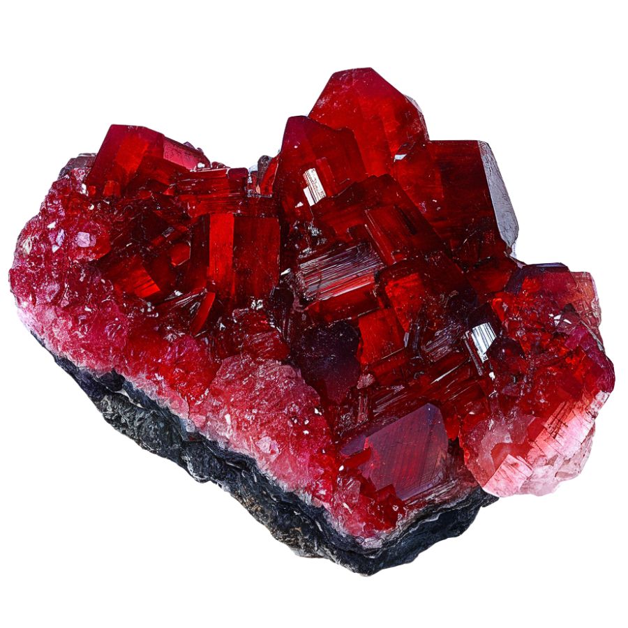
Those tiny red grains glittering in your black sand are garnets, ground off northern bedrock and delivered by the ice. Most are sand sized, but bigger stones turn up around Wausau and the northern ranges. Our guide to garnet in Wisconsin covers the best places to find them.
Pyrite
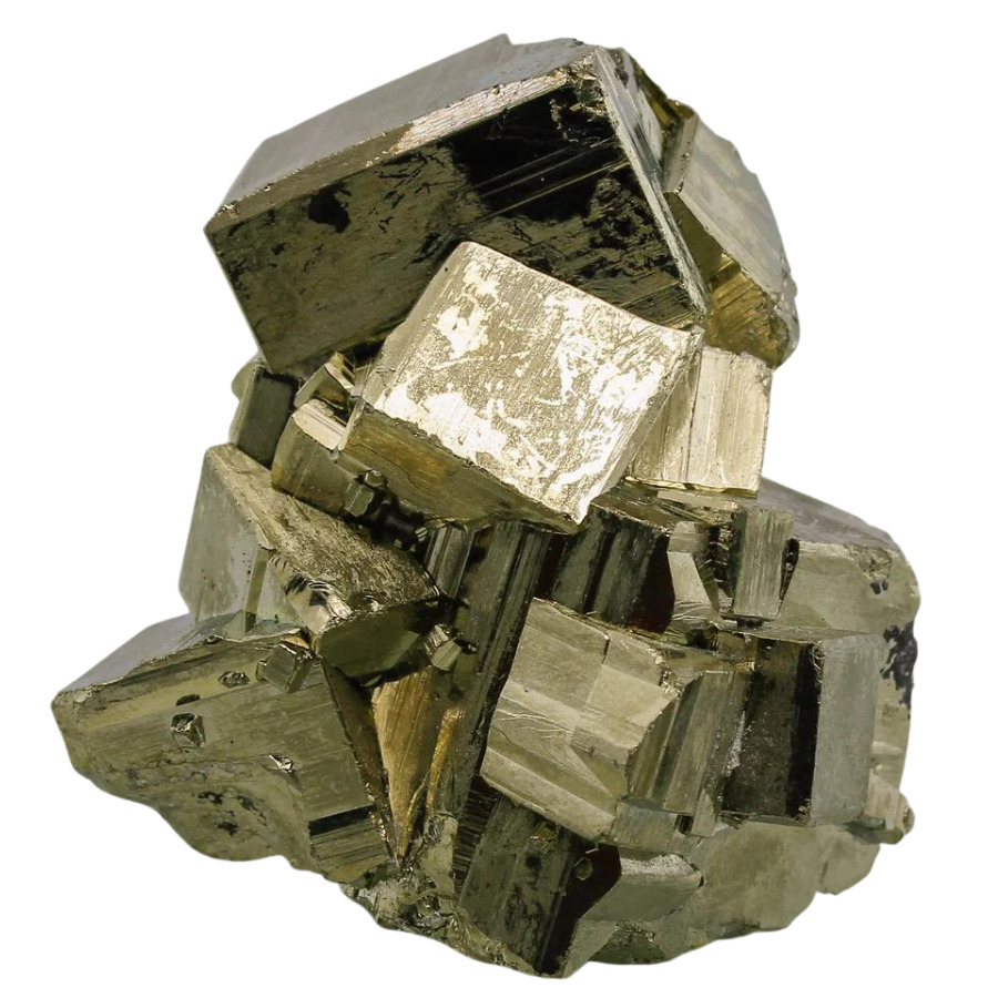
Yes, fool’s gold is worth keeping when it forms sharp brassy cubes. Good pyrite crystal clusters sell to collectors and look fantastic on a shelf. Wisconsin’s northern sulfide belts produce plenty of it, so save the best pieces you pan up.
Silver
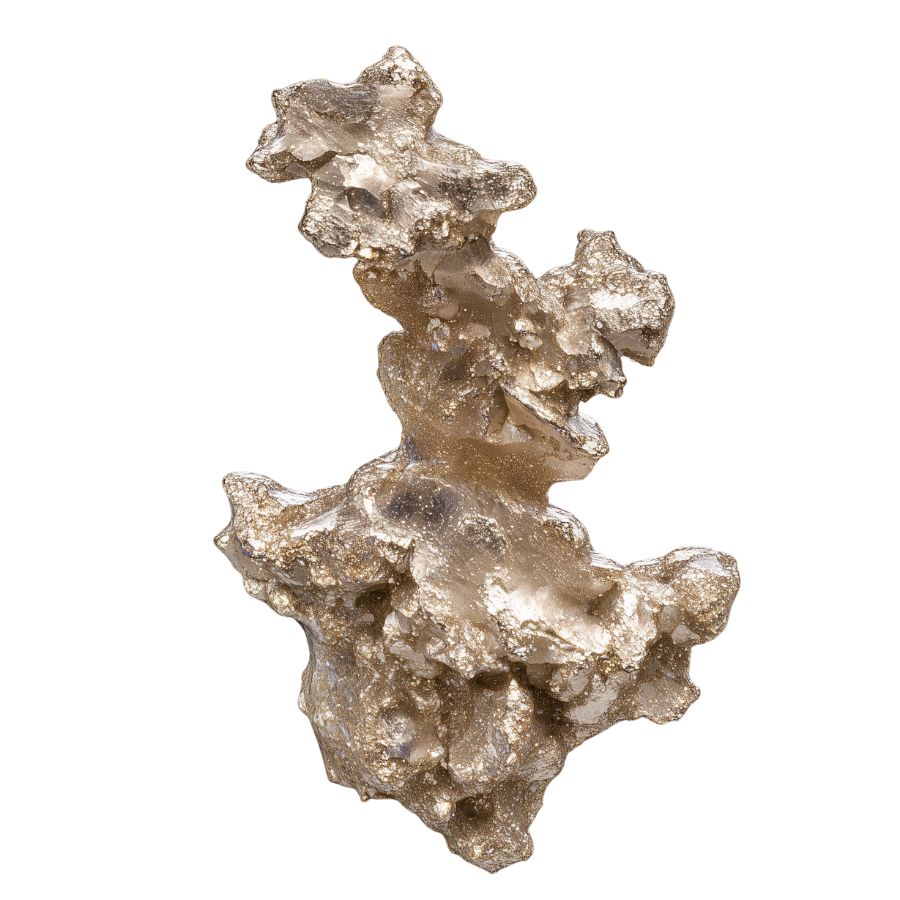
Native silver rode the same glaciers as the gold, torn from the famous silver districts north of Lake Superior, and Wisconsin’s own sulfide deposits carry it too. A bent gray wire in your concentrates deserves a second look. Our guide to silver in Wisconsin covers where it hides.
Fossilized Coral
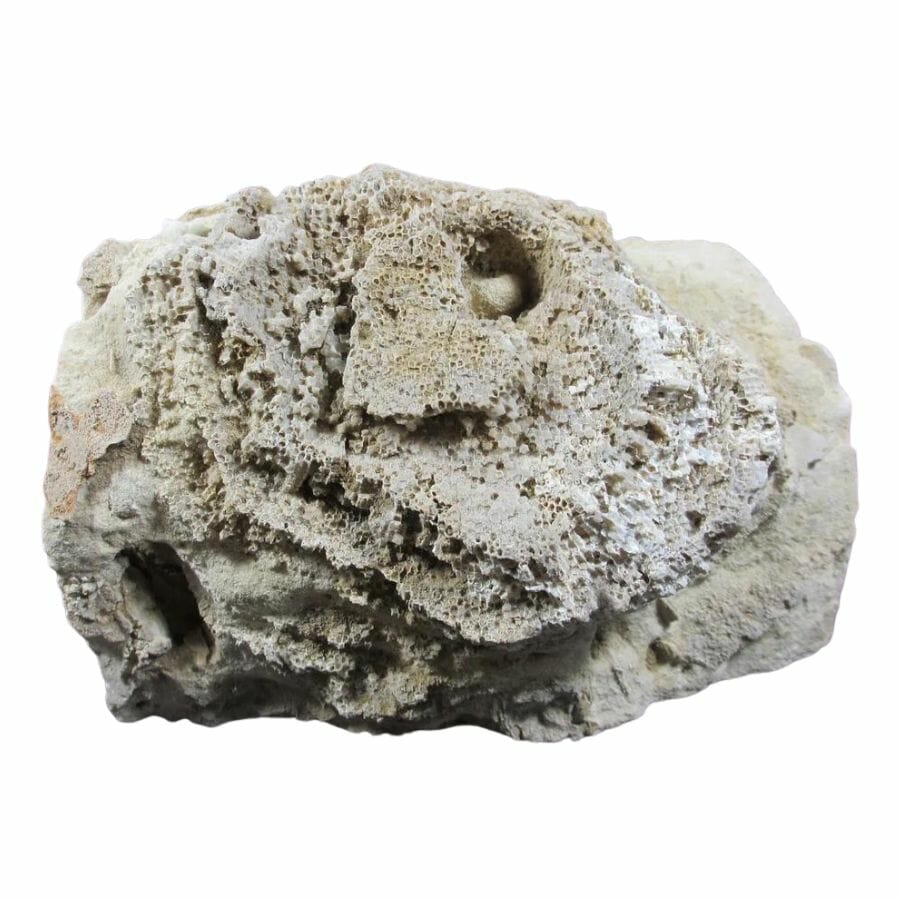
Wisconsin sat under a tropical sea long before the glaciers came, and honeycomb patterned coral fossils are common in creek gravel across the state. Polished pieces are beautiful and collectors buy them. Our guide to fossils in Wisconsin shows what else the old seafloor hides.
Here is the thing about every mineral on this list. In a wet pan, half of them look like gray or white pebbles, and people flick real treasure back into the creek every single weekend. The Michigan and Wisconsin Rocks and Minerals Field Guide exists so that never happens to you, with photo identification for more than 120 rocks and minerals you can check creekside in seconds.

Legal Rules for Gold Prospecting in Wisconsin

Before you touch a pan to gravel, read this section. We are rockhounds, not lawyers, and nothing here is legal advice. Rules change, and staying legal is entirely your responsibility.
Private Property
Most of Wisconsin’s gold water flows through private land, and you need the riparian landowner’s permission before you pan there. The DNR is explicit that the gold you find on private land belongs to the property owner unless you have an agreement, so settle that with a handshake before your pan gets wet. In our experience rural landowners often say yes to a polite ask.
Protected Land and Trout Streams
Wisconsin state parks, state trails, and state natural areas prohibit collecting, which rules out spots like Interstate State Park at the St. Croix Dalles. On other DNR managed lands a hobby collector needs a permit that caps removal at five pounds a day and fifty pounds a year, so ask the property manager first. The Chequamegon-Nicolet National Forest allows hand panning, but only with a pan, small shovel, and hand pick, in small areas for a few days a year, with advance notice to the forest’s minerals program manager.
Many of Wisconsin’s best gold creeks, including Black Earth Creek, the Rush, and the Plover, are classified trout streams. The national forest closes its trout waters to panning before April 15 and after September 15, and everywhere else the same logic applies. Stay off spawning gravel, fill your holes, and keep the water clear downstream.
Equipment Restrictions
The DNR requires no permit for recreational gold panning with hand tools, and it specifically allows pans, screens, shovels, small pry tools, small manual sluice boxes, and metal detectors. The hard limit is two cubic yards of streambed material per waterway per year, and anything mechanized, suction dredges included, counts as prospecting and needs a permit most hobbyists will never pursue. Inside the national forest the rules tighten further, with no sluices, no motors, and no chemicals of any kind.
Play it safe on every trip. Confirm access directly with the landowner or the managing agency before you dig, because boundaries and rules change without notice.
Some locations in this guide sit on land where collecting is limited or seasonal. When in doubt, treat a spot as look but do not take until you have confirmation in hand.
The best shortcut is local knowledge. Wisconsin’s prospecting community, including active Gold Prospectors Association of America chapters in the state, knows which landowners welcome panners, and a club membership pays for itself in access alone.
Wisconsin Gold FAQ
Is there gold in Wisconsin?
Yes, there is gold in Wisconsin, almost all of it glacial placer gold carried south by ice age glaciers, plus fine gold shed from the state’s own ancient greenstone belts. It shows up as flour gold and small flakes in creeks across most of the state. The state geological survey says a patient panner can raise a trace of color in nearly any county.
Where can you pan for gold in Wisconsin?
Plum Creek and Rock Elm Creek in Pierce County are the most proven placer waters, along with the Plover River in central Wisconsin and Black Earth Creek near Madison. The Chequamegon-Nicolet National Forest also allows small scale hand panning under its own rules. The best places section above breaks down access for every spot.
Do you need a permit to pan for gold in Wisconsin?
No, the Wisconsin DNR does not require a permit for recreational gold panning done with hand tools, small manual sluices, or metal detectors. You are limited to two cubic yards of streambed material per waterway per year, and motorized equipment requires a prospecting permit. You always need landowner permission on private land, and the gold legally belongs to the landowner unless you agree otherwise.
Has gold ever been mined in Wisconsin?
Yes, the Flambeau Mine near Ladysmith recovered roughly 328,000 ounces of gold along with its copper between 1993 and 1997, and small placer operations sluiced gold from Pierce County creeks in the late 1880s. No gold mine operates in Wisconsin today. The historic pits are closed and reclaimed, so modern hunting is all recreational panning.
What rivers in Wisconsin have gold?
Documented and reported gold waters include Plum Creek, Rock Elm Creek, the Rush River, the Plover River, the Big Rib River, the Chippewa River, the Eau Claire River at Big Falls, Black Earth Creek, and the Menominee River. Most creeks in glaciated Wisconsin can show a trace of color. The proven producers above are where your odds are best.
Get Every Find In Your Pan Identified In Seconds

Every pan you pull out of a Wisconsin creek is a mystery until you can name what is in it. The Michigan and Wisconsin Rocks and Minerals Field Guide identifies more than 120 rocks, minerals, and gemstones from these two states with over 300 clear photos, printed waterproof so it works right at the water’s edge.