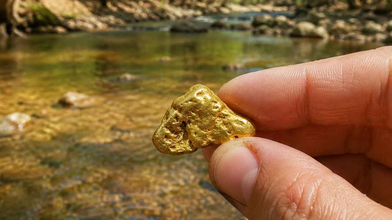
Every speck of gold in Missouri arrived by glacier. Yes, you can still find gold in Missouri today, especially along the Chariton River and the North Fabius River, where glacial placer gold has been showing up in pans for more than a century. Ice scraped it out of Canadian bedrock, hauled it hundreds of miles south, and dropped it in the rivers of the northern third of the state.
With gold trading above $4,000 an ounce, you do not need to find much for a weekend of panning to pay for itself.
Most people who try gold prospecting in Missouri make the same mistake. They head south to the Ozarks because hills and old mines look like gold country. Those mines produced lead and iron, and the ice never got that far. Your gold waits in the glacial till rivers up north, in the Chariton and North Fabius systems of the north central and northeast counties.
You will get every proven spot on the Chariton, the North Fabius, and the streams that feed them, plus the technique that works at each one. Every flood restocks those gravel bars, and fewer people are looking than you would guess.
Our team of geologists and experienced rockhounds mapped where the glaciers dropped their load, then matched it against a century of documented finds. Grab your pan, because we are about to find you some gold.
What’s In This Guide: Types of Gold | Where Gold Hides | Best Places | Techniques | Real vs Fool's Gold | How Gold Got Here | What To Bring | Best Seasons | Other Minerals | Legal Rules | FAQ | Field Guide
The Kinds of Gold You Can Find in Missouri
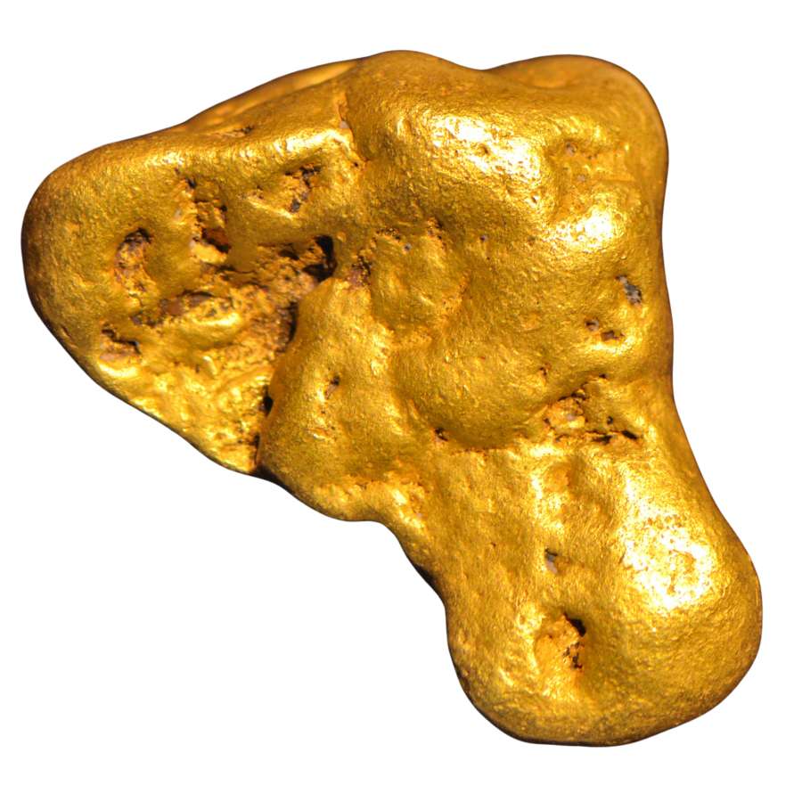
Missouri gold is glacial placer gold, ground fine by an ice ride of hundreds of miles. This is gold that hides, which is why so many people walk right past it and you will not.
Flour Gold
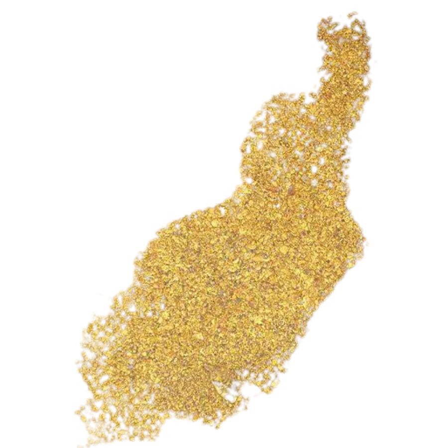
Flour gold is gold ground down to particles smaller than grains of sugar. It collects as bright golden dust in the crease of your pan after everything lighter washes away. It is the most common form of gold in Missouri by far, because the glaciers pulverized everything they carried.
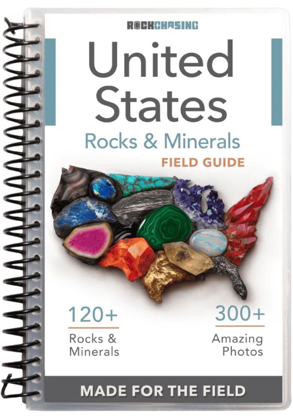
The mineral that fools you here is mica, which flashes gold in the sun but is nearly weightless. Shade your pan: real flour gold stays golden in shadow, while mica goes dull. The Rocks and Minerals of the United States Field Guide shows you what real gold looks like next to every mineral that imitates it, while your pan is still wet.
Flour gold washes out of a normal pan far too easily, so you want a dedicated finish pan. The Garrett Prospecting 10 Inch Backpacker Gold Pan is the one our team uses for exactly this job.
Gold Flakes
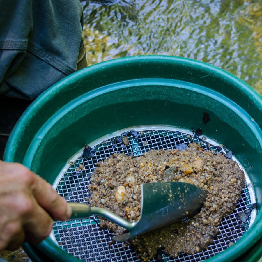
Flakes are the next size up, flat pieces about the size of a grass seed that you can pick out and admire. In Missouri they turn up where a stream has reworked glacial gravel for thousands of years, concentrating the bigger pieces in one spot. A single good flake is a real trophy here.
The lookalike is pyrite, which breaks into small brassy pieces in the same gravels. Shade the pan with your hand: gold stays warm and golden while pyrite goes gray and lifeless.
Flakes are nearly impossible to pick up with wet fingers. The Garrett Gold Guzzler Bottle sucks them straight out of your pan without losing one.
Rounded Pickers
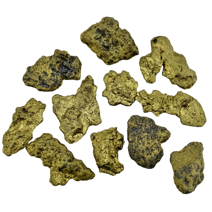
A picker is any piece of gold big enough to pick up with your fingers, and a Missouri picker is a find you will brag about for years. Glacial gold gets hammered and rolled on its long trip south, so a Missouri picker looks like a tiny flattened pebble with no sharp edges. That worn shape is your proof it rode the ice.
The false alarm is chalcopyrite, a coppery mineral that weathers into rounded brassy lumps. Check it up close: chalcopyrite shows greenish and purple tarnish while gold shows the same rich yellow from every angle.
The JARLINK 30X 60X Illuminated Loupe settles it on the spot and is small enough to live in your pocket every trip.
Where Gold Hides in Missouri Streams
Gold is about 19 times heavier than water, so it always sinks to the lowest, slowest spot the current allows. Learn these features and you can walk up to any river in this guide and know where to dig first.
Inside Bends
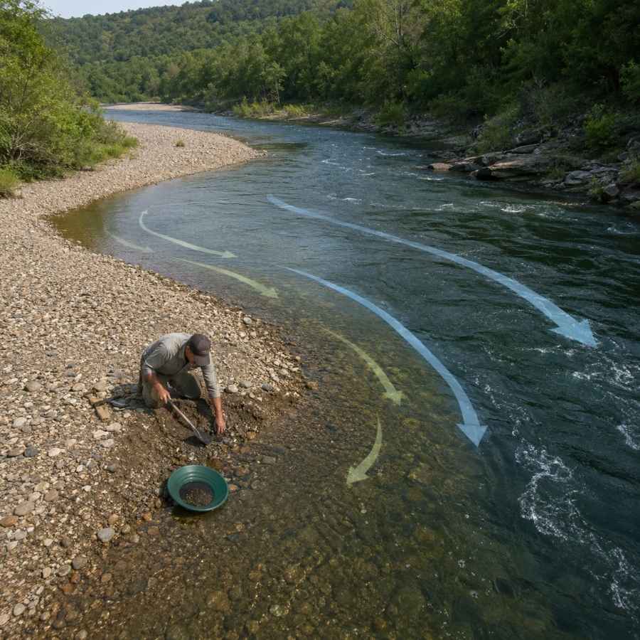
Water slows on the inside of every curve, and slow water drops its gold. Look for the gravel bar that builds on the inside of a bend and dig where the coarse gravel starts. In Missouri’s lazy farm country rivers, inside bends are your most reliable producers. You will be moving packed gravel here, and the Garrett 15 Inch Dual Riffle SUPERSLUICE Gold Pan has the deep riffles to catch fine gold at that volume.
Gravel Bars
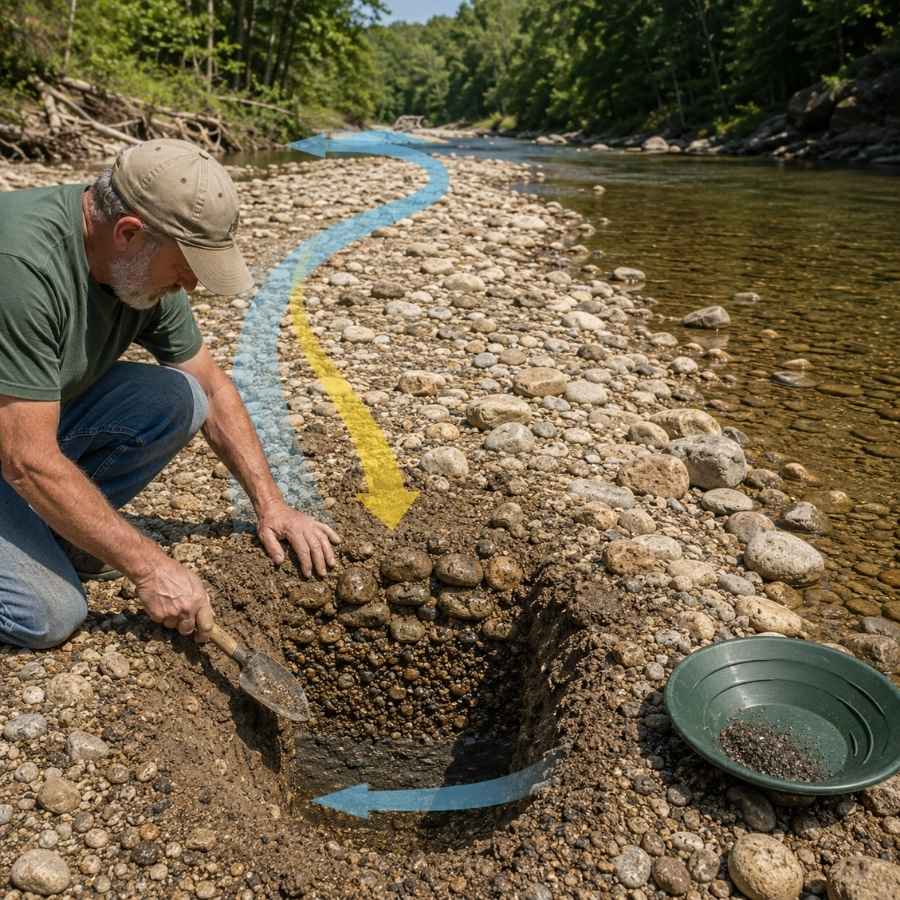
Summer low water exposes gravel bars that were underwater all spring. The gold in a bar concentrates at its upstream end and at the bottom of the gravel, not on the surface. Dig test holes and pan the deepest material you can reach. Bars are full of oversized rock, and screening it out with the SE Half Inch Sifting Screen doubles the gravel you process in a day.
Clay Hardpan and Bedrock Cracks
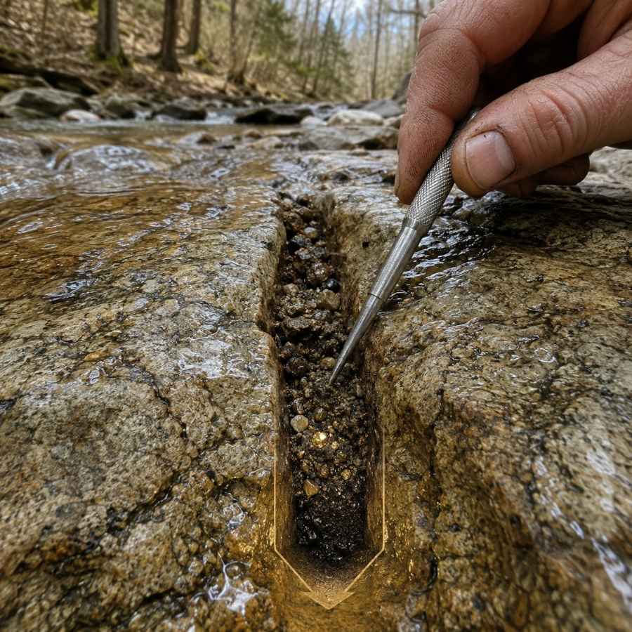
Gold sinks until something stops it, and in glacial country that something is often a layer of tough blue gray clay called hardpan. Prospectors call it false bedrock, and the gravel sitting right on top of it is the richest layer in a northern Missouri stream. Where limestone bedrock shows, every crack works the same way. The bottom inch against the clay is your money dirt, and the ASR Outdoor Steel Crevice Tool Set scrapes out what your fingers cannot reach.
Behind Boulders
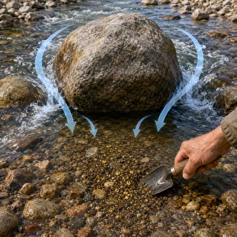
Every big rock splits the current and creates a calm pocket directly downstream, and gold traveling in a flood drops right into it. In northern Missouri many of those boulders are granite erratics the glaciers hauled from Canada with the gold, so a boulder that does not match the local rock is a double clue for you. The gravel behind them is cemented tight, and the Bully Tools 14 Gauge Round Point Shovel breaks it loose without snapping a handle.
Black Sand Streaks
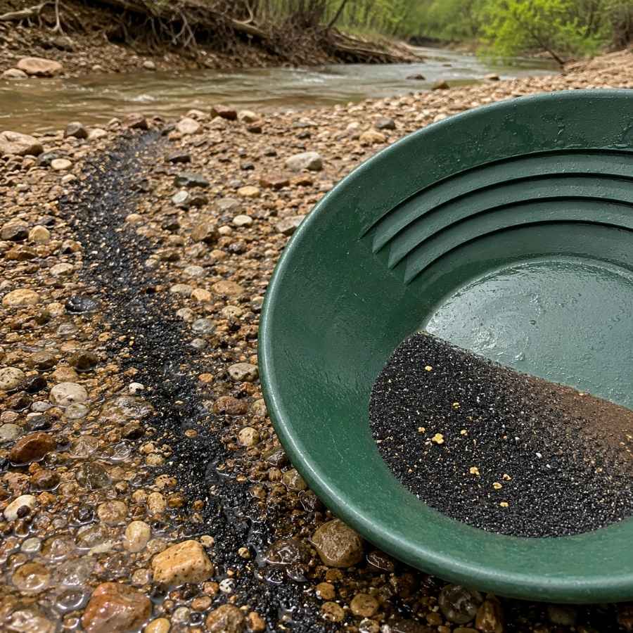
Black sand is crushed magnetite and hematite, and it is the number one gold indicator in Missouri. It is heavy, so it settles where gold does. When you see a dark streak in the gravel or a black layer in your pan, you are digging in the right place. At day’s end, the SE Magnetic Separator Pick Up Tool pulls the black sand out and leaves your gold behind in seconds.
Always Confirm Access and Collection Rules!
Before heading out to any of the locations on our list you need to confirm access requirements and collection rules for both public and private locations directly with the location. We haven’t personally verified every location and the access requirements and collection rules often change without notice.
Many of the locations we mention will not allow collecting but are still great places for those who love to find beautiful rocks and minerals in the wild without keeping them. We also can’t guarantee you will find anything in these locations since they are constantly changing.
Always get updated information directly from the source ahead of time to ensure responsible rockhounding. If you want even more current options it’s always a good idea to contact local rock and mineral clubs and groups
The Best Places To Find Gold in Missouri
Missouri’s gold country is the glaciated northern third of the state, roughly everything north of the Missouri River. Here is every spot worth your gas money.
North Central Missouri
The Chariton and Grand river systems drain the heart of Missouri’s glacial till country, the most productive gold ground in the state, and permission is the key that opens almost every spot.
Chariton River (Adair, Macon and Chariton Counties)
The Chariton is the most talked about gold river in Missouri, and prospectors still work its sandbars today. It enters from Iowa and runs south through Adair, Macon, and Chariton counties, cutting gold bearing glacial till the whole way. The upper river was straightened long ago, and that current keeps digging fresh gravel out of the banks for you.
Fine flour gold with the occasional small flake is the find, and careful panning of the inside bends and sandbar edges is the technique. Your pan will also show quartz pebbles, black sand, petrified wood, and the occasional Lake Superior agate. This is the moment people toss good finds, because a wet unidentified stone looks like nothing. The US Rocks and Minerals Field Guide lets you check every odd stone against clear photos before it goes back in.
Big water means big gravel to move, so bring the Garrett 15 Inch Dual Riffle SUPERSLUICE Gold Pan and pan down to the packed gravel at low water.
Difficulty rating: 2 out of 5. Beginner friendly, wading optional.
Mussel Fork Creek (Macon, Linn and Chariton Counties)
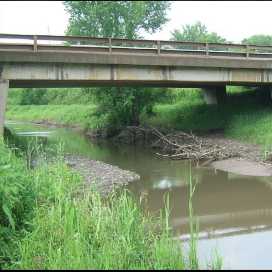
Mussel Fork is a quiet tributary of the Chariton that drains till country through Macon, Linn, and Chariton counties, and old placer reports follow it for miles. Smaller water means you can read it easily, and every inside bend and clay ledge is reachable in rubber boots. Nearly every foot flows through private farms, so knock on doors first.
Flour gold on clay hardpan is the pattern, and panning the material right off the clay is the play. Your bycatch is chert, jasper, and heavy black sand.
Those clay ledges hold the best gold, so bring the ASR Outdoor Steel Crevice Tool Set and scrape each one down to clean clay.
Difficulty rating: 3 out of 5. Easy water, permission takes legwork.
Macon County Glacial Gravels (Macon County)
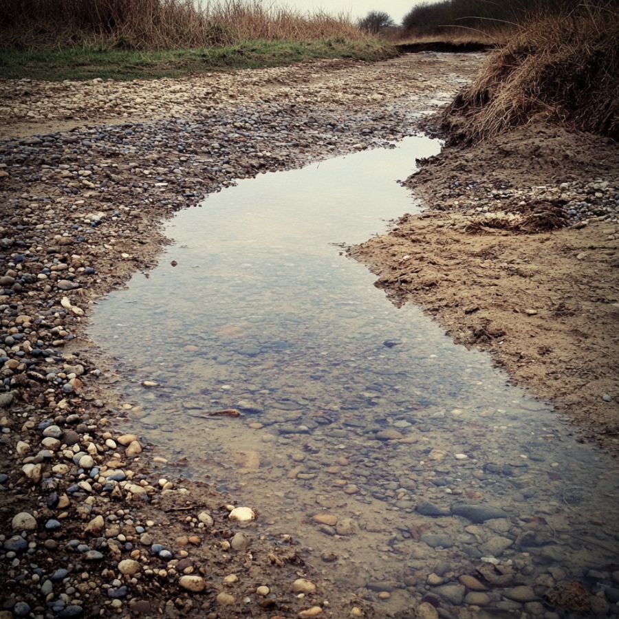
Macon County is the closest thing Missouri has to a named gold district. Old reports put gold in the gravels around Gifford, in Sand Creek near South Gifford, and in a draw northeast of Elmer that prospectors called Murray Gulch. These are glacial outwash deposits, and the creeks cutting through them have been concentrating gold ever since. Every acre is private, so this spot takes homework and a friendly handshake.
Flour gold with the occasional small picker is your target, and panning test holes where a creek cuts a gravel bank is the technique. The gravel also carries rounded quartz, granite pebbles, and the occasional agate.
Bank gravel is full of oversized rock, so bring the SE Half Inch Sifting Screen and classify every bucket before you pan it.
Difficulty rating: 4 out of 5. Homework heavy, big upside.
Before you toss that grey rock back in the creek, check it. Half the stones in a wet Missouri pan look like nothing until you match them against a photo, which is how good agates and jasper end up back in the river. The US Rocks and Minerals Field Guide prints those photos on waterproof pages you can hold right over your pan.

Grand River (Gentry, Daviess, Livingston and Chariton Counties)
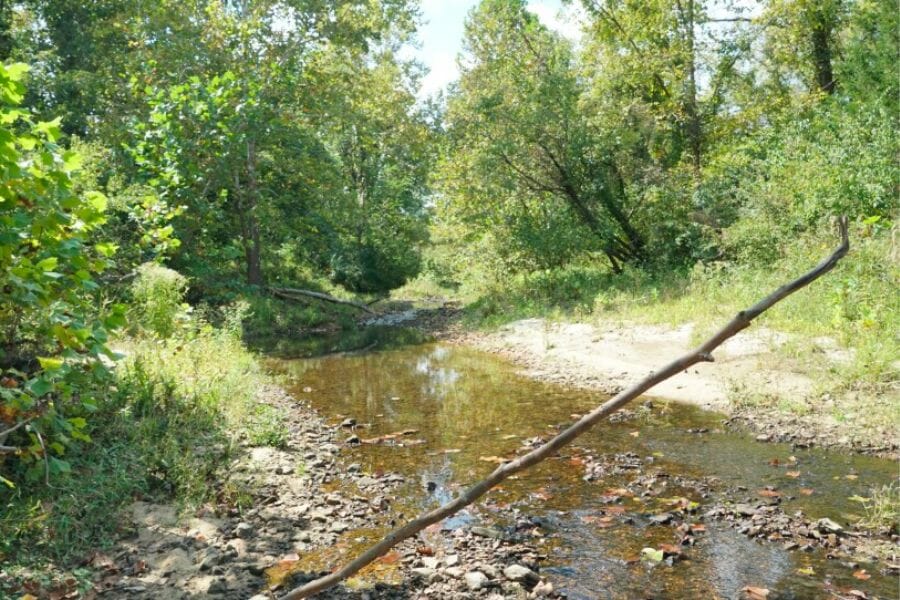
The Grand collects water, and gold, from a huge slice of till country as it runs through Gentry, Daviess, and Livingston counties to the Missouri near Brunswick. Old accounts of color center on its lower reaches in Chariton County. It is a big muddy river, so your game is finding bars and bends at low water, not wading the channel. Access mixes private ground and a handful of public accesses, so check each entry point.
Fine flour gold is the find, and panning the upstream ends of sandbars is the technique. The bars also carry petrified wood, jasper, and thick black sand streaks.
Where you have permission to run one, the Keene A52 Hand Sluice multiplies what you process on these deep bars.
Difficulty rating: 3 out of 5. Big water, time it right.
Thompson River (Harrison, Mercer, Grundy and Livingston Counties)
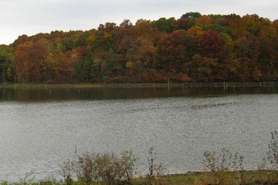
The Thompson is the Grand’s biggest branch, flowing through Harrison, Mercer, Grundy, and Livingston counties past Trenton. It drains some of the deepest glacial till in the state, and placer reports have followed it for generations. The riverbed is sand and gravel with clay ledges. Bridges and public accesses give you legal entry points, and permission opens the rest.
Flour gold on the clay layers is the pattern, and panning straight off the hardpan is the technique. After a flood year, retest bars you thought were worked out. Expect chert, quartzite pebbles, and the occasional agate in your pan.
Bring the Edward Tools Bend Proof Trowel and peel the packed gravel off each clay ledge in one scoop.
Difficulty rating: 3 out of 5. Public bridges, private bends.
Northeastern Missouri
The northeast corner shares the same glacial till plus a bonus, because this is Missouri’s famous geode country and a gold trip here can fill two buckets at once.
North Fabius River (Schuyler, Scotland, Knox, Lewis and Marion Counties)
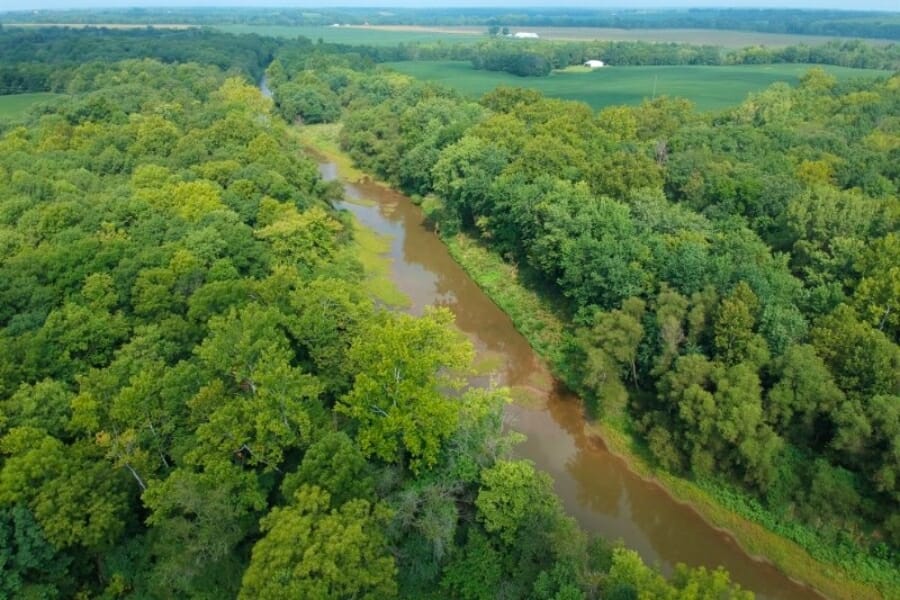
The North Fabius is the northeast’s best documented gold stream, running southeast through Schuyler, Scotland, Knox, Lewis, and Marion counties. Placer gold reports track its whole Missouri run, and the river is small enough to read easily and wade safely at summer levels. Highway crossings give you scouting points, and permission gets you onto the good bends.
Flour gold in the bend gravels is the standard find, and simple panning is all it takes. Your pan will also show chert and crinoid fossil pieces, and since this corner is loaded with Keokuk geodes, our guide to finding geodes in Missouri covers beds within an easy drive.
Fine gold and wet fingers do not mix, so bring the Garrett Gold Guzzler Bottle and lift every speck out of the pan.
Difficulty rating: 2 out of 5. Small water, easy wading.
Kirksville Area Gravels (Adair County)
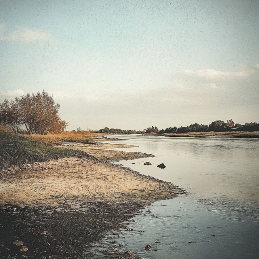
The sand and gravel deposits around Kirksville in Adair County have produced pannable gold, and they show you what to look for across the whole till country. Anywhere a creek, a road cut, or a working pit exposes deep glacial gravel, the bottom of that gravel can carry fine gold. Commercial pits are off limits without an invitation, so focus on creek cut banks with landowner permission.
Flour gold at the base of gravel exposures is the target, and panning test samples is the technique. Five test pans tell you whether a bank is worth a day. The gravels also hold agates, jasper, and dark basalt pebbles from the far north.
Test holes mean digging, so bring the Bully Tools 14 Gauge Round Point Shovel and get to the bottom of the gravel.
Difficulty rating: 4 out of 5. Homework heavy, and how new spots get found.
Northwestern Missouri
The big rivers of the northwest drain the loess hills and deep till of the state’s upper corner, so timing matters more here than anywhere else.
Platte River (Nodaway, Andrew, Buchanan and Platte Counties)

Missouri’s Platte River winds south through Nodaway, Andrew, Buchanan, and Platte counties, and it has carried placer gold reports for as long as prospectors have worked here. It is a sandy, winding farm country river with long point bars that rebuild after every high water. Bridge crossings make your scouting easy, and most banks are private, so ask first.
Fine flour gold in the point bar sands is the find, and careful finish panning is the technique, because this gold runs small even by Missouri standards. Pan the black sand streaks on the downstream ends of bars. The sand also gives up magnetite, garnet colored sand, and petrified wood chips.
Bring the Garrett Prospecting 10 Inch Backpacker Gold Pan and finish every pan slowly.
Difficulty rating: 3 out of 5. Easy scouting, patient panning.
Missouri River Gravel Bars (Northwestern Missouri)
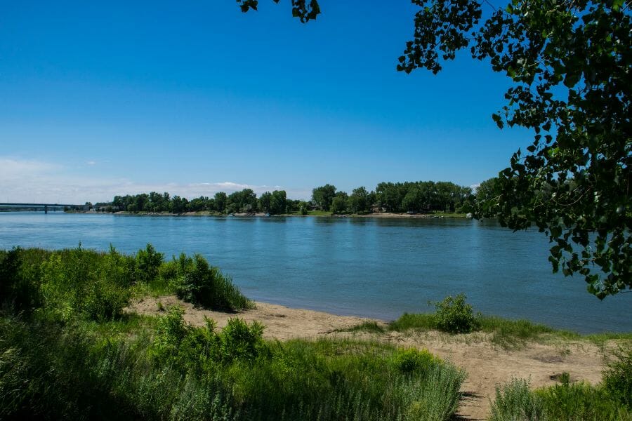
The Missouri River is the state’s gold highway, collecting fine gold from every glaciated tributary along its northern run. Low water exposes big sand and gravel bars from the Iowa line down past St. Joseph. The barge channel is dangerous, so treat exposed bars as your only workspace and never wade the main current. Many access points sit on Missouri Department of Conservation land where collecting is prohibited, so pan only from private ground with permission or water access you have confirmed is open.
Ultra fine flour gold is the target, and slow finish panning of black sand streaks is the technique. Hit the upstream tips of bars after a summer drop, and watch for agates, petrified wood, and fossil fragments.
Gold this fine hides in the sand, so bring the SE 1/8 Inch Mesh Sifting Screen and pan only what passes through it.
Difficulty rating: 3 out of 5. Bars only, and read the legal rules first.
More Proven Places To Find Gold in Missouri
The glaciers salted fine gold across dozens of northern Missouri waterways, and the streams below have their own documented reports and prospector finds. Every one sits on or near private farmland, so get permission before you visit.
North Central Missouri
Locust Creek (Linn and Sullivan Counties). Locust Creek runs through deep glacial till one drainage west of Mussel Fork, and prospectors work it the same way, panning the clay hardpan on the inside bends for fine flour gold. Pershing State Park sits on the lower creek and collecting is banned there, so stay on private stretches with permission.
Little Chariton River, East Fork (Macon and Randolph Counties). Old placer reports cover the Chariton and many of its tributaries, and the East Fork of the Little Chariton drains the same gold bearing till just west of Moberly. Its small gravel bars and clay ledges concentrate the same fine flour gold. It is nearly all private farm country, so a knock on the door comes before your pan.

Northeastern Missouri
Fox River (Clark County). The Fox drains the corner of Missouri where the till country meets famous Keokuk geode ground, and prospectors report fine colors from its gravels along with geodes from its banks. Pan the inside bends down to the clay. Access runs through private land, so this is another handshake spot.
Wyaconda River (Clark and Lewis Counties). The Wyaconda draws steady prospector interest as a glacial gold stream in the state’s far northeast corner. It is small, easy to read, and full of the black sand that flags fine flour gold. Ask the landowner before you cross a fence, and watch for purple paint.
Salt River below Mark Twain Lake (Monroe and Ralls Counties). Prospecting guides put the Salt River drainage among the better glacial placer areas in northern Missouri, and its gravels rebuild after every big release from the lake. Fine flour gold in the bar gravel is your target. Much of the shoreline is Corps of Engineers and conservation land where digging is banned, so pan only from private ground with written permission.
Schuyler County Creeks (Schuyler County). Old prospecting accounts say Schuyler County holds gold in many of its waters, the small creeks that feed the upper Chariton around Lancaster and Downing. These streams cut right through gold bearing till, so any gravel riffle or clay ledge is worth five test pans. Almost every foot is private, so line up permission first.
Middle Fabius River (Scotland, Knox and Lewis Counties). The Middle Fabius runs beside the well documented North Fabius, drains the identical glacial till, and gives prospectors the same fine colors in its bend gravels. Work the black sand streaks at the upstream ends of bars. Highway crossings make scouting easy, but the banks are private farms.
The Best Gold Hunting Techniques in Missouri
Missouri’s fine glacial gold rewards patient technique over expensive machinery. These three methods put Missouri gold in your vial, ordered from easiest to hardest.
Gold Panning (Difficulty: 1 out of 5)
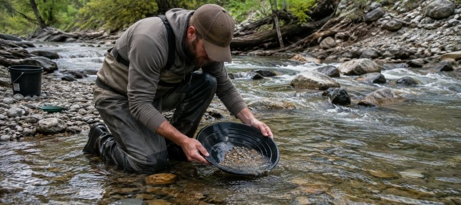
Panning is the whole game in Missouri. Fill your pan with gravel, submerge it, and shake hard so the heavy gold sinks. Then tilt and swirl the light material off the top until only the heavy concentrate line remains. With flour gold this fine, finish each pan slowly, because one careless swirl sends a day of gold back into the river. It is the only method you need on the Chariton and the North Fabius.
Essential Tools:
- Deep riffle gold pan: Garrett 15 Inch Dual Riffle SUPERSLUICE Gold Pan.
- Snuffer bottle: Garrett Gold Guzzler Bottle.
- Storage vials: SE Glass Vials with Caps.
Crevicing (Difficulty: 2 out of 5)
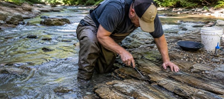
Crevicing means cleaning out the traps where gold stops sinking and panning what you scrape loose. In Missouri that mostly means the clay hardpan ledges in the northern streams, plus bedrock cracks where limestone shows. It is slow, surgical work, and it produces the best gold in the state, because those clay ledges have been trapping gold for thousands of years. Scrape every ledge down to clean clay, because the last spoonful of packed dirt holds most of the gold.
Essential Tools:
- Crevice tool set: ASR Outdoor Steel Crevice Tool Set.
- Hand trowel: Edward Tools Bend Proof Trowel.
- Finish pan: Garrett Prospecting 10 Inch Backpacker Gold Pan.
Sluicing (Difficulty: 3 out of 5)
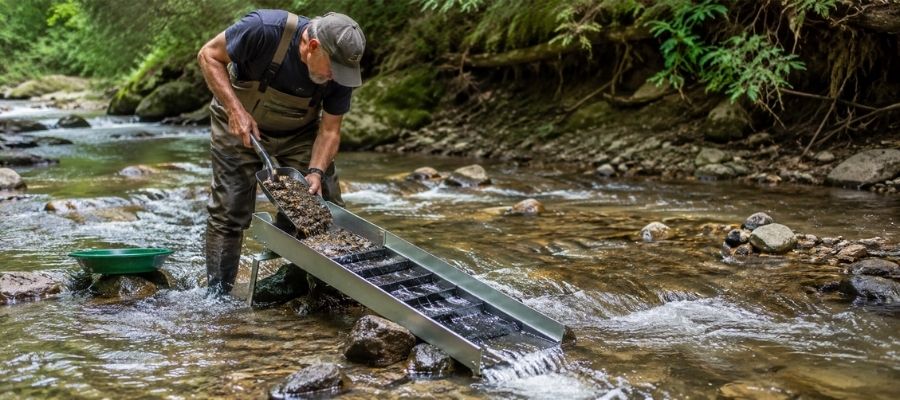
A hand sluice is a small channel with riffles that you set in the current, then feed with gravel while the river does the panning for you. It processes ten times what a pan can, which matters when the gold runs this fine. In Missouri a sluice is strictly a private land tool, run only with the landowner’s blessing, because public land rules here do not allow it. Where it is legal, it earns its keep on bigger flows like the Grand and the Thompson.
Essential Tools:
- Hand sluice: Keene A52 Hand Sluice.
- Digging shovel: Bully Tools 14 Gauge Round Point Shovel.
- Black sand magnet: SE Magnetic Separator Pick Up Tool.
How To Tell Real Gold From Fool's Gold
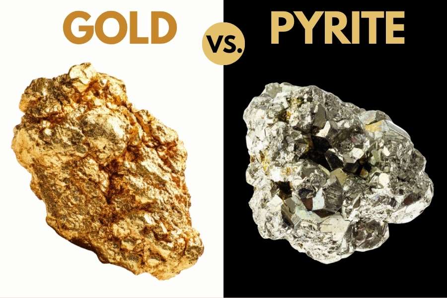
Missouri streams carry far more pyrite, mica, and chalcopyrite than gold, and all three have ended trips early with false celebrations. Two quick tests sort them out for you every time.
The shadow test takes one second. Shade your pan with your hand and watch the sparkle. Real gold stays rich and golden in shadow, while pyrite and mica go gray and lifeless the instant the direct light leaves them.
The poke test settles anything the shadow test misses. Press a pin firmly into the particle. Gold is soft metal, so it dents and holds the mark. Pyrite is brittle and shatters, and mica slides apart in sheets.
Get these two tests right and you never toss a pan that had real gold in it. The people who lose gold in Missouri never learned them, and now you have.
How Gold Got Into Missouri
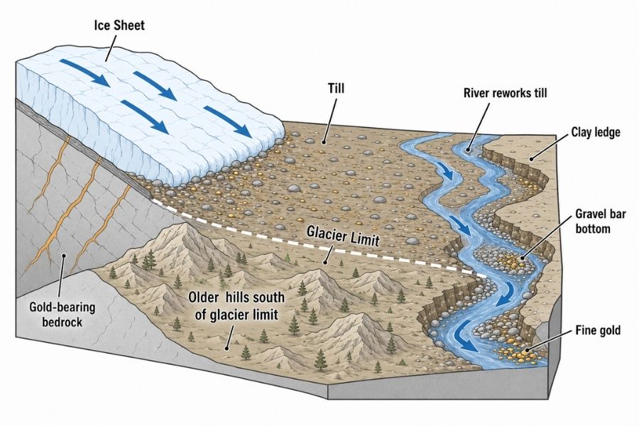
Every spot in this guide sits where it sits because of ice. What the glaciers did tells you why Missouri gold is fine, and why it all waits for you north of the Missouri River.
Hundreds of thousands of years ago, continental ice sheets ground their way south out of Canada, and they did it more than once. They bulldozed across ancient gold bearing rock, crushing it and folding the freed gold into a mix of clay, sand, gravel, and boulders called till. When the ice melted, it dropped that till in a blanket up to hundreds of feet thick across roughly the northern third of Missouri.
The ice stopped near the line the Missouri River follows today, which is why the river makes such a handy gold country boundary. Ever since the melt, rain and rivers have been sorting the till, and every flood concentrates a little more heavy gold on the clay ledges and bar bottoms where you now hunt it.
Missouri makes gold of its own too, because state geologists confirmed gold inside Missouri bedrock deep in the Pea Ridge iron mine in Washington County. The gold you can pan, though, is the glacial kind. The Ozarks carry lead, iron, and zinc, so in Missouri gold country is flat farm country, and you point your truck north.
What To Bring for a Missouri Gold Day Trip
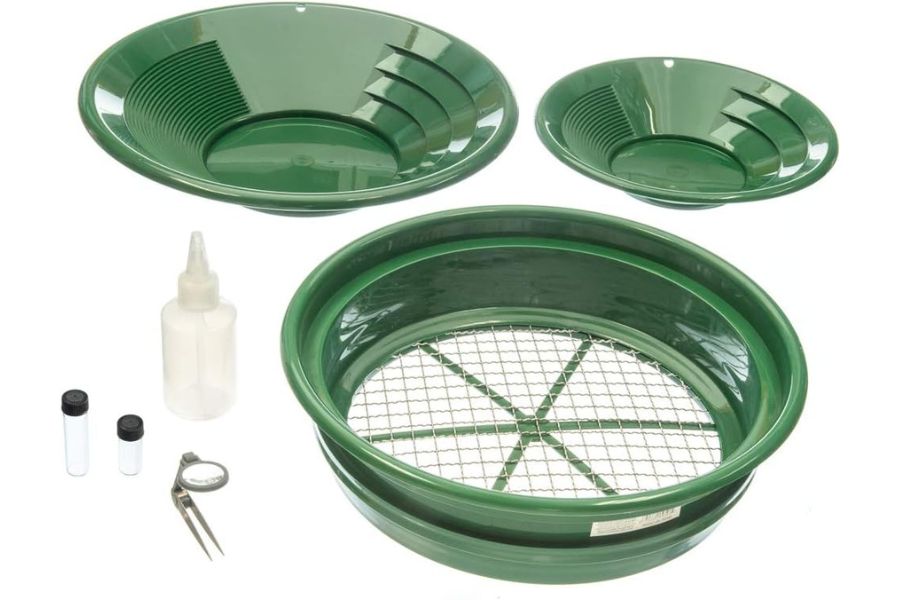
Here is your full checklist. Screenshot it before you head into the river bottoms.
- Gold pan and snuffer bottle.
- Crevice tools and hand trowel.
- Classifier screen and glass vials.
- Rubber boots or wading shoes with real tread.
- Drinking water, because Missouri summers are humid ovens.
- Sunscreen, bug spray, and a brimmed hat.
- Printed landowner permission and a plat map or landowner app for boundaries.
- Snacks and a dry change of clothes.
If you are starting from zero, one box solves it. The Garrett Deluxe Gold Pan Kit has the pans, classifier, snuffer, and vials in one purchase, and it is the kit we hand to every beginner who joins us.
The Best Time of Year To Hunt for Gold in Missouri
Timing your Missouri gold trip is about water levels, crops, and heat. Here is the calendar, region by region.
North Central Missouri
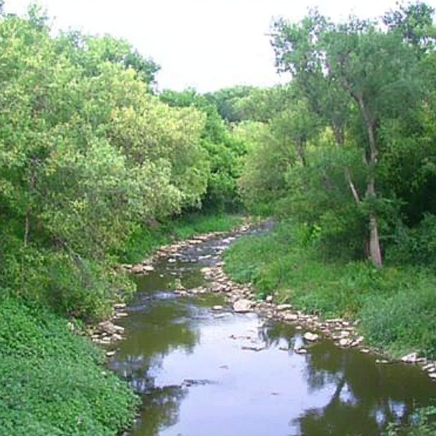
Late summer through fall is prime time on the Chariton, Mussel Fork, and the Grand system. Water drops to its lowest levels, exposing the bars and clay ledges that spring keeps drowned. Your bonus window is right after spring floods recede, when fresh gold has just been redeposited.
Skip the weeks right after heavy rain. These muddy rivers rise fast, and farm lanes turn to gumbo you will not drive out of.
Northeastern Missouri
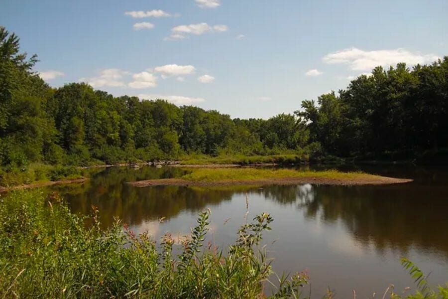
Summer and fall are your window on the North Fabius and the Kirksville gravels. Small streams here clear quickly after rain, and September wading is as pleasant as prospecting gets. Fall also pairs perfectly with a geode dig in the same corner of the state.
Landowner permission is easier to get after harvest too. A farmer who waved you off in June often says yes in late October.
Northwestern Missouri
Late summer and early fall are the smart windows on the Missouri and Platte rivers, when the big rivers drop enough to expose their bars safely. River levels change with upstream dam releases, so check gauges the morning you go.
Never work these rivers during spring rises or after heavy upstream rain. The Missouri takes bars back without warning.
Other Valuable Rocks and Minerals You Can Find in Missouri
The same glacial gravel that hides Missouri’s gold is loaded with other finds, and some are worth more than the gold. Our Missouri rockhounding guide covers the whole state, and these are the ones to watch for in your pan.
Lake Superior Agates
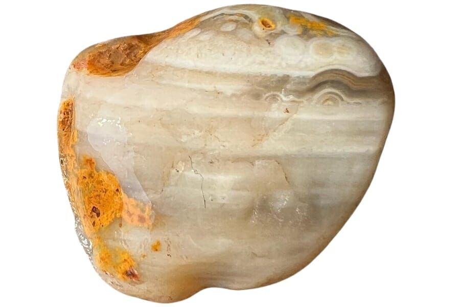
Lake Superior agates rode the same glaciers as the gold, all the way from the Great Lakes to northern Missouri’s gravel bars. Look for rounded stones with red and orange banding that glows when wet. Our guide to finding agates in Missouri shows you every proven spot.
Geodes
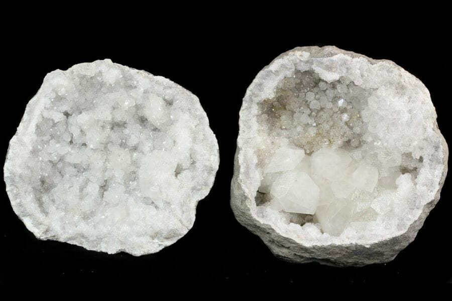
Northeastern Missouri sits on one of the world’s great geode regions, with crystal lined Keokuk geodes weathering out of creek banks. A round lumpy stone that feels too light for its size is your giveaway. Our guide to geodes in Missouri maps the best beds.
Mozarkite
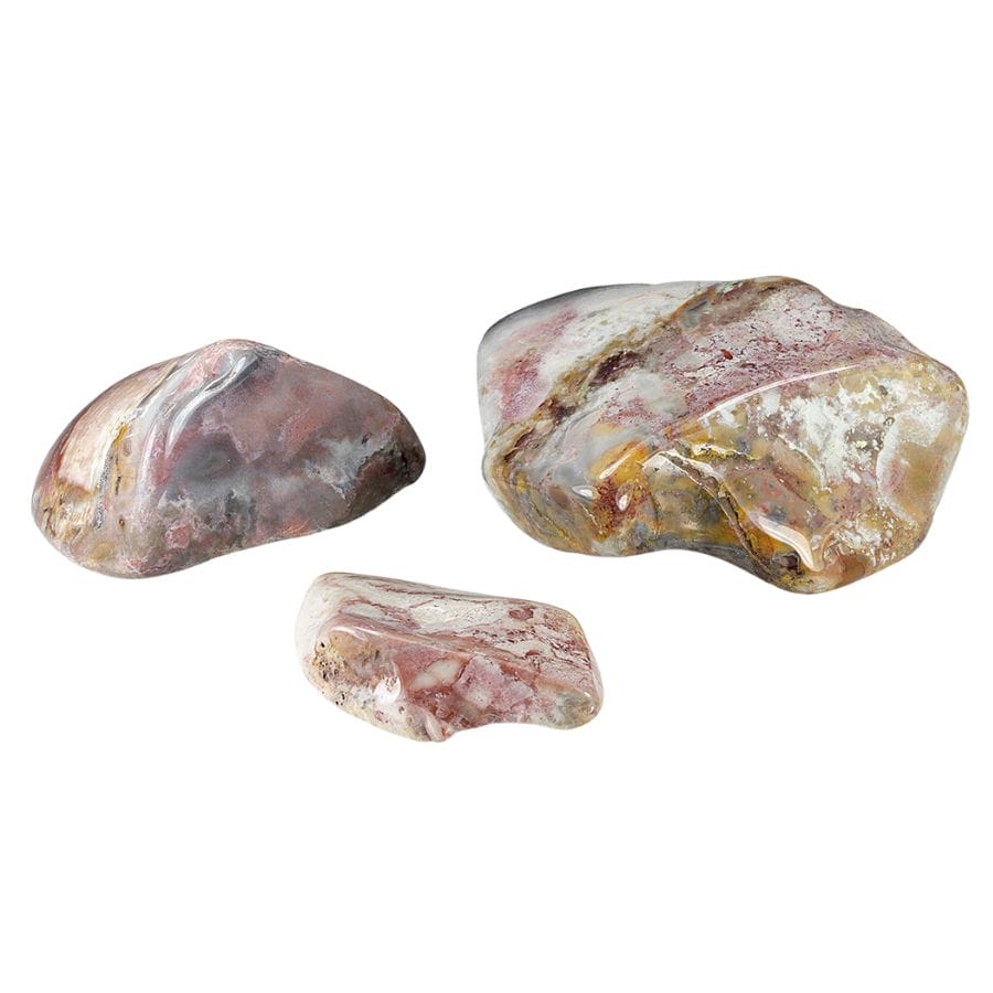
Mozarkite is Missouri’s official state rock, a chert swirled with pink, purple, and gray that polishes beautifully. It turns up in stream gravel across the state. Our overview of Missouri rocks, minerals, and gems shows what makes a top grade piece.
Galena
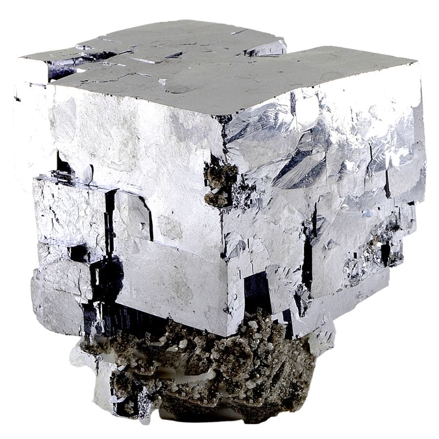
Galena is the official state mineral, a lead ore that forms heavy, mirror bright silver cubes. Missouri led the world in lead production for decades, and galena still turns up in southern stream gravels and old mine country.
Quartz
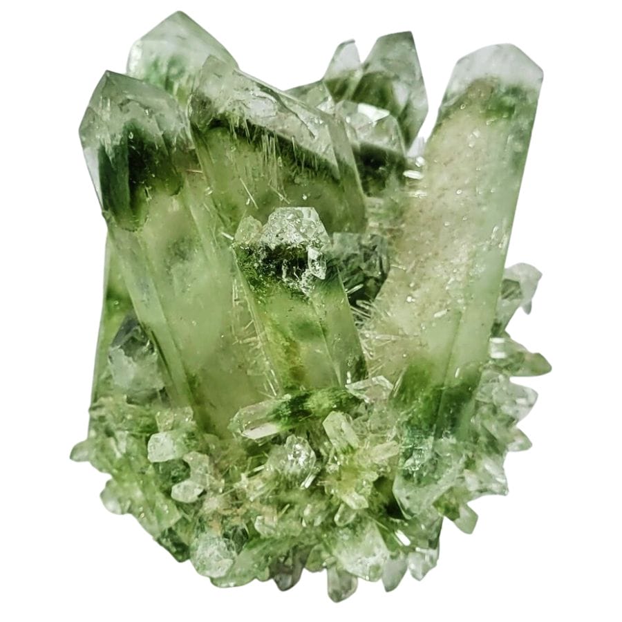
Quartz rides along in every Missouri gold pan, from milky white pebbles to the occasional clear point. Check any white stone with flat shiny faces before you toss it. Our guide to crystals in Missouri lists the best hunting spots.
Calcite
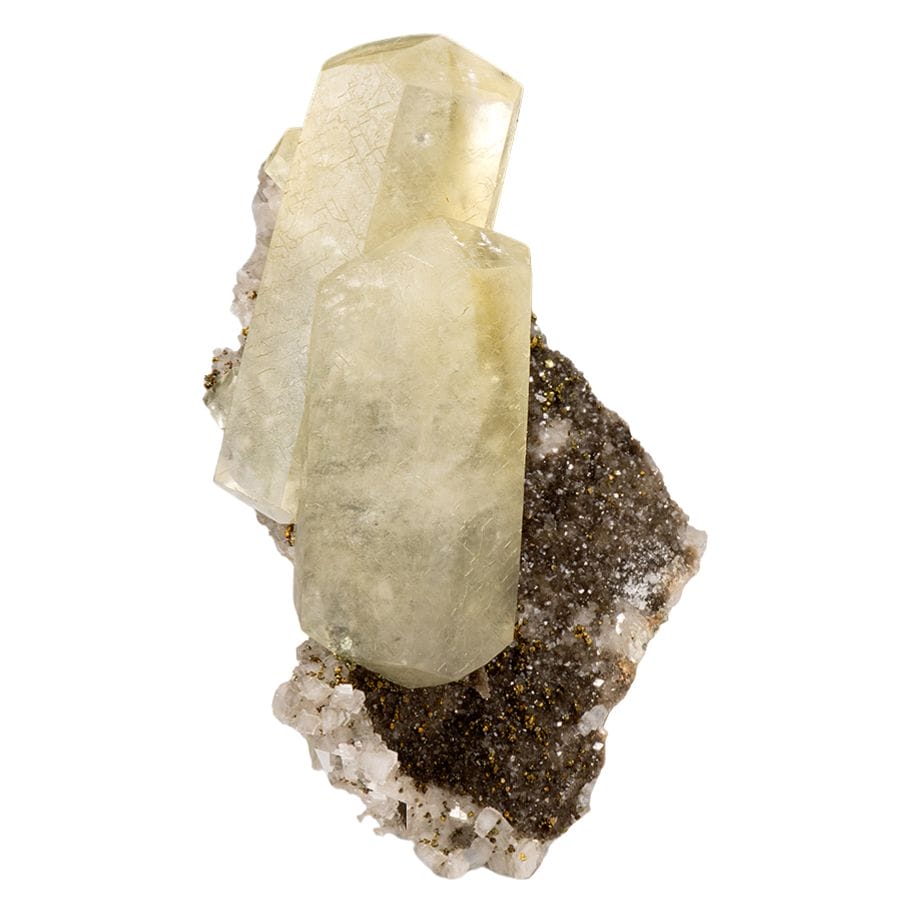
Calcite crystals line cavities all through Missouri’s limestone, and the state’s honey gold crystal clusters are famous with collectors. Creek gravel below bluffs often carries broken crystal pieces, so anything with glassy angled faces deserves your second look.
Pyrite
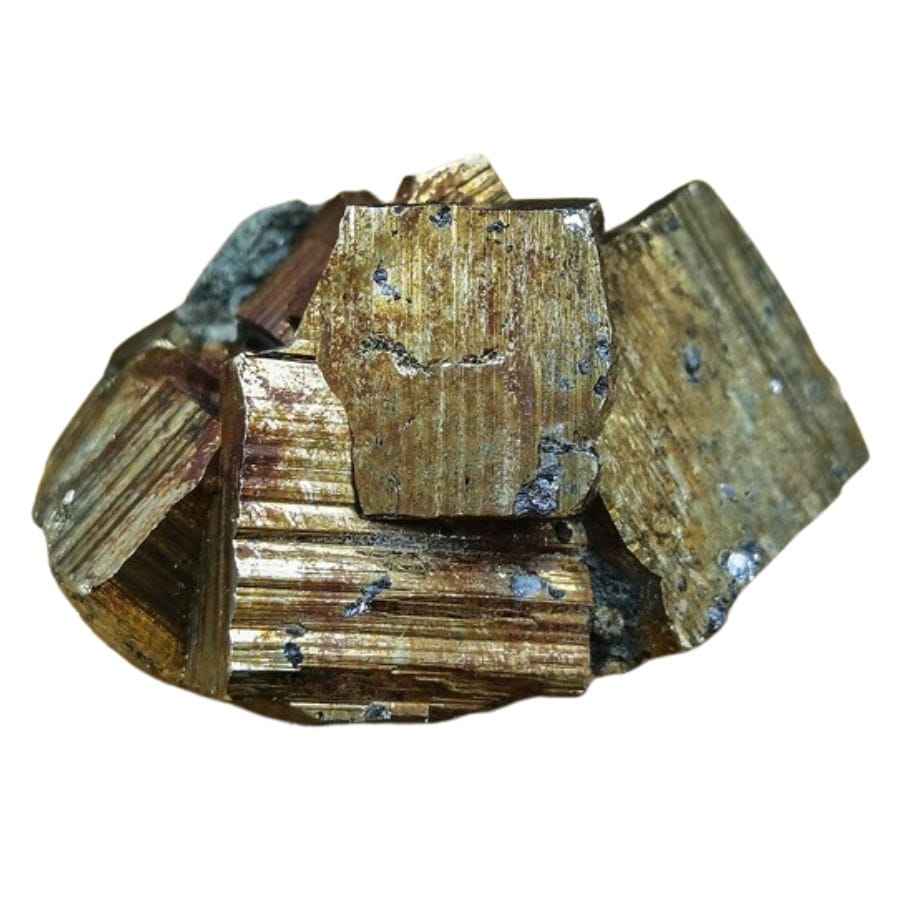
Yes, fool’s gold is worth keeping when it forms sharp brassy cubes. Good pyrite crystal clusters sell to collectors and look fantastic on a shelf. You will pan up plenty of small pieces in the northern gravels.
Hematite
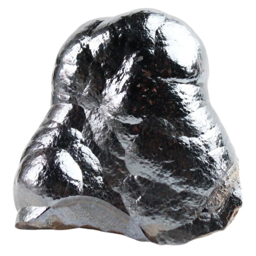
Hematite is the iron mineral that built Missouri’s iron mining history, and heavy silver black chunks of it collect in the same pan corner as your gold. Polished hematite has been jewelry material for centuries, so big clean pieces are worth pocketing.
Jasper
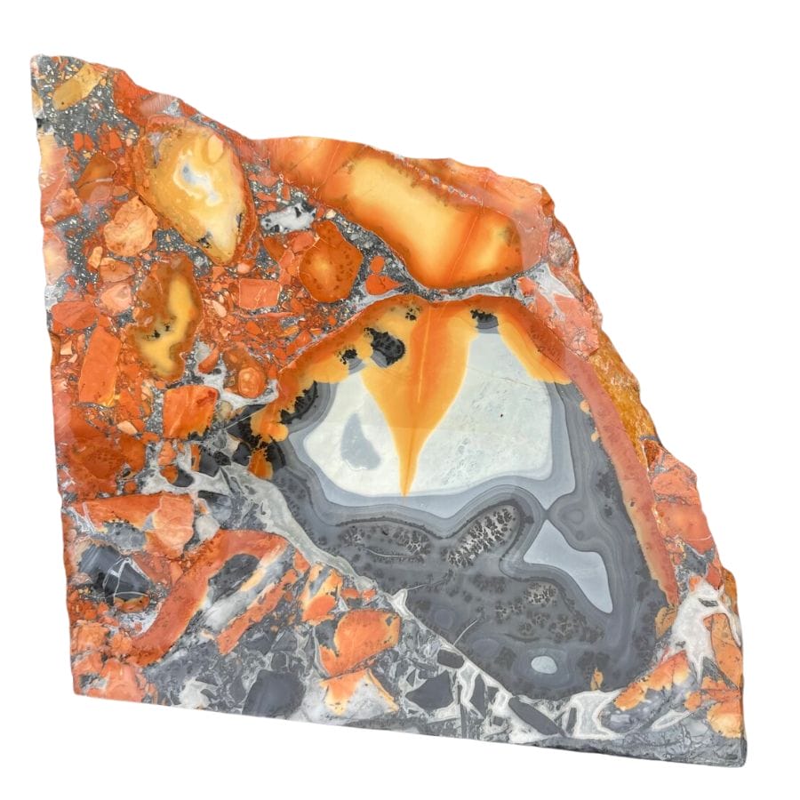
Jasper shows up in Missouri gravel as smooth red, brown, and mustard colored stones that take a glassy polish. The glacial gravels of the north carry some of the best pieces. Our guide to gem mining in Missouri shows you where color runs richest.
Crinoid Fossils
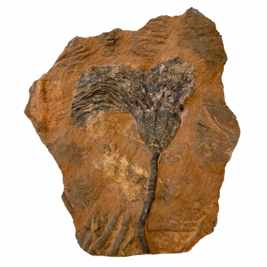
Crinoid fossils are the official state fossil, little stone rings and stacked segments from ancient sea lilies. They wash out of limestone into nearly every gravel bar in the state. Our guide to fossils in Missouri covers the best beds and what a museum grade piece looks like.
In a wet pan, half of these look like gray or white pebbles, and people flick real finds back into the river every weekend. The US Rocks and Minerals Field Guide exists so that never happens to you, with photos of 140 rocks and minerals you can check streamside in seconds.

Legal Rules for Gold Prospecting in Missouri

Before you touch a pan to gravel, read this section. We are rockhounds, not lawyers, and nothing here is legal advice. Rules change, and staying legal is your responsibility.
Private Property
Nearly all of Missouri’s gold country is private farmland, and the streambed of most waterways belongs to the adjacent landowner. That makes written permission the single most important tool you can carry. Watch for purple paint on fence posts and trees too, because under Missouri’s purple paint law that marking is a legal no trespassing notice by itself.
Active Mining Claims and Public Land
Missouri has no federal land open to staking mining claims, so claim maps are not part of your picture here. Your gatekeepers are farmers and state agencies instead. The Missouri Department of Conservation prohibits prospecting, mining, and mineral extraction on its conservation areas, and Missouri State Parks ban removing rocks and minerals as well. The Mark Twain National Forest allows casual hand panning in active stream channels with a pan only, no bank digging, but the forest sits in southern Missouri, far from the glacial gold.
Equipment Restrictions
A hand pan and hand tools are the safe baseline everywhere you have legal access. Sluices are not allowed on the national forest, and motorized dredging in Missouri streams triggers permitting through the Department of Natural Resources and the Army Corps of Engineers, so keep it human powered.
Play it safe on every trip. Confirm access with the landowner or the managing agency before you dig, because boundaries and rules change without notice.
Some locations in this guide sit near public land where collecting is limited. When in doubt, treat a spot as look but do not take until you have confirmation in hand.
The best shortcut is local knowledge. Missouri’s rock and mineral clubs know which landowners welcome prospectors, and a club membership pays for itself in access alone.
Missouri Gold FAQ
Is there gold in Missouri?
Yes, there is gold in Missouri, and it is fine glacial placer gold. Ice sheets carried it down from Canada and left it across roughly the northern third of the state, and hobby panners still find color there today.
Where can I pan for gold in Missouri?
The Chariton River, North Fabius River, and the Grand River system are your best documented options, all in the glaciated northern third of the state. Nearly all of that land is private, so landowner permission is your usual ticket. The best places section above breaks down access for every spot.
Is it illegal to pan for gold in Missouri?
Panning is legal in Missouri with the right permissions, and illegal without them. You need landowner permission on private land, and prospecting is banned in state parks and on Missouri Department of Conservation areas. The Mark Twain National Forest allows casual hand panning with a gold pan only.
Has anyone ever found gold in Missouri?
Yes. Placer gold has been panned from northern Missouri streams for well over a century, and geologists later confirmed gold in bedrock at the Pea Ridge iron mine. The gold you pan is fine flour gold, with flakes and rounded pickers as the prizes.
What rivers in Missouri have gold?
The Chariton River and its tributary Mussel Fork Creek are the best known, along with the North Fabius, Grand, Thompson, and Platte rivers. The Missouri River’s northern gravel bars also carry fine flour gold. All of them drain the till country north of the Missouri River.
Get Every Find In Your Pan Identified In Seconds

Every pan you pull from a Missouri river is a mystery until you can name what is in it. The Rocks and Minerals of the United States Field Guide identifies 140 rocks, minerals, and gemstones with clear photos, printed waterproof so it works right at the water’s edge.