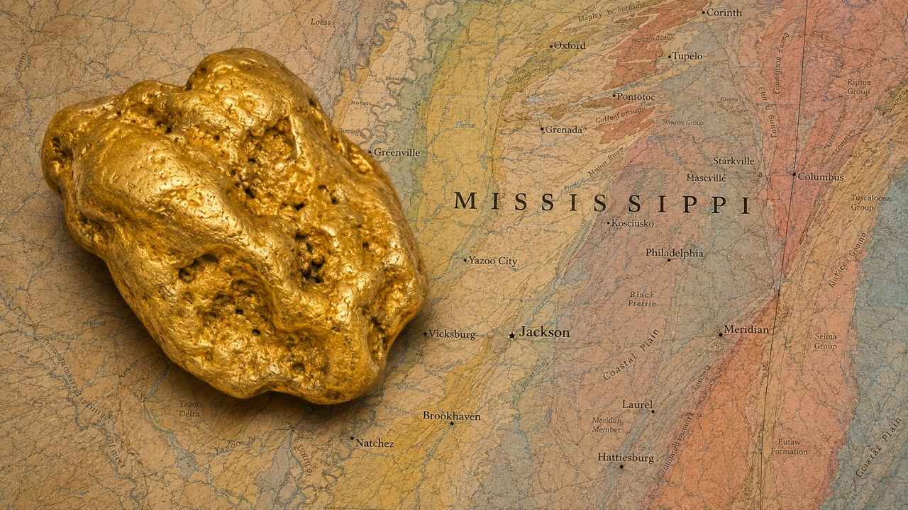
Gold in Mississippi starts with a buried volcano. When geologists pulled drill core from the Jackson Dome, an ancient igneous complex sitting under the city of Jackson, the altered rock came back carrying as much as 503 parts per billion of gold.
With gold trading above $4,000 an ounce, you do not need to find much for a weekend on the water to pay for itself.
Most people who try here make the same mistake. They work the clean white sand sitting on top of a bar and never dig down to the gravel layer and the packed clay underneath, which is exactly where the heavy material lands.
Yes, you can still find gold in Mississippi today, especially along the Tombigbee River gravel bars in Monroe County and the Mississippi River sandbars in Tunica County, where ancient rivers and glacial meltwater have been stacking gravel for millions of years. The state’s own geologists confirm that hobby panners recover gold particles here, and this guide shows you the drainages, the traps, and the gear that keep those particles in your pan.
Our team of geologists and experienced rockhounds built this around gravel provenance, public access, and the features that concentrate fine gold in Coastal Plain streams. Grab a pan and start with the first section below.
Jump To A Section
- Kinds of Gold
- Where Gold Hides
- Best Places
- Techniques
- Fool’s Gold
- How Gold Got Here
- What To Bring
- Best Time
- Other Minerals
- Legal Rules
- FAQ
The Kinds of Gold You Can Find in Mississippi
Two forms of natural gold show up in Mississippi gravel, and both of them reward a slow pan and a good screen. Knowing which one you are chasing tells you how to work the bar and what to look for at the bottom of the pan.
Flour Gold
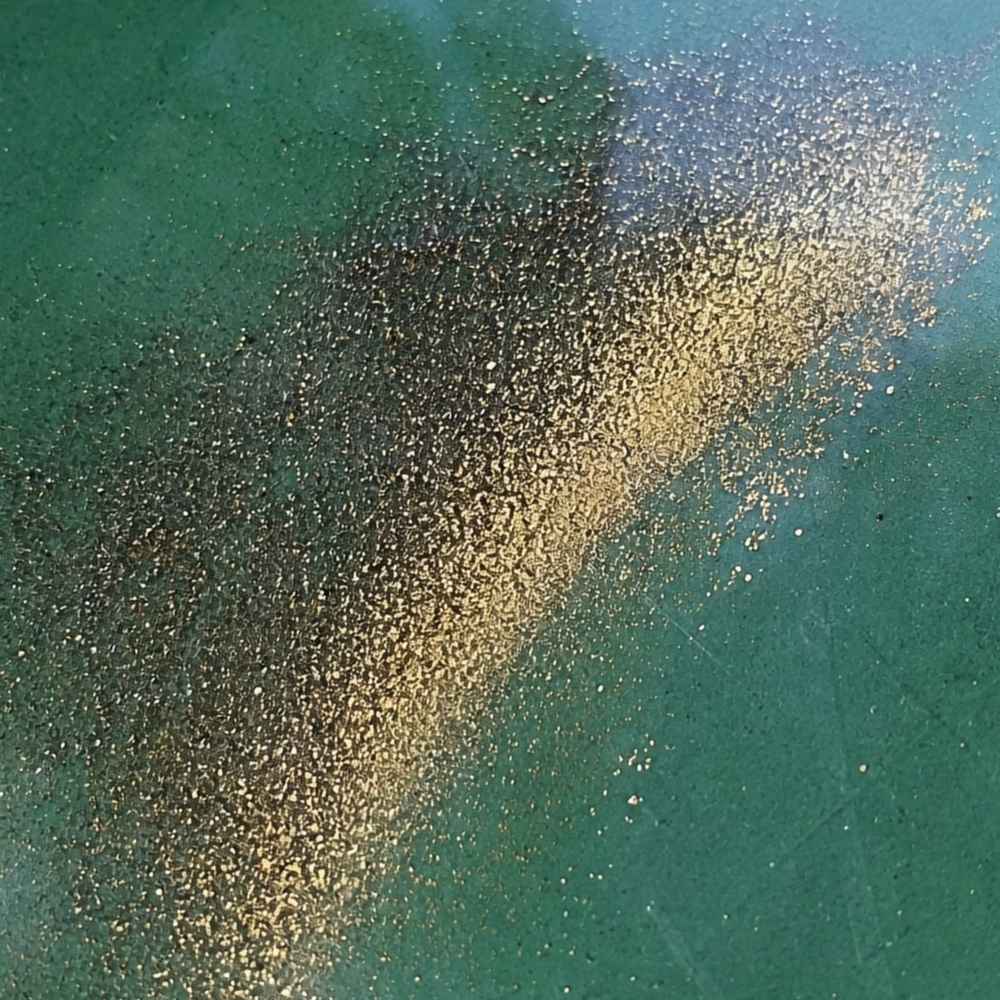
Flour gold is the headline act in this state. These are dust sized specks that traveled hundreds of miles inside moving gravel, getting hammered smaller the whole way, and they settle only where a stream finally runs out of energy.
That long ride is good news for you. Flour gold spreads itself along every bar and every seam instead of hiding in one secret hole, so almost any gravel you reach has a shot at holding color.
Mica is the lookalike that fools nearly everyone, and Mississippi sand is loaded with it. Mica flashes silver or bronze and changes brightness as you tip the pan, while gold holds one steady buttery color from every angle.
Press a wet fingertip on the speck. Gold smears and sticks to your skin, mica shatters into flecks and floats. A Magnifying Loupe: JARLINK 30X 60X Illuminated Loupe turns that call into a two second decision on the bank.
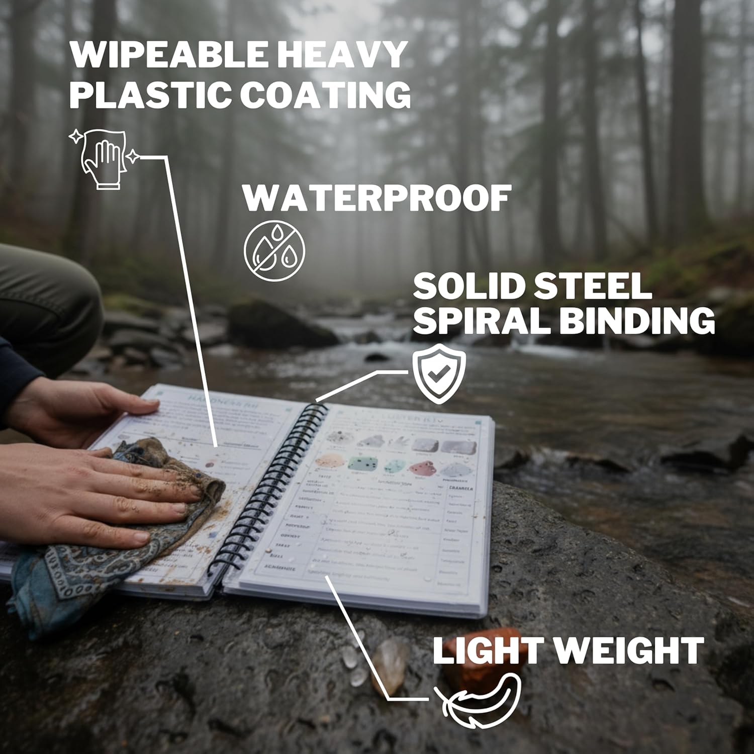
If you want to know exactly what you are looking at before you tip anything back in the water, the Rocks and Minerals of the United States Field Guide is built for this exact moment. It is waterproof, wire bound, and it photographs every specimen raw and cleaned so the thing in your pan matches a picture instead of a guess.
Fine Gold Flakes
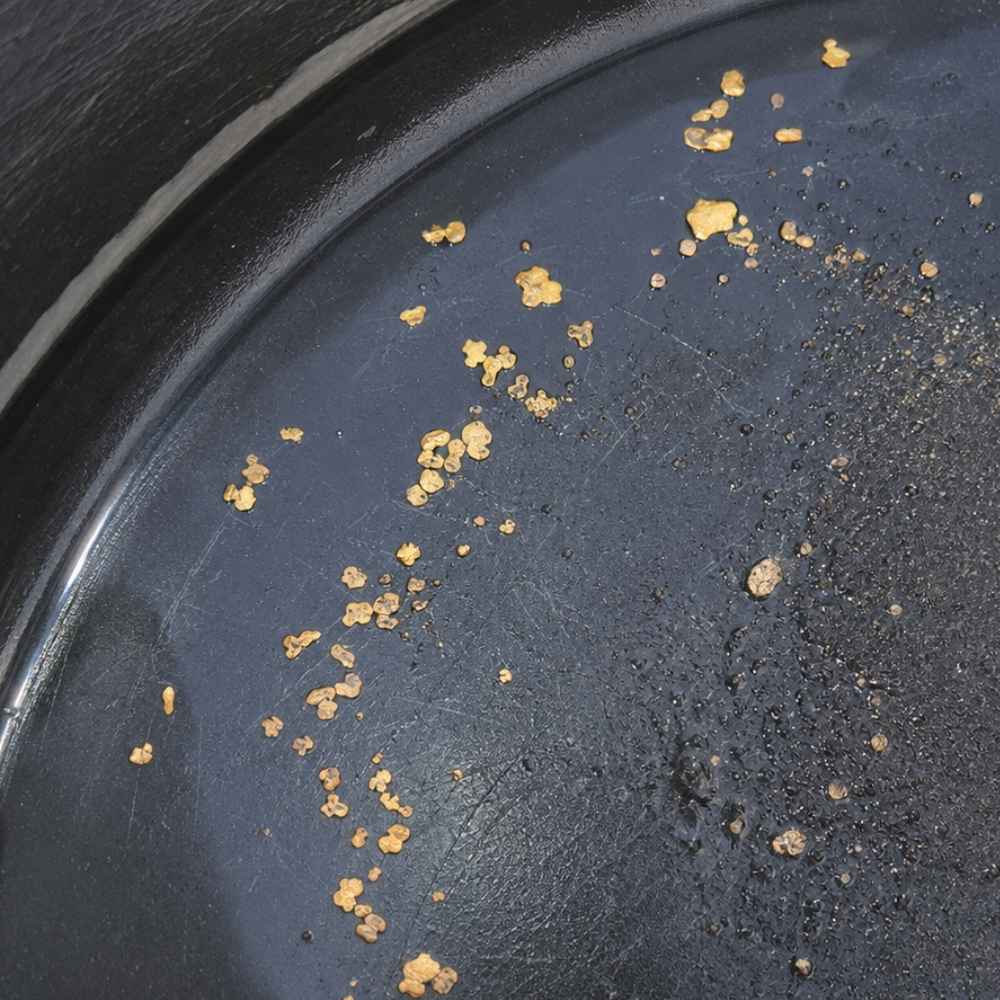
Flakes are the upgrade every Mississippi panner is hunting, and they turn up where a stream has had room and time to sort its load. Think the deep gravel bars on the Tombigbee, the long sand and gravel banks of the Mississippi River, and the coarse runs on Bear Creek up in the northeast corner.
A flake sits flat in the bottom of the pan and refuses to move when you swirl. That stubbornness is the tell, and it is a genuinely great feeling the first time you see it.
Weathered biotite mica is the impostor here. It comes off dark bronze and looks convincing until the light hits it and it goes flat and glassy.
Poke it with a pin. Gold dents and bends like soft metal, biotite splits into paper sheets. A Fine Sifting Classifier: SE 1/8″ Mesh Sifting Screen drops your material into one clean size so a flake cannot ride out over the lip on a raft of sand.
Once you know which of these two you are chasing, the next question is where in the creek they pile up. That is the whole game, and it is next.
Where Gold Hides in Mississippi Streams
Gold is roughly nineteen times heavier than water, so it drops the moment a stream slows down. Mississippi has no mountains doing that work for you, which means you read the sandbar instead, and five features do almost all of it.
Point Bars on the Inside of a Bend
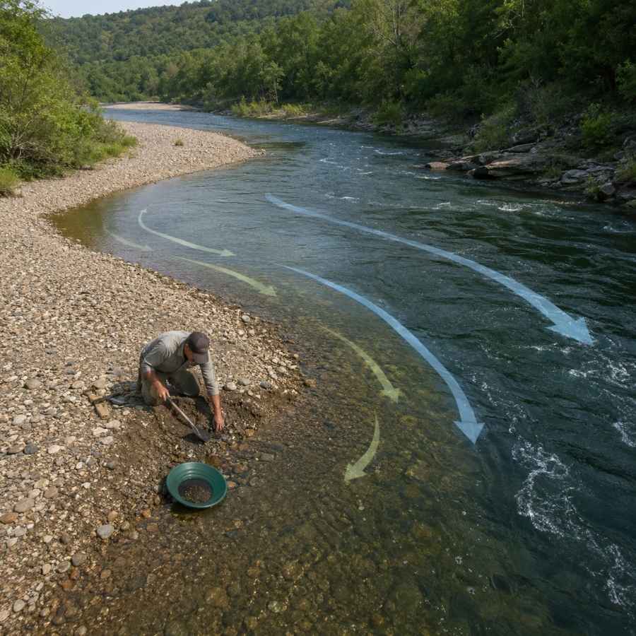
Every bend in a Mississippi stream has a fast cutting outside and a lazy building inside. The inside is where the water gives up its load, so the upstream third of a point bar is the first place your shovel should go.
Walk out to where the sand starts turning to pea gravel underfoot. That texture change is the line you are looking for, and it moves a little every flood. A Digging Shovel: Bully Tools 14 Gauge Round Point Shovel gets you through wet Coastal Plain sand without folding.
The Gravel Layer Under the Sand
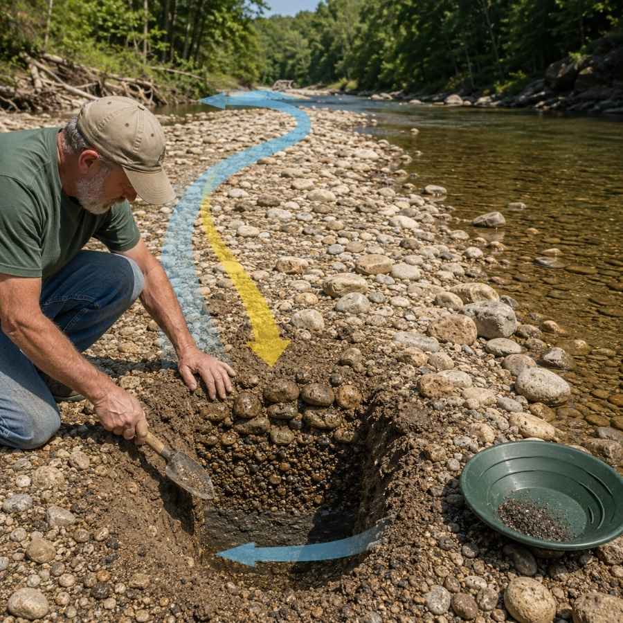
Sand on top is a lid, and the gravel under it is the prize. Mississippi bars usually run a foot or two of loose sand over a tight bed of rounded chert and quartz pebbles, and the heavy material sits in that gravel and on the surface right beneath it.
Dig a test hole first and look at the walls. When the color shifts from pale tan sand to gray brown packed gravel, you have found the layer worth filling buckets from. A Classifier Screen: SE Half Inch Sifting Screen strips out the cobbles so you are only panning the material that matters.
Clay Hardpan, the Deep South’s Bedrock
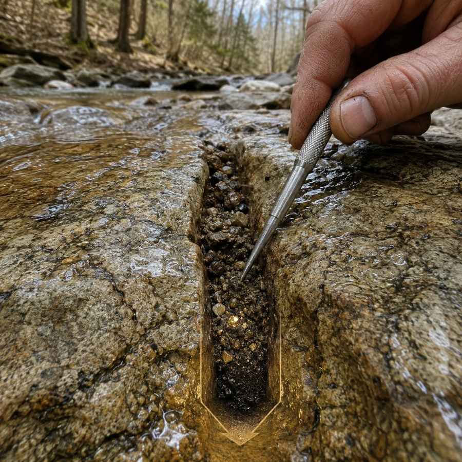
Most of Mississippi has no bedrock in the channel, so stiff blue gray clay does the job instead. Gold cannot punch through packed clay, so it stops right on top of it and stays there.
Feel for the change with your shovel. Loose gravel gives, then suddenly the blade skids and squeaks, and that squeak is your false bedrock.
Scrape the top inch of clay along with the gravel sitting on it, because that skin is where everything heavy has collected. A Crevice Tool: ASR Outdoor Steel Crevice Tool Set peels that layer cleanly and reaches the cracks a shovel cannot.
Log Jams and Root Wads
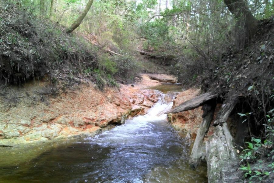
Southern creeks build dams out of fallen timber, and every one of them is a free sluice box. Water piles into a log jam, loses speed, and drops its heavy load in the gravel packed against the upstream side.
Work the upstream face and the pocket right under the biggest log. Root wads on a cut bank do the same thing, holding old gravel in place while the rest of the bank washes away. A Hand Trowel: Edward Tools Bend Proof Trowel fits into those tight pockets where a shovel is useless.
Black Sand Streaks
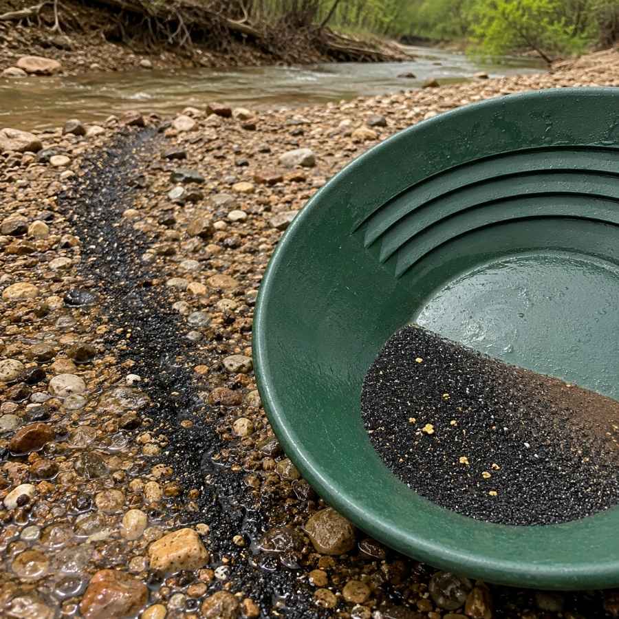
A dark gray streak across a pale sandbar is the best free signal in the state. Black sand is magnetite and ilmenite, both heavy, and they park in the same spots gold does, so a streak tells you the current is already doing your sorting.
Scoop the streak, not the pretty clean sand beside it. A Black Sand Magnet: SE Magnetic Separator Pick Up Tool with Quick Release pulls the magnetics off your concentrate at the end of the day so only the good stuff is left in the vial.
Always Confirm Access and Collection Rules!
Before heading out to any of the locations on our list you need to confirm access requirements and collection rules for both public and private locations directly with the location. We haven’t personally verified every location and the access requirements and collection rules often change without notice.
Many of the locations we mention will not allow collecting but are still great places for those who love to find beautiful rocks and minerals in the wild without keeping them. We also can’t guarantee you will find anything in these locations since they are constantly changing.
Always get updated information directly from the source ahead of time to ensure responsible rockhounding. If you want even more current options it’s always a good idea to contact local rock and mineral clubs and groups
The Best Places To Find Gold in Mississippi
These are the gravel bearing drainages worth loading the truck for, grouped by region so you can start with whatever sits closest to your driveway. Access runs from a paved boat ramp you can reach in sneakers to a sandbar you float a canoe to.
Northeast Mississippi
The northeast corner is the only part of Mississippi with real rock in the ground, and it holds the oldest and coarsest gravel in the state. This is where a pan feels most like prospecting anywhere else in the country.
1. Bear Creek and Bay Springs Lake, Tishomingo County
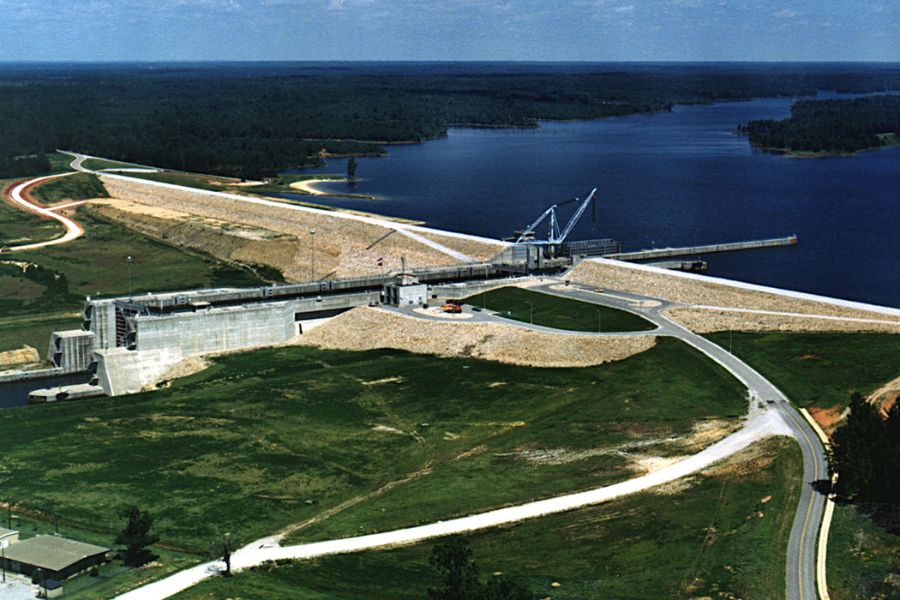
Tishomingo County is the one corner of Mississippi where Paleozoic bedrock actually reaches the surface, and Bear Creek cuts straight through it. You get sandstone ledges, chert gravel, clear water, and a stream gradient that behaves the way a prospecting creek is supposed to behave.
The gravel here came down the ancestral Tennessee River drainage off deeply weathered Paleozoic rock, which is the same kind of country that feeds gold into creeks in Alabama and Tennessee. That provenance is why the northeast corner is the first place experienced Mississippi panners go.
Public access is good. Bay Springs Lake sits on the Tennessee Tombigbee Waterway with Corps of Engineers recreation areas, ramps, and campgrounds, and the Bear Creek float run above the lake has established put ins. Tishomingo State Park is beautiful but it is a look and photograph stop, because state park rules prohibit removing rocks and minerals without written authorization.
Fine flakes and flour gold are the target, and crevicing pays better here than anywhere else in Mississippi because there is genuine bedrock in the channel. Work the seams below the ledges and the gravel packed against the upstream side of every boulder.
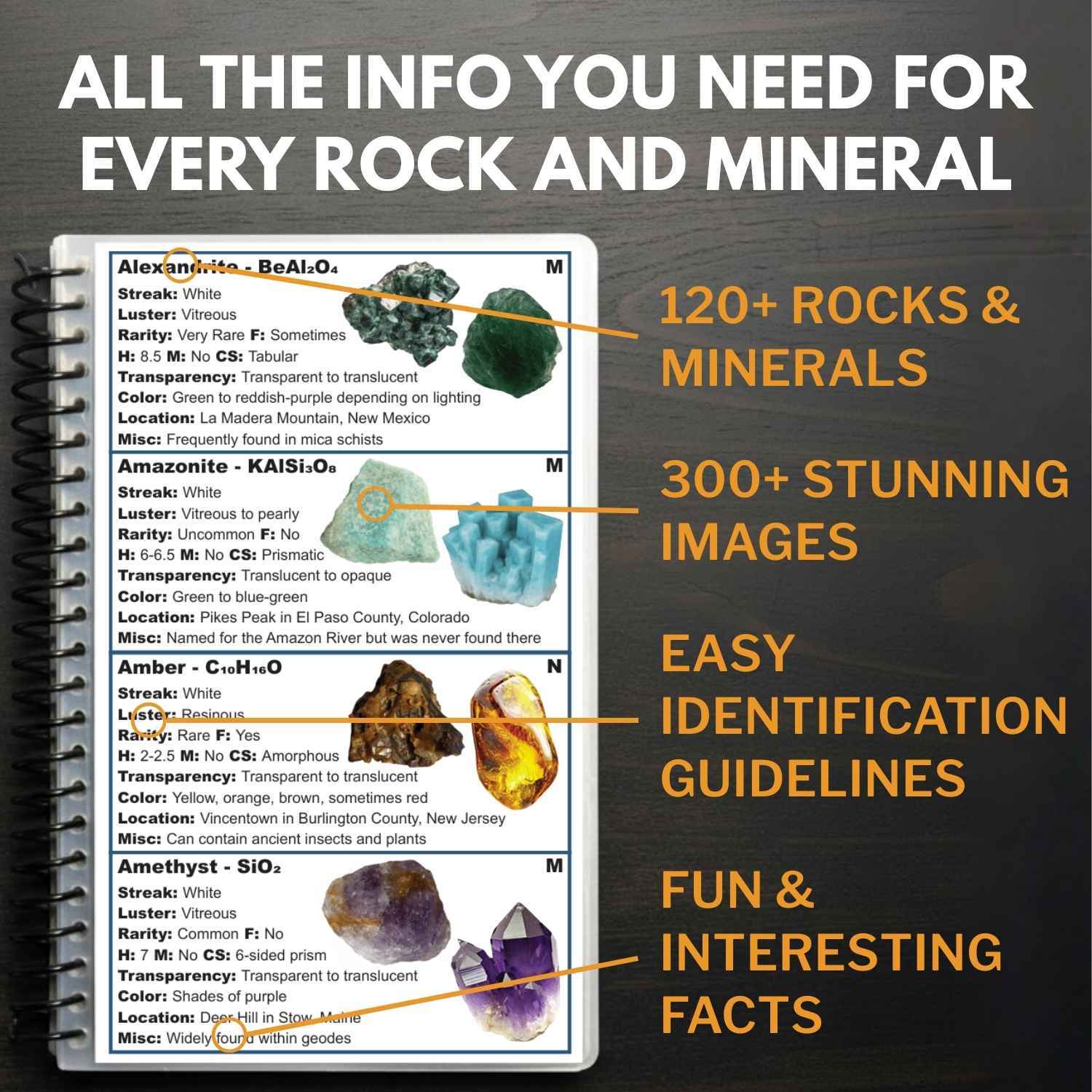
Bring a container for the rest of it, because this creek throws up chert, quartz, banded jasper, and Paleozoic fossils in the same shovel, and plenty of people have tossed something worth real money back in the water because it did not look like gold. The Rocks and Minerals of the United States Field Guide settles those calls on the bank with 300 plus true color photos and hardness and streak data for every specimen.
A Rock Pick: Estwing Geo Paleo Rock Pick lets you open a promising chert cobble and see what the fresh face says.
Difficulty rating: 3 out of 5
2. Tombigbee River Gravel Bars, Monroe and Itawamba Counties
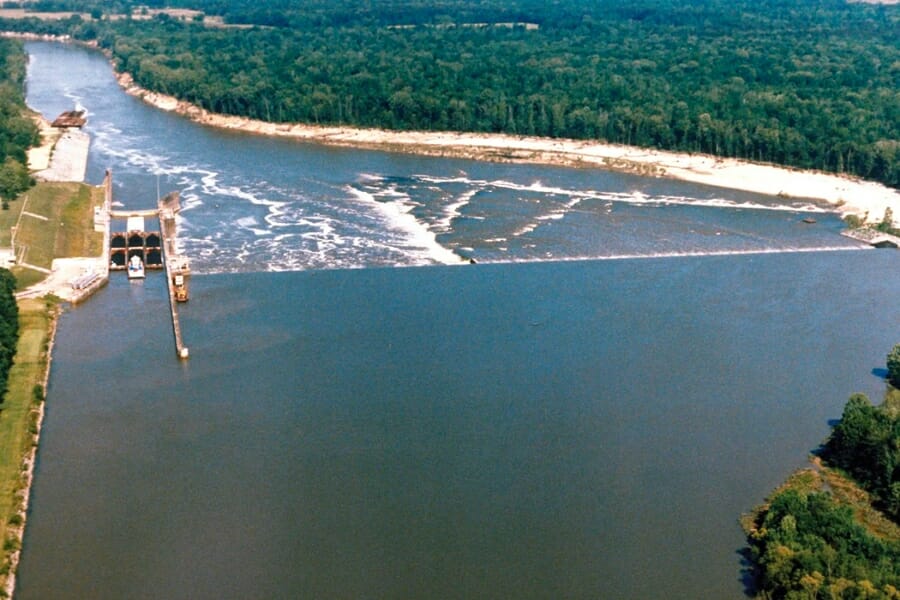
The Tombigbee moves more gravel than any other river in Mississippi, and the state survey ranks this corridor as the most heavily worked gravel district in the state. Commercial operations have mined the modern channel around Amory for decades, which tells you exactly how much gravel this river is carrying.
That gravel comes out of the Tuscaloosa Formation, laid down by Cretaceous rivers draining the Appalachians and the Nashville Dome. Every flood pulls more of it out of the hills and restacks it on the bars downstream, so you are never working picked over ground for long.
Access is easy along the Tennessee Tombigbee Waterway, where the Corps of Engineers maintains ramps, day use areas, and long stretches of public bank. Aim for the bars that surface at low water between Amory and Fulton.
Flour gold and fine flakes are what you are after, and this is the best sluicing river in Mississippi because you have unlimited classified material and steady current in the same place. Set the sluice at a shallow angle so the fines stay in the riffles.
Expect chert, quartz, jasper, agate, and petrified wood in the same shovel. A Sluice Box: Keene A52 Hand Sluice turns an afternoon here into real volume.
Difficulty rating: 2 out of 5
Northwest Mississippi
The northwest is Delta country, and its gravel came from farther away than anything else in the state. Material from the glaciated north rode the river down and dropped it right on Mississippi’s western edge.
3. Mississippi River Sandbars, Tunica and DeSoto Counties
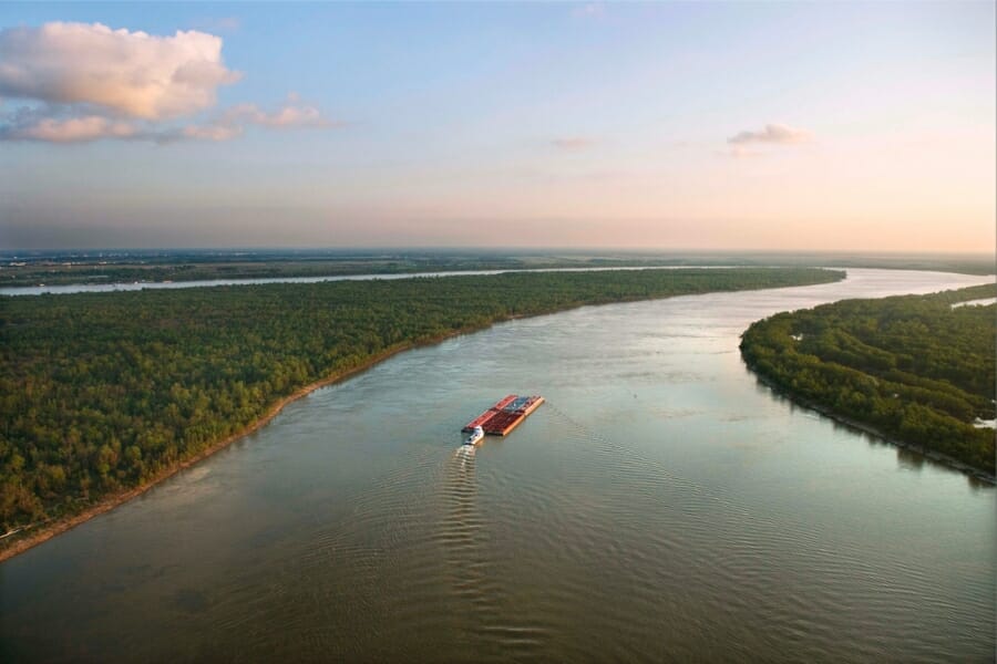
The Mississippi River is the single biggest gold delivery system this state has. Meltwater rivers draining the ice sheets scoured Precambrian bedrock in Minnesota, Wisconsin, and Canada, and the river has been hauling that material south past Tunica and DeSoto Counties ever since.
You do not have to take that on faith. Lake Superior agates and Keokuk geodes turn up in Mississippi gravel, and both of them came from up north on the same conveyor belt, which is proof that material from gold bearing country reaches this state.
Access is genuinely easy here. Tunica RiverPark, public landings, and the long open sandbars that emerge at low water give you room to work without knocking on a door, and the bars are flat and walkable.
Flour gold is the target and volume is the method. Screen hard, run a big deep pan, and finish small, because everything the river brings down here is fine and light enough to travel.
The same bars produce agate, jasper, quartz, and the occasional piece of purple Sioux Quartzite carried down from Minnesota, all of which are covered in our guide to Mississippi rocks, minerals, and gems. A Deep Riffle Gold Pan: Garrett 15″ Dual Riffle SUPERSLUICE Gold Pan holds enough material per lift to make a big river worth the drive.
Difficulty rating: 2 out of 5
Central Mississippi
Central Mississippi sits on Citronelle and terrace gravels perched in the hills, and its rivers have spent the last two million years cutting into them. That means fresh material arriving on the bars every single year.
4. Big Black River, Hinds and Madison Counties
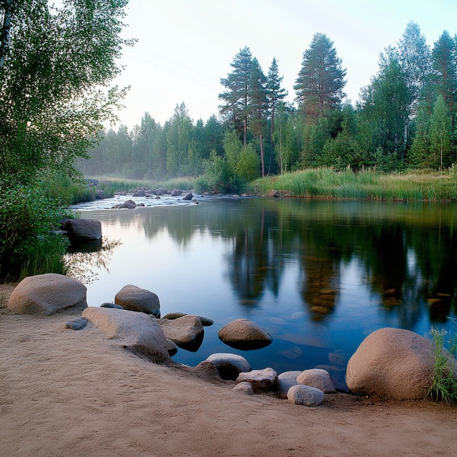
The Big Black runs more than 300 miles across the middle of the state, and the reach through Hinds and Madison Counties gives you the best mix of gravel and access on the whole river. Slow muddy pools alternate with swift sandy runs, and the swift runs are where the gravel piles up.
The river cuts directly into old terrace gravel on the bluffs above it, which means every high water event dumps unworked material straight into the channel. Fresh gravel is the whole reason this river stays interesting.
Public bridge crossings and landings along Highway 22 and Highway 27 give you legal places to park and get to the water. The banks are steep in places, so plan your exit before you climb down with a full bucket.
Flour gold is the prize and patience is the technique. Classify aggressively, pan slow, and work down to the clay hardpan wherever the water is low enough to reach it.
You will also turn up petrified wood, chert, carnelian, and ironstone concretions here. A Fine Sifting Classifier: SE 1/8″ Mesh Sifting Screen is the piece most people on this river are missing.
Difficulty rating: 3 out of 5
Southwest Mississippi
Southwest Mississippi is the loess bluff country, and the gravel sitting under that loess is some of the best in the state. Two national forest rivers here give you public ground and beautiful water in the same trip.
5. Homochitto River, Franklin County
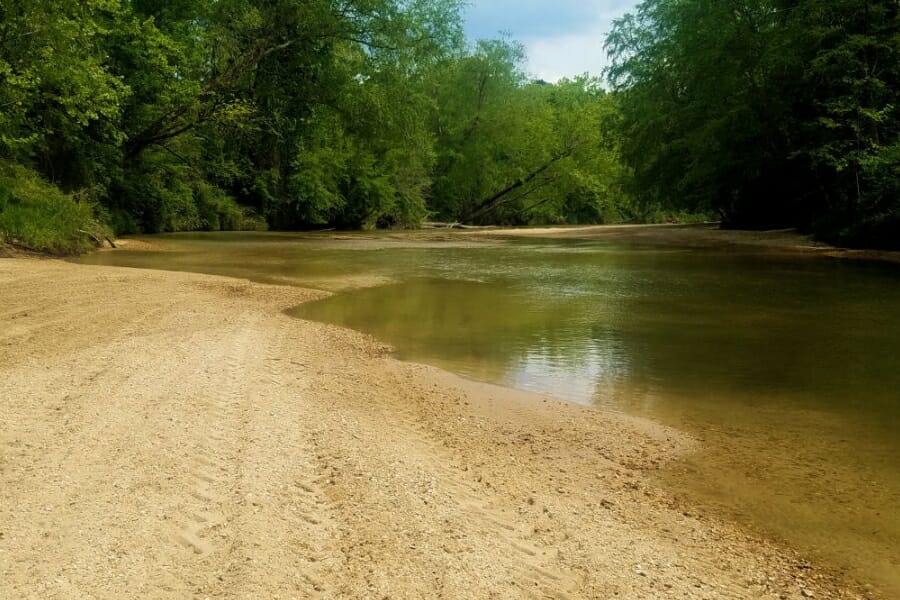
The Homochitto runs through the Homochitto National Forest with wide, bright, clean sand and gravel bars for mile after mile. It is one of the most pleasant places in Mississippi to spend a day with a pan, and the public land solves the access problem that makes so much of this state complicated.
The gravel here comes out of pre loess terrace deposits and the Citronelle Formation, both laid down by ancient rivers carrying material from the north and east. The Homochitto is actively cutting into those deposits, which is why its bars run so gravelly compared to neighboring streams.
Forest roads reach the river at several points and there are established crossings and camping areas. Call the district office before you go, because national forest rules on collecting vary and the staff will tell you exactly what is allowed on the stretch you want.
Flour gold is what you are hunting, and the trick is finding the gravel lens under the sand. Dig test holes across the bar until you hit the packed layer, then work only that.
Petrified wood, agate, jasper, and chert show up constantly on these bars. A Finish Pan: Garrett Prospecting 10″ Backpacker Gold Pan is what turns a bucket of concentrate into a vial you can actually show people.
Difficulty rating: 2 out of 5
6. Bogue Chitto River, Pike and Walthall Counties
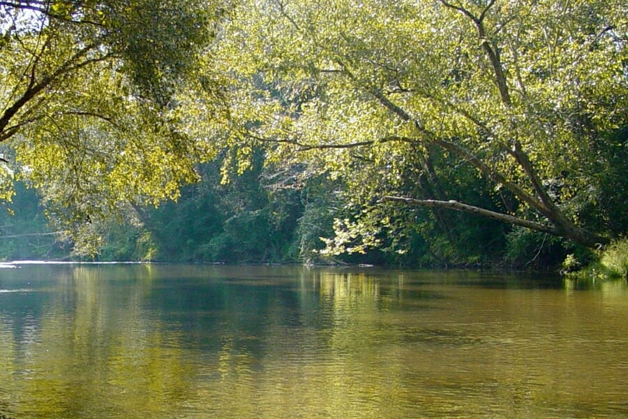
The Bogue Chitto is a gravel river with a canoe culture already built around it, which makes it one of the friendliest places in Mississippi to get started. Commercial gravel washing operated in this valley for years, and that is a straight answer about how much gravel the river moves.
Sand and gravel bars build on every bend, and the water runs clear enough that you can read the bottom before you dig. That visibility is a real advantage when you are learning to spot the gravel lens.
The Bogue Chitto Water Park in Pike County gives you managed public access, parking, and a place to launch, and outfitters run float trips that drop you at bars most people never reach. Take the float option at least once, because the best bars are always the ones with no road to them.
Flour gold is the target and panning is the method. Work the upstream nose of each bar and dig until the sand turns to pea gravel.
Agate, jasper, petrified wood, and quartz pebbles come off these bars all day. A Digging Shovel: Bully Tools 14 Gauge Round Point Shovel is the one tool you should not leave in the truck.
Difficulty rating: 2 out of 5
Southeast Mississippi
The southeast is Piney Woods country, and its creeks run over white sand and Citronelle gravel through the biggest block of public land in the state. This is the region for people who want to camp and prospect in the same trip.
7. Black Creek, Perry and Forrest Counties
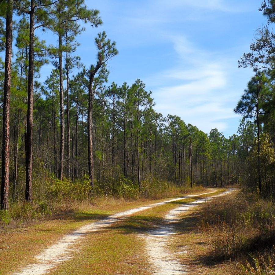
Black Creek is Mississippi’s only National Wild and Scenic River, and it flows through the De Soto National Forest with tall white sandbars on nearly every bend. It is the prettiest water in this guide and one of the easiest to reach.
Citronelle Formation gravel caps the hills throughout this part of the state, and Black Creek is steadily cutting into it. The gravel that ends up on these bars traveled here on Pliocene rivers from far to the north, which is the same delivery story that puts color in gravel all across the Coastal Plain.
Janice Landing and Fairley Bridge Landing give you developed public access, and the creek is a classic canoe run between them. Note that the Black Creek Wilderness has its own restrictions, so plan your digging outside the wilderness boundary and check current rules with the De Soto Ranger District.
Flour gold is what you are after, and the gravel pockets at the base of the tall sandbars are the feature to target. Those bars are constantly collapsing and rebuilding, which delivers unworked gravel right to your feet.
Petrified wood, agate, chert, and ironstone concretions all turn up along this creek. A Snuffer Bottle: Garrett Gold Guzzler Bottle makes sure the specks you worked all day for actually make it into the vial.
Difficulty rating: 3 out of 5
More Proven Places To Find Gold in Mississippi
These spots earn a trip too, and several of them sit closer to a town than the headline locations do. Check collection rules and access for each one before you go, because most Mississippi stream frontage is privately owned.
Northeast Mississippi
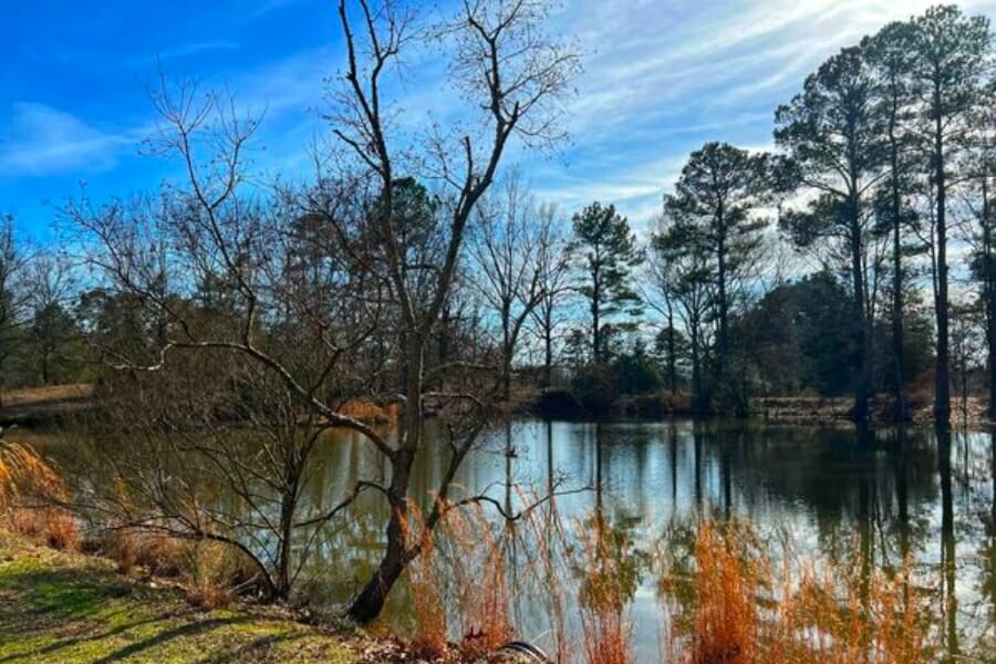
Buttahatchie River, Lowndes County. The Buttahatchie is the most intensively mined gravel stream in northeast Mississippi, which is the clearest possible signal about how much material it carries. Its bars run heavy in chert and quartz from the same Tuscaloosa Formation gravels that feed the Tombigbee, and the low water bars near Caledonia are the obvious place to start. Frontage is mostly private, so line up permission before you park.
Twentymile Creek, Prentiss County. This Tombigbee headwater cuts through basal Cretaceous gravel and drops it in coarse bars along its whole run. The gravel is chunky, well rounded, and easy to read, which makes it a good creek to learn the sand over gravel pattern on. Access is by bridge crossings and county roads, so ask at the nearest house before you work a bank.
Northwest Mississippi
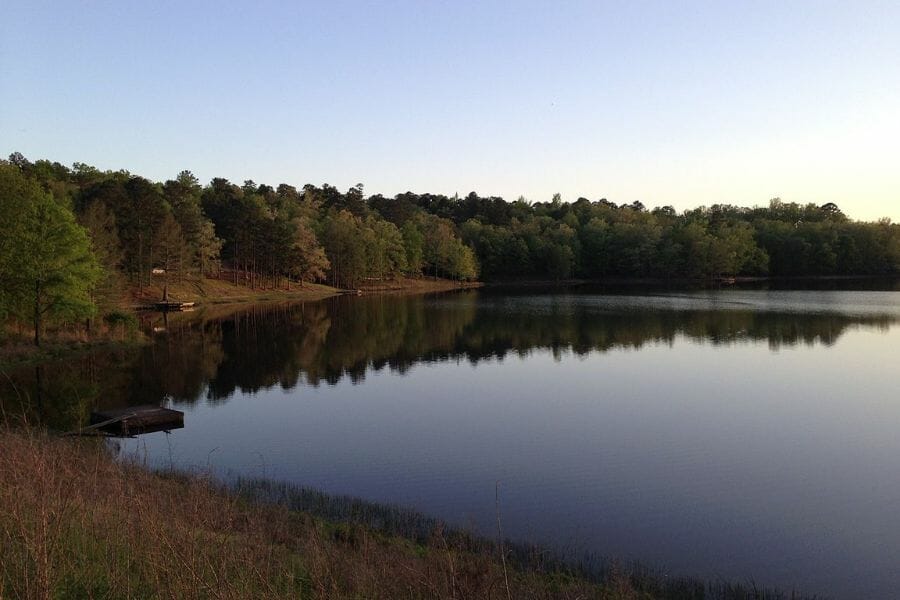
Holly Springs National Forest Creeks, Benton and Marshall Counties. The small creeks draining this national forest cut through gravelly upland deposits and are a known source of petrified wood, which means they are moving the right kind of material. Public forest land solves the access problem that makes so much of north Mississippi difficult. Check with the ranger district on current collecting rules before you dig.
Central Mississippi
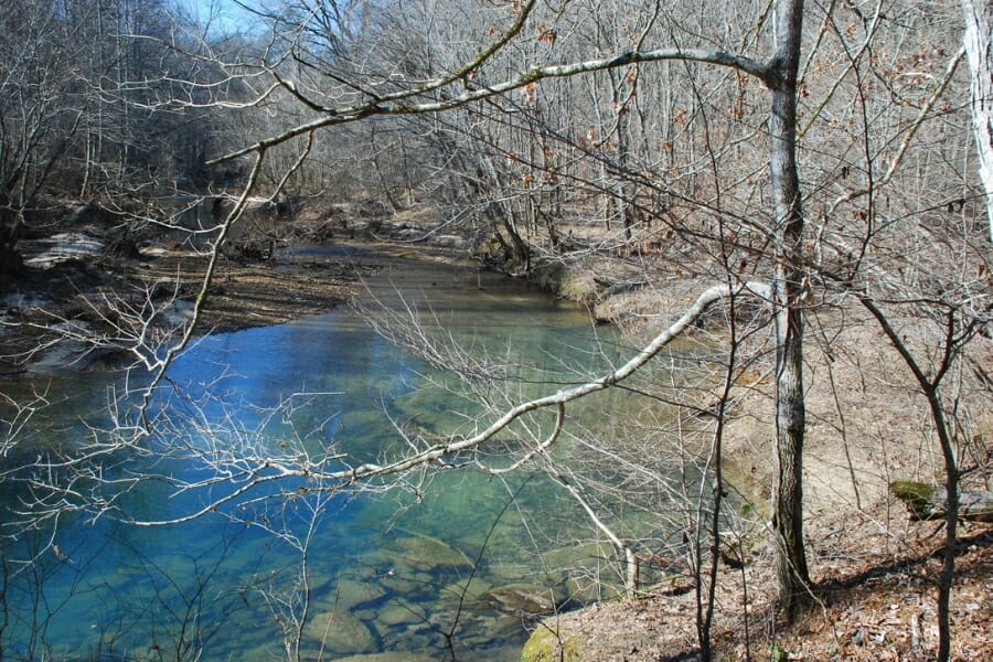
Copiah Creek, Copiah County. The hills around Crystal Springs sit on some of the thickest Citronelle Formation gravel in the state, and Copiah Creek drains straight through it. Gravel pits in this area have produced agate, jasper, and petrified wood for generations, and the creek carries the same material. Pits are private property, so work the public crossings or ask permission first.
Pearl River Gravel Bars, Lawrence and Marion Counties. Commercial gravel washing operated on this reach of the Pearl for years, which tells you the river is moving plenty of the coarse material gold rides with. The bars around Monticello and Columbia build wide at low water and are easy to read. Public landings give you legal launch points, and the bed itself is private, so ask before you dig.
Mississippi River Bars, Warren County. The Vicksburg reach carries the same northern gravel as the bars upstream, and the bluffs here expose the pre loess terrace deposits that make western Mississippi gravel country. Low water in late summer opens up bars you cannot reach the rest of the year. Vicksburg National Military Park is federal park land where collecting is off limits, so work the public river access points instead.
Thompson Creek and the Yazoo River, Yazoo County. These two waterways drain the Yazoo hills and are a long standing source of agate, jasper, and petrified wood in Mississippi rockhounding circles. The gravel that carries those stones is the same gravel that carries color. Bridge crossings and public landings are your access, and permission is the rule for everything else.
Southwest Mississippi
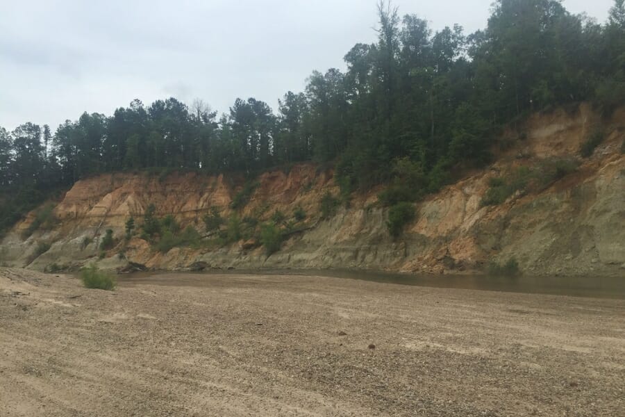
Bayou Pierre, Claiborne County. Bayou Pierre cuts deep into the loess bluffs near Port Gibson and exposes gravel and fossil beds that have drawn collectors for decades. Claiborne County also turns up in the state’s own file of historic gold reports, which makes this a fun place to work a pan. The banks are steep and unstable, so pick a gentle bar and watch the weather upstream.
McCall Creek, Franklin County. This small Homochitto tributary near Meadville runs over clean gravel and is a well known petrified wood and agate creek. Small water is easy water to read, and the gravel here sits shallow enough to reach with a trowel. Nearly all of it is private, so a knock on the door comes first.
Southeast Mississippi
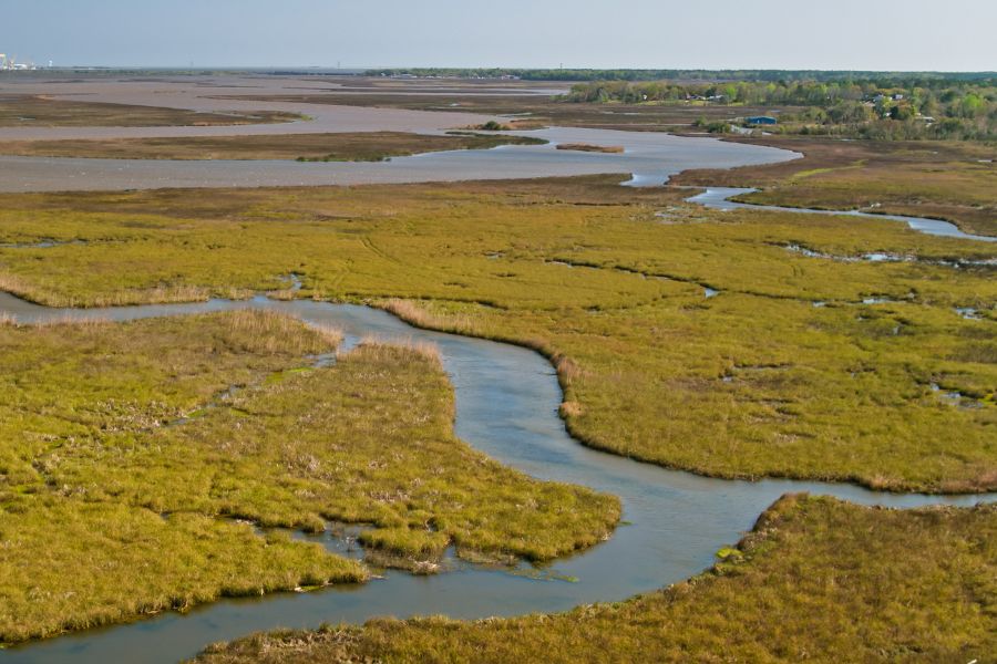
Pascagoula River, George County. The Pascagoula is the largest unimpounded river left in the lower 48 states, which means nothing has stopped it from sorting its own gravel. Huge white sandbars build on every bend and rebuild completely after every flood. Public landings around Lucedale and Wade give you legal access to the water.
Red Creek, Stone County. Red Creek runs tea colored water over bright white sand and gravel through the De Soto National Forest before joining the Pascagoula. The contrast between dark water and pale sand makes reading a bar unusually easy here. Forest crossings give you public access, and the ranger district can tell you the current rules.
Chickasawhay River, Wayne County. The Chickasawhay around Waynesboro is a well known collecting river for petrified wood and fossils, and it cuts through the same gravel bearing formations as the rest of southeast Mississippi. Sand and gravel bars stack on the inside of every bend. Public landings are limited, so a boat or a landowner conversation opens up the best water.
The Best Gold Hunting Techniques in Mississippi
Three techniques cover everything Mississippi gold asks of you, and all three are built around one idea: catch the small stuff. Fine gold is what these gravels deliver, so every method below is tuned to keep dust and flakes from washing over the lip.
Gold Panning (Difficulty: 1 out of 5)
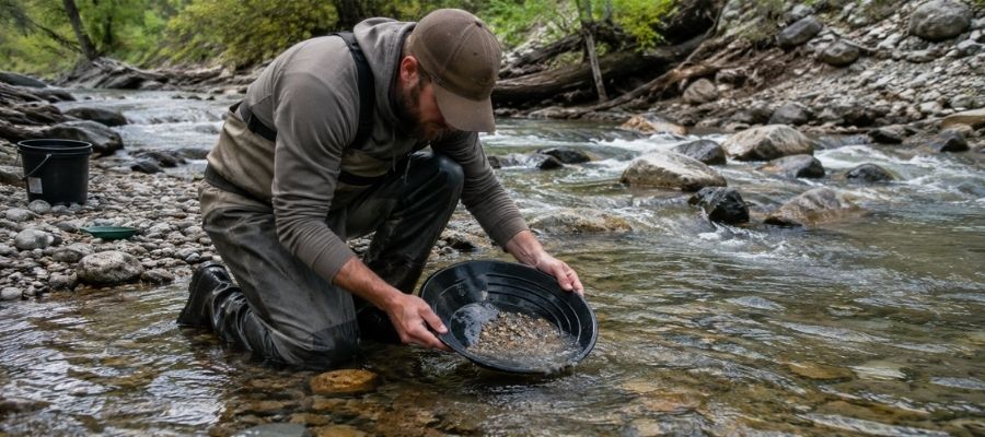
Panning is swirling gravel and water in a shallow pan so the heavy material sinks and the light material washes away. It takes about ten minutes to learn and a season to get good at.
In Mississippi it works everywhere, and it works best on the gravel bars of the Tombigbee, the Homochitto, and the Bogue Chitto. Tip the pan less than you think, keep the water moving gently, and always finish in a small pan where a speck has nowhere to hide.
Essential Tools
- Deep Riffle Gold Pan: Garrett 15″ Dual Riffle SUPERSLUICE Gold Pan
- Finish Pan: Garrett Prospecting 10″ Backpacker Gold Pan
- Classifier Screen: SE Half Inch Sifting Screen
- Snuffer Bottle: Garrett Gold Guzzler Bottle
- Glass Storage Vials: SE Glass Vials with Caps 144 Pack
- Practice Paydirt: Gold Strike Gold Panning Paydirt
Crevicing (Difficulty: 2 out of 5)
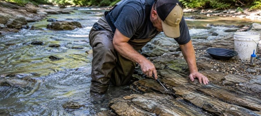
Crevicing means scraping out the cracks and seams that hold heavy material and panning what comes out. Every crack is a trap that has been collecting since the last flood scoured it clean.
Mississippi gives you two versions of this. Up in Tishomingo County you get real sandstone and chert bedrock with true seams, and everywhere else you scrape the top skin of packed clay hardpan, which stops gold just as effectively as stone does.
Essential Tools
- Crevice Tool: ASR Outdoor Steel Crevice Tool Set
- Rock Pick: Estwing Geo Paleo Rock Pick
- Hand Trowel: Edward Tools Bend Proof Trowel
- Magnifying Loupe: JARLINK 30X 60X Illuminated Loupe
Sluicing (Difficulty: 3 out of 5)
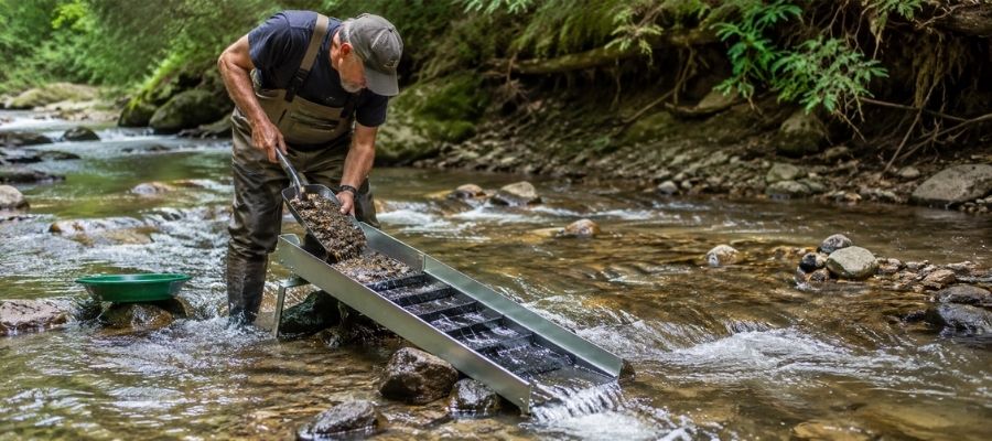
A sluice is a trough with riffles that you set in moving water so the current does the panning for you. You feed classified gravel in at the top and check the riffles every hour or so.
Sluicing pays off on the Tombigbee, the Mississippi River bars, and the Pascagoula, where you have unlimited material and steady current in the same place. Set the angle shallow, because too much slope sends flour gold straight out the back.
Non motorized sluices can need approval from the managing agency on public land and permission from the landowner everywhere else, so make the call before you carry one in.
Essential Tools
- Sluice Box: Keene A52 Hand Sluice
- Digging Shovel: Bully Tools 14 Gauge Round Point Shovel
- Fine Sifting Classifier: SE 1/8″ Mesh Sifting Screen
- Black Sand Magnet: SE Magnetic Separator Pick Up Tool with Quick Release
How To Tell Real Gold From Fool’s Gold
Pyrite and mica fool more Mississippi panners than anything else, and the state geologists have the files to prove it. People have carried in pyrite, marcasite, mica flakes, and even chips of yellow paint hoping for an assay, so you are in good company if you have to check.
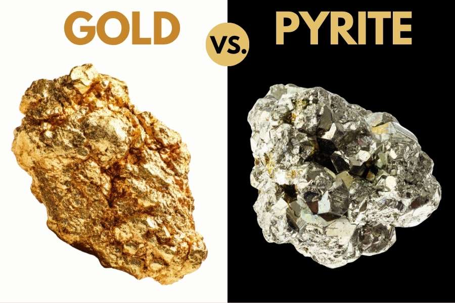
Use the shadow test first. Move your hand so the speck falls into shade, and real gold keeps its warm yellow glow while pyrite goes dull and gray, because pyrite only shines when light hits it head on.
Then use the poke test. Press the piece with a pin or a knife tip, and gold dents and smears like soft butter while pyrite cracks and crumbles into brassy dust.
Shape is the last tell. Pyrite and marcasite grow in cubes and sharp geometric faces, and gold almost never does, so anything with straight edges and flat square sides came out of a concretion, not a placer.
The expensive mistake is not mistaking pyrite for gold. It is throwing away the petrified wood, the agate, the carnelian, or the Keokuk geode sitting next to your gold because you could not name it. The Rocks and Minerals of the United States Field Guide covers 140 rocks, crystals, minerals, and gemstones with hardness, streak, and composition, and every page is laminated and wire bound so it lives in a wet pack all season.
How Gold Got Into Mississippi
Mississippi’s gold arrived by river, and that is why the spots in this guide sit where they sit. Three separate delivery systems dropped material here, and each one left a different kind of gravel behind.
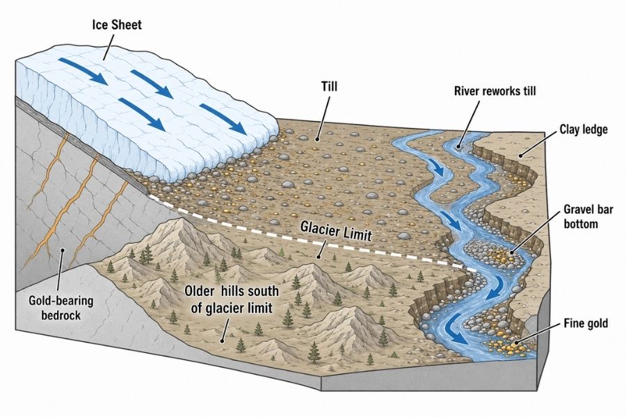
Start with the oldest. In the Late Cretaceous, big rivers drained the Appalachians in Alabama and the Nashville Dome in Tennessee and dumped their load across what is now northeast Mississippi. That material became the Tuscaloosa Formation gravel that still caps the hills in Tishomingo, Itawamba, Lowndes, and Monroe Counties.
The second delivery came from the north on ice. Glaciers ground down Precambrian bedrock in Minnesota, Wisconsin, and Canada, meltwater rivers carried the debris south, and the ancestral Mississippi River spread it along the state’s western edge as pre loess terrace gravel. Lake Superior agates and Keokuk geodes in Mississippi gravel are the receipt for that trip, and gold rode the same current.
The third came later and covered the south. Pliocene rivers laid the Citronelle Formation across the highest ground between Interstate 20 and the coast, which is why Copiah, Pike, Forrest, and Perry Counties all have gravel sitting on their hilltops today.
There is a local source too. Hydrothermal fluids moved through the igneous rock of the Jackson Dome and left gold behind in the altered rock, which is what the drill core results picked up. That is Mississippi gold that never had to travel at all.
Every one of those deliveries produced gold that spent millions of years getting hammered smaller inside moving gravel. That is why what waits in your pan is fine, bright, and spread across bars all over the state instead of locked in one hillside.
What To Bring for a Mississippi Gold Day Trip
Pack for heat, wet feet, and a long walk across soft sand. Mississippi creeks are easy country compared to a mountain river, and the difference between a great day and a miserable one is usually three items you left at home.
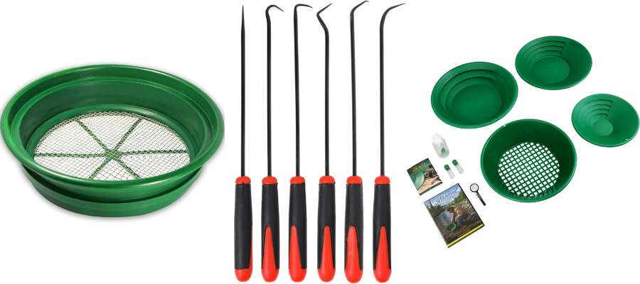
Gear
- Gold pan and finish pan (see Techniques)
- Classifier screens, coarse and fine (see Techniques)
- Crevice tool and a trowel (see Techniques)
- Snuffer bottle and glass vials (see Techniques)
- Loupe for on the spot identification
Everything Else
- Wading boots or old sneakers you do not mind soaking, plus dry socks
- Four liters of water in summer, because Mississippi humidity is no joke
- Sunscreen and a wide brimmed hat for open sandbars with zero shade
- Bug spray from April through October, plus a snake awareness habit
- A five gallon bucket, which doubles as a seat and a haul bag
- Printed permission slips or permit paperwork
- A trash bag, because you leave the sandbar cleaner than you found it
Starting from zero? The Beginner Starter Kit: Garrett Deluxe Gold Pan Kit puts pans, classifiers, vials, and a snuffer in one box so you are not assembling a kit piece by piece.
The Best Time of Year To Hunt for Gold in Mississippi
Late summer through late fall is prime season across the whole state, because low water exposes bars and clay hardpan you cannot reach in spring. Mississippi also gives you the longest season of almost any state, since winter here rarely shuts anything down.
Northeast Mississippi
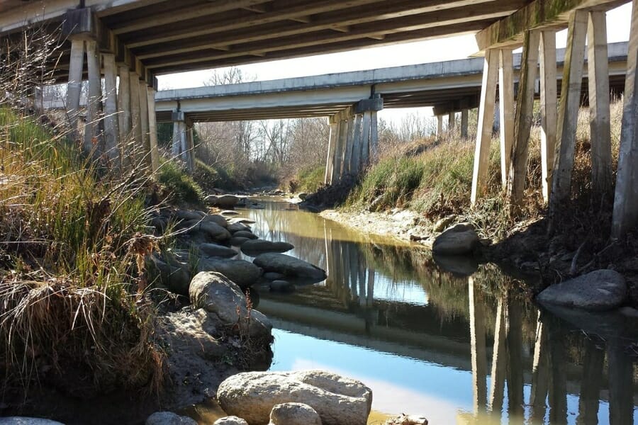
Best months are June through November. Bear Creek and the upper Tombigbee run their clearest and lowest through late summer, which puts the bedrock ledges and the deep gravel bars within reach.
Fall is the reward season up here. The heat breaks, the bugs quit, the hardwoods turn, and the water is as low as it gets all year.
Northwest Mississippi
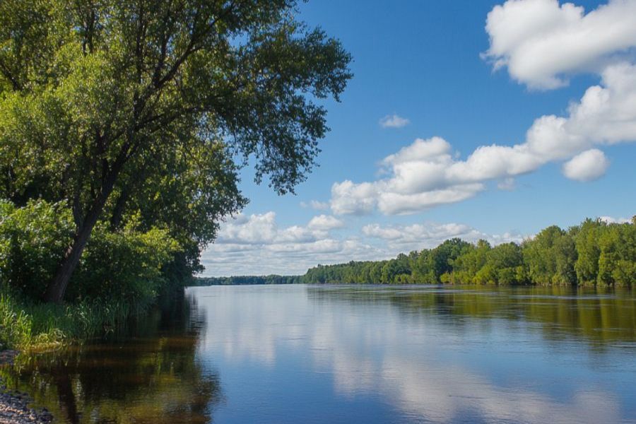
Best months are August through December. The Mississippi River drops hard through late summer and fall, and the enormous sandbars that appear at low water simply do not exist in spring.
Watch the river stage forecast before you drive. A one foot change on the gauge can double or erase the bar you were planning to work.
Central Mississippi
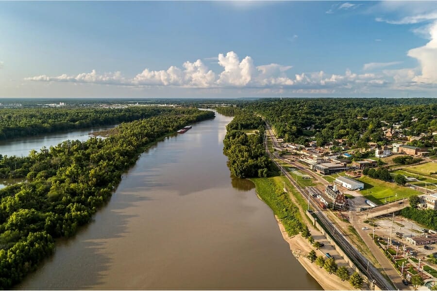
Best months are July through November. The Big Black and the Yazoo drainage carry mud in spring and clear up beautifully once the summer rains taper off.
This region is also the most forgiving in winter. On a mild January day the Big Black is perfectly workable, and you will have the entire river to yourself.
Southwest Mississippi
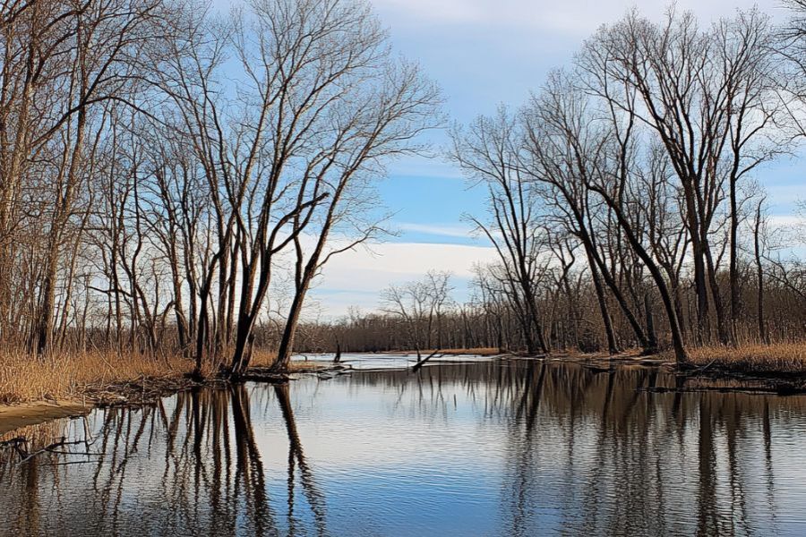
Best months are June through November. The Homochitto and the Bogue Chitto drop early and stay low, and their gravel bars are widest and easiest to read in late summer.
Float trips are at their best from June through September, when the water is warm and the outfitters are running. Book a shuttle and you can work three bars in a day instead of one.
Southeast Mississippi
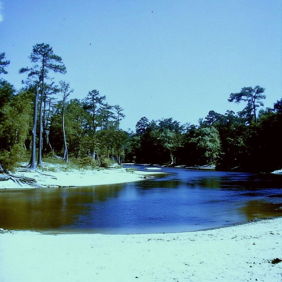
Best months are September through December. Summer thunderstorms can raise Piney Woods creeks in an hour, so the settled weather of early fall is when Black Creek and Red Creek are at their friendliest.
Winter works well down here too. The mosquitoes are gone, the sandbars are wide open, and De Soto National Forest campgrounds are quiet enough to have to yourself.
Other Valuable Rocks and Minerals You Can Find in Mississippi
The same gravel that holds your gold is loaded with other things worth keeping, and Mississippi is a genuinely great rockhounding state. Here is what shows up in the pan and on the bar while you are working.
Petrified Wood
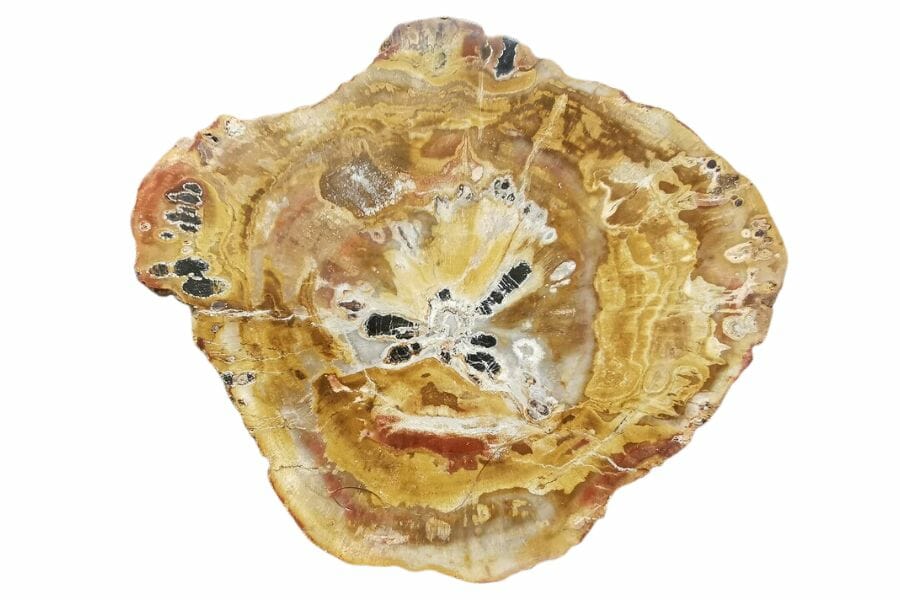
Petrified wood is Mississippi’s state stone, and it turns up in gravel across most of the state as heavy stone logs that still show growth rings and bark. Some of the palm wood pieces polish into showstoppers.
It is heavier than it looks and it rings when you tap it. Our guide to petrified wood in Mississippi covers the best gravel to hunt.
Agate
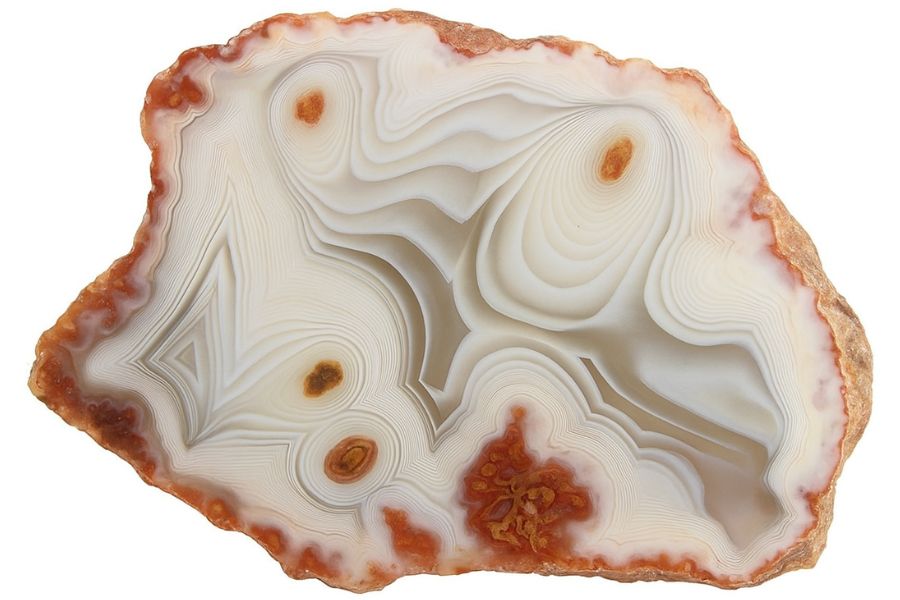
Agate turns up as water polished pebbles on gravel bars statewide, and the ones along the Mississippi River include true Lake Superior agates carried down from the north. Look for waxy translucent stones that glow when you hold them to the sun.
Wet every pebble on the bar, because dry agate hides in plain sight. Our guide to agates in Mississippi covers the productive gravel.
Jasper
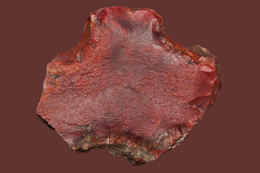
Jasper is opaque chalcedony colored red, yellow, or brown by iron, and it is one of the most common keepers on a Mississippi bar. The deep red pieces polish beautifully and cost you nothing but the bend to pick them up.
Look for solid color with no banding and a smooth waxy break. Our Mississippi gem hunting guide maps the best areas.
Carnelian
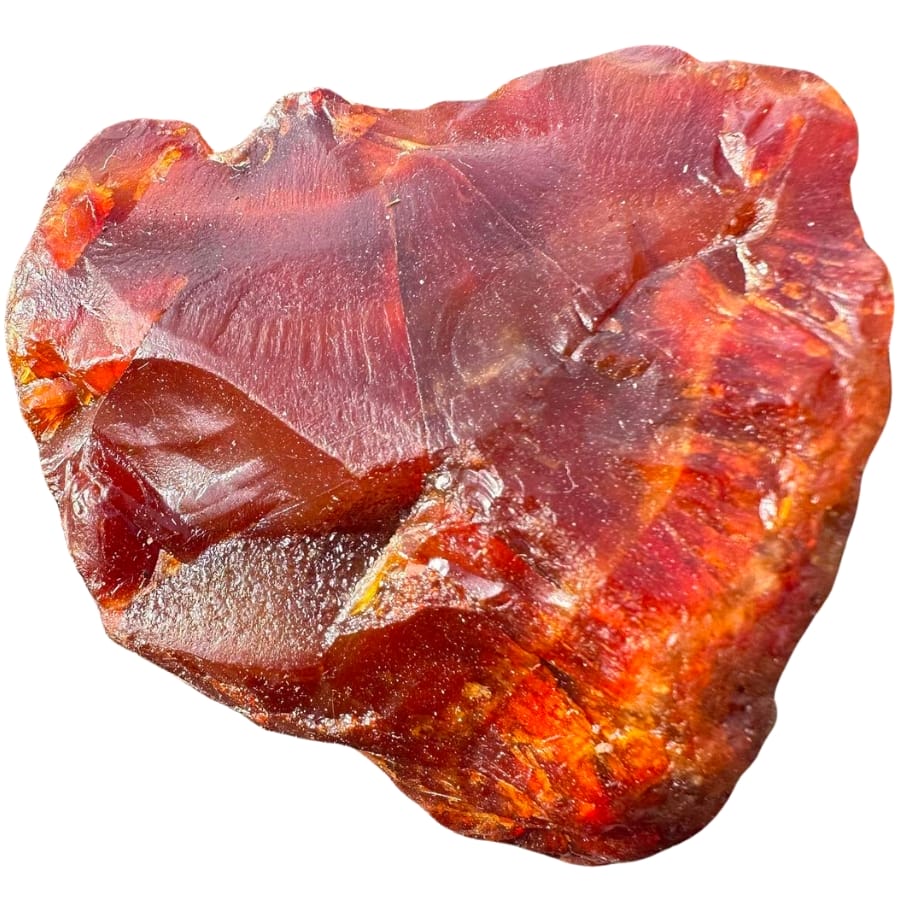
Carnelian is the glowing orange to red variety of chalcedony, and Mississippi gravel bars produce it in tumbled pebble form. Held up to the sun a good piece lights up like stained glass.
It often sits right beside plain chert, so check the sunlit side of every reddish pebble. More in our guide to Mississippi rocks, minerals, and gems.
Chalcedony
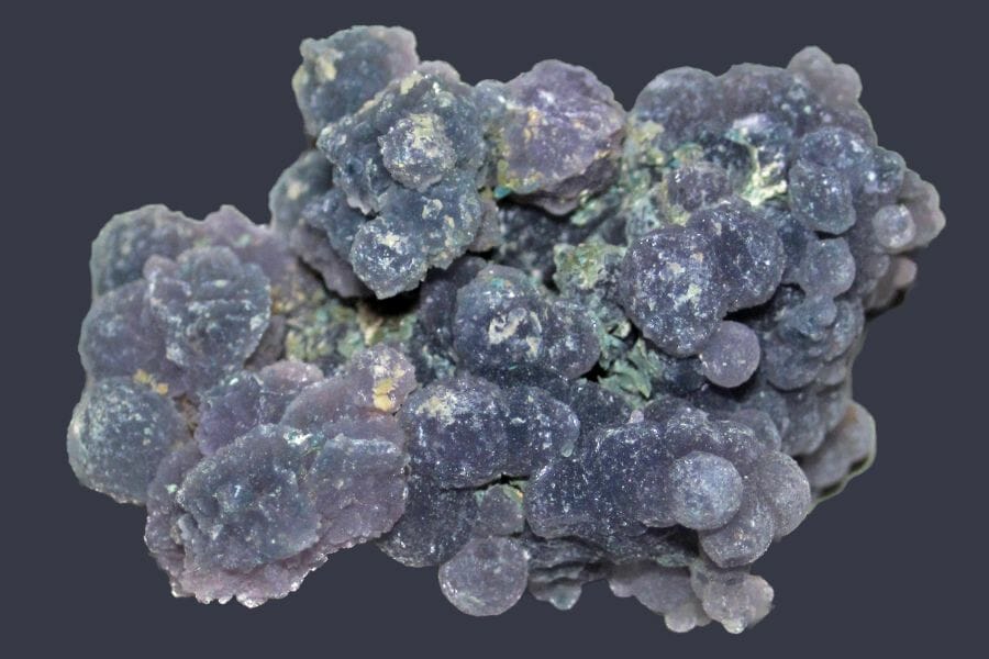
Chalcedony is agate’s smooth unbanded cousin, showing up as milky, blue gray, or violet pebbles with a soft waxy shine. It takes a great polish and it is common in the gravel across southern Mississippi.
You will find it on the same bars as agate and jasper. Our guide to crystals in Mississippi covers where to look.
Quartz
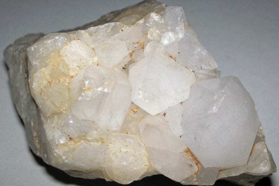
Quartz arrives in Mississippi gravel as rounded white and clear pebbles, and occasional pieces still show crystal faces. Smoky and milky varieties both turn up on the bigger rivers.
Its glassy break and hardness separate it from everything softer in your pan. See our crystals in Mississippi guide for details.
Keokuk Geodes
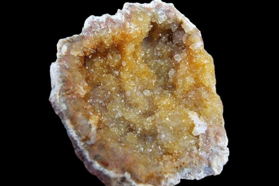
Keokuk geodes are hollow quartz lined nodules that formed in Iowa and Missouri and rode south in ancient river gravel. On a bar they look like plain lumpy rocks until you crack one open.
They feel oddly light for their size, which is the tell. Our guide to geodes in Mississippi covers where they surface.
Amber
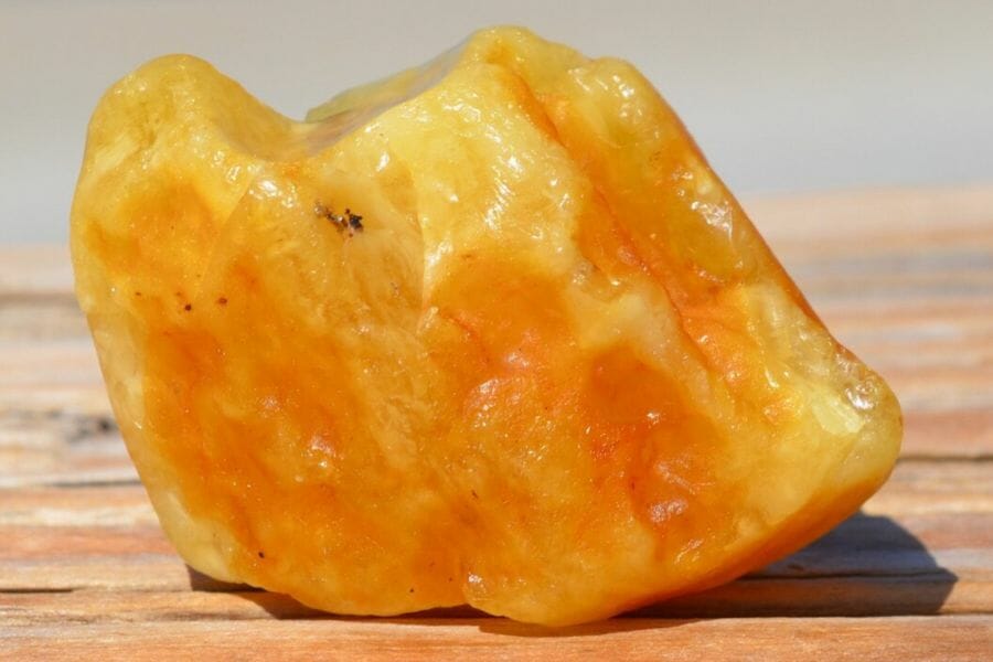
Amber comes out of the Cretaceous Tuscaloosa Formation in northeast Mississippi as small golden fragments of fossilized tree resin. Some pieces carry insect inclusions, which makes them genuinely valuable.
It is very light and it floats in salt water, which is the easiest field test there is. More in our guide to crystals in Mississippi.
Opal
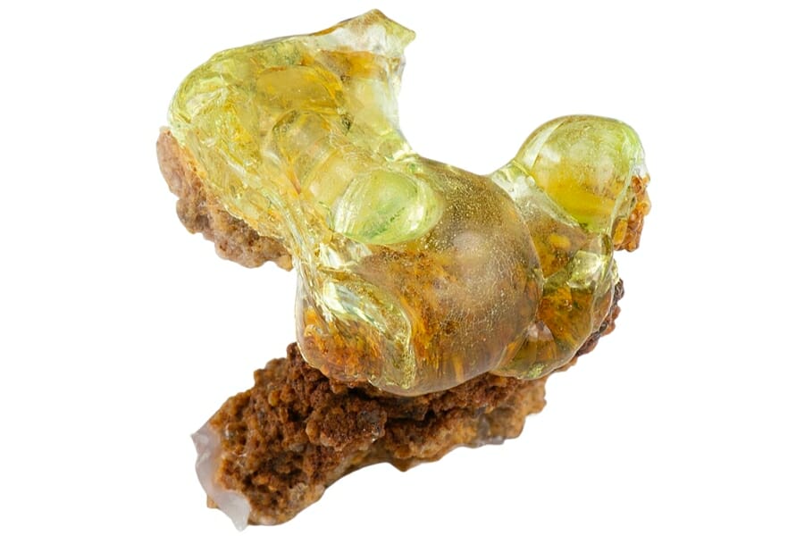
Opal shows up in Mississippi mainly as hyalite, a clear to pale yellow glassy coating on other rocks, and as opalized wood in the gravel. Hyalite often glows green under an ultraviolet light.
Check the underside of odd looking pebbles, because hyalite loves hidden surfaces. Our Mississippi gem hunting guide covers the ground.
Freshwater Pearls
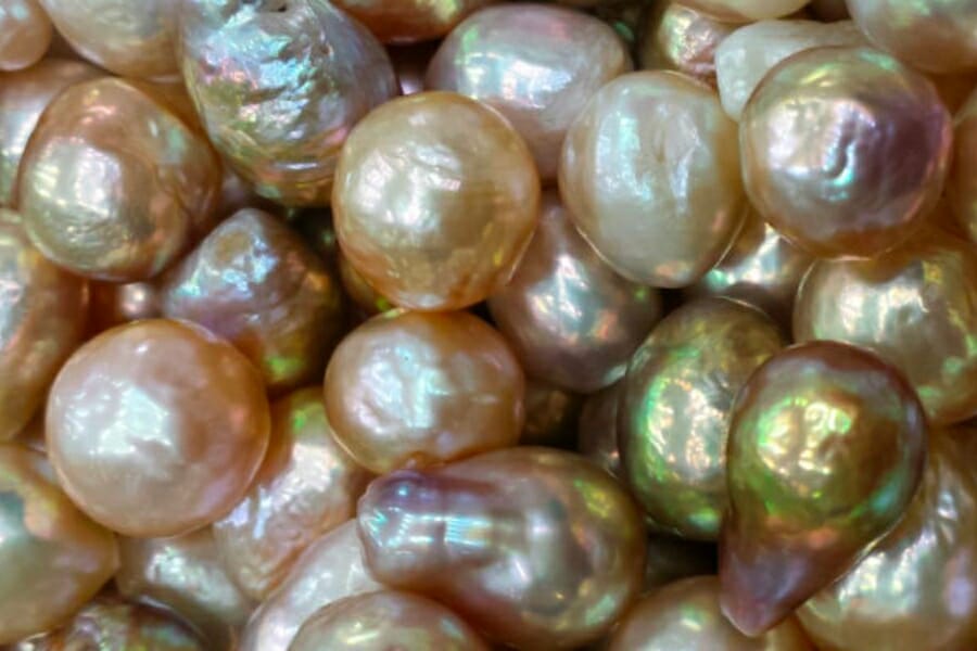
Freshwater mussels in Mississippi rivers produce natural pearls, and the state had a real pearling industry on the Mississippi and the Tombigbee. Shell fragments with an iridescent inner layer are the sign you are in the right water.
Live mussels are protected, so this is a shells on the bar hunt only. See our rockhounding in Mississippi guide for more.
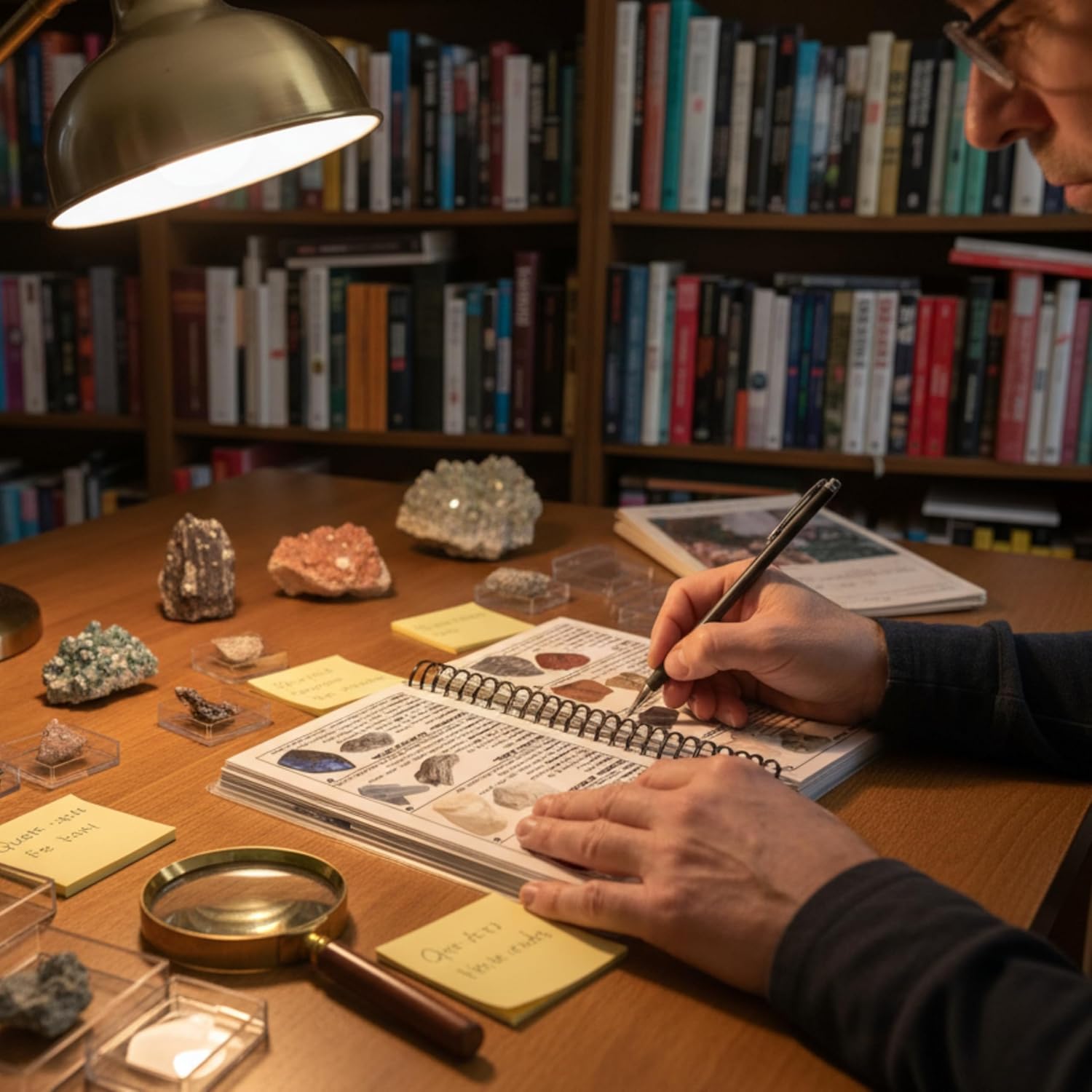
Here is the part that costs people money. The average shovel on a Mississippi gravel bar holds four or five identifiable materials, and most panners can name one of them, so real value goes back in the water every weekend. The Rocks and Minerals of the United States Field Guide puts 140 specimens and 300 plus true color photos in your pack so nothing valuable gets tossed.
Legal Rules for Gold Prospecting in Mississippi
This is general information and not legal advice, and rules change, so you are responsible for confirming what applies to the exact spot you plan to work. Three issues cover almost every situation in Mississippi.

Private Property
Mississippi law gives you the right of free passage on any natural stream with a mean annual flow of at least 100 cubic feet per second, and that covers most of the rivers in this guide. That same statute is clear that the streambed and banks stay in private ownership, and it prohibits disturbing the bed or the bank without the landowner’s permission.
So float freely, and ask before you dig. A short conversation ahead of time keeps every flake 100% yours, and Mississippi landowners are famously willing to say yes to someone who asked first.
Public Land Rules
State parks are look and photograph. Mississippi park regulations prohibit taking or removing any rock or mineral from a park property without written authorization, which covers Tishomingo State Park and every other park in the system.
National Park Service land is closed to collecting as well, and that includes the Natchez Trace Parkway, Vicksburg National Military Park, Brices Cross Roads, and Gulf Islands National Seashore. National wildlife refuges are closed too.
Mississippi’s six national forests and the Corps of Engineers lakes are the friendliest public ground in the state, but collecting rules vary by district and project office, so make the call before you go. That one phone call turns a maybe into a plan.
Equipment Restrictions
Hand tools are the easy path everywhere in Mississippi. A pan, a shovel, a trowel, a classifier, and a crevice tool raise no questions on water you have permission to work.
Anything beyond that changes the picture. A hand sluice can require agency approval on public land, and motorized equipment such as a suction dredge brings in the Mississippi Department of Environmental Quality and potentially the Army Corps of Engineers for instream work permits. Mining claims are possible on federal land in Mississippi, so if you are working federal ground it is worth a quick check of the BLM claim records first.
Confirm access directly with the landowner or the managing agency before every trip, and get it in writing when you can. Some of the best spots in this guide are look and do not take, and knowing which is which before you drive is what keeps the hobby fun.
Local rock and mineral clubs are the fastest shortcut to good ground, current rules, and people who already know which landowners say yes. Mississippi has active rockhounding clubs and collecting sites, and a single meeting will teach you more about local access than a month of searching.
Mississippi Gold FAQ
Is there gold in Mississippi?
Yes, natural gold occurs in Mississippi as fine flour gold and small flakes in stream gravel. The Mississippi Office of Geology confirms reliable reports of gold particles being recovered by people panning as a hobby, and drill core from the Jackson Dome has assayed as high as 503 parts per billion of gold.
The state has no commercial gold mines and never had a gold rush, which means these gravels have barely been touched. For a lot of panners that solitude is the whole appeal.
Where can I pan for gold in Mississippi?
The best gravel in the state sits in Bear Creek and the Tombigbee River in the northeast, the Mississippi River sandbars along the western border, the Big Black River in the middle, the Homochitto and Bogue Chitto Rivers in the southwest, and Black Creek in the De Soto National Forest. National forest crossings, Corps of Engineers recreation areas, and public river landings are the easiest legal starting points.
Always confirm the rules for the specific stretch you plan to work. State parks, National Park Service land, and wildlife refuges all prohibit collecting.
Do you need a permit to pan for gold in Mississippi?
Mississippi has no statewide permit for recreational hand panning, but the land you stand on decides what you need. Private landowners control the streambed and banks even on public waterways, national forest districts and Corps project offices set their own collecting rules, and state parks require written authorization to remove anything.
Motorized equipment is a separate matter and triggers state environmental permitting. Hand tools keep everything simple.
What kind of gold is found in Mississippi?
Mississippi produces flour gold and fine flakes in placer gravel. The gold arrived already fine, carried in by ancient rivers draining the Appalachians and the Nashville Dome, by glacial meltwater coming down the ancestral Mississippi River, and by the Pliocene rivers that laid the Citronelle Formation across the south of the state.
That long ride is why a classifier and a slow pan matter so much here. Learn more in our guide to gold hunting and prospecting equipment.
Has gold ever been mined in Mississippi?
No commercial gold mine has operated in Mississippi. The state geologist reported traces of gold in analyzed pyrite samples as early as 1857, and modern drilling confirmed gold in the altered igneous rock of the Jackson Dome, but neither has ever been mined for gold.
That leaves the state’s gravel bars entirely to hobby panners. If you want a neighboring state with a documented gold mining history, see our guide to gold in Alabama.
Take the Guesswork Out of Your Next Pan
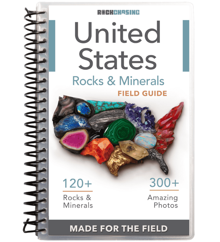
Every shovel you lift off a Mississippi gravel bar holds more than gold. It holds agate, jasper, carnelian, petrified wood, and geodes, and the only thing standing between you and knowing which is which is a book that fits in your pack.
The Rocks and Minerals of the United States Field Guide covers 140 rocks, crystals, minerals, and gemstones with 300 plus true color photos, printed on 44 laminated waterproof pages with a wire binding built for wet hands and sandbars.
Get the Rocks and Minerals of the United States Field Guide