Maryland’s gold story started with a Civil War soldier washing skillets in a stream near Great Falls, and the color he spotted in that pan set off seventy years of real gold mining just upriver from Washington, DC. More than 5,000 ounces of recorded gold came out of Maryland before the last mine closed in 1940.
With gold trading above $4,000 an ounce, you do not need to find much for a weekend of panning to pay for itself.
Most people who try gold prospecting in Maryland head straight for the famous old mines at Great Falls, which sit on national park land where panning and collecting are strictly off limits. Knowing that one rule before you go puts you ahead of the crowd.
The legal gold is in the small Piedmont streams that drain the very same gold belt. Yes, you can still find gold in Maryland today, especially in the Montgomery County streams around the old Potomac gold belt and along Deer Creek in Harford County, where fine placer gold has been showing up in pans since the Civil War. This guide covers the proven spots, the technique that works at each one, and the rules that keep your trip legal.
Our team of geologists and experienced rockhounds put this guide together the same way we approach every gold state. We mapped the old mine records against the streams that drain them, then matched that against what prospectors actually report finding today. Here is everything you need to plan your first Maryland gold trip.
Table of Contents
- Biggest Discovery
- Types of Gold
- Where Gold Hides
- Best Places
- Techniques
- Real vs Fool's Gold
- How Gold Got Here
- What To Bring
- Best Seasons
- Other Minerals
- Legal Rules
- FAQ
The Biggest Gold Discovery in Maryland History
Maryland’s gold rush began in a Union Army camp. In 1861, a private from a Pennsylvania regiment stationed at Great Falls was washing skillets in a little stream when he noticed heavy golden specks settling in the bottom of the pan. His regiment was nicknamed the California Regiment, and enough of its men had seen real gold out west to know exactly what they were looking at.
The war came first, but the soldier did not forget. He came back after mustering out, and by 1867 the first shaft was sunk at what became the Maryland Mine, the most famous gold mine on the East Coast north of the Carolinas.
The rush that followed put a string of mines along the Potomac between Georgetown and Great Falls. One newspaper reported half a dozen gold mines in actual operation at the peak, and the placers at Rock Run gave up nuggets as heavy as 4 ounces, a single stone worth more than $16,000 at today’s prices.
The Maryland Mine worked on and off until 1940, and the state’s recorded production topped 5,000 ounces, with some estimates putting the real total far higher. The mines are quiet now, but the gold belt that fed them still sheds color into the streams, and that is where this guide comes in.
The Kinds of Gold You Can Find in Maryland
Maryland gold is real lode country gold, born in quartz veins and washed into Piedmont streams, and knowing what it looks like is the difference between a great day and an empty vial. The Maryland Geological Survey says the gold recovered here is mostly very fine grained, though it ranges up to coarse sand size, and small nuggets have come out of these streams too. Here are the three forms you will actually see.
Flour Gold
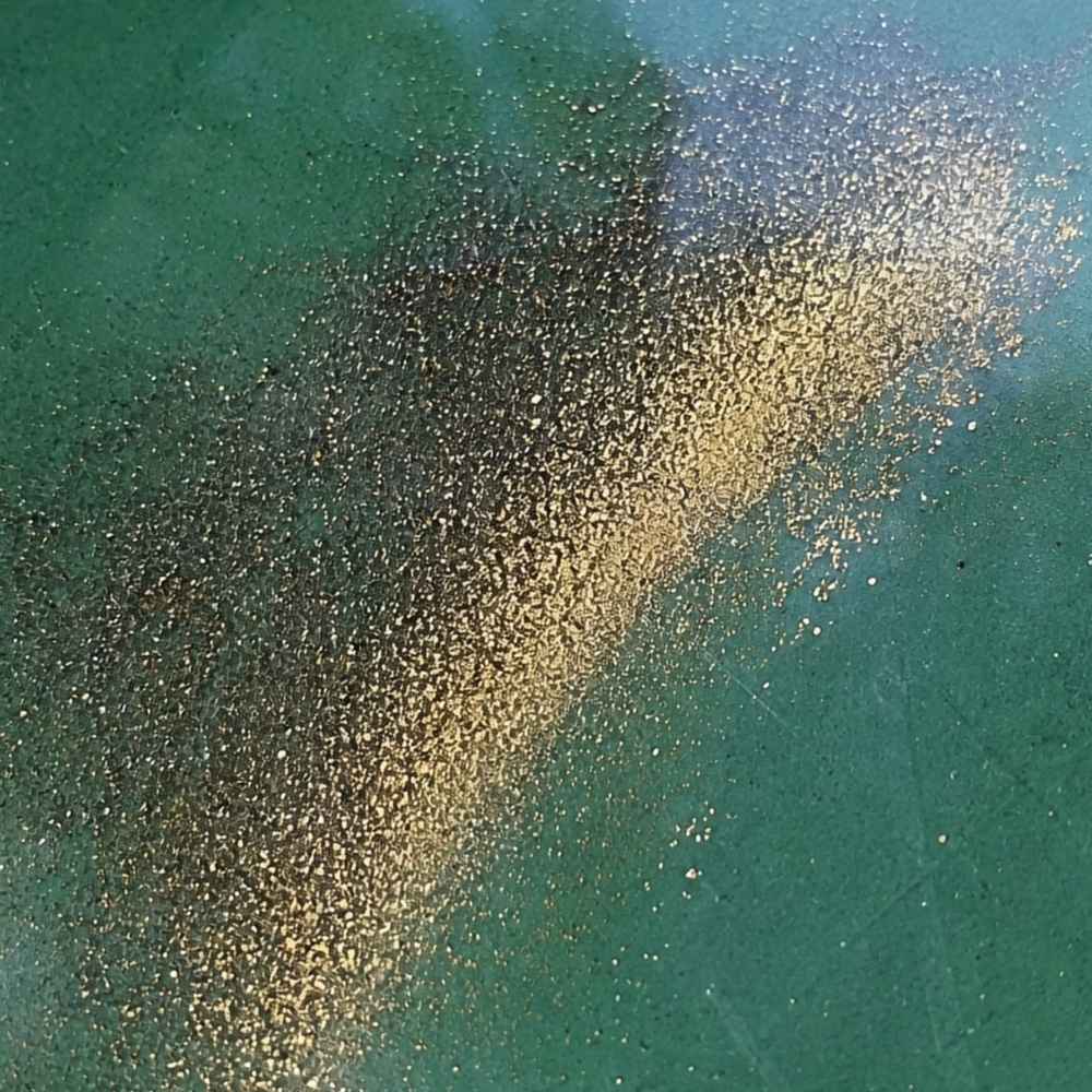
Flour gold is gold ground down to particles smaller than grains of sugar, and it is what most Maryland pans produce. The Piedmont streams have been grinding vein gold against schist bedrock for millions of years, so by the time it reaches your pan it is dust. It shows up as a bright golden smear in the crease of your pan after everything lighter washes away.
The mineral that fools people here is mica, which flakes out of Maryland’s schists by the ton. Mica flashes gold in sunlight but it is nearly weightless. Real flour gold sinks straight to the bottom of your pan and stays golden in the shade, while mica floats, flutters, and goes dull the moment the light changes.
Because flour gold washes out of a normal pan so easily, you want a dedicated finish pan for your final concentrates. The Garrett Prospecting 10 Inch Backpacker Gold Pan is the one our team uses for exactly this job.
This is also the stage where a good identification reference saves your whole trip. The Rocks and Minerals of the United States Field Guide shows you exactly what real gold looks like next to every mineral that imitates it, so you know what you are looking at while your pan is still wet.
Gold Flakes and Pickers
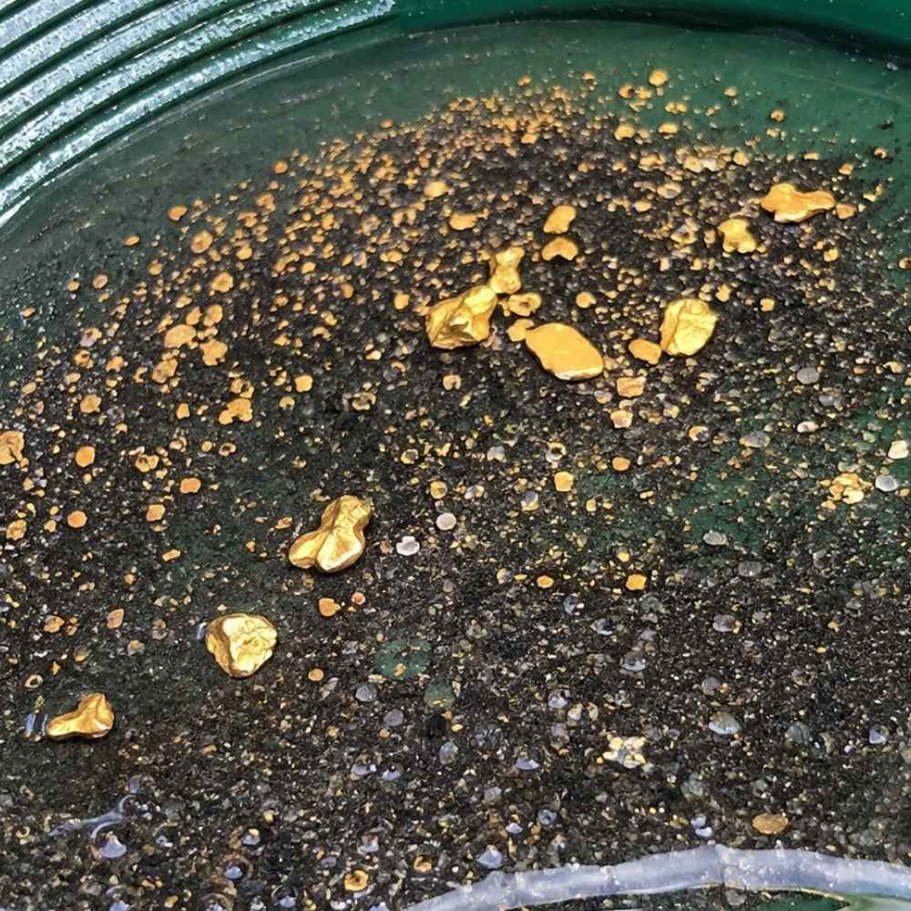
Flakes are the next size up, flat pieces about the size of a grass seed that you can actually pick out and admire. In Maryland these turn up where streams cut close to the old vein systems, especially in black sand layers sitting on bedrock. The survey records coarse sand sized gold, and old placer accounts record real nuggets, so keep your snuffer bottle ready for a picker on any trip.
The lookalike here is pyrite, and Maryland’s mineralized zones are loaded with it. The test takes one second. Poke it with a pin, because gold dents like soft metal while pyrite is brittle and shatters.
Flakes are nearly impossible to pick up with wet fingers. A snuffer bottle like the Garrett Gold Guzzler Bottle sucks them straight out of your pan without losing a single one.
Vein Gold in Quartz
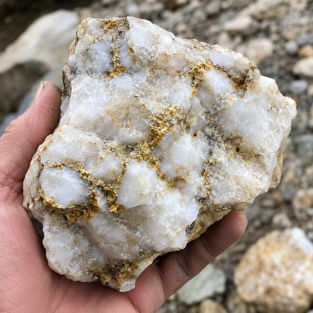
Maryland is one of the few eastern states where you can still find gold locked inside its original quartz. The survey describes it as grains, wires, and small sheets in white vein quartz along old fault zones, and pieces of that vein rock wash into the streams below every historic mine. A quartz pebble with a golden speck inside is the state’s signature find.
The imitator is chalcopyrite, a brassy copper mineral that stains quartz with metallic glitter. Scratch the metal with a pin and check the mark, because gold stays bright gold while chalcopyrite scratches greenish black.
Cracking suspect quartz is how you check inside. The Estwing Geo Paleo Rock Pick opens a cobble cleanly, and a quick look with a loupe settles the question.
Knowing what the gold looks like is half the game. The other half is knowing where the stream hides it and how to get it out, and that is exactly where this guide goes next.
Where Gold Hides in Maryland Streams
Gold is about 19 times heavier than water, so it always sinks to the lowest, slowest spot the current allows. The state survey’s advice for Maryland is specific and worth memorizing, because the ideal spot is just downslope from a vein quartz outcrop, at the first curve in the stream. Learn these five features and you can read any creek in this guide.
Inside Bends
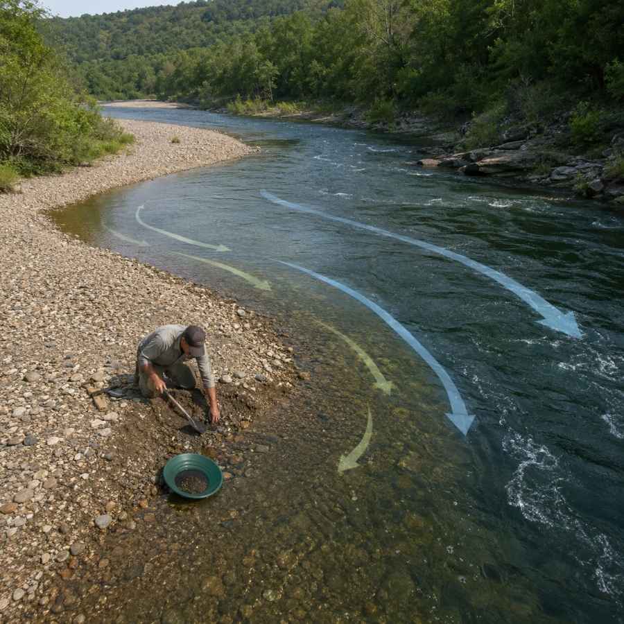
Water slows down on the inside of every curve, and slow water drops its gold. Look for the gravel bar that builds on the inside of a bend and dig where the coarse gravel starts. In Maryland’s small Piedmont creeks, the first bend below any quartz outcrop is the classic producer.
Digging here means moving packed gravel, and a wide pan with deep riffles catches the fine gold as you work. The Garrett 15 Inch Dual Riffle SUPERSLUICE Gold Pan is built for exactly this kind of high volume panning.
Gravel Bars
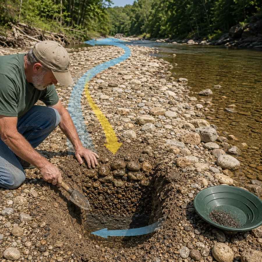
Summer low water exposes gravel bars that were underwater all spring. The gold in a bar concentrates at its upstream end and down at the base, not on the surface. Dig test holes and pan the bottom material.
Bars are full of oversized cobbles that waste pan space. Screening them out first with the SE Half Inch Sifting Screen doubles the gravel you can actually process in a day.
Bedrock Cracks
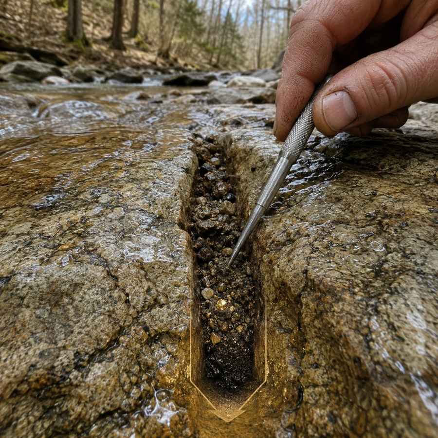
Bedrock is the floor gold cannot sink through, and Maryland streams are famous for it. The Piedmont’s tilted schist breaks into natural riffles, and every crack and joint has been trapping gold since the veins started eroding. Where a creek runs over bare rock, the cracks are the richest real estate in the water.
The dirt in the bottom inch of a crack holds most of the gold. A steel crevice tool set like the ASR Outdoor Steel Crevice Tool Set scrapes out material your fingers cannot reach.
Behind Boulders
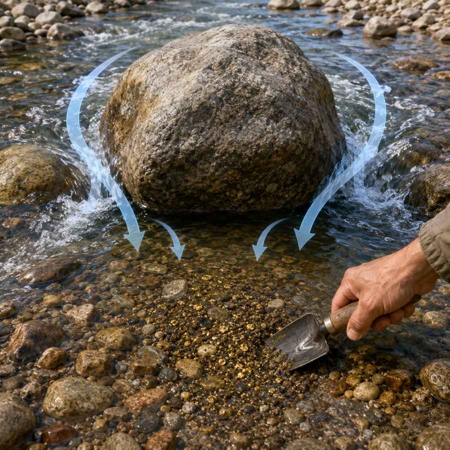
Every big rock splits the current and creates a calm pocket directly downstream, and gold traveling in a flood drops right into that pocket. The boulder strewn streams draining Maryland’s gold belt are full of these traps. Feel around the downstream base of big rocks and dig the packed gravel your fingers find there.
That gravel is usually cemented tight. A strong shovel like the Bully Tools 14 Gauge Round Point Shovel breaks it loose without snapping a handle mid trip.
Black Sand Streaks
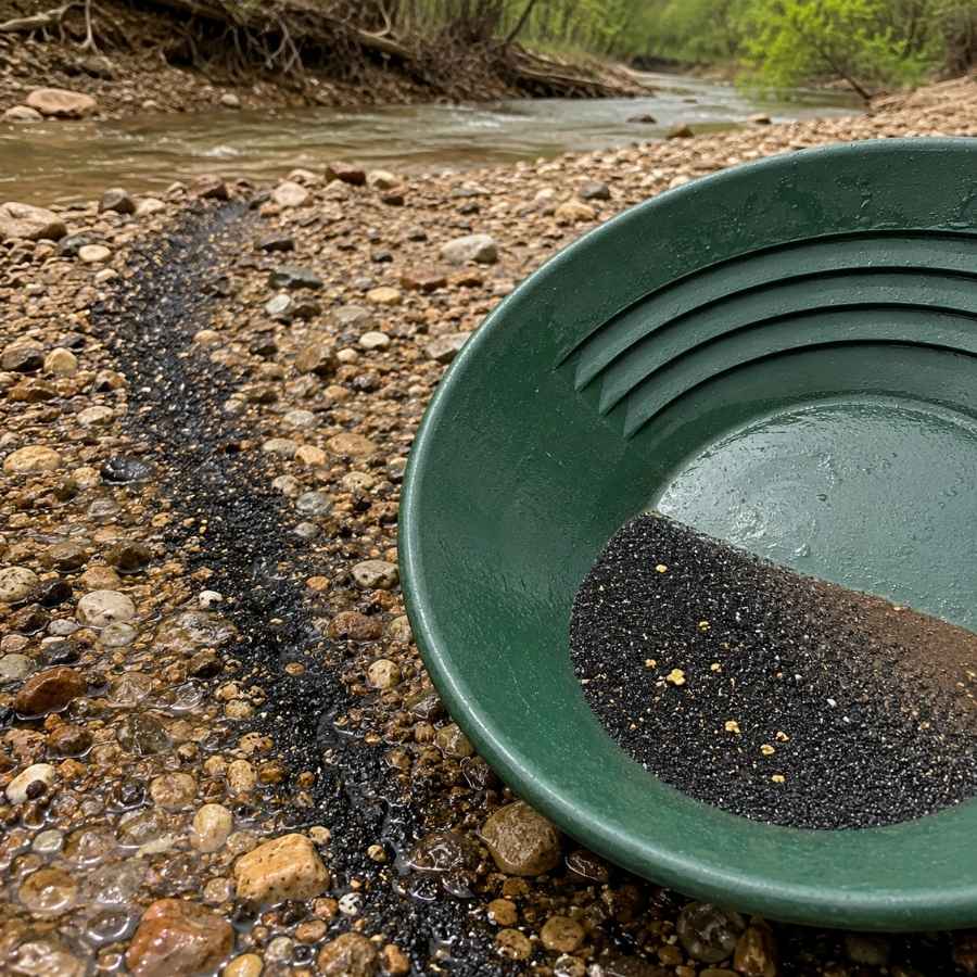
Black sand is crushed magnetite and other heavy minerals, and it is the number one gold indicator in Maryland. It erodes out of the same metamorphic rocks as the gold and settles in the same spots. When you see a dark streak in the gravel or a black layer in your pan, you are digging in the right place.
Separating fine gold from black sand at the end of the day is tedious by hand. A magnetic separator like the SE Magnetic Separator Pick Up Tool with Quick Release pulls the black sand out and leaves your gold behind in seconds.
Always Confirm Access and Collection Rules!
Before heading out to any of the locations on our list you need to confirm access requirements and collection rules for both public and private locations directly with the location. We haven’t personally verified every location and the access requirements and collection rules often change without notice.
Many of the locations we mention will not allow collecting but are still great places for those who love to find beautiful rocks and minerals in the wild without keeping them. We also can’t guarantee you will find anything in these locations since they are constantly changing.
Always get updated information directly from the source ahead of time to ensure responsible rockhounding. If you want even more current options it’s always a good idea to contact local rock and mineral clubs and groups
The Best Places To Find Gold in Maryland
Maryland’s gold clusters in three zones, the old Potomac gold belt of central Maryland, the copper and gold country of the northern counties, and the historic mining district of western Maryland’s Frederick County. One key thing to know before the list. Much of the historic belt sits inside the Chesapeake and Ohio Canal National Historical Park, where prospecting is prohibited, so this guide points you to the legal water and tells you plainly where you can only look.
Central Maryland
The Potomac gold belt runs through southern Montgomery County, and it produced nearly all of Maryland’s recorded gold. The streams here drain the very rock the old mines chased, which makes this the heart of Maryland prospecting.
Great Falls and the Maryland Mine
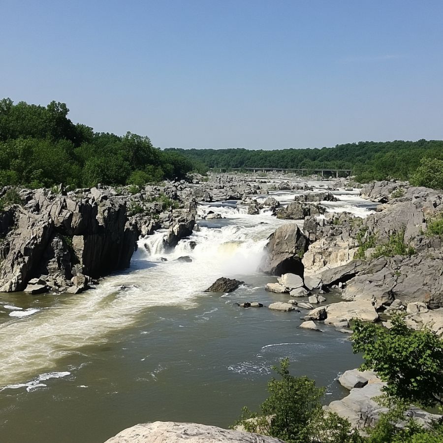
Great Falls is the historic heart of Maryland gold, where the Potomac crashes through a rocky gorge about 14 miles upstream of Washington. The ruins of the Maryland Mine still stand near the park entrance, and the Gold Mine Loop trail walks you right through the old workings. Here is the one rule to know. The whole area sits inside the Chesapeake and Ohio Canal National Historical Park, so panning, digging, and collecting are prohibited, and this stop is look but do not take.
Treat it as your scouting trip. The gorge shows you exactly what gold bearing Maryland rock looks like, white quartz veins cutting dark schist, and the small feeder streams that drain this same belt on private land outside the park boundary are where a polite knock can put your pan in legal water.
The gravel in this belt carries garnet, white vein quartz, mica, and heavy black sand, and every stream in this guide shares that mix. This is exactly where people throw away good finds, because a wet unidentified stone looks like nothing. The Rocks and Minerals of the United States Field Guide lets you check every odd pebble against clear photos before it goes back in the creek.
Bring nothing but boots and a camera inside the park, and save the gear in the techniques section for legal water.
Difficulty: 3 out of 5
Rock Run
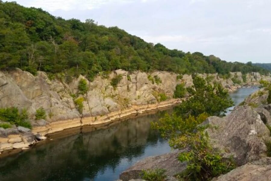
Rock Run is the most storied placer stream in Maryland, the little Potomac tributary whose gravels supported a commercial placer operation and five separate mines in the early 1900s. Old accounts credit its placers with a considerable amount of gold, including nuggets up to 4 ounces. The lower run near the Potomac sits inside the national park where collecting is banned, but the upper watershed threads through stream valley parkland and private ground near Potomac village.
Fine flour gold with occasional flakes fills the vial here, and crevicing the schist bedrock plus careful panning is the combination that works. Hobbyists have reported color from a surprising number of Montgomery County streams in this belt, and Rock Run is the anchor of the list.
The gravel carries garnet, quartz, mica, and black sand. Crevice tools earn their keep here, linked in the techniques section.
Difficulty: 4 out of 5
Seneca Creek
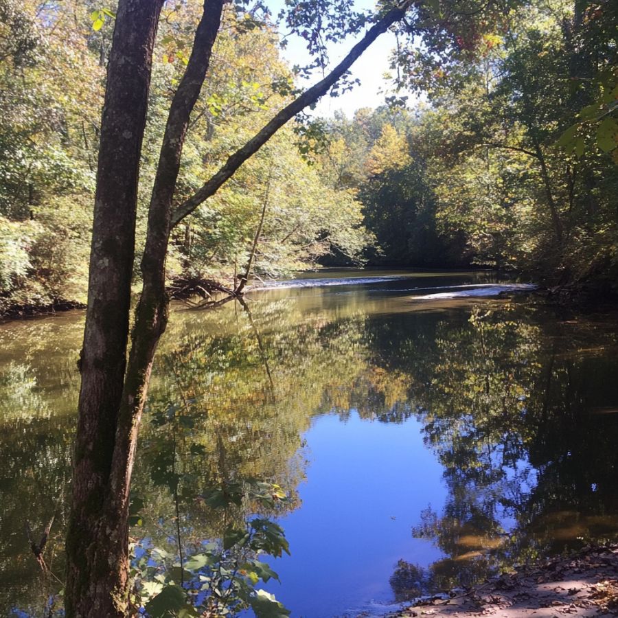
Seneca Creek drains the northwestern edge of the gold belt on its way to the Potomac, and it has a long history of small gold finds. The creek runs shallow over gravel and bedrock for miles, which gives it more workable water than any other stream in the county. The state park section is closed to collecting, so head for the private stretches upstream and down, where farm owners often say yes to a polite ask.
Flour gold and small flakes in black sand are the find, and standard panning is the technique. Work the inside bends and pan the gravel sitting on clay or bedrock.
Your pan will also show garnet sand, quartz pebbles, and mica. Deep riffle panning gear covers this creek, linked in the techniques section.
Difficulty: 2 out of 5
Cabin John Creek
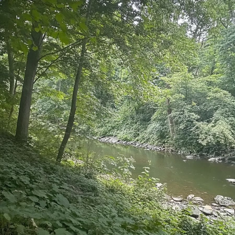
Cabin John Creek runs straight through the eastern side of the old gold belt, from Rockville down to the Potomac. Old mine workings dot its watershed, and the creek has been reworking their spoil for a century. It is close in, easy to reach, and one of the most convenient gold waters in the Washington suburbs.
Fine flour gold shows up steadily here, and panning the bedrock cracks and inside bends is the method. The lower end near the Potomac enters national park land where collecting is banned, and the county stream valley park in between has its own rules, so target the stretches where you have clear permission.
Expect quartz, mica, garnet, and black sand in the pan. A hand trowel and finish pan handle this small water, linked in the techniques section.
Difficulty: 2 out of 5
Watts Branch
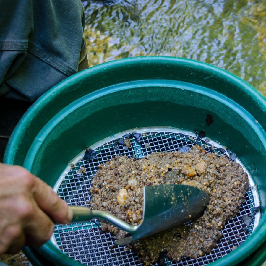
Watts Branch is the quiet local favorite, a small Potomac tributary rising near Rockville that drains the same mineralized rock as the famous mines. Prospectors report steady fine color from its gravels, and its size makes it a perfect learning stream. Small water like this concentrates gold fast, because every flood pushes the whole flow over the same few gravel patches.
Flour gold in black sand pockets is the find, and careful panning with a finish pan is the technique. Work the first bends below any quartz outcrop.
The gravel carries mica, quartz, and garnet sand. Almost the whole stream runs through private and county land, so permission comes first. The finish pan is linked in the techniques section.
Difficulty: 3 out of 5
Patuxent River
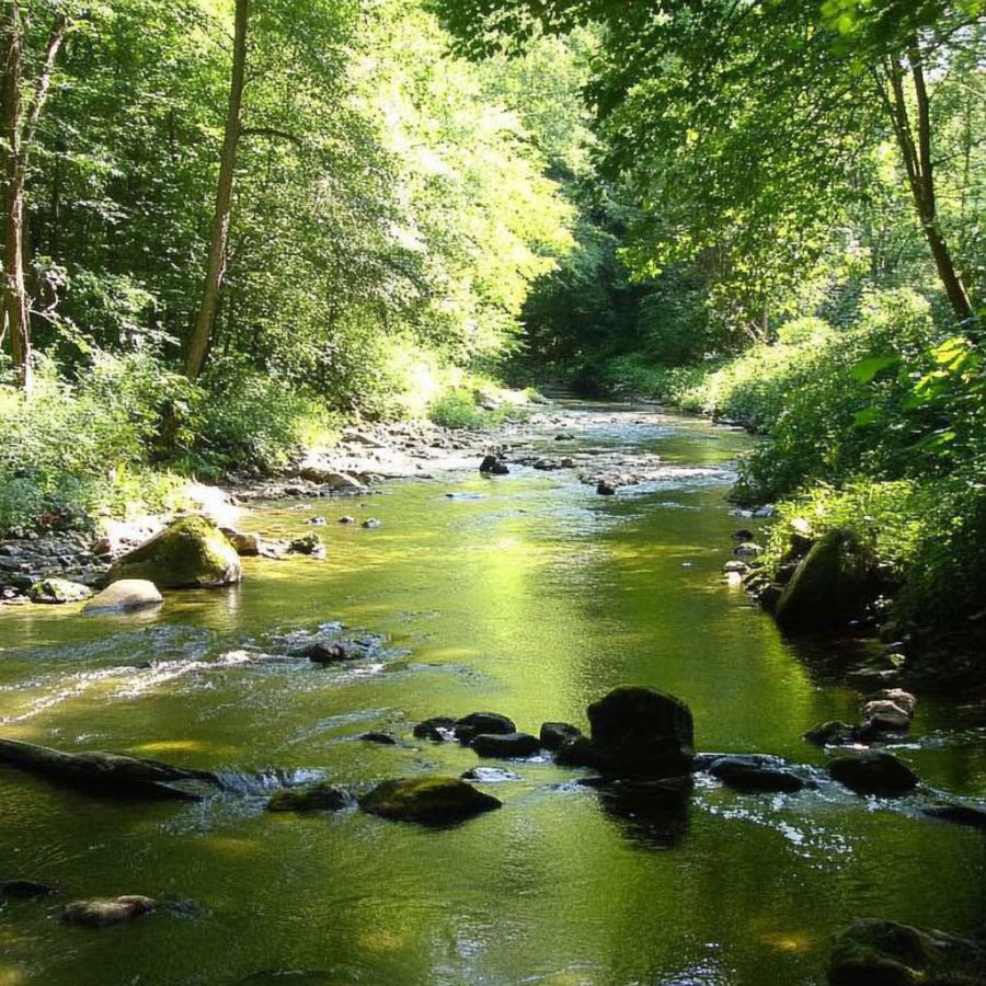
The upper Patuxent River drains the Piedmont hills where Montgomery, Howard, Frederick, and Carroll counties meet, gathering runoff from old gold and copper prospects on both banks. The river has had thousands of years to concentrate whatever those hills shed, and prospectors report fine gold from its upper gravel bars. As a bonus, this is the home water of the Patuxent River Stone, Maryland’s state gem.
Flour gold in bar gravel is the classic find here, and gravel bar panning is the technique. Dig the upstream ends of bars and pan the bottom material.
Much of the upper river runs through Patuxent River State Park, where collecting requires state permission, so work permitted private stretches. Bycatch includes quartz, reddish Patuxent River Stone pebbles, and black sand. A classifier screen speeds the sorting, linked in the techniques section.
Difficulty: 3 out of 5
Northern Maryland
The northern counties trade the Potomac gold belt for copper country, where gold rode along in the ores of old mines, plus one genuinely gold bearing creek near the Pennsylvania line. This is quieter prospecting with fewer crowds.
Deer Creek
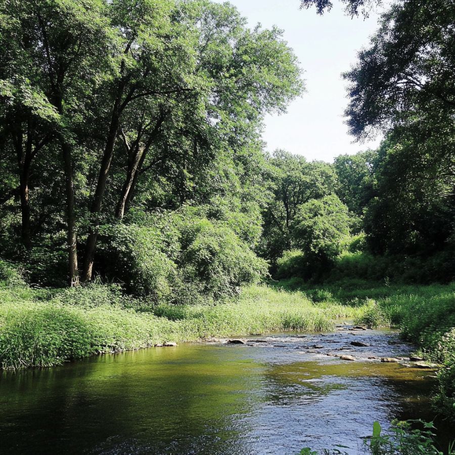
Deer Creek is northern Maryland’s best gold water, a rocky Piedmont stream crossing Harford County for more than 50 miles. Prospectors report fine gold and small flakes from its gravels, concentrated from the metamorphic rocks it cuts through, and collectors have also documented heavy mineral finds in its black sands. Riffles, deep pools, and gravel bars follow one after another, so there is always workable water.
Fine placer gold is the find, and panning inside bends and behind boulders is the technique. The stretch through Rocks State Park is closed to collecting, so work the farm country above and below with permission.
The pan also shows garnet, quartz, and abundant black sand. Standard panning gear covers it, linked in the techniques section.
Difficulty: 2 out of 5
Western Maryland
Frederick County’s rolling farm country hides a real mining district, where copper and gold came out of the same shafts in the 1800s. The mines are gone, but the streams that drain them still carry the evidence.
Libertytown Gold District
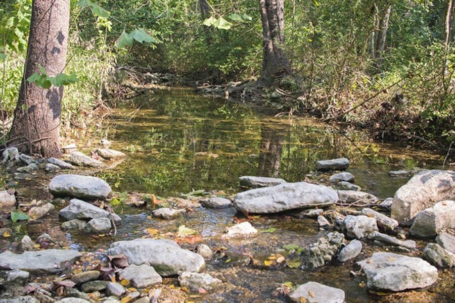
The hills around Libertytown and Unionville hosted several old mines, including the Liberty Mine, where gold was worked alongside copper. The state survey documents gold occurrences in Frederick County, and the small streams draining the old workings, including Dollyhyde Creek, are the modern way in. This is classic knock on a farmhouse door country.
Fine gold and the occasional speck of gold in quartz are the finds, and panning below the old dump areas is the technique. Never enter old shafts or adits, because they are deadly and most are on posted land anyway.
Bycatch is the fun part here, with malachite stained quartz, pyrite, and chalcopyrite from the copper ores. A rock pick and loupe help you check quartz cobbles, and the panning gear is linked in the techniques section.
Difficulty: 4 out of 5
More Proven Places To Find Gold in Maryland
The waters above are where we would send a friend first, but Maryland’s mining records run much deeper. These next spots are documented mines, prospects, and placers from the state’s gold records and old reports, and every one earns a look too. Most are on private land, and none of the old workings are safe to enter, so treat these as research leads, confirm access, and get permission before visiting any of them.
Central Maryland
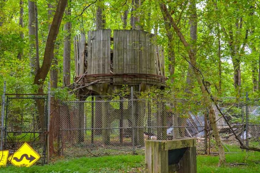
Maryland Mine on the Arrington farm (Howard County). Old records list a second, lesser known Maryland Mine on a farm near Simpsonville, where gold was prospected in quartz veins. The site is private farmland, and its real value is proof that the gold belt reaches into Howard County. Streams draining these hills are worth a test pan with permission.
Bethesda Mine (Montgomery County). The state survey lists the Bethesda Mine among Maryland’s gold workings, a reminder that the gold belt once ran right through what is now deep suburbia. The site itself is built over. Its value today is as a signpost for the belt’s eastern edge.
Black Hills Mine (Montgomery County). This survey listed mine worked quartz veins near the Little Seneca Creek drainage in the county’s northwest. Much of the area now sits under Black Hill Regional Park and its lake, where collecting is not allowed. Streams outside the park in the same drainage are the legal angle.
Eagle Mine (Montgomery County). The Eagle is one of the named mines of the Great Falls district in the state survey’s records. Like most of the district it sits on closed park or private land. It marks another point on the vein system that feeds the belt’s streams.
Ellicott Mine (Montgomery County). This is where Maryland gold was first reported, on a farm near Brookville in 1849, twelve years before the Great Falls discovery. No production was ever recorded, but prospect workings followed. The surrounding farm country streams drain the same rocks.
Ford Mine (Montgomery County). Also known in the records as the Allerton Ream, the Ford Mine worked veins in the heart of the Potomac gold belt near Potomac village. The workings are long gone on private ground. The small streams nearby share the district’s gold.
Haddlestone Mine (Montgomery County). The state survey lists the Haddlestone among Maryland’s gold mines and prospects in the Great Falls district. Our previous research had placed it in Allegany County, which does not match the survey’s district list, so we have corrected it here. Private land, research lead only.
Harrison Mine (Montgomery County). The survey lists the Harrison, also called the Sawyer, as one of the district’s gold producers. Older lists sometimes count Harrison and Sawyer as two separate mines, but the state records treat them as one operation. It sits on closed land near the Great Falls district core.
Oxon Creek (Prince George’s County). Old reports mention fine placer gold from Oxon Creek near Oxon Hill, just over the line from Washington. The gold would be reworked from Piedmont sediment, and the area is heavily urbanized today. A landowner’s permission on a stretch of clean gravel is the key that unlocks this one.
Northern Maryland
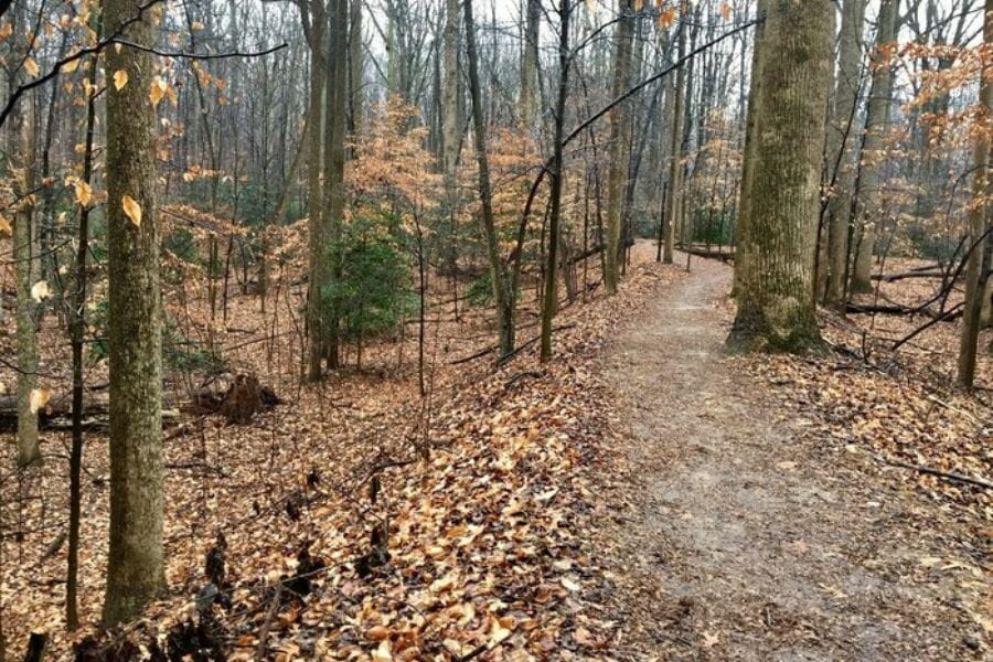
Oella Mill (Baltimore County). Gold was reported in quartz near the historic mill village of Oella on the Patapsco River. The neighboring Patapsco Valley State Park is closed to collecting, so private water is the way in here. With streamside permission from private owners, the Patapsco gravels are well worth a test pan.
Florence Mine (Carroll County). Old records list the Florence among Carroll County’s mineral workings with gold reported. The site is private farmland. The nearby streams draining the Sykesville area mineral belt are the practical angle.
Mineral Hill Mine (Carroll County). Mineral Hill was a real producer, a copper mine near Louisville where gold came out of the ores as a byproduct. The state survey documents gold occurrence in Carroll County, and this mine is the reason. The workings are sealed on private land, so the draw is panning nearby drainages with permission.
Springfield Mine (Carroll County). The Springfield worked copper ores near Sykesville, and old assays reported gold riding along in the sulfides. Like its neighbors it is closed and private. Streams cutting the same belt between Sykesville and Louisville deserve a look.
Western Maryland
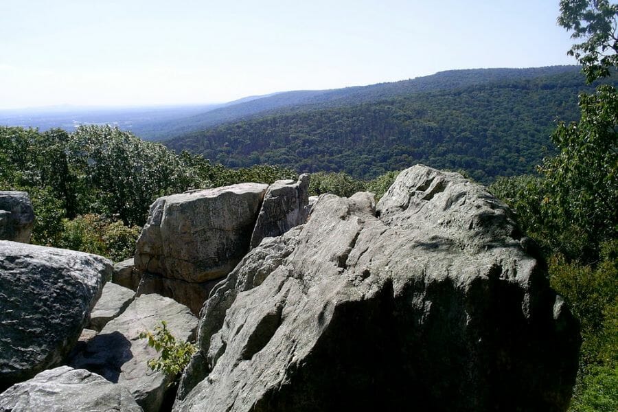
New London Mine (Frederick County). The New London worked copper ore laced with gold bearing pyrite near the village of New London, on the southern edge of the Libertytown district. The shafts are long collapsed on private ground. Dollyhyde Creek and the other small streams draining this district are the modern prospector’s way to sample it.
The Best Gold Hunting Techniques in Maryland
Maryland’s fine Piedmont gold rewards patient hand methods, and the state’s rules push the same direction, since anything bigger than hand tools can trigger permit requirements. These are the three methods that actually put Maryland gold in a vial, ordered from easiest to hardest.
Gold Panning (Difficulty: 1 out of 5)
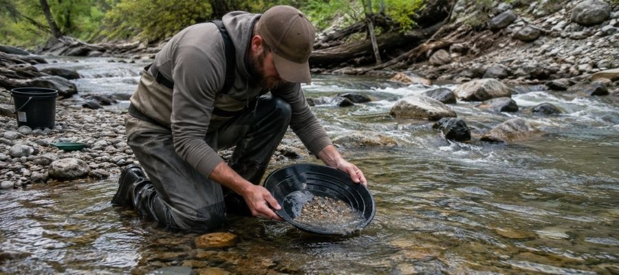
Panning is the whole game in Maryland. Fill your pan with gravel, submerge it, shake hard so the heavy gold sinks, then tilt and swirl the light material off the top until only the heavy concentrate line remains. With flour gold this fine, finish each pan slowly, because one careless swirl sends a day of gold back into the creek.
It works everywhere in this guide, and it is the only method you need at Seneca Creek, Deer Creek, and the Patuxent bars.
Essential Tools:
- Deep riffle gold pan: Garrett 15 Inch Dual Riffle SUPERSLUICE Gold Pan
- Finish pan: Garrett Prospecting 10 Inch Backpacker Gold Pan
- Snuffer bottle: Garrett Gold Guzzler Bottle
- Storage vials: SE Glass Vials with Caps
Crevicing (Difficulty: 2 out of 5)
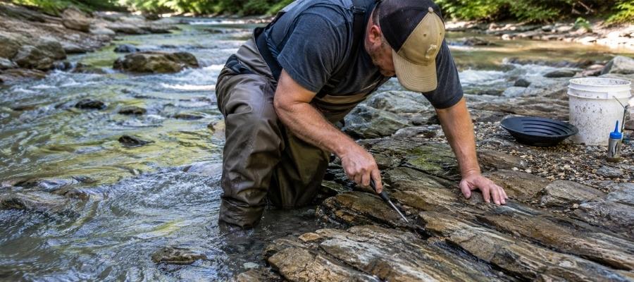
Crevicing means cleaning out the cracks in exposed bedrock and panning what you scrape loose. Maryland is made for it, because the Piedmont’s tilted schist gives its streams more exposed bedrock than almost any gold state east of the Rockies. Rock Run’s upper reaches and the rocky stretches of Cabin John Creek are the classic crevicing waters.
Work every crack down to its very bottom, because the last spoonful of packed dirt holds most of the gold.
Essential Tools:
- Crevice tool set: ASR Outdoor Steel Crevice Tool Set
- Hand trowel: Edward Tools Bend Proof Trowel
- Finish pan: linked in the panning list above
- Magnifying loupe: JARLINK 30X 60X Illuminated Loupe
Metal Detecting (Difficulty: 2 out of 5)
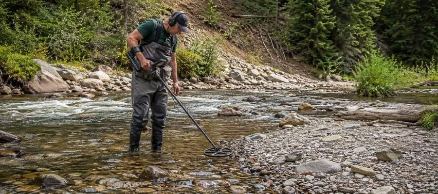
A gold capable detector opens up the dry side of Maryland prospecting, the old district hillsides where quartz float with gold inside still surfaces in plowed fields and eroded slopes. Maryland’s gold is small, so you need a machine tuned for tiny targets, not a coin detector. Private farms around the Libertytown district and the Montgomery County belt are the hunting grounds, always with written permission.
Detecting is banned in national and state parks, so this is strictly a private land method here. Every target you dig gets checked with a pinpointer before it goes in the pouch.
Essential Tools:
- Gold metal detector: Garrett AT Gold Metal Detector
- Pinpointer: Garrett Pro-Pointer AT
- Digging shovel: Bully Tools 14 Gauge Round Point Shovel
How To Tell Real Gold From Fool’s Gold
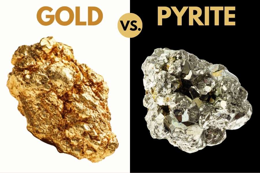
Here is the one skill that pays off on every Maryland trip. The same mineralized zones that carry the gold are stuffed with pyrite, chalcopyrite, and glittering mica, and all three have ended trips early with false celebrations. Two quick tests sort them out every time.
The shadow test takes one second. Shade your pan with your hand and watch the sparkle. Real gold stays rich and golden in shadow, while pyrite and mica go gray and lifeless the instant the direct light leaves them.
The poke test settles anything the shadow test misses. Press a pin firmly into the particle. Gold is soft metal, so it dents and holds the mark. Pyrite is brittle and shatters, and mica just slides apart in sheets.
The reason to get this right is not avoiding embarrassment. It is that people who cannot tell the difference eventually toss a pan that had real gold in it. The Rocks and Minerals of the United States Field Guide is the insurance policy, with side by side photos of gold and its imitators, printed on waterproof pages you can hold right over your wet pan.

How Gold Got Into Maryland
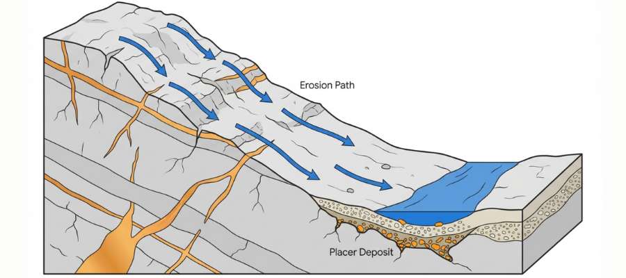
Every spot in this guide sits where it sits because of an ancient mountain range. Maryland’s gold belongs to the same Piedmont gold belt that runs from the Carolinas to New York, and its story starts hundreds of millions of years ago.
When ancient continents collided, the rocks of central Maryland were buried, cooked, and folded into the schists and gneisses you see in the Potomac gorge today. Superheated fluids squeezed through cracks in that rock and cooled into white quartz veins, carrying dissolved gold along with pyrite and other sulfides. The survey measured gold in these veins at up to 5 parts per million, which is real ore by eastern standards.
Great Falls is the sweet spot because faulting concentrated the veins there, which is exactly why the mines clustered along that stretch of the Potomac. In the northern and western counties, the same mountain building events emplaced copper ores that carried gold as a passenger, which is why old copper mines keep showing up in Maryland’s gold records.
Ever since the mountains started eroding, Maryland’s streams have been chewing up the veins and concentrating the freed gold into the bends, bars, and bedrock cracks in this guide. The mines took the rich rock, but erosion never stopped restocking the streams, and that is the gold waiting for your pan.
What To Bring for a Maryland Gold Day Trip
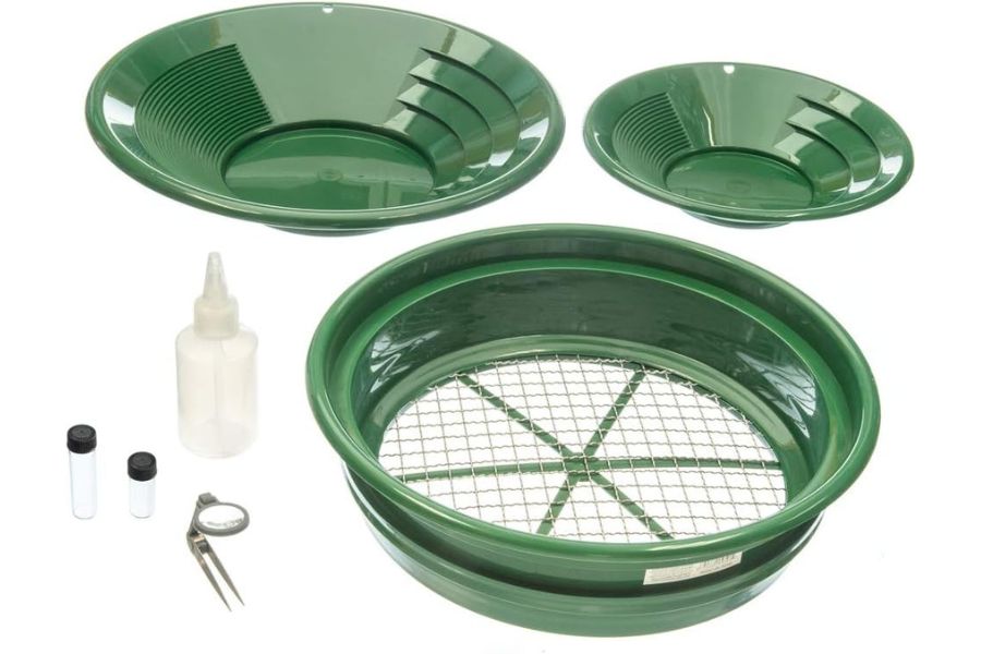
Here is the full checklist. Screenshot this section before you head for the creek.
- Gold pans and snuffer bottle, covered in the techniques section
- Crevice tools and trowel, same place
- Classifier screen and vials
- Rubber boots or wading shoes with real tread
- Drinking water and bug spray, Piedmont stream valleys are humid mosquito country in summer
- Sunscreen and a brimmed hat
- Printed landowner permission and a paper map of property and park boundaries
- Snacks and a dry change of clothes
If you are starting from zero, one box solves it. The Garrett Deluxe Gold Pan Kit has the pans, classifier, snuffer, and vials in one purchase, and it is the kit we hand to every beginner who joins us.
The Best Time of Year To Hunt for Gold in Maryland
Timing a Maryland gold trip is about water levels, because the gold does not move but the streams sure do. Here is the calendar, region by region.
Central Maryland
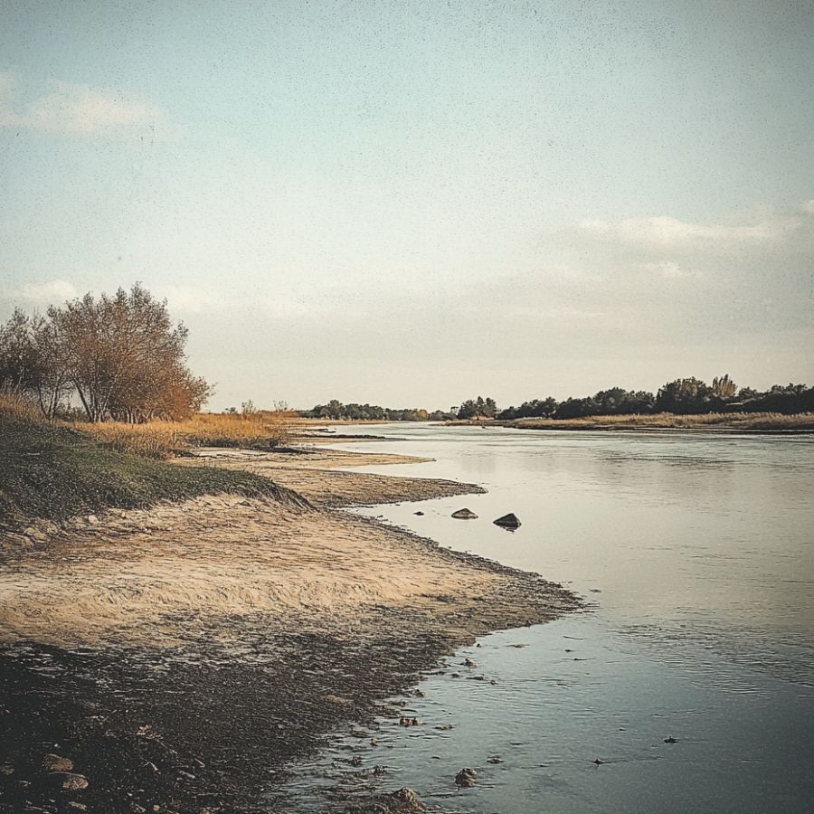
Late summer through fall is prime time in the Potomac gold belt. The little streams drop to their bones, exposing the bedrock and gravel that hold the gold, and the humidity finally breaks in September. The bonus window is right after spring high water recedes, when fresh gold has just been redeposited.
Respect the Potomac itself all year. The river around Great Falls has deadly currents, and the pools claim lives every summer, so keep your feet in the small tributaries.
Northern Maryland
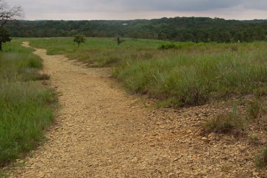
June through October is the window on Deer Creek and the Carroll County drainages. Summer low water exposes gravel bars, and fall brings crisp days and easier farm access after the crops are in. October on Deer Creek is some of the prettiest panning weather in the state.
Skip the weeks after heavy rain. These rocky Piedmont streams rise fast and run hard.
Western Maryland
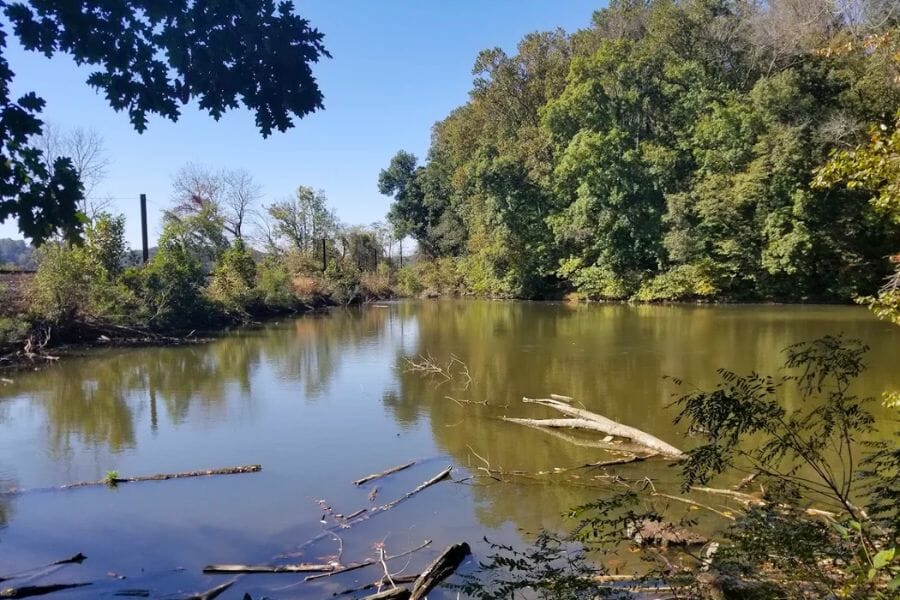
Late summer and early fall are best in the Libertytown district. The small streams shrink to a trickle, which concentrates your panning into the deeper pockets that remain, and detecting season on the farms opens up after harvest. Winter work is possible in mild spells since these are small, safe waters.
March and April bring runoff and mud. Let the fields and creeks drain before you ask a farmer for access.
Other Valuable Rocks and Minerals You Can Find in Maryland
The same streams and old mine country that hide Maryland’s gold are loaded with other treasure, and some finds are worth more than the flakes in your vial. The Piedmont’s cooked and folded rock produces a surprising variety, so keep an eye on everything your pan and rock pick turn up. Our guide to Maryland’s rocks, minerals, and gems covers the full lineup.
Quartz Crystals
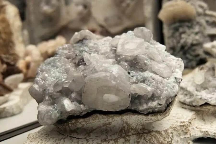
The same white vein quartz that carries Maryland’s gold sometimes opens into pockets lined with clear crystals. Check the vein rock you crack for hollow spots. Our guide to crystals in Maryland lists the best hunting grounds.
Patuxent River Stone
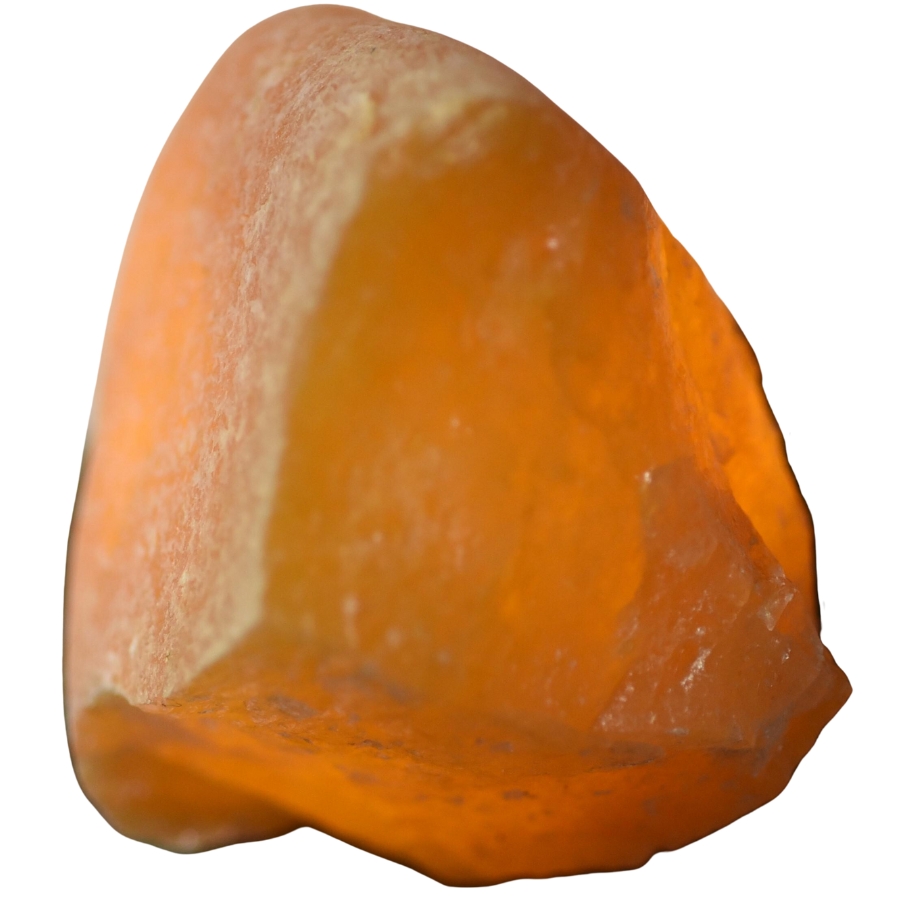
Maryland’s official state gem is an iron rich quartz that glows red and yellow, found in the gravels of the river that shares its name. If you pan the upper Patuxent for gold, you are hunting two treasures at once. Our overview of Maryland’s rocks, minerals, and gems shows what the best pieces look like.
Williamsite Serpentine
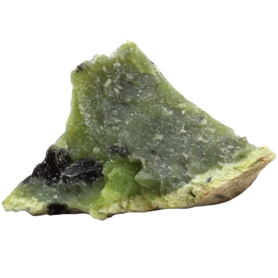
Williamsite is a translucent, apple green form of serpentine so fine it gets cut as a gemstone, and Maryland’s serpentine barrens along the Pennsylvania line are its classic source. Collectors prize even small polished pieces. Our guide to gem mining in Maryland covers where to find it.
Azurite and Malachite
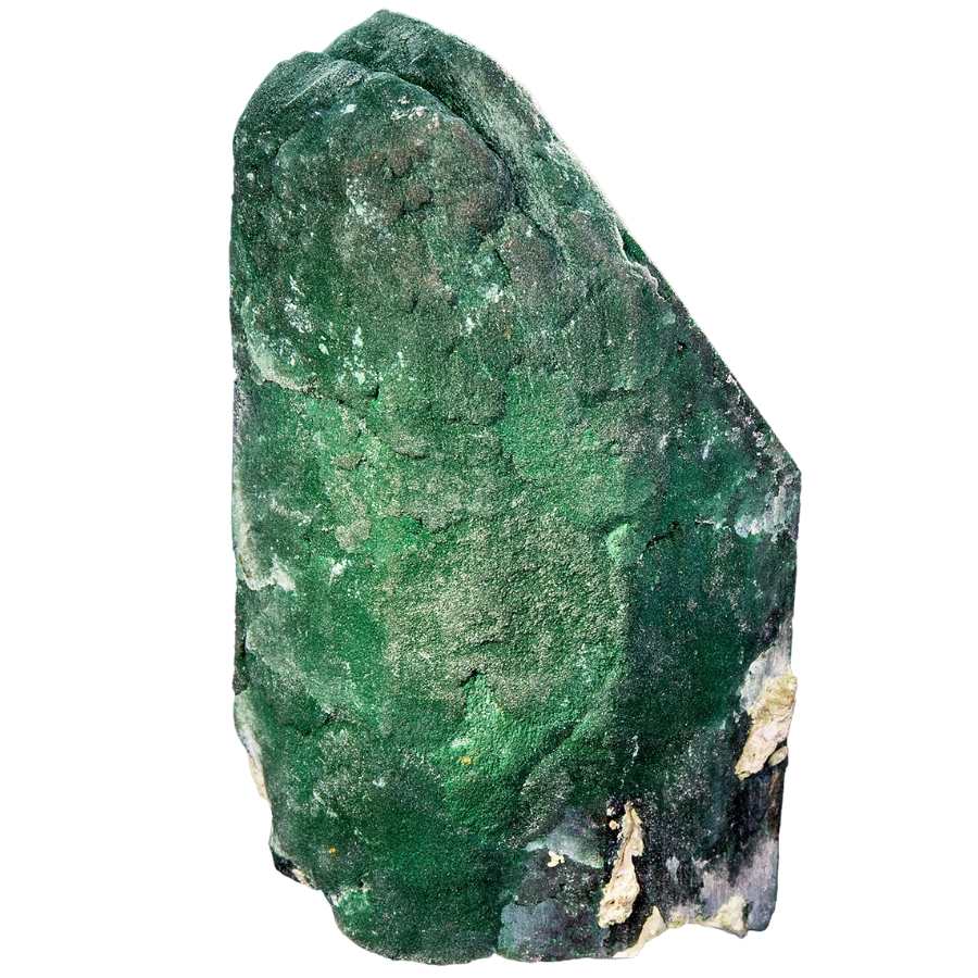
The old copper mines of Carroll and Frederick counties left waste rock stained brilliant blue and green with azurite and malachite. Pieces still surface in the streams draining the old workings. Our Maryland rockhounding guide lists the copper country locations.
Garnet
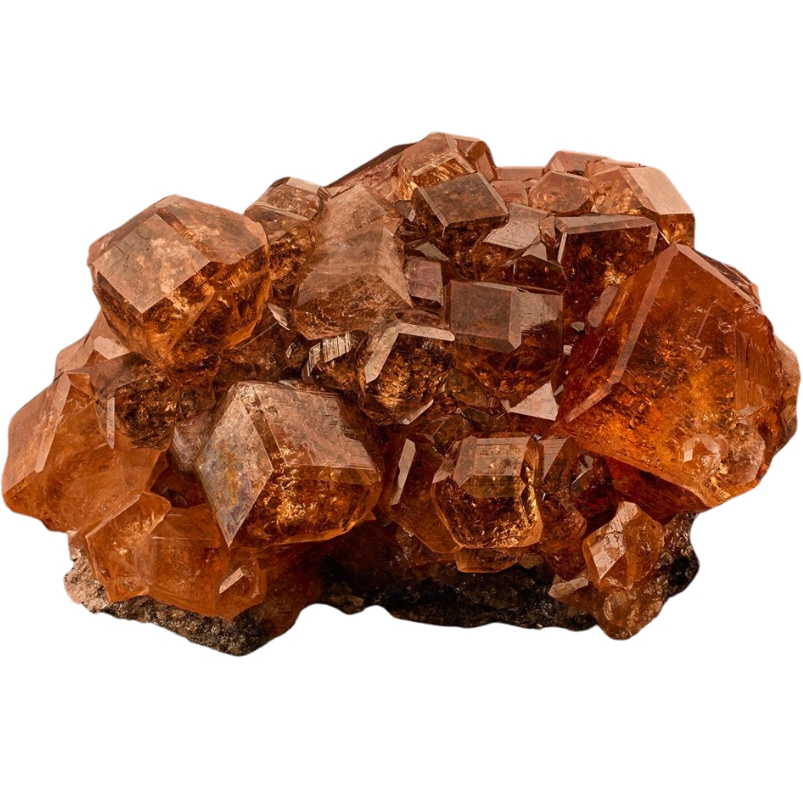
Those tiny red grains glittering in your black sand are garnets, weathered out of the Piedmont’s mica schists. Most are sand sized, but the schist belts occasionally give up crystals worth keeping. They are the most reliable companion mineral in every gold pan in this guide.
Pyrite
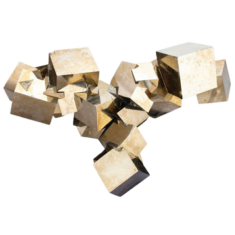
Yes, fool’s gold is worth keeping when it forms sharp brassy cubes. Good pyrite crystal clusters sell to collectors and look fantastic on a shelf. Maryland’s mineralized zones produce plenty, so save the best pieces you pan up.
Geodes
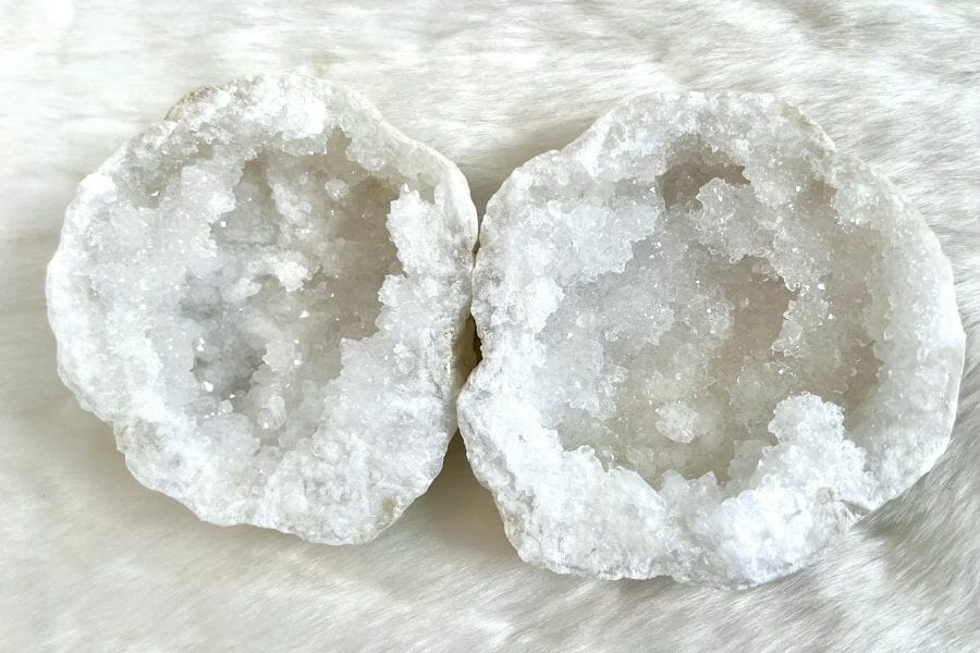
Maryland geodes look like plain round rocks until you crack them open on a crystal lined hollow. They turn up in stream gravel and weathered rock in several counties. Our guide to geodes in Maryland lists the best spots.
Fossil Shark Teeth
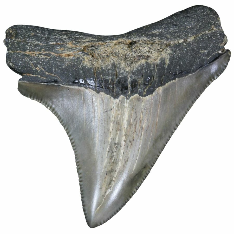
When the gold streams run high, Maryland offers a backup treasure hunt, because the Calvert Cliffs beaches produce fossil shark teeth up to giant megalodon size. It is some of the best fossil hunting on the East Coast. Our guide to fossils in Maryland maps the beaches.
Tourmaline
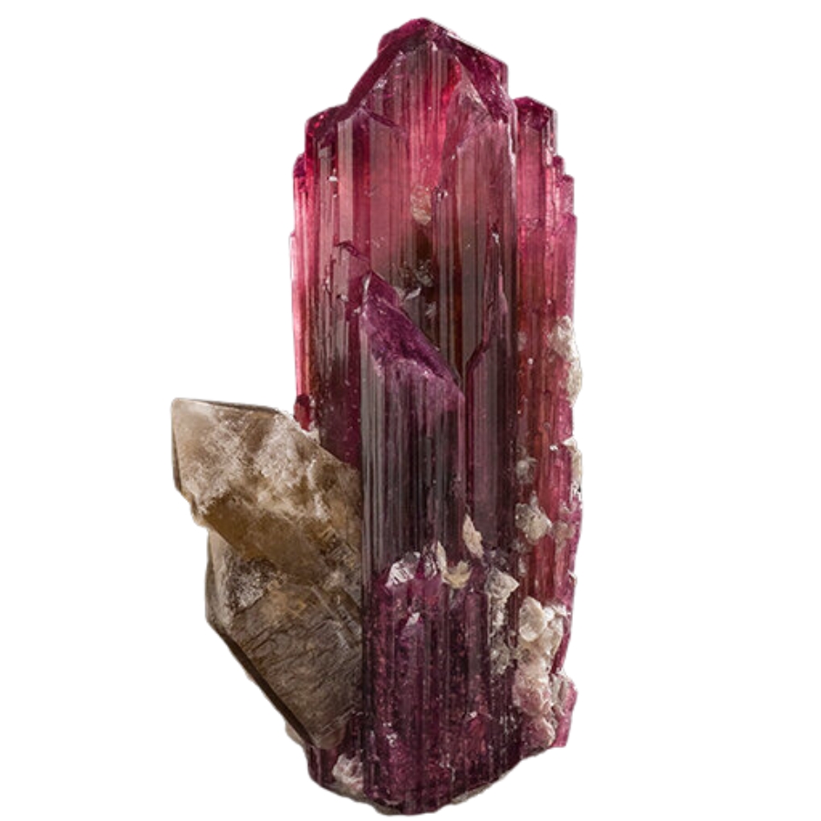
Black tourmaline crystals grow in Maryland’s pegmatites and weather into its streams, showing up as glossy black rods in gravel. Sharp specimens are collector pieces. Check any striped black crystal before you toss it.
Here is the thing about every mineral on this list. In a wet pan, half of them look like gray or white pebbles, and people flick real treasure back into the creek every single weekend. The Rocks and Minerals of the United States Field Guide exists so that never happens to you, with clear photo identification for 140 rocks, minerals, and gems you can check creekside in seconds.

Legal Rules for Gold Prospecting in Maryland

Before you touch a pan to gravel, read this section, because knowing exactly which Maryland waters are open is what keeps every find 100% yours. We are rockhounds, not lawyers, and nothing here is legal advice. Rules change, and staying legal is entirely your responsibility.
Private Property
Nearly every legal gold stream in Maryland flows through private land, and the landowner’s permission is required to prospect, pan, or dig. Without it you are trespassing, full stop, and that is the Maryland Geological Survey’s own warning. Written permission is the single most important tool you can carry, and rural landowners often say yes to a polite ask.
Federal and State Park Land
The historic heart of the gold belt sits inside the Chesapeake and Ohio Canal National Historical Park, which runs the entire Maryland shore of the Potomac, and prospecting and collecting there are prohibited. Maryland state parks are also closed to collecting unless you have authorization from the Maryland Park Service, which rules out the park stretches of Seneca Creek, Deer Creek, the Patuxent, and the Patapsco. County stream valley parks in Montgomery County carry their own restrictions, so confirm with Montgomery Parks before working any stream inside one.
Equipment Restrictions
Hand pans and hand tools are the safe baseline everywhere you have permission. Anything that seriously disturbs a streambed, like dredging or high banking, runs into Maryland Department of the Environment waterway and wetland rules, and commercial scale digging triggers surface mining licenses. Keep it to a pan, a trowel, and hand tools and you stay inside the hobby lane.
Play it safe on every trip. Confirm access directly with the landowner or the managing agency before you dig, because boundaries and rules change without notice.
Some of the most famous spots in this guide, including the Maryland Mine ruins and the Great Falls gorge, are strictly look but do not take. Enjoy them as history, and save your pan for water where you have clear permission.
The best shortcut is local knowledge. Maryland sits within reach of active prospecting and mineral clubs, and members know which landowners welcome panners, so a club membership pays for itself in access alone.
Maryland Gold FAQ
Is there gold in Maryland?
Yes, there is real gold in Maryland, concentrated in a gold belt along the Potomac River in Montgomery County. The state recorded more than 5,000 ounces of production from mines that operated from 1867 until 1940. Today fine placer gold can still be panned from streams draining the old gold and copper districts.
Can you pan for gold at Great Falls Maryland?
No, panning and collecting are prohibited at Great Falls because the area sits inside the Chesapeake and Ohio Canal National Historical Park. You can hike the Gold Mine Loop to the ruins of the historic Maryland Mine, but it is look but do not take. Legal panning happens on private land streams in the same belt with landowner permission.
Where can you find gold in Maryland?
The best documented gold country is southern Montgomery County around the old Potomac gold belt, including the Rock Run and Seneca Creek drainages. Prospectors also report fine gold from Deer Creek in Harford County and streams draining old mine districts in Carroll and Frederick counties. The best places section above breaks down the access for every spot.
Is it legal to pan for gold in Maryland?
Gold panning is legal in Maryland on private land with the owner’s permission, using hand tools. It is prohibited in the C&O Canal National Historical Park and in state parks without authorization from the Maryland Park Service. Motorized equipment can trigger state environmental permits, so hobby panners stick to a pan and hand tools.
Has anyone found a gold nugget in Maryland?
Yes, old placer operations on Rock Run in Montgomery County reportedly recovered nuggets weighing up to 4 ounces. Flour gold and small flakes fill most modern pans, and the same nugget producing gravels get reworked by every flood. Anything bigger in your pan makes for a banner day worth celebrating.
Get Every Find In Your Pan Identified In Seconds

Every pan you pull out of a Maryland stream is a mystery until you can name what is in it. The Rocks and Minerals of the United States Field Guide identifies 140 rocks, minerals, gemstones, and geodes from across the country with clear photos, printed on heavy duty laminated pages that shrug off water right at the creek.