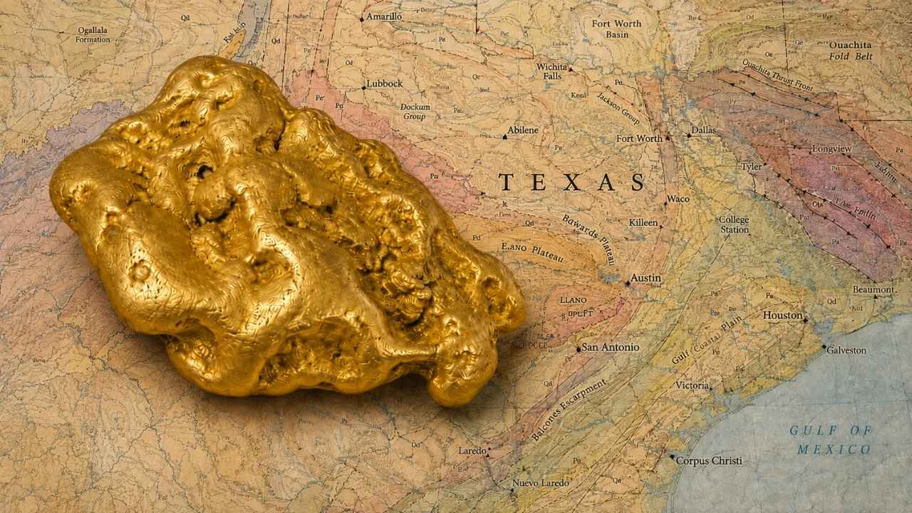
Texas mines pulled more than 8,000 ounces of gold out of the ground before the Presidio mine shut its doors in 1942, and almost every ounce came from rock that people were digging for something else. That gold is still working its way into Texas creeks today, and the best of it lands in water you can legally stand in.
With gold trading above $4,000 an ounce, you do not need to find much for a weekend of panning to pay for itself.
The one thing that separates a great Texas gold day from a slow one is setting up for fine gold instead of hunting nuggets. Texas gold is small, heavy, and it hides in the packed gravel and bedrock cracks that most people wade right over.
Yes, you can still find gold in Texas today, especially along the Llano River and Sandy Creek, where placer deposits eroding out of the Llano Uplift have been producing fine gold for well over a century. This guide walks you through the Hill Country water that anyone can reach from a public crossing, the West Texas districts where the state’s biggest gold came from, and the North Texas gravel bars that prospectors keep going back to.
Our team of geologists and experienced rockhounds studies the geology that builds gold deposits, so every spot below is tied to a real reason the gold is there. Grab a pan and let’s get into it.
Jump To A Section
- Biggest Discovery
- Types of Gold
- Where Gold Hides
- Best Places
- Techniques
- Fool’s Gold
- How Gold Formed
- What To Bring
- Best Time
- Other Minerals
- Legal Rules
- Texas Gold FAQ
The Biggest Gold Discovery in Texas History
The Presidio mine at Shafter produced more gold than every other Texas operation combined, and it did it while the crews were chasing silver. Thousands of ounces of natural gold came out of that ore between the 1880s and September of 1942, when the mine finally closed.
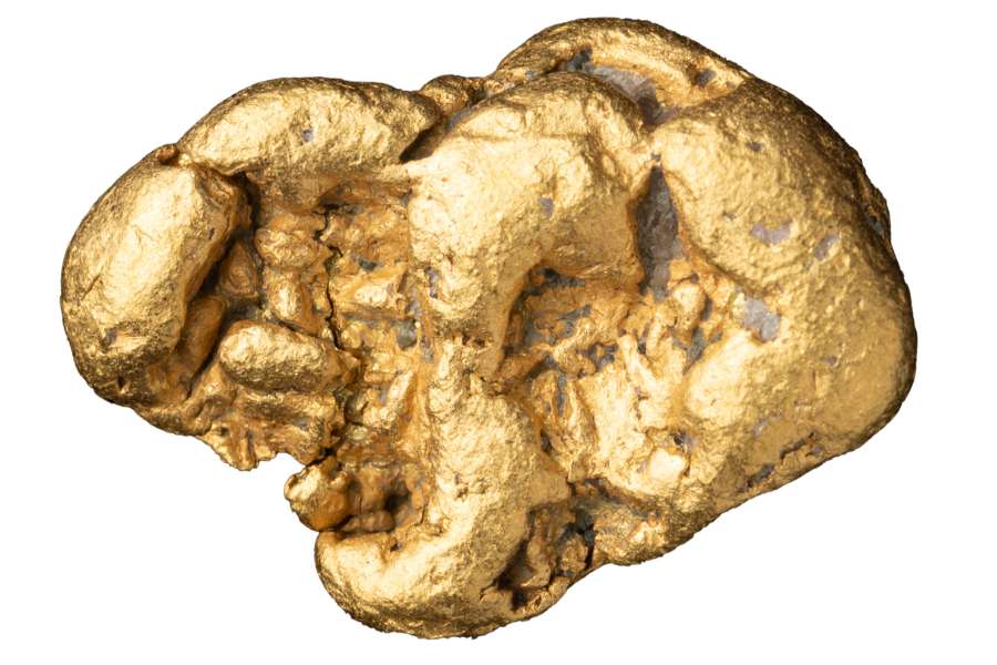
Statewide, Texas recorded more than 8,000 fine ounces of gold before that closure. At today’s prices that same gold would be worth well over thirty million dollars, and it was pulled from a corner of the state most people drive straight past.
The reason Shafter was so rich comes down to hot water and broken rock. Mineral rich fluids rose through fractures in the limestone, cooled near the surface, and dropped silver, lead, and gold into thick replacement bodies.
The Hazel mine up in the Van Horn country did the same trick in older Precambrian rock, and native gold has been confirmed there too. Both districts still shed heavy metal into the desert washes below them every time a monsoon storm rolls through.
The Kinds of Gold You Can Find in Texas
Texas gold shows up in four forms, and knowing which one you are hunting changes how you set up your pan. The Llano Uplift supplies most of it, and the West Texas districts supply the rest.
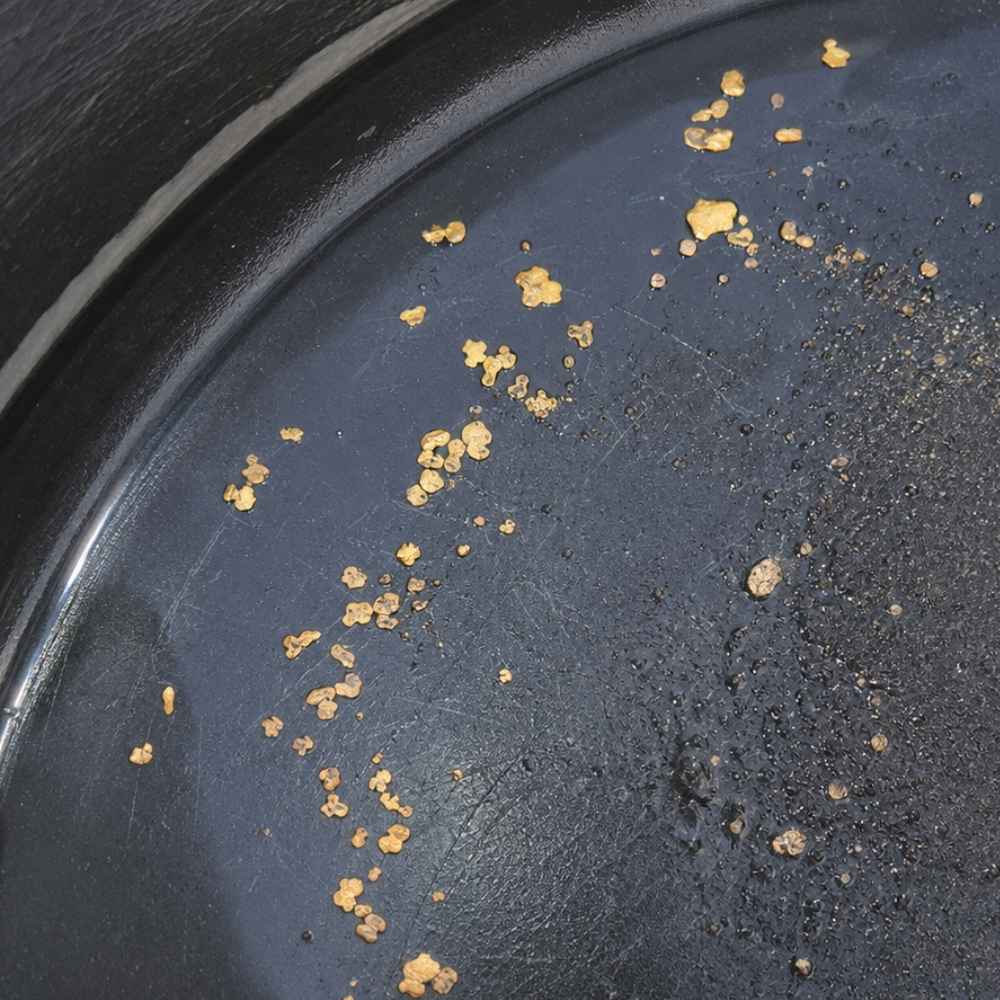
Flour Gold
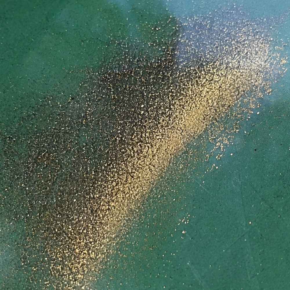
Flour gold is the smallest size Texas produces, and it looks like bright yellow dust riding on top of black sand. You will see it along the Llano River and in the Mason County creeks, usually as a thin yellow line at the edge of your black sand streak.
Beginners often grab shiny yellow mica instead. Real gold stays bright yellow when you shade it with your hand, while mica goes dull and gray the second the sun comes off it.
A pan with deep riffles keeps this size from washing over the lip. The Garrett 15″ Dual Riffle SUPERSLUICE Gold Pan is built for exactly this kind of light material.
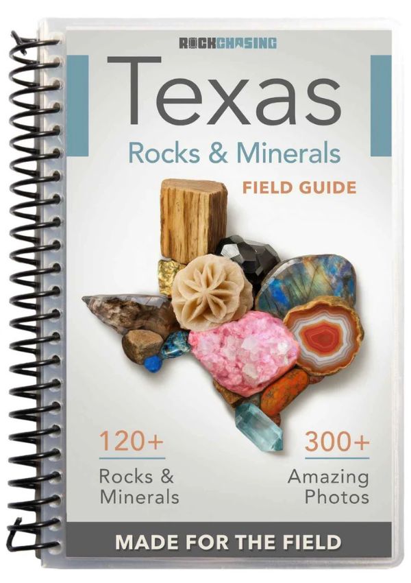
Flour gold is also the moment most people realize they have no idea what the other twenty things in their pan are. Our Texas Rocks and Minerals Field Guide shows you the local minerals side by side with photos, so you can name every heavy piece in your concentrates before you dump them.
Fine Gold Flakes
Flakes are the size most Texas prospectors take home, and they are big enough to pick out with a snuffer. They collect behind boulders and in the gravel packed against bedrock along the Llano River and Sandy Creek.
Chalcopyrite fools people at this size because it flashes the same brassy yellow. Gold bends when you press it with a knife tip, while chalcopyrite crumbles into brittle green black powder.
Once you spot a flake, get it out of the pan fast before the next wash takes it. A Garrett Gold Guzzler Bottle sucks flakes straight off the water without you touching them.
Gold Pickers
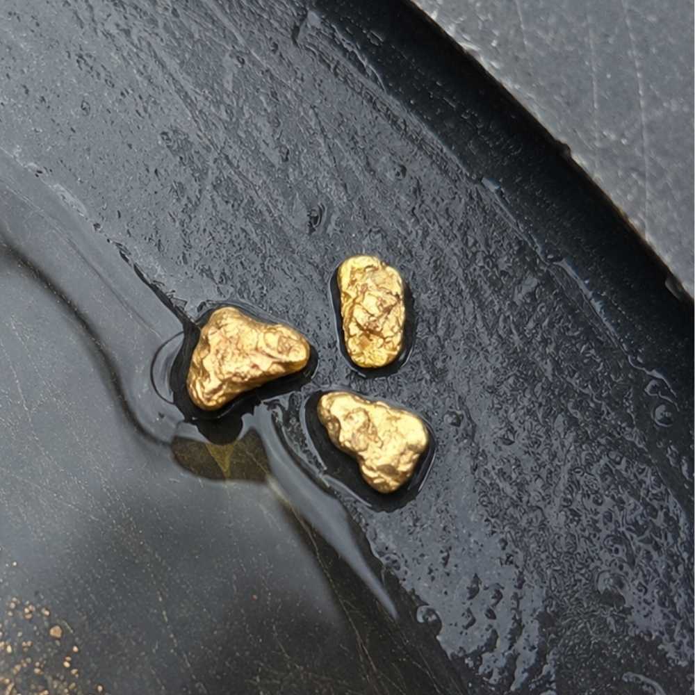
Pickers are the pieces heavy enough to hear when they hit the bottom of a vial, and Texas drops them into deep bedrock pockets. The Guadalupe River near Kerrville and the deeper cracks on the Llano have both given up pieces this size.
Heavy gray lead shot and dark ironstone pebbles get mistaken for pickers all the time. Gold has a soft metallic shine on every face and will not shatter when you tap it, while ironstone breaks and lead shows a dull gray streak.
Getting to picker ground means reaching into tight cracks that a shovel cannot touch. The ASR Outdoor Steel Crevice Tool Set scrapes those pockets clean.
Vein Gold in Quartz
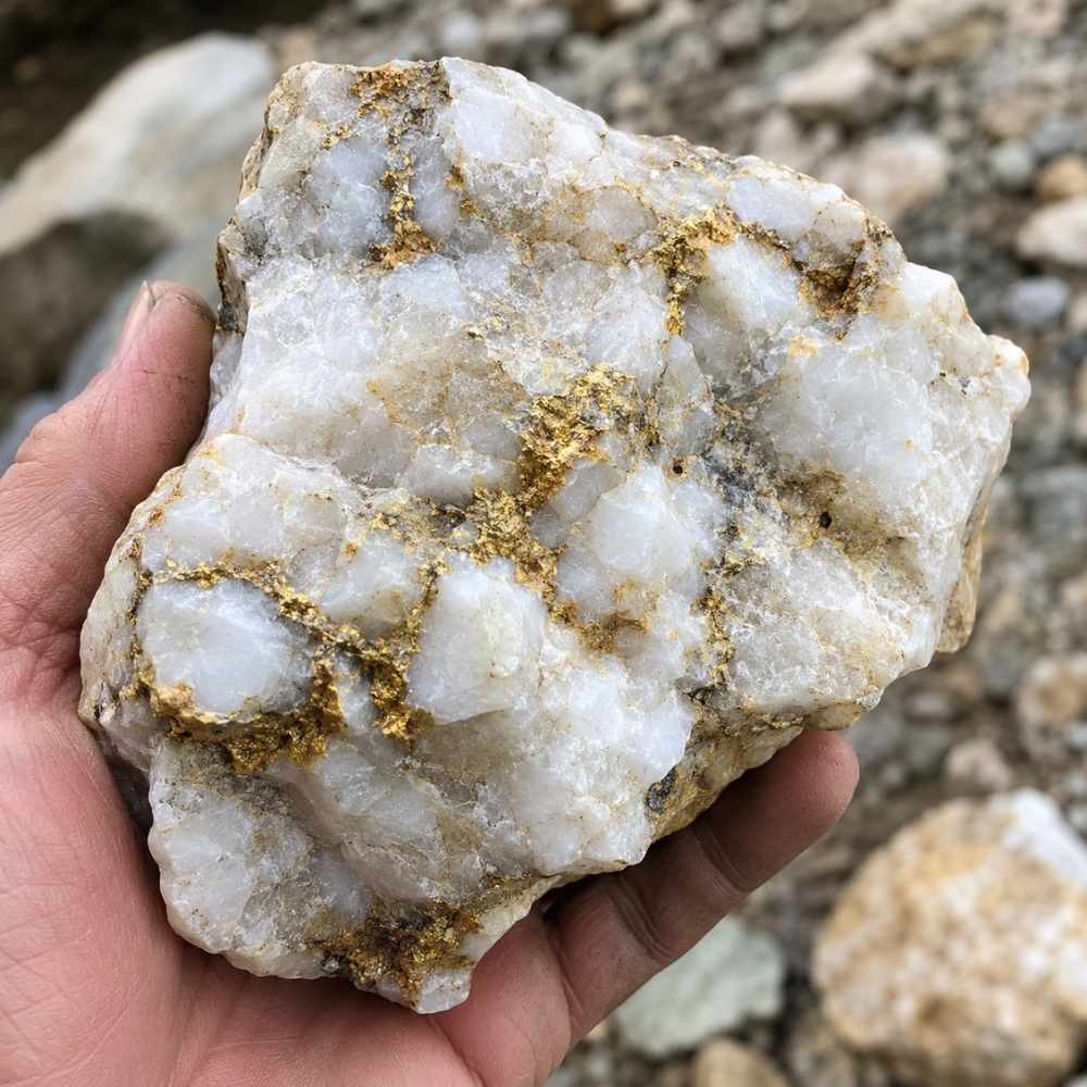
Vein gold sits inside white quartz that never made it into the water, and the Llano Uplift is full of the quartz that carries it. The old Heath mine ground northwest of Llano worked this exact kind of rock.
Rusty iron staining on quartz looks like gold in bright sun and fools nearly everyone once. Gold shows a real metallic glint from any angle, while iron stain stays a flat orange smear on the surface.
Cracking float quartz open is how you find out what is inside. An Estwing Geo Paleo Rock Pick splits samples cleanly without wrecking the specimen.
Every one of these forms responds to a different setup, and the techniques section below walks you through the exact method that pulls each one out of Texas gravel.
Where Gold Hides in Texas Streams
Gold in Texas collects in five places, and learning to read them turns a random creek into a plan. Gold weighs about nineteen times what water does, so it drops the instant the current lets go of it.
Bedrock Cracks and Potholes
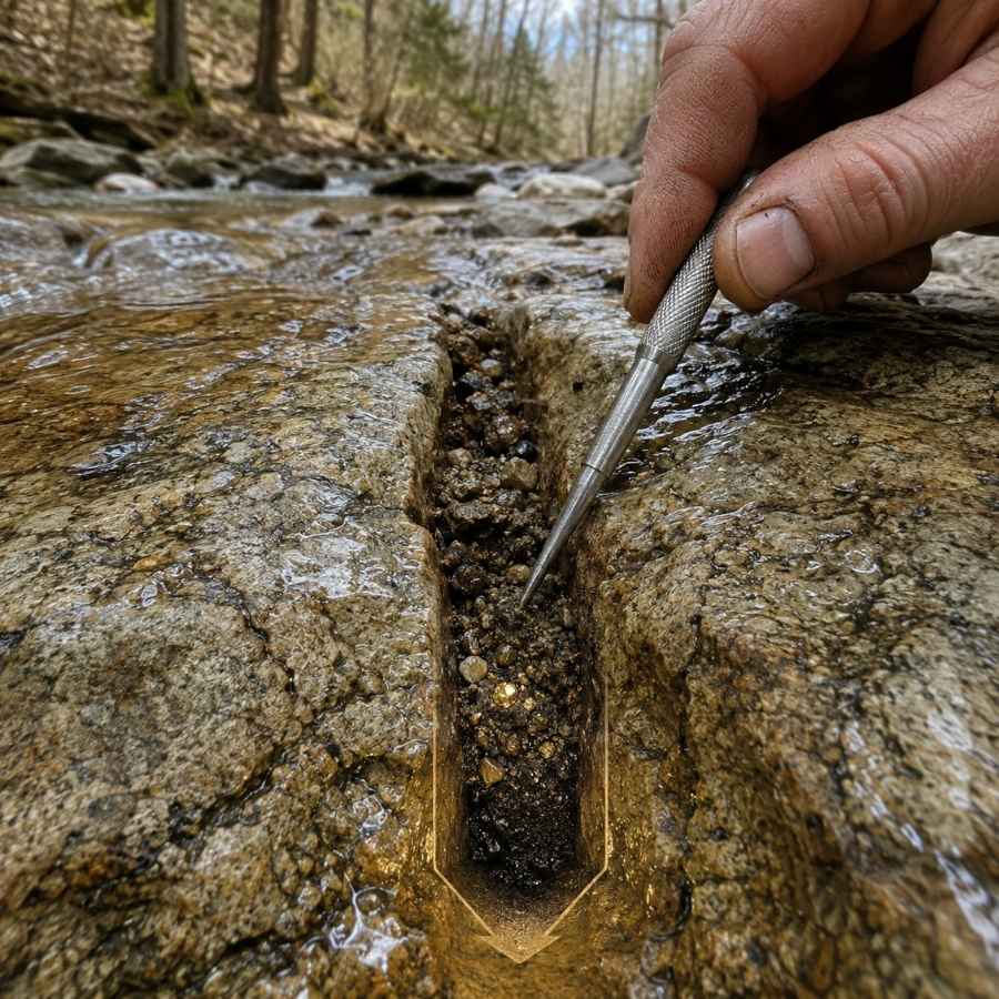
Exposed bedrock is the single best trap in Texas, and the Llano Uplift gives you miles of it. Every crack and pothole in that granite works like a riffle that has been catching gold for thousands of years.
Dig those cracks all the way to the bottom and expect packed clay and gravel that fights you. The material down there feels dense and gritty, and that heaviness is the whole point.
A Garrett Prospecting 10″ Backpacker Gold Pan finishes crack material fast once you have it screened.
Inside Bends and Gravel Bars
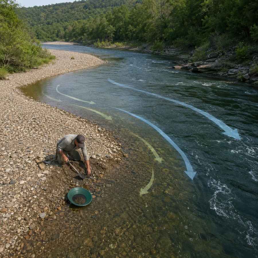
The inside of a river bend is where the current slows down and gives up its heavy load. On the Llano and the Colorado, those inside bars build up fresh every spring.
Work the upstream head of the bar and dig down to the packed layer under the loose surface rock. The loose top gravel moves every flood, but the packed layer underneath is where the gold sits.
Screen out the big cobbles first with an SE Half Inch Sifting Screen so you are only panning material that can hold gold.
Behind Large Boulders
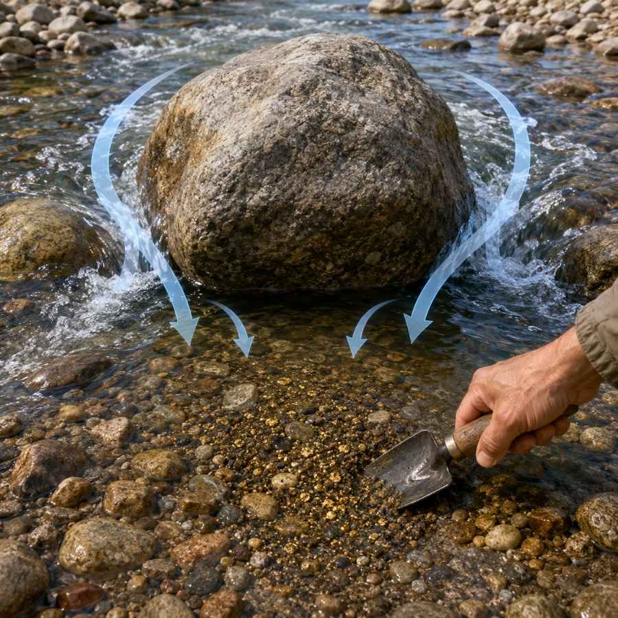
Big boulders create a pocket of dead water on their downstream side, and gold drops into it. Hill Country creeks are full of granite boulders that have been doing this since long before anyone was watching.
The sand right behind a boulder is usually darker and heavier than the sand three feet away. That color change is your signal to start digging.
An Edward Tools Bend Proof Trowel gets into those tight pockets without moving the boulder.
Black Sand Streaks
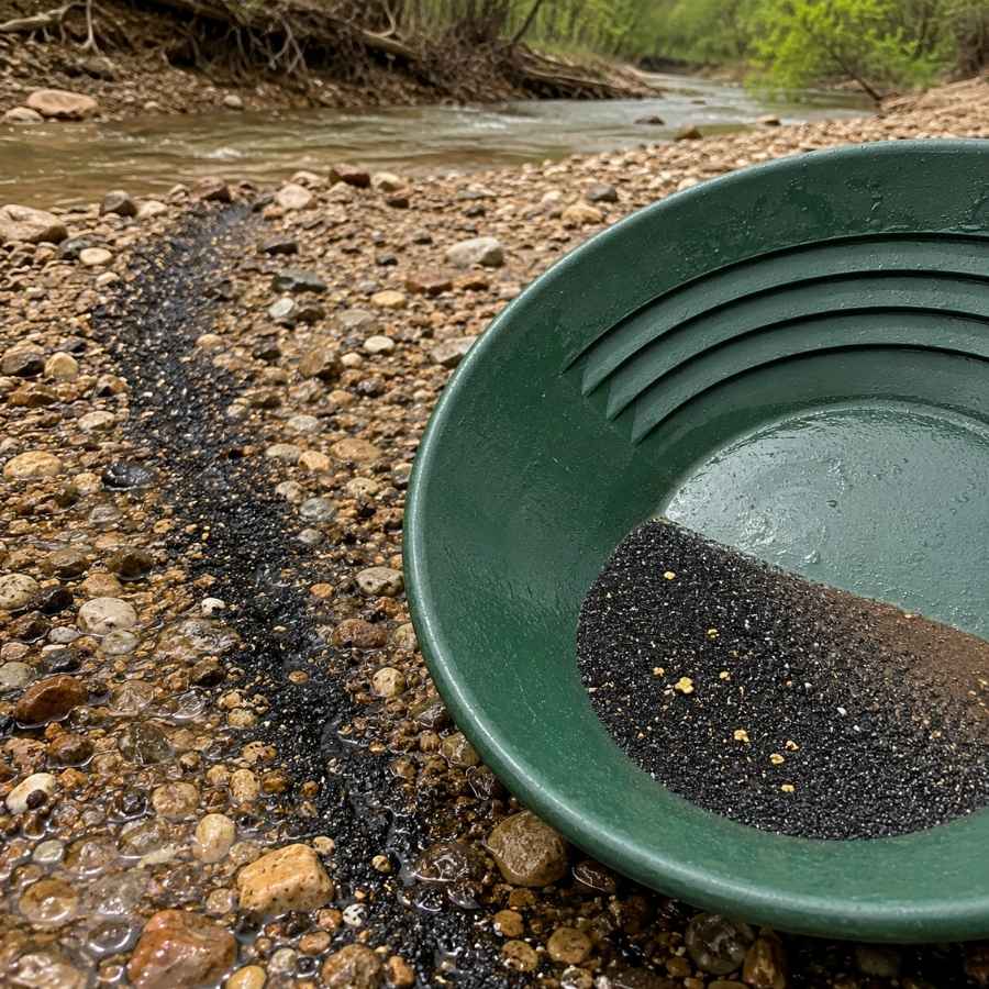
Black sand is magnetite and hematite, and it travels with gold because it is almost as heavy. When you see a dark streak painted across a Texas gravel bar, you are looking at a natural sorting line.
Sample the head of that streak first. The material feels gritty and dense in the pan and takes patience to work down.
An SE Magnetic Separator Pick Up Tool with Quick Release pulls the magnetics out of your concentrates so the gold stands alone.
Where a Creek Meets the River
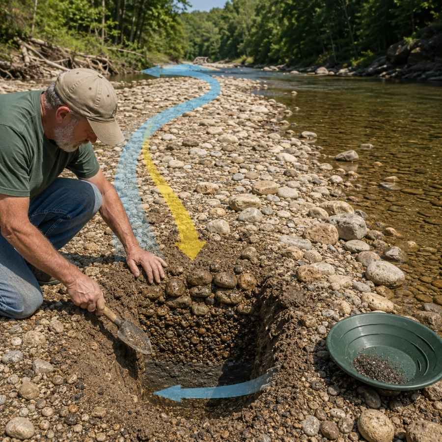
Confluences are drop zones, and Texas has hundreds of them where Hill Country creeks empty into the Llano and the Colorado. Fast water hits slow water, loses its energy, and dumps everything heavy in one spot.
Look for the gravel wedge that builds just downstream of where the two currents meet. That wedge is usually shallow, easy to dig, and loaded with black sand.
A Bully Tools 14 Gauge Round Point Shovel moves the overburden so you can reach the good layer underneath.
Always Confirm Access and Collection Rules!
Before heading out to any of the locations on our list you need to confirm access requirements and collection rules for both public and private locations directly with the location. We haven’t personally verified every location and the access requirements and collection rules often change without notice.
Many of the locations we mention will not allow collecting but are still great places for those who love to find beautiful rocks and minerals in the wild without keeping them. We also can’t guarantee you will find anything in these locations since they are constantly changing.
Always get updated information directly from the source ahead of time to ensure responsible rockhounding. If you want even more current options it’s always a good idea to contact local rock and mineral clubs and groups
The Best Places To Find Gold in Texas
Texas gold country splits into three regions, and each one gives you a different kind of day. Central Texas has the public river access and the finest gold, West Texas has the historic districts and the biggest pieces, and North and East Texas have big gravel bars that most prospectors never touch.
Almost all Texas land is privately owned, and that is good news once you understand how it works. The beds of navigable Texas streams belong to the state, so you can legally work them if you enter from a public crossing, bridge right of way, boat ramp, or public park. For everything else, one friendly phone call to a landowner turns a closed spot into ground almost nobody else is working, and every flake you find is one hundred percent yours.
Central Texas
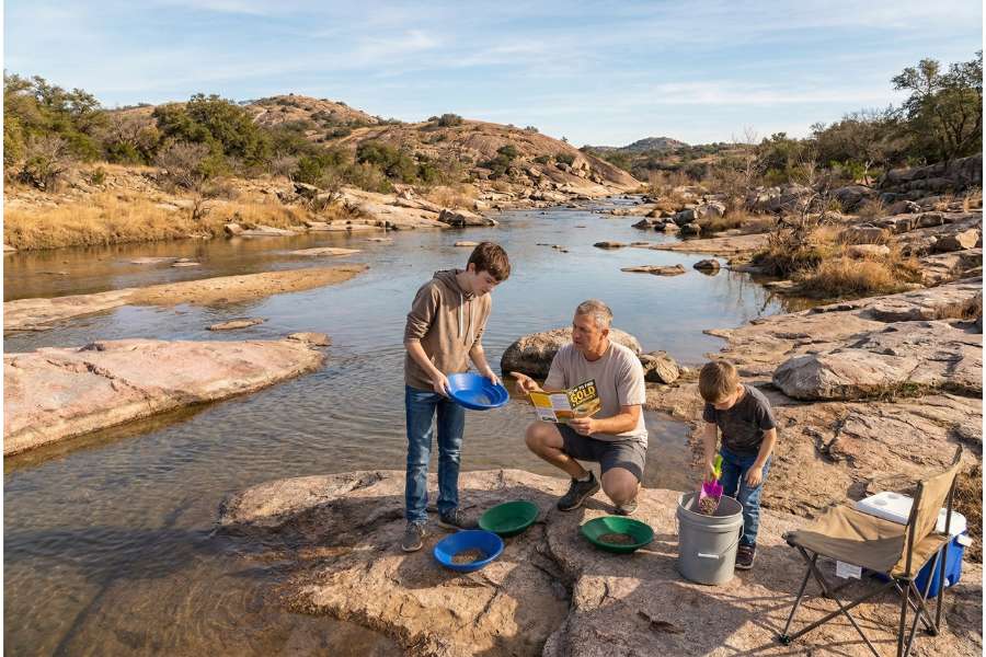
Central Texas is built on the Llano Uplift, a billion year old dome of granite, gneiss, and schist that is the source of nearly all the state’s placer gold. This is where the public access is, and it is where a first time Texas prospector should start. The same granite country makes it one of the best rockhounding regions in Texas for gems and crystals as well.
Kingsland Slab on the Llano River
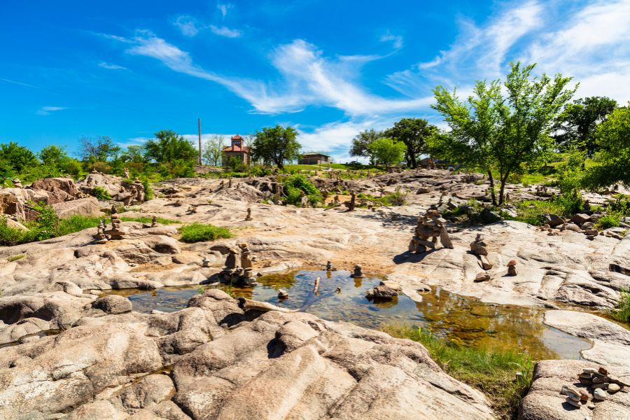
The Kingsland Slab is the most popular gold panning spot in Texas, and it is a public low water crossing you can drive right up to. The Llano River spreads out into a thin sheet across a giant granite slab here, which means the bedrock is exposed and the cracks are within easy reach.
It sits off Slab Road near Kingsland, just off FM 1431. Parking fills up on warm weekends because it doubles as a swimming hole, so early mornings are yours.
You are hunting flour gold and fine flakes packed into the crevices. Crevicing is the technique that pays here, because every crack in that slab has been collecting heavy sand for centuries.
Your pan will also fill with garnets, black sand, smoky quartz, and the occasional piece of blue topaz. This is the spot where people throw away the good stuff, so use our Texas Rocks and Minerals Field Guide to check every heavy piece before it goes back in the river.
Bring an ASR Outdoor Steel Crevice Tool Set because the slab rewards anyone willing to dig into tight rock.
Difficulty rating: 1 out of 5
The Llano River at Llano
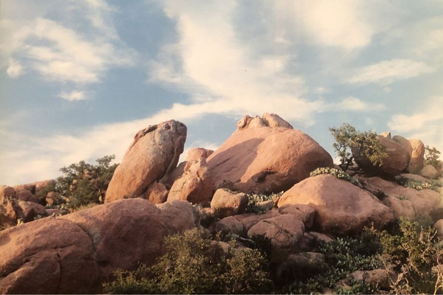
The town of Llano gives you public river access below the dam, and it is one of the easiest legal entries in the state. Grenwelge Park and Robinson City Park both put you on the south bank where the river drops its load coming off the dam.
The gold here is fine and it hides under the rock piles and in the packed sand along the bank. Local prospectors work the gravel right where the current slows against the shore.
Panning is the method, and a patient hand beats a fast one every time. The river runs shallow enough through here that wading is comfortable in warm months.
Expect black sand, quartz, feldspar, and small garnets alongside your gold. The town’s mining museum is worth a stop if you want local advice before you get wet.
A SE 1/8″ Mesh Sifting Screen will speed up your day by cutting the volume you actually pan.
Difficulty rating: 1 out of 5
Sandy Creek
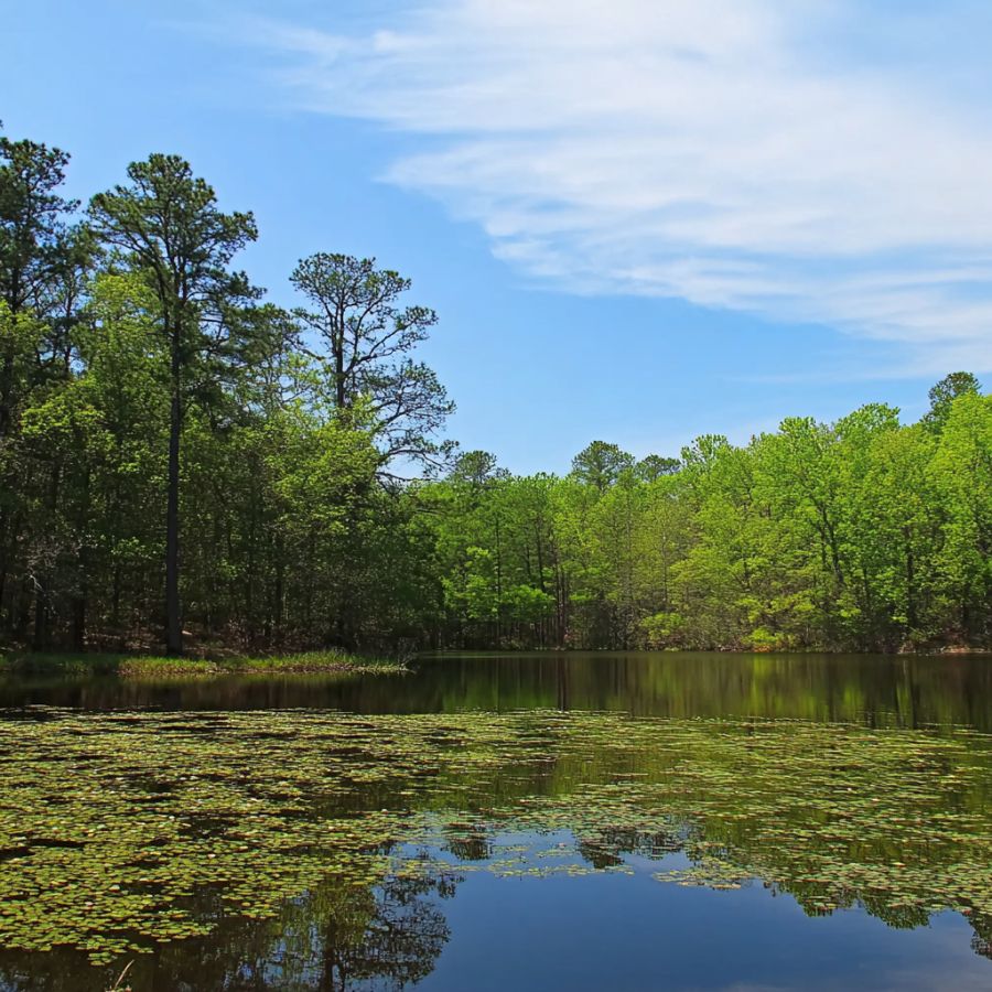
Sandy Creek cuts straight through gold bearing granite south of the town of Llano, and it is one of the most consistently named creeks in Texas prospecting. Highway 16 crosses it, which gives you a public crossing to work from.
The creek gets its name honestly, and the heavy material sinks through that loose sand until it hits solid rock. Dig to the bedrock floor and you are in the right layer.
You are after very fine gold here, so pan slowly and let the water do the sorting. Some prospectors dry wash the bank material when the creek is low.
Sandy Creek also produces blue topaz, smoky quartz, and feldspar out of the local pegmatite. It is a strong two for one trip.
An SE Half Inch Sifting Screen keeps the granite cobbles out of your pan.
Difficulty rating: 2 out of 5
Packsaddle Mountain Creeks

The creeks draining Packsaddle Mountain cut through the Packsaddle Schist, one of the two oldest rock units in the Llano Uplift. That schist is the host for the quartz veins that fed gold into this whole region.
The drainages here are steep and rocky and the surrounding land is private ranch country, so this is a permission first destination. Ranchers in the area are often happy to talk if you call ahead and explain what you are doing.
Fine gold and small flakes concentrate where the steep gradient suddenly flattens. Panning and crevicing both work once you find the flat spots.
The gravel is loaded with schist, mica, and garnet, and garnet in your pan is a very good sign you are on heavy ground.
A Estwing Geo Paleo Rock Pick helps you break into the schist and quartz float on the slopes.
Difficulty rating: 4 out of 5
Pennington Creek
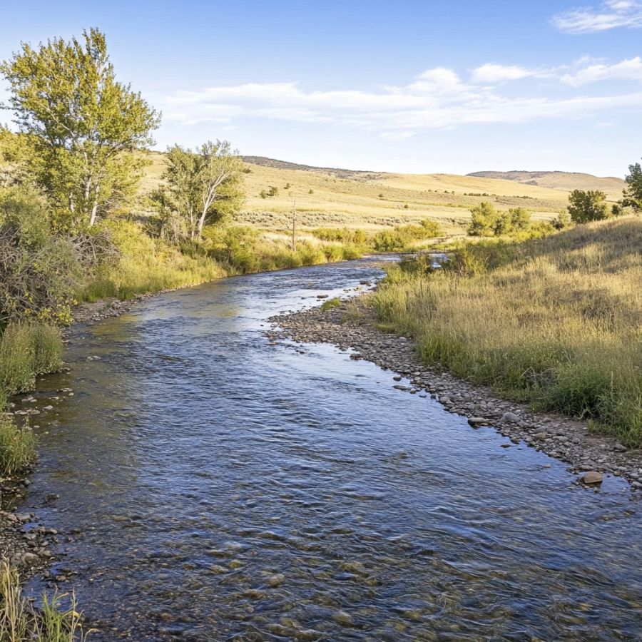
Pennington Creek in Llano County is one of the historically named placer creeks in the uplift, and it drains straight off the gold bearing granite. Small scale placer work happened in this part of the county back in the late 1800s.
The creek runs through private ranch land, so a call ahead is the whole game. Landowners along these creeks deal with far fewer prospectors than a public slab does, which is exactly why the ground is fresh.
Fine gold sits on the bedrock under the gravel, so plan on digging rather than surface panning. A crevice tool earns its keep here.
Quartz, feldspar, and iron stones fill the gravel bars alongside the gold.
An ASR Outdoor Steel Crevice Tool Set is the right tool for the packed bedrock cracks.
Difficulty rating: 3 out of 5
The Llano River near Mason

The upper Llano River through Mason County carries the same gold as the famous stretches downstream, with a fraction of the traffic. County road crossings give you legal entry to the streambed.
This part of the river runs through granite and gneiss country, and the bars build up on every inside bend. The water is usually clear enough to read the bottom before you dig.
Flour gold and fine flakes are the target, and slow careful panning is the method. Work the head of each bar where the gravel is coarsest.
Mason County is famous for topaz, so keep an eye out for clear and pale blue crystals in your screen. Garnet and smoky quartz turn up here too.
A Garrett 15″ Dual Riffle SUPERSLUICE Gold Pan holds onto the fine stuff this river is known for.
Difficulty rating: 2 out of 5
Walnut Creek
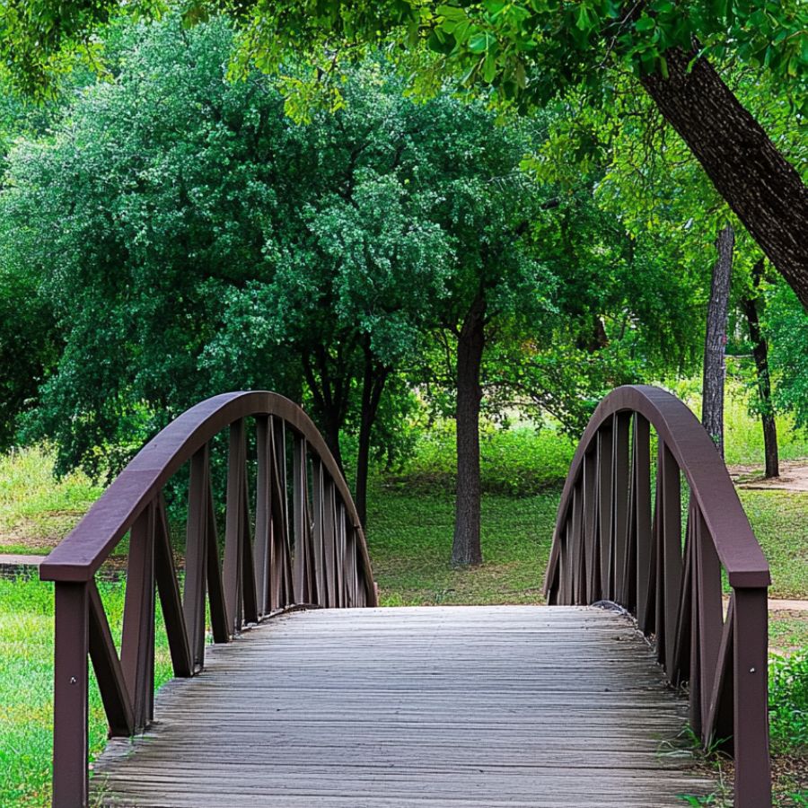
Walnut Creek in Blanco County saw real placer work in the late 1880s, which puts it on a very short list of Texas creeks with a documented mining history. That history is why prospectors still come back to it.
The creek is small, shaded, and lined with oaks whose roots make excellent natural traps for heavy sand. Access runs through private property in most spots, so line up permission before you go.
Fine gold collects in the root pockets and against the bedrock ledges. Panning and crevicing both produce here.
Limestone, chert, and quartz make up most of the gravel, and the darker heavy sand is what you want to keep.
An Edward Tools Bend Proof Trowel fits into the root pockets where a shovel cannot go.
Difficulty rating: 3 out of 5
The Guadalupe River near Kerrville
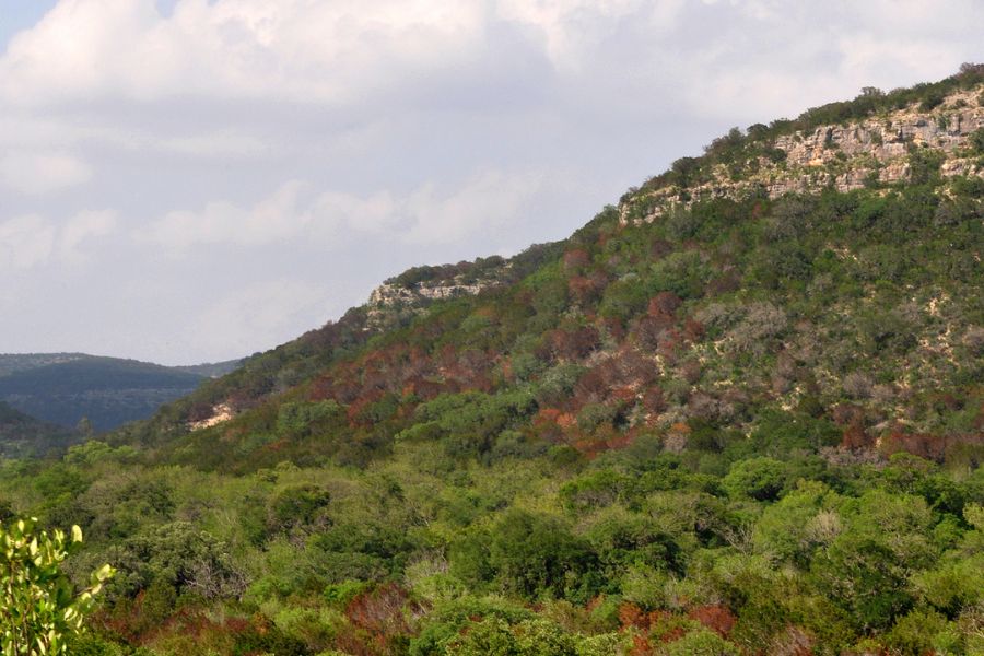
The Guadalupe near Kerrville earned its reputation when a find in the area got prospectors looking harder at the whole stretch. It is one of the few Texas rivers where people report pieces big enough to call pickers.
Kerrville has public river parks and several public crossings, which makes legal entry simple. The river runs shallow over a wide limestone bed with rapids and deep pools trading off.
The sudden speed changes drop heavy material into the pools, so target the tail of a rapid and the head of the pool below it. Panning works, and a small sluice works better when the water is running.
Look for patches of black sand as your indicator, plus chert, flint, and calcite in the gravel. Cypress roots along the bank hold heavy sand the same way boulders do.
A Keene A52 Hand Sluice lets you process real volume where the current cooperates.
Difficulty rating: 2 out of 5
The Colorado River near Marble Falls
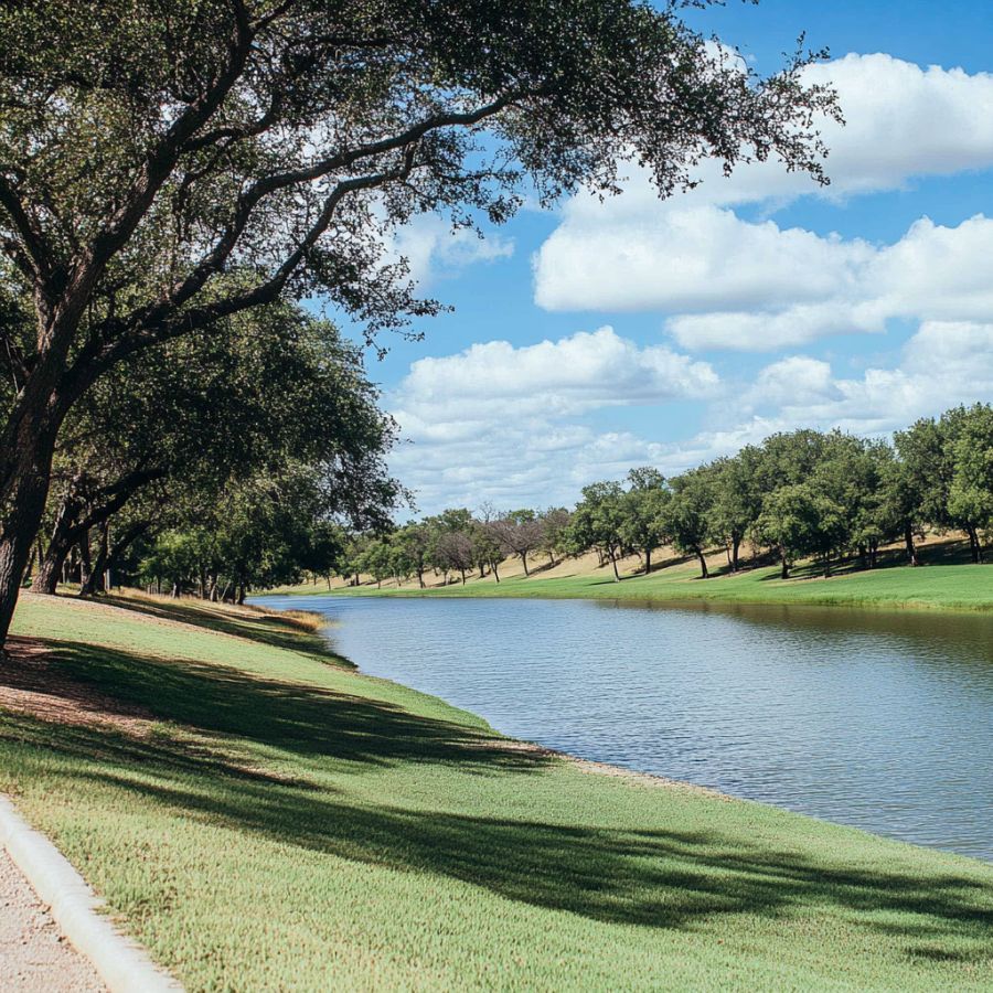
The Colorado River picks up everything the Llano River carries, because the Llano empties into it just upstream near Kingsland. That makes the Burnet County stretch a natural collection point for uplift gold.
A small rush hit the upper Colorado in the early 1850s, and the river has kept producing fine placer gold since. Public boat ramps and river parks around Marble Falls give you entry.
The gold here has been tumbled flat by miles of river travel, so it comes out as bright wide flakes that show up fast against black sand. Slow panning and a fine classifier are how you keep every one.
Petrified wood, jasper, and agate show up in the same sandy bars. It is a good river for a family day where everybody finds something.
A SE 1/8″ Mesh Sifting Screen is close to required for gold this fine.
Difficulty rating: 3 out of 5
Gazley Creek
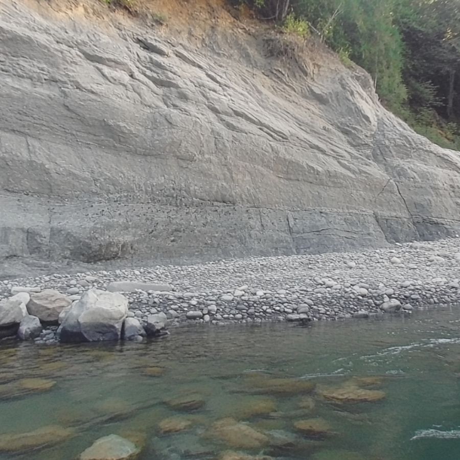
Gazley Creek near Royston Hill in Bastrop County is one of the few Texas creeks named for gold well outside the Llano Uplift. It has produced very fine gold for a long time and it still does.
The bottom is soft sand, which makes digging easy and makes this a great creek for a first outing with kids. Most access is through private land, so ask first and you will usually be welcome.
The gold is exceptionally small, so a sluice run beats a pan for volume. Classify tight and take your time on the finish pan.
The gravel here is famous for petrified palm wood, which is the Texas state stone and worth collecting on its own.
A Keene A52 Hand Sluice handles the volume this fine gold demands.
Difficulty rating: 3 out of 5
West Texas
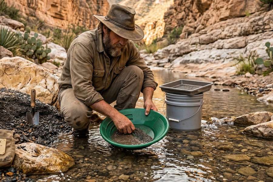
West Texas is where the state’s gold actually got mined, and the districts around Shafter, Van Horn, and Allamoore produced almost all of it. The country is dry, the land is ranch land, and the payoff is the biggest gold Texas has.
The Shafter District and Cibolo Creek

Shafter sits at the foot of the Chinati Mountains in Presidio County, and the Presidio mine there produced more gold than the rest of Texas combined. The gold came out of silver ore, which is why so few people know Texas had a gold mine at all.
Cibolo Creek drains the district and its flash floods sweep fresh heavy material out of the mountains every monsoon season. The town is a ghost town today and the surrounding land is private ranch property, so permission is the first step and it is worth taking.
Fine placer gold still shows in the washes below the old workings. Panning after a storm and dry washing between storms are both productive here.
The gravel carries galena, silver ore, quartz, and jasper. Bring water and tell somebody where you are going, because this is remote country.
A Bully Tools 14 Gauge Round Point Shovel moves the desert gravel you need to reach caliche and bedrock.
Difficulty rating: 4 out of 5
The Van Horn and Allamoore District Washes

The Van Horn and Allamoore district in Culberson County is home to the Hazel mine, where native gold has been confirmed in the ore. The Hazel was the second largest silver producer in Texas and it carried gold right alongside the copper and silver.
The washes draining off the old workings catch everything gravity pulls downhill. All of it is private ranch land, so track down the owner and get a yes before you drive in.
You are working dry gravel here, so a dry washer or a bucket of hauled water is the setup. Panning works if you can find a stock tank or haul water in.
The washes are full of bright green malachite and deep blue azurite, plus quartz and jasper. Those copper minerals are your signal you are in the right drainage.
An Estwing Geo Paleo Rock Pick is the tool for sampling the float rock scattered across these slopes.
Difficulty rating: 4 out of 5
North and East Texas
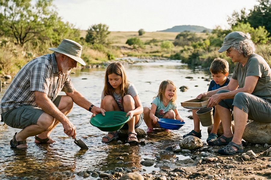
North and East Texas run on big rivers with enormous gravel bars, and prospectors report fine flood gold in several of them. Very few people work this part of the state for gold, which means the bars reset every flood and nobody is beating you to them.
Red River Gravel Bars

The Red River along the Texas and Oklahoma line has a long history of yielding gold, and prospectors still work its bars today. The river carries material a very long way, which is why the gold arrives flat and fine.
Public boat ramps and highway bridge crossings along the state line give you legal entry to the bed. Sandbars shift constantly, so a spot that was flat last year may be a gravel pile now.
Look for the darker heavy sand layers exposed in the cut banks and at the head of the bars. Sluicing is the efficient play because you are moving a lot of light sand.
The bars also produce petrified wood, quartz, and agate. Watch the current, because Red River sand can be soft in places.
A Keene A52 Hand Sluice turns a big sandbar into a manageable day.
Difficulty rating: 3 out of 5
The Elm Fork of the Trinity River

The Elm Fork of the Trinity near Dallas is the most accessible prospecting river in the state’s largest metro area. Public greenbelt parks and boat ramps run along much of it, so you can be panning twenty minutes after work.
The river is heavily modified today, but the old gravel bars along the channel still hold fine heavy material. Dig into the packed gravel rather than the loose sand on top.
Fine flood gold is the target and a classifier plus patient panning is the method. Black sand layers in the bank are your marker.
Petrified wood, quartz, and fossil material turn up constantly in the same gravel. It is a great after work spot to practice reading a river.
A SE 1/8″ Mesh Sifting Screen lets you cut a big bar down to a pan you can actually finish.
Difficulty rating: 3 out of 5
More Proven Places To Find Gold in Texas
These spots earn a trip too, and several of them see almost no prospecting pressure at all. Confirm access and collection rules before you go, and remember that a friendly call to a landowner opens most of them.
Central Texas

The Blanco River, Blanco County. The Blanco cuts through clean limestone and runs remarkably clear, which makes reading bedrock cracks on the bottom easy. Prospectors report very fine flour gold in the crack material here. Public river parks in Blanco and Wimberley give you legal entry to the bed.
Hickory Creek, Blanco County. This small creek drains the sandy edge of the central mineral region and drops to isolated pools in late summer. Low water is an advantage, because it puts the deepest bedrock cracks within arm’s reach. Most of its length runs through private land, so ask first.
Coal Creek, Gillespie County. Coal Creek cuts through the serpentine and metamorphic ground near Willow City on the southern rim of the uplift. Its gravel carries heavy magnetite and chromite that stick hard to a magnet, which is a reliable sign the creek sorts heavy material well. Access is by landowner permission.
Legion Creek, Gillespie County. Legion Creek is narrow, heavily shaded, and lined with oaks whose roots trap heavy sand against the bank. Serpentine and talc dominate the gravel, and prospectors report fine gold in the root pockets. It runs almost entirely through private ranch land.
North Grape Creek, Gillespie County. This creek runs near the old community of Gold, which tells you what people were looking for here. Fine particles sink fast through the loose gravel, so dig to the clay layer before you start panning. Permission is required for most access points.
Baby Head Creek, Llano County. Baby Head Creek has a history of small scale mineral exploration and the creek bed still carries residual heavy material below the old dig sites. Granite chunks and iron ore fill the gravel above bedrock. Access runs through private ranch land.
Big Sandy Creek, Llano County. Big Sandy funnels heavy minerals down off the granite highlands and rewards anyone willing to hike in. The bed is packed with granite cobbles and hematite, which drops out of the current in the same places gold does. Confirm access before you park.
Bull Head Creek, Llano County. Spring floods rebuild the sandbars on Bull Head every year, which means fresh material every season. Broken feldspar and small quartz crystals wash out of local pegmatite and travel with the heavier metal. Most of the creek is on private property.
Heath Mine Area Creeks, Llano County. The Heath mine northwest of Llano was one of the most productive gold operations in Texas, and the small drainages below it carry material shed from that same vein system. Quartz float on the surrounding slopes is worth breaking open. The ground is private, so permission comes first.
Pecan Creek, Llano County. Pecan Creek runs through the central mineral belt before joining the Llano River, and prospectors report fine flour gold in its lower reaches. Expect heavy black sand that makes processing slow but tells you the creek concentrates well. Access is through private land.
Comanche Creek, Mason County. Comanche Creek moves slowly through thick brush and rarely runs clear, so most digging here happens by feel. The bed is paved with flat limestone and flint nodules over granite derived sand. Landowner permission is required.
Hasse Creek, Mason County. Hasse Creek crosses flat farm ground with clay banks instead of clean sand, and washing that clay away is where the work is. Petrified wood and fossil material come up alongside the fine heavy sand. Ask before you enter.
Honey Creek, Mason County. Honey Creek drains limestone and granite country and carries very fine particles of precious metal down toward the Llano River. Heavy iron stones and dark black sand fill the pan, and topaz turns up in the same gravel. Access is private.
Katemcy Creek, Mason County. Katemcy Creek runs right past massive pink granite outcrops and has cut permanent natural sluices into the rock. The coarse granite sand carries garnet and mica, both good indicators of a well sorted bed. Permission is required.
Little Willow Creek, Mason County. The bed widens suddenly along this tributary, and those widened stretches pile up gravel that is worth digging. Crushed granite and heavy iron stones dominate the material. It runs through private ranch land.
Mitchell Creek, Mason County. Mitchell Creek has a heavily eroded bedrock bottom that looks like a washboard, and the grooves just below each shelf hold the most promise. Those grooves pack tight with dense black sand. Confirm access with the landowner.
Spice Creek, Mason County. Spice Creek weaves through a boulder field and creates hard localized whirlpools that sort material aggressively. The gravel yields garnet, fluorite, and large quartz crystals along with fine gold. Thick brush makes this one a workout and access is private.
Tiger Creek, Mason County. Tiger Creek depends on seasonal rain to push water through a steep rocky channel, and that flushing leaves a clean rocky bottom behind. Solid quartz chunks and iron concretions wedge into the tightest spots where gold also collects. Permission is required.
Willow Creek, Mason County. Heavy rains wash fresh fine gold down into Willow Creek from the surrounding granite hills. The gravel bars trap clear quartz, and dense black sand marks the spots worth working. Access is through private property.
Wolf Branch, Mason County. Wolf Branch is a seasonal wash that usually sits as a dry rocky ditch, which makes it ideal for dry washing. Raw blue topaz occasionally washes in from higher ground along with the heavy sand. Ask the landowner before you drive in.
The San Saba River, San Saba County. The San Saba drains the northern edge of the Llano Uplift and carries material off the same ancient rock that feeds the Llano River. Limestone and chert nodules dominate the bars, and the deeper channels hold the heavy material. Public bridge crossings give you legal entry to the bed.
The Concho River, Tom Green County. Prospectors report fine gold in the Concho drainage on the western edge of the Hill Country. The river runs through San Angelo, where public parks along the water give you easy access. Panning slowly is the only way to hold gold this fine.
The Leona River, Uvalde County. Uvalde County is on the historical record as one of the Texas counties with recorded gold traces. The Leona runs across flat farm country with silty banks, so target the few gravel wedges and any exposed hard layer. Flint nodules and chert flakes fill the same gravel.
The San Gabriel River, Williamson County. Williamson County appears in the historical record among the Texas counties where gold traces have been noted. The San Gabriel has excellent public access through county and city parks around Georgetown. Work the gravel bars below the forks where the two branches meet.
West Texas

The Van Horn Mountains, Culberson County. These mountains hold complex geology and deep ravines where ancient placer material has sat undisturbed. Barite and fluorite fill the gravel alongside the heavy metal. It is remote private ranch country, so plan carefully and get permission.
Beals Creek, Howard County. Howard County sits on the historical record among Texas counties with noted gold traces. Beals Creek is the main drainage through the Big Spring area and its cut banks expose old gravel layers. Nearly all of it is private land.
The Alice Ray Mine Area, Hudspeth County. The Alice Ray prospect sits along the same fault system as the Bonanza workings and shares its mineralization. Green epidote and black tourmaline crystals show up in the slope material. The ground is private and the slopes are steep and loose.
The Bonanza Mine Area, Hudspeth County. The Bonanza was a productive historic site in the northern Quitman Mountains, and gravity keeps pulling ore from the old dumps into the ravines below. Red iron staining and garnet crystals mark the heavy sand. Permission is required and the terrain is rugged.
The Eagle Mountains, Hudspeth County. The Eagle Mountains produced valuable industrial minerals and their deep bowls collect material washing off the peaks. Purple and green fluorite is scattered across the ground here. It is private ranch land in remote country.
The Quitman Mountains, Hudspeth County. The Quitmans hold a wide variety of mineral veins and their canyons channel violent flood water that moves tons of rock. Copper minerals and zinc ore glitter in the wash gravel. Access is private and monsoon flooding is a real hazard.
The Middle Concho River, Irion County. Irion County appears in the historical record among Texas counties with noted gold traces. The Middle Concho drains the western plateau and its gravel bars build where the gradient flattens. Almost all of the drainage is private ranch land.
Chinati Mountains Washes, Presidio County. Ancient volcanic activity pushed mineral rich fluids into fractures here and built enormous silver and lead veins. The dry creek beds below are littered with volcanic glass and pumice over heavier sand. Much of the range is private or conservation land, so confirm status before you go.
Red Hills Prospect Washes, Presidio County. The Red Hills is a large zone of fractured rock with deep copper mineralization, and copper systems like this commonly carry gold. Oxidation turns the surrounding dirt rust red and leaves brittle iron caps and gossan boulders on the surface. The area is private ranch land.
Elm Creek, Taylor County. Taylor County is on the historical record among Texas counties with recorded gold traces. Elm Creek runs through the Abilene area with public park access along parts of its length. Work the gravel where the creek cuts down to hard rock.
North and East Texas

Coffee Mill Creek, Fannin County. Coffee Mill Creek feeds into the Red River system in far North Texas, and prospectors report very fine gold in its lower gravel. The mud here is packed with excellent petrified wood and small fossils. Public access exists near the national grassland, so confirm the current rules for that unit before collecting.
The Brazos River, McLennan County. The Brazos near Waco builds massive sandbars that shift with every major storm, and the black sand layers buried in the banks are where prospectors focus. The sand is very fine and carries polished clear quartz. Public parks and boat ramps around Waco give you legal entry to the bed.
The Sabine River, Sabine County. The Sabine forms the eastern border of the state and moves slowly through dense bottomland, which means the fine heavy material settles and stays put. Target the few firm gravel wedges and the exposed clay hardpan rather than the soft mud. Public boat ramps and bridge crossings provide access.
The Best Gold Hunting Techniques in Texas
Panning is the technique that finds Texas gold, and everything else is a way to process more material before you pan it. Texas gold is small and heavy, so the winner is always the person who is patient with the final wash.
Gold Panning (Difficulty: 1 out of 5)
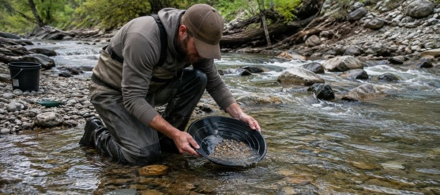
Panning uses water and motion to let heavy gold sink while lighter sand washes over the lip. You fill the pan, submerge it, shake it side to side to settle the heavy material, then tip and wash the top layer away a little at a time.
Panning works everywhere in Texas and it is the only method that makes sense at the Kingsland Slab and the Llano River parks. Slow down at the end, because the last two tablespoons in the pan are where Texas gold lives.
Essential Tools
- Deep Riffle Gold Pan: Garrett 15″ Dual Riffle SUPERSLUICE Gold Pan
- Finish Pan: Garrett Prospecting 10″ Backpacker Gold Pan
- Classifier Screen: SE Half Inch Sifting Screen
- Snuffer Bottle: Garrett Gold Guzzler Bottle
- Glass Storage Vials: SE Glass Vials with Caps 144 Pack
Metal Detecting (Difficulty: 2 out of 5)
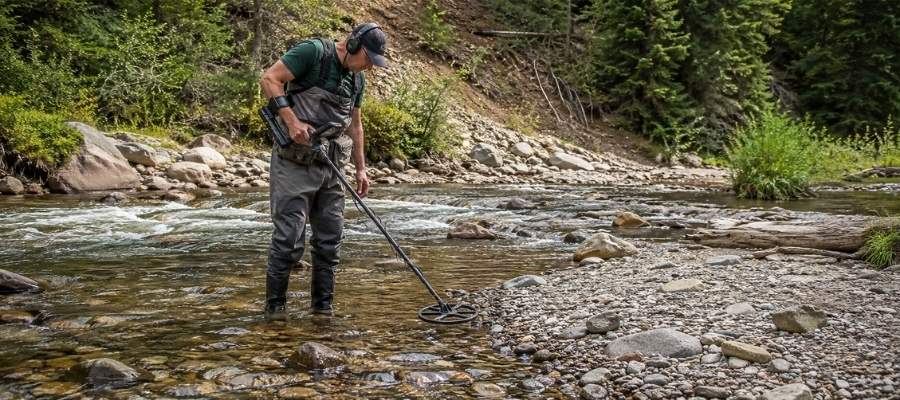
A gold detector reads the tiny signal a metal object gives back and tells you where to dig before you move any dirt. It shines where the gold is coarse and the ground is dry.
West Texas is detector country, and the slopes and washes below the old Shafter and Van Horn district workings are where it pays. In the Hill Country, use it to check quartz float on the hillsides above the creeks rather than the creek gravel itself.
Essential Tools
- Metal Detector: Garrett AT Gold Metal Detector
- Pinpointer: Garrett Pro Pointer AT
- Digging Shovel: Bully Tools 14 Gauge Round Point Shovel
- Rock Hammer: ESTWING 22 oz Rock Pick
Crevicing (Difficulty: 3 out of 5)
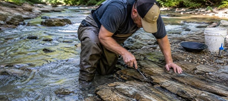
Crevicing means scraping the packed material out of cracks in exposed bedrock and panning what comes out. Those cracks have been trapping heavy metal for thousands of years and floods do not empty them.
This is the highest value technique in Texas because the Llano Uplift gives you so much exposed granite. The Kingsland Slab, Sandy Creek, and every bedrock ledge on the Llano River are built for it.
Essential Tools
- Crevice Tool: ASR Outdoor Steel Crevice Tool Set
- Hand Trowel: Edward Tools Bend Proof Trowel
- Fine Sifting Classifier: SE 1/8″ Mesh Sifting Screen
- Black Sand Magnet: SE Magnetic Separator Pick Up Tool with Quick Release
Sluicing (Difficulty: 4 out of 5)
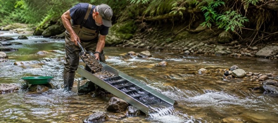
A sluice is a channel with riffles that you set in moving water so the current does the sorting for you. You shovel classified gravel in at the top and the riffles hold the heavy material while everything else washes out.
Sluicing turns a big sandbar into a real day’s work, which is why it fits the Guadalupe, the Colorado, the Red River, and Gazley Creek so well. Set it where the water runs steady and check your riffles often, because Texas gold is light enough to walk if the flow is too fast.
Essential Tools
- Sluice Box: Keene A52 Hand Sluice
- Digging Shovel: Bully Tools 14 Gauge Round Point Shovel
- Classifier Screen: SE Half Inch Sifting Screen
- Magnifying Loupe: JARLINK 30X 60X Illuminated Loupe
How To Tell Real Gold From Fool’s Gold
Pyrite fools almost every new prospector at least once, and Texas creeks are full of it. Two quick field tests settle the question before you get too excited.
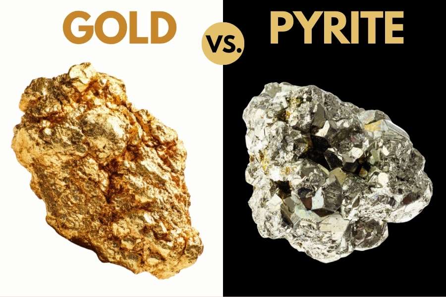
The shadow test is the fastest. Cup your hand over the piece and block the sun, and real gold keeps its warm yellow glow while pyrite goes dull and greenish black the moment the direct light comes off it.
The poke test settles anything the shadow test leaves open. Press the piece with a knife tip or a needle, and gold dents and bends because it is soft, while pyrite is brittle and shatters into little cubes.
Pyrite is only one of the lookalikes you will meet. Mica, chalcopyrite, and weathered ironstone all fool people, and so do half the genuinely valuable minerals sitting next to your gold.
That is the real cost of guessing, because the piece you toss might be worth more than the gold. Our Texas Rocks and Minerals Field Guide is waterproof, built for the creek bank, and shows you side by side photos so you can settle an identification in seconds instead of driving home wondering.

How Gold Got Into Texas
Texas gold sits where it does because of two separate events, one ancient and one relatively recent. That is exactly why the spots in this guide cluster in the Hill Country and out along the Rio Grande.
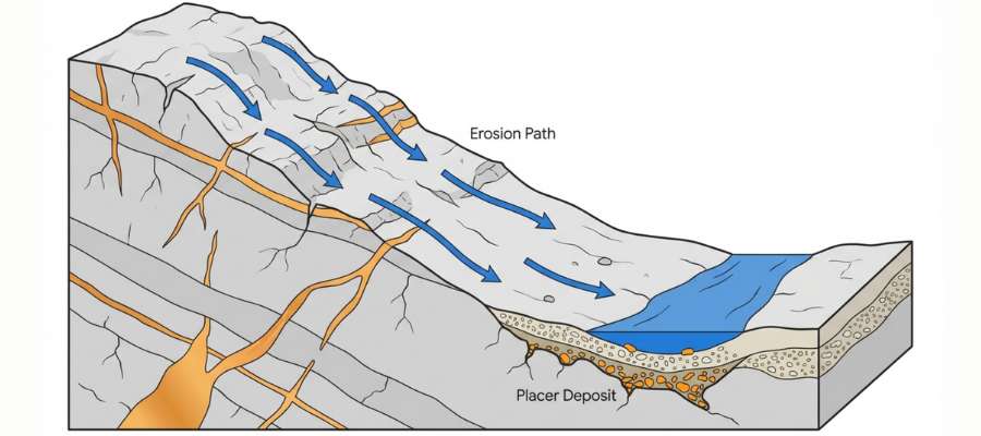
The first event built the Llano Uplift more than a billion years ago. Ancient sediments were cooked and squeezed into gneiss and schist, then hot granite pushed up into them and mineral rich fluids filled the cracks with quartz veins.
Those veins carried gold. Over the next billion years the softer rock on top wore away and left that ancient basement sitting exposed in the middle of Texas, which is the only place in the state where you can stand on rock that old.
Rain and floods have been grinding those veins down ever since. The gold falls out of the quartz, works its way into the Llano River and its creeks, and settles into the same bedrock cracks it has been filling for centuries.
The second event happened out west, when volcanic activity along the Rio Grande pushed hot mineral fluids up through limestone and Precambrian rock. Those fluids built the silver and copper bodies at Shafter, Van Horn, and Allamoore, with natural gold locked in beside them.
What To Bring for a Texas Gold Day Trip
Pack for heat and sun first, because Texas will beat you before the gold does. Here is the checklist that covers a Hill Country creek day and a West Texas wash day alike.
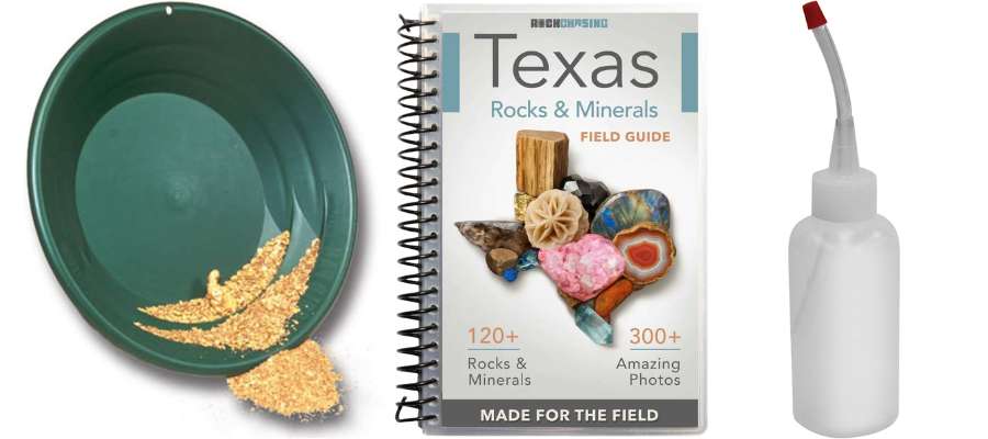
- Gold pan and finish pan, plus a classifier screen (see Techniques)
- Crevice tool and hand trowel for bedrock work (see Techniques)
- Snuffer bottle and glass vials so nothing you find gets lost
- More water than you think you need, plus electrolytes
- Sunscreen, a wide brim hat, and long sleeves
- Sturdy boots you do not mind soaking, and water shoes for slick granite
- Printed or saved landowner permission, and screenshots of your access point
- Bug spray for the Hill Country and East Texas bottoms
- A charged phone and a paper map, because West Texas has dead zones
If you want everything in one box the first time out, the Garrett Deluxe Gold Pan Kit gets you on the water without shopping for pieces one at a time.
The Best Time of Year To Hunt for Gold in Texas
Timing in Texas is about water level and heat, and the sweet spots are different in each region. Get the season right and you get exposed bedrock and comfortable digging on the same trip.
Central Texas
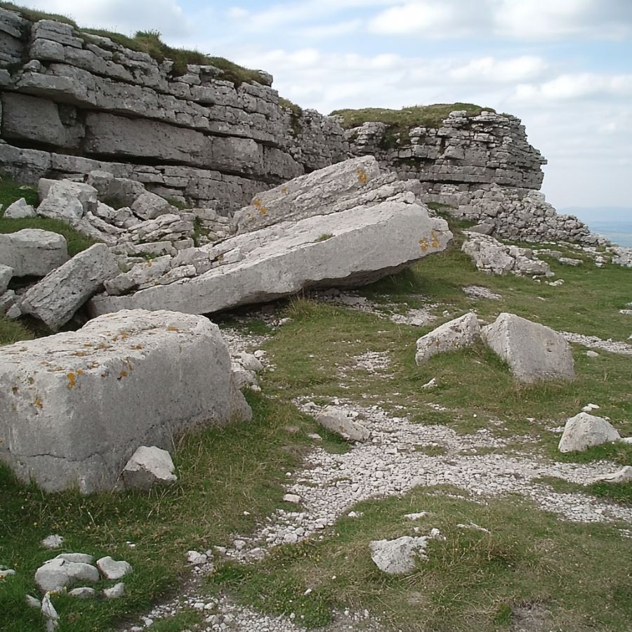
Late fall and early spring are the best months for the Llano Uplift. Water levels drop in the fall, which exposes the bedrock cracks and slabs that hold the gold, and the digging is comfortable instead of brutal.
Spring is the other window because flood water reworks the gravel bars and lays down fresh material. Go right after the water drops back and you are working ground that nobody has touched.
West Texas

Winter and early spring are the only sensible seasons in the desert. Summer heat out here is genuinely dangerous for the kind of work prospecting takes.
Late summer monsoon storms are what recharge the washes, so the best plan is to let the storms run in August and September and come back in the cool months to work what they moved.
North and East Texas

Late summer and fall are when the big rivers drop and the gravel bars come out of the water. That is your window on the Red River, the Brazos, and the Sabine.
Late winter and early spring work well too, because the vegetation thins out and you can actually see the creek beds and cut banks in the brushy country. Cooler air lets you cover far more ground in a day.
Other Valuable Rocks and Minerals You Can Find in Texas
The same gravel that holds Texas gold holds some of the best gem material in the state. Every spot in this guide is a two for one trip if you know what you are looking at, and our guide to gem hunting in Texas goes deeper on the gem side.
Blue Topaz

Blue topaz is the Texas state gem and it comes out of the same Llano Uplift granite that feeds the gold. Water clear and pale blue crystals wash into Mason and Llano County creeks and land in the same gravel you are already screening.
Learn the full story in our guide to finding topaz in Texas.
Agate
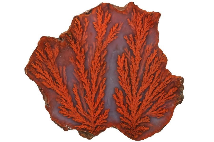
Texas agate ranges from banded Hill Country nodules to the world famous plume and moss material out of the Big Bend country. You will see rounded waxy pebbles with a glassy surface sitting right on the gravel bars.
Our guide to agate hunting in Texas covers the best hunting grounds by region.
Garnet
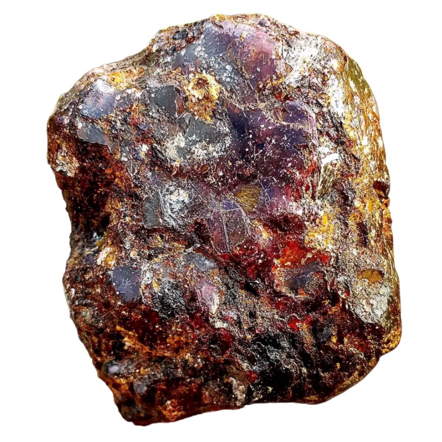
Garnet is heavy, so it lands in your pan for exactly the same reason gold does. Deep red grains and small crystals show up constantly in the Llano Uplift creeks and in the Packsaddle Schist drainages.
See where the best crystals come from in our guide to garnet in Texas.
Quartz Crystals
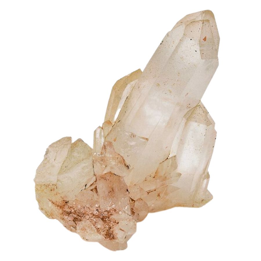
Quartz is the host rock for Texas vein gold, and the pegmatites of the Llano Uplift produce clear and smoky crystals worth keeping. Sandy Creek and the Mason County creeks both turn up good material.
Our guide to quartz in Texas shows you which formations produce the best crystals.
Petrified Wood

Petrified palm wood is the Texas state stone, and it fills the sandy bars of the Colorado, the Brazos, and Gazley Creek. Look for wood grain texture and a heavy stony feel.
Find the best beds in our guide to petrified wood in Texas.
Opal
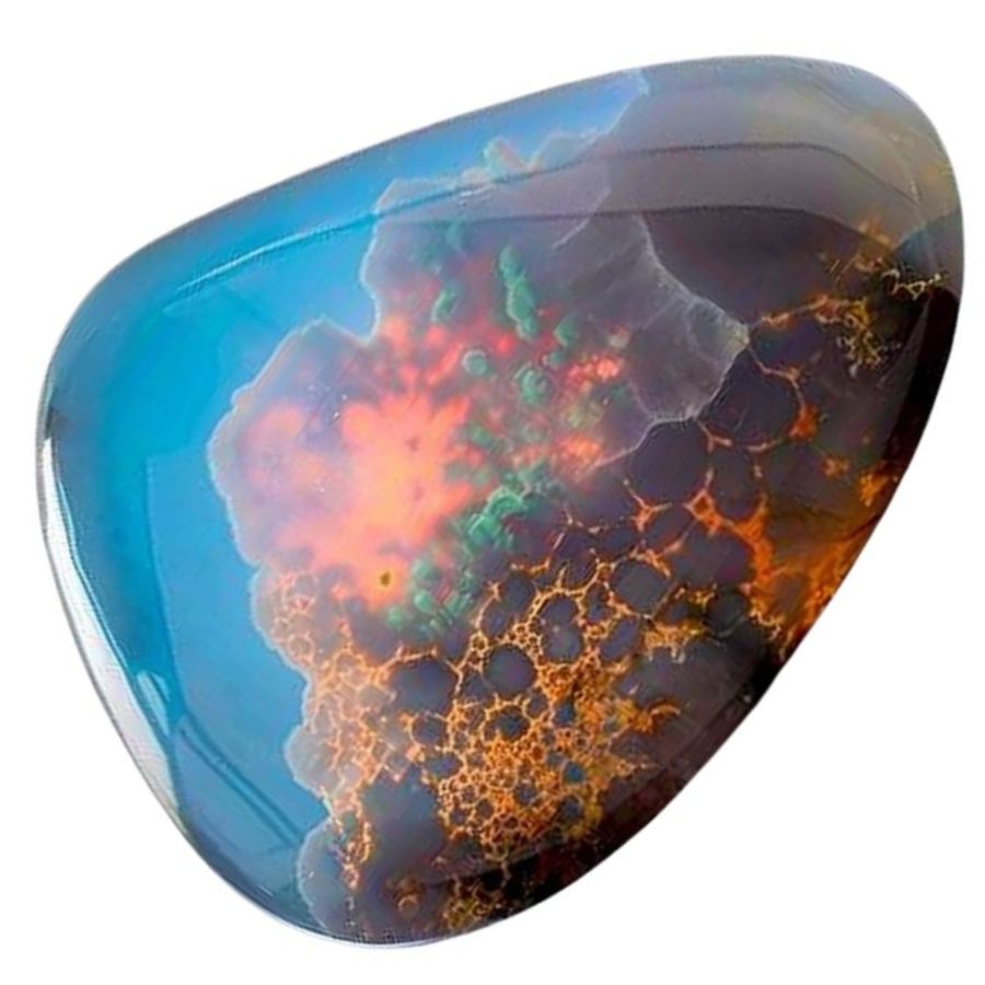
Texas opal turns up in the volcanic country of the Trans Pecos and in a few Hill Country pockets. Common opal is far more frequent than precious opal, and it still cuts beautifully.
Our guide to opal in Texas maps the productive areas.
Pyrite
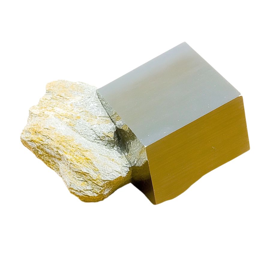
Pyrite is the lookalike that fools people, but sharp cubes and pyrite suns are genuinely collectible. You will find it in the shales of North Texas and in the mineralized zones out west.
Learn to spot the good specimens in our guide to pyrite in Texas.
Fluorite

Purple and green fluorite is scattered across the Eagle Mountains and the Quitman country in far West Texas. Cubic crystals with soft glassy faces are the giveaway.
Our roundup of Texas crystals covers fluorite and the other crystal species worth chasing.
Turquoise

Texas turquoise comes out of the copper mineralized country in the far west, near the same districts that produced the state’s gold. Sky blue to green nodules sit in seams within the host rock.
See the known deposits in our guide to turquoise in Texas.
Marine Fossils

Most of Texas was under a shallow sea, and the limestone in your creek bank is packed with echinoids, ammonites, and shark teeth. They wash into the same gravel bars you are panning.
Our guide to fossils in Texas shows you the richest sites.
Every one of those minerals is easy to walk past when your eyes are locked on the bottom of a gold pan. Our Texas Rocks and Minerals Field Guide puts photos of all of them in your pocket, so the topaz or agate in your screen comes home with you instead of going back in the creek.

Legal Rules for Gold Prospecting in Texas
Texas rules come down to who owns the ground under your boots, and that answer changes every few hundred feet. The information here is general guidance and not legal advice, and confirming the rules for your exact spot is your responsibility.

Private Property
Roughly ninety five percent of Texas is privately owned, and criminal trespass is covered under Texas Penal Code Section 30.05. Never cross a fence line or enter posted ground without clear permission from the owner.
The good news is that a polite ask works far more often than people expect. Explain that you want to pan a creek, offer to fill your holes and pack out everything you bring, and get the permission in writing or by text so you have it on your phone.
Texas law does give the public the beds of navigable streams, generally those that average thirty feet or more in width. You can legally work those beds if you enter from a public road crossing, a bridge right of way, a public boat ramp, or a public park, and you may not cross private land to reach the water.
Active Mining Claims
Mining claims are far less common in Texas than out west because the state has very little federal land. Where federal land does exist, an active claim gives the claimholder the mineral rights and prospecting there without permission is not allowed.
Check the Bureau of Land Management Mineral and Land Records System before you work any federal parcel. County clerk records are the place to check for state and private mineral leases.
Equipment Restrictions
Hand tools are the safe choice everywhere in Texas, and a pan, a shovel, a classifier, and a crevice tool need no state permit for recreational panning. Motorized equipment is a different matter entirely.
Suction dredges, highbankers, and any motorized in stream work can require authorization from the Texas Commission on Environmental Quality and potentially the US Army Corps of Engineers. Collecting rocks and minerals is prohibited in Texas state parks, and prospecting is not allowed in Big Bend National Park or Big Bend Ranch State Park.
Before you head to any spot in this guide, confirm access requirements directly with the landowner or managing agency. Our team has not personally visited every location, and access rules and collection rules change without notice.
Some of these places are wonderful to explore even where you cannot take anything home, and seeing gold in the wild is worth the trip on its own. We also cannot promise what any given creek will give up, because rivers rebuild themselves with every flood.
Always get current information straight from the source before you go. Local rock and mineral clubs and the Texas chapters of the Gold Prospectors Association of America are the fastest route to current access, and several of them run outings on private Llano Uplift ground that members can work legally.
Texas Gold FAQ
Can you find gold in Texas?
Yes, you can find gold in Texas, and prospectors do it every weekend. The most productive ground is the Llano Uplift in Central Texas, where the Llano River, Sandy Creek, and their tributaries carry fine placer gold eroded out of ancient granite. West Texas districts around Shafter and Van Horn also hold natural gold in and below their historic workings.
Is it legal to pan for gold in Texas?
Recreational hand panning is legal in Texas and no state permit is required for it. The catch is access, because most land is private and you need the landowner’s permission to be on it. The beds of navigable streams are public, so you can work them as long as you enter from a public crossing, boat ramp, or park.
Where is the most gold found in Texas?
The Llano Uplift produces the most placer gold you can actually go pan, centered on Llano and Mason counties. The Kingsland Slab on the Llano River is the single best known public spot in the state. Historically, the Presidio mine at Shafter in Presidio County produced more gold than everywhere else in Texas combined.
What kind of gold is found in Texas?
Texas gold is mostly fine placer gold, meaning flour gold and small flakes that settle into black sand and bedrock cracks. Pickers show up in deeper bedrock pockets on rivers like the Guadalupe and the Llano, and vein gold in white quartz occurs in the Llano Uplift and the West Texas districts.
Our guide to valuable rocks in Texas covers what else is worth keeping when you find it.
Do you need a permit to pan for gold in Texas?
No permit is needed for recreational hand panning with a pan, shovel, and classifier. Motorized equipment such as a suction dredge or a highbanker is a different story and can require permits from the Texas Commission on Environmental Quality and the US Army Corps of Engineers. State parks prohibit mineral collecting regardless of the tools you use.
Know Every Rock in Your Pan

Gold is the reason you drove out there, but it is almost never the only valuable thing in your pan. Topaz, agate, garnet, and a dozen other Texas minerals ride in the same heavy gravel, and they are worth real money to the person who can name them.
The Texas Rocks and Minerals Field Guide is waterproof, fits in a back pocket, and identifies everything in your pan in seconds. Take it to the creek and nothing valuable goes back in the water.