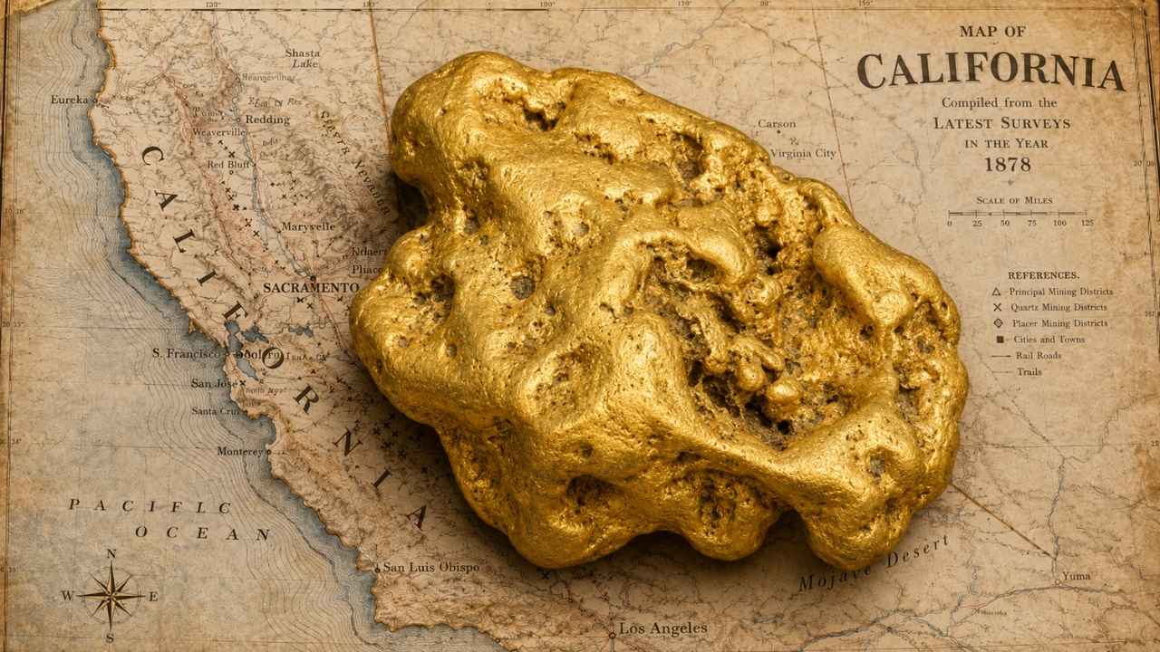
California has produced more than 106 million troy ounces of gold since 1848, and the same rivers that built that number still run through public land you can walk into this weekend. Finding gold in California is a matter of knowing which water is open and where the heavy stuff settles.
With gold trading above $4,000 an ounce, you do not need to find much for a weekend trip to pay for itself.
The mistake most people make here is driving to a famous river, dropping a pan in the first pretty riffle they see, and never checking whether that gravel sits under somebody’s active mining claim. California also has something almost no other state offers, which is a whole network of designated public panning areas where the ground is open to anybody with a pan.
Yes, you can still find gold in California today, especially along the American River and the Trinity River, where placer deposits have been producing since 1848. This guide walks you through the open water at Whiskeytown National Recreation Area, the BLM stretch of the Merced River at Briceburg, the state park gravel at Coloma where the whole rush started, and gold country from the Oregon line to the desert washes above the Colorado River.
Our team of geologists and experienced rockhounds put this together around one idea, which is that a great gold day starts with legal, open ground and a clear picture of what the gravel is telling you. If you are new to rockhounding in California, gold is the perfect place to start. Grab your pan and let us show you where to put it.
Table of Contents
- Biggest Discovery
- Types of Gold
- Where Gold Hides
- Best Places
- Techniques
- Fool’s Gold
- How Gold Formed
- What To Bring
- Best Time
- Other Minerals
- Legal Rules
- FAQ
The Biggest Gold Discovery in California History
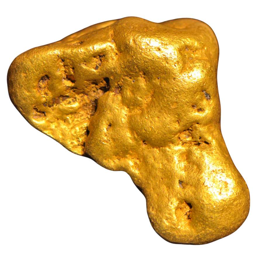
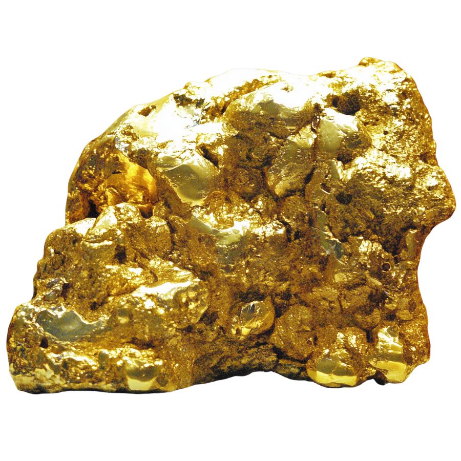
The largest single mass of gold ever pulled out of American ground came out of Carson Hill in Calaveras County on November 22, 1854. Five miners working the Comstock claim broke into a pocket and lifted out a lump of gold that weighed 195 troy pounds.
That is 2,340 troy ounces of gold in one piece. At today’s prices that single lump would be worth well over nine million dollars, and the men who found it sold it for $43,534, which was a staggering fortune at the time.
The nugget was bought by a New Orleans dealer, shipped across the Atlantic, and put on display at the French Exhibition in Paris in 1856 before it was finally melted down. Nobody has ever found a bigger natural piece of gold in the United States.
Carson Hill was not a fluke. The Morgan Mine on that same hill reportedly produced more than three million dollars in its first two years, and the district kept producing through the 1930s. What made the hill so rich was a swarm of quartz veins cutting through the Mother Lode fault zone, the same structure that runs for 120 miles through the Sierra foothills.
That fault zone is still there. It still feeds the creeks below it, and every winter storm shakes a little more of it loose into gravel you can pan.
The Kinds of Gold You Can Find in California
California produces four kinds of gold you will actually meet in the field, and telling them apart tells you what tool to reach for. Each one sits in a different part of the state’s plumbing, from the finest dust in a slow river to solid veins locked in white quartz.
Fine Gold Flakes
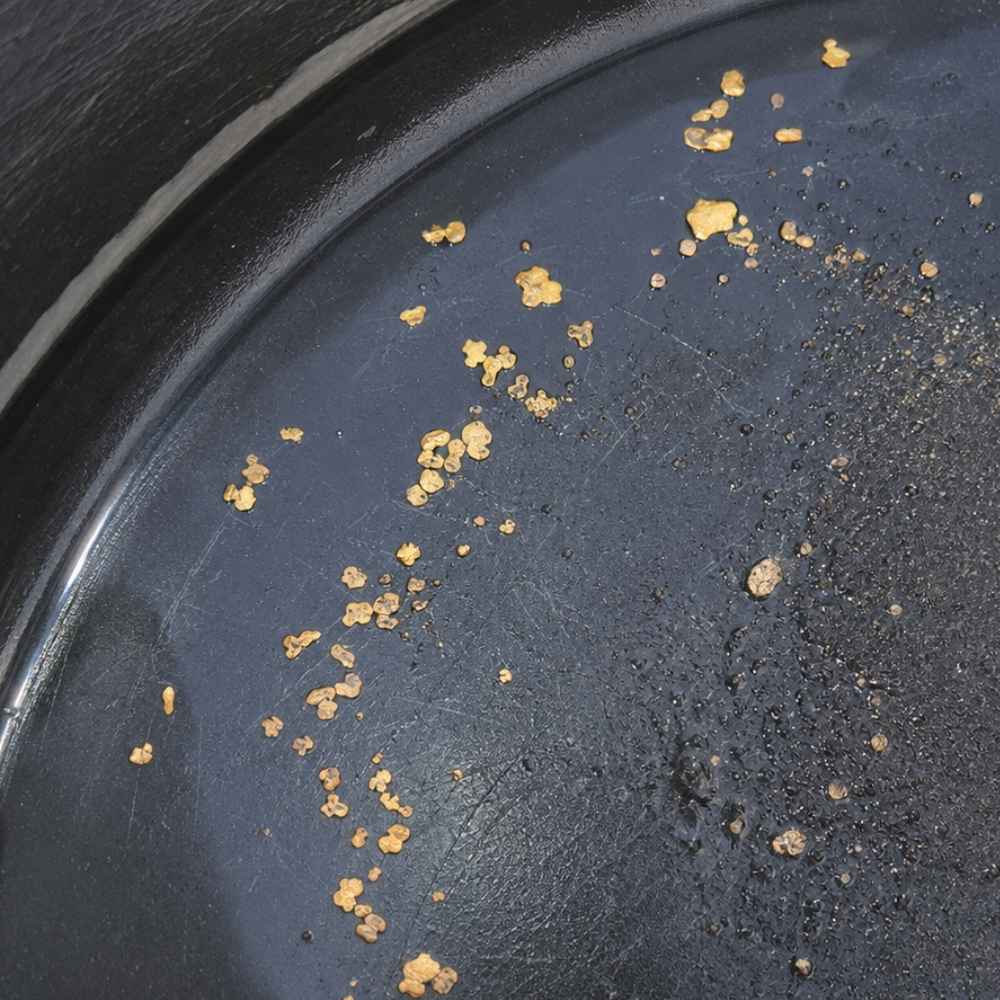
Fine flakes are the bread and butter of California panning. They look like tiny bright chips floating on the black sand at the bottom of your pan, thin enough that a careless swirl sends them over the lip. Below the flakes sits flour gold, which is finer than table salt and needs a slow, patient finish to hold.
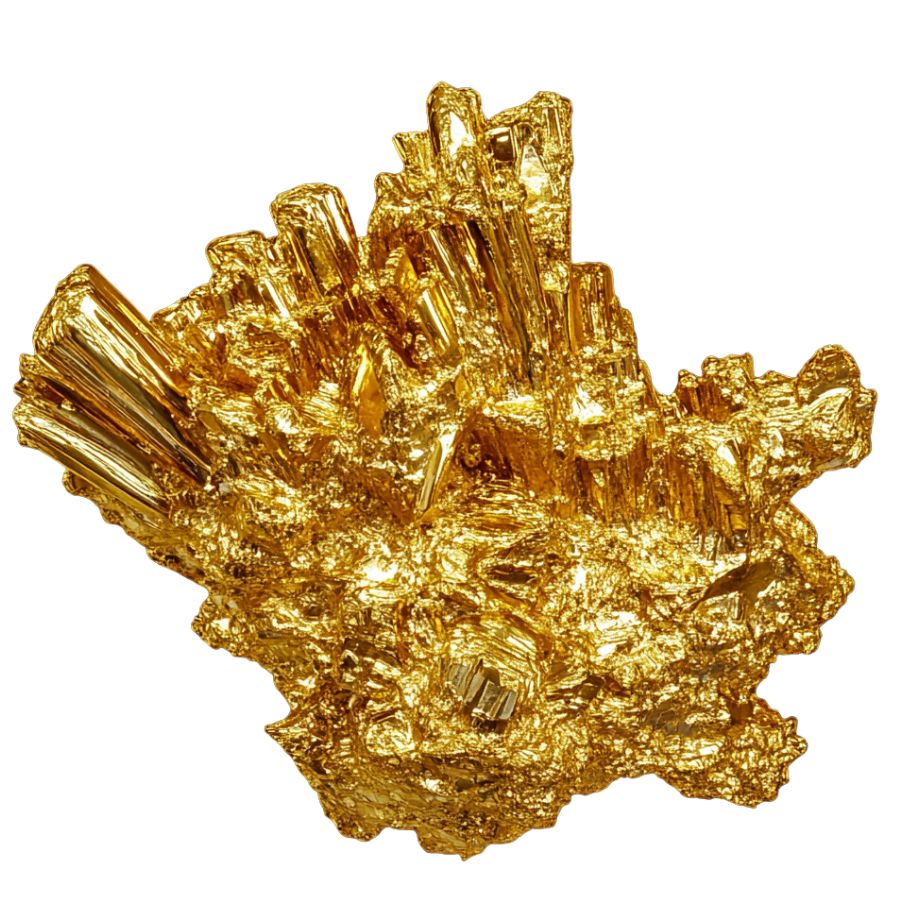
The lookalike here is mica, which shows up in almost every Sierra stream and flashes just as bright. The test takes two seconds, which is to press the flake with a fingertip under water. Gold stays put and bends, while mica shatters into flitters and drifts away.
A Garrett Gold Guzzler Bottle is the tool that saves this size of gold, because fingers simply cannot pick up a flake that small without losing it.
Fine gold is also where most people talk themselves out of a good day. Those flakes add up fast once you learn to read a gravel bar, and a full afternoon of them fills a vial you will be proud of.
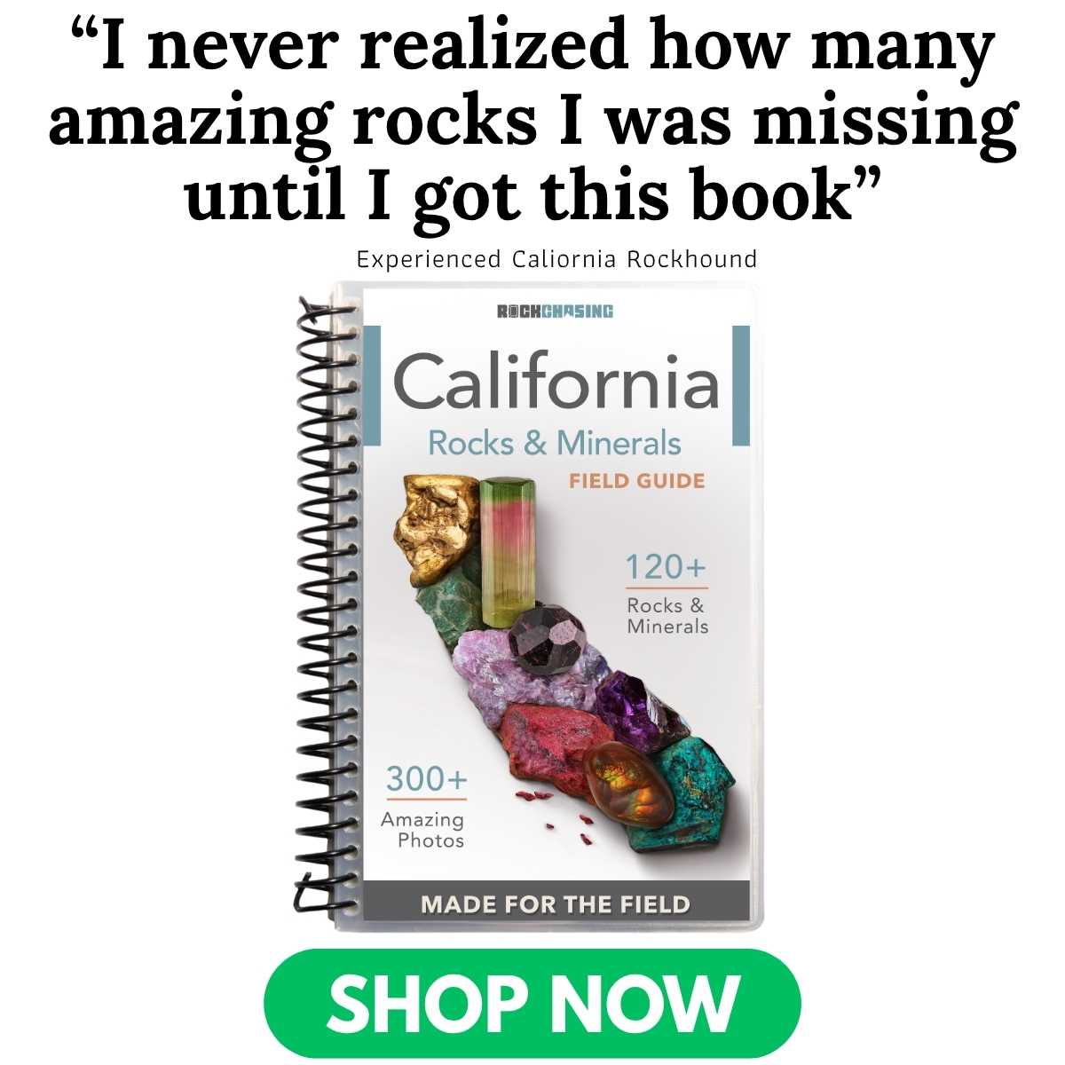
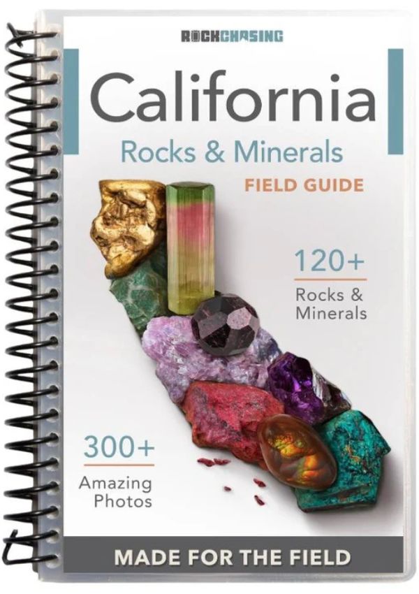
Know exactly what you are looking at before you tip your pan out. Gold country gravel is loaded with garnet, pyrite, magnetite, and quartz that hides other valuable minerals, and most beginners rinse real money back into the creek because nothing in the pan had a name. The California Rocks and Minerals Field Guide puts 120 rocks and minerals and 300 color photos in your pack on waterproof pages, so every heavy, odd, or bright thing in your pan gets identified on the spot instead of guessed at.
Gold Pickers
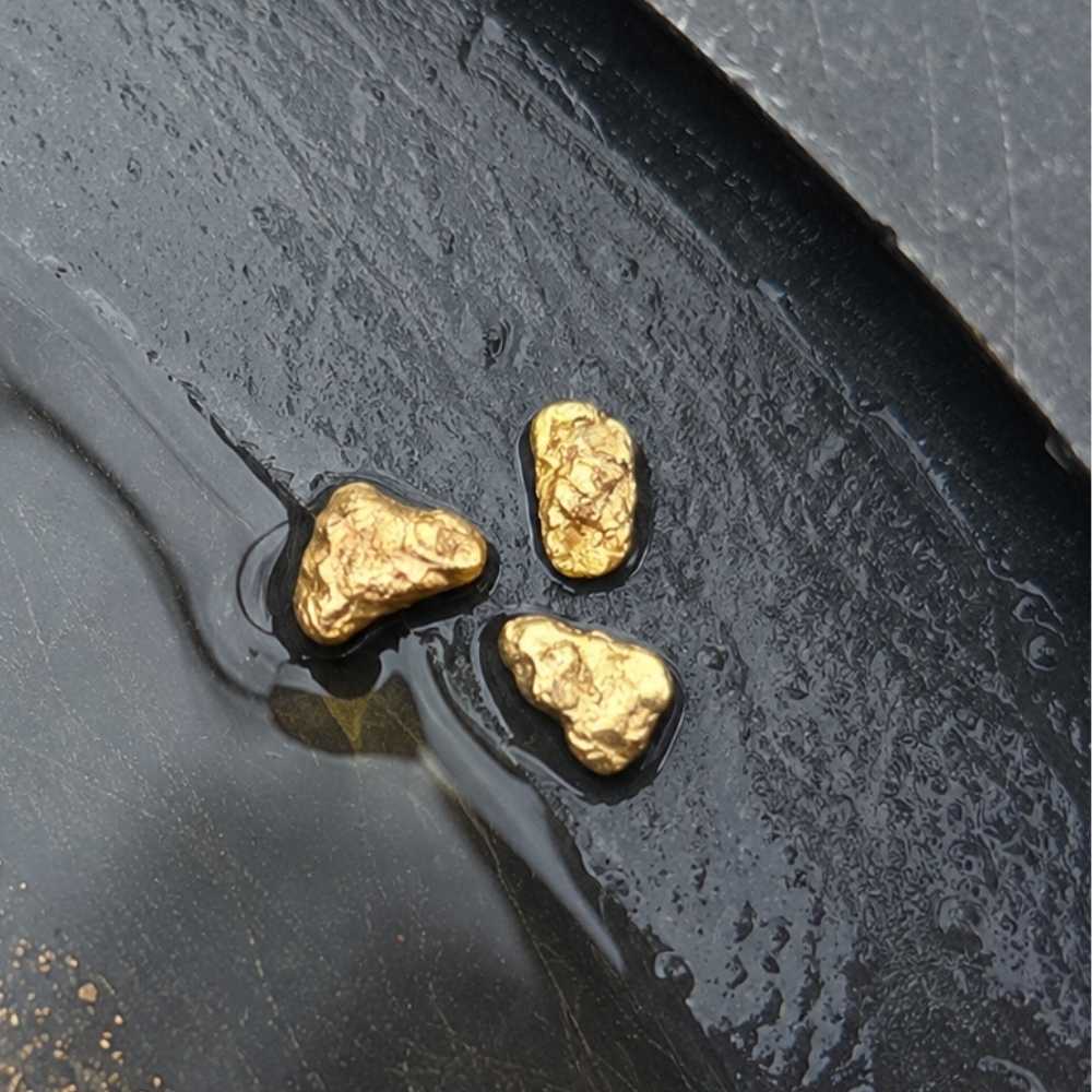
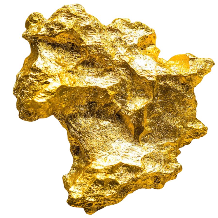
Pickers are the pieces big enough to pluck out of the pan with your fingers, roughly the size of a match head or larger. They are rounded and dented from tumbling downstream, and they sit dead still in the bottom of the pan while everything else moves.
Brass filings and weathered bits of old mining hardware fool people constantly in California, because a century and a half of mining left metal everywhere. The check is color under water, since real gold keeps its warm buttery yellow in shade and brass goes flat and greenish.
A Garrett 15 inch Dual Riffle SUPERSLUICE Gold Pan is built for this, because the deep riffles trap pickers on the first hard swirl instead of letting them ride out.
Pickers show up most often where a stream drops out of a canyon and slows down. Find one and slow way down, because they rarely travel alone.
Gold Nuggets
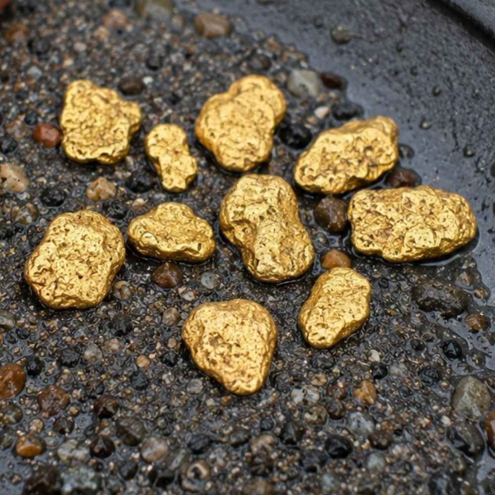
Nuggets are California’s trophy gold, and the state has produced more of them than anywhere else in the country. They turn up in old channel gravel, in desert washes below quartz outcrops, and packed into bedrock cracks that nobody reached with a pan.
Iron stained quartz cobbles are the classic false alarm, because a sunlit quartz face with limonite on it looks golden from six feet away. Pick it up, because a nugget of any size feels shockingly heavy for how small it is and quartz feels like a rock.
A Garrett AT Gold Metal Detector is the honest tool for nugget hunting, because most nuggets left in California sit in ground a pan will never reach.
The desert districts in Kern, San Bernardino, and Imperial counties are nugget country, and so are the old hydraulic pits in the northern Sierra.
Vein Gold in Quartz
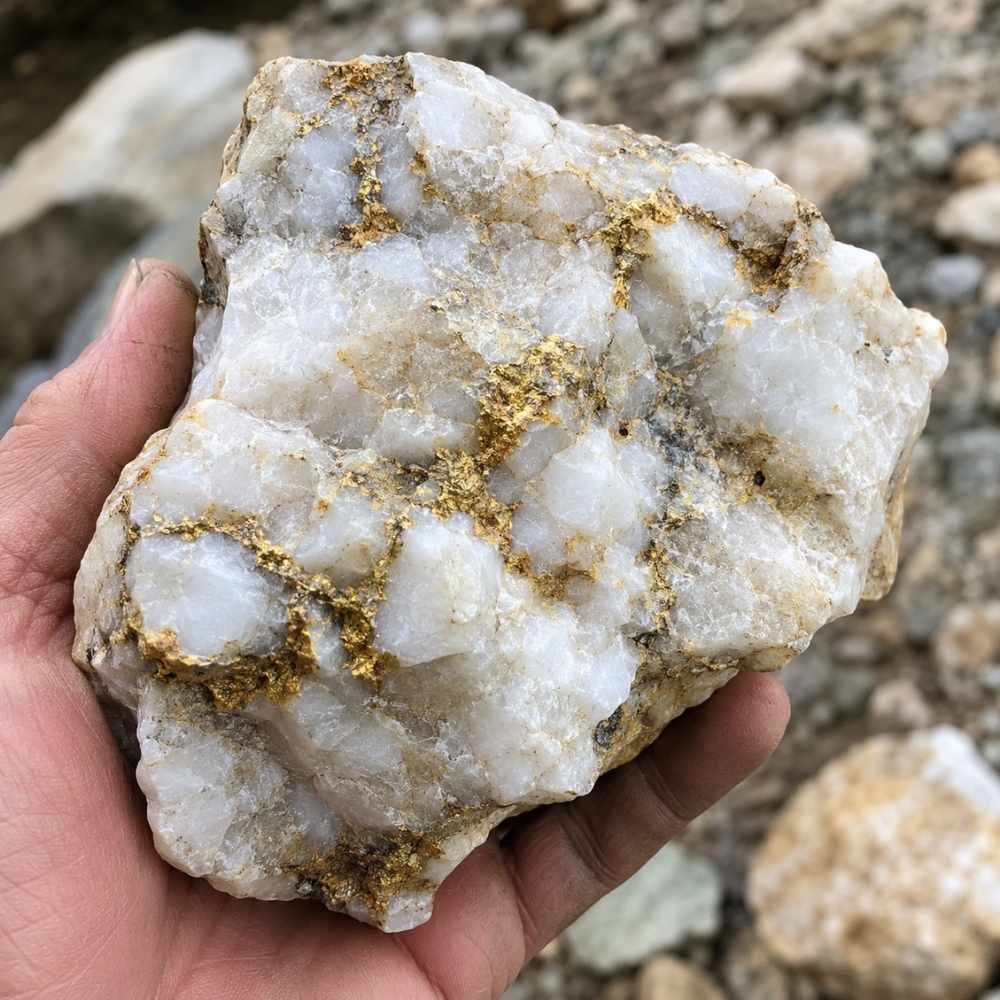
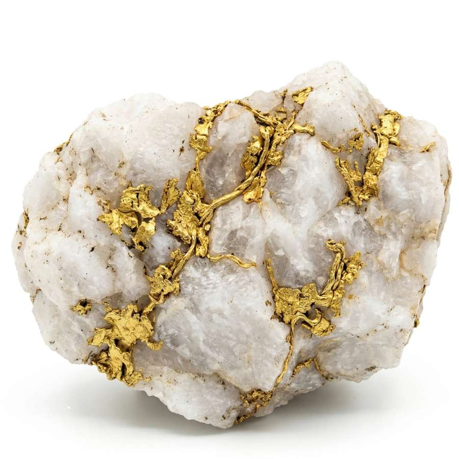
Vein gold is gold still sitting in its host rock, usually as bright threads and blebs running through milky white quartz. California is the best state in the country for it, because the Mother Lode is one enormous quartz vein system and pieces of it litter the creeks below.
Pyrite in quartz is the trap, and it is convincing. Turn the specimen so the bright spot falls into shadow, because gold keeps glowing and pyrite goes dark and metallic grey.
An Estwing Geo Paleo Rock Pick lets you crack a promising quartz cobble open and see whether the color runs all the way through.
Specimen quartz with visible gold sells for far more than its melt value, so a good piece is worth keeping whole. The same veins produce collectible crystals across California, which is a nice bonus on a slow gold day.
Coming up we walk through the exact stream features that concentrate all four of these, then the places where you can legally go get them.
Where Gold Hides in California Streams
Gold in California moves until something stops it, and five features do almost all the stopping. Learn to spot these and you stop wandering a river and start working it.
Gravel Bars on the Inside of Bends
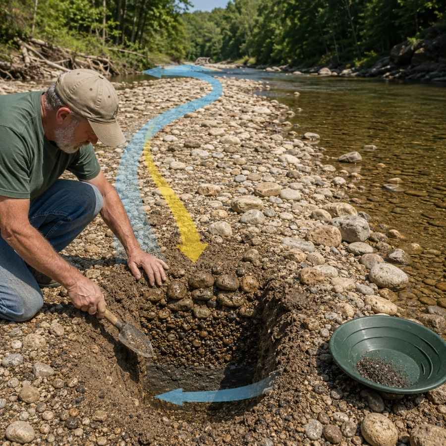
When a river swings around a corner, the water on the inside of the turn slows down and drops whatever it was carrying. That is why every big inside bend in the Sierra foothills has a gravel bar sitting on it.
Dig down through the loose surface rock to the packed layer underneath, because the top foot has usually been picked over and reshuffled by high water. The good material feels dense and gritty and takes real effort to shovel.
A Bully Tools 14 Gauge Round Point Shovel moves that packed gravel without bending, which cheap garden shovels will not survive.
Bedrock Cracks and Crevices
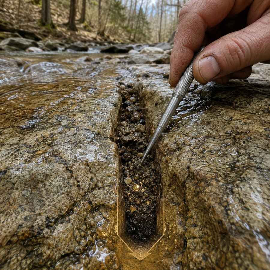
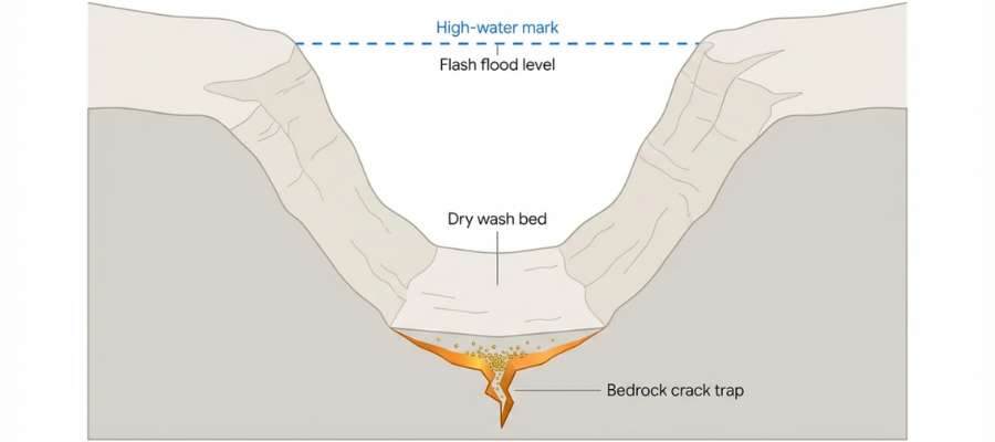
Exposed bedrock is the single best thing you can find in a California creek. Gold sinks until it hits something it cannot get through, and a cracked slab of bedrock is a natural trap that has been filling for thousands of years.
Work the cracks that run across the current rather than with it, because those catch material instead of flushing it. Scrape all the way to the bottom of each crack, since the bottom quarter inch holds most of the gold.
An ASR Outdoor Steel Crevice Tool Set gets into cracks a trowel cannot reach.
Behind and Below Big Boulders
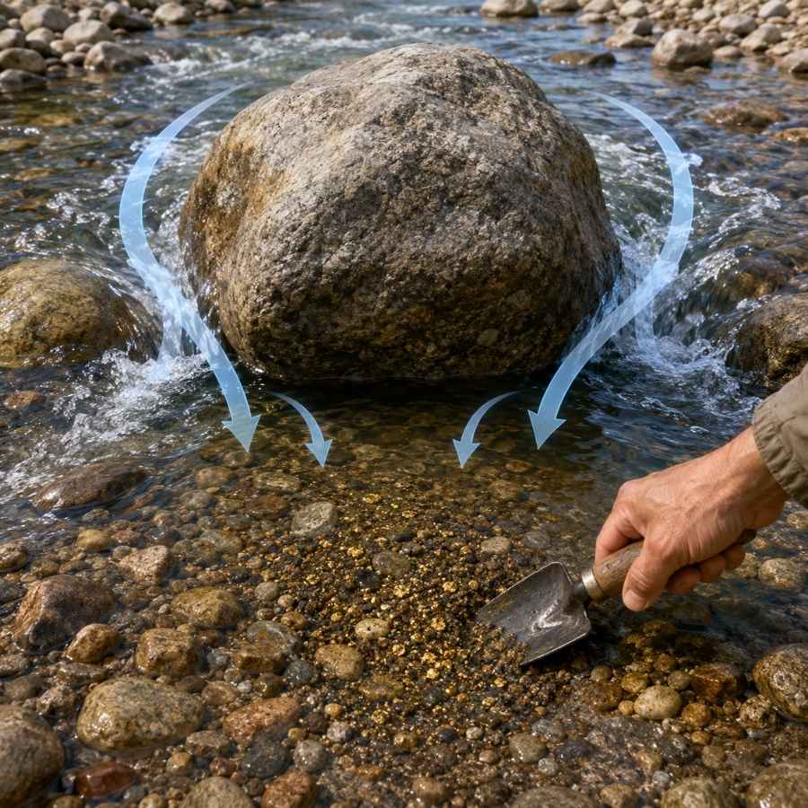
Any boulder sitting in current creates a dead spot right behind it. Gold drops into that pocket and stays, which is why prospectors call these boulder traps.
The material behind a big rock is often thin, but it is concentrated. Two buckets from a good boulder trap can beat twenty from open gravel.
An SE Half Inch Sifting Screen over your bucket lets you strip out the cobbles fast so you only pan what matters.
Black Sand Streaks
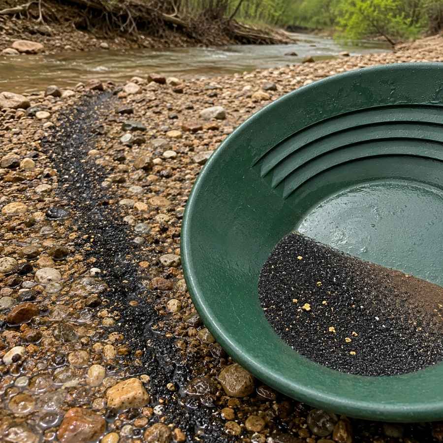
Black sand is heavy iron mineral, and it settles in exactly the same places gold does. When you see dark streaks lying on a gravel bar or banded into a cut bank, you are looking at a natural sorting line.
Follow the streak upstream to where it thickens, because that is where the current dies first. The heaviest black sand and the best gold usually sit within a few feet of each other.
An SE Magnetic Separator Pick Up Tool with Quick Release pulls the magnetite out of your finished concentrates so the gold is easy to see.
Old Hydraulic Pits and Tailing Piles
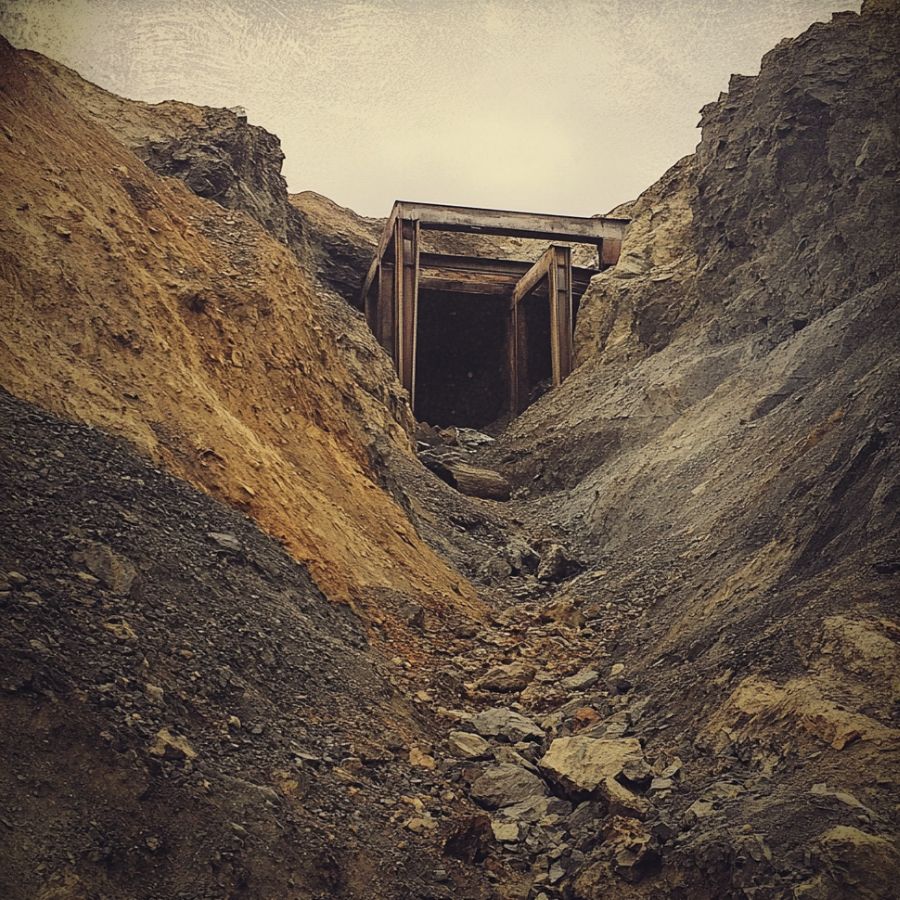
California is covered in ground that was worked once with equipment that could not save fine gold. Hydraulic pits, dredge tailings, and hand stacked rock piles all still carry color, and the material is already broken up for you.
Look for the fine sediment that has washed out of a tailing pile and settled below it, because that is where the gold the old timers lost ended up.
An ESTWING 22 oz Rock Pick is handy here for breaking cemented gravel and checking quartz in the piles.
Always Confirm Access and Collection Rules!
Before heading out to any of the locations on our list you need to confirm access requirements and collection rules for both public and private locations directly with the location. We haven’t personally verified every location and the access requirements and collection rules often change without notice.
Many of the locations we mention will not allow collecting but are still great places for those who love to find beautiful rocks and minerals in the wild without keeping them. We also can’t guarantee you will find anything in these locations since they are constantly changing.
Always get updated information directly from the source ahead of time to ensure responsible rockhounding. If you want even more current options it’s always a good idea to contact local rock and mineral clubs and groups
The Best Places To Find Gold in California
California’s open gold ground splits into four regions, and each one has designated public panning areas alongside the famous rivers. Everything below is either a posted public panning area, a national forest stretch open to hand tools, a state park with a panning program, or a pay to pan operation where access is part of the ticket.
Northwestern California
The Klamath Mountains hold some of the coarsest gold in the state, and the Trinity, Klamath, Scott, and Smith rivers all cut straight through it. Public campgrounds and river access sites give you legal footing in a region where clubs and claim holders hold a lot of the best water.
Trinity River at Junction City and Steel Bridge, Trinity County
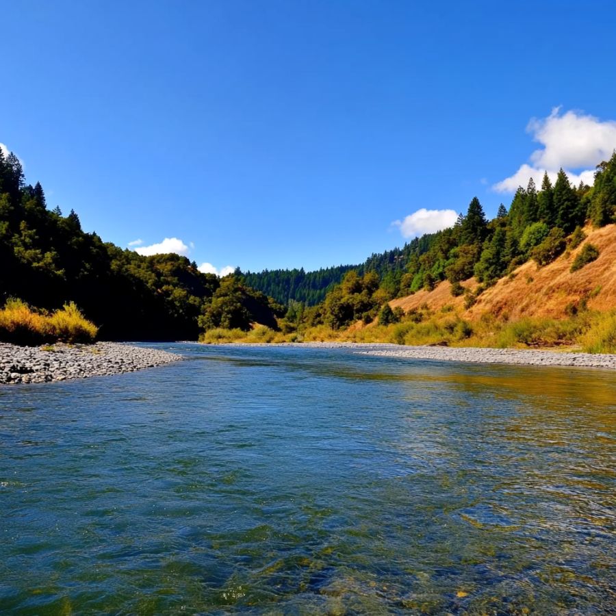
The Trinity River between Lewiston and Junction City is one of the friendliest places in California to start, because BLM runs public campgrounds right on the water and panning is a listed activity at them. Junction City Campground sits along Highway 299 with direct river access, and Steel Bridge Campground sits downstream of Lewiston Lake on Steel Bridge Road.
This stretch is Wild and Scenic river with a long dredging and dragline history above and below it. The gold is coarse and lives in the gravel bars, and the bars rebuild every winter.
Look for fine flakes and pickers here, and work gravel bars with a pan and classifier. Bycatch includes serpentine, jade, jasper, and heavy black sand.
Gold country gravel is full of stones that look like nothing and sell for real money, and California serpentine and jade both turn up in Trinity County pans. Do not rinse away a payday because it did not look like gold. The California Rocks and Minerals Field Guide identifies every one of them on waterproof pages you can use standing in the river.
Bring a Garrett 15 inch Dual Riffle SUPERSLUICE Gold Pan for the loose bar material.
Difficulty rating: 2 out of 5
Klamath River at Happy Camp, Siskiyou County
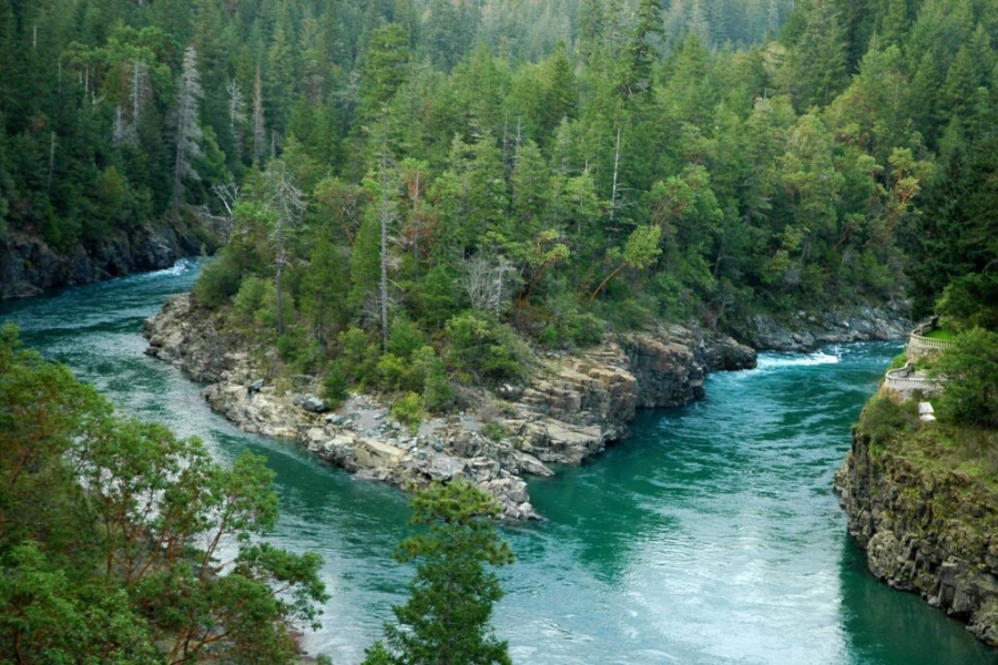
Happy Camp sits where Indian Creek meets the Klamath River, and it has been a working gold town since 1851. The Klamath National Forest maintains public river access sites up and down this stretch, and the Happy Camp district lists gold panning among its recreation activities.
The Klamath carries gold out of the Salmon and Marble mountains and drops it wherever the canyon widens. Bedrock shows in many places at low water, which is exactly what you want.
Expect flakes and pickers, and work bedrock cracks with a crevice tool. Bycatch includes jade, serpentine, and river agate.
Prospecting clubs hold a lot of claims around Happy Camp, so pull up the claim layer before you pick a bar, and use posted Forest Service river access sites when you are not sure.
Bring an ASR Outdoor Steel Crevice Tool Set for the bedrock.
Difficulty rating: 3 out of 5
South Fork Smith River, Del Norte County
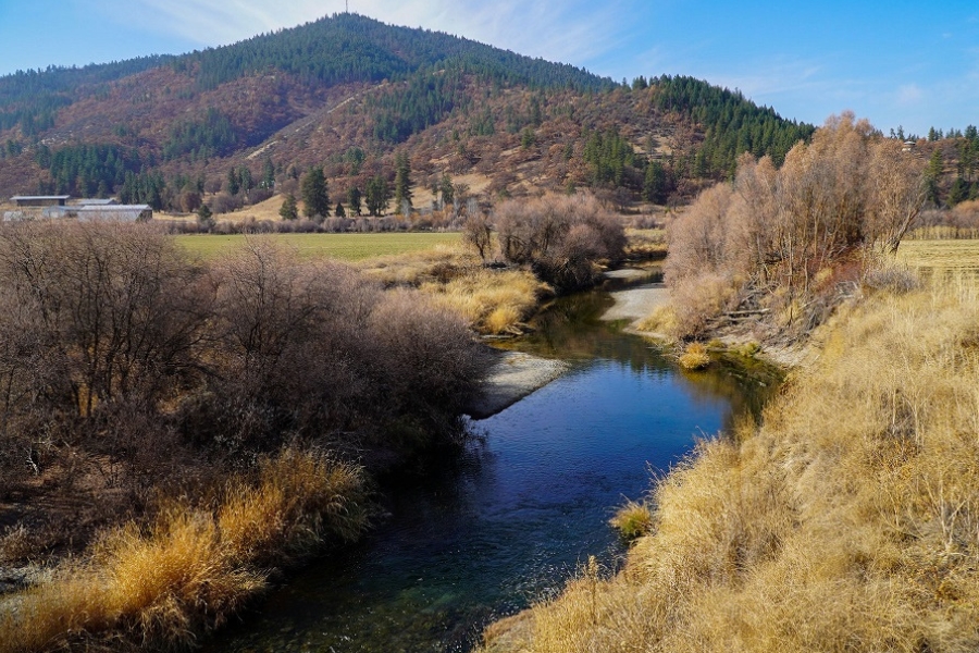
The South Fork of the Smith River drew more early miners than any other water in Del Norte County, and the whole watershed has produced somewhere around 40,000 ounces. Six Rivers National Forest ground gives you public access along Highway 199 past Gasquet, with campgrounds close to several producing creeks.
The present day gravels carry fine gold, and the ancient bench channels above the river carry the richer material. Rowdy Creek and the tributaries along Highway 199 are the easiest public starting points.
Fine gold dominates here, so pan slowly and finish carefully. Bycatch includes jade, serpentine, chromite, and jasper.
Bring an SE 1 8 inch Mesh Sifting Screen to concentrate the fine material before you pan it.
Difficulty rating: 3 out of 5
Whiskeytown National Recreation Area, Shasta County
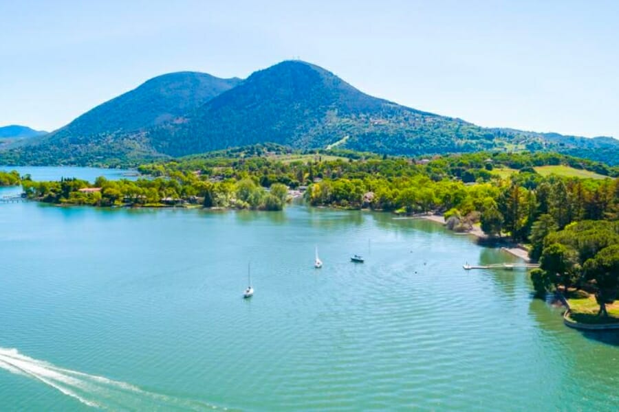
Whiskeytown is the rare federal park unit that welcomes gold panners, and it is the single easiest legal gold day in northern California. A one dollar panning permit good for a full year plus your entrance pass puts you on the water, and both are available at the visitor center or on Recreation.gov.
Panning is allowed at the Tower House Historic District, where Mill Creek, Crystal Creek, and Clear Creek come together, and at the Clear Creek Picnic Area on Trinity Mountain Road. The stretch of Clear Creek from the mouth of Paige Bar Creek to the Environmental School Camp access road bridge is closed.
Rules are a metal or plastic pan plus small digging tools with blades no bigger than four inches by eight inches. No sluices, no detectors, no digging above the water line.
Expect fine flakes and the occasional picker. Bycatch includes garnet, magnetite, and quartz.
Bring a Garrett Prospecting 10 inch Backpacker Gold Pan, which fits the small tool rules perfectly.
Difficulty rating: 1 out of 5
Swasey Recreation Area on Clear Creek, Shasta County
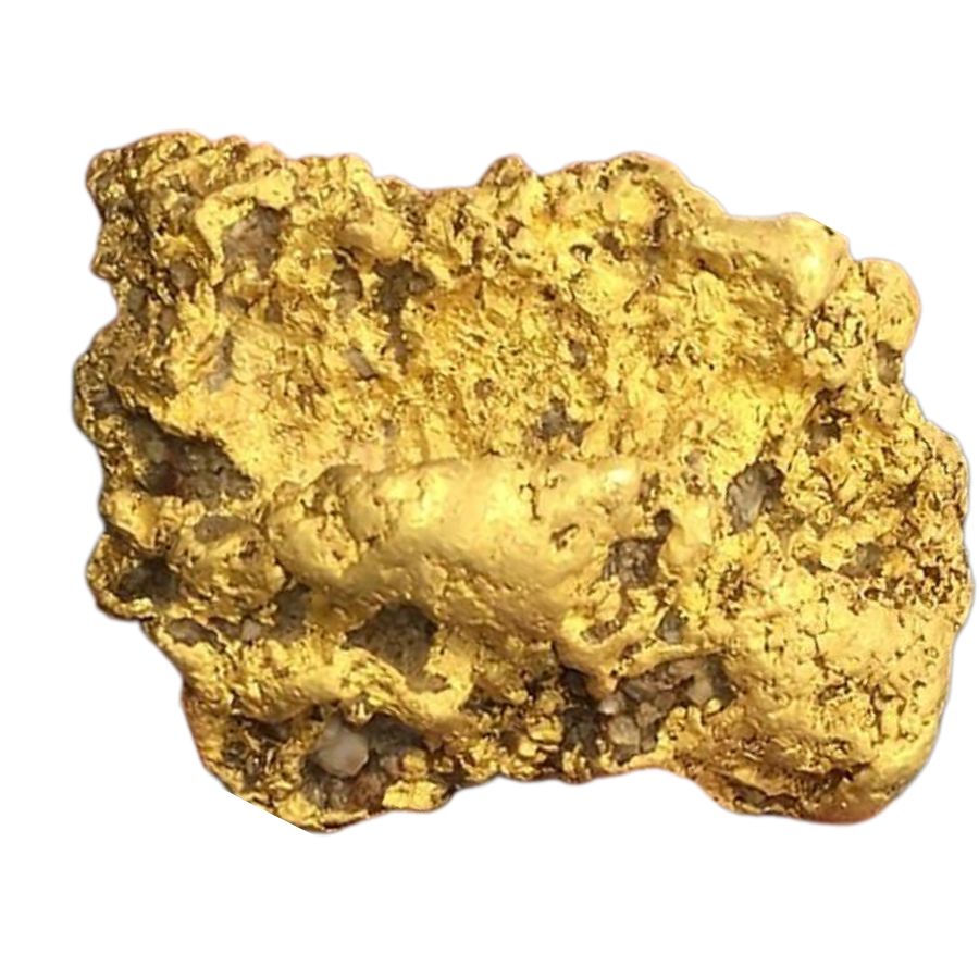
Clear Creek at Swasey is where the first gold in this part of California was found, and the BLM land here cannot be staked as a mining claim. That single fact makes it one of the most relaxed places in the state to prospect, because you never have to wonder whose ground you are on.
Swasey sits just west of Redding off Placer Street and Swasey Drive, inside a 35 mile trail system with easy creek access. Metal detecting is allowed here, which is unusual for public panning ground.
Fine gold and small pickers are the norm. Bycatch includes serpentine, jasper, and black sand.
Fill your holes before you leave, since this is a heavily used recreation area.
Bring a Garrett Pro Pointer AT if you plan to detect the creek edges.
Difficulty rating: 2 out of 5
Northeastern California
The northern Sierra is hydraulic mining country, where whole hillsides were washed into the rivers and left gravel that panners still work today. Butte, Plumas, Sierra, and Nevada counties all have designated recreational mining ground.
Forks of Butte Creek Recreation Area, Butte County

The Forks of Butte Creek is BLM ground set aside specifically for recreational mining, which makes it one of the few places in Butte County where you can pan without hunting for claim posts. The area sits in the canyon above Chico and gets worked hard every summer for a reason.
This ground is withdrawn from the mining law, so hand tools only. Motorized equipment, pumps, and motorized high bankers are all out, and high banking is specifically not allowed here.
The creek runs over bedrock in long stretches and holds flakes and pickers. Bycatch includes quartz crystals, jasper, and magnetite.
Call the BLM Redding Field Office before you go, because the recreation area rules here are stricter than general public land.
Bring a Bully Tools 14 Gauge Round Point Shovel for the packed creek gravel.
Difficulty rating: 3 out of 5
North Fork Feather River at Rich Bar and Belden, Plumas County
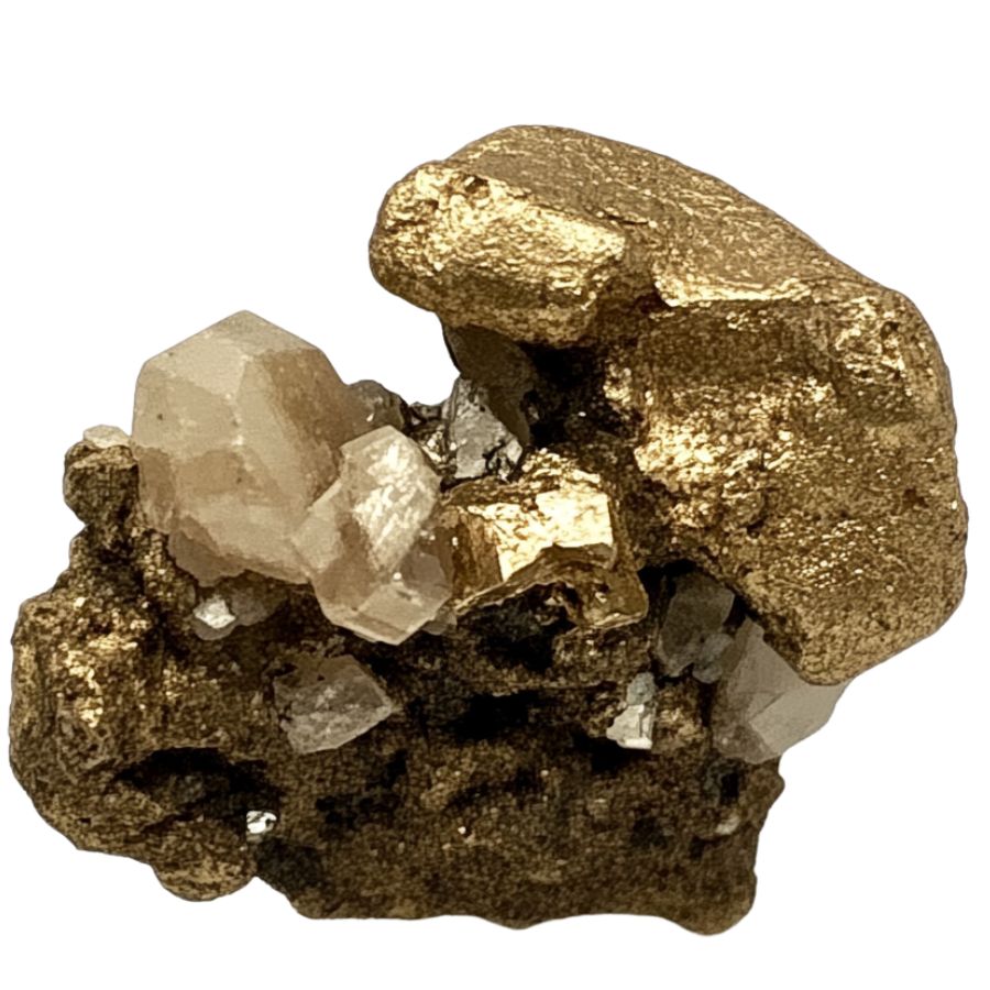
Rich Bar on the North Fork Feather River earned its name honestly, and the bar sits just north of Belden right off Highway 70. Plumas County still points panners at the Feather River gravel bars, and the North Fork canyon is the classic destination.
The North Fork cuts through metamorphic rock that feeds gold into the channel constantly. Gravel bars rebuild after every big water year, which keeps this stretch productive.
Expect flakes with pickers in the coarser bars. Bycatch includes vesuvianite, quartz, garnet, and serpentine.
Much of the Plumas National Forest is open where claims are not staked, so check the claim maps and the Plumas County Recorder before you commit to a bar.
Bring an SE Half Inch Sifting Screen to speed up bar work.
Difficulty rating: 3 out of 5
Union Flat Campground on the North Yuba River, Sierra County
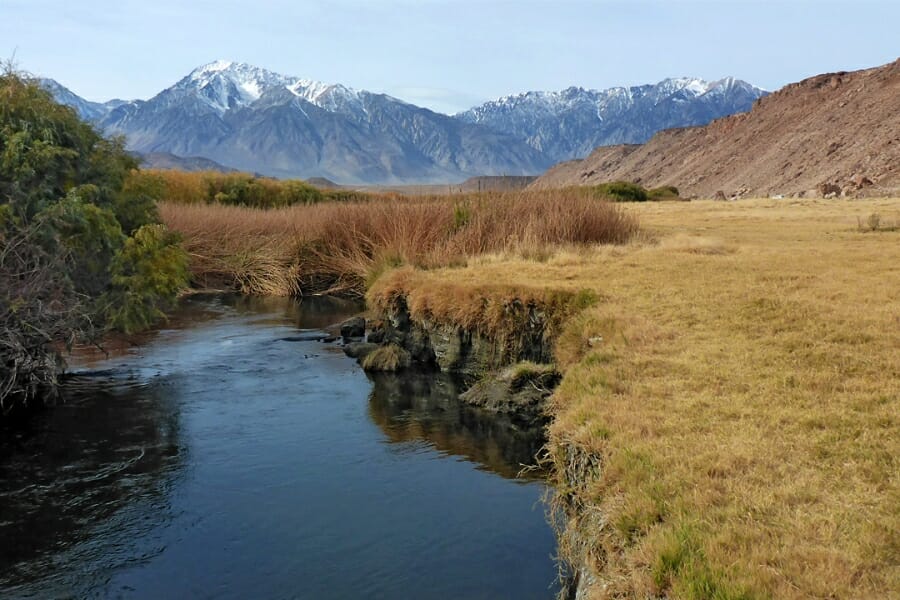
Union Flat is the one designated recreational mining spot on the entire North Yuba River, and the Tahoe National Forest says so plainly. It sits six miles east of Downieville on Highway 49, with the mining area running downstream from the campground.
The rule here is hands and pans only. Claims cover the surrounding river, so watch for claim markers and stay inside the designated stretch.
The North Yuba is famous for coarse gold, and visitors have pulled real nuggets out of this water. Bycatch includes quartz, garnet, and heavy black sand.
Camping on site makes this an easy overnight, and the river is beautiful even on a slow day.
Bring a Garrett Gold Guzzler Bottle so nothing small escapes your pan.
Difficulty rating: 2 out of 5
South Yuba River State Park, Nevada County
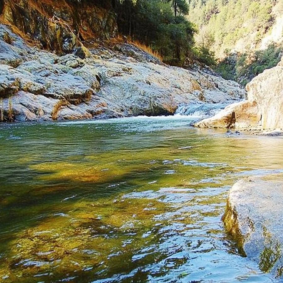
South Yuba River State Park is the state park California points people to when they ask where to pan, and gold was first found on this river at Rose’s Bar in 1848. The park runs a long ribbon of river from below Malakoff Diggins down toward Englebright Reservoir, with the Bridgeport covered bridge as the main hub.
Rules are hands and pans only, up to 15 pounds of material a day, on beaches and gravel bars subject to annual flooding. Muddy water cannot be visible more than 20 feet from where you are working, and nothing you find can be sold.
The river runs over scoured bedrock with deep potholes, which is ideal gold ground. Expect fine flakes and small pickers, with garnet, quartz, and serpentine as bycatch.
Summer panning demonstrations run at the park, which makes this a great first trip with kids.
Bring a Garrett Prospecting 10 inch Backpacker Gold Pan for the finish work.
Difficulty rating: 1 out of 5
Malakoff Diggins State Historic Park, Nevada County
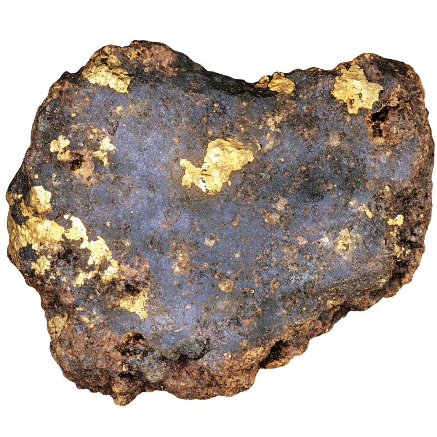
Malakoff Diggins preserves the largest hydraulic mine in California, a mile long pit of orange and white cliffs that was blasted apart with water cannons. Humbug Creek drains that pit, and it carries the gold the monitors never caught.
Panning is reported to be allowed on Humbug Creek between the Chinese Gardens and the Relief Hill Bridge, with pans available at the museum. Confirm the current open stretch with park staff before you start, because state park boundaries here are specific.
The park also runs hands on gold panning during Humbug Day in June, which is a fun way to learn the motion.
Expect fine gold, since hydraulic washed material is well sorted. Bycatch includes quartz, iron stained gravel, and petrified wood fragments.
Bring an SE 1 8 inch Mesh Sifting Screen because this material runs fine.
Difficulty rating: 2 out of 5
Central California
This is the Mother Lode, the 120 mile quartz vein belt that runs through the Sierra foothills from Mariposa to Georgetown. Between BLM recreation areas, state historic parks, and long running pay to pan camps, central California has more legal, easy gold access than anywhere else in the country.
Auburn State Recreation Area, Placer County
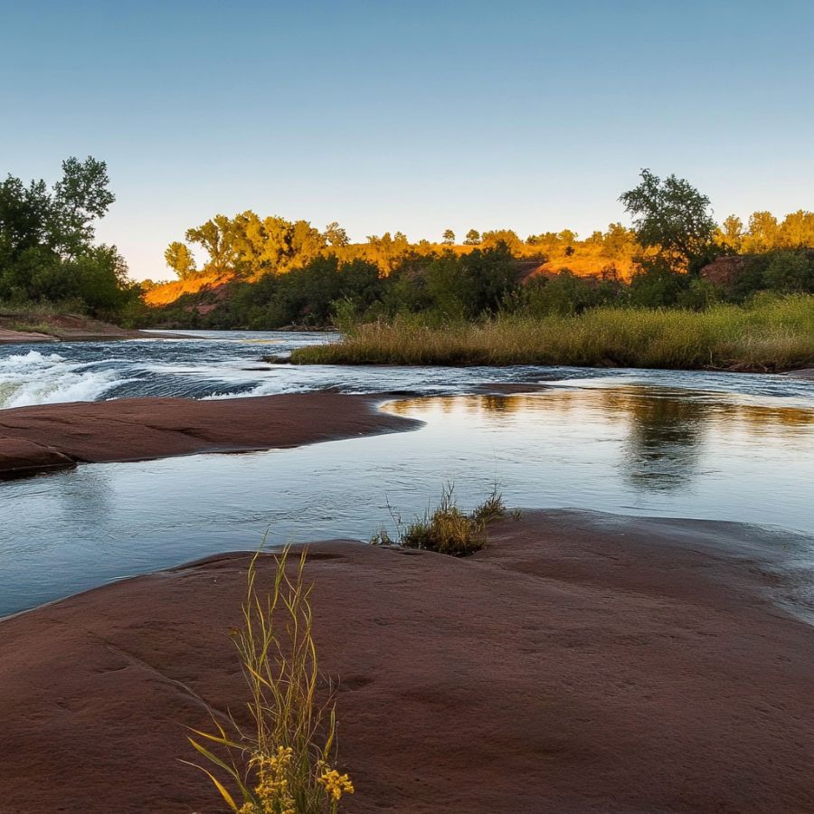
Auburn State Recreation Area covers more than 40 miles of the North and Middle Forks of the American River, and gold panning is allowed throughout as a form of rockhounding. That is an enormous amount of legal water inside an hour of Sacramento.
The rules are hands and pans, with the gold pan as the only permitted tool, a 15 pound daily limit on material, and work limited to gravel bars subject to annual flooding. Metal detectors are not allowed. Muddy water cannot show more than 20 feet away from you.
The Middle Fork was dredged and hand worked for a century and still gives up flakes and pickers. Bycatch includes quartz, garnet, jasper, and serpentine.
Confluence and Mineral Bar are the classic access points, and both have parking right on the water.
Bring a Garrett 15 inch Dual Riffle SUPERSLUICE Gold Pan, which is the only tool you need here.
Difficulty rating: 2 out of 5
Marshall Gold Discovery State Historic Park, El Dorado County
Coloma is where James Marshall found gold in the tailrace of Sutter’s Mill in January 1848 and set off the rush that built the state. You can pan the same river, a few hundred feet from the discovery site.
Panning is allowed on the east side of the South Fork American River across the Mount Murphy Bridge during park hours. Hands and pans only, no other mining equipment, and you can bring your own pan or buy one at the Marshall Gold Mercantile.
Lessons run most days at 10, 11, 1, 2, and 3 for ten dollars a person, with about 30 minutes of panning after a short lesson. Call ahead, since lessons stop when it is over 92 degrees.
Expect fine gold, garnet, and pyrite in the pan, which makes it a perfect place to practice telling them apart.
Bring a JARLINK 30X 60X Illuminated Loupe so you can see exactly what you saved.
Difficulty rating: 1 out of 5
PiPi Campground and the Cosumnes River, Amador County
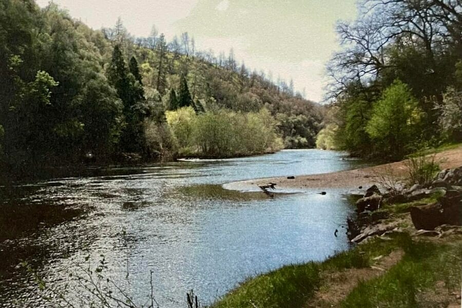
The Eldorado National Forest names the PiPi Campground area as one of its two recommended recreational panning spots, and no permit is needed to pan on national forest land there. The campground sits on the Middle Fork Cosumnes River off Omo Ranch Road.
Forest rules keep you inside the wetted channel of the stream. Do not cut streamside plants, do not dig the banks, and do not change the channel.
The Cosumnes drains the eastern edge of the Mother Lode and carries fine gold with occasional pickers. Bycatch includes quartz, garnet, and schist with mica.
Stop at a ranger district office for the ownership and claim maps, because private ground and claims sit close by.
Bring an Edward Tools Bend Proof Trowel for working the small gravel pockets.
Difficulty rating: 2 out of 5
Roaring Camp on the Mokelumne River, Amador County
Roaring Camp near Pine Grove puts you on a private stretch of the Mokelumne River canyon that very few people ever get to touch. Access is by guided tour, and you keep what you find.
The all day guided tour runs 50 dollars a person and includes panning instruction on the river. A Saturday night cookout tour includes a panning lesson, and gold you recover is yours. Longer stays on the gold bearing gravel piles with sluices are available for serious diggers.
Because the canyon is private and worked lightly, the gravel is far less picked over than public water. Expect flakes and pickers with real nugget potential.
Bycatch includes quartz, serpentine, and slate.
Bring SE Glass Vials with Caps so your gold travels home safely.
Difficulty rating: 1 out of 5
Columbia State Historic Park, Tuolumne County
Columbia is a preserved gold rush town three miles north of Sonora on Highway 49, and the Matelot Gulch Mining Company runs the panning there. The town sat on one of the richest pockets of the southern Mother Lode.
Panning options start at ten dollars for a pan rental and go up to 25 dollars for private instruction and guaranteed gold in your first pan. You keep everything you find, and you can pan all day.
This is the best place in California to bring a first timer, because the lesson is real and the gold is real. Bycatch includes garnet, which the operators call miners rubies, plus quartz and pyrite.
The whole town around it is worth an afternoon on its own.
Bring a JARLINK 30X 60X Illuminated Loupe to inspect the garnet and gold together.
Difficulty rating: 1 out of 5
Merced River Recreation Management Area at Briceburg, Mariposa County
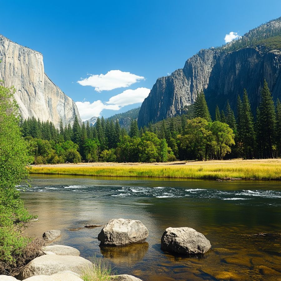
The BLM stretch of the Merced River below Yosemite is one of the best known public panning areas in the state. It runs along Highway 140 about 12 miles east of Mariposa, downstream of the park boundary, and recreational gold panning is a listed activity.
Access is through the Briceburg Visitor Center, across the suspension bridge, then along the unpaved Briceburg Campground Road to McCabe Flat, Willow Placer, and Railroad Flat campgrounds. Cable Rock Day Use Area is another easy entry.
The Merced cuts through metamorphic and igneous rock and drops gold behind boulders and in slow water. Expect flakes and pickers, with quartz, garnet, and black sand as bycatch.
Check the BLM claim map first, because several miles here are open and other stretches are claimed. The Yosemite National Park section upstream is closed to all prospecting.
Bring an ASR Outdoor Steel Crevice Tool Set for the bedrock pockets.
Difficulty rating: 2 out of 5
Southern California
Southern California gold sits in two very different settings, which are the Kern River canyon on the southern tip of the Sierra and the dry desert placers of the Mojave and Colorado deserts. Both have BLM ground open to hand prospecting.
Keysville Special Recreation Management Area, Kern County
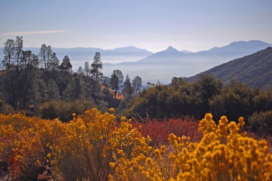
Keysville is 400 acres of BLM land set aside for recreational mining, covering about 1.25 miles of the Kern River two miles northwest of Isabella Lake. The BLM lists recreational gold panning as a primary activity here.
Two entrances off Highway 155 near Lake Isabella get you in, with Keysville South for camping and river access and Keysville North for camping and trails. Dispersed camping is allowed, which makes a multiday trip easy.
The Kern carries gold down from the Greenhorn Mountains and drops it in the bars and behind boulders. Expect flakes and pickers, with quartz, garnet, and schist as bycatch.
Use extreme caution near the river, because the Kern runs fast and cold.
Bring a Keene A52 Hand Sluice if you plan to process volume, and confirm current equipment rules with the BLM Bakersfield Field Office first.
Difficulty rating: 2 out of 5
Greenhorn Creek near Wofford Heights, Kern County
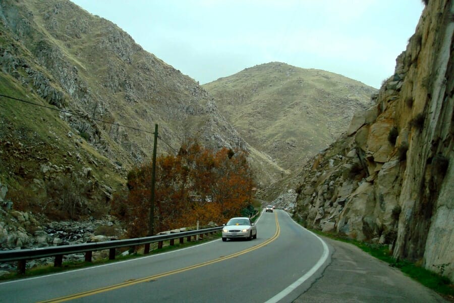
Greenhorn Creek is where gold was first found in Kern County in 1851, at the point where the creek meets the Kern River. The creek drains the Greenhorn Mountains through Sequoia National Forest ground above Wofford Heights.
The creek is small, which is an advantage, because a narrow channel concentrates gold into obvious traps. Bedrock is exposed in long runs at low water.
Expect fine gold with pickers where the gradient flattens. Bycatch includes quartz, garnet, and mica schist.
Claims cover parts of this drainage, so check with the Sequoia National Forest district office and the BLM claim map before choosing a spot.
Bring an ASR Outdoor Steel Crevice Tool Set for the bedrock cracks.
Difficulty rating: 3 out of 5
Lytle Creek, San Bernardino County
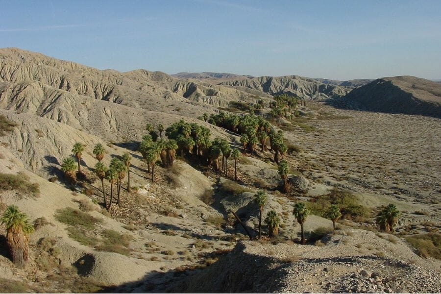
Lytle Creek has been producing placer gold since the 1860s and is the best known panning creek in the San Bernardino Mountains. The creek drains steep granite country and flushes fresh material down every winter.
The San Bernardino National Forest treats Lytle Creek as an environmentally sensitive area, which means you file a Notice of Intent with the district ranger before panning. That form is free and it is the difference between a legal trip and a citation, so do it first.
Work only below the high water mark and fill every hole before you leave. Expect fine gold and small pickers, with quartz, garnet, and magnetite as bycatch.
The Lytle Creek Ranger Station is right on the road in and can tell you which forks are open.
Bring an Edward Tools Bend Proof Trowel, which is all you need for creek gravel.
Difficulty rating: 3 out of 5
Julian and the Banner District, San Diego County
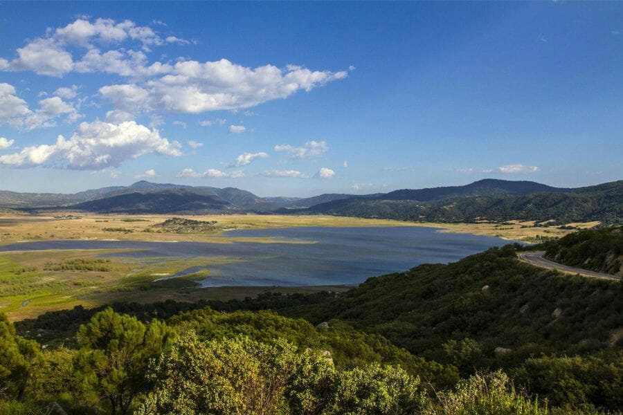
Julian is southern California’s own gold rush town, born when Fred Coleman panned color out of a creek in 1869 while watering his horse. Within a year more than 54 claims were recorded in the Julian Mining District, and the George Washington Mine produced around 200,000 dollars in gold.
The historic mines here are on private ground, but Julian is set up for visitors. The Julian Mining Company offers gold panning and the Eagle Mine runs underground tours, so you get real hands on time without needing permission from a claim holder.
Coleman Creek and the Banner Grade drainages carry fine gold and small pickers. Bycatch includes tourmaline, quartz, garnet, and feldspar, since this is also pegmatite country.
Combine it with one of the public gem mines in California, because San Diego County is the best tourmaline ground in the country.
Bring SE Glass Vials with Caps to keep your color separate from your gem finds.
Difficulty rating: 2 out of 5
Cargo Muchacho Mountains and Tumco, Imperial County
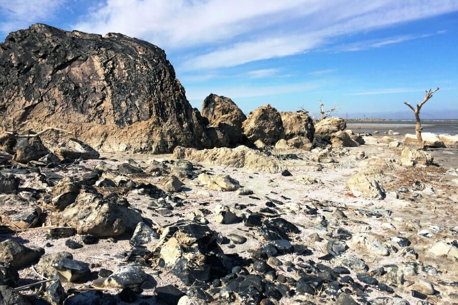
The Cargo Muchacho Mountains northeast of Ogilby held one of the oldest gold districts in California, worked by Spanish miners long before 1849. The ghost town of Tumco and the Picacho district sit in this same corner of the Colorado Desert.
This is dry placer country on BLM land, where you work washes with a dry washer or a detector instead of a pan. Winter is the only sane season, and summer heat here is genuinely dangerous.
Expect small nuggets and coarse gold, since desert gold does not travel far from its source. Bycatch includes quartz, kyanite, and iron oxides.
Active claims and a modern exploration project cover parts of the district, so pull the BLM claim map before you drive out.
Bring a Garrett AT Gold Metal Detector, which is the right tool for desert placers.
Difficulty rating: 4 out of 5
More Proven Places To Find Gold in California
These spots earn a trip too, and several of them are famous names in California mining history. Check access and collection rules for each one before you go, and pull up the BLM claim map first, because claims cover a great deal of the best ground in this state.
Northwestern California
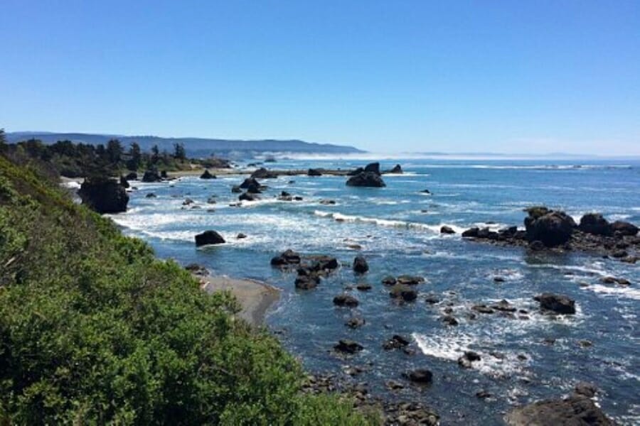
Rowdy Creek, Del Norte County. Rowdy Creek flows near Smith River town and has good public land access with campgrounds nearby. Prospectors report steady fine gold in the creek gravel, and the beach deposits at the mouth of the Smith River are worth a look on the same trip. Beach gold is very fine, so bring a fine classifier.
Shelly Creek and Monkey Creek, Del Norte County. Both creeks sit along Highway 199 past Gasquet on the way to the Oregon line, inside Six Rivers National Forest. They are documented gold producers with campgrounds close by. Confirm claim status with the forest office before you dig in.
Orleans and the lower Klamath River, Humboldt County. The Orleans placer ground along the Klamath has been worked since the 1850s and still gives up fine gold and flakes. Much of the surrounding land is tribal or private, so stick to Six Rivers National Forest river access and ask before crossing anything posted.
Willow Creek and the lower Trinity River, Humboldt County. The Trinity River below the Trinity County line carries gold all the way to its confluence with the Klamath. Bars near Willow Creek hold fine gold that rebuilds every high water year. Hoopa Valley tribal land begins downstream, and you need tribal permission there.
French Gulch, Shasta County. French Gulch was one of the richest lode districts in northern California and produced through the twentieth century. Creek gravel below the old workings still carries color. Most of the mine ground is private or claimed, so work public creek access and ask locally.
Indian Creek above Happy Camp, Siskiyou County. Indian Creek joins the Klamath at Happy Camp and has produced since 1851. Prospectors report coarse gold in the bedrock cracks along the lower creek. Club claims are common here, so check the claim layer or join a club that holds ground.
Salmon River at Sawyers Bar and Forks of Salmon, Siskiyou County. The Salmon River drains the Salmon Mountains and was heavily worked around Sawyers Bar, Cecilville, and Forks of Salmon. The gold is coarse and the canyon is remote. Roads are narrow and slow, so plan a full day just for the drive.
Scott River at Scott Bar and Callahan, Siskiyou County. The Scott River runs 60 miles to the Klamath and was one of the earliest strikes in the north state. Scott Bar and the Callahan reach are the classic spots, with hard rock mines like the Black Bear in the hills above. Klamath National Forest access points are the safest legal entries.
Canyon Creek near Junction City, Trinity County. Canyon Creek drops out of the Trinity Alps into the Trinity River and carries coarse gold in its lower reach. Shasta Trinity National Forest ground gives public access below the wilderness boundary. The Trinity Alps Wilderness upstream is closed to prospecting.
Douglas City and the Trinity River, Trinity County. The BLM Douglas City Campground sits right on the Trinity River south of Weaverville, in the same open reach as Steel Bridge. Bars here rebuild every winter and hold flakes and pickers. It makes a good base camp for the whole Trinity stretch.
Northeastern California
Butte Creek Canyon near Centerville, Butte County. Butte Creek below the Forks was mined hard from the 1850s and still carries fine gold and pickers. Public access is limited and much of the canyon is private, so use posted access points and ask permission on the rest. The Forks of Butte Creek recreation area upstream is the open option.
Deer Creek at Nevada City, Nevada County. Deer Creek runs right through Nevada City and was one of the first creeks worked in the county. Prospectors report fine gold in the bedrock cracks along the Deer Creek Tribute Trail. City and private ground line much of it, so confirm access before you pan.
Jamison Creek and Plumas Eureka State Park, Plumas County. Plumas Eureka preserves the Eureka Mine and the town of Johnsville, and the park runs ranger led gold panning plus Gold Discovery Days on the third weekend in July. Jamison Creek drains the old workings. Panning outside the organized programs needs park approval, so ask first.
Middle Fork Feather River near Nelson Point, Plumas County. The Middle Fork Feather is a Wild and Scenic river with a long placer history around Nelson Point and Nelson Creek. The canyon is steep and the access is rough, which keeps the gravel fresher than most. Plumas National Forest ground gives public access where claims are not staked.
Downie River at Downieville, Sierra County. The Downie River joins the North Yuba right in town and gave up some of the largest nuggets in California history in the 1850s. Claims cover most of the river, so the Union Flat designated area is the reliable place to pan. Downieville itself is worth the stop for the mining museum.
Goodyears Bar, Sierra County. Goodyears Bar sits on the North Yuba a few miles west of Downieville and was a major hydraulic and drift mining camp. The bars along Highway 49 here hold flakes and pickers. Watch for claim markers, because this stretch is well claimed.
Sierra City and the Sierra Buttes, Sierra County. The Sierra Buttes mines produced heavily from quartz veins high above the North Yuba, and the creeks below them carry gold in quartz. Sierra City sits at the base with Tahoe National Forest access all around. The steep tributary creeks are the interesting ground.
Central California
East Fork Carson River and the Monitor District, Alpine County. Alpine County’s Monitor and Silver Mountain districts produced gold and silver from veins near Markleeville. The East Fork Carson River below them carries placer gold. Humboldt Toiyabe National Forest ground gives access, and the Carson Iceberg Wilderness is closed to prospecting.
Sutter Creek and Jackson, Amador County. This is the heart of the Mother Lode, where the Kennedy and Argonaut mines went thousands of feet deep. Sutter Creek and the small drainages below the old workings still carry fine gold. Nearly all the historic ground is private, so look for public creek crossings and ask permission.
Angels Camp and Carson Hill, Calaveras County. Carson Hill produced the largest natural gold mass ever found in the United States, and Angels Camp sits at the center of the district. The mine ground itself is private, but the surrounding creeks below the vein system carry gold. Ask locally and check the claim map before working anything.
Mokelumne Hill, Calaveras County. Mokelumne Hill was one of the richest camps of the rush, and the Mokelumne River canyon below it still produces. Public river access is limited and much of the canyon is claimed or private. The pay to pan operation upriver is the easy way onto this water.
Georgetown and Cache Rock on the Rubicon, El Dorado County. The Eldorado National Forest names the Cache Rock area as one of its two recommended recreational panning spots, and no permit is needed on forest ground. Georgetown sits on the divide above the Rubicon and the Middle Fork American. Get the ownership maps from the Georgetown Ranger District first.
Placerville and Weber Creek, El Dorado County. Placerville was Old Dry Diggings, one of the busiest camps of 1848 and 1849. Weber Creek and Hangtown Creek drain the old ground and still carry fine gold. The town has grown over most of it, so this is a permission and public access game.
Hornitos and Bear Valley, Mariposa County. Hornitos and Bear Valley sit on the southern Mother Lode where John Fremont’s Las Mariposas grant produced heavily. The creeks here carry coarse gold in quartz. Land ownership is a patchwork of private and BLM, so pull the claim map and ownership layer before you go.
Gold Run, Placer County. Gold Run was one of the biggest hydraulic mines in California, and the washed gravels above the North Fork American are still full of fine gold. The old diggings are partly public and partly claimed. Access from the Interstate 80 corridor is easy, which makes it a good scouting stop.
Michigan Bluff and the Middle Fork American, Placer County. Michigan Bluff sat on an ancient buried river channel that produced enormous amounts of gold. The Middle Fork American far below it is legendary nugget water. Trails drop steeply into the canyon, so this is a fit hiker’s trip, and Auburn State Recreation Area rules apply on the lower river.
Sonora and Sullivan Creek, Tuolumne County. Sonora sat on rich pocket gold ground where quartz veins held concentrated shoots of coarse gold. Sullivan Creek and the drainages east of town still carry color. Most of it is private, so Columbia State Historic Park nearby is the reliable public option.
Southern California
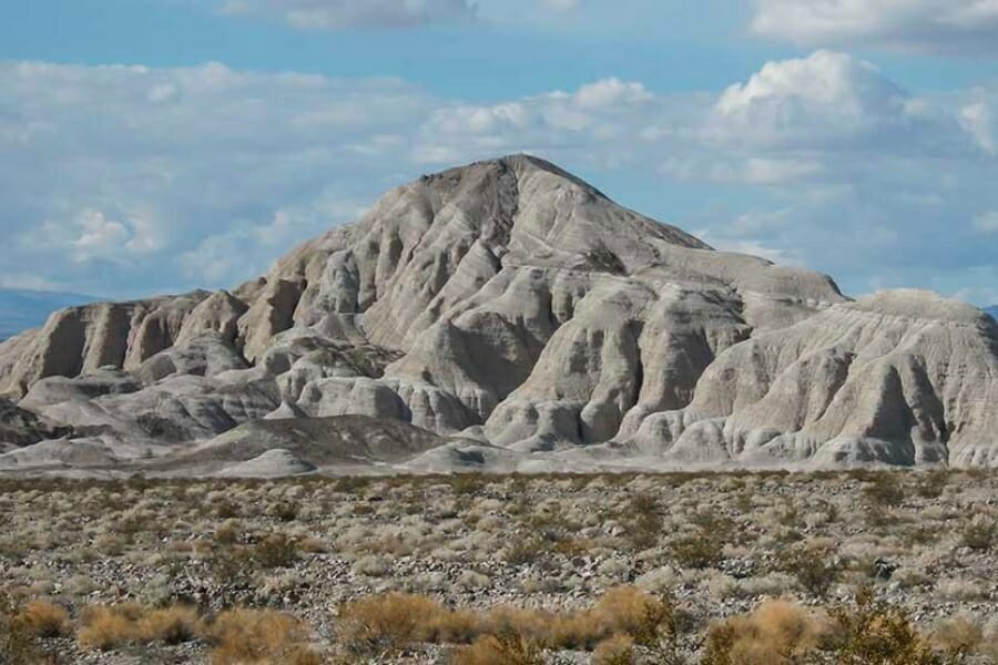
Ballarat and Panamint Valley, Inyo County. The Panamint Range above Ballarat produced gold and silver from the 1870s onward, and the alluvial fans below it hold dry placer gold. Ballarat is a ghost town on BLM ground with road access from Trona Wildrose Road. Death Valley National Park begins just east and is closed to all prospecting.
El Paso Mountains and Last Chance Canyon, Kern County. The El Paso Mountains north of Red Rock Canyon hold documented dry placers worked from the 1890s onward. Last Chance Canyon and the Goler district are the classic ground, on BLM land with rough roads. Red Rock Canyon State Park itself is closed to collecting.
Randsburg and the Rand District, Kern County. The Rand district around Randsburg and Johannesburg was one of California’s biggest gold producers and the town is still standing. Claims blanket most of the district, and modern operations are active nearby. Treat this as a history stop unless you have confirmed open ground on the claim map.
Acton and Soledad Canyon, Los Angeles County. Placer gold has been found around Acton and Soledad Canyon since before the 1848 rush, and a 12.8 ounce nugget came out near Acton in 1993. Much of the surrounding range sits inside the San Gabriel Mountains National Monument, where recreational panning is closed. Work private ground with permission or club claims only.
Dale Mining District, San Bernardino County. The Dale district east of Twentynine Palms produced gold from lode mines and dry placers into the twentieth century. It sits on BLM desert ground with primitive road access. Joshua Tree National Park adjoins it and is closed to prospecting, so know exactly where the boundary is.
Holcomb Valley, San Bernardino County. Holcomb Valley north of Big Bear was southern California’s biggest gold rush in 1860 and still has visible diggings. The San Bernardino National Forest lists it as an environmentally sensitive area, so file a free Notice of Intent with the district ranger before you pan or detect. That form is quick and it keeps the trip clean.
Banner Grade and Chariot Canyon, San Diego County. Banner sits below Julian on the grade toward the desert and was the second major strike of the district. Chariot Canyon holds the old Golden Chariot workings. Ownership is mixed private and BLM, so confirm before you work anything.
Piru Creek and Frazier Mountain, Ventura County. Placer gold has been reported around Frazier Mountain and in the Piru Creek drainage in the Los Padres National Forest. This is quiet, lightly worked ground compared to the Sierra. Check the Mount Pinos Ranger District for current access, since fire closures are common here.
The Best Gold Hunting Techniques in California
Four techniques cover almost everything you will do in California, and the state’s equipment rules shape which one you can use where. Start with the first, add the others as your ground allows.
Gold Panning (Difficulty: 1 out of 5)
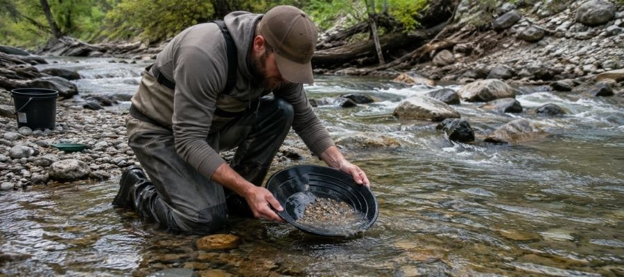
Panning is filling a pan with gravel, submerging it, shaking it so the heavy material sinks, and washing the light stuff over the lip a little at a time. Gold is about seven times denser than the sand around it, so it stays put if you keep the pan tipped correctly.
It works everywhere in California, and it is the only method allowed at Marshall Gold Discovery, South Yuba River State Park, Auburn State Recreation Area, Whiskeytown, and Union Flat. Learn it well, because on public panning ground it is often your only legal option.
Essential Tools
- Deep Riffle Gold Pan: Garrett 15 inch Dual Riffle SUPERSLUICE Gold Pan
- Classifier Screen: SE Half Inch Sifting Screen
- Snuffer Bottle: Garrett Gold Guzzler Bottle
- Glass Storage Vials: SE Glass Vials with Caps
Metal Detecting (Difficulty: 2 out of 5)
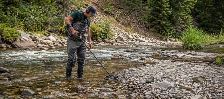
A gold detector finds nuggets that a pan will never see, because it reads metal under dry ground where there is no water to wash gravel. You sweep slowly, dig every repeatable signal, and use a pinpointer to find the target in your dirt pile.
This is the method for southern California’s desert placers, for the El Paso Mountains and the Cargo Muchacho district, and for Swasey Recreation Area in the north. Detectors are not allowed at Auburn State Recreation Area or Whiskeytown, so check each spot’s rules first.
Essential Tools
- Metal Detector: Garrett AT Gold Metal Detector
- Pinpointer: Garrett Pro Pointer AT
- Digging Shovel: Bully Tools 14 Gauge Round Point Shovel
Sluicing (Difficulty: 3 out of 5)
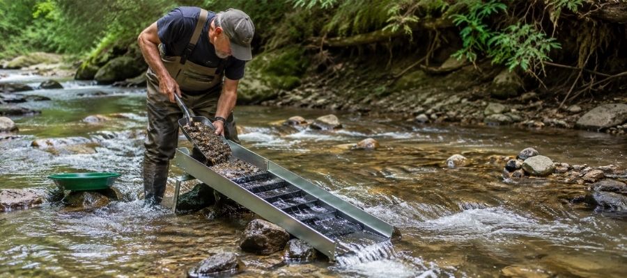
A sluice is a channel with riffles that you set in moving water so the current does the washing for you. You shovel classified gravel into the top, and the riffles catch the heavy material while everything else washes through.
A sluice processes many times the volume of a pan, which matters on a big gravel bar. California restricts where you can use one, so it belongs on national forest and BLM ground where hand tools are allowed, never at hands and pans sites.
Essential Tools
- Sluice Box: Keene A52 Hand Sluice
- Fine Sifting Classifier: SE 1 8 inch Mesh Sifting Screen
- Black Sand Magnet: SE Magnetic Separator Pick Up Tool with Quick Release
Crevicing (Difficulty: 4 out of 5)
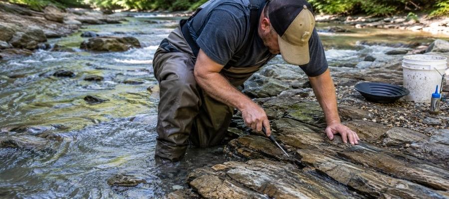
Crevicing is digging gold out of cracks in exposed bedrock with picks, scrapers, and a suction tool. It is slow, awkward work in tight spaces, and it is where the best gold on many California rivers has been sitting untouched.
The Klamath, the Merced, Greenhorn Creek, and the South Yuba all expose bedrock at low water. Work each crack all the way to the bottom, because the last scrape usually holds the most.
Essential Tools
- Crevice Tool: ASR Outdoor Steel Crevice Tool Set
- Finish Pan: Garrett Prospecting 10 inch Backpacker Gold Pan
- Magnifying Loupe: JARLINK 30X 60X Illuminated Loupe
How To Tell Real Gold From Fool’s Gold
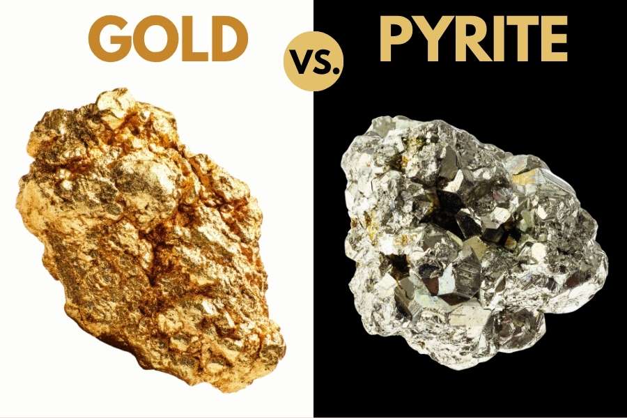
Pyrite is everywhere in California gold country, and it has fooled people since 1849. It forms in the same quartz veins as gold and washes into the same creeks, so a pan full of Mother Lode gravel very often has both.
The shadow test settles it in one second. Cup your hand over the bright spot in your pan, because gold keeps glowing a warm yellow in shade and pyrite goes dull grey the moment the sun comes off it.
The poke test settles the rest. Press the piece with a needle or a fingernail, and gold dents and bends because it is soft, while pyrite is brittle and cracks into little cubes.
Color and shape help too. Pyrite grows in sharp cubes with flat faces, and real gold is rounded, dented, and irregular from tumbling downstream.
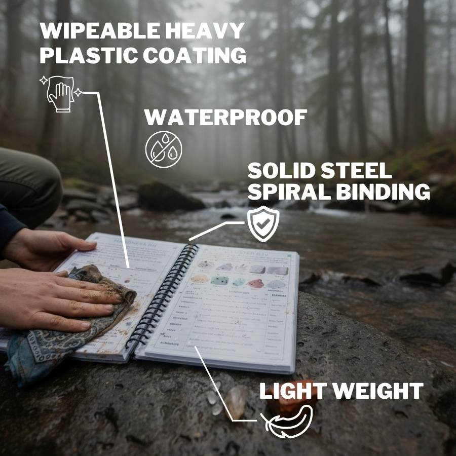
Knowing gold is only half the job in California. The same pan holds garnet, tourmaline, jade, jasper, and quartz that people throw back every day, and the loss adds up faster than most beginners believe. The California Rocks and Minerals Field Guide is waterproof, spiral bound, and built to be used with wet hands in a creek, so nothing valuable goes back in the water because you could not name it.
How Gold Got Into California
The spots in this guide sit where they sit because of one enormous geologic collision. Everything traces back to it.
For roughly 200 million years, the floor of the Pacific Ocean slid underneath the western edge of North America. That process melted rock deep below the surface and built the granite core of the Sierra Nevada, while scraping seafloor rock, volcanic islands, and ocean sediment onto the edge of the continent.
Superheated water carrying dissolved gold pushed up through the fractures created by all that grinding. As the water cooled, quartz crystallized in the cracks and gold came out of solution with it. That is the Mother Lode, a belt of gold bearing quartz veins running about 120 miles along the western Sierra foothills, plus the same kind of veins in the Klamath Mountains and the desert ranges.
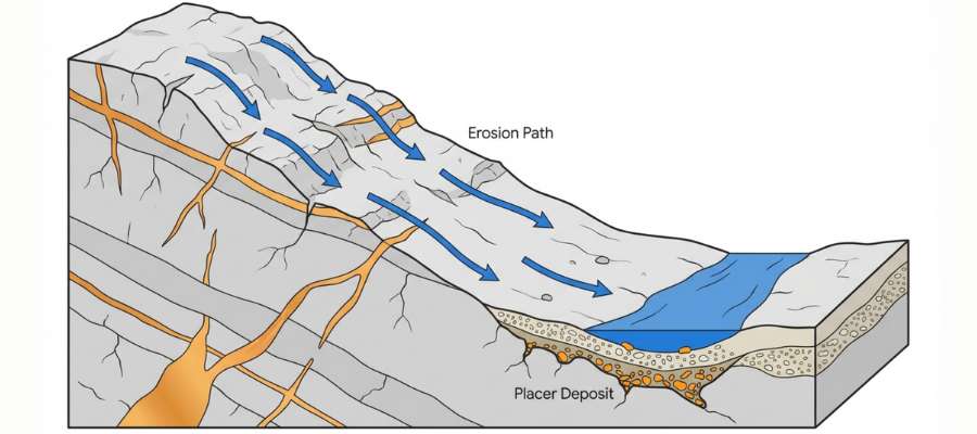
Then erosion went to work. Rivers cut into the veins, freed the gold, and carried it downhill for millions of years, rounding it and dropping it wherever the current slowed. Some of those ancient rivers were later buried under volcanic mudflows, which is why nineteenth century miners tunneled into hillsides hundreds of feet above the modern streams.
Today’s rivers are still doing the same job on the same rock. Every winter storm cuts a little deeper into the veins and the old channels and restocks the gravel bars downstream.
What To Bring for a California Gold Day Trip
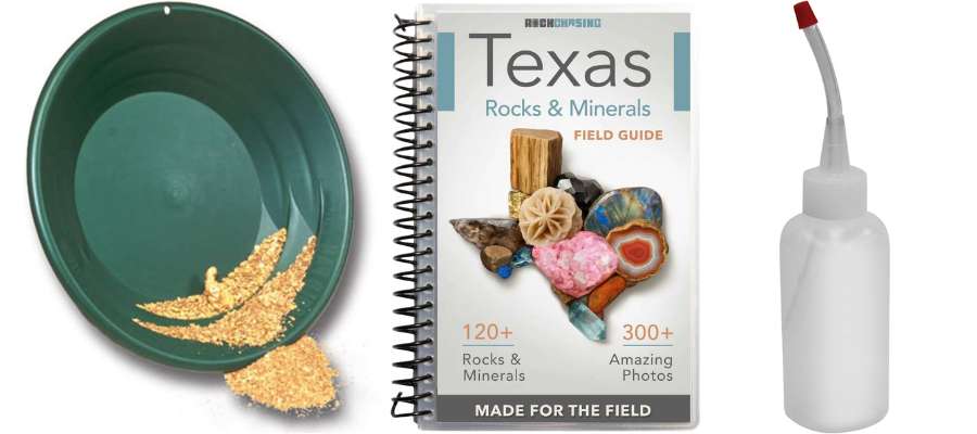
Pack light and pack legal, because most California public panning sites limit you to a pan and small hand tools anyway.
Gear from the techniques section above:
- Gold pan and a finish pan
- Classifier screen
- Snuffer bottle and glass vials
- Small trowel or crevice tool
- Loupe for checking finds
Everything else:
- Two liters of water per person, more in summer
- Sunscreen and a wide brim hat
- Boots you do not mind soaking, plus dry socks
- Knee pads, because you will be kneeling on rock all day
- Printed or downloaded claim map for your area
- Printed permission notes or permits, since cell service dies in most canyons
- Trash bag, and fill your holes before you leave
New to this? The Garrett Deluxe Gold Pan Kit gets you everything in one box so you are not assembling a kit piece by piece the night before.
The Best Time of Year To Hunt for Gold in California
Water level decides everything in California, and the right month is different in each corner of the state. Time it well and you get exposed bedrock and low, safe water.
Northwestern California
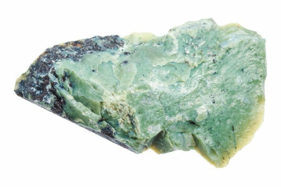
Late July through October is the window on the Klamath, Trinity, Scott, and Smith rivers. Winter and spring runoff here is heavy and the rivers stay high and cold into early summer.
By August the bars are dry and bedrock is exposed. Fall is the sweet spot, with low water, cool air, and far fewer people on the river.
Northeastern California
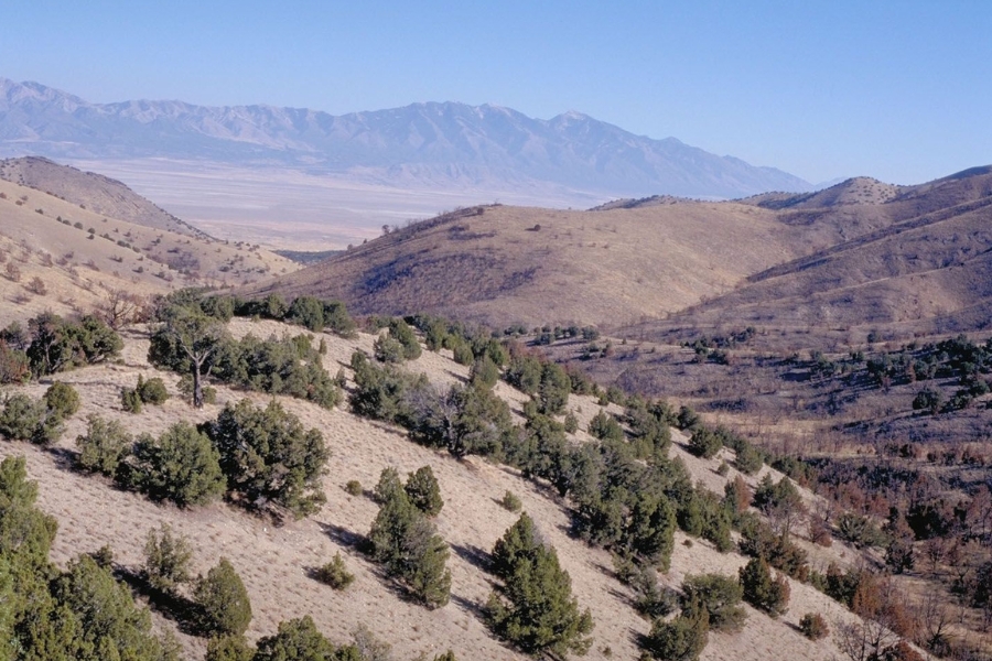
June through October works for the northern Sierra, and higher elevations open later. Snow closes roads into the Sierra Buttes, Plumas Eureka, and Malakoff Diggins into late spring.
July and August give you the lowest water on the Yuba and Feather. Watch for afternoon thunderstorms in the high country and get out of the canyon if the water starts rising.
Central California
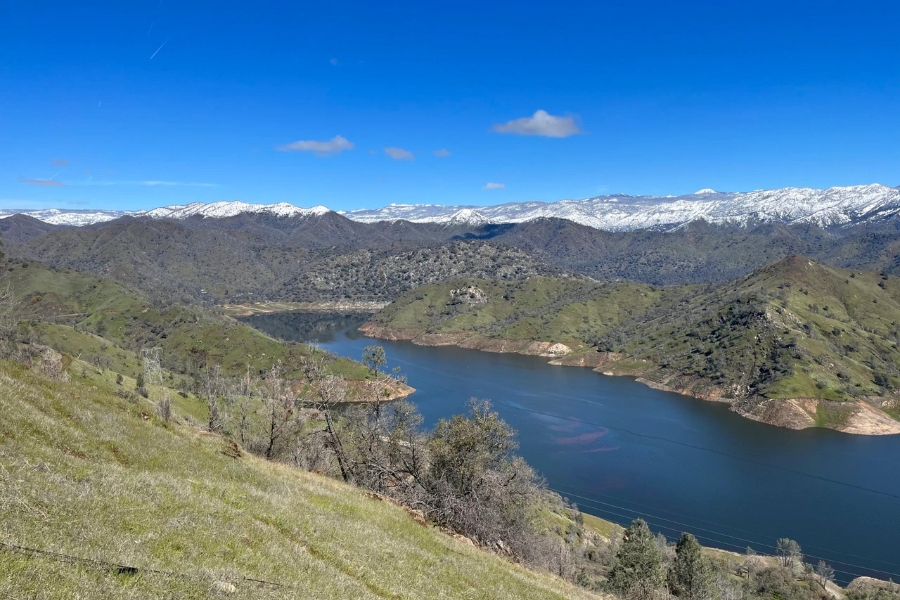
The Mother Lode foothills are workable most of the year, with April through June and September through November the most comfortable. Summer afternoons in Sonora, Coloma, and Auburn regularly clear 100 degrees.
Spring gives you the freshest gravel after winter storms have rearranged the bars. Just wait for flows to drop before wading anything on the American or the Merced.
Southern California
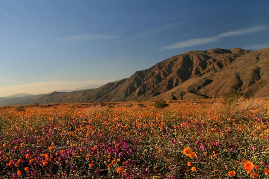
November through March is desert season, and it is not optional. Summer heat in the El Paso Mountains, the Cargo Muchachos, and the Panamint country is life threatening.
The Kern River canyon at Keysville works from spring through fall, with the best low water from July into October. Flash floods hit desert washes fast, so never camp in a wash when rain is anywhere in the forecast.
Other Valuable Rocks and Minerals You Can Find in California
The same gravel that holds gold in California holds some of the best gem and mineral material in the country. Learn to spot these and every trip pays twice.
Quartz
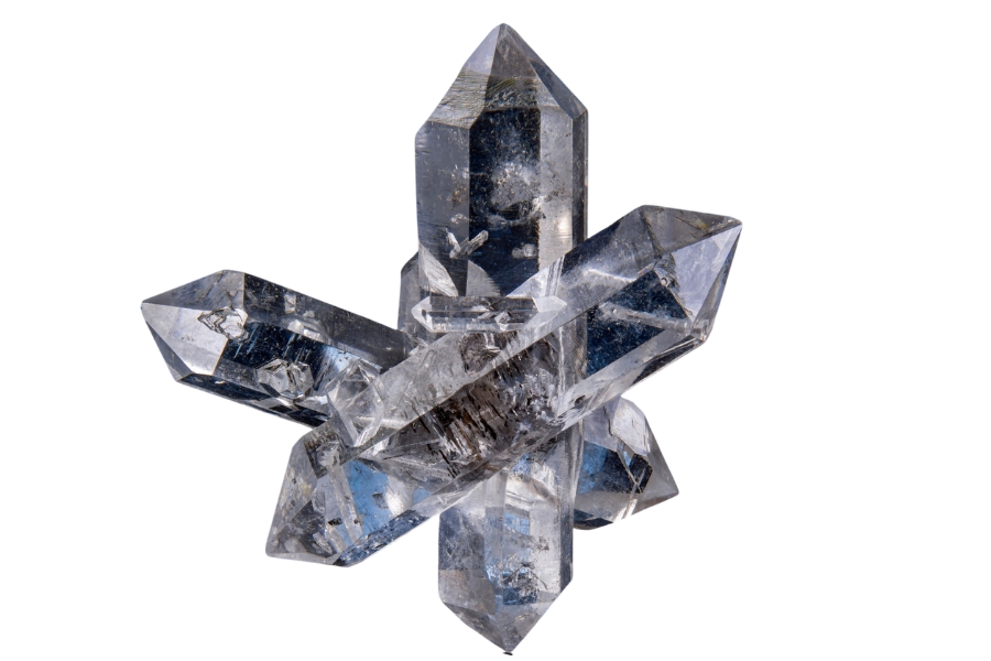
Quartz is the host rock for most California gold, so white quartz cobbles are everywhere in gold country gravel. Clear and smoky crystal pockets turn up in the same veins.
Check every quartz cobble with visible color running through it, because gold in quartz is worth far more than its melt weight. See our full guide to quartz in California for the best crystal localities.
Garnet
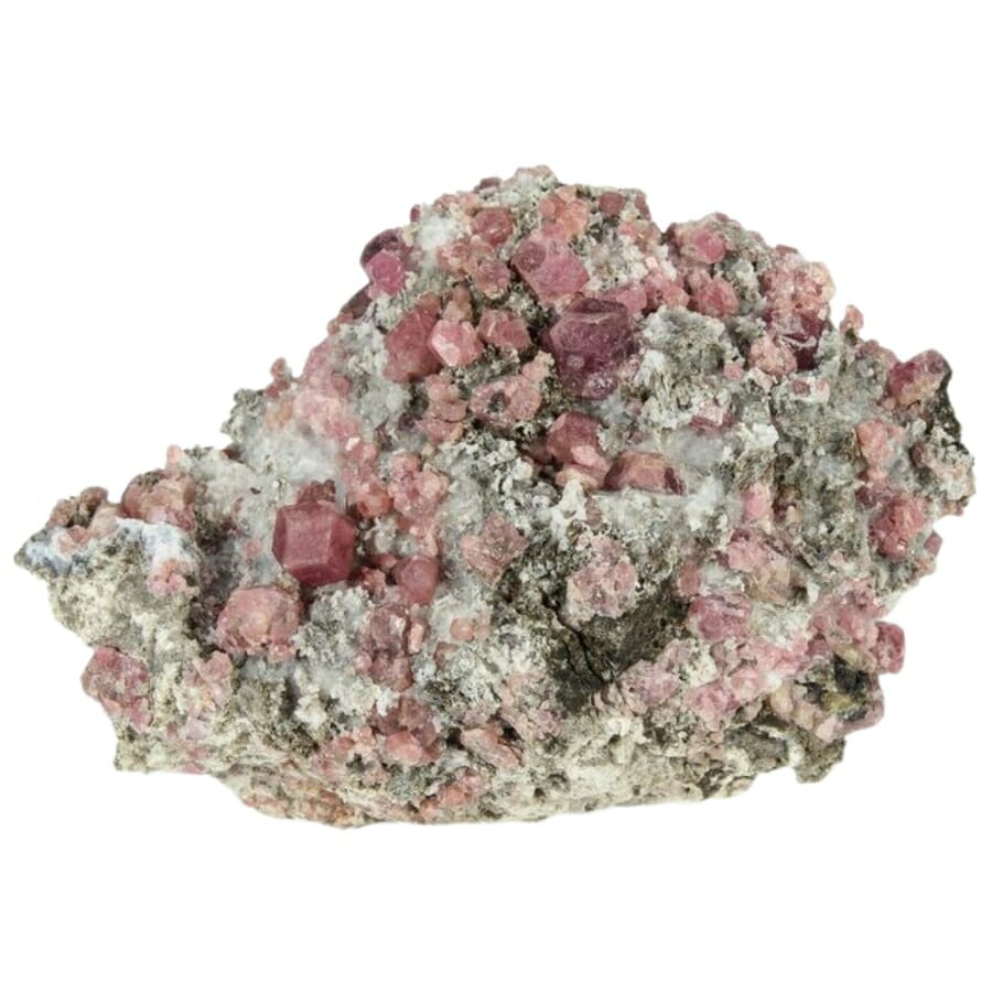
Garnet shows up as deep red grains in almost every pan of Sierra concentrate, and the old timers called them miners rubies. Larger crystals come out of the metamorphic rock along the Mother Lode.
They are heavy, which is exactly why they end up with the gold. Our guide to garnet in California covers where the gem quality material is.
Pyrite
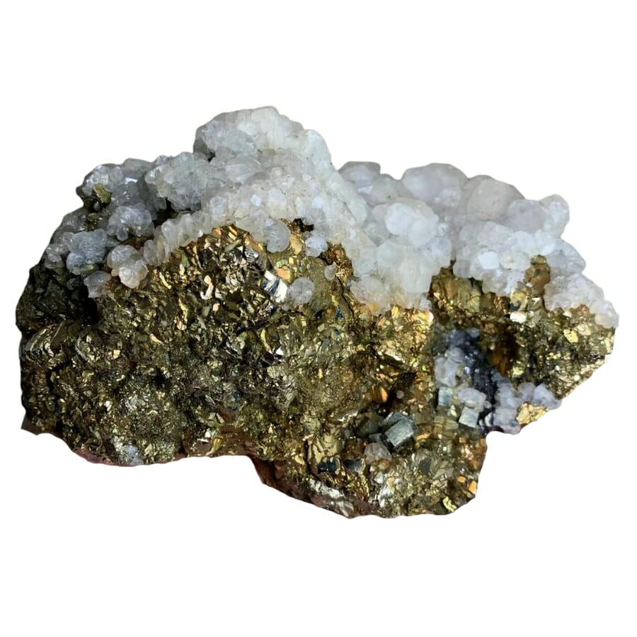
Pyrite forms in the same quartz veins as gold and often sits right beside it. Good cubic crystal groups are collectible in their own right.
Massive pyrite in California quartz sometimes carries invisible gold, which is how several big mines here made their money. Read more in our guide to pyrite in California.
Jade

Nephrite jade comes out of the serpentine belts in the Klamath Mountains and along the Big Sur coast. Trinity, Siskiyou, and Del Norte county rivers all carry jade cobbles.
It is dense, greasy looking, and does not scratch with a knife. See our guide to jade in California for the best hunting grounds.
Tourmaline
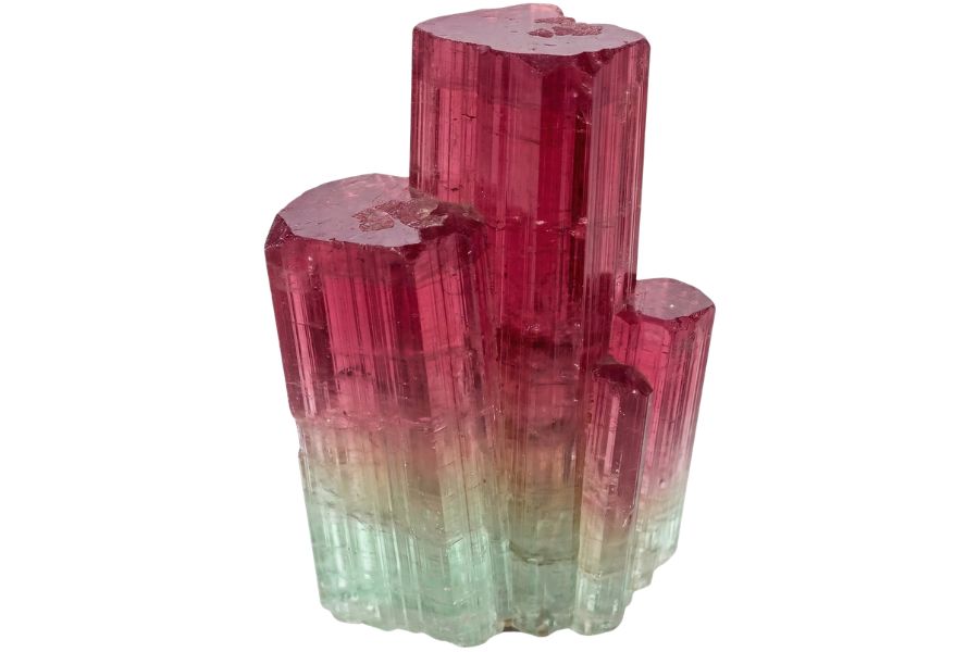
San Diego County pegmatites produce the finest tourmaline in North America, in pink, green, and watermelon colors. The gem districts around Pala and Mesa Grande sit close to Julian gold country.
If you are panning southern California, add a gem mine to the trip. Our guide to tourmaline in California has the details.
Jasper
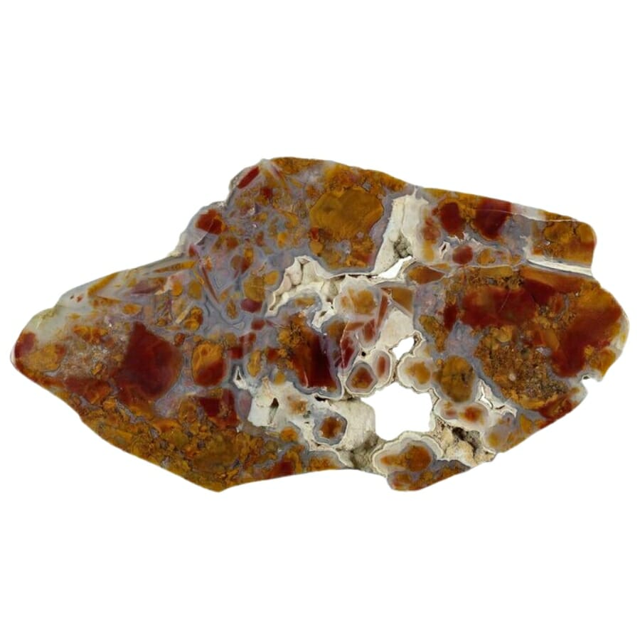
Jasper turns up in the same river gravel as gold across the northern part of the state, in red, yellow, brown, and green. It takes a mirror polish and is a favorite for cabochons.
Watch for smooth, opaque, waxy pebbles with strong color. Our guide to jasper in California maps the best beds.
Agate
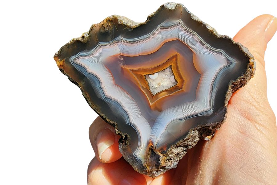
Agates show up in California river gravel and on the north coast beaches, often banded and translucent when wet. The desert ranges produce fire agate as well.
Hold a candidate up to the sun, because agate glows around the edges and jasper does not. Our guide to agates in California covers the top spots.
Amethyst
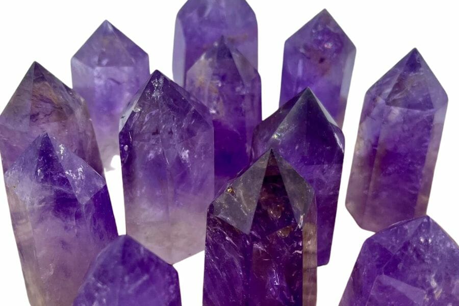
Amethyst forms in the same quartz systems that carry gold, and California produces it in several districts. Pockets in volcanic and vein rock hold the best crystals.
Purple quartz in a gold country creek is always worth picking up. See our guide to amethyst in California.
Obsidian
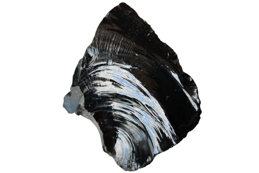
Obsidian is volcanic glass, and northern California has world class deposits including rainbow and snowflake varieties. Glass Mountain and the Clear Lake area are the famous ones.
It is light and sharp, so handle it carefully. Our guide to obsidian in California lists the collecting areas.
Copper Minerals
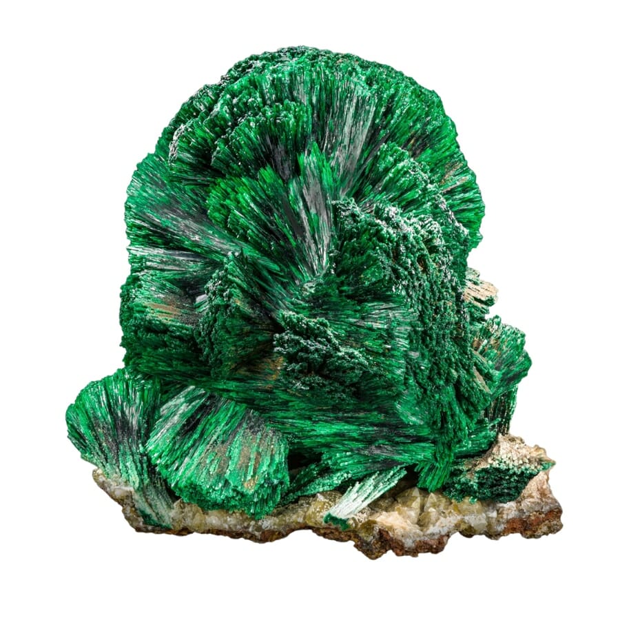
Bright green malachite and blue azurite mark copper ground, and several California gold districts produced copper alongside gold. Foothill copper belts run through Shasta, Calaveras, and Plumas counties.
Green stain on a rock is a signal worth following. Our guide to copper in California has the districts.
Do not lose a gemstone because you were looking for gold. A tourmaline crystal or a good jade cobble can be worth more than a day of flakes, and both go straight back in the creek when you cannot identify them. The California Rocks and Minerals Field Guide covers 120 rocks and minerals with 300 photos on waterproof pages, so everything heavy or odd in your pan gets named before you tip it out.
Legal Rules for Gold Prospecting in California

California has more gold law than any other state, and getting it right is what keeps every flake you find 100 percent yours. What follows is general information and not legal advice, and you are responsible for confirming the rules for your exact spot before you dig.
Private Property
California land ownership in gold country is a patchwork, and a river bar that looks wild is often deeded to somebody. Ownership can change from one bend to the next along the same creek.
Get permission in writing or by text before you work private ground, and keep it on your phone and on paper. County assessor maps and Forest Service ownership maps show you where the boundaries actually fall.
Tribal lands including the Hoopa Valley Reservation on the lower Trinity require tribal permission, which is a separate process from state or federal rules.
Active Mining Claims
This is the big one in California. Huge areas of BLM and Forest Service land that look completely open are covered by valid mining claims, and panning on someone’s claim is trespassing on their mineral rights even though the surface is public.
Check the BLM Mineral and Land Records System before every trip, and look for claim posts and notices on the ground. County recorder offices also keep claim records, and the Plumas, Sierra, and Siskiyou county recorders are used to the question.
If you want claim access without staking your own, join a prospecting club. Groups like the Gold Prospectors Association of America and regional clubs hold claims up and down the state, and membership is the simplest legal path to good ground.
Equipment Restrictions
Suction dredging is banned in California waters, full stop, and enforcement is active. Motorized equipment in and near streams is tightly restricted statewide, and rules vary between BLM districts, national forests, and state parks.
State parks and most designated public panning areas are hands and pans only, with the gold pan as the only tool allowed and a 15 pound daily limit on material. National parks and wilderness areas are closed to prospecting entirely, with narrow exceptions written into law like the permit program at Whiskeytown National Recreation Area.
Some national forest areas need a free Notice of Intent before you pan, including Lytle Creek and Holcomb Valley in the San Bernardino National Forest. Recreational panning is also closed inside the San Gabriel Mountains National Monument.
Confirm access and collection rules directly with the managing agency or landowner before every trip, because rules change without notice and a phone call takes five minutes.
Some of the places in this guide are look and photograph spots rather than collecting spots, and treating them that way keeps them open for everybody who comes after you.
Local rock and mineral clubs are the best source of current, on the ground information in California. They know which claims changed hands, which roads washed out, and which stretches are open this season.
California Gold FAQ
Can you still find gold in California?
Yes, you can still find gold in California, and people do it every weekend. Placer gold is renewed in the rivers every winter as storms erode gold bearing quartz veins and old channel gravels, and public panning areas like Whiskeytown, Auburn State Recreation Area, and the Merced River at Briceburg give you legal access to it.
The state has produced more than 106 million troy ounces since 1848, and the geology that made that number is still exposed and still eroding.
Where is the best place to pan for gold in California?
The best places to pan for gold in California are the designated public panning areas, because they are open to anyone and free of claim conflicts. Whiskeytown National Recreation Area, Auburn State Recreation Area on the American River, South Yuba River State Park, the BLM Merced River area at Briceburg, and Keysville on the Kern River are the most reliable.
Marshall Gold Discovery State Historic Park at Coloma is the best place to learn, since lessons run daily on the river where the rush began.
Is it legal to pan for gold in California?
Yes, recreational gold panning is legal in California on public land that is not claimed, closed, or otherwise restricted. Hand panning with a pan and small hand tools is allowed on most national forest and BLM ground, and several state parks allow hands and pans panning under a 15 pound daily material limit.
Suction dredging is banned statewide, national parks and wilderness areas are closed to prospecting, and panning inside the San Gabriel Mountains National Monument is prohibited.
Do you need a permit to pan for gold in California?
Most places do not require a permit for simple hand panning, but several do. Whiskeytown National Recreation Area requires a one dollar annual panning permit plus an entrance pass, and the San Bernardino National Forest requires a free Notice of Intent for panning at Lytle Creek and Holcomb Valley.
No permit is needed for hand panning on general Eldorado National Forest ground or at most BLM recreation areas, though you should always confirm with the managing office first.
How much gold is left in California?
A great deal of gold is left in California, and geologists estimate that only a fraction of the state’s total endowment was ever recovered. Early miners had no way to save fine gold, so the tailings, hydraulic pits, and dredge piles they left behind still carry it.
New material also arrives every year, because the Mother Lode and Klamath vein systems are still exposed at the surface and still eroding into the rivers below them.
Get Every Find Identified in Seconds
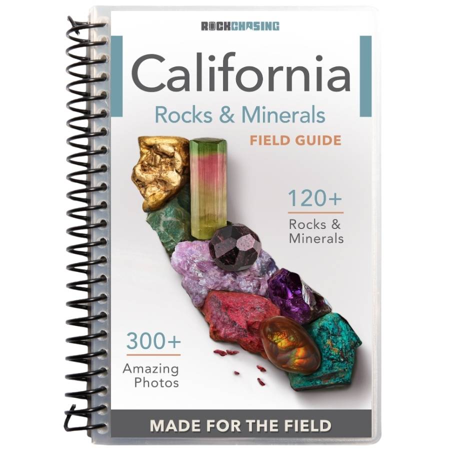
Gold is only part of what comes up in a California pan, and the rest of it is worth knowing. Garnet, tourmaline, jade, jasper, agate, and gold bearing quartz all ride in the same gravel, and the difference between a good day and a great one is being able to name what you are holding.
The California Rocks and Minerals Field Guide covers 120 rocks and minerals with 300 color photos on waterproof, spiral bound pages built for wet hands and muddy creek banks.
Get the California Field Guide