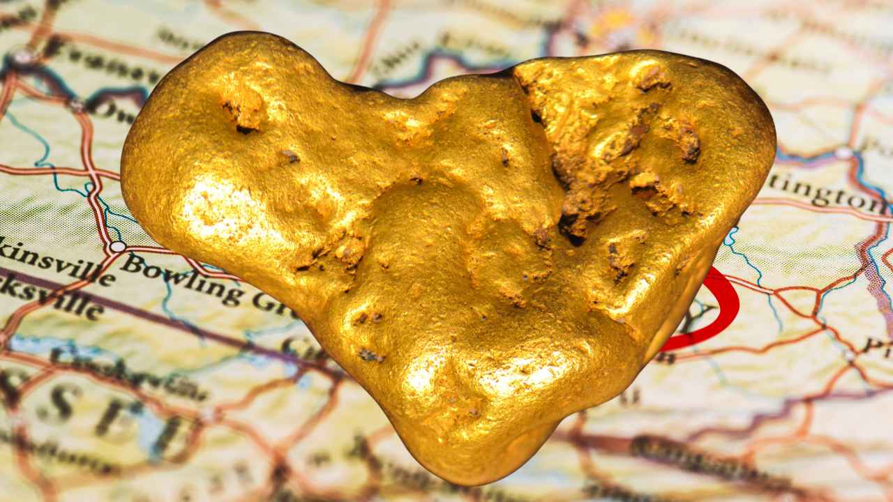
There is real gold in Kentucky creeks, and it has one of the greatest origin stories in American prospecting. Ice age glaciers hauled it hundreds of miles south from Canada and tucked it into the gravel along the state’s northern edge, where panners are still washing out color today.
With gold trading above $4,000 an ounce, even the fine flakes in a Kentucky pan are worth more than they have ever been.
Most newcomers head for the pretty mountain streams in the east or the big rivers in the west. The gold took a different route into the state, and knowing that route is your biggest advantage.
It rode the ice into a band of far northern counties along the Ohio River. Yes, you can find gold in Kentucky today, especially in Boone County creeks like Middle Creek and along the lower Licking River, where ice age glaciers dropped fine placer gold that local panners still recover. This guide covers every proven spot, the technique that works at each one, and the rules that keep your trip legal.
Our team of geologists and experienced rockhounds put this guide together the same way we approach every gold state. We mapped where the ice actually crossed the river into Kentucky, then matched that against survey records and what local prospectors report. Here is everything you need to plan a Kentucky gold trip that ends with real color in your vial.
Table of Contents
- Types of Gold
- Where Gold Hides
- Best Places
- Techniques
- Real vs Fool’s Gold
- How Gold Got Here
- What To Bring
- Best Seasons
- Other Minerals
- Legal Rules
- FAQ
The Kinds of Gold You Can Find in Kentucky
Kentucky gold is glacial placer gold, ground fine and polished bright on its long ride south inside the ice. Knowing exactly what it looks like is the difference between walking past color and washing it into your vial. The glaciers seeded the far northern counties with the real thing, and finding it feels fantastic.
Flour Gold
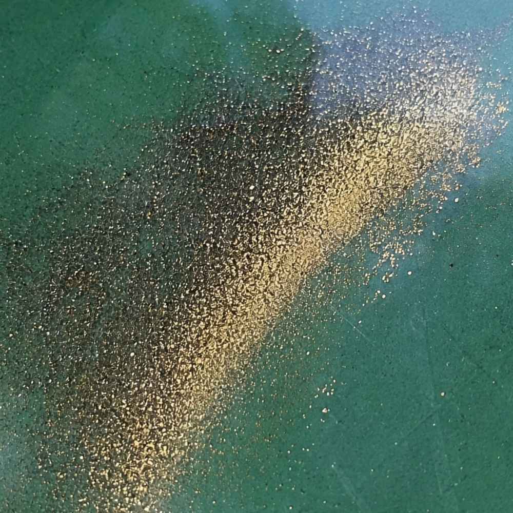
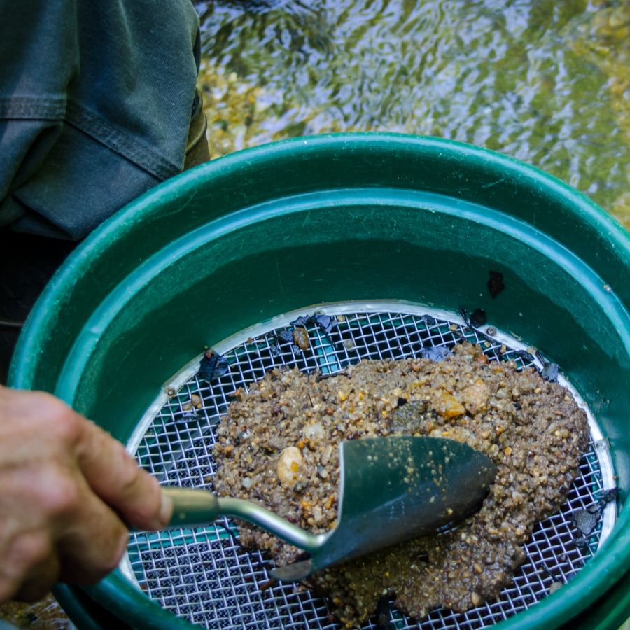
Flour gold is gold ground down to dust sized particles, and it is what almost every real Kentucky find looks like. The glaciers that carried it here were nature’s rock crushers, so the gold arrived already pulverized. It shows up as a thin golden glitter in the crease of your pan after everything lighter washes away.
The mineral that fools people here is mica, which flashes gold in Kentucky creek gravel everywhere. The test takes one second. Shade your pan with your hand, because real gold stays rich and golden in shadow while mica goes pale and lifeless the moment direct light leaves it.
Gold this fine escapes a normal pan easily, so you want a dedicated finish pan for your final concentrates. The Garrett Prospecting 10 Inch Backpacker Gold Pan is the one our team uses for exactly this job.
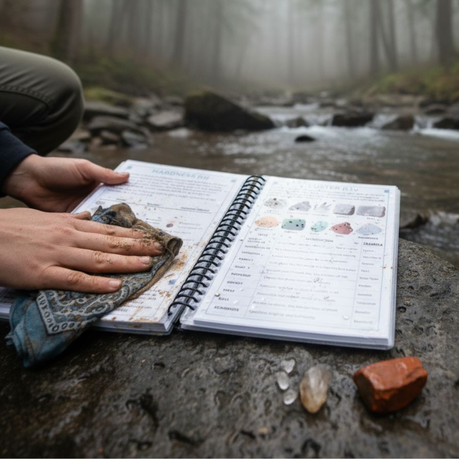
This is also the moment a good identification reference saves your trip. The United States Rocks and Minerals Field Guide shows you exactly what real gold looks like next to mica, pyrite, and every other mineral that imitates it in Kentucky gravel, so you know what you are looking at while your pan is still wet.
Fine Gold Flakes
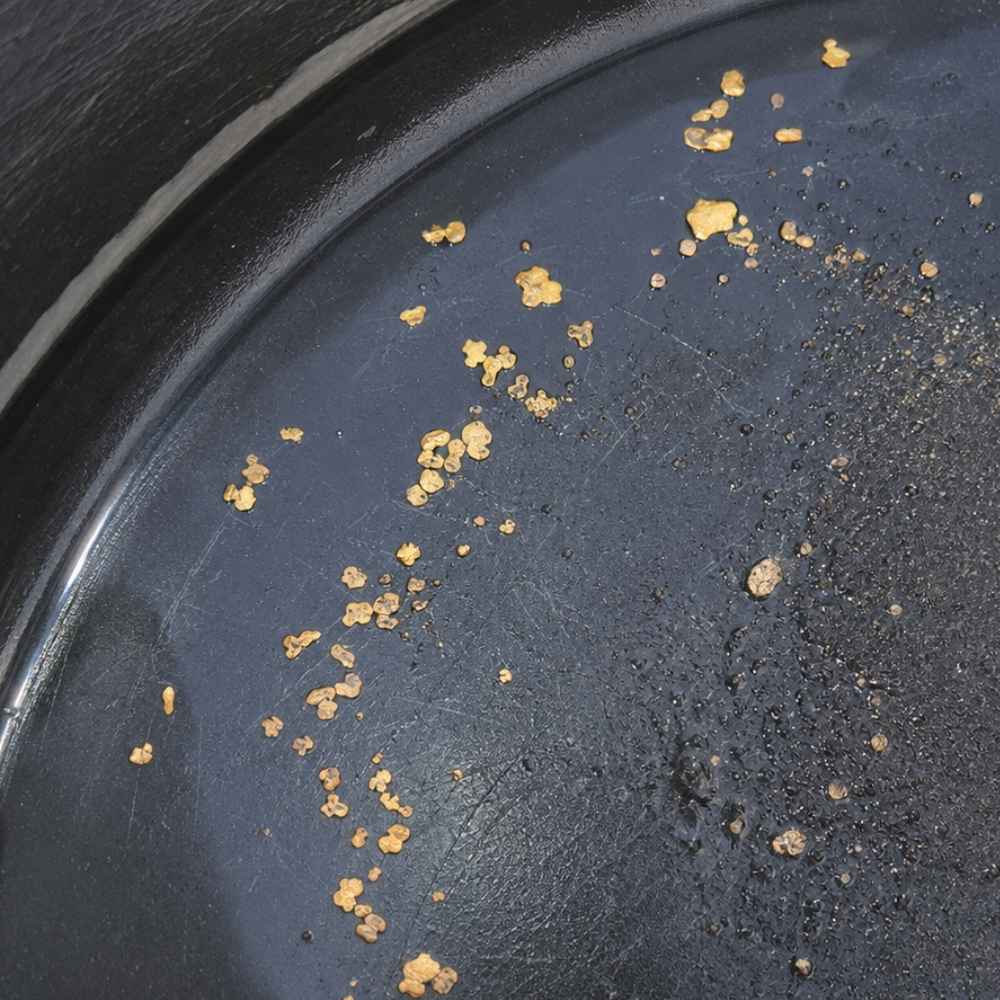
A visible flake is a genuinely good Kentucky find, the kind local panners talk about for weeks. These flat pieces turn up where northern Kentucky creeks have had thousands of years to concentrate the glacial gold, especially in black sand pockets on limestone. A pan with a flake or two in it is a trophy worth photographing.
The lookalike at this size is pyrite, which Kentucky gravel carries in quantity. Poke the particle with a pin. Gold is soft metal that dents and holds the mark, while pyrite is brittle and shatters.
Flakes this small are nearly impossible to pick up with wet fingers. A snuffer bottle like the Garrett Gold Guzzler Bottle sucks them straight out of your pan without losing a single one.
Knowing what Kentucky gold looks like is half the game. The other half is knowing where the water hides it and how to get it out, and that is exactly where this guide goes next.
Where Gold Hides in Kentucky Streams
Gold is about 19 times heavier than water, so it always sinks to the lowest, slowest spot the current allows. Kentucky’s gold is fine, which makes reading the water even more important, because only the calmest traps hold dust sized flakes. Learn these features and you can walk up to any creek in this guide and know where to dig first.
Inside Bends
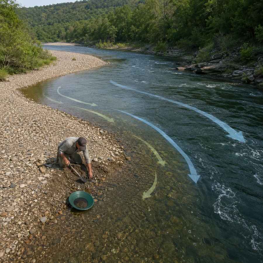
Water slows down on the inside of every curve, and slow water drops its gold. Look for the gravel bar that builds on the inside of a bend and dig where the coarse gravel starts. In northern Kentucky’s small till creeks, inside bends are the most reliable producers.
Digging here means moving packed gravel, and a wide pan with deep riffles catches fine gold as you work. The Garrett 15 Inch Dual Riffle SUPERSLUICE Gold Pan is built for exactly this kind of high volume panning.
Gravel Bars
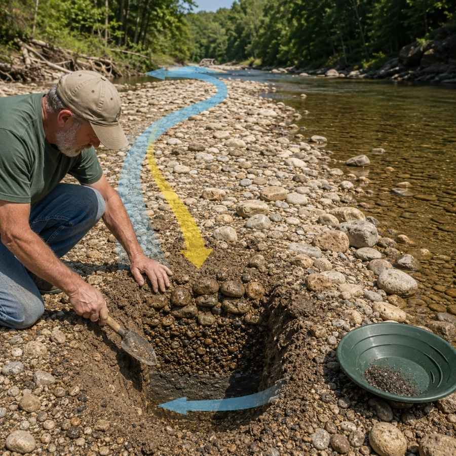
Low water on the Ohio River and its Kentucky tributaries exposes gravel bars that were drowned all spring. The gold concentrates at a bar’s upstream end and down at its base, not on the surface. Dig test holes and pan the bottom material.
River bars here are full of oversized glacial cobbles that waste pan space. Screening them out first with the SE Half Inch Sifting Screen doubles the gravel you can actually process in a day.
Limestone Bedrock Cracks
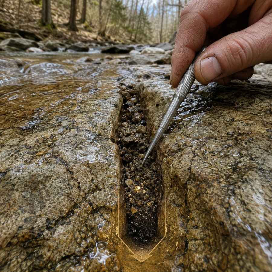
Kentucky’s creeks run over flat sheets of limestone, and that rock floor is the best gold trap in the state. Gold cannot sink through solid rock, so every crack and joint fills up like nature’s own sluice box. Prospectors who work northern Kentucky swear by cleaning out the dirt packed into those limestone cracks and panning every spoonful.
The bottom inch of a crack holds the richest material in the creek. A steel crevice tool set like the ASR Outdoor Steel Crevice Tool Set scrapes out material your fingers cannot reach.
Black Sand Streaks
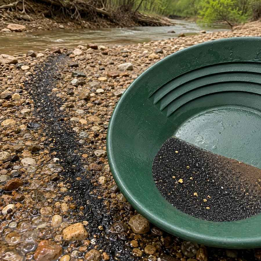
Black sand is crushed magnetite and hematite, and it is the number one gold indicator in Kentucky. The glaciers dropped it in the same load as the gold, and both settle in the same slack water spots. When you see a dark streak in the gravel or a black layer in your pan, you are digging in the right place.
Separating fine gold from black sand at the end of the day is tedious by hand. A magnetic separator like the SE Magnetic Separator Pick Up Tool with Quick Release pulls the black sand out and leaves your gold behind in seconds.
Always Confirm Access and Collection Rules!
Before heading out to any of the locations on our list you need to confirm access requirements and collection rules for both public and private locations directly with the location. We haven’t personally verified every location and the access requirements and collection rules often change without notice.
Many of the locations we mention will not allow collecting but are still great places for those who love to find beautiful rocks and minerals in the wild without keeping them. We also can’t guarantee you will find anything in these locations since they are constantly changing.
Always get updated information directly from the source ahead of time to ensure responsible rockhounding. If you want even more current options it’s always a good idea to contact local rock and mineral clubs and groups
The Best Places To Find Gold in Kentucky
Kentucky’s gold country is a golden ribbon along the Ohio River, where the ice sheets crossed the water and left their gravel behind. The best odds sit in the northern counties around Cincinnati, with more spots scattered along the river to the west and east. Here is every place worth your gas money, grouped by region.
Northern Kentucky
Boone, Kenton, and Campbell counties are Kentucky’s gold headquarters, the one corner of the state where glacial till and outwash are mapped on the ground you stand on. Local panners work these creeks today, and spring floods restock the gravel every year.
Middle Creek

Middle Creek is the best documented panning creek in Kentucky, a Boone County stream where local prospectors have shown reporters real gold in the pan. It winds through wooded valleys near Belleview before emptying into the Ohio River, cutting glacial deposits the whole way. Northern Kentucky press has covered panners recovering fine gold here, proof in print that this creek produces.
The gold is flour gold with the occasional tiny flake, and slow careful panning is the technique. Work the inside bends and pan the black sand pockets down on the limestone.
Your pan will also turn up garnet sand, magnetite, mica, and quartz pebbles carried from far to the north. This is exactly the moment people throw away good finds, because a wet unidentified stone looks like nothing. The United States Rocks and Minerals Field Guide lets you check every odd pebble against clear photos before it goes back in the creek.
Part of the creek flows through Middle Creek Park, and the rest crosses private land, so confirm rules with Boone County Parks or get landowner permission first. Bring the finish pan and snuffer bottle from the techniques section below.
Difficulty: 2 out of 5
Ohio River Gravel Bars of Boone County

The Ohio River itself is Kentucky’s biggest gold trap, because its valley is filled with glacial outwash sand and gravel washed straight out of the melting ice. The Boone County shore around Belleview Bottoms and Rabbit Hash exposes long gravel bars at low water. Every one of them is worth a test pan.
Fine flour gold in black sand is the classic find, and high volume panning with a classifier is the method. Dig the upstream ends of bars and pan the material sitting right on packed clay or rock.
The gravel also carries colorful granite and quartzite pebbles from Canada, fossil crinoids from Kentucky’s own limestone, and heaps of black sand. River access is easiest at public ramps, and the banks above the waterline are mostly private, so mind where you dig. A classifier screen speeds the work, linked in the techniques section.
Difficulty: 2 out of 5
Ohio River Shore Below the Little Miami Mouth
Ohio’s Little Miami River carries documented glacial gold, and it empties into the Ohio River directly across from Campbell County. Whatever fine gold that river releases in floods ends up in the big river’s gravel, and the Kentucky shore downstream of the confluence is where prospectors go looking for it. It is a clever way to fish downstream of a proven producer without leaving Kentucky.
Flour gold in bar gravel and black sand streaks is the pattern, and panning at low water is the technique. Focus on slack water below the confluence and behind anything that breaks the current.
Bycatch includes garnet sand, pyrite, and worn fossil fragments. The riverfront here mixes city parks, industry, and private land, so check each access point’s rules before you dig. Standard panning gear from the techniques section covers it.
Difficulty: 3 out of 5
Lower Licking River

The lower Licking River cuts through some of the oldest glacial deposits in Kentucky, and that is exactly why it earns its place here. Geologists have mapped ancient ice age sediments along the river’s buried old valley in Campbell, Kenton, and Pendleton counties, left when glaciers dammed and rerouted the river more than half a million years ago. Where today’s river slices into those old gravels, it inherits their fine gold.
Flour gold on the inside bends is the classic find, with limestone crevicing as the bonus technique wherever the river runs over rock ledges. Pan the black sand streaks at the base of gravel banks.
The pan also shows mica, pyrite, and plenty of fossil fragments from the famous Ordovician limestone of this corner of the state. Banks are mostly private with some city and county access points, so ask first. Crevice tools earn their keep here, linked in the techniques section.
Difficulty: 3 out of 5
North Central Kentucky
West of the Cincinnati corner, the mapped glacial drift belt follows the Ohio River counties toward Louisville. The river keeps reworking outwash gravel past every bottomland farm, restocking the bars year after year.
Kentucky River Mouth at Carrollton

Carrollton sits where the Kentucky River meets the Ohio, inside the band of Ohio River counties where geologists have mapped Illinoian glacial drift. Two rivers’ worth of gravel mixes here, and the big confluence bars have had thousands of years to sort the heavy material out of the glacial load. Confluences are classic gold ground everywhere on Earth, and this is Kentucky’s most promising one.
Fine flour gold in black sand is the target, and panning the bar gravel at low water is the technique. Test the downstream ends of the confluence bars where slack water sits.
Expect quartz pebbles, fossil crinoids, and dark heavy sand in every pan. General Butler State Resort Park overlooks the town, and state parks prohibit collecting, so stay on the public river access and permitted private ground below. Standard panning gear from the techniques section is all you need.
Difficulty: 3 out of 5
Northeastern Kentucky
Upstream of the Cincinnati bend, the drift belt runs to Bracken County and the outwash filled river valley continues past Maysville. This reach sits directly across from Ohio creeks with documented glacial gold, which is exactly why prospectors keep an eye on the Kentucky shore.
Ohio River Bars of Mason County

The Mason County shore from Maysville down to Dover faces Ohio’s Brown County, whose creeks carry documented glacial gold down to the big river. Prospecting forums have long pointed at this stretch of far northern Kentucky as the place to try, since floodwater spreads that fine gold across the Ohio’s gravel bars. Low water in late summer exposes long bars with fresh material every year.
Flour gold in black sand streaks is the classic find, and high volume panning with a classifier is the method. Work the upstream bar heads and any gravel resting on clay.
The gravel carries exotic glacial pebbles, pyrite, and fossil fragments. Access is by boat ramps and permitted private bottomland, and the bars can be soft and remote, so bring a partner. The full gear list is in the techniques section.
Difficulty: 4 out of 5
More Proven Places To Find Gold in Kentucky
The creeks above are where we would send a friend first, but the ice left its gravel across the whole northern fringe of the state. These next spots come from the mapped glacial drift belt and the habits of local panners, and every one earns a test pan. Check current rules and get permission before visiting, and you get fresh ground that few panners have ever tested.
Northern Kentucky

Big Bone Creek (Boone County). This famous little valley cuts through the same glacial country as Middle Creek on its way to the Ohio River, and its gravel is worth testing for fine gold. Big Bone Lick State Historic Site occupies part of the valley and collecting there is prohibited. Work only private stretches outside the park with landowner permission.
Gunpowder Creek (Boone County). Gunpowder Creek drains the heart of Boone County’s mapped glacial deposits, cutting gravel banks that feed fresh material downstream every flood. Fine flour gold in black sand pockets is the classic target. The watershed is a mix of suburbs and farms, so permission and local park rules come first.
Woolper Creek (Boone County). Woolper Creek runs from the Burlington area down to the Ohio River, right through the neighborhood where northern Kentucky’s known panners live and practice. It cuts the same drift as its neighbors, and limestone ledges near the mouth give the gold somewhere to lodge. The banks are private farm country, so knock and ask.
Twelvemile Creek (Campbell County). This creek drains toward the Ohio through country flanking the Licking River’s buried ancient valley, where old glacial sediments are mapped. Pan where the creek cuts into gravel banks or runs over limestone. Nearly every foot is private land, so permission is essential.
Banklick Creek (Kenton County). Banklick Creek gathers runoff from the glaciated uplands south of Covington before joining the Licking River. Test the gravel on inside bends downstream of cut banks. The corridor is suburban with county park stretches, so check each segment’s rules before digging.
North Central Kentucky

Ohio River Bars at Warsaw (Gallatin County). Gallatin County’s riverfront sits inside the drift belt, and low water exposes outwash gravel bars near Warsaw. Fine flour gold in black sand is the classic find here. Use the public ramp for access and stay off private banks without permission.
Harrods Creek (Oldham County). Oldham County marks the western end of Kentucky’s mapped Illinoian drift, and Harrods Creek drains that ground on its way to the Ohio. The lower reaches with gravel bars and rock ledges are the spots to test. The valley is horse farm country, so a polite ask goes a long way.
Corn Creek (Trimble County). Corn Creek crosses the drift belt bottomlands before meeting the Ohio River near a state fish and wildlife area. Pan the gravel where the creek cuts its banks, and note that wildlife management areas have their own rules on disturbance. Confirm boundaries and get permission for the private stretches.
The Best Gold Hunting Techniques in Kentucky
Kentucky’s fine glacial gold rewards patient technique over expensive machinery. These are the two methods that work best here, ordered from easiest to hardest.
Gold Panning (Difficulty: 1 out of 5)
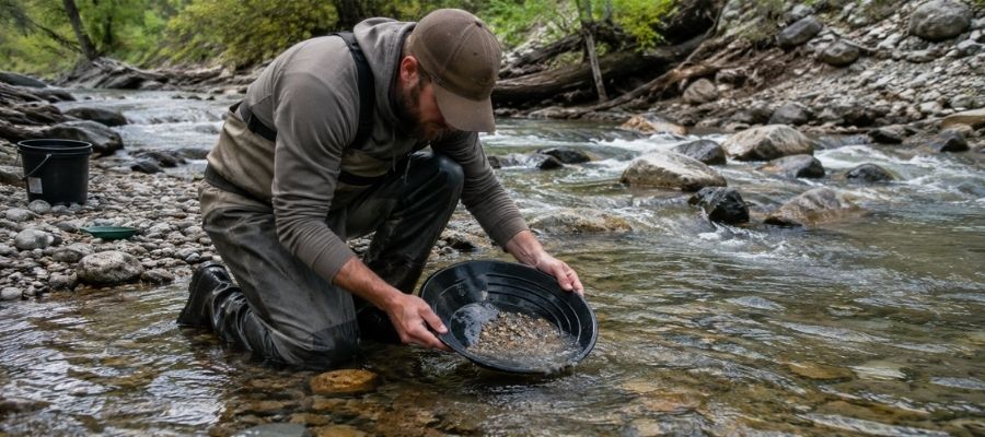
Panning is the whole game in Kentucky. Fill your pan with gravel, submerge it, shake hard so the heavy gold sinks, then tilt and swirl the light material off the top until only the heavy concentrate line remains. With gold this fine, finish every pan slowly, because one careless swirl sends a day of color back into the creek.
It works everywhere in this guide, and it is the only method you need at Middle Creek and on the Ohio River bars.
Essential Tools:
- Deep riffle gold pan: Garrett 15 Inch Dual Riffle SUPERSLUICE Gold Pan
- Finish pan: Garrett Prospecting 10 Inch Backpacker Gold Pan
- Snuffer bottle: Garrett Gold Guzzler Bottle
- Storage vials: SE Glass Vials with Caps
Crevicing (Difficulty: 2 out of 5)
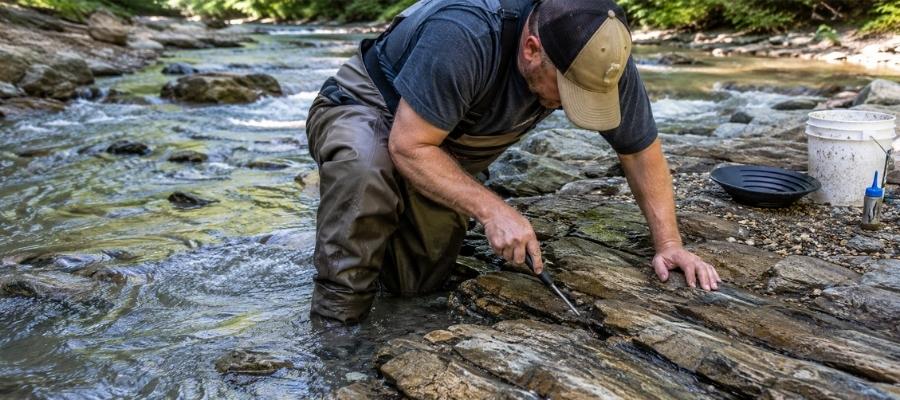
Crevicing means cleaning out the cracks in exposed bedrock and panning what you scrape loose. It is slow, surgical, and it is the technique Kentucky prospectors trust most, because the state’s flat limestone creek beds are one giant crack system that has been trapping fine gold since the ice melted. The lower Licking River’s rock ledges and any northern creek running over stone are prime ground.
Work every crack down to its very bottom, because the last spoonful of packed dirt holds most of the gold.
Essential Tools:
- Crevice tool set: ASR Outdoor Steel Crevice Tool Set
- Hand trowel: Edward Tools Bend Proof Trowel
- Finish pan: linked in the panning list above
- Magnifying loupe: JARLINK 30X 60X Illuminated Loupe
How To Tell Real Gold From Fool’s Gold
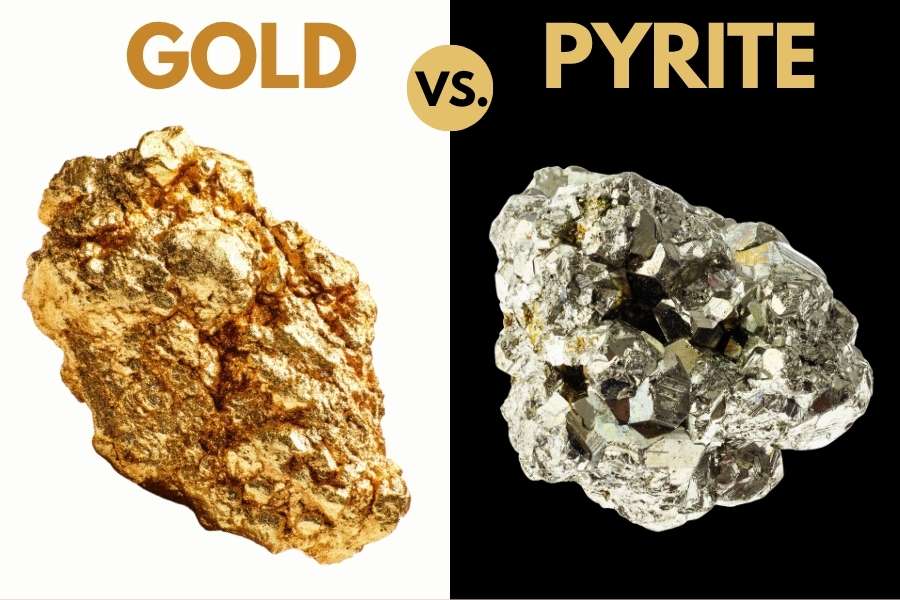
Kentucky creek gravel is full of sparkle, and sorting the real gold from the glitter is a skill you can master in one afternoon. Your pan will show you plenty of pyrite and mica alongside the gold. Two quick tests sort them out every time.
The shadow test takes one second. Shade your pan with your hand and watch the sparkle. Real gold stays rich and golden in shadow, while pyrite and mica go gray and lifeless the instant the direct light leaves them.
The poke test settles anything the shadow test misses. Press a pin firmly into the particle. Gold is soft metal, so it dents and holds the mark. Pyrite is brittle and shatters, and mica just slides apart in sheets.
The reason to get this right is not avoiding embarrassment. It is that people who cannot tell the difference eventually toss a pan that had real gold in it. The United States Rocks and Minerals Field Guide is the insurance policy, with side by side photos of gold and its imitators, printed on waterproof pages you can hold right over your wet pan.
How Gold Got Into Kentucky
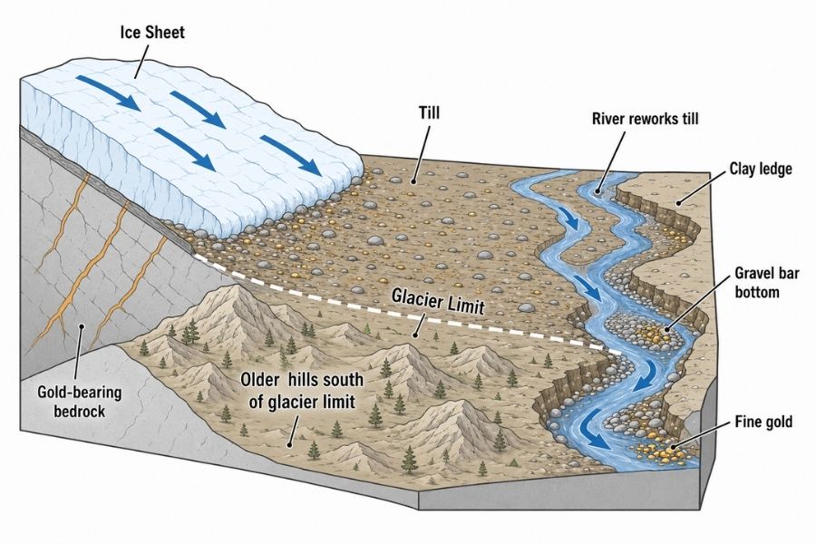
Every spot in this guide sits where it sits because of ice. Kentucky’s gold arrived by special delivery, carried in by the most powerful transport system nature ever built. The story of Kentucky gold is the story of the glaciers.
The gold was born in ancient volcanic rock in Canada, in the same mineral belts that feed famous mines today. Ice sheets up to a mile thick ground across that rock, plucked up the gold, crushed it fine, and dragged it hundreds of miles south. At their greatest reach, the oldest glaciers shoved across the Ohio River into Kentucky’s northern edge.
Geologists have mapped that glacial drift in a band of Ohio River counties, roughly from Oldham County up through the Cincinnati corner to Bracken County. The ice also rerouted whole rivers, burying the Licking River’s ancient valley and giving birth to the modern Ohio River, whose valley later filled with gold dusted outwash gravel from melting ice upstream. Ever since, Kentucky’s northern creeks have been washing that material and concentrating the fine gold into the bends, bars, and limestone cracks in this guide.
That history makes planning a trip wonderfully simple. The glaciers concentrated their gift along the state’s northern edge, so stay on the glaciated fringe and every pan has a real chance at color.
What To Bring for a Kentucky Gold Day Trip

Here is the full checklist. Screenshot this section before you head for the creek.
- Gold pans and snuffer bottle, covered in the techniques section
- Crevice tools and trowel, same place
- Classifier screen and vials
- Rubber boots or wading shoes with real tread
- Drinking water and bug spray, Kentucky creek bottoms are humid mosquito country in summer
- Sunscreen and a brimmed hat
- Printed landowner permission and a paper map of property lines
- Snacks and a dry change of clothes
If you are starting from zero, one box solves it. The Garrett Deluxe Gold Pan Kit has the pans, classifier, snuffer, and vials in one purchase, and it is the kit we hand to every beginner who joins us.
If you are bringing kids who need guaranteed sparkle, Kentucky’s pay to pan operations are a fun warm up. Our guide to gem mining in Kentucky lists the family spots where every bucket produces something.
The Best Time of Year To Hunt for Gold in Kentucky
Timing a Kentucky gold trip is about water levels, because the gold does not move but the rivers sure do. Here is the calendar, region by region.
Northern Kentucky

Late summer through fall is prime time on Middle Creek and the neighboring till creeks. Water drops to its lowest levels, exposing the gravel and limestone that crevicers need. The bonus window is right after spring high water recedes, when floods have just restocked the bends with fresh material.
Skip the weeks after heavy rain. These small watersheds rise fast, run muddy, and hide everything you came to read.
North Central Kentucky

August through October is the window at Carrollton and the Gallatin County bars, when the Ohio River pool drops enough to expose gravel. River stage is dam controlled, so check the gauges before you drive. Farm access is also easier after crops are in.
Spring on the Ohio is flood season and genuinely dangerous. Let the big water pass, then work the fresh gravel it leaves behind.
Northeastern Kentucky

September and October are best on the Mason County reach. The bars are at their widest, the mud has firmed up, and cool days make the long walks pleasant. Boat access is safest at these lower stages too.
Watch the river gauge year round here. Dam releases and upstream storms can raise the Ohio quickly even under blue skies.
Other Valuable Rocks and Minerals You Can Find in Kentucky
The same gravel that hides Kentucky’s gold is loaded with other treasure, and some of these finds are every bit as exciting as the gold. The glaciers and the state’s famous limestone both stock these creeks, so keep an eye out for all of these while your pan is working. Our overview of Kentucky’s rocks, minerals, and gems shows what the best finds look like.
Kentucky Agate

Kentucky agate is the official state rock, and the best red and black banded pieces rank among the finest agates in the world. It comes from creeks in the east central part of the state, a fun road trip from gold country. Here is our full guide to finding agates in Kentucky.
Geodes
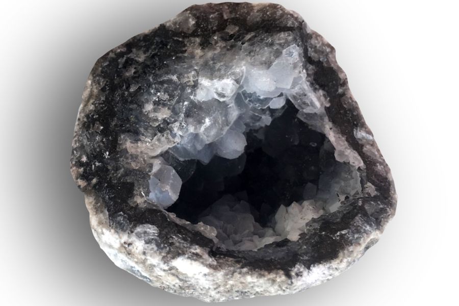
Kentucky is one of America’s great geode states, and plain looking round rocks in creek gravel crack open on sparkling crystal. Gold panners walk past them constantly without knowing. Our guide to geodes in Kentucky lists the best hunting grounds.
Fluorite

Western Kentucky’s fluorspar district produced some of the finest purple and yellow fluorite ever mined in America. Loose crystals still turn up in old mine country and rock shops statewide. Our guide to crystals in Kentucky covers the fluorite story in full.
Quartz

Quartz pebbles and the occasional crystal wash through nearly every Kentucky creek, including the gold streams up north. Clear, water worn pieces polish beautifully. Our guide to quartz in Kentucky shows where the best material hides.
Freshwater Pearls

Kentucky’s rivers once supported a real pearling industry, and native mussels still occasionally produce them. Harvesting live mussels is illegal, but knowing the history makes every riverbank walk more interesting. Our Kentucky rocks and gems overview tells the pearl story.
Pyrite

Yes, fool’s gold is worth keeping when it forms sharp brassy cubes. Good pyrite crystal clusters sell to collectors and look fantastic on a shelf. Kentucky’s shales and creek gravels produce plenty, so save the best pieces you pan up.
Garnet

Those tiny red grains glittering in your black sand are garnets, ground off Canadian bedrock and delivered by the same ice that brought the gold. Most are sand sized, but bigger ones reward sharp eyes. Our guide to gem mining in Kentucky shows what other gems hide in this state.
Barite

Barite forms heavy white and amber crystal clusters in Kentucky’s limestone country, and its weight fools people into thinking they found something metallic. It is a legitimate collector mineral in its own right. Our Kentucky rockhounding guide lists the best barite ground.
Fossils

The limestone under northern Kentucky’s gold creeks is world famous among paleontologists, and every gravel bar is dotted with brachiopods, horn corals, and crinoid stems. Collectors travel across the country for what locals walk past. Our guide to fossils in Kentucky shows what else the rock hides.
Diamonds
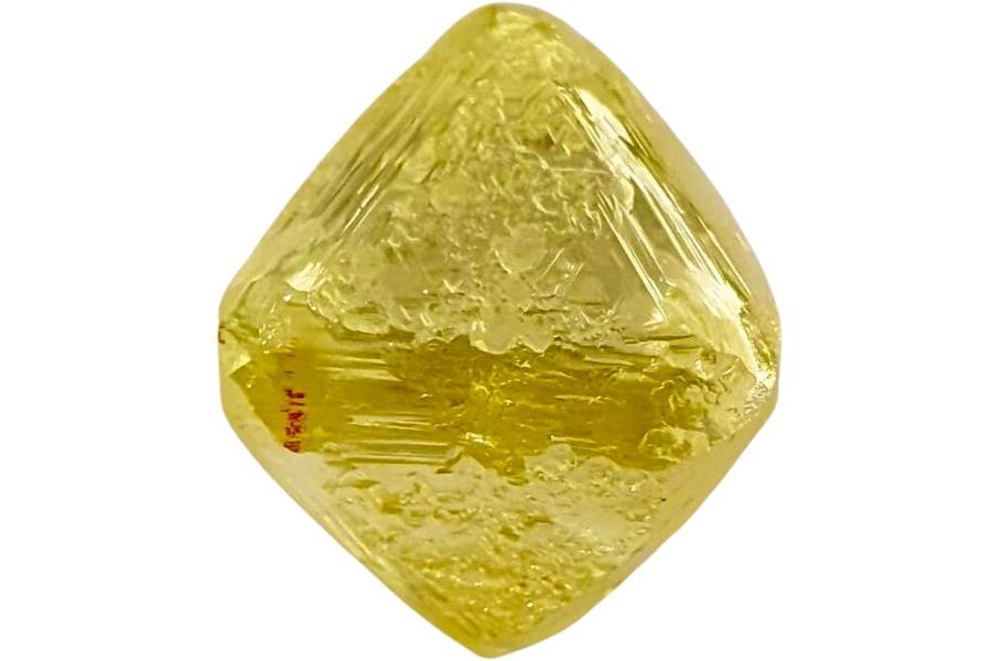
Tiny diamonds have reportedly come from glacial deposits in the states around the Ohio Valley, carried south from Canada in the same ice that brought Kentucky’s gold. They look like greasy glass pebbles, not sparkling gems. The full story is in our guide to diamonds in Kentucky.
Here is the thing about every mineral on this list. In a wet pan, half of them look like gray or white pebbles, and people flick real treasure back into the creek every single weekend. The United States Rocks and Minerals Field Guide exists so that never happens to you, with photo identification for well over a hundred rocks and minerals you can check creekside in seconds.
Legal Rules for Gold Prospecting in Kentucky

Before you touch a pan to gravel, read this section. We are rockhounds, not lawyers, and nothing here is legal advice. Rules change, and staying legal is entirely your responsibility.
Private Property
Nearly every gold bearing creek in Kentucky flows through private land, and on smaller streams the adjoining landowner generally owns the streambed too. Wading up a creek without permission can be trespassing even if you entered at a public bridge. Written permission is the single most important tool you can carry, and in our experience rural landowners often say yes to a polite ask.
Protected and Restricted Land
Kentucky state parks and state nature preserves prohibit removing rocks and minerals, which rules out places like Big Bone Lick State Historic Site and General Butler State Resort Park. Kentucky has no state permit system for recreational panning, which means the rules come from whoever manages each piece of land. On the Ohio River, stay clear of locks, dams, and commercial facilities, and treat the banks as private unless posted otherwise.
Equipment Restrictions
Hand pans and hand tools are the safe baseline everywhere panning is allowed. Suction dredges and other motorized equipment trigger federal Clean Water Act permitting and state water quality rules, which puts them out of reach for casual prospecting. Keep it to a pan, a shovel, and hand tools and you stay in hobby territory.
Play it safe on every trip. Confirm access directly with the landowner or the managing agency before you dig, because boundaries and rules change without notice.
Some locations in this guide sit on land where collecting is limited or seasonal. When in doubt, treat a spot as look but do not take until you have confirmation in hand.
The best shortcut is local knowledge. Northern Kentucky panners often connect through prospecting clubs across the river in the Cincinnati area, and club outings are the fastest way to learn which landowners welcome panners.
Kentucky Gold FAQ
Is there gold in Kentucky?
Yes, there is real gold in Kentucky, all of it fine glacial placer gold carried down from Canada by ice age glaciers. It shows up as flour gold and tiny flakes in creeks and river bars in the far northern counties along the Ohio River. Every bit of it is placer gold sitting in creek gravel, which means anyone with a pan can reach it.
Where can you pan for gold in Kentucky?
The best odds are in the northern glacial fringe, especially Boone County creeks like Middle Creek, the lower Licking River, and Ohio River gravel bars. The best places section above breaks down access for every spot. Always get landowner permission first, since most of these waters cross private ground.
Is it legal to pan for gold in Kentucky?
Recreational hand panning is legal in Kentucky on private land with the owner’s permission, and the state has no permit system for hobby prospecting. Collecting is prohibited in state parks and nature preserves. Motorized equipment like dredges brings in water quality permitting that casual prospectors should simply avoid.
Has anyone ever found gold in Kentucky?
Yes. Local panners in northern Kentucky recover fine glacial gold from creeks like Middle Creek, and their finds have even been covered by the local press. Every spring flood restocks those gravels with fresh material, so new finds keep coming year after year.
What rivers in Kentucky have gold?
The best gold water is all in the north. The Ohio River’s gravel bars, the lower Licking River, and small Boone County streams like Middle Creek, Gunpowder Creek, and Woolper Creek are the waters prospectors test and talk about. Focus your trips on the glaciated northern fringe, because that is exactly where the ice made its delivery.
Get Every Find In Your Pan Identified In Seconds
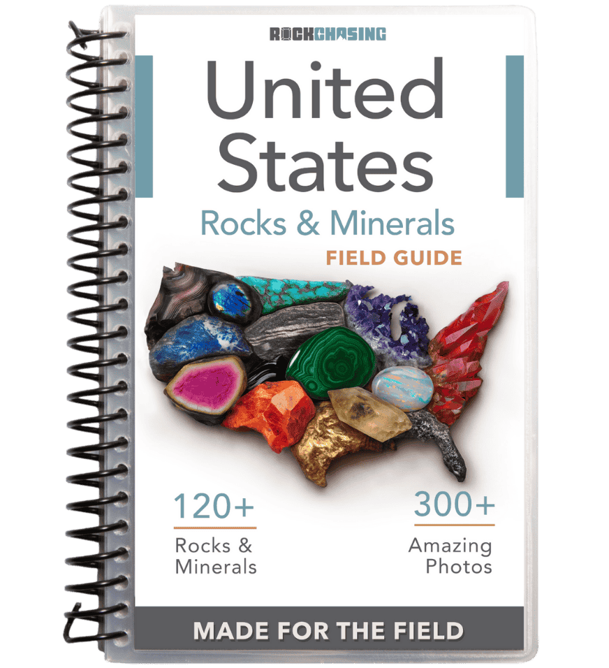
Every pan you pull out of a Kentucky creek is a mystery until you can name what is in it. The United States Rocks and Minerals Field Guide identifies well over a hundred rocks, minerals, and gemstones with hundreds of clear photos, printed waterproof so it works right at the water’s edge.