Yes, there is real gold in Arkansas. Prospectors have reported fine placer gold in Ouachita Mountains gravel since the 1800s, especially along the Caddo River and the Little Missouri River, and every flood restocks those gravels with fresh color.
With gold trading above $4,000 an ounce, the fine gold that Arkansas streams carry is worth more today than ever before.
Smart prospectors here play a double game. They pan the bends and bedrock cracks for fine gold, and they keep one eye on the quartz crystals and other valuable stones that make these mountains famous worldwide.
This guide covers every credible spot, the techniques that put color in your vial, and the bonus finds that make an Arkansas trip pay twice.
Our team of geologists and experienced rockhounds put this guide together the same way we approach every gold state. We matched documented reports against the geology that decides where fine gold collects. Here is everything you need to plan your first Arkansas gold trip.
Table of Contents
- Types of Gold
- Where Gold Hides
- Best Places
- Techniques
- Real vs Fool’s Gold
- How Gold Got Here
- What To Bring
- Best Seasons
- Other Minerals
- Legal Rules
- FAQ
The Kinds of Gold You Can Find in Arkansas
Arkansas gold is fine placer gold, washed out of the Ouachita Mountains and tucked into stream gravel across the region. The streams carry traces, fines, scales, and flakes that patient panners concentrate pan after pan, usually mixed with a little natural silver. Know what each form looks like and you will recognize a real find the moment it appears.
Flour Gold
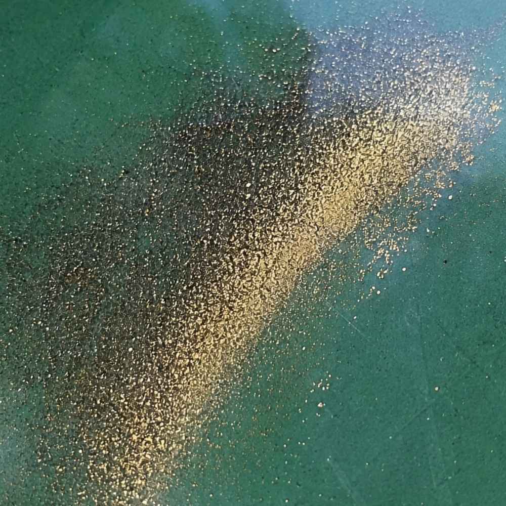
Flour gold is gold ground down to particles finer than grains of sugar, and it is the signature Arkansas find. Millions of years of erosion have milled the state’s gold into dust as it washed out of the Ouachita Mountains. It shows up as a thin golden glitter in the crease of your pan after everything lighter washes away.
The mineral that fools people here is mica, which flakes out of the Ouachitas’ ancient shales and sandstones. Mica flashes gold in sunlight but it is nearly weightless. Real flour gold sinks straight to the bottom of your pan and stays golden in the shade, while mica floats, flutters, and goes dull the moment the light changes.
Because flour gold washes out of a normal pan so easily, you want a dedicated finish pan for your final concentrates. The Garrett Prospecting 10 Inch Backpacker Gold Pan is the one our team uses for exactly this job.
This is also the stage where a good identification reference saves your whole trip. The Rocks and Minerals of the United States Field Guide shows you exactly what real gold looks like next to every mineral that imitates it, so you know what you are looking at while your pan is still wet.
Fine Flakes and Scales
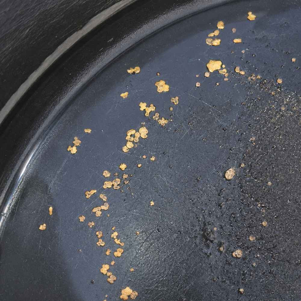
Flakes and scales are the next size up, flat glinting specks you can actually see without squinting. The state survey describes Arkansas placer gold turning up as scales and flakes in stream gravel, usually where black sand collects on the inside of bends. A Ouachita pan with two or three visible flakes is a genuinely good day.
The lookalike here is pyrite, and Ouachita rocks are loaded with it. The test takes one second. Poke the speck with a pin, because gold dents like soft metal while pyrite is brittle and shatters or flips away.
Flakes are nearly impossible to pick up with wet fingers. A snuffer bottle like the Garrett Gold Guzzler Bottle sucks them straight out of your pan without losing a single one.
Small Grains and Pickers
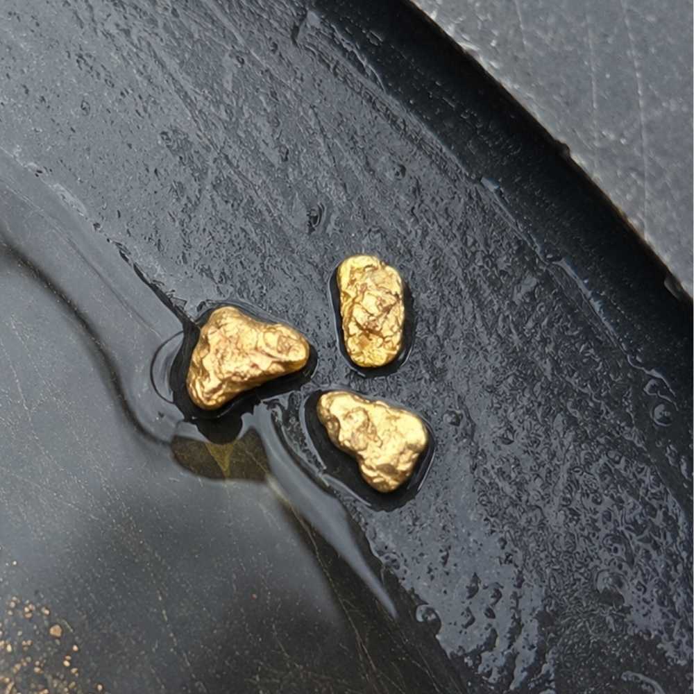
Grains big enough to pick up with your fingers are the trophy find of Arkansas panning. The state survey’s records list grains and even small nuggets among the forms placer gold takes here, and Arkansas gold often carries enough natural silver to look slightly pale.
The false alarm at this size is chalcopyrite, a brassy copper mineral that weathers out of the region’s old mine dumps. Chalcopyrite is harder and more orange than gold, and it crushes to a greenish black powder instead of denting.
At this scale a magnifier settles arguments fast. The JARLINK 30X 60X Illuminated Loupe shows you dents, crystal faces, and color at a glance, right at the water’s edge.
Knowing what Arkansas gold looks like is half the game. The other half is knowing where a mountain stream hides it and how to get it out, and that is exactly where this guide goes next.
Where Gold Hides in Arkansas Streams
Gold is about 19 times heavier than water, so it always sinks to the lowest, slowest spot the current allows. Ouachita streams are steep, rocky, and flashy after rain, which makes them textbook water for reading these five features.
Inside Bends
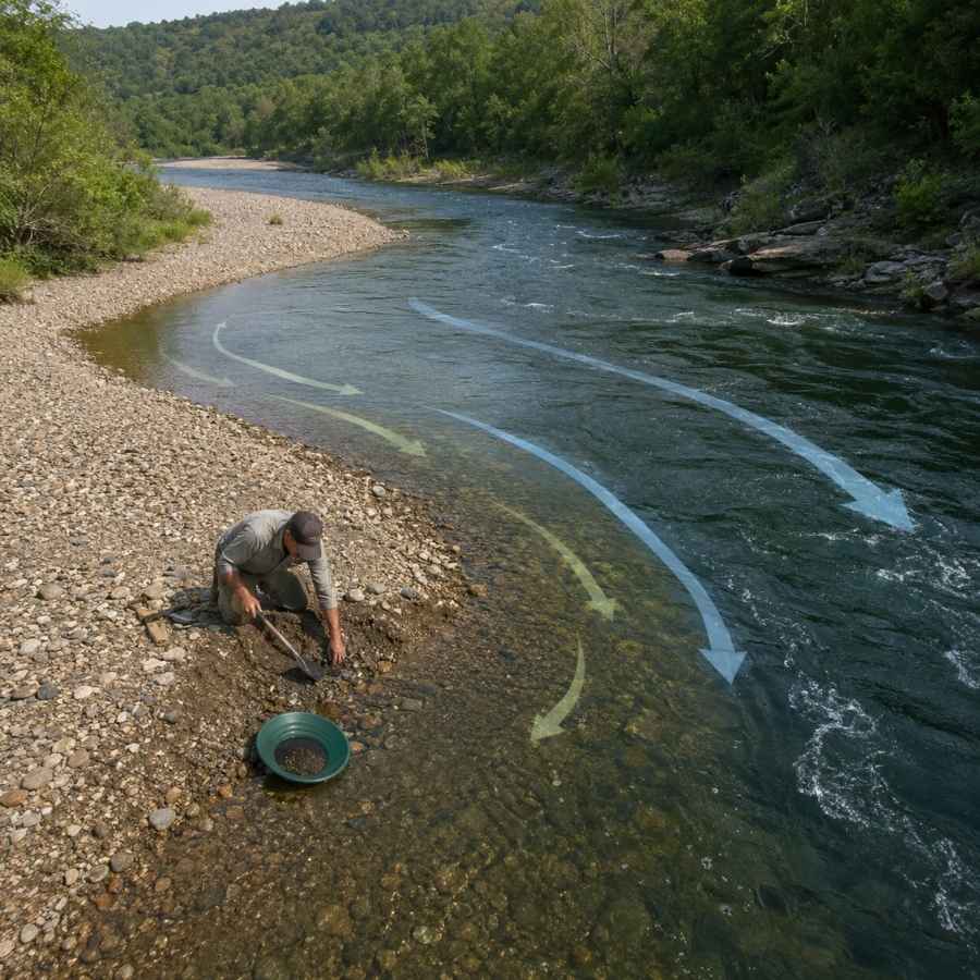
Water slows down on the inside of every curve, and slow water drops its gold. Look for the gravel bar that builds on the inside of a bend and dig where the coarse gravel starts. On the Caddo and the upper Ouachita, inside bends are the most reliable place to start a day.
Digging here means moving packed gravel, and a wide pan with deep riffles catches fine gold as you work. The Garrett 15 Inch Dual Riffle SUPERSLUICE Gold Pan is built for exactly this kind of high volume panning.
Gravel Bars
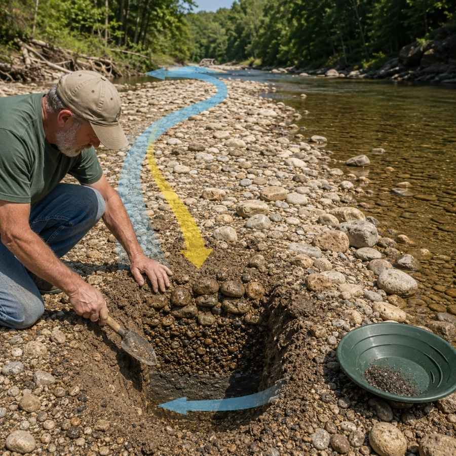
Summer low water exposes gravel bars that were underwater all spring. The gold in a bar concentrates at its upstream end and down at the base, not on the surface. Dig test holes and pan the bottom material.
Ouachita bars are full of fist sized cobbles that waste pan space. Screening them out first with the SE Half Inch Sifting Screen doubles the gravel you can actually process in a day.
Bedrock Cracks
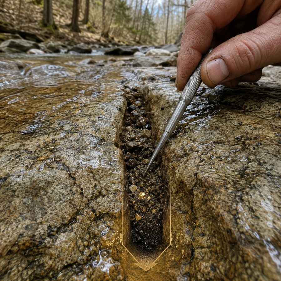
Bedrock is the floor gold cannot sink through, and the Ouachitas serve it up better than almost anywhere. These mountains are made of tilted layers of sandstone, shale, and novaculite, so streams flow across upturned rock edges that trap heavy material like the riffles of a natural sluice. Every crack and joint has been collecting since the last flood.
The dirt in the bottom inch of a crack is the richest material in the creek. A steel crevice tool set like the ASR Outdoor Steel Crevice Tool Set scrapes out material your fingers cannot reach.
Behind Boulders
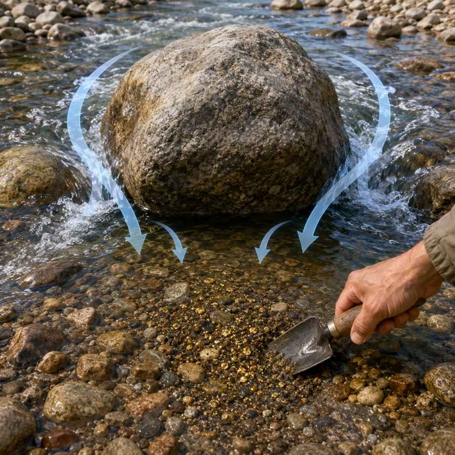
Ouachita streams are strewn with big sandstone and novaculite boulders, and every one splits the current to create a calm pocket directly downstream. Heavy material traveling in a flood drops right into that pocket. Feel around the downstream base of big rocks and dig the packed gravel your fingers find there.
That gravel is usually cemented tight. A strong shovel like the Bully Tools 14 Gauge Round Point Shovel breaks it loose without snapping a handle mid trip.
Black Sand Streaks
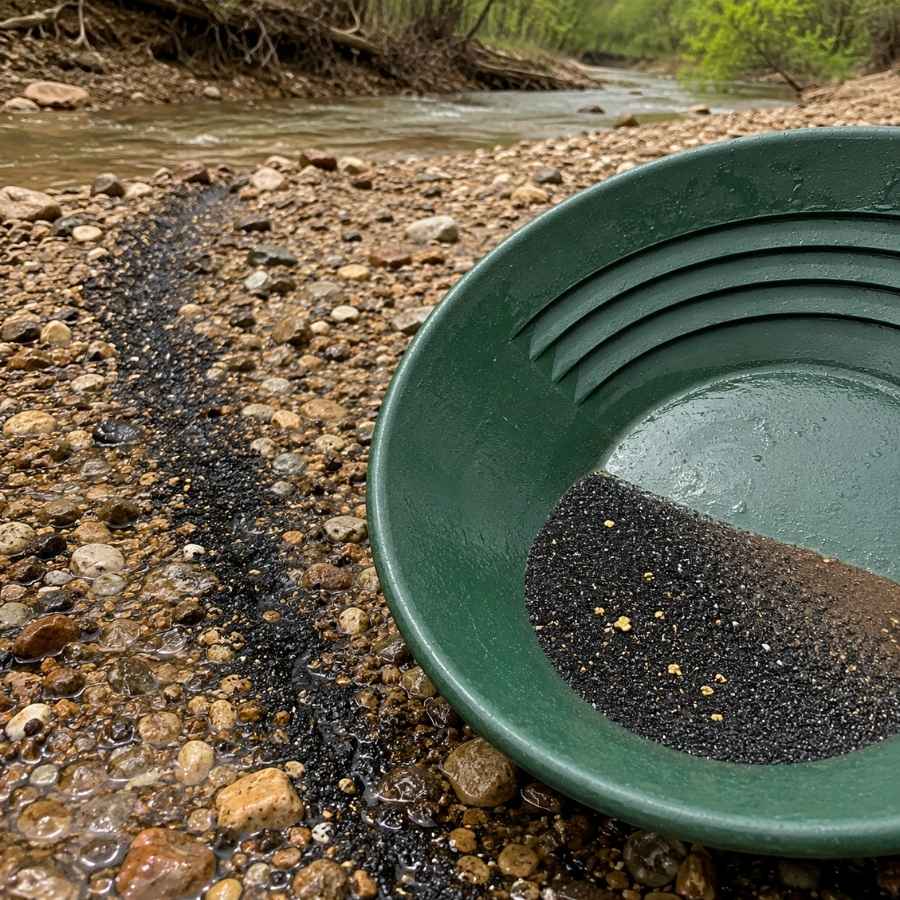
Black sand is mostly magnetite and hematite, and it is your number one indicator in Arkansas. It is heavy, it travels with the fine gold the stream carries, and it settles in the same slow spots. When you see a dark streak in the gravel or a black layer in your pan, you are digging in the right place.
Separating fine gold from black sand at the end of the day is tedious by hand. A magnetic separator like the SE Magnetic Separator Pick Up Tool with Quick Release pulls the black sand out and leaves your gold behind in seconds.
Always Confirm Access and Collection Rules!
Before heading out to any of the locations on our list you need to confirm access requirements and collection rules for both public and private locations directly with the location. We haven’t personally verified every location and the access requirements and collection rules often change without notice.
Many of the locations we mention will not allow collecting but are still great places for those who love to find beautiful rocks and minerals in the wild without keeping them. We also can’t guarantee you will find anything in these locations since they are constantly changing.
Always get updated information directly from the source ahead of time to ensure responsible rockhounding. If you want even more current options it’s always a good idea to contact local rock and mineral clubs and groups
The Best Places To Find Gold in Arkansas
Every credible gold report in Arkansas traces back to the Ouachita Mountains, and this list works outward from their heart. The detailed spots cluster in two zones, the west central lake and river country around Mount Ida and Hot Springs, and the rugged southwestern streams toward Mena and Murfreesboro.
West Central Arkansas
The upper Ouachita River country in Montgomery and Garland counties is where the 1880s excitement burned hottest, and it is still the center of Arkansas prospecting. Public land in the Ouachita National Forest makes this the easiest region to legally get a pan wet.
Ouachita River
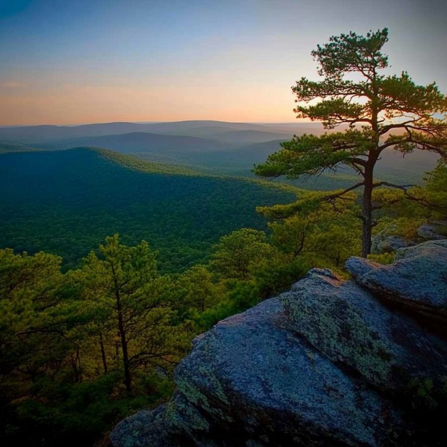
The upper Ouachita River is the backbone of Arkansas gold country, gathering the wash from the same hills that fueled the old boom. Prospectors report fine gold from its gravel bars along the stretch from Mount Ida downstream toward Lake Ouachita and Hot Springs. Long reaches flow through Ouachita National Forest land, which keeps access simple.
The gold is flour fine with the occasional tiny flake, and careful panning is the technique that works. Work the inside bends and pan the black sand streaks down on the packed gravel.
Your pan will also turn up quartz pebbles, pyrite, and black sand, and this is world famous quartz crystal country where a milky pebble can hide a collector grade point. This is exactly the moment people throw away good finds, because a wet unidentified stone looks like nothing. The Rocks and Minerals of the United States Field Guide lets you check every odd stone against clear photos before it goes back in the river.
Bring the finish pan and snuffer bottle from the techniques section below.
Difficulty: 2 out of 5
Bear Creek and the Bear City District
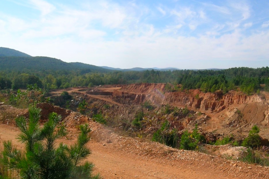
The hills around the old Bear City boomtown sit near the south side of Lake Ouachita in Garland County, and they are the most storied square miles in Arkansas gold lore. A 1923 study by U.S. Geological Survey geologists confirmed silver and gold in vein material near Hot Springs, so the traces here are the real thing. Today the area is quiet national forest country with plenty of room to roam.
Fine flour gold in the creek gravel is the target, and slow panning is the method. Sample the small drainages below the old workings and pan anywhere black sand shows.
The gravel carries quartz, pyrite, and chalcopyrite weathered from old prospect dumps. Never enter old mine openings, and confirm you are on national forest rather than private inholdings. A crevice tool set earns its keep here, linked in the techniques section.
Difficulty: 3 out of 5
Caddo River
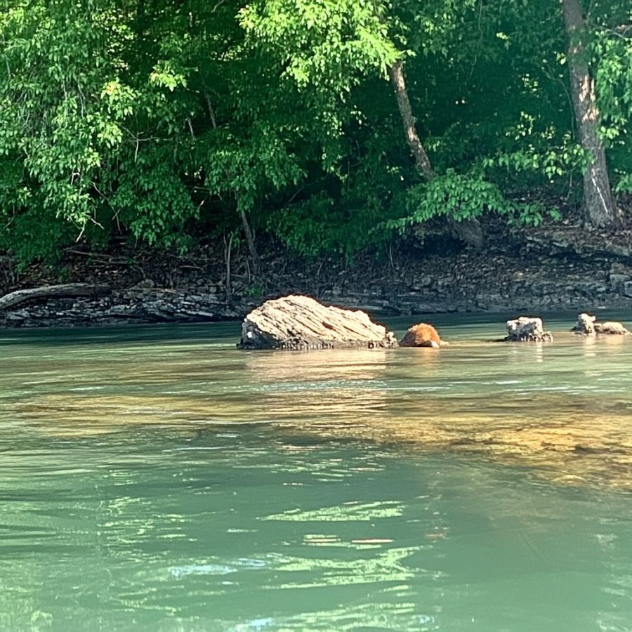
The Caddo River is the friendliest panning water in Arkansas, a clear mountain stream running from Montgomery County through Norman, Caddo Gap, and Glenwood. Gold rumors here go back to the 1500s, when Spanish explorers pushed through Caddo Gap hunting for gold, and prospectors still report fine color in the river’s black sand today.
Flour gold on the inside bends is the find, and standard panning is the technique. The stretch between Norman and Glenwood runs calm and shallow by summer, which makes it a great first trip with kids.
The pan also shows quartz pebbles, black sand, and shiny mica that fools every beginner once. Much of the riverbank is private, so ask permission or stick to established public access points. Standard panning gear from the techniques section covers it.
Difficulty: 2 out of 5
Southwestern Arkansas
The southwestern Ouachitas hold the state’s roughest country and its most interesting mineral ground, from the old Mena mining district to the diamond fields near Murfreesboro. Gold reports here stretch from the early 1800s right up to today, and the scenery alone repays the drive.
Cossatot River
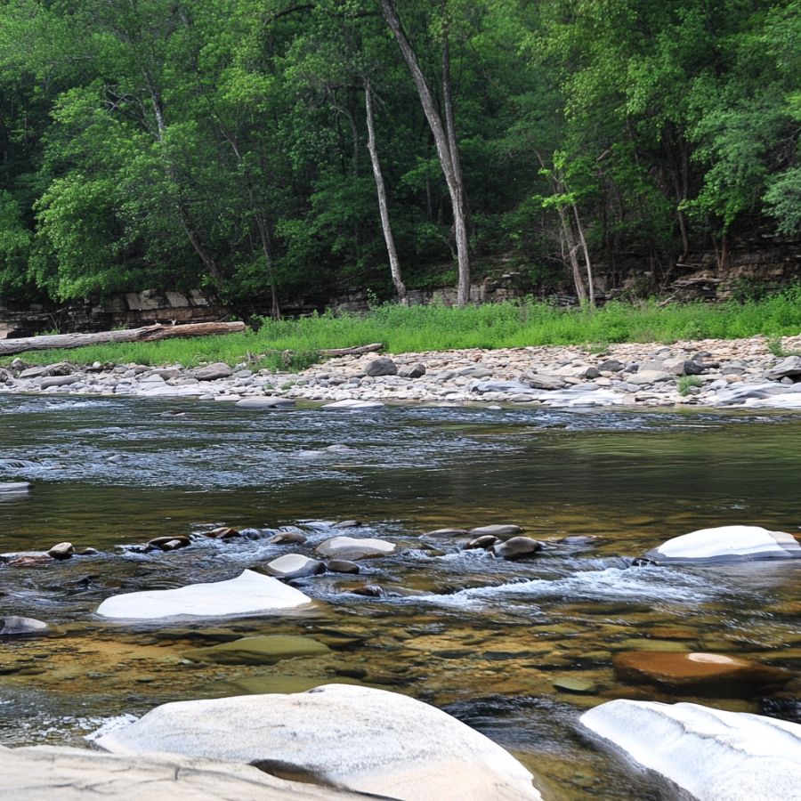
The Cossatot is Arkansas’s wildest river, a whitewater stream that saws through tilted novaculite ridges in Polk and Howard counties. Its name is said to come from a French phrase for skull crusher, which tells you what the rapids think of careless visitors. All that exposed, upturned bedrock is the draw for prospectors, because it traps heavy material the way few Arkansas streams can.
Fine gold in bedrock cracks and pockets is the target, and crevicing at low water is the standout technique. Work the joints and potholes in the slower reaches, never the falls.
The gravel also carries novaculite, quartz, and black sand. The Cossatot River State Park Natural Area protects a long stretch where collecting is not allowed, so pan only the reaches on national forest land upstream, and treat this river with respect. Crevice tools are the key gear, linked in the techniques section.
Difficulty: 4 out of 5
Little Missouri River
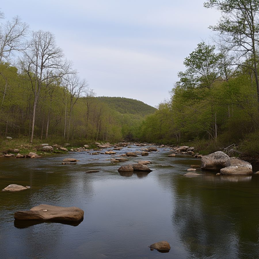
The Little Missouri rises in the high Ouachitas and tumbles southeast through waterfalls and rock gardens before settling down near Murfreesboro. Small mining operations tried these waters in the late 1800s, and prospectors still report fine gold below the falls and rapids where the current finally slows. The upper river runs through Ouachita National Forest, with a stretch protected as a wild and scenic river.
Flour gold and fine flakes behind boulders and in bedrock pockets are the find, and panning plus crevicing is the combination. Sample where the gradient flattens and gravel collects.
Downstream near Murfreesboro the river passes close to the only public diamond field in the country, covered in our guide to finding diamonds in Arkansas. The river gravel itself carries quartz, jasper, and black sand. Check current rules before panning the wild and scenic stretch, and bring the finish pan from the techniques section.
Difficulty: 3 out of 5
Little Brushy Creek and the Mena Mining District
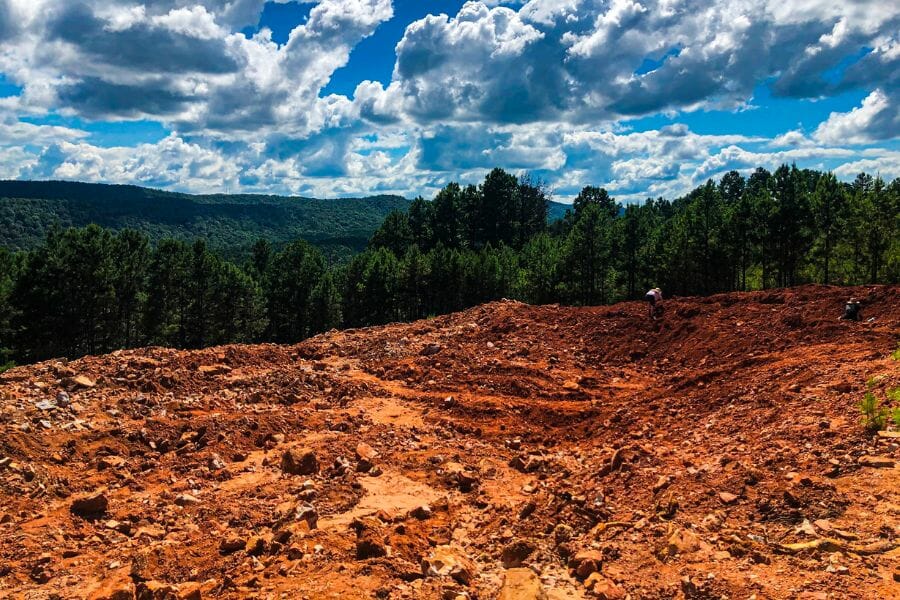
The hills east of Mena in Polk County hosted the most serious gold and silver mining Arkansas ever saw, and Little Brushy Creek was its heart. A camp here ran one of the most elaborate operations in the state, complete with electric power and cyanide processing. Placer gold was reported east and south of Mena as far back as the early 1800s.
Fine flour gold in the creek gravel is the find, and slow careful panning is the technique. Test below the old workings where floods rework the ground.
Expect quartz, pyrite, and chalcopyrite in the gravel, with galena possible near old dumps. Much of this district is a patchwork of private and forest land, so check ownership carefully and stay out of any mine opening. A hand trowel and classifier speed the work, linked in the techniques section.
Difficulty: 4 out of 5
More Proven Places To Find Gold in Arkansas
The spots above are where we would send a friend first, but Arkansas’s mining history scattered credible reports across more hills than one shortlist can hold. These next spots earn a trip too, especially if you like your prospecting with a side of history. Rules and access change, so check current regulations and get permission before visiting any of them.
West Central Arkansas
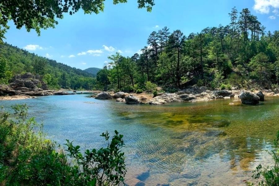
Old Spanish Diggings (Garland County). Legend says Spanish explorers dug for gold in the hills near Hot Springs as far back as the 1540s, and the site called the Old Spanish Diggings has drawn hopeful panners ever since. The 1923 federal survey work nearby confirmed traces of gold and silver in these hills, so the legend has a real mineral backbone. The area sits in a maze of forest and private land, so confirm access before you dig.
Silver City District (Montgomery County). Silver City boomed to more than 1,000 people around 1880 on silver ores that carried gold along with the silver. Prospectors report panning traces in the nearby forks of the Caddo drainage below the old workings. The town site is history now, and the surrounding land mixes forest and private ground, so ask before you pan.
Southwestern Arkansas
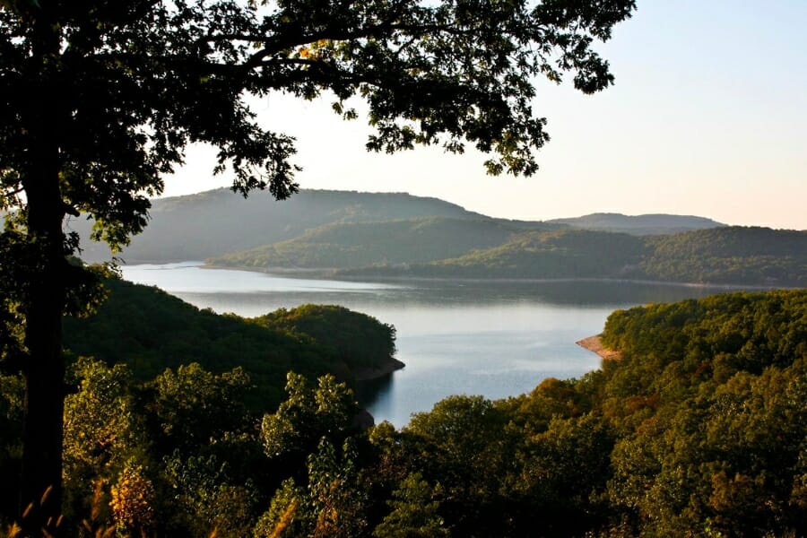
Helen Gould Mine Area (Polk County). Old records show this mine near the Cherry Hill community east of Mena actually shipped gold ore, one of the few Arkansas workings with production on paper. Every heavy rain reworks the creeks draining the site, making them a smart place to pan for fresh traces. The mine ground is private, so work only with permission and never enter old workings.
Old Silver World Mine Area (Polk County). This 1880s mine east of Mena reportedly produced gold and silver during the Mena district boom. The drainages below the old site are worth a test pan for flour gold after heavy rain moves fresh gravel. It sits on private land along a county road, so a polite ask comes first.
Rolling Fork River (Sevier County). The Bellah Mine on the Rolling Fork worked copper ore that carried some gold and silver, but the original veins now sit under the waters of De Queen Lake. Panners try the river below the dam, where floods rework gravel from the old mineralized ground and restock the bars with fresh material. Fine traces in the black sand are the target, with permission required on the private stretches.
Central Arkansas
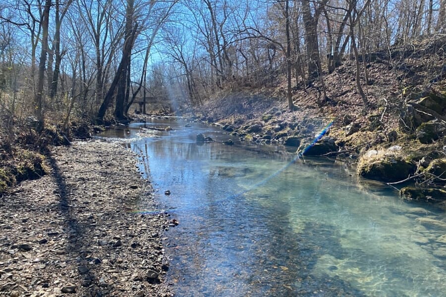
West Branch of Carter Creek (Dallas County). Small mines were worked for gold along this quiet creek southeast of the Ouachita front. It is an off the map spot that gives explorers first crack at gravel most panners have never tested. The land is private timber and farm country, so permission is essential.
Kellogg Mines Area (Pulaski County). The Kellogg mines north of Little Rock worked lead, zinc, and silver ores for decades, and federal mineral records list gold among the metals present. Panning the small creeks that drain the old district can turn up specks of color in the black sand. The area is now a mix of private land and suburbs, so confirm ownership before you dig.
The Best Gold Hunting Techniques in Arkansas
Arkansas’s fine gold rewards patient technique over expensive machinery. These are the three methods that actually put color in a vial here, ordered from easiest to hardest.
Gold Panning (Difficulty: 1 out of 5)
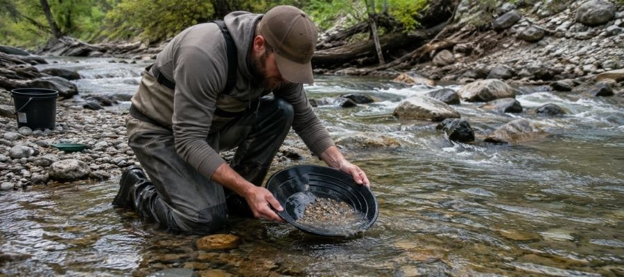
Panning is the whole game in Arkansas. Fill your pan with gravel, submerge it, shake hard so the heavy material sinks, then tilt and swirl the light material off the top until only the concentrate line remains. With gold this fine, finish each pan slowly, because one careless swirl sends your whole day back into the creek.
It works everywhere in this guide, and it is the only method you need on the Caddo, the upper Ouachita, and the quiet creeks of the old mining districts.
Essential Tools:
- Deep riffle gold pan: Garrett 15 Inch Dual Riffle SUPERSLUICE Gold Pan
- Finish pan: Garrett Prospecting 10 Inch Backpacker Gold Pan
- Snuffer bottle: Garrett Gold Guzzler Bottle
- Storage vials: SE Glass Vials with Caps
Crevicing (Difficulty: 2 out of 5)
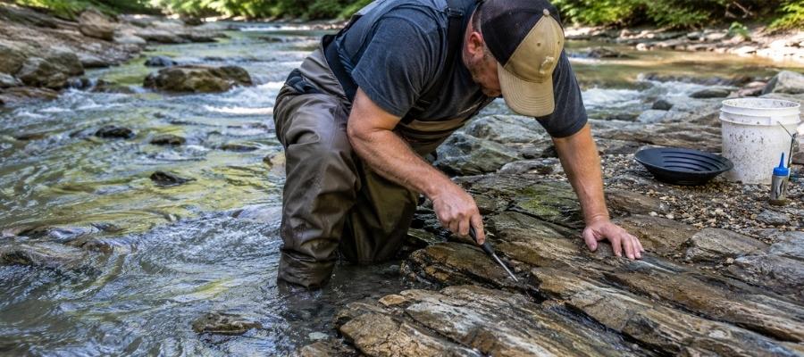
Crevicing means cleaning out the cracks in exposed bedrock and panning what you scrape loose. The Ouachitas’ tilted rock layers make this the state’s signature technique, because every upturned edge is a trap that has been collecting heavy material since the last flood. The Cossatot’s rock gardens and the Little Missouri’s low water ledges are the headquarters.
Work every crack down to its very bottom, because the last spoonful of packed dirt holds most of the gold.
Essential Tools:
- Crevice tool set: ASR Outdoor Steel Crevice Tool Set
- Hand trowel: Edward Tools Bend Proof Trowel
- Finish pan: linked in the panning list above
- Magnifying loupe: JARLINK 30X 60X Illuminated Loupe
Sluicing (Difficulty: 3 out of 5)
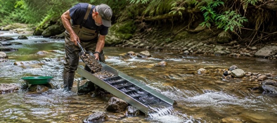
A hand sluice is a small channel with riffles that you set in the current, then feed with gravel while the stream does the panning for you. It processes ten times what a pan can, which stacks up far more black sand and fine gold by the end of the day. Check the legal section first, because anything beyond a pan gets a closer look from land managers and always needs the landowner’s specific okay.
Where rules and permission allow, a sluice earns its keep on the bigger waters, the upper Ouachita and the calmer reaches of the Caddo.
Essential Tools:
- Hand sluice: Keene A52 Hand Sluice
- Digging shovel: Bully Tools 14 Gauge Round Point Shovel
- Classifier screen: SE Half Inch Sifting Screen
- Black sand magnet: SE Magnetic Separator Pick Up Tool with Quick Release
How To Tell Real Gold From Fool’s Gold
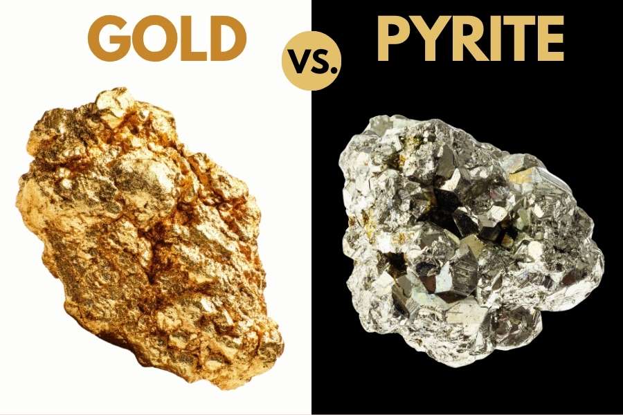
These mountains carry pyrite, mica, and chalcopyrite right alongside the gold, and telling them apart is a skill you can master in one afternoon. Two quick tests sort them out every time.
The shadow test takes one second. Shade your pan with your hand and watch the sparkle. Real gold stays rich and golden in shadow, while pyrite and mica go gray and lifeless the instant the direct light leaves them.
The poke test settles anything the shadow test misses. Press a pin firmly into the particle. Gold is soft metal, so it dents and holds the mark. Pyrite is brittle and shatters, and mica just slides apart in sheets.
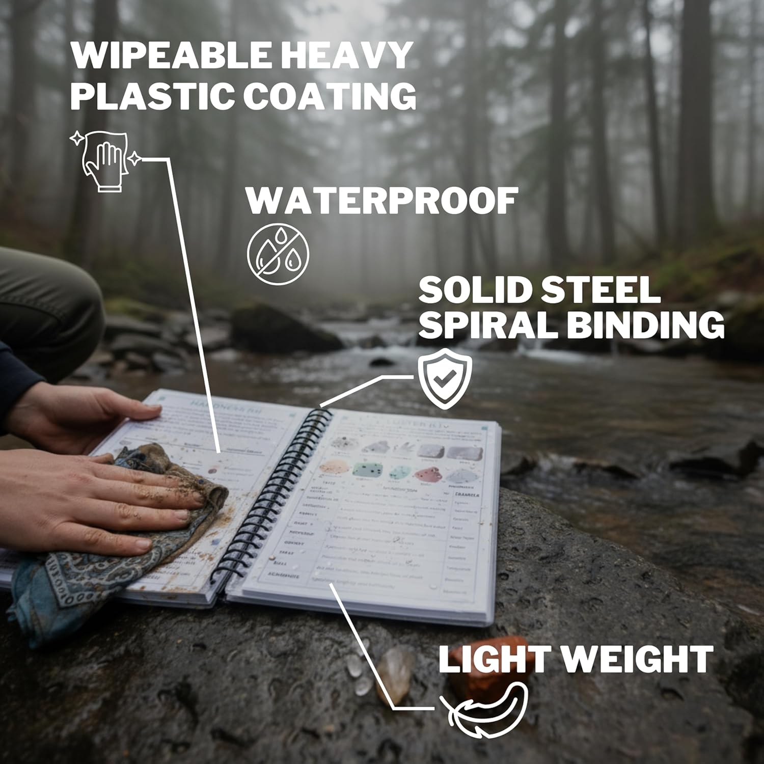
The reason to get this right is not avoiding embarrassment. It is that people who cannot tell the difference eventually toss a pan that had something real in it. The Rocks and Minerals of the United States Field Guide is the insurance policy, with side by side photos of gold and its imitators, printed on waterproof pages you can hold right over your wet pan.
How Gold Got Into Arkansas
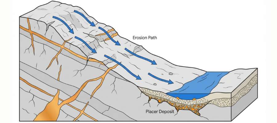
Every spot in this guide sits where it sits because of a mountain building collision, and the same event explains exactly where to look. About 300 million years ago, a southern continent slammed into North America and crumpled deep ocean sediments into the folded ridges of the Ouachita Mountains.
That collision squeezed hot, mineral rich water through cracks in the buckled sandstone and shale. The Ouachita fluids carried huge loads of dissolved silica, and when they cooled they built the biggest and clearest quartz crystal veins in North America, with traces of gold and silver locked inside.
Ever since, rain and rivers have been tearing those mountains down. Streams grind the veins apart, carry off the light material, and tuck the heavy golden specks into bends, bars, and bedrock cracks, which is exactly where this guide has been pointing you.
That geology hands Arkansas prospectors a bonus few states can match. The same mountains that host the gold filled the state with world class quartz, and a separate volcanic pipe to the south seeded the only public diamond field in the country. Few gold states can offer bycatch like that.
What To Bring for an Arkansas Gold Day Trip
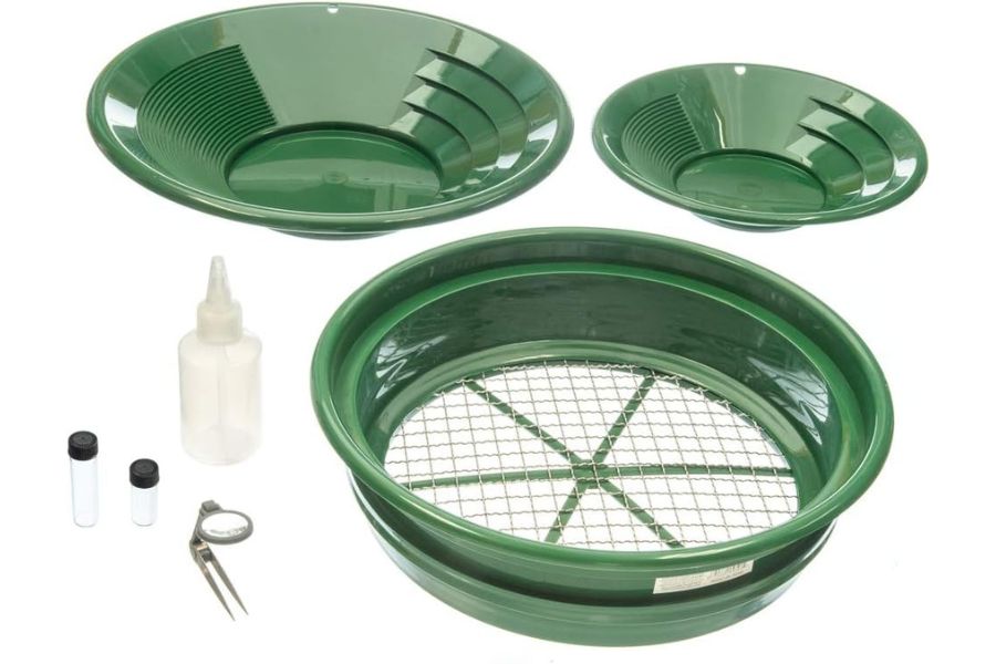
Here is the full checklist. Screenshot this section before you head for the mountains.
- Gold pans and snuffer bottle, covered in the techniques section
- Crevice tools and trowel, same place
- Classifier screen and vials
- Rubber boots or wading shoes with real tread, Ouachita rocks are slick
- Drinking water and bug spray, these valleys are tick and mosquito country in summer
- Sunscreen and a brimmed hat
- Printed landowner permission and a paper map of forest boundaries
- Snacks and a dry change of clothes
If you are starting from zero, one box solves it. The Garrett Deluxe Gold Pan Kit has the pans, classifier, snuffer, and vials in one purchase, and it is the kit we hand to every beginner who joins us.
The Best Time of Year To Hunt for Gold in Arkansas
Timing an Arkansas trip is about water levels, because the gold does not move but these flashy mountain streams sure do. Here is the calendar, region by region.
West Central Arkansas
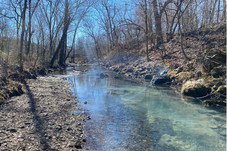
Late summer through fall is prime time on the upper Ouachita and the Caddo. Water drops to its clearest and lowest, exposing gravel bars and the bedrock edges crevicers need. October adds cool air and thin crowds to the bargain.
Skip the days after heavy rain. These drainages rise fast, run muddy, and hide everything you came to read.
Southwestern Arkansas
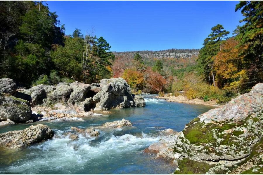
June through October is the window for the Cossatot, the Little Missouri, and the Mena country creeks. The Cossatot especially is only safe to work at summer low flow, when its rapids relax and the bedrock pockets come within reach. Winter panning is possible in mild spells, since this is the state’s warm corner.
Respect flash floods here above all. These steep watersheds can rise dangerously within an hour of a storm, so check the forecast and never work narrow canyons with rain upstream.
Central Arkansas
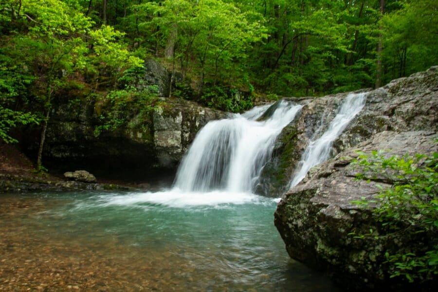
Late summer and early fall are best for the quiet creeks of the old central districts. Low water concentrates the gold the creeks move into the deeper pockets that remain, and dry weather makes the private land access roads passable. Crisp October days here are some of the best panning weather in the state.
Spring is for scouting rather than panning. High water hides the gravel, but it also reworks it, so note the bars that build and hit them when the levels drop.
Other Valuable Rocks and Minerals You Can Find in Arkansas
Here is the twist that makes Arkansas special. It is one of the best collecting states in the country, and the same streams and hills on this list produce finds that shine right alongside the gold in your vial. Keep an eye out for all of these while your pan is working.
Quartz Crystal
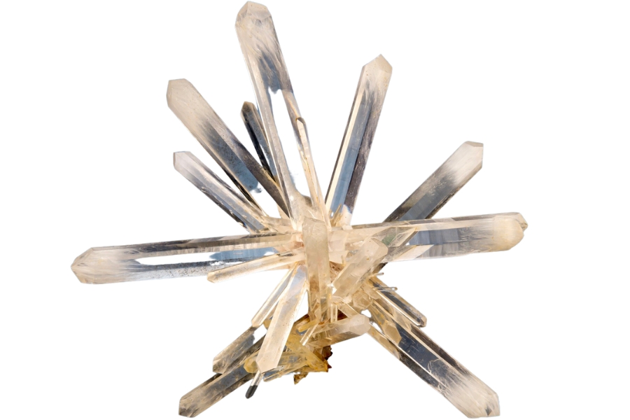
Arkansas quartz is famous worldwide, and the veins around Mount Ida and Hot Springs produce some of the clearest crystals on Earth. Every gold spot in the west central hills doubles as crystal country. Our guide to quartz in Arkansas covers the best digging spots and what good points are worth.
Diamonds
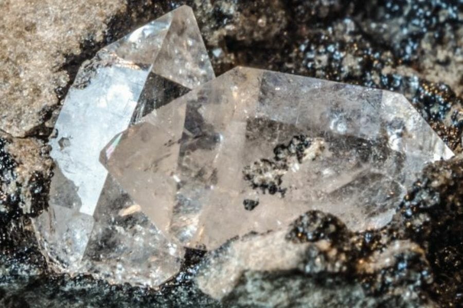
Arkansas is the only state where the public can dig real diamonds and keep them, at Crater of Diamonds State Park near Murfreesboro. Visitors have found tens of thousands of diamonds there, and the 40.23 carat Uncle Sam stone unearthed in 1924 is still the largest diamond ever found in the country. Our guide to diamonds in Arkansas covers how to search.
Amethyst
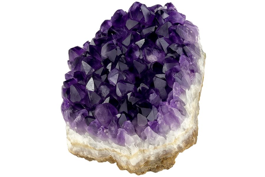
Purple amethyst turns up in Arkansas alongside its famous clear quartz, and good crystals reward sharp eyes at the pay to dig mines. Our guide to amethyst in Arkansas lists the proven spots.
Agate
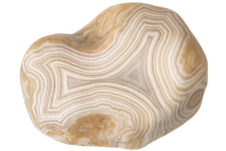
Banded agates hide in Arkansas gravel bars, and wet ones flash colors that dry rock keeps secret. Check every glassy pebble your classifier catches. Here is our full guide to finding agates in Arkansas.
Wavellite
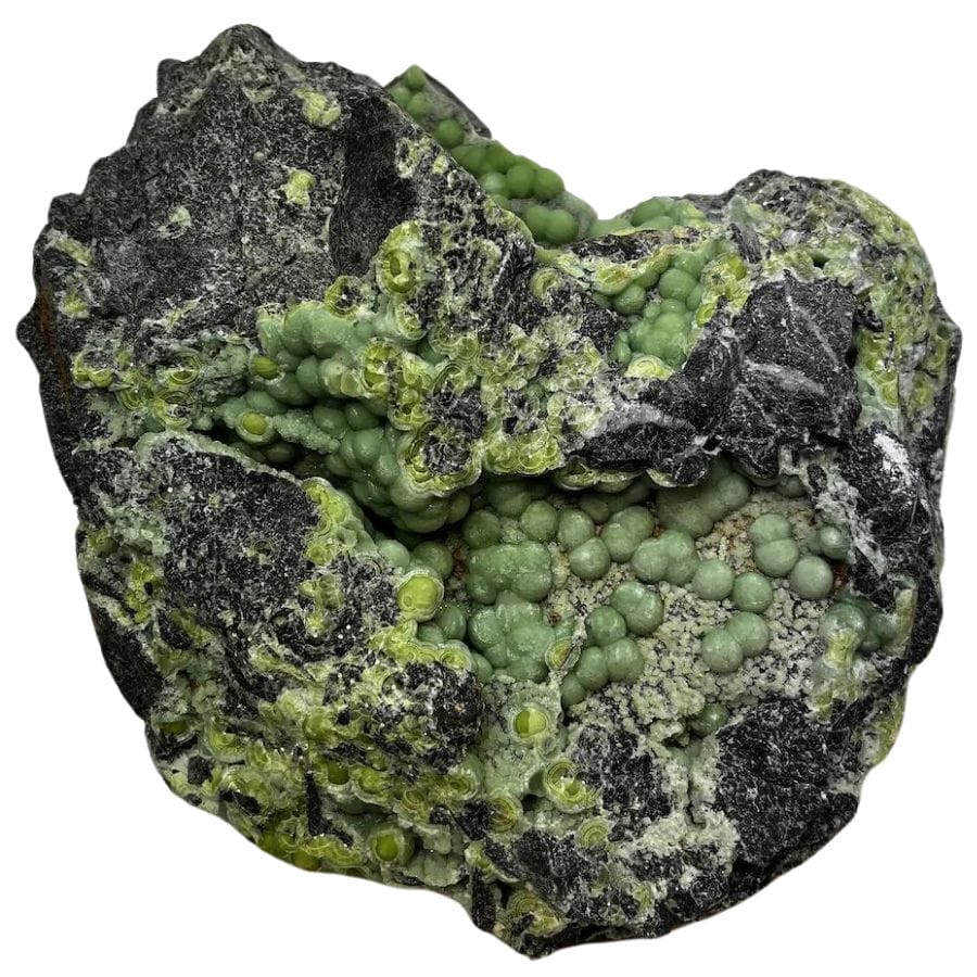
Wavellite forms glowing green starburst clusters, and Arkansas specimens are considered the world’s best. It weathers out of the same Ouachita rocks that host the gold country in this guide. Our Arkansas rockhounding guide points you to the classic localities.
Smoky Quartz
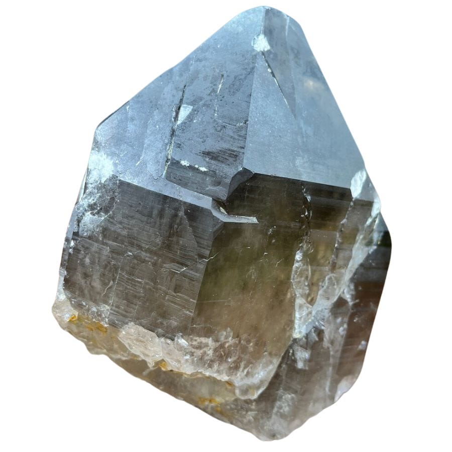
Natural radiation turns some Arkansas quartz a rich smoky brown, and collectors prize the dark points. They turn up in the same veins and creek gravel as the clear crystal. Our guide to crystals in Arkansas shows what else the quartz belt hides.
Turquoise
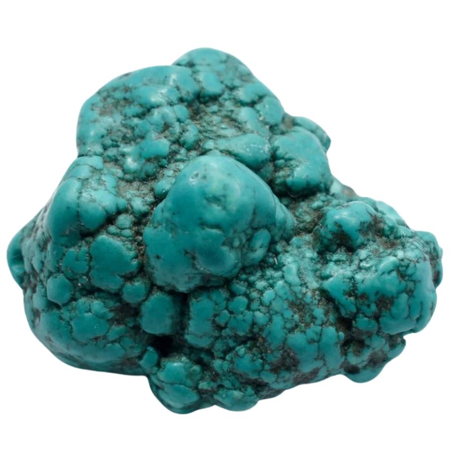
Few people know Arkansas has produced genuine turquoise from the Mena area, a rarity east of the Rockies. Blue green crusts on brown rock are the tell. Our guide to gem hunting in Arkansas covers the state’s full gemstone lineup.
Galena

Galena is a heavy silver gray mineral that glitters in broken chunks, and it was the real payer at many of the old mines in this guide. Its weight fools panners into thinking they have struck something precious. Our overview of Arkansas rocks, minerals, and gems shows how to know it on sight.
Geodes
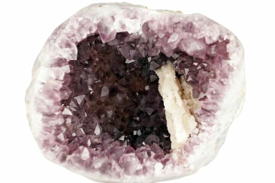
Arkansas geodes look like plain round rocks until you crack them open on a crystal lined hollow. Creek gravel is a classic place to spot their bumpy shells. Our guide to Arkansas geodes lists the best hunting grounds.
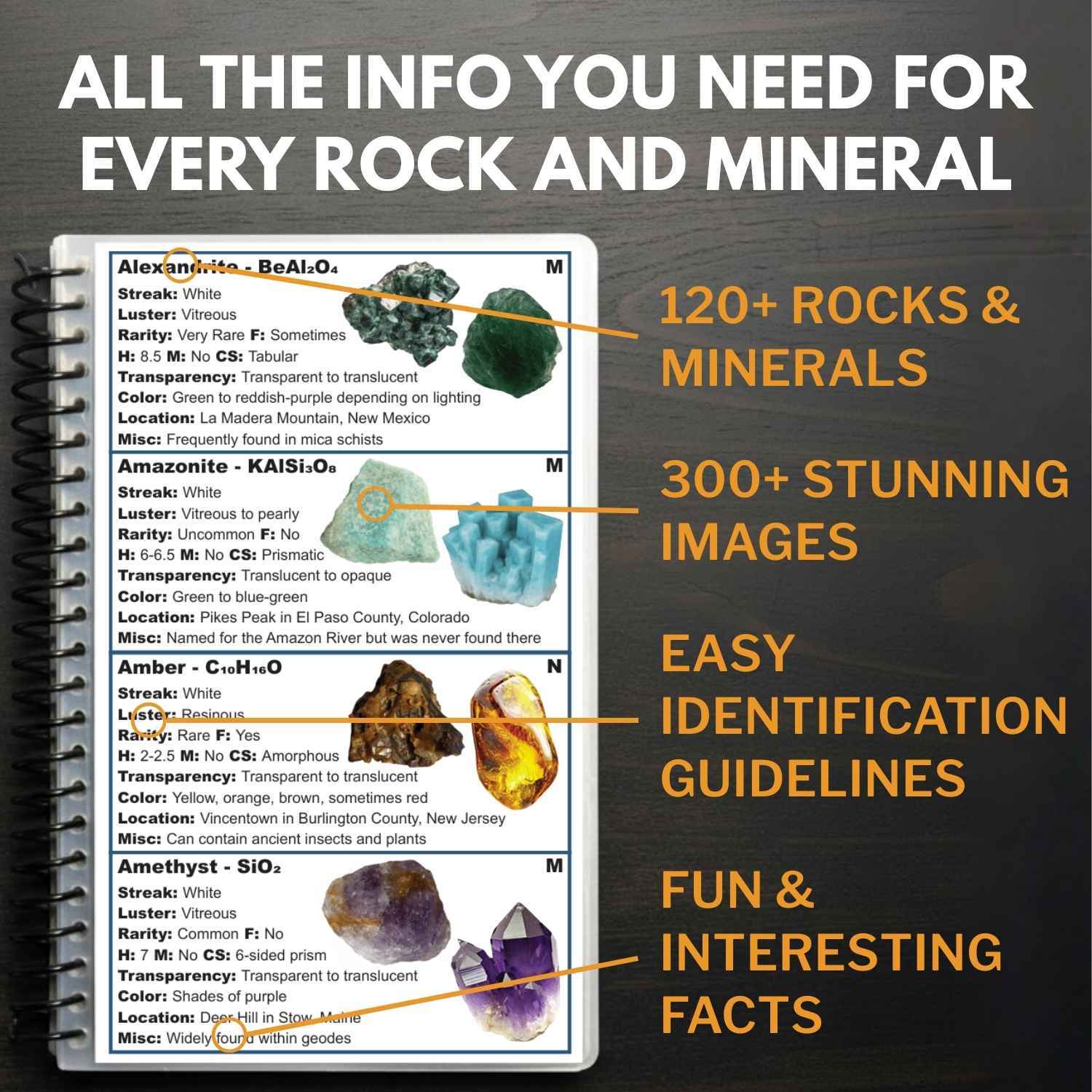
Here is the thing about every mineral on this list. In a wet pan, half of them look like gray or white pebbles, and people flick real treasure back into the creek every single weekend. The Rocks and Minerals of the United States Field Guide exists so that never happens to you, with photo identification for 140 rocks, minerals, and gemstones you can check creekside in seconds.
Legal Rules for Gold Prospecting in Arkansas

Before you touch a pan to gravel, read this section. We are rockhounds, not lawyers, and nothing here is legal advice. Rules change, and staying legal is entirely your responsibility.
Private Property
Much of Arkansas gold country flows through private land, and permission is not optional. Even on streams the public can float, the right to paddle or wade does not automatically include the right to dig gravel, and mineral rights can belong to someone other than the surface owner. Written permission is the single most important tool you can carry, and rural landowners often say yes to a polite ask.
Public and Protected Land
The Ouachita National Forest is the bright spot, where casual hand panning for recreation is generally allowed without a permit, with wilderness areas and developed recreation sites excluded. Arkansas state parks prohibit collecting, with one famous exception, because Crater of Diamonds State Park lets you keep what you find inside its plowed search area only. The Cossatot River State Park Natural Area and stretches of designated wild and scenic river carry their own no collecting rules, so know exactly whose land your gravel bar sits on.
Equipment Restrictions
Hand pans and hand tools are the safe baseline everywhere panning is legal. Suction dredges and other motorized equipment trigger state water quality permitting and federal review, which puts them out of reach for casual prospecting. Keep it to a pan, a shovel, and hand tools and you stay inside the hobby lane.
Play it safe on every trip. Confirm access directly with the landowner or the managing agency before you dig, because boundaries and rules change without notice.
Some locations in this guide sit on land where collecting is limited or seasonal. When in doubt, treat a spot as look but do not take until you have confirmation in hand.
The best shortcut is local knowledge. Arkansas’s rock and mineral clubs know which landowners welcome panners and which old districts are open, and a club membership pays for itself in access alone.
Arkansas Gold FAQ
Is there gold in Arkansas?
Yes, there is gold in Arkansas. The streams draining the Ouachita Mountains carry fine placer gold, and the Arkansas Geological Survey’s records list traces, flakes, grains, and even small nuggets among the forms it takes. Patient panners collect flour gold and flakes there today, especially along the Caddo and upper Ouachita rivers.
Where can you pan for gold in Arkansas?
The best reported panning waters are the upper Ouachita River near Mount Ida, the Caddo River between Norman and Glenwood, and the Little Missouri and Cossatot rivers in the southwestern Ouachitas. Much of this country lies in the Ouachita National Forest, where casual hand panning is generally allowed. The best places section above breaks down access for every spot.
Was gold ever mined in Arkansas?
Yes, Arkansas saw a genuine mining boom in the 1880s, with towns like Bear City and Silver City springing up around gold and silver claims in the Ouachitas. Small mines such as the Helen Gould near Mena shipped gold ore, and a 1923 federal survey confirmed gold and silver in vein material near Hot Springs. The creeks draining those old districts still give panners color today.
Can you find gold at Crater of Diamonds State Park?
No, gold is not found at Crater of Diamonds State Park, because its volcanic soil is diamond country rather than gold country. The park near Murfreesboro lets visitors dig and keep diamonds, amethyst, garnet, jasper, and agate from its search area. It is the only public diamond dig in the country and an easy add on to a southwest Arkansas gold trip, covered in our guide to rockhounding in Arkansas.
Is it legal to pan for gold in Arkansas?
Recreational hand panning is legal in Arkansas with the landowner’s permission on private land, and it is generally allowed in the Ouachita National Forest outside wilderness and developed sites. State parks and natural areas prohibit collecting, and motorized dredging requires permits most hobbyists never pursue. Always confirm current rules with the managing agency before you dig.
Get Every Find In Your Pan Identified In Seconds
In Arkansas, the flash in your pan might be gold, quartz, or something better than both. The Rocks and Minerals of the United States Field Guide identifies 140 rocks, minerals, and gemstones from across the country with hundreds of clear photos, printed waterproof so it works right at the water’s edge.