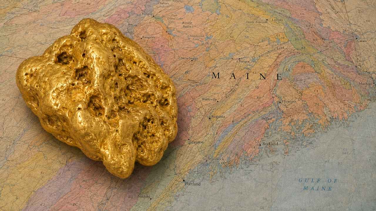
Gold in Maine turns up in enough streams that the state wrote its own prospecting rules just for them, naming eleven stretches of river and brook where gold has been recovered. The Maine Geological Survey keeps that list public, which means the state itself will tell you where to start.
With gold trading above $4,000 an ounce, you do not need to find much for a weekend in western Maine to pay for itself.
Most people who go looking for gold in Maine pull over at the first promising stretch of water and start digging. In Maine the streambed gravel belongs to the landowner even though the water is public, so a quick ask ahead of time keeps every flake you find 100% yours.
Yes, you can still find gold in Maine today, especially along the Swift River and the Sandy River, where placer gold has been filling pans since the 1800s. This guide walks you through the streams the state has named, the free public spot where anyone can pan without asking a soul, and the technique that works best at each one.
Our team of geologists and experienced rockhounds built this guide around the quartz veins buried in Maine’s western mountains and the ice that spread their gold across the whole state. Here is exactly where that gold ended up.
Table of Contents
- Biggest Discovery
- Types of Gold
- Where Gold Hides
- Best Places
- Techniques
- Real vs Fool’s Gold
- How Gold Got Here
- What To Bring
- Best Seasons
- Other Minerals
- Legal Rules
- FAQ
The Biggest Gold Discovery in Maine History
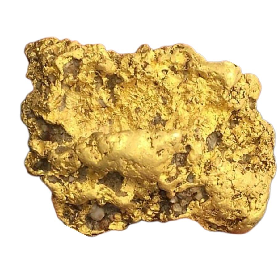
The largest pile of gold ever found in Maine sits inside a hill in Aroostook County, and a geologist found it with a drill rig instead of a pan. In 1977 John Cummings punched holes into Bald Mountain in T12 R8 WELS and hit a massive sulfide body that nobody knew was there.
The numbers are enormous. State records put the deposit at roughly 33.8 million tons of ore, made up of a 30 million ton sulfide body, a copper rich zone, and a 1.4 million ton cap of weathered rock called gossan that carries the richest gold in the whole system.
Gossan is what happens when a sulfide ore body sits near the surface for millions of years. Rain and air rot the sulfur minerals away, the metals that dissolve easily wash out, and gold, which does not dissolve, stays behind and concentrates. That cap is the reason Bald Mountain matters to a gold hunter.
Cummings later put the combined value of the copper, zinc, and gold at six to seven billion dollars. Maine’s mining rules are strict enough that the ore is still sitting there untouched today, which is a fine outcome for the moose and a great story for the rest of us.
The lesson for you is that Maine’s bedrock genuinely carries gold. The same belt of ancient volcanic rock that built Bald Mountain runs across northern and western Maine, and the streams that cut through it have been washing gold out of it since the ice left.
The Kinds of Gold You Can Find in Maine
Maine gives you four kinds of gold, and knowing which one your stream carries tells you exactly how to work it. The western mountain streams run heaviest on fine gold, the Swift River drainage produces the chunkiest pieces in the state, and quartz float from the old veins turns up in gravel everywhere.
Flour Gold
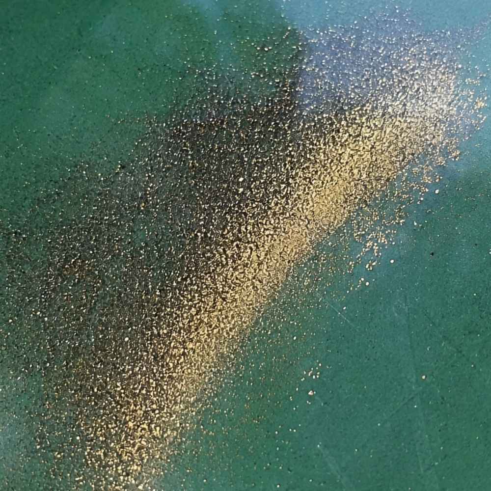
Flour gold is gold ground finer than sugar, and it is the most common gold in Maine water. The St. Croix River in Washington County is known for it, and so are the lower reaches of the Sandy River, where the gold arrives as a bright yellow tail in the crease of your pan after everything lighter has washed out.
The mineral that fools people here is mica, and Maine has more mica than almost any state in the country. Mica flashes gold when the sun hits it, but it floats and rides out of the pan on the first swirl. Real flour gold sinks straight to the bottom and holds its warm yellow color even when you shade the pan with your hand.
Because flour gold escapes a rough pan so easily, save a smooth finish pan for your last few swirls. The Garrett Prospecting 10 Inch Backpacker Gold Pan is built for exactly that final step.
This is also the moment a good identification reference earns its keep. The New England Rocks and Minerals Field Guide shows real gold beside every mineral that imitates it, so you know what you are holding while your pan is still wet.
Gold Flakes and Pickers
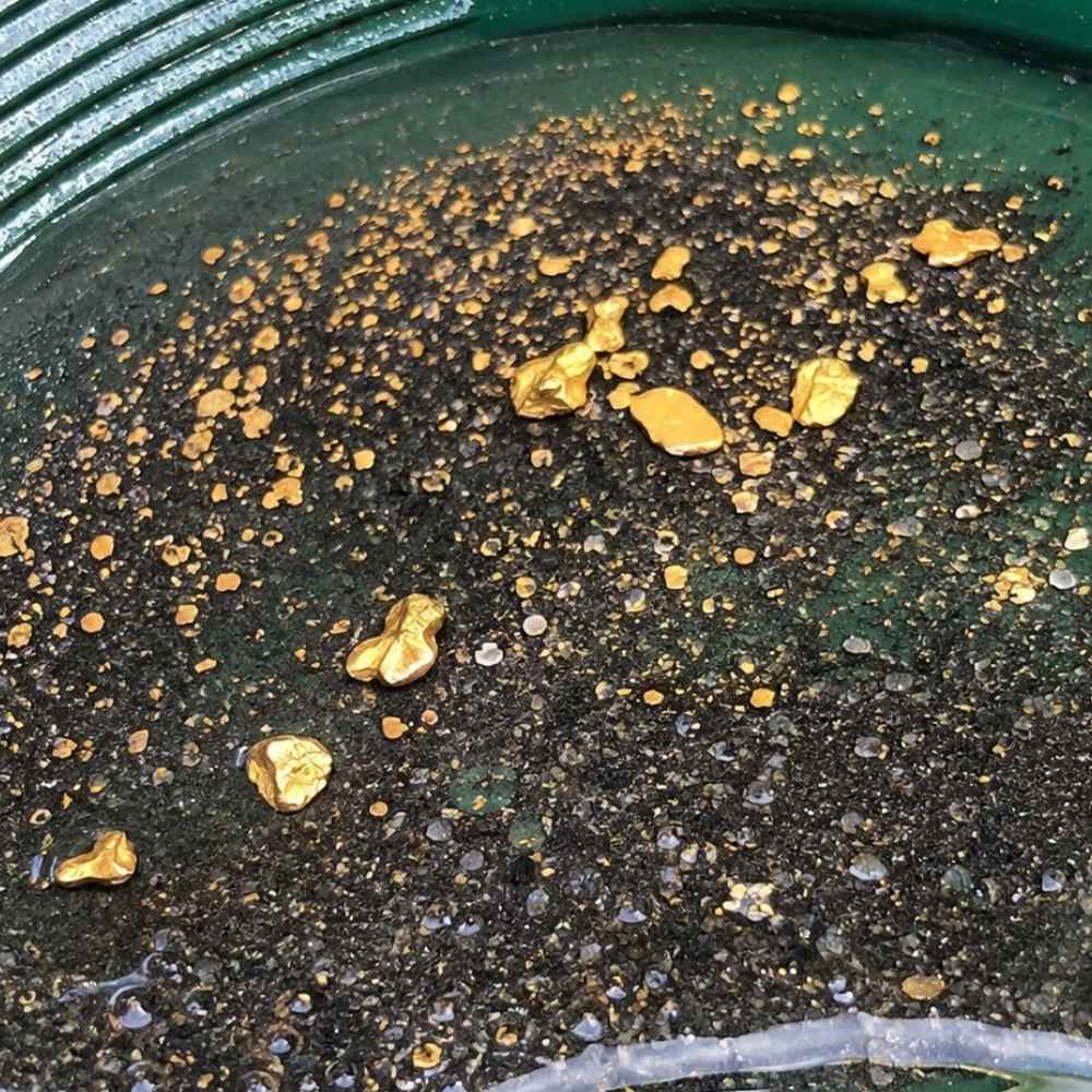
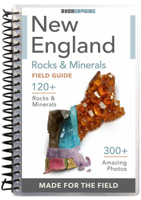
Flakes and pickers are the pieces you can grab with your fingers, and the Swift River drainage produces them all season. A flake is flat and thin, a picker is thick enough to pinch out of the pan without a snuffer bottle, and both tell you that you are standing over good ground. Coos Canyon and the East Branch of the Swift River are the classic addresses for pieces this size.
Pyrite is the lookalike that trips people up on flakes. Pyrite comes in hard little cubes with sharp corners and it shatters when you press it. A real gold flake bends and dents instead, and it never grows a flat crystal face.
Pull flakes and pickers out of your pan with a snuffer bottle before a wave takes them back. The Garrett Gold Guzzler Bottle sucks them straight off the water without losing a single piece.
Gold Nuggets
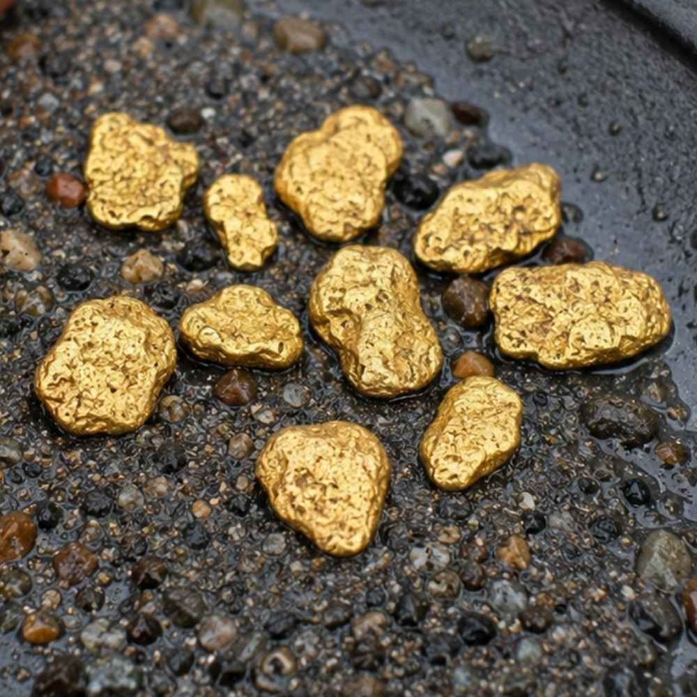
Nuggets are the trophy, and the Swift River is where Maine’s nuggets come from. Prospectors have been pulling coarse gold out of the Byron stretch since the 1800s, and the East Branch has a long reputation for producing the biggest and purest pieces in New England. Every spring flood tears into fresh bank gravel and puts new material where you can reach it.
Nuggets carry a deep buttery color and a heft that surprises people the first time they hold one. Anything that looks like a nugget but feels light for its size is almost always weathered pyrite or a chunk of iron stained rock.
A nugget big enough to matter is usually sitting under packed gravel where no pan will ever find it, which is where a detector earns its price. The Garrett AT Gold Metal Detector is tuned for small gold and handles Maine’s mineral heavy stream gravel well.
Gold in Quartz
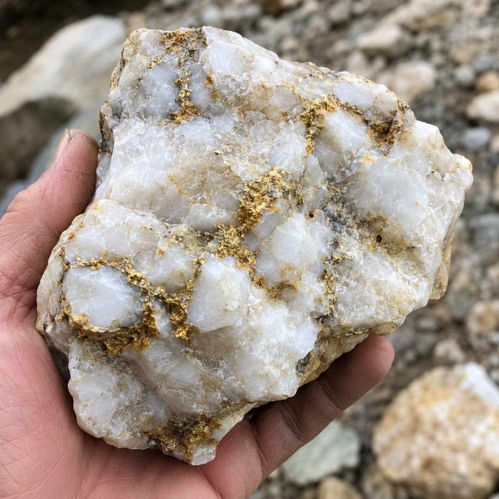
Gold in quartz is where every flake of Maine placer gold started, and broken pieces of those veins still wash down the streams. Look for chunks of milky white quartz with rusty orange staining and thin yellow threads showing in the fresh breaks. The Maine Geological Survey confirms gold occurs in the state’s bedrock veins as well as its stream gravels.
Chalcopyrite is the mineral that fakes it best inside quartz, showing a brassy yellow that looks convincing until you scratch it. Chalcopyrite leaves a greenish black streak on a rough surface, while gold streaks yellow and stays yellow.
Cracking open a promising quartz cobble takes a real rock pick, not a claw hammer. The Estwing Geo Paleo Rock Pick splits quartz cleanly so you can see what is inside.
Every one of these four kinds has a technique that suits it best, and the techniques section further down breaks each one apart with the gear list to match.
Where Gold Hides in Maine Streams
Maine gold sits exactly where the water gives up speed, and reading that beats any map. These are the five features that pay off across the state, from the Swift River gorge to the wide bars on the St. Croix.
Bedrock Cracks and Potholes
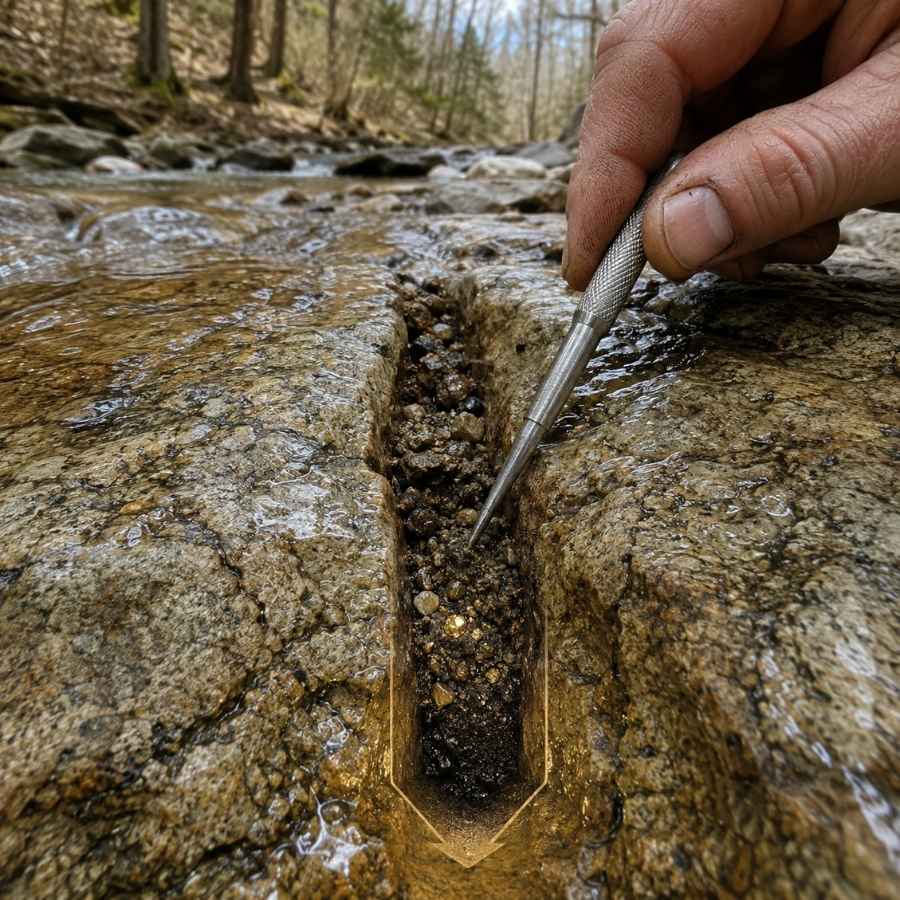
Bedrock is the floor gold cannot fall through, and Maine’s western streams expose miles of it. Coos Canyon is the showcase, where the Swift River has drilled round potholes and long seams straight into solid rock. Gold works down into those cracks over decades and has nowhere else to go.
Cleaning a crack feels like dentistry. You scrape, you flush, and you keep going until the seam is empty, because the last spoonful is almost always the richest one.
A steel crevice tool set is the only thing that reaches into a tight seam. The ASR Outdoor Steel Crevice Tool Set gives you several shapes so one of them always fits.
Inside River Bends
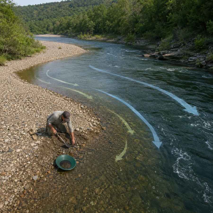
The inside of a bend is the slowest water in the whole stream, and gold drops there first. Stand at the bend and find the line where the gravel changes from cobbles to sand, because that transition is where the heavy stuff quits moving.
Digging an inside bend feels like work at first and then gets easy. The top layer is loose rounded rock, and about a foot down you hit packed gravel that holds together on the shovel. That packed layer is the one you want in your pan.
A round point shovel moves the overburden fast so you can get to the good material. The Bully Tools 14 Gauge Round Point Shovel holds up to Maine cobble without bending.
Gravel Bars
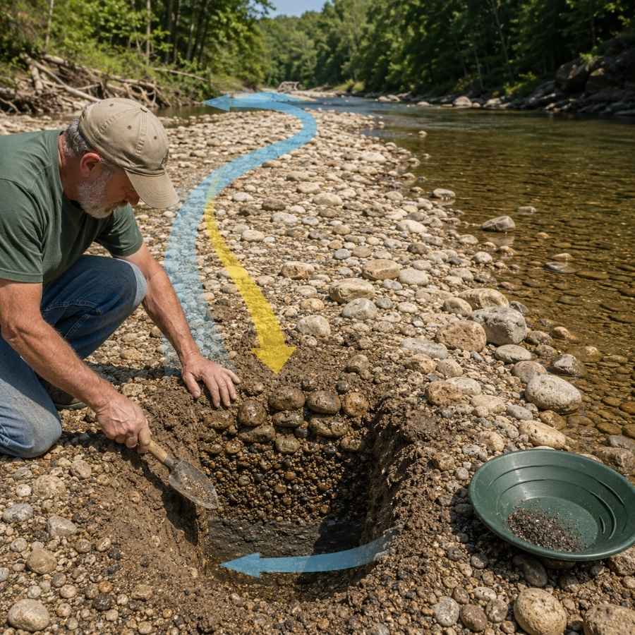
Gravel bars are the easiest gold traps in Maine to spot and the easiest to work. The upstream tip of a bar is the money spot, because that is where the current first slows and drops what it is carrying. On the Sandy River and the St. Croix, whole bars rebuild after every spring runoff.
Bar gravel is loose on top and tighter underneath, and the color usually improves as you go down. Dig test holes across the whole bar instead of one deep hole in the middle.
Screening the oversize rock out before you pan doubles how much material you can process. The SE Half Inch Sifting Screen sits right on your pan and does it in seconds.
Behind Boulders
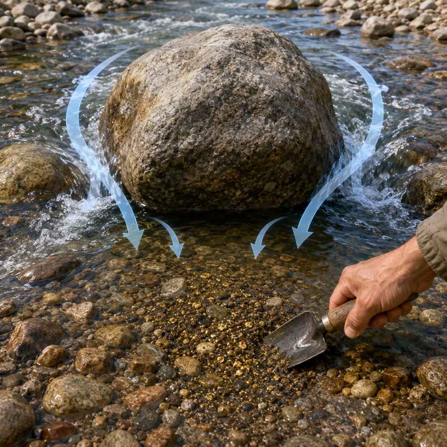
Every big boulder in a Maine stream builds a pocket of dead water behind it, and dead water drops gold. The bigger the boulder and the faster the water around it, the better the pocket. This is the most reliable feature there is in steep brooks like Nile Brook and Kibby Stream.
The gravel behind a boulder is usually packed tight and full of black sand, which is a very good sign. Dig it out down to whatever hard surface sits underneath.
A bend proof hand trowel gets into the pocket without wrecking your back. The Edward Tools Bend Proof Trowel is the one that survives a season of cobble.
Black Sand Streaks
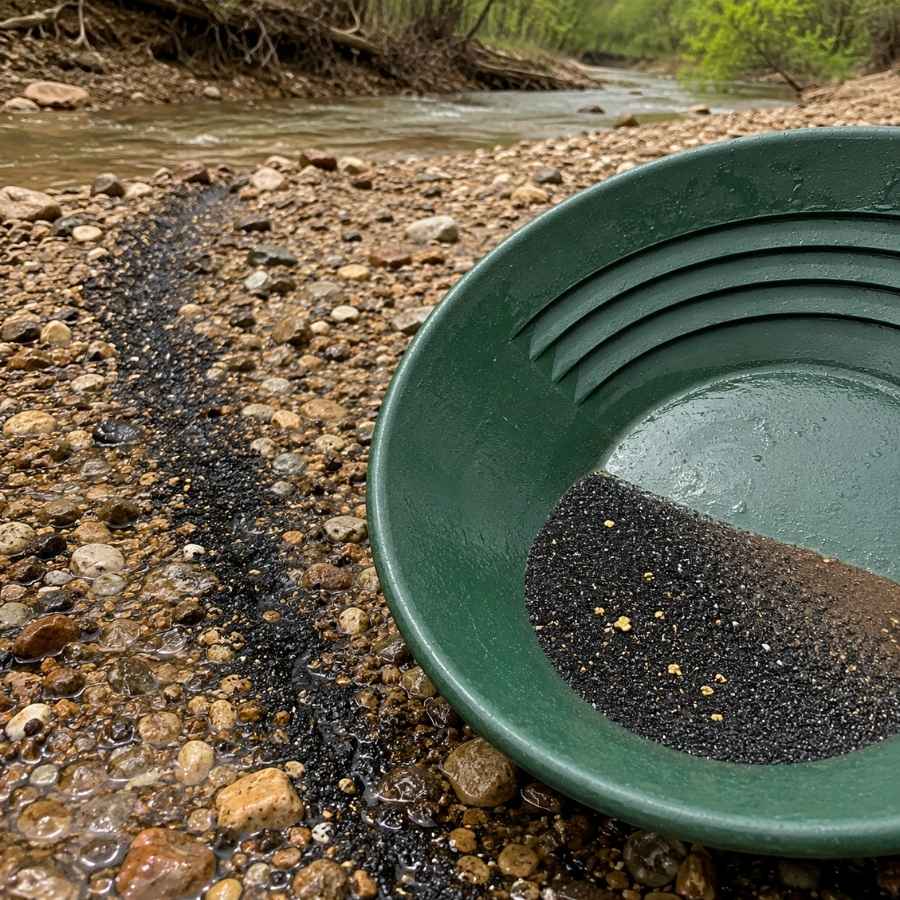
Black sand is your compass in Maine, because it is heavy iron mineral that travels and settles exactly where gold does. Look for dark ribbons across the top of a bar or dark layers in a cut bank. Where the black sand concentrates, your gold is in the same handful.
Following black sand also means your pan fills with magnetite, which has to come out before you can see anything. That is a two minute job with the right tool.
A magnetic separator pulls the iron out of your concentrate and leaves the gold behind. The SE Magnetic Separator Pick Up Tool with Quick Release drops the whole load in one click.
Always Confirm Access and Collection Rules!
Before heading out to any of the locations on our list you need to confirm access requirements and collection rules for both public and private locations directly with the location. We haven’t personally verified every location and the access requirements and collection rules often change without notice.
Many of the locations we mention will not allow collecting but are still great places for those who love to find beautiful rocks and minerals in the wild without keeping them. We also can’t guarantee you will find anything in these locations since they are constantly changing.
Always get updated information directly from the source ahead of time to ensure responsible rockhounding. If you want even more current options it’s always a good idea to contact local rock and mineral clubs and groups
The Best Places To Find Gold in Maine
Maine’s gold sits in three broad regions, and one of them has a free public park where anybody can walk down and pan the same afternoon. Here is every spot worth your gas money, starting with the one that has been putting gold in beginners’ vials for generations.
Western Maine
The Swift River and Sandy River drainages in Oxford and Franklin counties are the heart of Maine gold, and they hold the state’s coarsest pieces. This is also the most accessible gold country in Maine, with paved highways running right alongside the water for miles. The same mountain belt keeps producing across the state line, so our guide to gold in New Hampshire pairs well with a western Maine trip.
Coos Canyon on the Swift River, Byron, Oxford County

Coos Canyon is the most famous gold spot in Maine and the easiest place in the state to start. The town of Byron maintains a free roadside park right on Route 17 where the Swift River drops through a bedrock gorge, and the Land for Maine’s Future program helped protect nine acres of it in 2006 so it stays open. You park, walk twenty steps, and you are standing on gold ground.
The gorge itself is the reason this spot works. Centuries of water have carved potholes and long seams into solid rock, and those act like natural sluice boxes that have been collecting gold the entire time. Flakes and pickers are the standard find, and panning the crack fills and the gravel behind boulders is the technique.
Your pan will also turn up garnet, staurolite, magnetite, ilmenite, quartz, and heavy black sand from the surrounding schist. This is exactly the moment people throw a good stone back in the river, because everything looks the same when it is wet. The New England Rocks and Minerals Field Guide lets you check every odd piece against clear photos before it goes back in the water.
The rock shop across the road rents pans and sells supplies, and there is a campground nearby if you want to make a weekend of it. Bring the crevice tools from the techniques section below, because the potholes here reward them.
Difficulty: 1 out of 5
East Branch Swift River, Byron, Oxford County
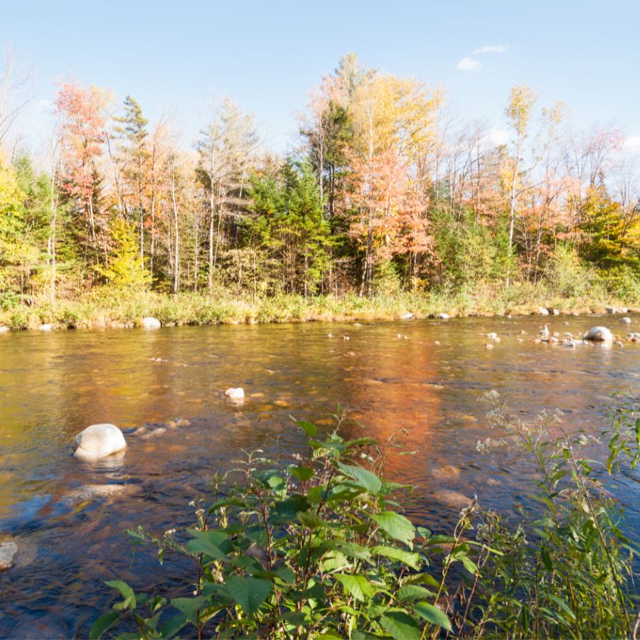
The East Branch of the Swift River is the address that produced Maine’s most impressive gold. It is a recognized mineral locality with gold, quartz, magnetite, ilmenite, garnet, staurolite, biotite, and scheelite all recorded from its gravels, and prospectors report it as the best water in the state for a picker or better.
The branch joins the main Swift River above Byron and runs down through steep, boulder heavy ground. Coarse flakes and pickers are the target, and the technique that works is digging bank gravel down to bedrock and cleaning every crack you expose.
Expect garnet, staurolite, and thick black sand alongside the gold. Much of this drainage is working timberland, so knock on the door at the timber office or the local rock shop and get permission before you set up. A crevice tool and a good shovel are the two pieces you will actually use here.
Difficulty: 3 out of 5
Swift River at Roxbury and Mexico, Oxford County

The lower Swift River gives you miles of gold water below the famous canyon and far fewer people on it. From Byron the river runs about twelve miles south through Roxbury and Mexico before joining the Androscoggin, and Route 17 follows it nearly the whole way with pullouts along the road.
Everything that washes out of Coos Canyon and the East Branch ends up down here, and it collects on inside bends and the upstream tips of gravel bars. Fine flakes and flour gold are the normal find, with pickers turning up after a big runoff year.
The same gravel gives up garnet, quartz, and black sand by the handful. This stretch is one of the waters where Maine allows motorized prospecting under state rules from June 15 to September 15, which makes it a good place to graduate from a pan to a hand sluice. Bank land is private, so pick a spot and ask first.
Difficulty: 2 out of 5
Sandy River from Madrid to Phillips, Franklin County

The Madrid to Phillips stretch of the Sandy River is important enough that Maine wrote it into the rules by name. The state closed this reach to motorized prospecting specifically to protect it, which tells you the gold and the habitat here are both worth protecting. Hand panning and hand sluicing are still open to you.
The river runs out of the Sandy River Ponds through steep country and drops its load where the valley opens up. Fine flakes are the standard find, and the productive material is in the bar gravel and packed against bedrock. Smalls Falls sits just up the road and makes an easy landmark for finding the upper reach.
Garnet, mica, and black sand ride along with the gold in every pan. Route 4 parallels the river with plenty of places to pull over, and the banks are a mix of private land and town road frontage, so confirm your spot before you dig. Panning gear from the techniques section is all you need here.
Difficulty: 2 out of 5
Sandy River from Avon to New Sharon, Franklin County
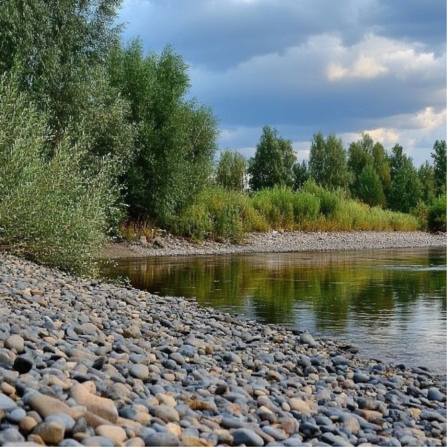
The lower Sandy River is the longest run of legal gold water in Maine, stretching roughly thirty miles from Avon down through Strong, Farmington, and New Sharon. Maine lists this whole reach as open to motorized recreational prospecting inside the June 15 to September 15 season, which makes it the state’s most flexible stretch of gold river.
The gradient eases here and the river widens, so it builds big gravel bars that rebuild every spring. Flour gold and fine flakes are what you will see, and a sluice pays for itself fast on material like this. Work the upstream tips of the bars and the inside of every bend.
Garnet, mica, feldspar, and black sand come up with it. Road access is easy the whole way along Route 4 and Route 134, but almost every foot of bank is private property, so a conversation with the landowner is the first step at any spot you like.
Difficulty: 2 out of 5
Nile Brook, Dallas Plantation and Rangeley, Franklin County
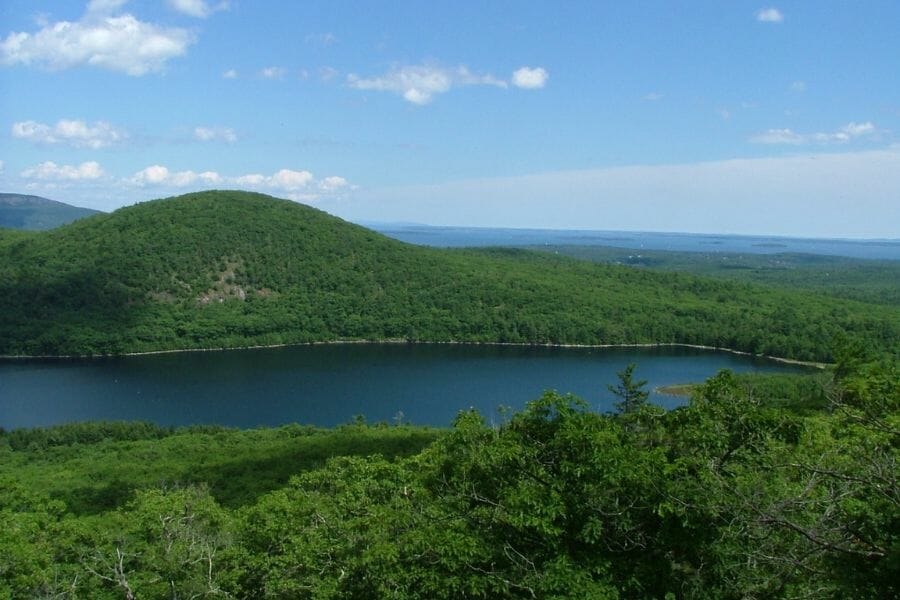
Nile Brook is one of only a handful of Maine waters the state names as a gold stream, and it sits in the Rangeley Lakes high country. It drains the slopes above Dallas Plantation and flows toward the Rangeley area, cutting through glacial material that came off gold bearing bedrock.
This is a small, steep brook, which is exactly the setting where gold concentrates hard. Fine gold and small flakes are the find, and the technique is working the pockets behind boulders and any bedrock you can expose. Small water means you can read the whole channel in an afternoon.
Garnet, mica, and black sand fill out the pan. Maine allows motorized prospecting here in season, though the brook is small enough that a pan and a hand sluice are the sensible tools. The land is a mix of plantation, private, and timber ownership, so ask before you park.
Difficulty: 3 out of 5
Kibby Stream, Kibby Township, Franklin County
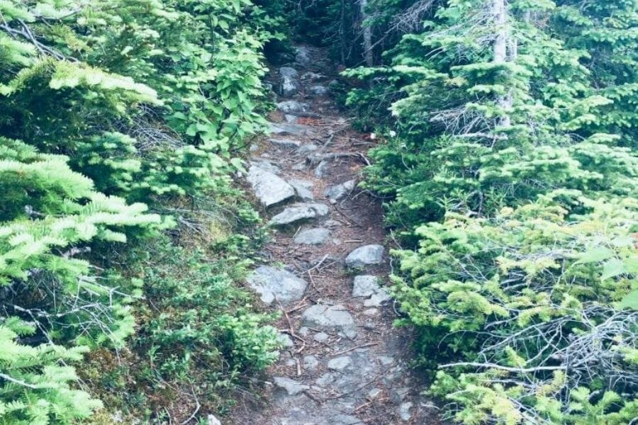
Kibby Stream is remote, protected, and named by the state as a gold water. Maine closed it to motorized prospecting, which keeps the streambed intact and leaves hand panning as your way in. It runs through Kibby Township in the high country near the Quebec border, some of the least visited ground in New England.
The stream cuts through the same belt of ancient volcanic and metamorphic rock that hosts gold across northern Maine. Fine gold is the expected find, concentrated behind boulders and in the gravel wedged against bedrock. You will likely have the entire drainage to yourself.
Black sand, garnet, and quartz come up with it. Getting here means driving private logging roads off Route 27 above Eustis, so bring a full tank, a paper map, and the landowner’s blessing. Yield to every log truck you meet.
Difficulty: 4 out of 5
Gold Brook at Chain of Ponds, Franklin County
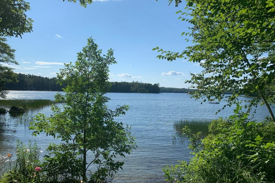
A brook named Gold Brook is worth the drive, and northern Franklin County has one running through the Chain of Ponds country. The state lists it among the waters open to motorized recreational prospecting, which is a strong signal that gold has been recovered from it.
The brook drains into the Chain of Ponds chain along the Arnold Trail corridor, and it runs through glacial deposits over gold bearing bedrock. Fine gold and small flakes are the target, and panning the boulder pockets and any exposed bedrock is the way to work it.
Expect black sand, quartz, and garnet in the same scoop. Route 27 runs north through this country toward the Canadian border with pullouts along the water, and the surrounding land is commercial timberland where permission is the rule. The season is short at this elevation, so plan for midsummer through early fall.
Difficulty: 4 out of 5
Northern and Central Maine
Northern Maine’s gold sits in the Somerset County brooks and the big river drainages that cut the state’s volcanic belt. This is working forest country, which means fewer people, bigger water, and a road system you should treat with respect.
South Branch Penobscot River, Somerset County
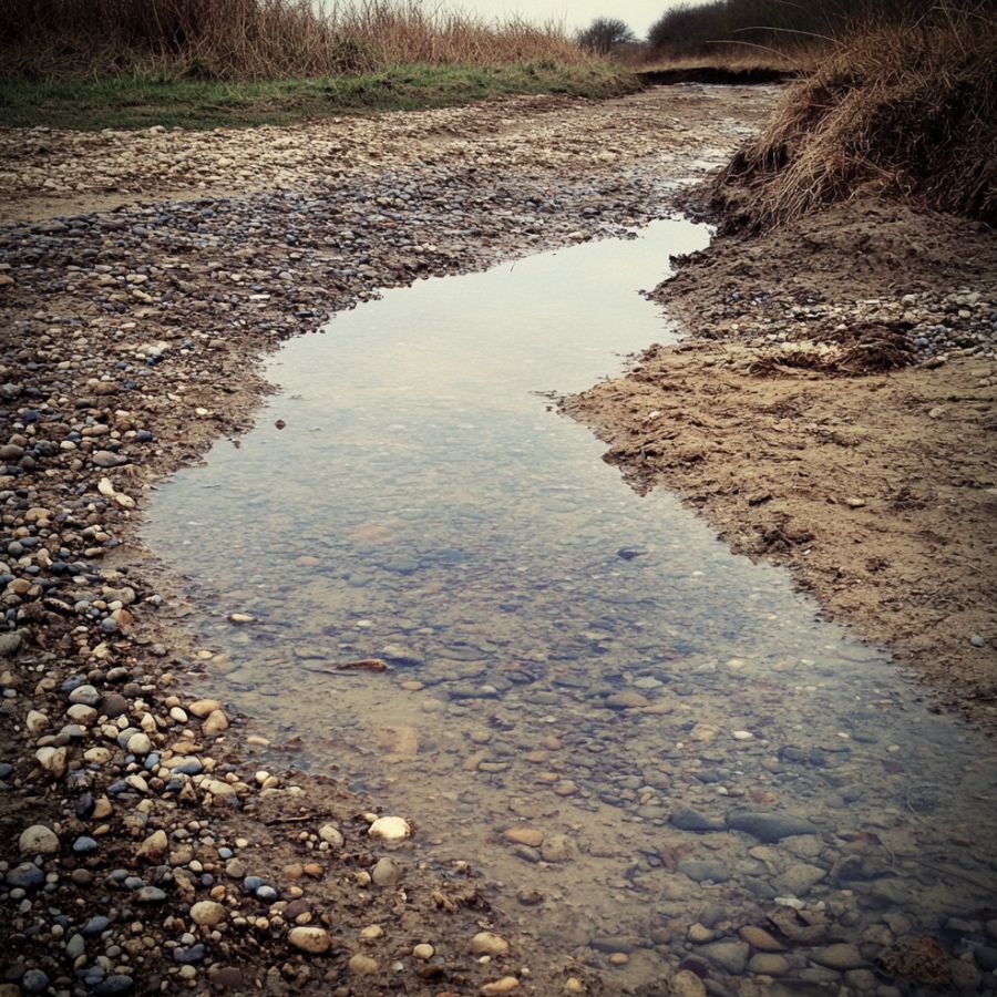
The South Branch of the Penobscot River is the biggest named gold water in northern Maine. The state lists the stretch running through Sandy Bay, Bald Mountain Township, and Prentiss Township as open to motorized recreational prospecting in season, which puts a lot of river in play.
This is a wide, cobbled river with long gravel bars, and bars like these are the easiest gold traps in the state to read. Fine gold and flakes are the find, and the productive material is at the upstream ends of the bars and along the inside of the bends. A hand sluice moves a lot of gravel here.
Black sand, quartz, and garnet fill the rest of your pan. Access runs on private logging roads out of Jackman and the Route 201 corridor, and this is genuine backcountry, so travel with a spare tire, extra fuel, and a plan. Use the shovel and sluice from the techniques section.
Difficulty: 4 out of 5
Downeast Maine
Downeast gold sits in the St. Croix drainage along the New Brunswick border, and it is the finest gold in the state. Fine gold comes in volume, and this river hands it to you with roadside access and public boat launches.
St. Croix River at Baileyville, Washington County
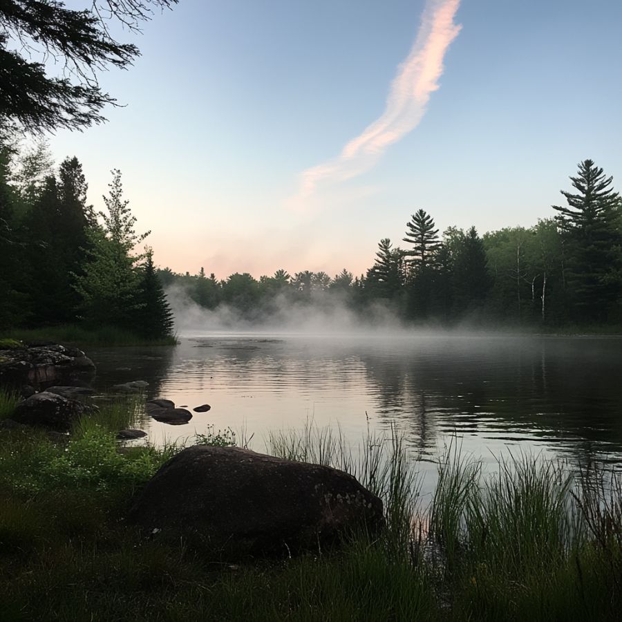
The St. Croix River at Baileyville is Maine’s only named gold water east of the mountains, and it is the most overlooked spot in this guide. The state lists this reach as open to motorized recreational prospecting in season, and the river forms the international border with New Brunswick.
The gold here is very fine flour gold, carried in from the mineralized ground upstream. That means slow, careful panning and a finish pan, and it means a sluice with fine matting will out produce a pan by a wide margin. Work the gravel bars and the slack water where tributary streams come in.
Black sand is heavy in this drainage, along with quartz and jasper pebbles. Route 1 and Route 6 both reach the river, and the Baileyville area has public boat launches that put you on the water quickly. This is an international boundary river, so stay on the American side and mind the posted rules.
Difficulty: 2 out of 5
More Proven Places To Find Gold in Maine
These spots earn a trip too, and several of them are on the state’s own list of gold waters. Check current access and collection rules before you go, because ownership and rules in Maine’s woods change without notice.
Western Maine
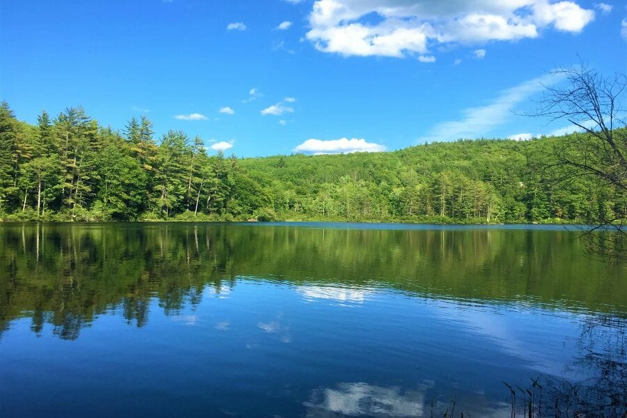
Carrabassett River near Kingfield, Franklin County. The Carrabassett drains the high country below Sugarloaf and Maine prospectors name it among the streams they work. It carries glacial material off the same western mountain belt that feeds the Sandy River. Route 27 follows the river with easy pullouts, and the banks are private, so ask first.
Chandler Mill Stream near Madrid, Franklin County. Chandler Mill Stream is a Sandy River tributary west of Madrid, close to Smalls Falls, and prospectors report fine gold in its gravel. Small tributaries like this concentrate gold hard because there is nowhere for it to spread out. Work the boulder pockets and any bedrock you can reach.
Crossman Stream near Phillips, Franklin County. Crossman Stream feeds the Sandy River in the Phillips area and shows up on prospecting lists of Maine gold tributaries. Fine gold is what people report, held in the gravel where the stream slows before it joins the main river. Access runs across private land, so a knock on the door comes first.
South Bog Stream, Rangeley Plantation, Franklin County. South Bog Stream is a recorded gold locality feeding Rangeley Lake, one of the named mineral occurrences in Franklin County. The stream runs through glacial deposits in classic Rangeley high country. Much of the corridor is conservation and private land, so confirm access before you unload gear.
Tumbledown Brook near Weld, Franklin County. Tumbledown Brook drains the Tumbledown Mountain country above Webb Lake, and prospectors report gold in the Weld area drainages. Steep brooks off a mountain like this drop their heavy material fast. The area is popular with hikers, and much of it is public reserved land, so check the current rules for the unit you are on.
Berdeen Stream near Byron, Oxford County. Berdeen Stream is one of the named Swift River tributaries prospectors work above Coos Canyon. Tributaries feeding a proven gold river are always worth a look, because they are the delivery system. Timber company land surrounds it, so permission comes before the pan.
Cupsuptic River north of Rangeley, Oxford County. The Cupsuptic flows south into Mooselookmeguntic Lake through remote Oxford County forest, and it appears on lists of Maine gold streams. It cuts glacial material laid over the western Maine metamorphic belt. Logging roads reach it, and a Rangeley area club can point you to the stretches that are open.
Gold Brook at Bowmantown Township, Oxford County. The state names this Gold Brook specifically and closed it to motorized prospecting, which leaves hand panning as your route in. A protected stream is a stream with something in it worth protecting. Bowmantown is remote township land, so plan your access before you drive.
West Branch Swift River, Oxford County. The West Branch is the Swift River’s other main feeder above Byron, and it drains the same gold bearing ground as the East Branch. Prospectors report color throughout the Swift River system and its tributaries. Working timberland surrounds it, so ask at the timber office or the rock shop in Byron.
White Mountain National Forest streams near Gilead, Oxford County. The Maine slice of the White Mountain National Forest is the only federal ground in this guide, and the Forest Service issues a free permit for recreational gold panning there. A free permit and open public land is a great combination anywhere. Stop at the ranger district office and ask which drainages are currently open.
Northern and Central Maine

Aroostook River near Ashland, Aroostook County. The Aroostook River drains the same northern volcanic belt that hosts the Bald Mountain deposit, and prospecting sources point to the Ashland reach. Big northern rivers build long gravel bars that are easy to read. Access here runs through private timberland and North Maine Woods checkpoints, so budget for a day use fee.
Kennebec River, Kennebec County. The Kennebec carries material down from the gold bearing brooks of Somerset County, and prospectors report finding color along its shorelines. A river this size carries its gold a long way downstream, and it builds bar after bar to catch it. Public boat launches and river parks give you plenty of legal places to start.
Gold Brook at Chase Stream Township, Somerset County. This is the second of Somerset County’s two Gold Brooks, running through the Chase Stream country west of Moosehead Lake. The state lists it as open to motorized recreational prospecting in season. Private roads reach it, so contact the landowner or the gate before the trip.
Gold Brook in Appleton Township, Somerset County. Maine names a third Gold Brook in T5 R6 BKP WKR, also called Appleton Township, and lists it among the waters open to motorized prospecting. Three separate brooks named for gold in one region says a great deal about the ground. This is deep timber country, so treat the roads and the log trucks with respect.
Spencer Stream, Somerset County. Spencer Stream drains the Spencer Lake country toward the Dead River and shows up on prospecting lists of Maine gold streams. Fine gold in the gravel is what people report. Access runs on private roads out of the Route 201 corridor, so plan the drive and get permission first.
The Best Gold Hunting Techniques in Maine
Four techniques cover every kind of Maine gold water, and you can start with the first one for the price of lunch. Work through them in order and each new tool multiplies what the last one taught you.
Gold Panning (Difficulty: 1 out of 5)
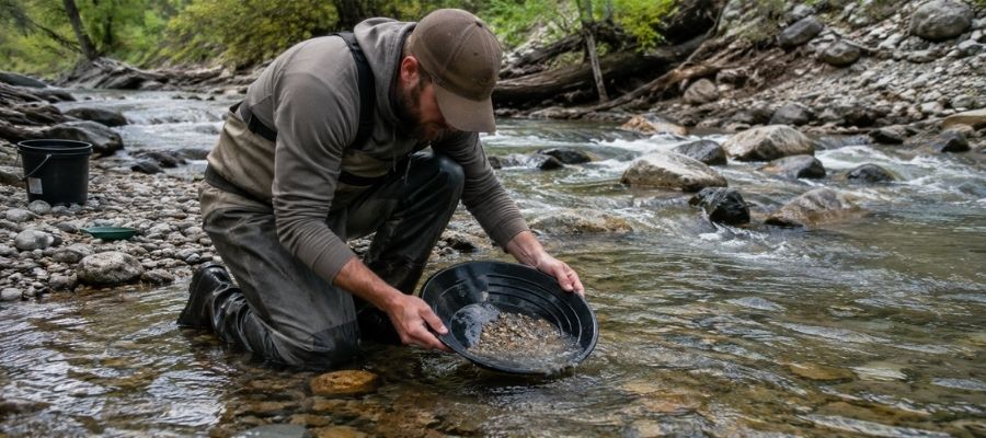
Panning is scooping gravel into a pan and washing the light material away until only the heavy material is left. Gold is about seven times heavier than the sand around it, so it sinks to the bottom of the pan and stays there while everything else goes over the lip. Ten minutes of practice and you have the motion.
Panning works everywhere in Maine and it needs no permit as long as you leave the banks alone. Coos Canyon is the best place in the state to learn, because the potholes concentrate the gold for you.
Essential Tools
- Gold pan: Garrett 15 Inch Dual Riffle SUPERSLUICE Gold Pan
- Finish pan: Garrett Prospecting 10 Inch Backpacker Gold Pan
- Classifier screen: SE Half Inch Sifting Screen
- Snuffer bottle: Garrett Gold Guzzler Bottle
- Storage vials: SE Glass Vials with Caps
Sluicing (Difficulty: 2 out of 5)
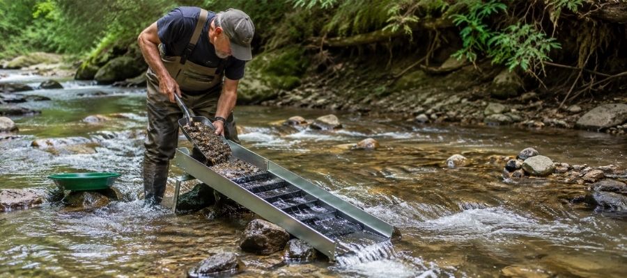
A sluice is a long box you set in the current so the river does your panning for you. You shovel classified gravel into the top, water carries the light material out the bottom, and ribs called riffles trap the gold along the way. One person with a sluice processes ten times the gravel of one person with a pan.
Maine allows a hand sluice up to ten square feet without a permit, which covers every hand sluice on the market. The wide bars on the lower Sandy River, the South Branch Penobscot, and the St. Croix are made for it.
Essential Tools
- Sluice box: Keene A52 Hand Sluice
- Digging shovel: Bully Tools 14 Gauge Round Point Shovel
- Fine classifier: SE 1/8 Inch Mesh Sifting Screen
- Black sand magnet: SE Magnetic Separator Pick Up Tool with Quick Release
Metal Detecting (Difficulty: 2 out of 5)
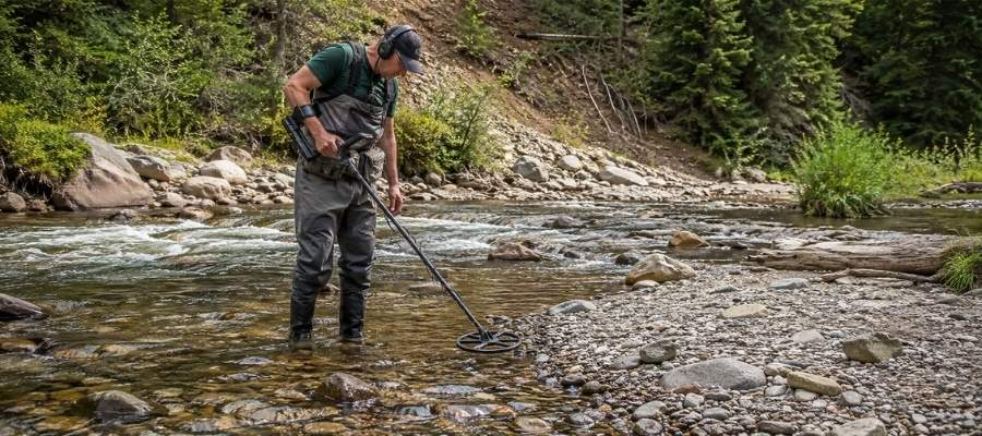
A gold detector finds the pieces that are too big and too deep for a pan to ever reach. You sweep the coil low and slow over gravel bars, exposed bedrock, and old workings, and you dig every signal. Maine’s stream gravel carries a lot of iron mineral, so a detector built for gold and set up properly matters more here than in many states.
The Swift River drainage is the ground where this pays off, since it produces the coarsest gold in the state. Old bank cuts and freshly flooded gravel are the places to sweep first.
Essential Tools
- Metal detector: Garrett AT Gold Metal Detector
- Pinpointer: Garrett Pro Pointer AT
- Hand trowel: Edward Tools Bend Proof Trowel
- Magnifying loupe: JARLINK 30X 60X Illuminated Loupe
Crevicing (Difficulty: 3 out of 5)
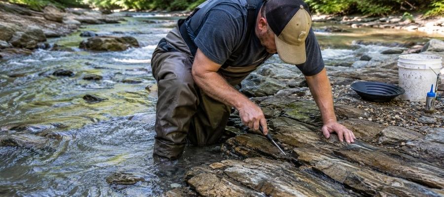
Crevicing is digging gold out of the cracks in exposed bedrock, and in Maine’s gorges it is the highest payoff technique there is. Gold works its way down into a seam over decades and cannot go any further, so a crack nobody has cleaned is a savings account. You scrape, flush, and repeat until the seam is empty.
Coos Canyon is the crevicing capital of Maine, with potholes and long joints cut into solid rock. The East Branch of the Swift River and the upper Sandy River both expose bedrock at low water too.
Essential Tools
- Crevice tool set: ASR Outdoor Steel Crevice Tool Set
- Rock hammer: ESTWING 22 oz Rock Pick
- Snuffer bottle: Garrett Gold Guzzler Bottle
- Storage vials: SE Glass Vials with Caps
How To Tell Real Gold From Fool’s Gold
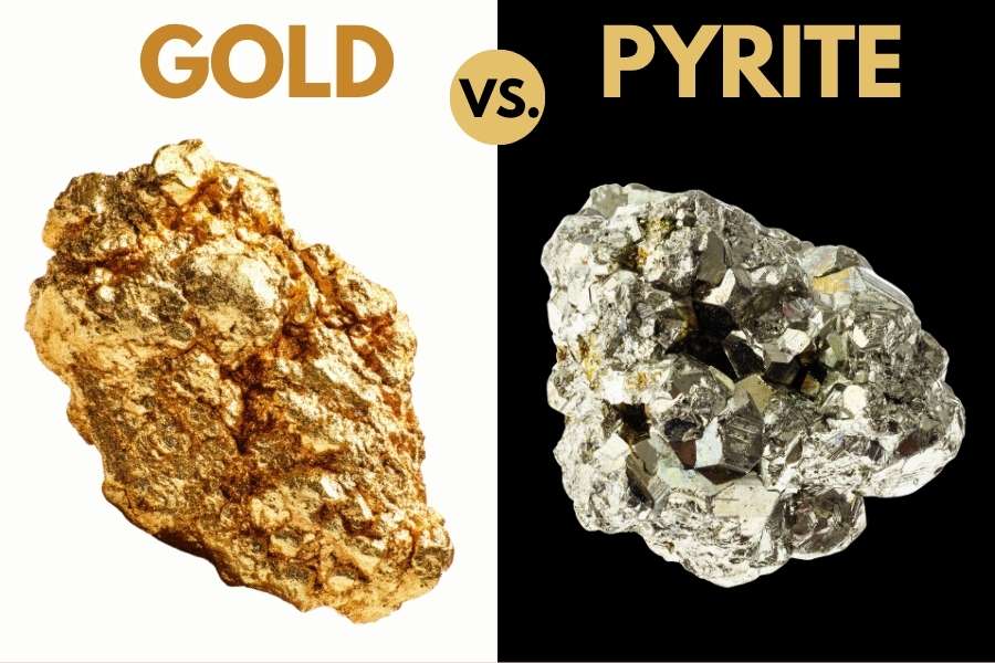
Maine streams carry more mica and pyrite than gold, and both put on a convincing show in a wet pan. The good news is that two simple tests separate them every single time, and neither one takes more than a few seconds.
The shadow test is the fastest. Cup your hand over the pan and watch the sparkle. Real gold keeps its warm yellow glow in shade, while pyrite and mica go gray and flat the instant the direct sunlight leaves them.
The poke test settles whatever the shadow test leaves open. Press a pin or a knife tip firmly into the piece, and gold will dent and hold the mark because it is soft metal. Pyrite is brittle and cracks apart, and mica peels into thin sheets.
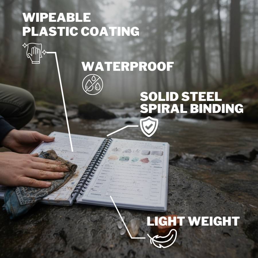
Getting this right matters because the real cost of guessing is not embarrassment. It is dumping a pan that had gold in it, or tossing back a garnet or a piece of tourmaline worth more than the gold was. The New England Rocks and Minerals Field Guide puts gold and all of its imitators side by side on waterproof pages you can hold right over a dripping pan.
How Gold Got Into Maine
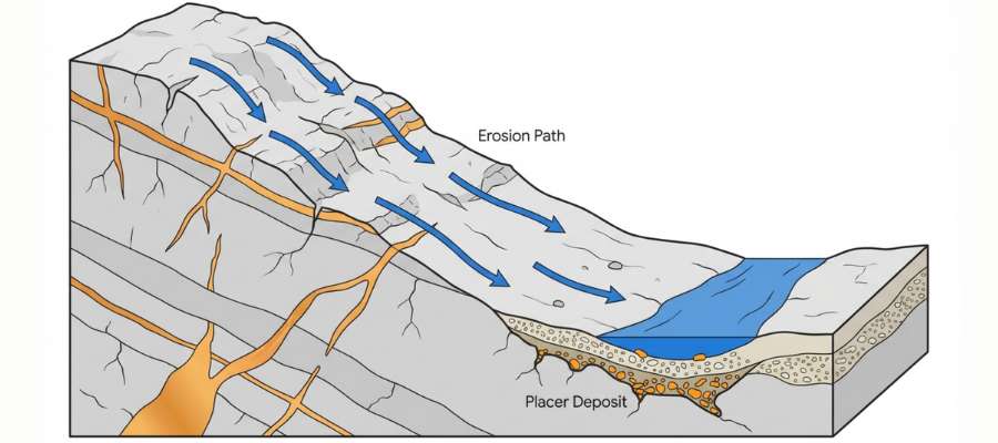
Every spot in this guide sits where it does because of two events, one that made the gold and one that spread it around. The first happened hundreds of millions of years ago when an ocean closed and slammed a chain of volcanic islands into the edge of North America.
That collision built the mountains of western and northern Maine and cooked the rock deep underground. Superheated water carrying dissolved gold moved through cracks in that rock, and as it cooled it dropped its metal into the cracks as quartz veins. Those veins are the original source of every flake you will ever pan in Maine, and the Bald Mountain ore body is what one of them looks like when it stays buried.
Then the ice came. A continental glacier more than a mile thick ground across the entire state, scraped the tops off those veins, and carried the broken material south and east. When the ice melted it dumped everything it was carrying as gravel, sand, and till, which is why Maine gold turns up far from any vein.
The last step is still happening. Every stream in the state has spent the ten thousand years since the ice left sorting that glacial gravel, and because gold is about seven times heavier than sand, it sinks and stays while the light material keeps moving. That is why every spring flood restocks the bars at Coos Canyon and on the Sandy River with fresh material.
What To Bring for a Maine Gold Day Trip
Pack for cold water and black flies, because both are part of a Maine gold day. Here is the checklist that covers a full day on any stream in this guide.
Prospecting gear
- Gold pan and finish pan, from the techniques section
- Classifier screen and a small shovel
- Crevice tools if you are working bedrock
- Snuffer bottle and glass vials for your gold
- Magnet for pulling black sand out of concentrates
Everything else
- Plenty of water and food, since services are far apart once you leave the highway
- Bug spray with a real repellent, especially from late May through July
- A rain shell and a warm layer, because Maine mountain weather turns fast
- Boots you can soak, wool socks, and a dry change in the car
- Printed permission, permits, or gate passes for wherever you are headed
- A paper map, a first aid kit, and a charged phone, since cell service disappears in the woods
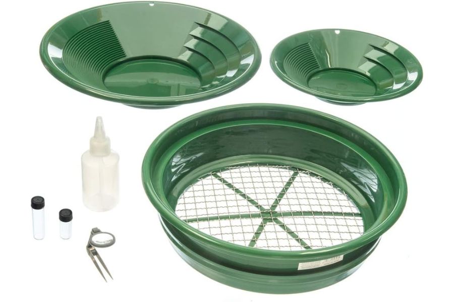
If you would rather buy the whole prospecting side in one box, the Garrett Deluxe Gold Pan Kit covers the pans, classifier, vials, and snuffer bottle together. Our full gold hunting and prospecting equipment guide breaks down what each piece actually does.
The Best Time of Year To Hunt for Gold in Maine
Timing matters in Maine because snowmelt controls the water and the logging roads control everything else. Here is the window for each region.
Western Maine
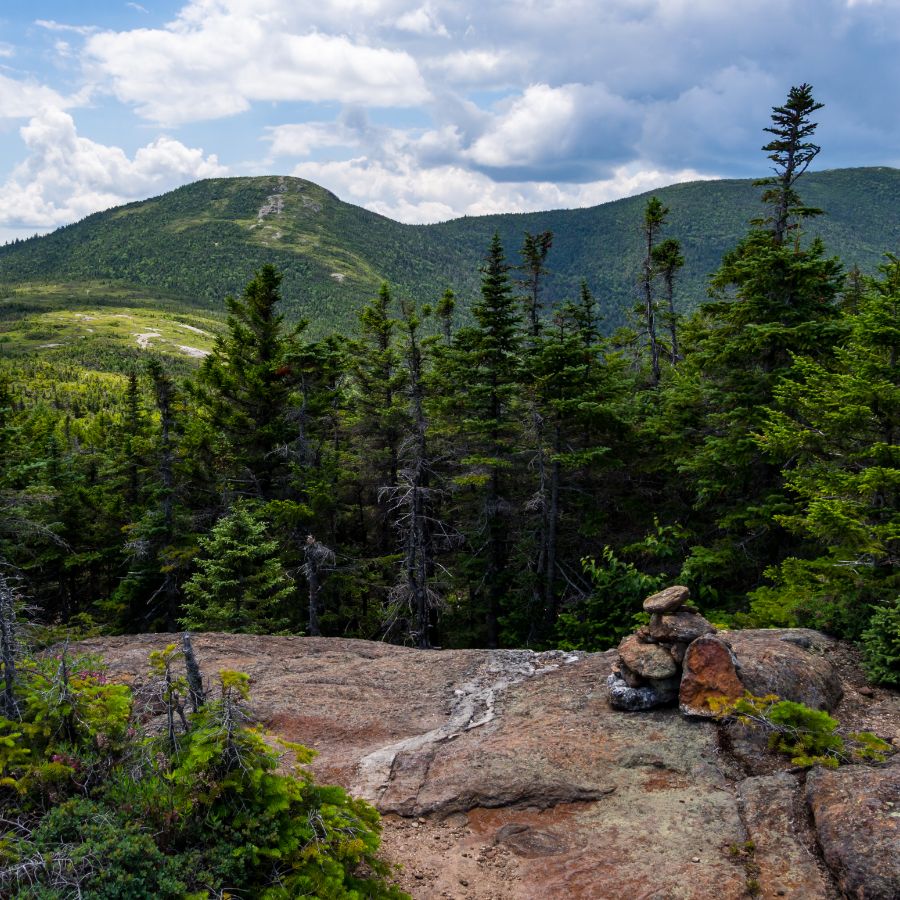
July through October is prime time on the Swift River and the Sandy River. The water drops to safe wading levels by midsummer, and the bedrock and gravel bars that come out of the water in September are the best of the year.
Spring runoff in April and May makes these streams genuinely dangerous and too high to reach anything good, though that same runoff is what rebuilds the bars you will work later. Early October is the sweet spot, with low water, fall color, and no bugs at all.
Northern and Central Maine
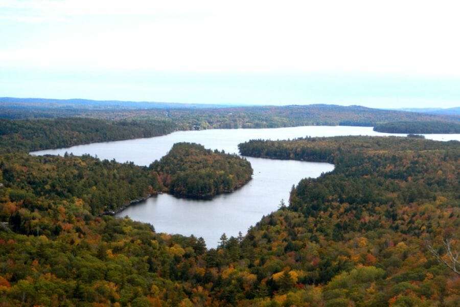
Late June through September is your window in the north, and the logging road network sets the schedule as much as the water does. Mud season keeps the roads soft well into May, and gates and checkpoints run on a summer calendar.
This also lines up with Maine’s motorized prospecting season, which runs June 15 to September 15 statewide. Black flies peak in June, so July and August are the comfortable months and September is the quiet one.
Downeast Maine
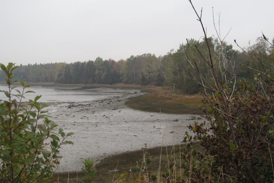
Late summer through October is the sweet spot on the St. Croix. The river settles into low, clear conditions by August, which exposes bar gravel that spends most of the year underwater.
The coastal climate keeps Downeast a little cooler and a little later than the rest of the state, so fog is common into July. October gives you the best light, the lowest water, and the whole river to yourself.
Other Valuable Rocks and Minerals You Can Find in Maine
The same ground that holds Maine’s gold holds some of the best gem minerals in North America. Keep your eyes open while you pan, because Maine has funded more than one trip with something that was not gold at all.
Tourmaline
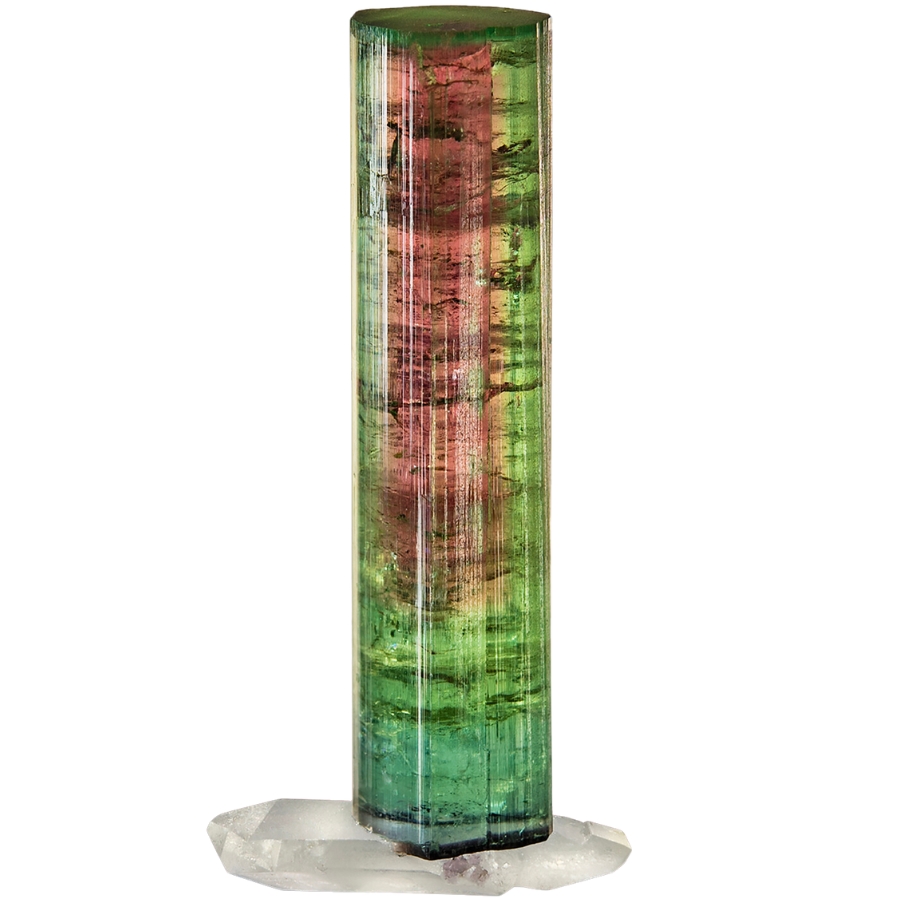
Tourmaline is Maine’s state mineral and the gem that made the state famous, coming out of pegmatite pockets at Mount Mica and Newry in green, pink, and watermelon banded crystals. Broken pegmatite ends up in streams all over Oxford County, so a green or pink crystal in your gravel is a real possibility. Our guide to gem hunting in Maine covers the quarries and pockets that produce it.
Amethyst

Amethyst is purple quartz, and Maine produces it in pegmatite pockets and vugs across the western mountains. Deer Hill in Oxford County is the classic locality, and loose crystals travel downhill into the brooks below. Our guide to crystals in Maine lists the collecting areas that are open to the public.
Garnet
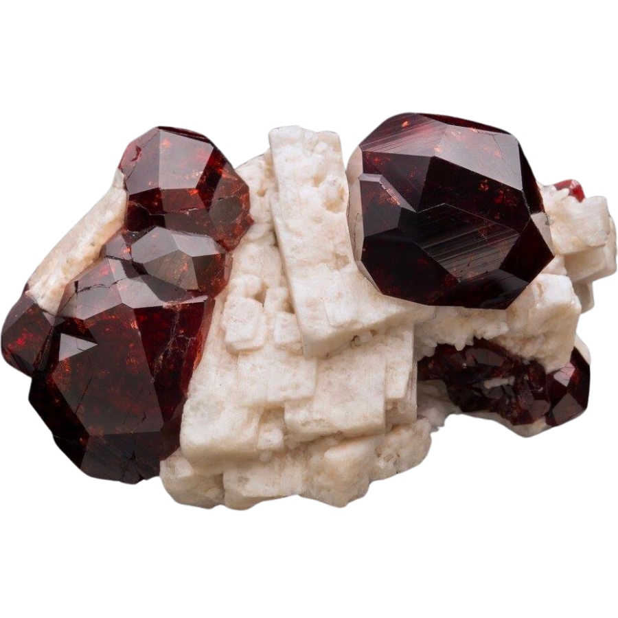
Garnet is the mineral you are most likely to see in the same pan as your gold, because it is heavy enough to settle with it. Maine schist is full of dark red almandine, and it shows up as hard little crystals with flat faces. Our guide to garnet in Maine shows what the good material looks like and where to dig for it.
Aquamarine
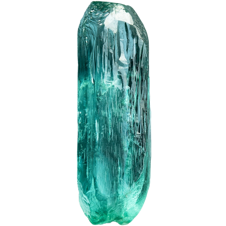
Aquamarine is blue beryl, and Maine’s pegmatites have produced world class crystals of it. Look for hexagonal crystals with flat ends and a glassy blue green color in pegmatite float. Our gem hunting guide for Maine covers the beryl localities in Oxford and Androscoggin counties.
Quartz Crystals
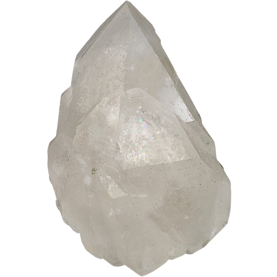
Clear quartz crystals line pockets throughout Maine’s pegmatites and vein systems, and they roll into brooks whenever a pocket breaks open. A sharp six sided crystal in your gravel means a pocket is upstream. Our guide to geodes in Maine covers the pocket localities around Newry and Mount Mica.
Apatite
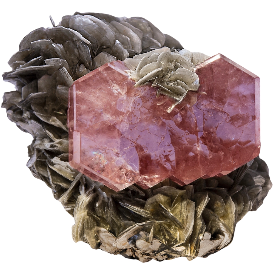
Apatite comes in purple, blue green, and pink, and Maine has an entire mountain named for it. Mount Apatite in Auburn is the best known locality, and the same mineral shows up in pegmatite float across the state. Our guide to rockhounding in Maine covers Mount Apatite and the other public digging sites.
Agate
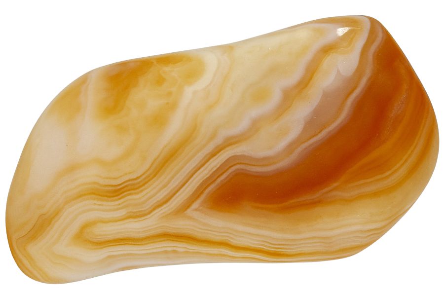
Agate turns up in Maine’s volcanic rock and along the Downeast shoreline, and it is the mineral to watch for on the St. Croix. Look for a waxy, translucent pebble that glows when you hold it up to the light. Our guide to agates in Maine covers the coves and lakeshores where they collect.
Rhodonite
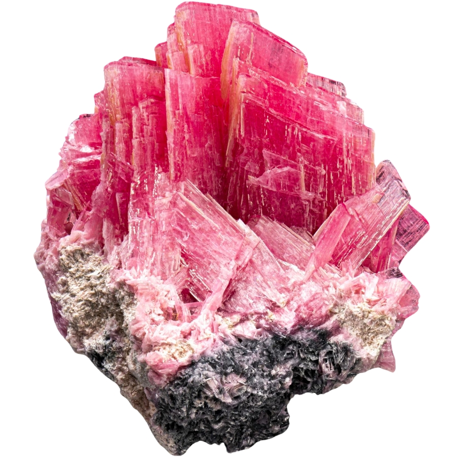
Rhodonite is a pink to cherry red manganese mineral that takes a beautiful polish, and Maine’s coastal and central deposits produce it. It shows up as a solid pink mass with black veins running through it, which makes it easy to spot on a gravel bar. Our Maine gem hunting guide covers where to look for it.
Jasper
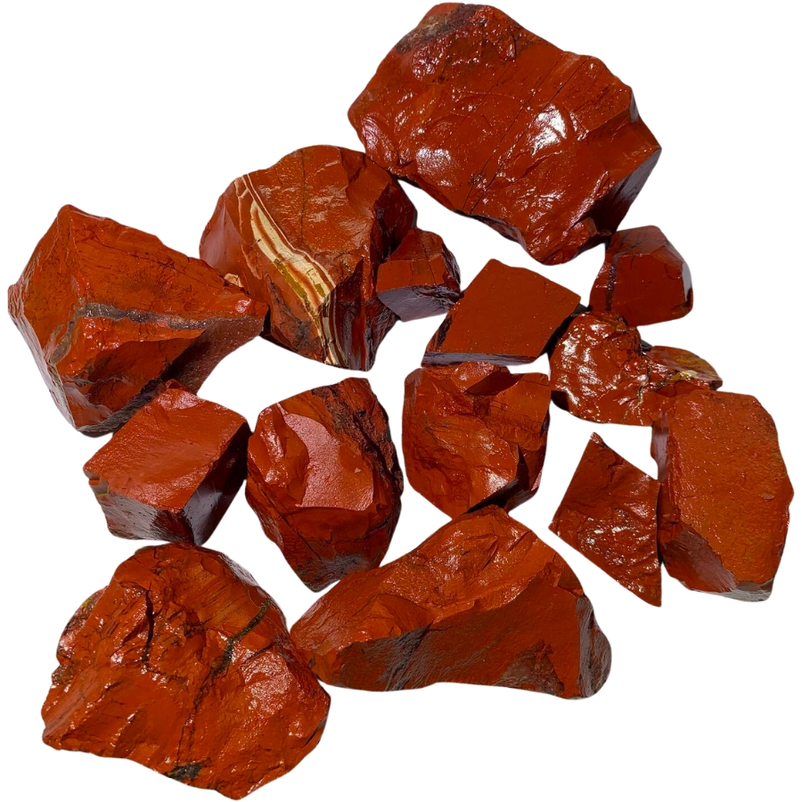
Jasper is solid colored chalcedony in red, brown, and yellow, and Maine’s volcanic rock produces it in quantity. The famous red jasper beach in Washington County is the state’s showpiece, and rounded jasper pebbles turn up in the St. Croix drainage too.
Chiastolite
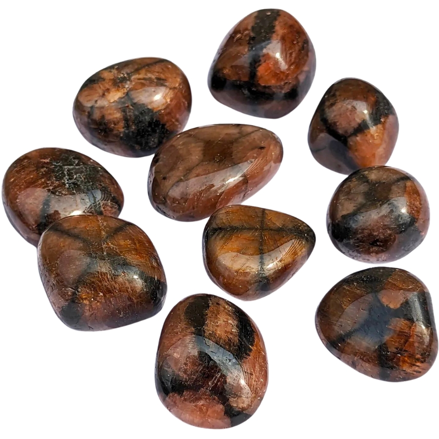
Chiastolite is a variety of andalusite that grows a dark cross inside the crystal, which makes it one of the most striking things you can pick out of Maine gravel. It forms in the same metamorphic rock that hosts the state’s gold veins.
Every one of these can end up in your pan or your pocket on a gold trip, and every one of them is easy to walk past when it is wet and dirty. The New England Rocks and Minerals Field Guide gives you photos of all of them on waterproof pages, so nothing valuable goes back in the stream by mistake.
Legal Rules for Gold Prospecting in Maine

Read this before you put a pan in the water. We are rockhounds, not lawyers, and nothing here is legal advice. Rules change, and staying legal is entirely your responsibility.
Private Property
This is the big one in Maine. The water in a Maine stream is public, but the gravel and the minerals in the bed belong to whoever owns the land, so prospecting without permission is taking someone’s property. Maine also has a strong tradition of private land staying open to respectful recreation, and a state law that protects landowners who allow it, which is why so much of the state is walkable.
Northern and western Maine are dominated by commercial timberland, and much of the far north is managed for public access by North Maine Woods, which runs gated checkpoints and charges a small day use fee. Elsewhere, a phone call to the timber company or a stop at the local rock shop usually gets you a yes. A quick ask ahead of time keeps every flake you find 100% yours.
Public Land and Federal Land
Maine’s state parks and public reserved lands are managed by the Bureau of Parks and Lands, and their rules govern what you can do on each unit, so check with the bureau for the specific parcel before you plan a dig. The Maine slice of the White Mountain National Forest is the one federal option in this guide, and the Forest Service issues a free recreational panning permit for it.
Acadia National Park is closed to prospecting, as every national park in the country is. Designated wilderness areas are closed to mineral activity as well.
Equipment Restrictions
A pan and hand tools are the safe baseline statewide. Maine allows hand panning and hand sluicing with no state permit as long as you do not disturb the stream banks, do not remove vegetation, keep your sluice under ten square feet, and restore the streambed before you leave.
Motorized prospecting is a separate world. It runs only from June 15 to September 15, requires written landowner permission, caps you at seven horsepower with a suction hose no larger than four inches, and bans mercury, nitric acid, and any stream diversion. The Department of Environmental Protection handles organized towns and the Land Use Planning Commission handles the unorganized townships, and a full permit application carries a fee.
The state also names specific waters where motorized prospecting is off limits, including the Sandy River from Madrid to Phillips, Gold Brook in Bowmantown, and Kibby Stream, along with Class AA waters and designated brook trout and Atlantic salmon habitat. Hand panning is still on the table at those places.
Play it safe on every trip. Confirm access directly with the landowner or the managing agency before you dig, because boundaries and rules change without notice.
Some locations in this guide sit on or near ground where collecting is limited. When in doubt, treat a spot as look but do not take until you have confirmation in hand.
The best shortcut is local knowledge. Maine’s rock and mineral clubs and prospecting clubs know which stretches are open, which gates are unlocked, and which landowners welcome visitors, and a membership usually pays for itself in access alone.
Maine Gold FAQ
Can you find gold in Maine?
Yes, you can find gold in Maine, and people do it every summer. The Maine Geological Survey names eleven stretches of river and brook where gold has been recovered, including the Swift River, the Sandy River, Nile Brook, Kibby Stream, and the St. Croix River. Most Maine gold is flour gold and flakes, with the coarsest pieces coming out of the Swift River drainage in Oxford County.
Where can you pan for gold in Maine?
Coos Canyon in Byron is the best known spot, a free town park on Route 17 where the Swift River runs through a bedrock gorge. The Sandy River in Franklin County, Nile Brook near Rangeley, the South Branch Penobscot River in Somerset County, and the St. Croix River at Baileyville are all named by the state as gold waters. The best places section above covers the access rules for each one.
Do you need a permit to pan for gold in Maine?
Hand panning and hand sluicing need no state permit in Maine as long as you leave the stream banks undisturbed, keep your sluice under ten square feet, and restore the streambed. You do need landowner permission, because the gravel in a Maine streambed is private property. Motorized prospecting is a different matter and requires written landowner permission plus a permit review from the state.
What river in Maine has the most gold?
The Swift River in Oxford County is the most productive gold river in Maine and the one prospectors travel for. It runs from Byron down through Roxbury and Mexico, and its East Branch has the state’s best reputation for coarse gold. The Sandy River in Franklin County is the runner up and gives you far more miles of legal water to work.
Is gold panning legal in Maine?
Gold panning is legal in Maine on any water where you have the landowner’s permission and you follow the state’s rules on stream banks and equipment. The Maine Geological Survey states that panning is allowed without a special state permit as long as the banks are not disturbed and no unlicensed discharge is created. The White Mountain National Forest requires its own free permit, and national parks are closed to it entirely.
Get Every Find In Your Pan Identified In Seconds
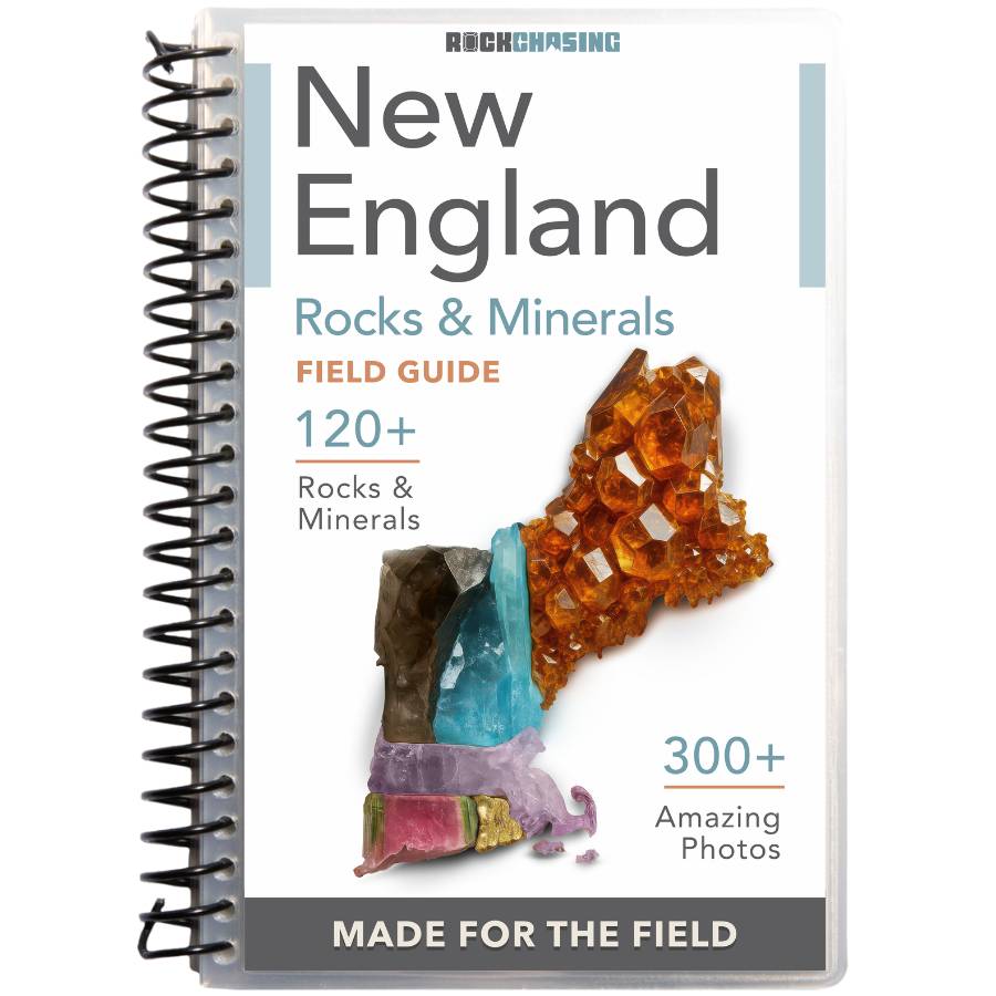
Every pan you pull out of a Maine stream is a question until you can name what is in it. Gold, pyrite, mica, garnet, and tourmaline all show up in the same gravel, and the difference between them can be hundreds of dollars.
The New England Rocks and Minerals Field Guide identifies 120 rocks, minerals, crystals, and gemstones with more than 300 color photos, printed on waterproof pages that work right at the water’s edge.