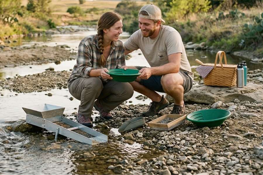
Gold hunting is still very much alive in Texas, and if you know where to look, you can find it. While many people think of oil when they think of Texas, there are many areas around the state that have been producing fine gold for over a century.
Our team of geologists and experienced rockhounds has spent decades studying the geology and conditions that produce gold deposits. We focus on the science of how gold moves through the landscape to help you narrow down your search. This expert approach ensures you are looking in areas with a high probability of success.
This guide covers the best places to find gold in Texas, from well-known waters like the Llano River and Sandy Creek to the rugged terrain of the Trans-Pecos region. We provide the geological context you need to understand where heavy metals settle in these specific waterways.
Here is exactly where to look. Let’s get started on your Texas prospecting journey.
What You Will Learn
- The biggest gold strike in Texas history
- The different types of gold you can find in Texas
- How to identify gold from lookalikes
- The other valuable rocks and minerals you can find while gold hunting
- The best places to hunt for gold in Texas
- The basic gold hunting equipment you will need
- When to go hunting
- Understanding the laws for the state
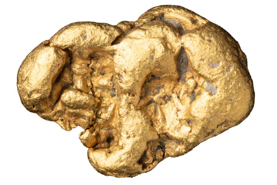
The Largest Gold Strike in Texas History – The Hazel Mine Strike
The most significant precious metal strike in Texas history occurred at the Hazel Mine in Culberson County, where miners extracted millions of dollars in wealth.
While the mine was famous for silver, it produced a staggering amount of gold as a byproduct, making it one of the most successful operations in the state. At today’s market prices, the total value of the metals pulled from this single location would be worth tens of millions of dollars.
This massive discovery happened because of a unique geological “fissure” where hot, mineral-rich water rose through cracks in the red sandstone. As the water cooled near the surface, it deposited heavy metals into thick, rich veins.
This simple natural process created a concentrated treasure chest that stayed hidden for thousands of years until its discovery in the 1880s.
The Different Types of Gold You Can Find in Texas
There are several different forms of gold that you can be found around Texas including:
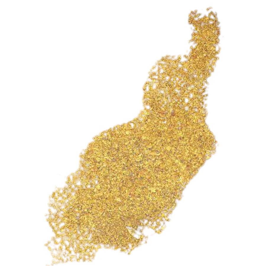
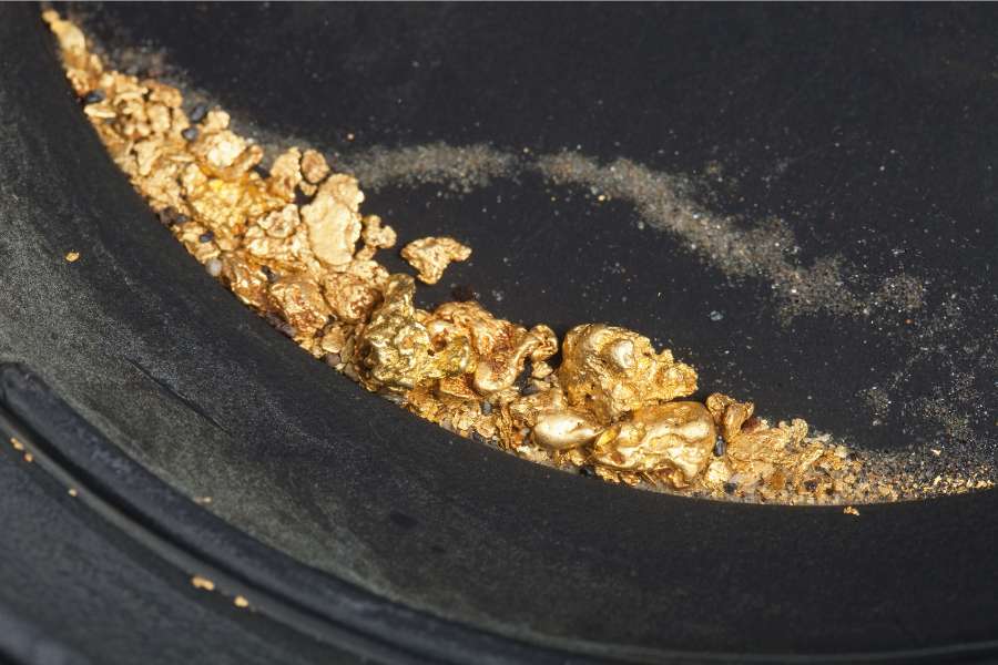
Flour Gold
Flour gold consists of tiny flakes that look like shiny yellow dust. You will usually find these tiny specks mixed in with dark black sand along the riverbanks of the Llano River. Because it is very light, it responds beautifully to careful panning techniques.
Beginners sometimes see shiny yellow mica and wonder if they have found gold. You can tell the difference because real gold stays bright yellow even in the shade, while mica loses its shine. Our Texas field guides show you exactly how to test these minerals in the wild so you can be confident in your find.
Standard pans work well, but you can increase your catch by using a Minelab PRO-GOLD 15 Inch Dual Riffle Pan and a Stansport Gold Snuffer Bottle to trap these tiny pieces. Read our section below on the exact gold hunting equipment you need to make sure you have the right gear.
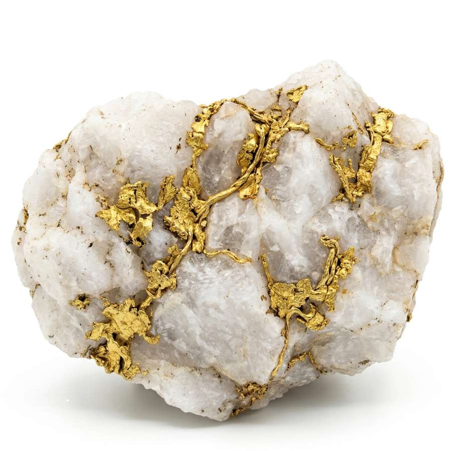
Lode Gold
Lode gold is gold that is still tucked inside its original host rock, which is usually white quartz. In Texas, you might find these small “stringers” of gold in the hard rock outcrops of the Llano Uplift. These specimens look like jagged yellow veins or wires frozen inside the stone.
Many people enjoy learning to distinguish yellowish iron stains from real lode gold. Real gold will be metallic and malleable, while iron stains are just flat colors on the rock surface.
Extracting gold from hard rock is a fun challenge that requires the right equipment. You will want a professional Estwing Geo Paleo Rock Pick to sample these outcrops. Check out our equipment guide below to see the best tools for your adventure.
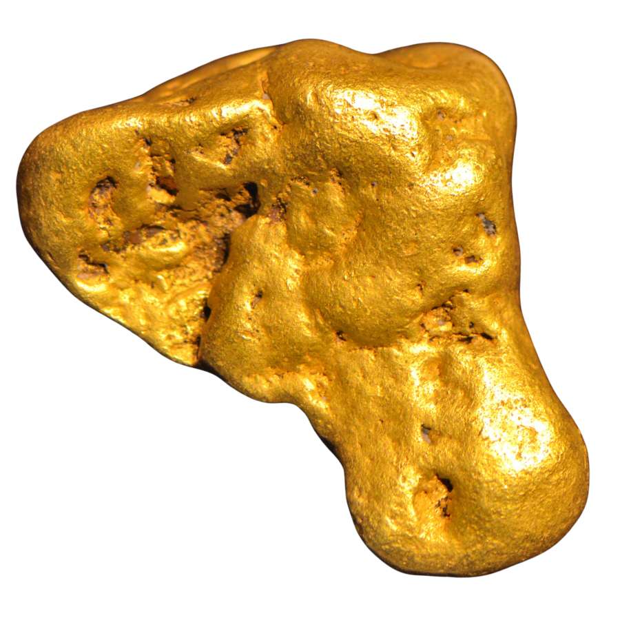
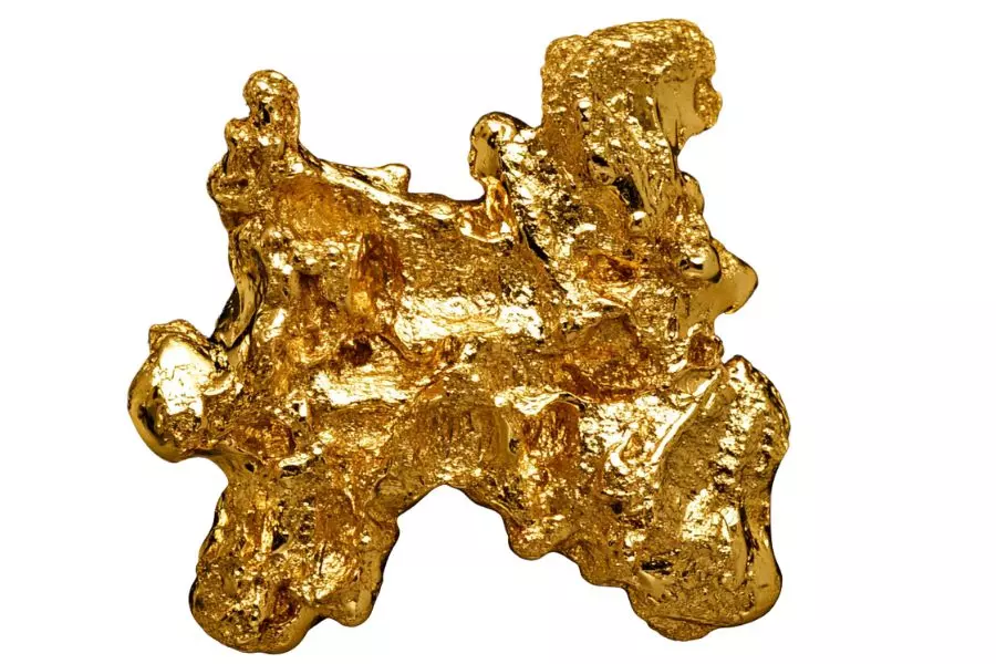
Placer Nuggets
While rare, small placer nuggets can be found in Texas where heavy gold has settled into deep bedrock pockets. These are small, rounded pieces of gold that have been tumbled by the river until they are smooth. Finding a small nugget is a thrilling experience for any prospector.
Sometimes people find heavy lead or shiny pebbles and mistake them for nuggets. You can tell it is real gold because it is much heavier than other rocks and will not break when struck.
To find these heavier pieces, you often need to reach deep into the cracks of the riverbed. An ASR Outdoor Steel Crevice Tool Set is the perfect tool for reaching those hidden spots where nuggets hide. Learn more about these tools in our equipment section below.
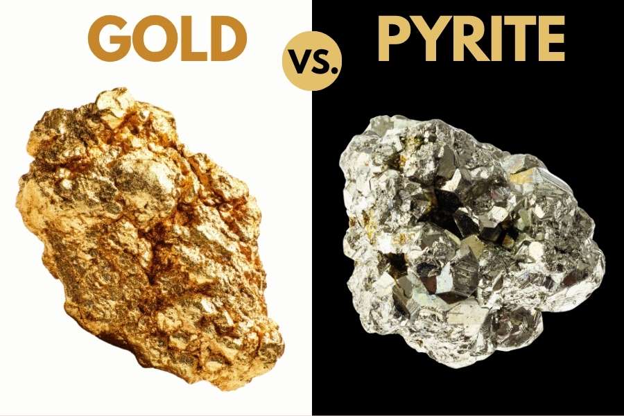
Finding shiny yellow metal in the dirt is thrilling but you should never celebrate too early. Pyrite is famously known as fool’s gold because it tricks so many beginners into thinking they struck it rich. You must always test your find properly before you get too excited.
The shadow test
The easiest way to check your find is to block the sun with your hand. Real gold keeps its bright yellow glow even when it is in a dark shadow. Pyrite will lose its metallic shine and look like a dull greenish-black rock when you take it out of the direct light.
The poke test
You can also test the metal by poking it with a small needle or a knife point. Real gold is very soft and will dent or bend, while brittle pyrite will simply shatter into tiny pieces.
There are several other rocks and minerals that are also mistaken for gold. It’s always a good idea to have a trusty field guide, like our guide to Texas rocks and minerals, as your insurance policy against these mistakes so you never walk past a valuable specimen or throw away real treasure.
How gold formed in Texas
Understanding the geological history of Texas is the secret to knowing exactly where to look for gold. Long before it was the Lone Star State, parts of Texas were shaped by massive volcanic eruptions and shifting tectonic plates.
These powerful natural events are what pushed precious metals from deep within the earth up to the surface where we can find them today.
The most important event for gold hunters was the formation of the Llano Uplift over a billion years ago. During this time, hot magma and mineral-rich fluids were forced into cracks in the earth’s crust.
As these fluids cooled, they formed veins of quartz and granite that carried tiny amounts of gold. This ancient “basement” of rock was eventually pushed upward, and over millions of years, the softer rocks on top eroded away, exposing the gold-bearing formations we see today.
Where gold accumulates in Texas
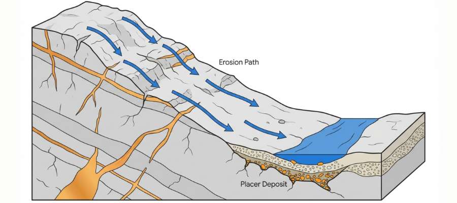
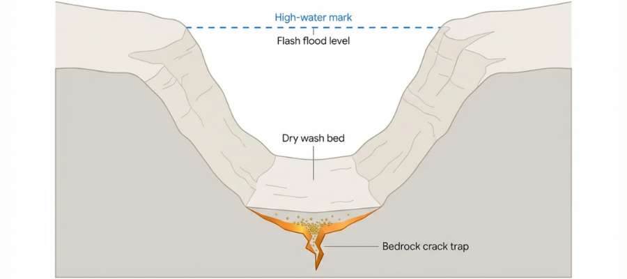
There are specific geological “traps” where gold is much more likely to be found around Texas. Gold is extremely heavy, about 19 times heavier than water, which means it always follows a predictable paths and behaviors.
We’ll get into specific locations in the next chapter, but you will want to keep an eye out for these traps anywhere you are looking.
Here are the five best general locations to search in any gold-bearing region:
Inside Bends of Rivers
When a river curves, the water on the outside of the bend moves fast, while the water on the inside slows down. Because gold is so heavy, it cannot stay suspended in slow-moving water and drops to the bottom.
Search the gravel bars on the inside curves of a river. This is one of the most reliable places to find “pay streaks” where gold has concentrated over many years.
Behind Large Boulders
Large rocks and boulders act as natural obstructions in a stream. As water flows over or around a big rock, it creates a small pocket of calm water directly behind it. Gold often drops into these quiet zones and settles into the sand.
Use your Rock Chasing field guide to help you identify the right types of heavy black sands that usually hide right alongside the gold in these spots.
Bedrock Cracks and Crevices
Think of the bottom of a river like a giant gold trap. If the riverbed is made of solid rock (bedrock), any cracks or “potholes” in that rock act like natural riffles in a gold pan.
Gold falls into these deep cracks and stays there, even during heavy flooding. Use an ASR Outdoor Steel Crevice Tool Set to scrape the packed material out of these tight spots.
Where a Fast Stream Meets a Slow River
When a fast-moving mountain stream empties into a wider, slower-moving river, the sudden drop in water speed causes heavy minerals to fall out of suspension immediately.
These “confluence” points are excellent places to set up a sluice or start panning. The sudden change in energy creates a massive natural drop-zone for gold of all sizes.
High-Water Benches (Old River Channels)
Rivers change their path over thousands of years. Sometimes, the “old” riverbed is now a dry bench sitting high above the current water level. These areas are called “ancient placers.”
If you see a line of rounded river rocks sitting on a hillside above a creek, you are looking at an old channel that might still hold gold that was deposited centuries ago.
The Best Locations to Find Gold in Texas (By Region)
These are the proven spots for finding gold organized by region and county. We break them out into the 5 regions of the state and then have them listed alphabetically by county.
Always Confirm Access and Collection Rules!
Before heading out to any of the locations on our list you need to confirm access requirements and collection rules for both public and private locations directly with the location. We haven’t personally verified every location and the access requirements and collection rules often change without notice.
Many of the locations we mention will not allow collecting but are still great places for those who love to find beautiful rocks and minerals in the wild without keeping them. We also can’t guarantee you will find anything in these locations since they are constantly changing.
Always get updated information directly from the source ahead of time to ensure responsible rockhounding. If you want even more current options it’s always a good idea to contact local rock and mineral clubs and groups
Central Texas
The Blanco River
The Blanco River cuts through the beautiful limestone hills of Blanco County. While it is not famous for large nuggets the river does carry very fine flour dust. The water here is famous for being incredibly clear which makes identifying underwater bedrock cracks very simple and allows prospectors to see exactly how the heavy sand moves along the bottom.
County: Blanco County
Closest city: Blanco
Difficulty level: 3 out of 5
Other Notable Rocks and Minerals: White Limestone, Chert
Hickory Creek
Hickory Creek flows gently through the sandy terrain of the central mineral region. The creek is relatively small and often dries up into isolated pools during the intense summer heat, which makes it incredibly easy to reach the deepest and most productive bedrock cracks.
The creek dirt contains a huge mixture of broken feldspar crystals and smooth milky quartz.
County: Blanco County
Closest city: Johnson City
Difficulty level: 3 out of 5
Other Notable Rocks and Minerals: Milky Quartz, Feldspar
The Colorado River
The Upper Colorado River sparked a minor but exciting rush in the early eighteen fifties. While it never reached the scale of the California rush the river continues to hold fine placer deposits today.
The heavy metals found here have been flattened into tiny flakes by miles of brutal river tumbling. The sandy banks are filled with heavy pieces of petrified wood and tumbled jasper.
County: Burnet County
Closest city: Marble Falls
Difficulty level: 3 out of 5
Other Notable Rocks and Minerals: Petrified Wood, Jasper
Coal Creek
Coal Creek is another fascinating waterway cutting through the Gillespie County serpentine deposits. The creek earned a reputation among local rockhounds for producing rare minerals that are not found anywhere else in the state.
The local gravel is packed with heavy magnetite and occasional pieces of chromite, which are highly magnetic and will stick firmly to any simple hand magnet.
County: Gillespie County
Closest city: Willow City
Difficulty level: 4 out of 5
Other Notable Rocks and Minerals: Magnetite, Chromite
Fredericksburg Creeks
The small creeks running through and around the historic town of Fredericksburg carry surprisingly good color. The urban environment means prospectors must be extremely mindful of local city ordinances and park rules.
The local limestone constantly breaks down and fills the creeks with fine white powder, making careful and slow washing required to see the heavy metals shining at the bottom.
County: Gillespie County
Closest city: Fredericksburg
Difficulty level: 2 out of 5
Other Notable Rocks and Minerals: White Limestone Mud
Legion Creek
Legion Creek cuts through the interesting serpentine rock formations of Gillespie County. The creek is very narrow and heavily shaded by large oak trees lining the banks.
The tree roots reach directly into the water and create fantastic natural traps for heavy sand. Searchers will find massive amounts of green serpentine rock and occasional pieces of talc.
County: Gillespie County
Closest city: Fredericksburg
Difficulty level: 3 out of 5
Other Notable Rocks and Minerals: Serpentine, Talc
North Grape Creek
North Grape Creek is located in Gillespie County near the historic and aptly named town of Gold. The creek still produces very fine particles of precious metal for those who know exactly where to dig.
Because the surrounding rock is relatively light the heavy metals sink extremely fast through the loose gravel, meaning prospectors must dig all the way down to the hard clay layers to find the trapped deposits.
County: Gillespie County
Closest city: Fredericksburg
Difficulty level: 2 out of 5
Other Notable Rocks and Minerals: Limestone Cobbles
The Guadalupe River
The Guadalupe River near Kerrville has recently gained attention for producing small but beautiful nuggets. The wide limestone bed creates numerous shallow rapids and deep stagnant pools.
The sudden changes in water speed force the river to drop its heaviest materials directly into the deep holes. The riverbanks are lined with massive cypress trees that create incredible natural traps in their roots.
County: Kerr County
Closest city: Kerrville
Difficulty level: 2 out of 5
Other Notable Rocks and Minerals: Yellow Chert, Flint
Baby Head Creek
Baby Head Creek features a rich history of early mineral exploration and scattered mining efforts. The creek bed still holds residual heavy metals that escape from the old historic dig sites.
The surrounding dirt is packed with rough granite chunks and scattered iron ore, which prospectors must sift through to reach the untouched bedrock below.
County: Llano County
Closest city: Llano
Difficulty level: 3 out of 5
Other Notable Rocks and Minerals: Granite Chunks, Iron Ore
Big Sandy Creek
Big Sandy Creek offers fantastic recreational prospecting opportunities for those willing to hike. The creek acts as a natural funnel for the heavy minerals washing down from the elevated granite formations.
The riverbed is absolutely loaded with beautiful granite river rocks and heavy pieces of hematite, an iron oxide mineral that sinks incredibly fast in moving water.
County: Llano County
Closest city: Llano
Difficulty level: 3 out of 5
Other Notable Rocks and Minerals: Hematite, Granite
Bull Head Creek
Bull Head Creek is another highly recommended waterway in the central mineral region. The stream constantly reshapes the sandbars during heavy spring floods which creates brand new deposits every single year.
The gravel here holds an abundance of broken feldspar and small quartz crystals, which wash out of the local pegmatite rocks and travel alongside the heavier metals.
County: Llano County
Closest city: Llano
Difficulty level: 3 out of 5
Other Notable Rocks and Minerals: Feldspar, Quartz
Kingsland Slab
The Kingsland Slab is a massive exposure of solid bedrock located directly on the Llano River. The river flows as a thin sheet of water entirely over this giant flat rock.
The rock is filled with thousands of tiny cracks and deep crevices that act as perfect natural traps for heavy metals. Every single crack is packed tightly with heavy black sand and tiny garnets.
County: Llano County
Closest city: Kingsland
Difficulty level: 1 out of 5
Other Notable Rocks and Minerals: Black Sand, Garnets
Packsaddle Mountain Creeks
Packsaddle Mountain is a famous local landmark surrounded by steep and rocky drainage creeks. The creeks surrounding the base of the mountain definitely carry legitimate trace amounts of heavy metals washed down from the slopes.
The dirt here contains massive amounts of local schist and crumbly metamorphic rock, which breaks apart very easily in the water and releases its trapped minerals.
County: Llano County
Closest city: Kingsland
Difficulty level: 4 out of 5
Other Notable Rocks and Minerals: Schist, Metamorphic Rock
Pecan Creek
Pecan Creek runs directly through the central mineral belt before emptying into the Llano River. This specific tributary is known to carry fine flour gold mixed tightly into the local dirt.
Prospectors will encounter extreme amounts of black sand while digging in this specific creek, which is incredibly dense and makes processing the dirt a very slow task.
County: Llano County
Closest city: Llano
Difficulty level: 2 out of 5
Other Notable Rocks and Minerals: Black Sand, Iron
Sandy Creek
Sandy Creek offers excellent access just south of the town of Llano. This waterway is highly regarded by local prospectors because it cuts deeply through ancient gold bearing granite.
The heaviest materials always sink through the loose sand and rest directly on the solid stone floor. Digging in this creek bed frequently yields small pieces of beautiful blue topaz.
County: Llano County
Closest city: Llano
Difficulty level: 2 out of 5
Other Notable Rocks and Minerals: Quartz
The Llano River
The Llano River is one of the most famous gold panning spots in central Texas. The water flows over ancient rocks and drops heavy gold flakes directly into the sandy gravel bars. The heaviest deposits are usually found securely trapped behind large boulders in the main water channel.
Hunters will also find a lot of interesting quartz and colorful agates mixed into this river gravel.
County: Llano County
Closest city: Llano
Difficulty level: 2 out of 5
Other Notable Rocks and Minerals: Agates, Quartz, Iron Stones, Black Sand
Walnut Creek
Walnut Creek is a highly popular destination located just a short drive from the main Llano River. The creek boasts a very rocky bottom that creates hundreds of natural riffles and drop pools.
The local dirt is incredibly rich in dark mica flakes and small pieces of smoky quartz. Beginners frequently mistake the shiny mica for real treasure because it glitters brightly in the shallow water.
County: Llano County
Closest city: Llano
Difficulty level: 2 out of 5
Other Notable Rocks and Minerals: Mica, Smoky Quartz
Comanche Creek
Comanche Creek is a remote and quiet stream located deep within Mason County. The water moves sluggishly through the thick vegetation and rarely clears completely, forcing prospectors to dig mostly by feel rather than sight.
The stream bed is heavily paved with flat limestone rocks and sharp flint nodules.
County: Mason County
Closest city: Mason
Difficulty level: 3 out of 5
Other Notable Rocks and Minerals: Flint Nodules, Limestone
Hasse Creek
Hasse Creek moves slowly through flat agricultural lands before joining the main river systems. The water here is often murky and the banks are lined with thick clay deposits instead of clean sand.
Washing the clay away reveals small pieces of petrified wood and ancient aquatic fossils.
County: Mason County
Closest city: Mason
Difficulty level: 3 out of 5
Other Notable Rocks and Minerals: Fossils, Petrified Wood
Honey Creek
Honey Creek flows through Mason County and carries very fine particles of precious metals. The water moves slowly through the dense limestone and granite environment.
Searchers will frequently uncover heavy iron stones and dark black sand while working the creek dirt.
County: Mason County
Closest city: Mason
Difficulty level: 2 out of 5
Other Notable Rocks and Minerals: Topaz
Katemcy Creek
Katemcy Creek flows directly past massive pink granite outcroppings that define this specific region. The water cuts directly through these hard rocks creating deep and permanent natural sluices.
The sand here is extremely coarse and entirely made of degraded pink granite, with small garnets and tiny pieces of shiny mica mixed heavily throughout.
County: Mason County
Closest city: Mason
Difficulty level: 3 out of 5
Other Notable Rocks and Minerals: Garnets, Mica
Koocks Branch
Koocks Branch is a tiny waterway that gently meanders through open grassy fields. The lack of strong current means the gold dust is distributed very evenly across the stream bottom.
The creek bottom is covered in very fine silica sand and tiny fragments of broken shells.
County: Mason County
Closest city: Mason
Difficulty level: 3 out of 5
Other Notable Rocks and Minerals: Silica Sand, Shells
Little Willow Creek
Little Willow Creek serves as a small but active tributary in the Mason County watershed. The sudden expansion of the creek bed creates massive piles of accumulated rocks and gravel.
Digging in these widened drop zones reveals tons of crushed granite and heavy iron stones.
County: Mason County
Closest city: Mason
Difficulty level: 3 out of 5
Other Notable Rocks and Minerals: Iron Stones, Granite
Mitchell Creek
Mitchell Creek features a heavily eroded bedrock bottom that looks like a giant washboard. The deepest grooves located immediately after a shallow shelf hold the most promise.
The grooves are always packed tightly with dense black sand and small lead pieces left behind by hunters.
County: Mason County
Closest city: Mason
Difficulty level: 3 out of 5
Other Notable Rocks and Minerals: Lead Bullets, Black Sand
Mud Creek
Mud Creek certainly lives up to its name with extremely steep and slippery clay banks. The heavy metals wash out of the collapsing walls and gather in the deepest pools directly below.
The local dirt is rich in strange calcium formations and heavy iron nodules.
County: Mason County
Closest city: Mason
Difficulty level: 3 out of 5
Other Notable Rocks and Minerals: Calcium Formations, Iron
Spice Creek
Spice Creek is notoriously difficult to access due to thick brush and extremely rugged terrain. The water weaves violently through the boulder field and creates intense localized whirlpools.
The gravel here holds an amazing variety of minerals including garnet fluorite and large quartz crystals.
County: Mason County
Closest city: Mason
Difficulty level: 4 out of 5
Other Notable Rocks and Minerals: Garnet, Fluorite
Tiger Creek
Tiger Creek relies on seasonal rains to push water through its steep and rocky channel. The fast moving water strips away the light silt and leaves a completely clean rocky bottom.
Searchers will find massive chunks of solid quartz and heavy iron concretions wedged into the tightest spots.
County: Mason County
Closest city: Mason
Difficulty level: 3 out of 5
Other Notable Rocks and Minerals: Quartz, Iron Concretions
Willow Creek
Willow Creek winds through the mineral rich terrain of Mason County. Heavy rains occasionally wash new deposits of fine flour gold down from the surrounding granite hills. The gravel bars here are famous for trapping beautiful pieces of clear quartz.
Searchers will also uncover dense black sand which is an excellent indicator that heavy metals are nearby.
County: Mason County
Closest city: Mason
Difficulty level: 3 out of 5
Other Notable Rocks and Minerals: Clear Quartz, Black Sand
Wolf Branch
Wolf Branch is a very small seasonal wash that feeds into the larger Mason County rivers. It rarely holds flowing water for long and usually appears as a dry rocky ditch. The dry dirt is incredibly dusty and packed tightly with sharp angular rocks that have not been smoothed by water.
Small pieces of raw blue topaz occasionally wash into this ravine from the higher elevations.
County: Mason County
Closest city: Mason
Difficulty level: 4 out of 5
Other Notable Rocks and Minerals: Blue Topaz, Angular Rocks
The San Saba River
The San Saba River carries legendary tales of lost Spanish mines and hidden silver caches. The deep channels make accessing the bedrock incredibly difficult without specialized underwater breathing equipment.
Limestone and dense chert nodules dominate the gravel bars along this river.
County: San Saba County
Closest city: San Saba
Difficulty level: 3 out of 5
Other Notable Rocks and Minerals: Chert, Flint
West Texas
Cave Peak Area
Cave Peak is a highly isolated geological feature located north of the town of Van Horn. The area is famous among geologists for containing extremely rare minerals like molybdenum and tungsten.
The ground contains heavy pieces of the tungsten mineral known as scheelite, which glows a bright neon blue under a shortwave ultraviolet light.
County: Culberson County
Closest city: Van Horn
Difficulty level: 5 out of 5
Other Notable Rocks and Minerals: Scheelite
Hazel Mine Washes
The Hazel Mine in Culberson County was historically the second largest producing silver mine in the entire state. The vast network of dry sandy washes surrounding the old property catches everything that washes off the mountain.
The sand is full of strange copper carbonates like bright green malachite and deep blue azurite.
County: Culberson County
Closest city: Van Horn
Difficulty level: 4 out of 5
Other Notable Rocks and Minerals: Malachite, Azurite
The Van Horn Mountains
The Van Horn Mountains present a massive and imposing landscape full of highly complex geology. The deep ravines cutting through the mountains hold ancient placer deposits that have sat undisturbed for thousands of years.
The rocks here are incredibly diverse and include heavy chunks of raw barite and colorful fluorite.
County: Culberson County
Closest city: Van Horn
Difficulty level: 5 out of 5
Other Notable Rocks and Minerals: Barite, Fluorite
El Paso Area Washes
The mountains immediately surrounding El Paso hold the absolute oldest recorded mining history in the state. The deep dry washes leading out of the Franklin Mountains still hide forgotten heavy minerals from these ancient Spanish efforts.
The gravel consists mostly of shattered limestone and heavily weathered silver ores. County: El Paso County
Closest city: El Paso
Difficulty level: 4 out of 5
Other Notable Rocks and Minerals: Silver Ores, Limestone
Alice Ray Mine Area
The Alice Ray Mine sits adjacent to the Bonanza Mine and shares the exact same rich fault line. The slopes below the mine are incredibly steep and covered in loose sliding rock.
Searchers will find beautiful green epidote crystals and long black tourmaline crystals in the dirt.
County: Hudspeth County
Closest city: Sierra Blanca
Difficulty level: 5 out of 5
Other Notable Rocks and Minerals: Epidote, Tourmaline
Allamoore District Washes
The Allamoore District features lower rolling hills that are heavily scarred by ancient geological pressures. The flat nature of the terrain means flood waters spread out widely and lose energy very quickly.
The dirt is filled with heavy pieces of pure white quartz and dark red jasper.
County: Hudspeth County
Closest city: Van Horn
Difficulty level: 4 out of 5
Other Notable Rocks and Minerals: White Quartz, Jasper
Bonanza Mine Area
The Bonanza Mine is a historic and highly productive site located within the northern Quitman Mountains. Gravity slowly pulls the heavy ores out of the old mine dumps and down into the deep ravines below.
The local dirt is heavily stained red by massive amounts of oxidizing iron, and prospectors will also find lovely red garnet crystals mixed tightly into the heavy sand.
County: Hudspeth County
Closest city: Sierra Blanca
Difficulty level: 5 out of 5
Other Notable Rocks and Minerals: Red Garnet, Iron
Sierra Blanca Peaks
The Sierra Blanca peaks stand out dramatically from the surrounding desert due to their bright white rock formations. The loose rhyolite rock shifts constantly underfoot and makes walking a major chore.
The dirt is filled with incredibly sharp pieces of white rhyolite and solid chunks of clear quartz.
County: Hudspeth County
Closest city: Sierra Blanca
Difficulty level: 4 out of 5
Other Notable Rocks and Minerals: Rhyolite, Quartz
The Eagle Mountains
The Eagle Mountains in Hudspeth County hold a rich history of producing valuable industrial minerals. Heavy metals wash down from the highest peaks and settle into the deep bowls located between the sharp ridges.
Prospectors will find massive quantities of purple and green fluorite scattered across the ground.
County: Hudspeth County
Closest city: Sierra Blanca
Difficulty level: 5 out of 5
Other Notable Rocks and Minerals: Purple/Green Fluorite
The Quitman Mountains
The Quitman Mountains in Hudspeth County hold a massive variety of complex mineral veins. The steep desert canyons channel explosive flood waters during the monsoon season which moves tons of heavy rock.
The ground here glitters with raw copper minerals and shiny pieces of zinc ore.
County: Hudspeth County
Closest city: Sierra Blanca
Difficulty level: 5 out of 5
Other Notable Rocks and Minerals: Copper Minerals, Zinc
Chinati Mountains Washes
The Chinati Mountains are the result of massive ancient volcanic eruptions that baked the surrounding landscape. The volcanic activity pushed rich mineral fluids into the rock fractures creating enormous veins of silver and lead.
The dry creek beds are littered with sharp volcanic glass and lightweight pumice stones.
County: Presidio County
Closest city: Shafter
Difficulty level: 5 out of 5
Other Notable Rocks and Minerals: Volcanic Glass, Pumice
Cibolo Creek
Cibolo Creek runs directly through the historic Shafter Mining District in Presidio County. The flash floods act like a giant natural broom sweeping fresh heavy metals out of the mountains and down into the lowlands.
The dry gravel is absolutely loaded with heavy lead ore and dark pieces of raw silver ore.
County: Presidio County
Closest city: Shafter
Difficulty level: 4 out of 5
Other Notable Rocks and Minerals: Lead Ore, Silver Ore
Presidio Mine Washes
The dry washes surrounding the famous Presidio Mine are incredibly rich in heavy minerals. The raw dirt blowing across the desert floor still contains valuable trace metals that escaped the old processing mills.
Prospectors will constantly uncover bright yellow jarosite and heavy chunks of galena while digging in this desert sand.
County: Presidio County
Closest city: Presidio
Difficulty level: 5 out of 5
Other Notable Rocks and Minerals: Jarosite, Galena
Red Hills Prospect Washes
The Red Hills prospect features a massive zone of fractured rock containing deep copper deposits. The constant oxidation of the copper and iron turns the surrounding desert dirt a deep rust red color.
Searchers will find the dirt is packed with brittle iron caps and heavy rocks called gossans.
County: Presidio County
Closest city: Presidio
Difficulty level: 4 out of 5
Other Notable Rocks and Minerals: Caps, Gossans
North and East Texas
The Trinity River
The Elm Fork of the Trinity River near Dallas has a surprisingly rich history tied to the famous forty niners. The river is massive and heavily modified today but the ancient gravel bars still hold fine heavy metals.
Searchers will uncover hundreds of historic artifacts like old square nails and antique glass bottles in the gravel.
County: Dallas County
Closest city: Dallas
Difficulty level: 3 out of 5
Other Notable Rocks and Minerals: Historic Artifacts, Glass
Coffee Mill Creek
Coffee Mill Creek is located far to the north in Fannin County near the Red River system. The creek carries tiny amounts of very fine flour gold that originated from ancient glacial pushes.
The mud here is packed with incredible pieces of ancient petrified wood and small fossils.
County: Fannin County
Closest city: Bonham
Difficulty level: 2 out of 5
Other Notable Rocks and Minerals: Petrified Wood, Fossils
The Brazos River
The Brazos River near Waco features massive sandbars that shift and move with every major rainstorm. Prospectors must look for the distinct layers of black sand buried deep inside the towering riverbanks.
The sand is incredibly fine and contains beautifully polished pieces of small clear quartz.
County: McLennan County
Closest city: Waco
Difficulty level: 3 out of 5
Other Notable Rocks and Minerals: Clear Quartz, Black Sand
The Sabine River
The Sabine River forms the eastern border of the state and moves incredibly slowly through dense swamps. Finding natural heavy metals here is extremely difficult because the thick mud swallows everything heavy instantly.
The river bottom is littered with ancient heavy logs and dense iron concretions.
County: Sabine County
Closest city: Hemphill Difficulty level: 4 out of 5
Other Notable Rocks and Minerals: Iron Concretions, Wood
South Texas
Gazley Creek
Gazley Creek is located in Bastrop County and is a very popular spot for recreational prospectors. The sandy bottom is extremely soft and requires very little effort to dig through.
The local gravel is loaded with beautiful pieces of petrified palm wood. County: Bastrop County
Closest city: Bastrop
Difficulty level: 2 out of 5
Other Notable Rocks and Minerals: Petrified Palm Wood
The Leona River
The Leona River flows southward through Uvalde County across flat agricultural plains. The completely flat terrain provides no natural bedrock features to trap the moving metals.
The river banks are composed of incredibly fine silt and thick agricultural loam holding massive amounts of small heavy flint nodules and sharp chert flakes.
County: Uvalde County
Closest city: Uvalde
Difficulty level: 3 out of 5
Other Notable Rocks and Minerals: Flint Nodules, Chert
The Equipment You Want to Start Hunting For Gold
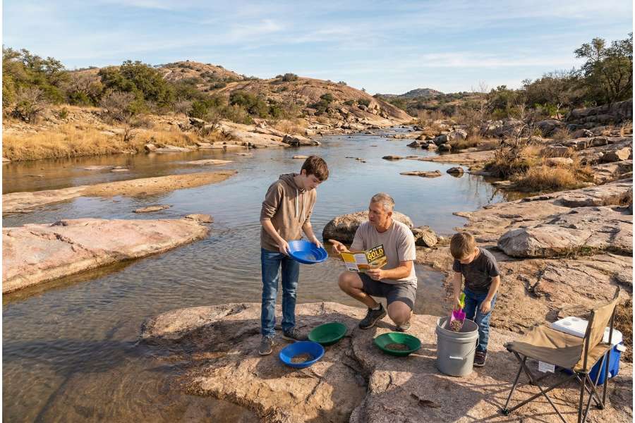
Starting your gold hunting journey is incredibly easy and inexpensive. You only need a few basic tools to get out on the water and start finding color. With a little bit of luck, your first good gold strike will easily pay for all of your beginner gear.
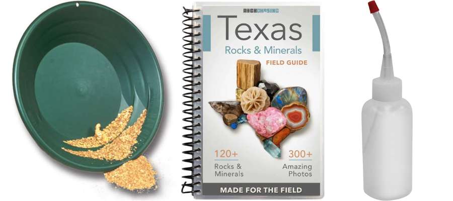
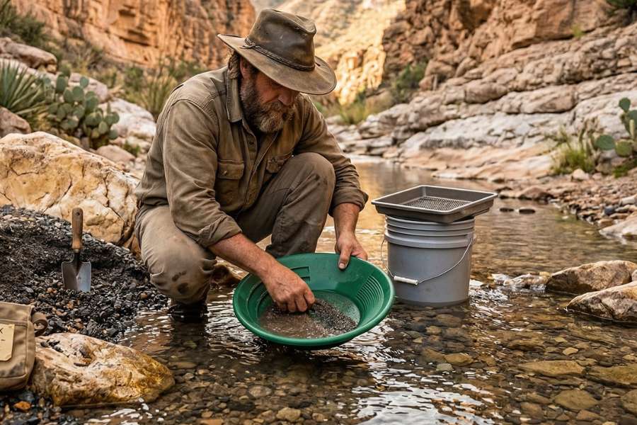
A Deep Riffle Gold Pan
A basic gold pan is the very first thing you need to buy. You want a durable plastic pan with deep ridges, or “riffles,” to help catch the heavy gold while you wash away the lighter sand. This specific design is essential for trapping the fine flour gold commonly found in the Llano River and other waterways.
What we like: Minelab PRO-GOLD 15 Inch Dual Riffle Pan
A Texas Rockhounding Field Guide
The most important tool you can carry is a reliable field guide for the local area. Finding gold is exciting, but you will often find other valuable gemstones and minerals in your pan that are easy to miss. A professional guide ensures you can identify every treasure you uncover so you never accidentally throw away a rare find.
What we like: Rock Chasing’s Texas Field Guide
A Gold Snuffer Bottle
Tiny flakes of gold will stick to your wet fingers if you try to pick them up by hand. A snuffer bottle works just like a tiny vacuum to safely suck the gold right out of your pan and into a storage container. This tool is the best way to ensure you don’t lose any of the fine gold dust you worked hard to find.
What we like: Stansport Gold Snuffer Bottle
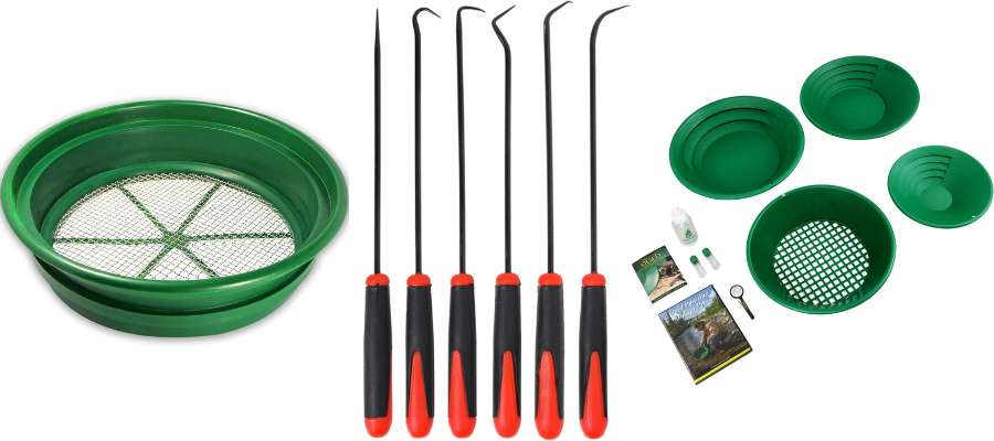
A Classifier Sifting Screen
A classifier screen helps you work much faster by filtering out large, worthless rocks before they ever hit your pan. By sifting your material first, you only spend your energy panning the fine gravels where the gold is actually hiding. This is a must-have tool for processing the rocky bars found throughout Central Texas.
What we like: SE Half Inch Sifting Screen
Crevice Tool Set
Gold loves to hide deep inside the tight cracks of river bedrock where standard shovels can’t reach. A dedicated metal crevice tool allows you to scrape this rich, heavy dirt out of narrow spaces where the biggest flakes are often trapped. These tools are made of solid steel so they will not bend or break when you are working in tough Texas granite.
What we like: ASR Outdoor Steel Crevice Tool Set
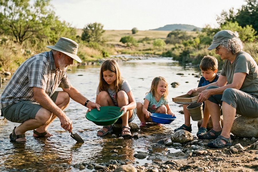
A Good Beginner Starter Kit
If you want to get everything you need in one package, a bundled starter kit is the easiest and most affordable way to begin. These kits include pans, classifiers, and snuffer bottles that are designed to work together perfectly.
This is our top recommendation for families or anyone new to the hobby who wants to head straight to the river with confidence. The only additional piece you would need would be a field guide.
What we like: Garrett Deluxe Gold Pan Kit
The Best Time of Year to Hunt for Gold in Texas
Knowing when to hunt for gold is just as important as knowing where to look. Extreme weather and changing water levels can completely change your experience. Here is a breakdown of the best seasons to prospect in each major region of the state.
Central Texas
The best time to pan for gold in Central Texas is during the early spring or late fall. During these months, the temperatures are much more comfortable for the physical work of digging and panning. Lower water levels in the late fall are especially helpful because they expose the deep bedrock cracks where heavy gold naturally settles.
East Texas
The best time to search for gold in East Texas is during the dry spells of late summer and autumn. When river levels drop, large gravel bars are revealed along the Brazos River and other coastal plain waterways. These lower water levels provide the best access to the fine sands where microscopic gold flakes and Petrified Palmwood are often found.
North Texas
The best time to look for minerals and fine gold in North Texas is during the late winter and early spring months. During this time, the vegetation is thin, making it much easier to spot promising gravel deposits in dry creek beds and erosion washes. The cooler temperatures allow you to cover more ground safely before the intense humidity and heat arrive in the summer.
South Texas
For the South Texas plains and the Rio Grande valley, the winter months from December through February are the best for prospecting. This region stays very warm, so the winter months provide the most comfortable weather for digging in the sandy soil. You will find that the lower brush levels during winter make it much easier to access remote areas near the river.
West Texas
For the rugged terrain of West Texas, winter and early spring are the ideal times for an adventure. The summer heat in the desert can be dangerous for strenuous outdoor activity like prospecting. Planning your trip for the cooler months allows you to safely explore dry desert washes and arroyos for longer periods of time.

Legal Considerations for Prospecting in Texas
Hunting for gold is heavily regulated and the rules change depending on exactly where you stand. You are completely responsible for researching and following all local laws before you put a shovel in the dirt. The information below is just a general warning and does not constitute legal advice.
Private Property
Texas is a state with very little public land, and most riverbanks are privately owned. You must never cross a fence or enter a property without explicit permission from the landowner. Even if you are in the water, the land beneath you may be private, so always verify your access before you begin.
Active Mining Claims
While less common in Texas than in the West, active mining claims still exist and must be respected. It is illegal to prospect on someone else’s active claim without their permission. You can check with the Bureau of Land Management or local county offices to see if an area is open for public use.
Equipment Restrictions
Some areas may allow gold panning but strictly prohibit the use of motorized equipment like highbankers or dredges. Many state parks and protected river segments have specific rules about the size of the holes you can dig and the tools you can use. Always check with the local park ranger or city office to ensure your gear is legal for that specific spot.
Final Warning and Disclaimer
Before you head out to any spot on our list, you must confirm the access requirements directly with the location. We have not personally verified every single spot mentioned in this guide. Access requirements and collection rules often change without any notice.
Many of these locations will not allow you to take rocks or gold home. However, they are still great places to enjoy finding beautiful minerals in the wild without keeping them. We also cannot guarantee you will find anything since natural landscapes are constantly changing.
Always get updated information directly from the source to ensure responsible rockhounding. If you want even more current options, it is a great idea to contact local rock and mineral clubs. These groups are the best resource for safe and legal places to hunt.